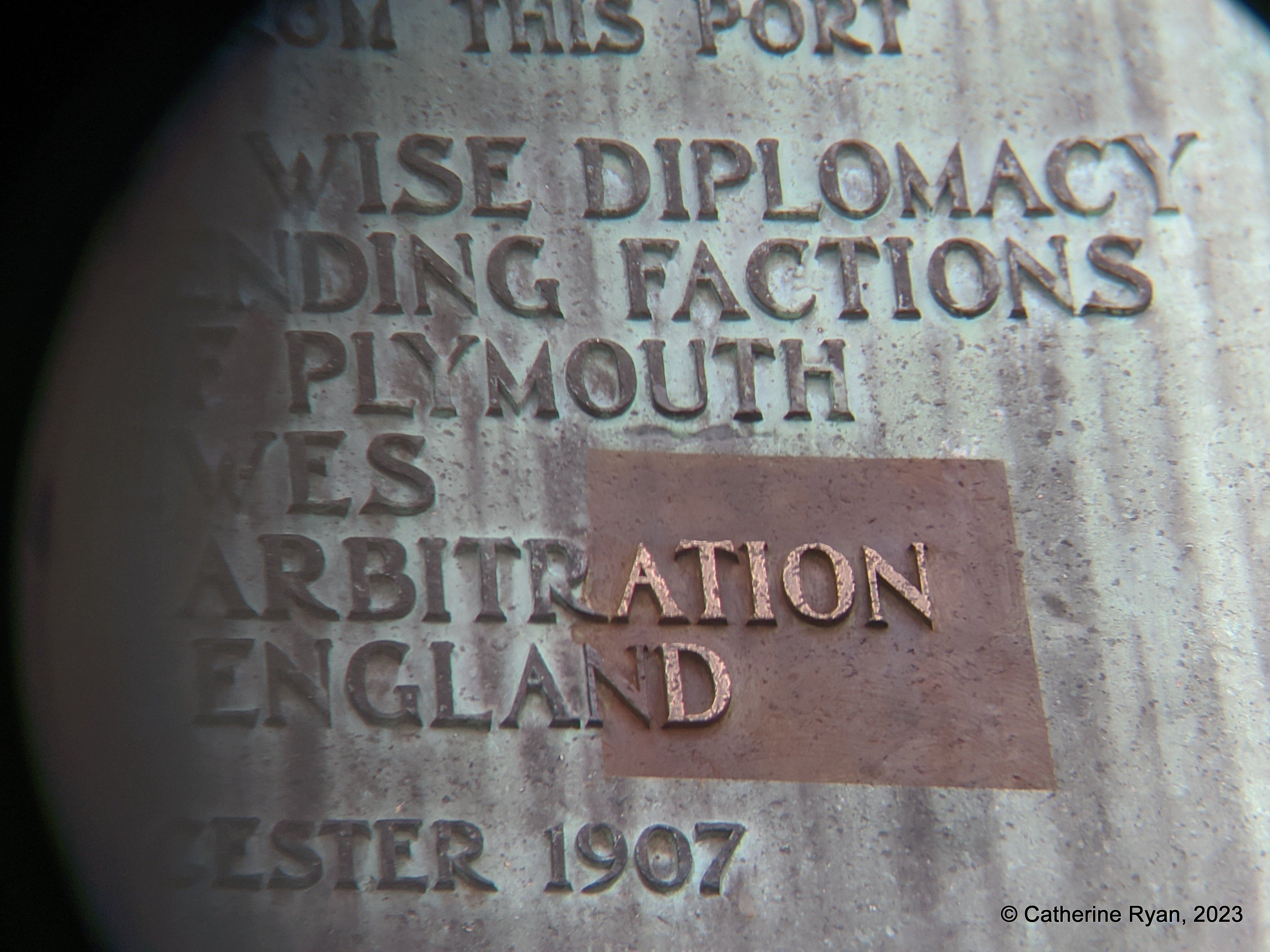
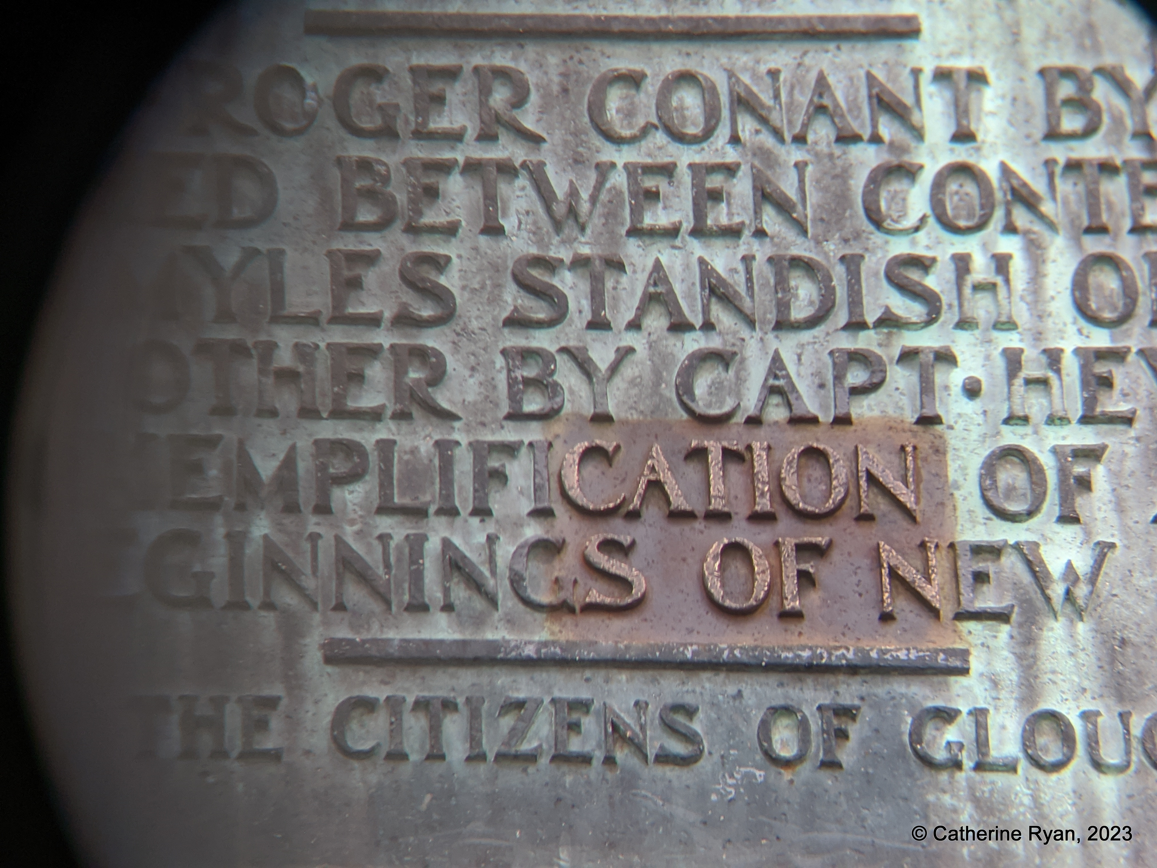
Part 2. “NOTABLE”. “EXEMPLIFICATION”. “ARBITRATION”.
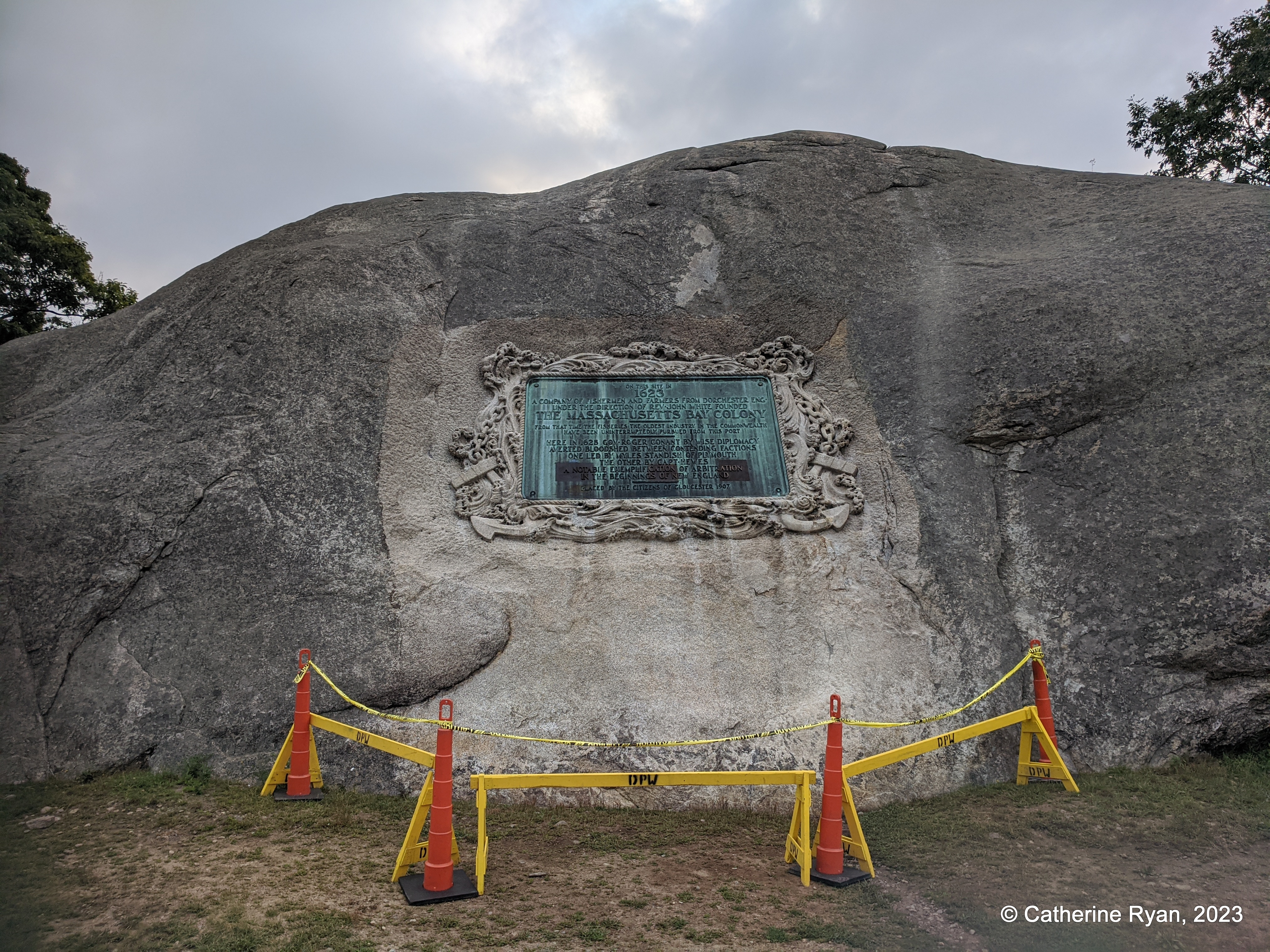
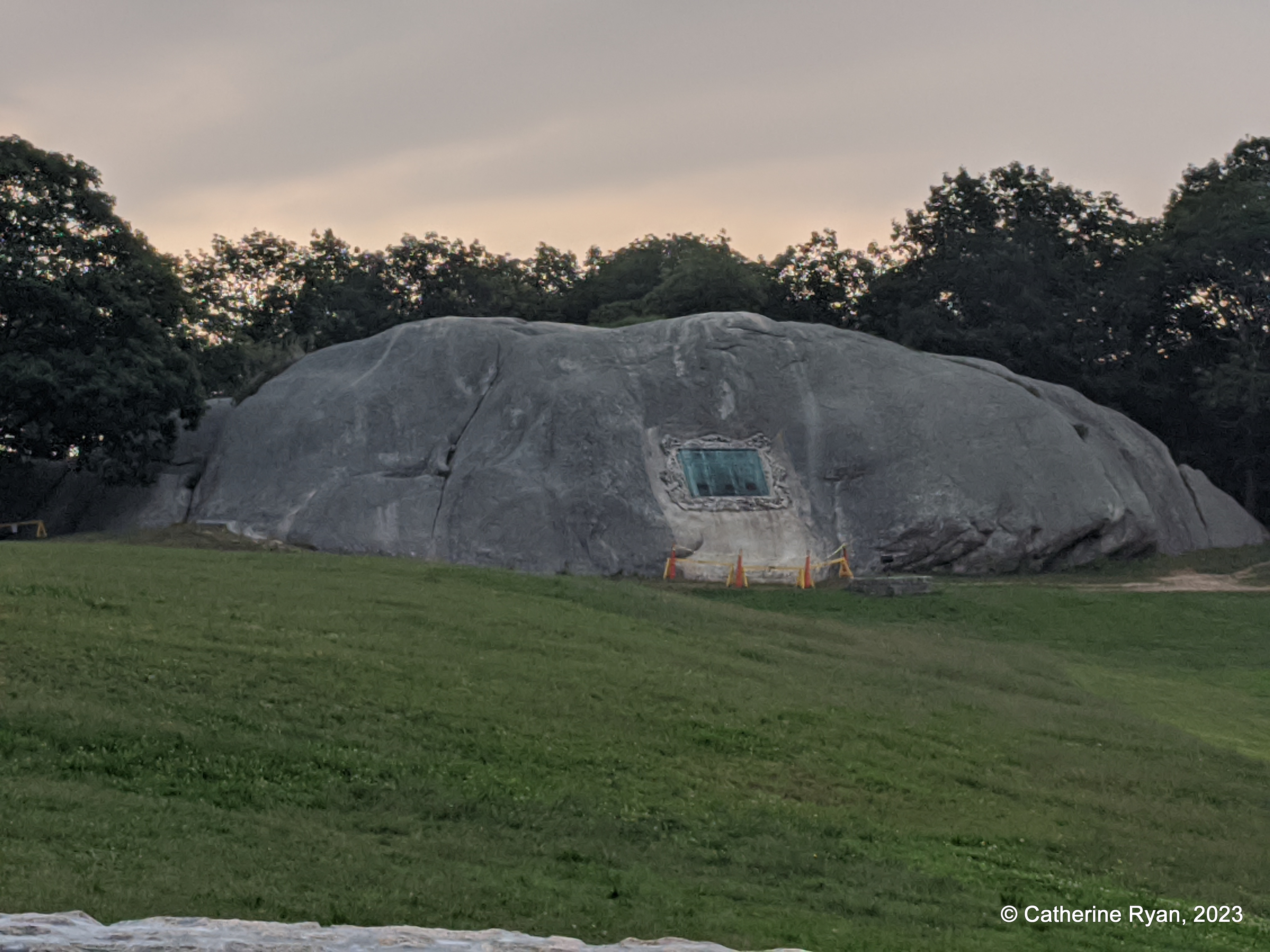
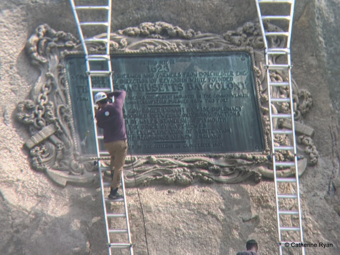
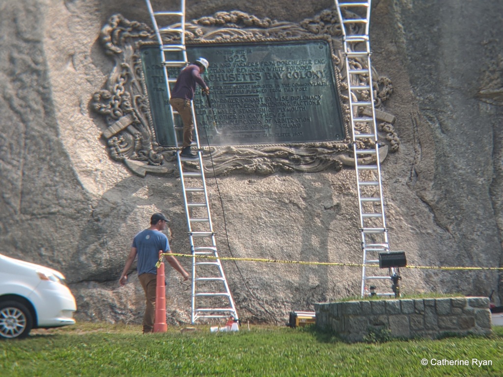
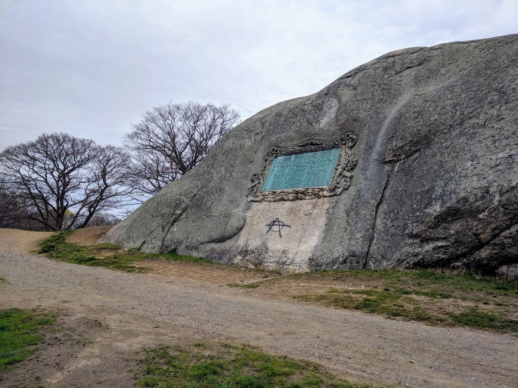
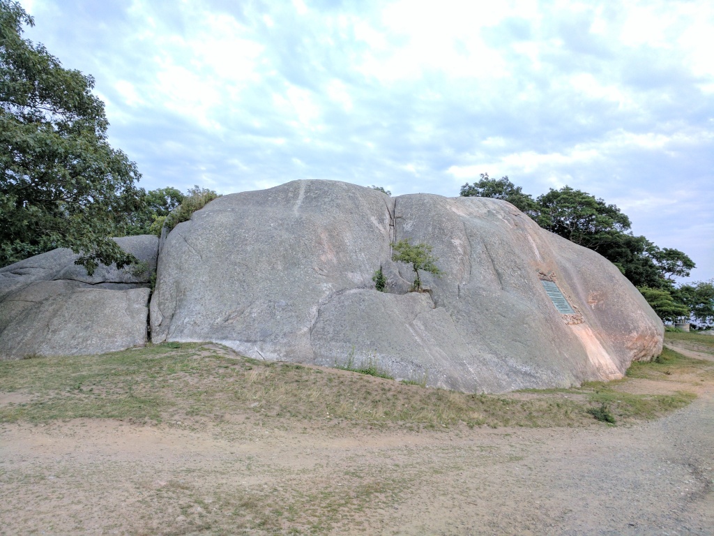
Three test patches are visible on the commemorative bronze plaque set into Tablet Rock. Along with surface patina aesthetic choices, test patches are left to cure or age to see their impact. When considering care and protection for public art, there is no singular approach. There is no other American commemorative tablet that’s so colossal, set into a glacial outcropping in this precise angle and manner, and susceptible to its surroundings and climate over this length of time. Hence the test patches.
Daedalus is a renowned sculpture conservation firm and will approach this work with respect.
Money was raised to address the plaque and patination (some had preference for a brown finish) Gloucester Daily Times, 2016, and then that project was paused. As far as I know, funds were not returned nor redirected for restoration of the city’s art deemed in distress. At the time William Taylor addressed the verdigris:
“As an antique dealer for decades who dealt many times with bronzes and patinas I completely agree that the tablet should not be restored. While I applaud…well-meaning and generous inclinations not only does natural oxidization form a protective surface it looks appropriate and should not be fiddled with. Restoration is too expensive and absolutely not necessary. Cleaning it would remove many decades of well acquired history.
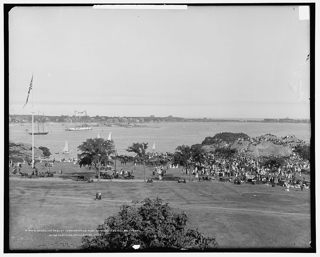
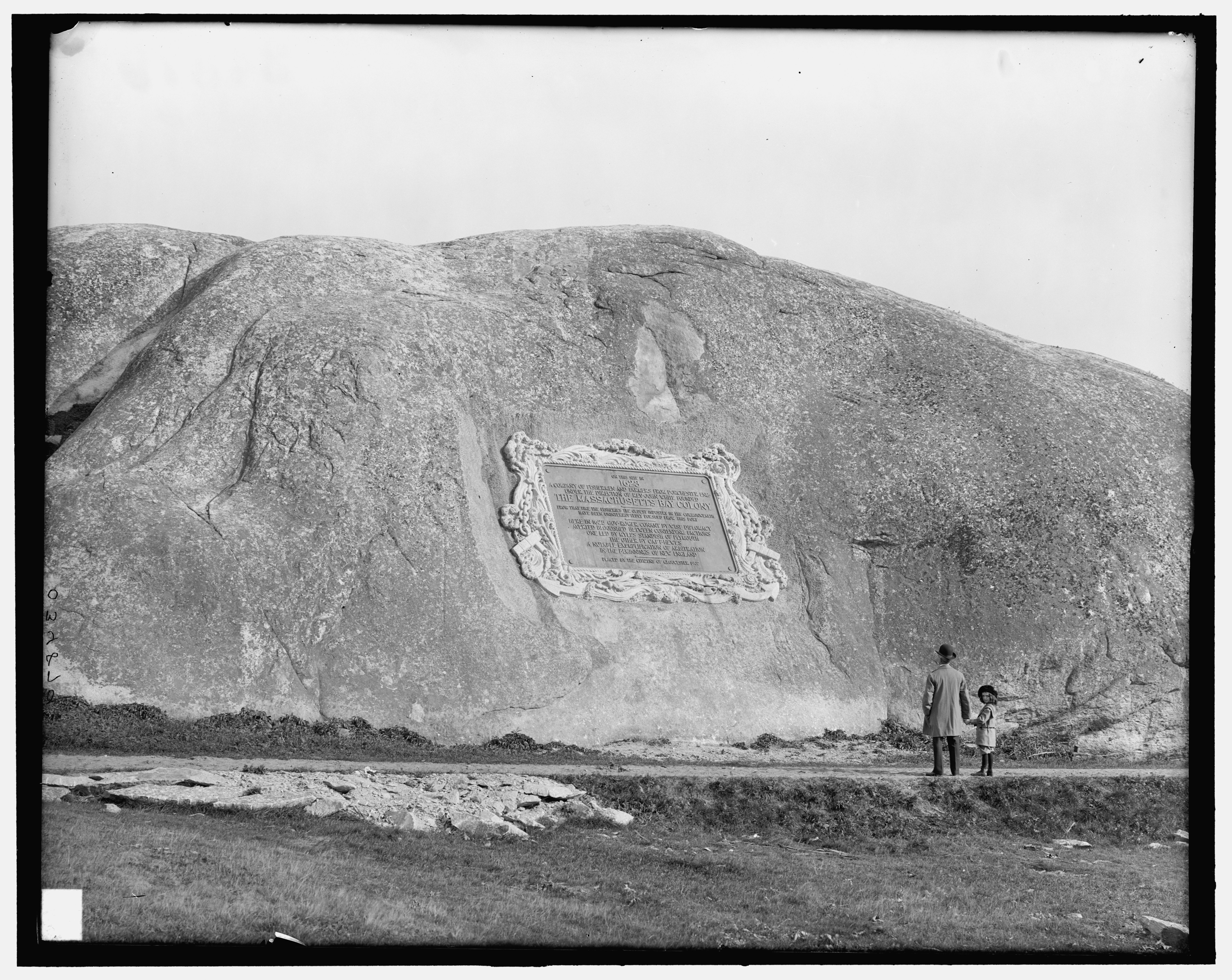
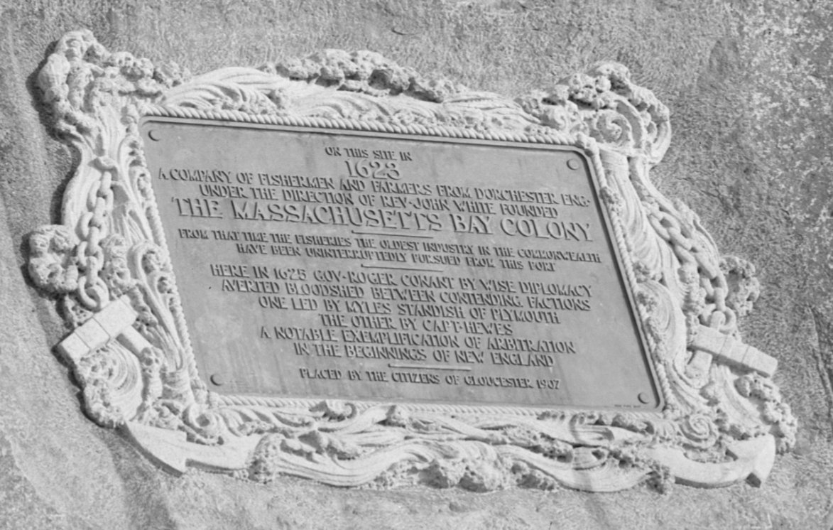
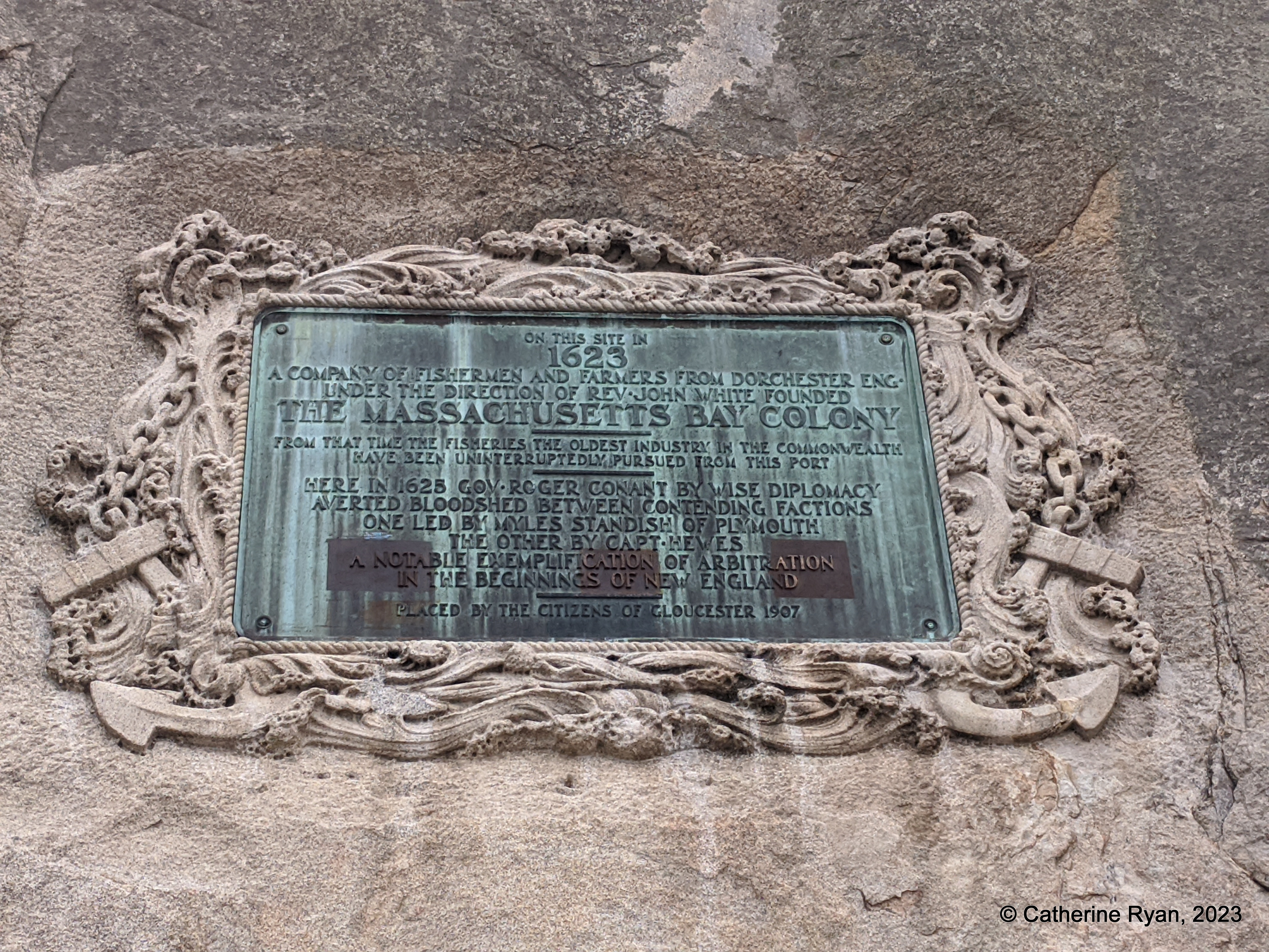
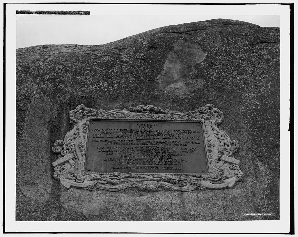
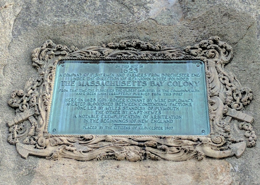
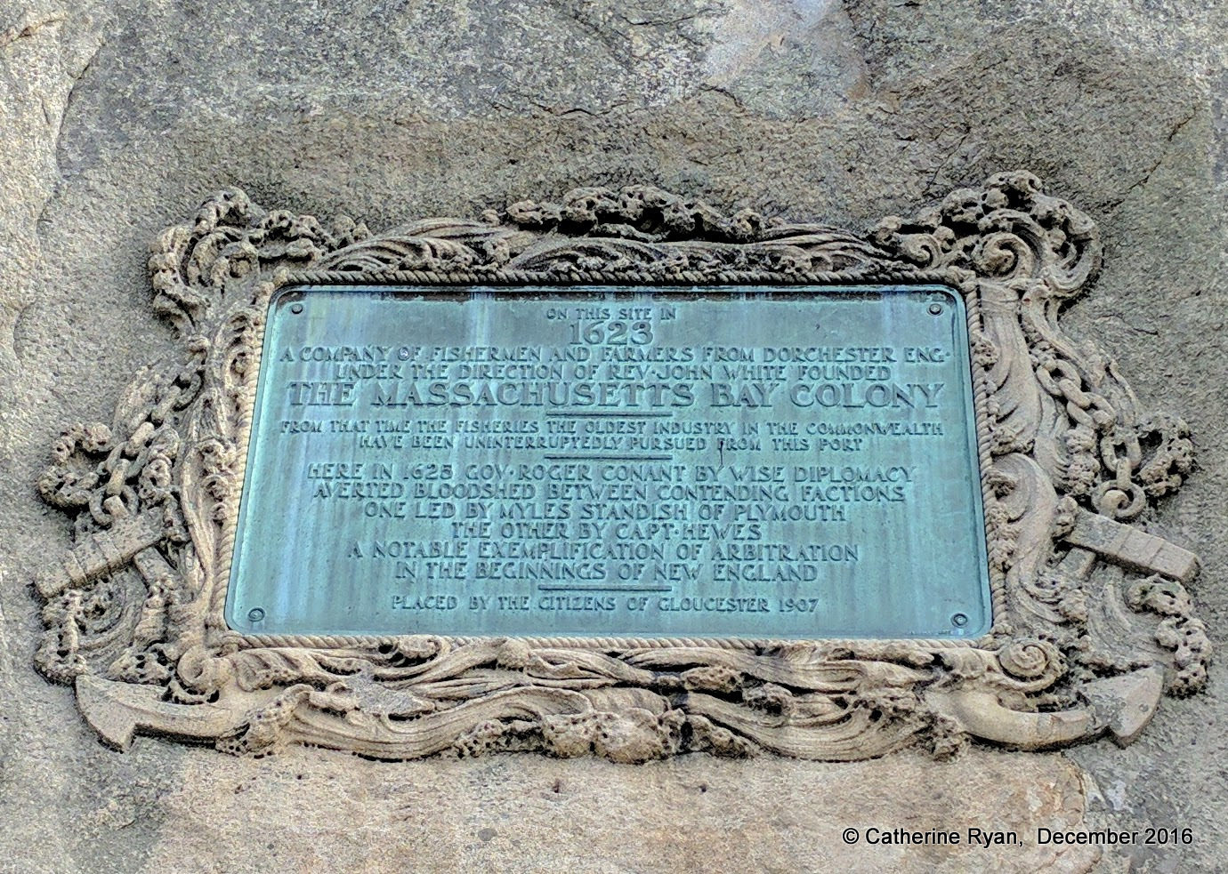
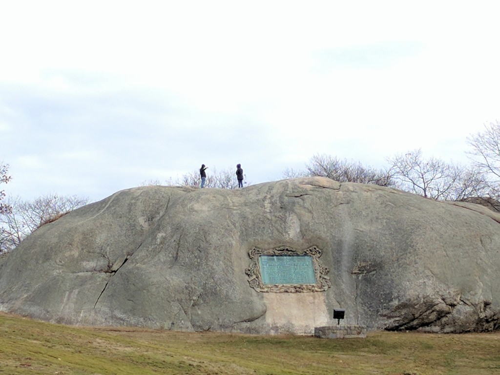
The enormous 20th Century plaque on Tablet Rock in Stage Fort Park commemorating the first permanent European settlement, the “Founding of the Massachusetts Bay Colony in 1623”, was dedicated in August 1907. James R. Pringle was designated to write the inscription. The execution of the design and bas relief border was by Eric Pape.
“The nautical scheme of decorative framework and embellishment was the composite suggestion” of various committees dating as far back as the 1880s.
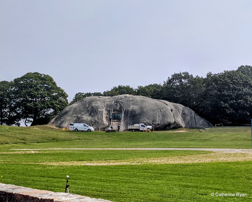
Founders plaque – tablet rock photo C. Ryan 2016
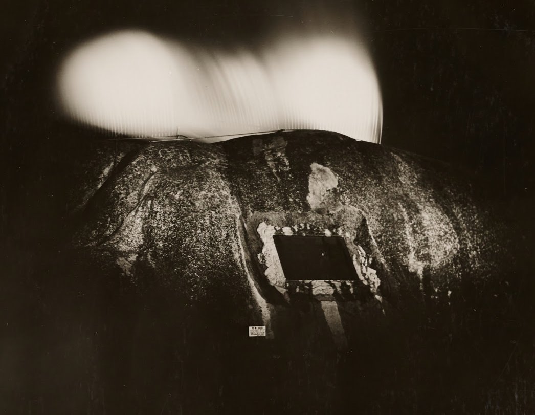
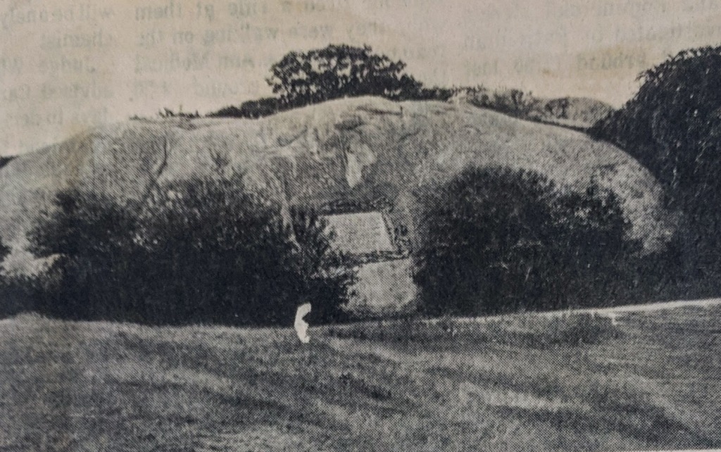
Image block documenting how Tablet Rock looked pre bronze tablet through today: before the plaque, 1901 (branded Battery K still visible); 1907 dedication, Library of Congress (Hammond with his daughter Natalie Hammond); 1970s; 1974 (graffiti beneath); 2016; 2019. Note the rectangular area beneath the plaque was lightened at the time of installation. The border carving degraded. The dark streaks accelerated after 2020 (note the verdigris patina 2016, 2019, etc)
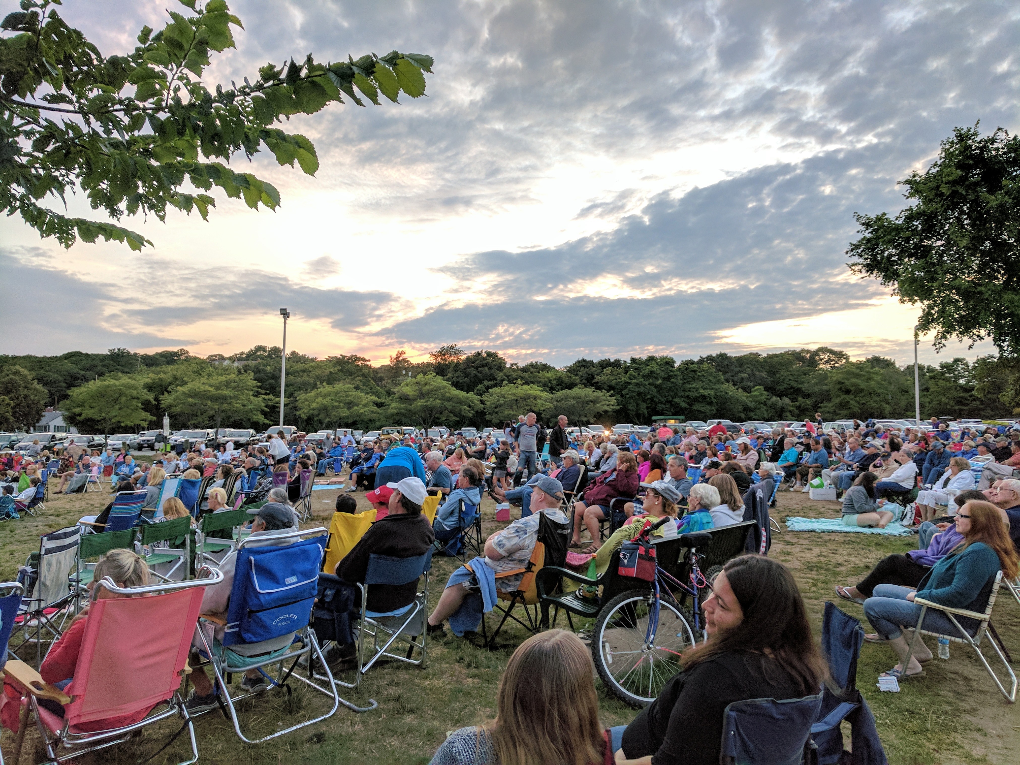
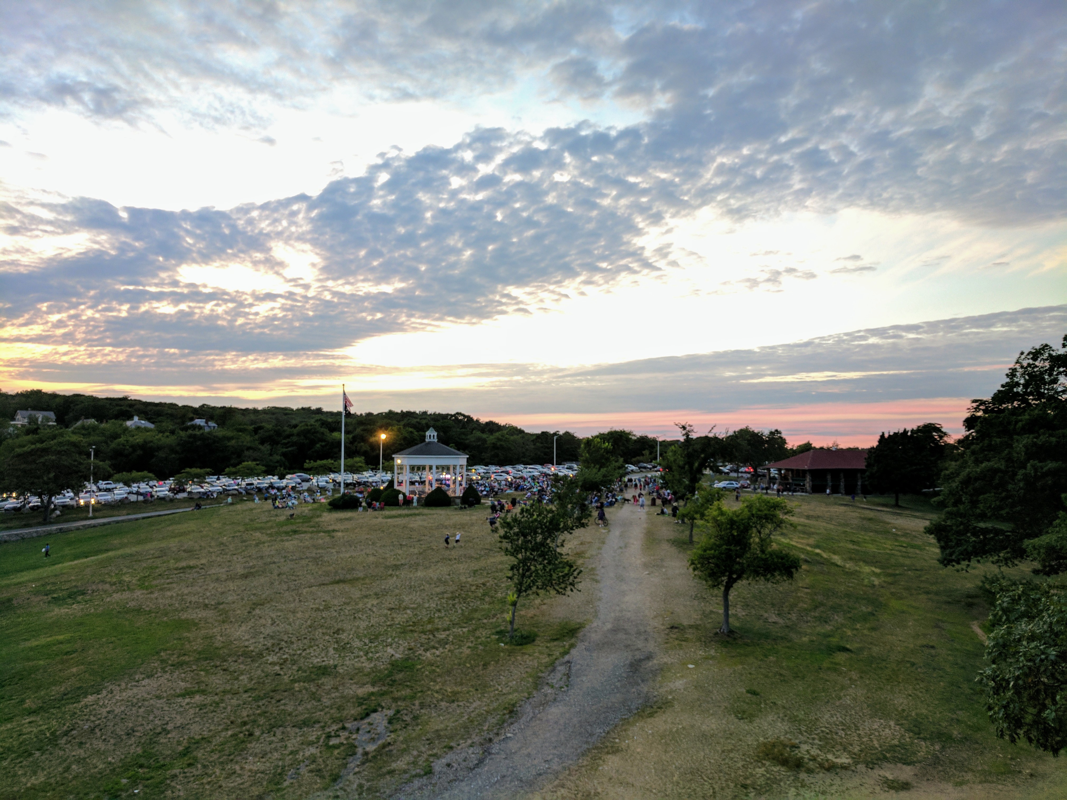
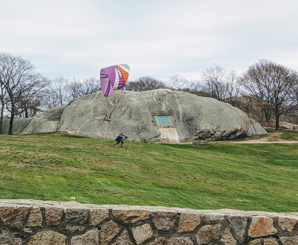
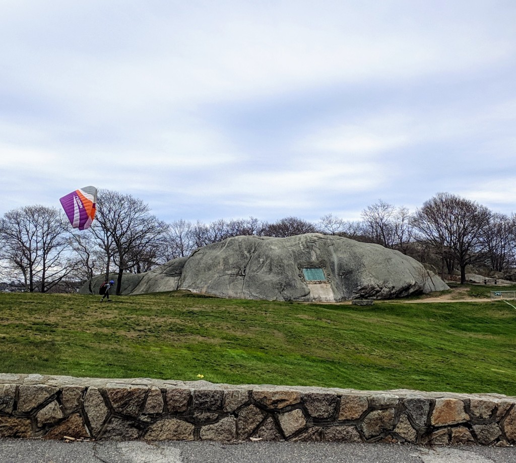
One month away- mark your calendars! Countdown to Cape Ann Symphony’s very own Pops concert–a preeminent 400+ celebration– at Stage Fort Park is July 28, 2023. Classical and popular music for all in a spectacular setting!
For Gloucester’s Tablet Rock dedication in 1907, momentous Gloucester Day celebrations, and the city’s 300th, the natural open air ampitheatre of Stage Fort Park and its sweeping vistas beckoned and accomodated thousands for sheer casual delight, open and accessible to all. The Cape Ann Symphony Pops in the Park event echoes this history! On a smaller scale, the city hosts the popular free Antonio Gentile Bandstand Summer Concert Series at Stage Fort Park.
20161907201719071909Stage Fort Fisherman’s Field plaque honoring all actions. My attribution is Harriet Hyatt_plaque refers to restoration of area 1930 by DAR
Heidi Dallin shares the details from Cape Ann Symphony:
CAPE ANN SYMPHONY RETURNS TO STAGE FORT PARK
Celebrate Gloucester’s 400+ at
POPS IN THE PARK
FREE ORCHESTRA CONCERT SET FOR JULY 28 at 8 PM
Cape Ann Symphony has partnered with the Gloucester 400+ to bring Cape Ann’s 70-member professional orchestra to Stage Fort Park for Pops in The Park, a special concert to celebrate Gloucester’s 400+, on Friday, July 28 at 8 PM.
“Over the last 6 months we’ve been raising the funds needed to put the symphony on stage and I am delighted to share that we just reached our goal. We are so appreciative of our corporate sponsors and all the individual donors who contributed to make this marquee event of the 400th celebration a reality! So, save the date of July 28th on your calendar and come join us at Pops in the Park, a glorious evening of symphonic music free to the public.”
Jodi Nedrow-Counihan, CAS board member and coordinator of the Pops event
Set against the majestic backdrop of Gloucester Harbor, this FREE outdoor all ages event will be a special evening of music. The program includes Rossini’s Barber of Seville Overture; Anderson’s Selections from Irish Suite; Copland’s Hoedown; William’s Adventures on Earth; A Tribute to Henry Mancini; Tchaikovsky’s Finale of The 1812 Overture and the world premiere of Celebration Overture by acclaimed Gloucester composer Robert J Bradshaw.
“The Pops in the Park Concert on July 28th is a celebration not only of the 400+ years of Gloucester history but of the 70+ years of the Cape Ann Symphony” adds Nedrow-Counihan. The Cape Ann Symphony began in 1952 as a volunteer group of thirty or so individuals calling themselves the “Gloucester Civic Symphony Orchestra”. On July 10th, 1952 the symphony performed their inaugural concert in the Gloucester High School auditorium and wowed the audience of over 800 concertgoers with their performance of Beethoven’s First Symphony.
Today, the Cape Ann Symphony has evolved into an all-professional orchestra of more than 70 members from throughout the New England area with a performance level to rival any regional Symphony in the country. For more than 20 years Maestro Yoichi Udagawa has been the CAS Music Director and Conductor and his artistry and passion have made him an audience favorite. Maestro Udagawa is at home in popular and contemporary music as well as the standard symphonic repertoire. He is known for his relaxed manner and ability to speak from the podium which has helped new audiences as well as enthusiasts gain a greater appreciation for symphonic music.
The Cape Ann Symphony’s Pops in the Park Concert, a preeminent event to celebrate Gloucester’s 400+, is Friday, July 28, 2023 at 8:00 pm in Stage Fort Park, 24 Hough Avenue, Gloucester, MA. Admission to this outdoor concert on the harbor is FREE. For information, call 978-281-0543 or visit pops.capeannsymphony.org
aBOUT Stage Fort Park Tablet Rock
*“In 1623, 14 English fishermen set up the first European colony on Cape Ann here in what was then Fisherman’s Field and is now Stage Fort Park. These ramparts overlook the harbor, first built during the Revolutionary War, renewed for the War of 1812, the Civil War and the Spanish American War.”
Alas, those first settlers, sent across the ocean by the Dorchester Company, were unable to live off the sea and these rock-bound fields. They moved a few miles south to what is now Salem in 1626. Then, within a decade, there were enough permanent settlers on Cape Ann to incorporate the town of Gloucester. The first meetinghouse was built on the Town Green in 1642 near what is now the Grant Circle rotary of Route 128. The City set this land aside as a public park in 1898 and its Tablet Rock was dedicated by Henry Cabot Lodge in 1907.“
James R. Pringle was designated to write the inscription for the bronze plaque. The execution of the design was by Eric Pape. “The nautical scheme of decorative framework and embellishment was the composite suggestion” of various committees dating as far back as the 1880s. Bronze tribute plaques embedded in Tablet Rock at Stage Fort Park detail the site’s history and were commissioned and unveiled at different times. The monumental and stunning Founders plaque from 1907 on Tablet Rock itself is in fantastic condition. Two DAR plaques were inlaid on the glacial outcroppings past half moon beach on the way to the cannons. The Fisherman’s Field (1934) which I attributed to Harriet Hyatt is so worn it’s nearly indecipherable, though that’s part of its charm**. The plaque compels close inspection, lingering and discovery. It’s a fun family activity for anyone who likes a challenge. For those who want help reading the content, I transcribed it back in 2010. Harriet Hyatt designed the Meeting House Plain plaque across from Cape Ann near Washington and Poplar. – 2015, 2027 **Update 2020: Cape Ann Museum acquired the original drawing for the plaque design in 2020!
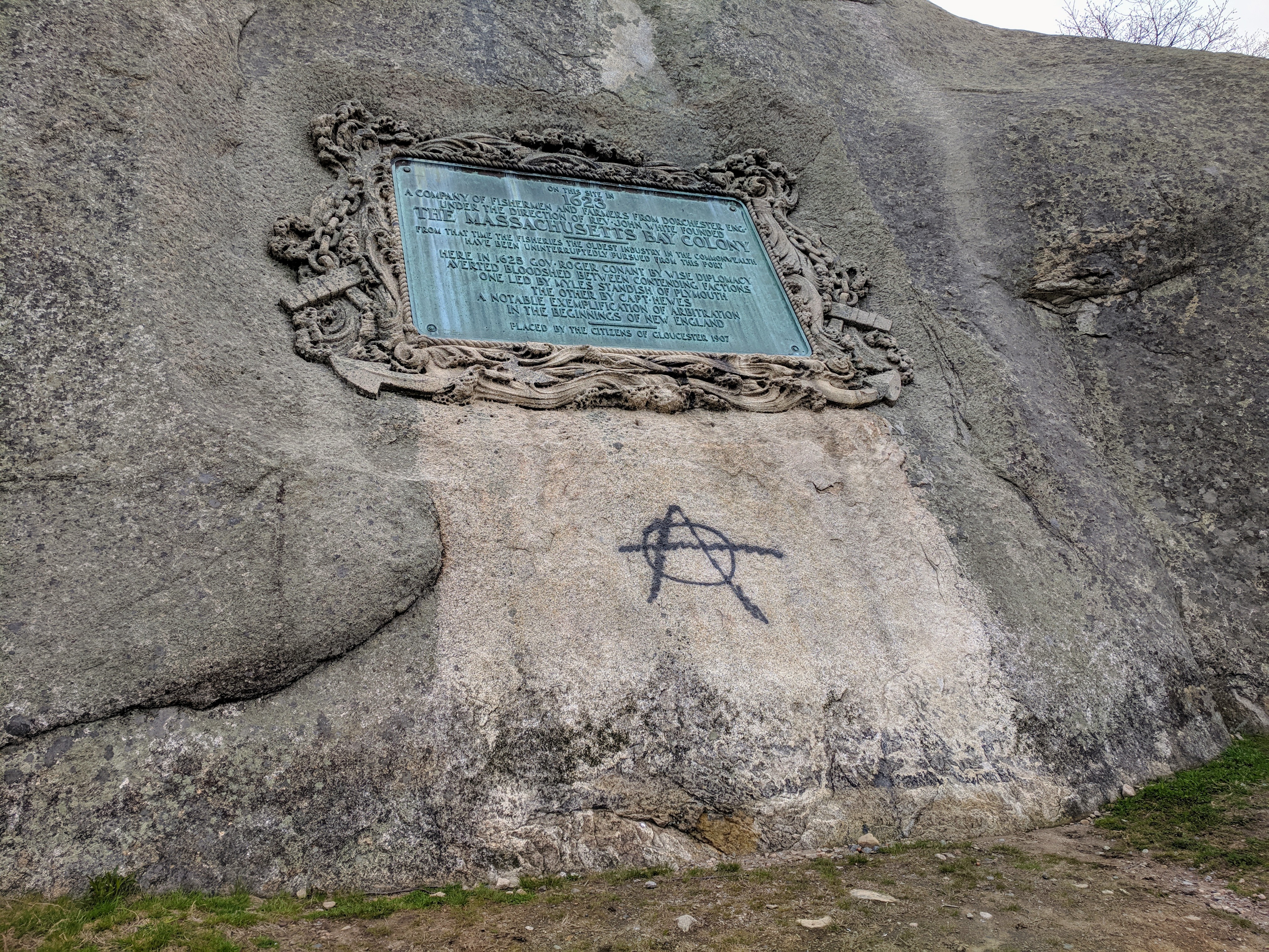
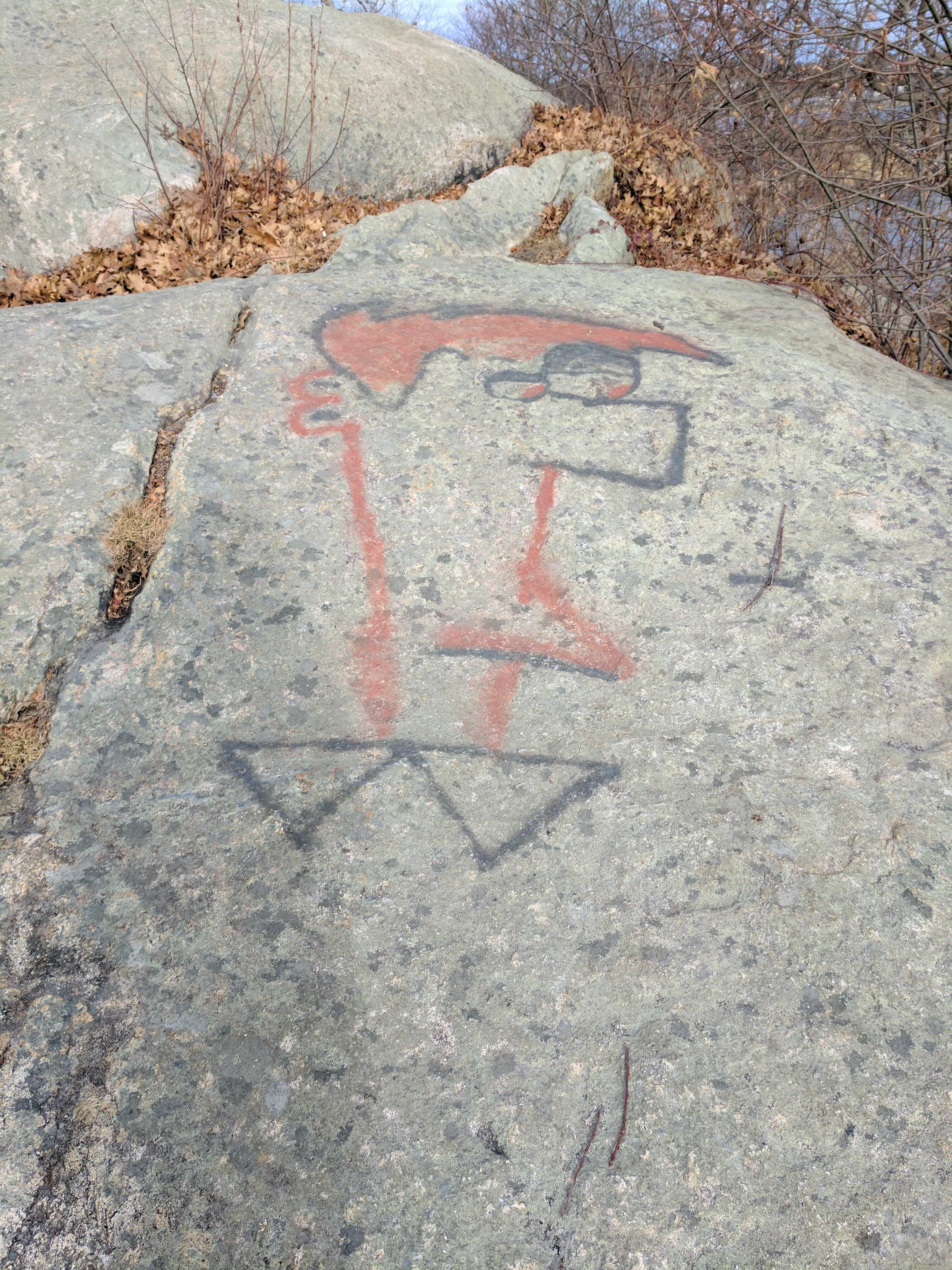
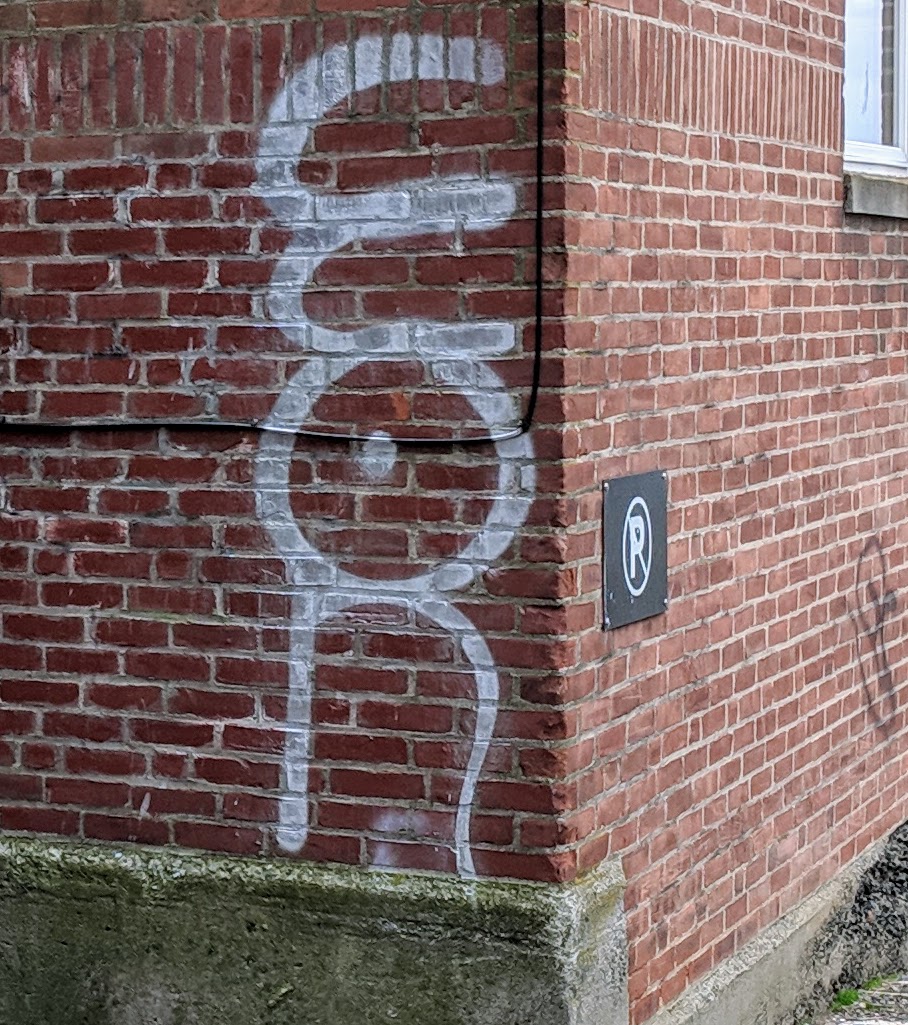
Blanched and illuminated area beneath the founder’s plaque was tagged with graffiti which will be ably removed by the city DPW. Scroll below to historic photographs for context and comparison.
Days earlier it wasn’t. For comparison, here’s how the giant rock appeared May 1, 2019. Had it been on that day…
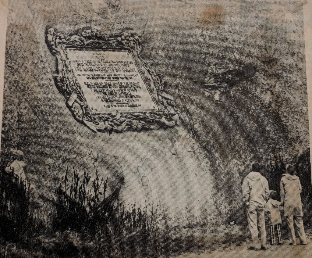
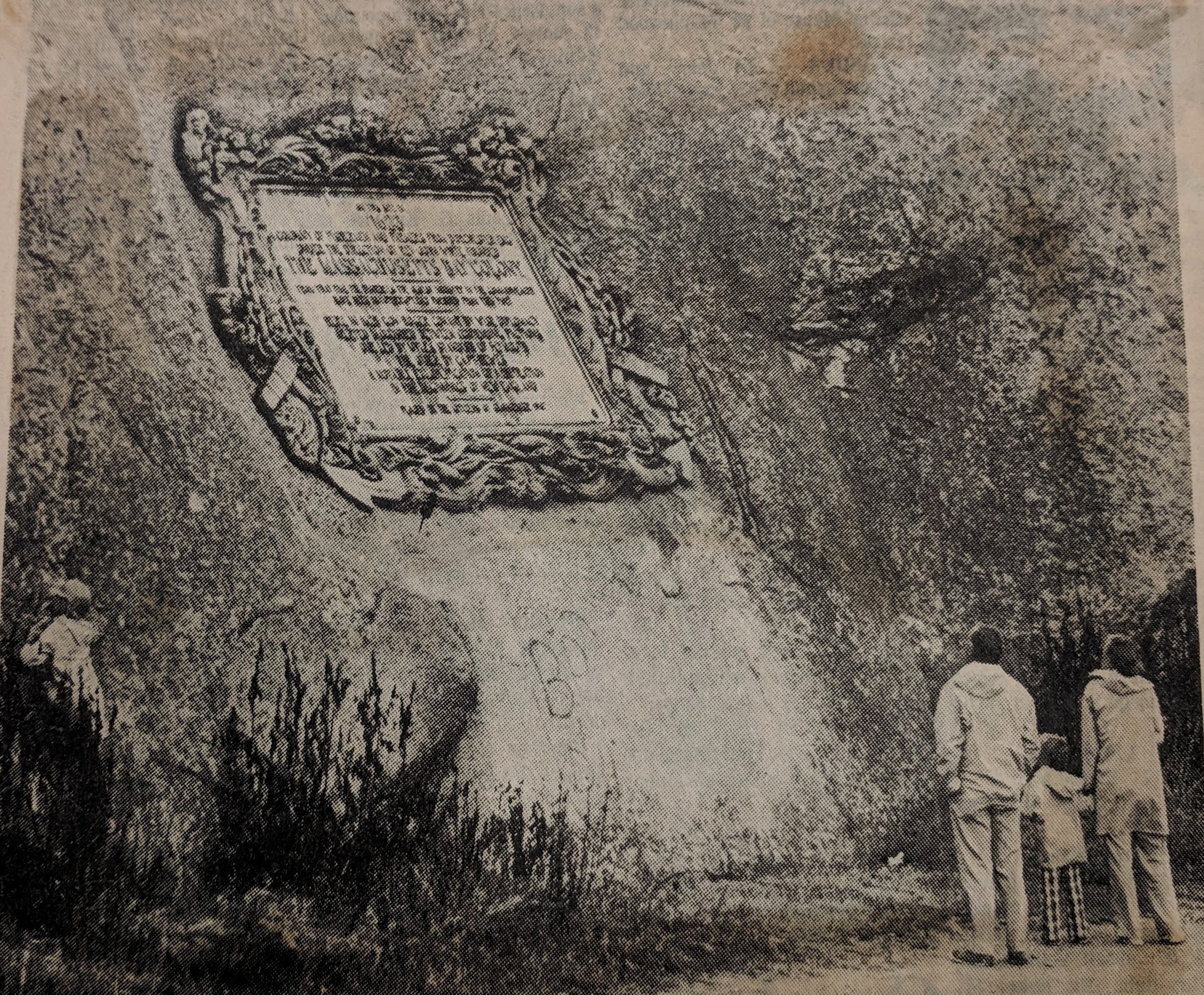
1974
Though uncommon, graffiti has been removed from this same spot before. Here’s a 1974 photograph from the Gloucester Daily Times catching a family reading the founder’s plaque. Graffiti was visible and without mention.
1907
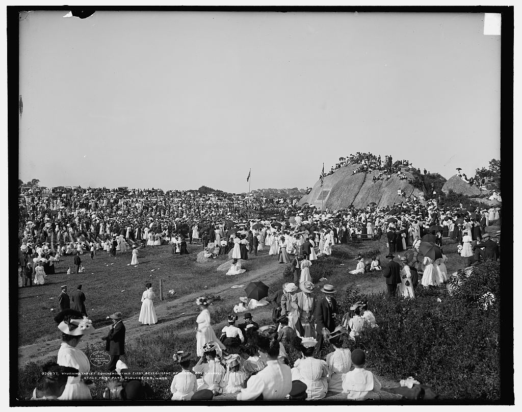
John Hays Hammond, Sr (1855-1936) holding hands with daughter Natalie (looking back to the camera) after the unveiling. Hammond’s involvement made this tribute happen (CR id research). Natalie hays Hammond (1904-1985) had the honor of pulling back the cord for the big reveal. 1907 photograph collection Library of Congress
Gloucester’s wrap around picturesque landscape was preserved as a public park in 1898. In 1907, the monumental natural glacial outcropping was decorated with an inset of bronze plaque and stone relief commemorating the first fishermen from England laying claim in 1623. Eric Pape was commissioned for its design.
Gloucester, Mass.- Great teacher at Gloucester High School, Shaun Goulart, creates a local history scavenger hunt trivia game for his 9th grade students that takes place weekly for 6 weeks. We’re taking the challenge one week after the students. Good luck!
ANSWERS TO SHAUN GOULART’S LOCAL HISTORY TRIVIA WEEK TWO
How did you do? Week two delved into scenes of historic battles. I’ve added some background. Stop here if you prefer to go back to see Week 2 questions only from 3/17/19
WEEK 2: DEFENDING GLOUCESTER Location #1
Who was the first governor of Massachusetts Bay Colony? ANSWER – ROGER CONANT
Go to the location of the fort named after him and take a picture with a member in it. *Stage Fort Park “Fisherman’s Field”
Bronze tribute plaques embedded in Tablet Rock at Stage Fort Park detail the site’s history and were commissioned and unveiled at different times. The monumental and stunning Founders plaque from 1907 on Tablet Rock itself is in fantastic condition. Two DAR plaques were inlaid on the glacial outcroppings past half moon beach on the way to the cannons. The Fisherman’s Field (ca.1930) is so worn it’s nearly indecipherable, though that’s part of its charm. The plaque compels close inspection, lingering and discovery. It’s a fun family activity for anyone who likes a challenge. For those who want help reading the content, I transcribed it back in 2010. Scroll down below the “read more” break in this post to open.
Stage Fort Fisherman’s Field plaque honoring all actions. My attribution is Harriet Hyatt_plaque refers to restoration of area 1930 by DAR
Revolutionary War tribute commissioned by DAR and installed 2013
During which war did it receive this name? ANSWER – FORT CONANT during the Civil War
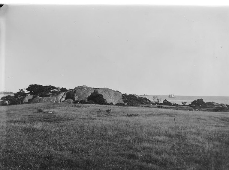
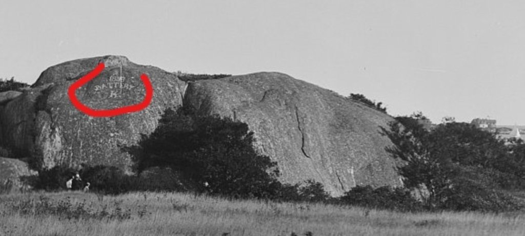
When you zoom in on this 1901 photograph, you can see the big ‘Battery K’- for the Spanish American War (Camp Hobson) Fort conant during Civil War
Scrutiny
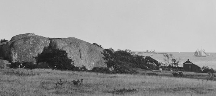
1901 before the Tablet
Gloucester vs Plymouth / Captain John Hewes vs Miles Standish
DAR plaques marvelous glacial outcroppings Stage Fort Park
Founders Plaque
Gloucester HarborWalk #32
Location #2
location 2 courtesy photos
Take a picture at Fort Point with the former location of the Coast Guard Aviation Station behind you (must be visible in the picture) ANSWER – TEN POUND ISLAND
What was the fort called on Fort Point? ANSWER – FORT DEFIANCE Fort Point Hill, Fort Lillie (Lily)
Name a war it was utilized in. ANSWER – Efforts to fortify as early as 1703 (see Pringle) ATTACK OF CAPTAIN LINDSAY (OR LINZEE) 1775 –population about 5000 –REVOLUTIONARY WAR, WAR OF 1812, CIVIL WAR
“In 1743, what is known as the old fort on Commercial Street, now encroached upon and surrounded by buildings, was completed. On this point, well selected strategically, is a hill which effectually commands the inner harbor. In 1742 and 1742, the General Court appropriated 527 pounds to defray the cost of fortification. Breastworks were thrown up and eight 12-pounders placed in position in the fort. The immediate cause of its erection was the fear of French incursions, but these fears were never realized. An effort had been made as early as 1703 to fortify the place, but the petition of the selectmen to the General Court for an appropriation for the purpose was refused. The petition shows that he harbor, even at that early date was extensively frequent for shelter, and was “very seldom free from vessels.”
“In order to be better prepared for future assaults breastworks were thrown up at Stage Fort, the Cut, Duncan’s Point and Fort Point. This, however was the last attack by sea or land that the people experienced.”
Location #3
From Fort Point go to the location of the seven-gun earthwork battery and barracks in ramparts field. Take a picture with the old towers in the background (do not go on private property) ANSWER – EASTERN POINT FORT by eminent domain, Ramparts Field Road Fort Hill
Name a war it was utilized in ANSWER – CIVIL WAR
“Immediate action was taken toward the erection of fortifications. Land at Eastern Point, belonging to Thomas Niles was acquired by the government, and earthwork fort erected and manned…”
Screenshot
Screenshot Google Earth with all three above locations in it and circle them. Submit the image.
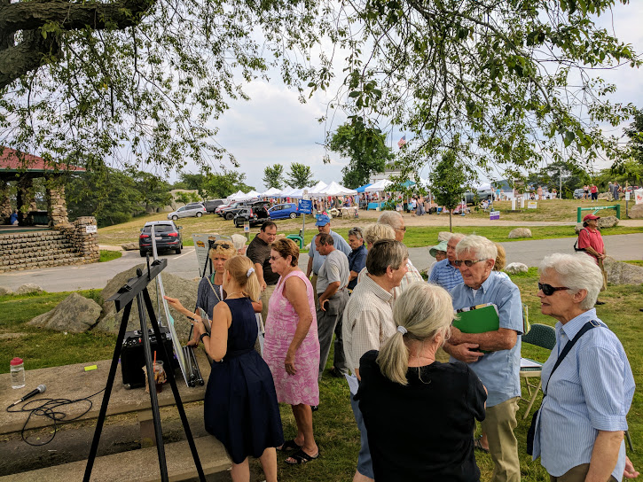
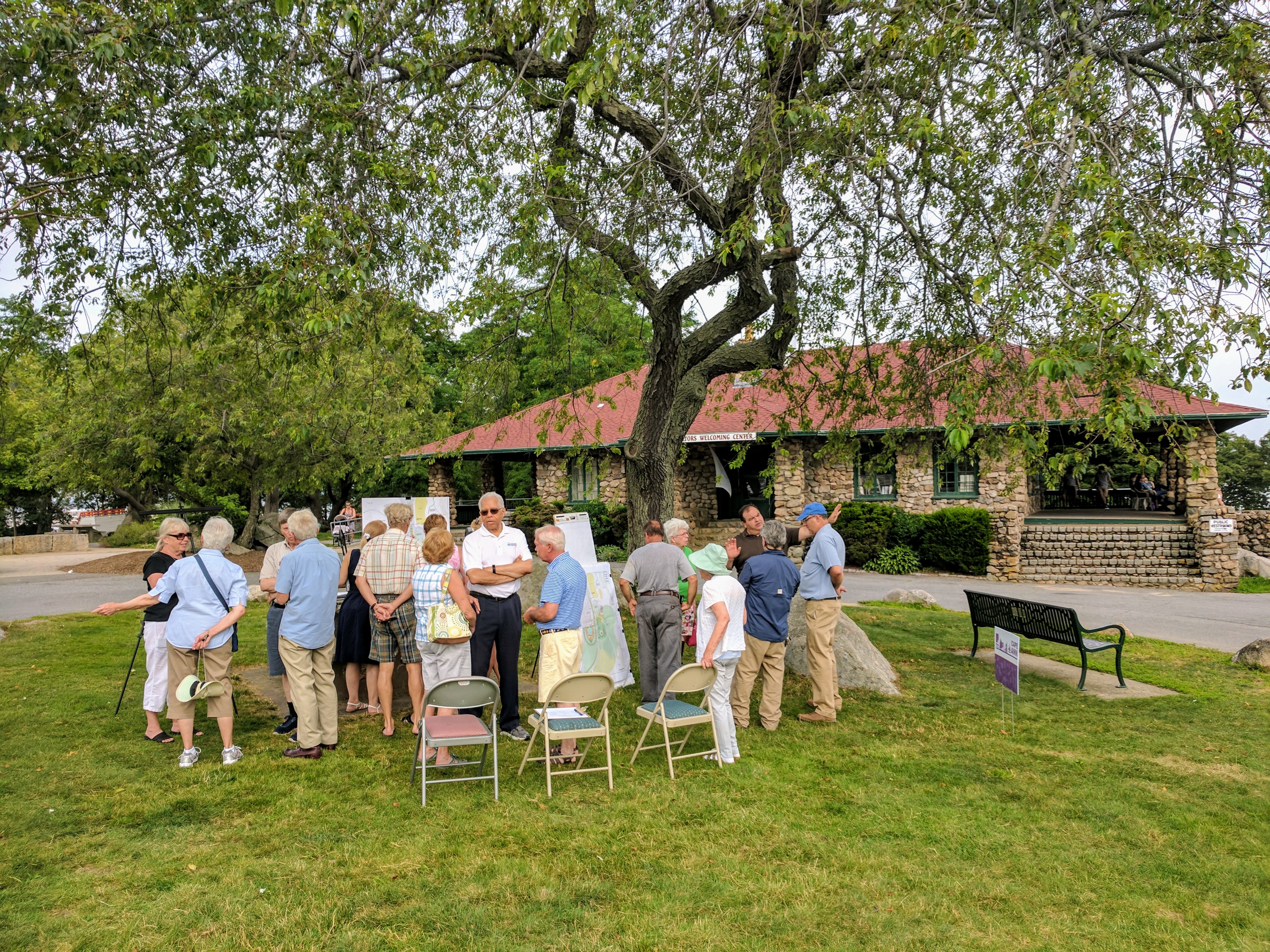
Scenes from last Thursday’s public display and discussion about proposed plans to Stage Fort Park, held during the Cape Ann Farmers Market.
The plans are similar to ones you may have seen over the last year, though it is always something else to inspect them in person, walk through a site, and hear feedback, input and questions. I’ve considered the plans before, but had not realized that the parking lot was going to be shifted and expanded double wide at the top abutting the dog park. Some neighbors liked the idea of an altered viewshed, others not so much. People talked about cleaning up the broken glass, trash management (great praise for DPW dealing with this every day), repairing the stone steps, the beach, bringing back some of the fanciful playground elements, trees and maintenance. There was pretty much universal praise for the Rotary and the farmers market. I was told there was mention of altering the Tablet Rock plaque, which does not need it, though I did not hear any. I was there for the duration of the meeting and even a tad beyond as Steve Winslow was kind enough to lead a tour into the field and perimeter afterwards. A great challenge is maintaining the meadow expanse which many feel is ragged around the gazebo while serving crowds. The proposed plans center about the gazebo and parking lot, and did not cover the area along the harbor (across from the cupboard) where the annual Waterfront music festivals occur as well as elements listed above.
Here are some scenes from July 23rd during the 4 Ever Fab Beatles nicely played tribute band evening sponsored by Cape Ann Savings Bank, part of the 2017 line up for the annual Stage Fort Park summer concert series at the Antonio Gentile Bandstand. See the full 2017 schedule here The crowd brought chairs and blankets. What a venue!
We walked to Stage Fort Park from City Hall and could hear 4 Ever Band on the approach from the Boulevard, and later Tablet Rock where we settled in with a picnic dinner. The band sounded great!
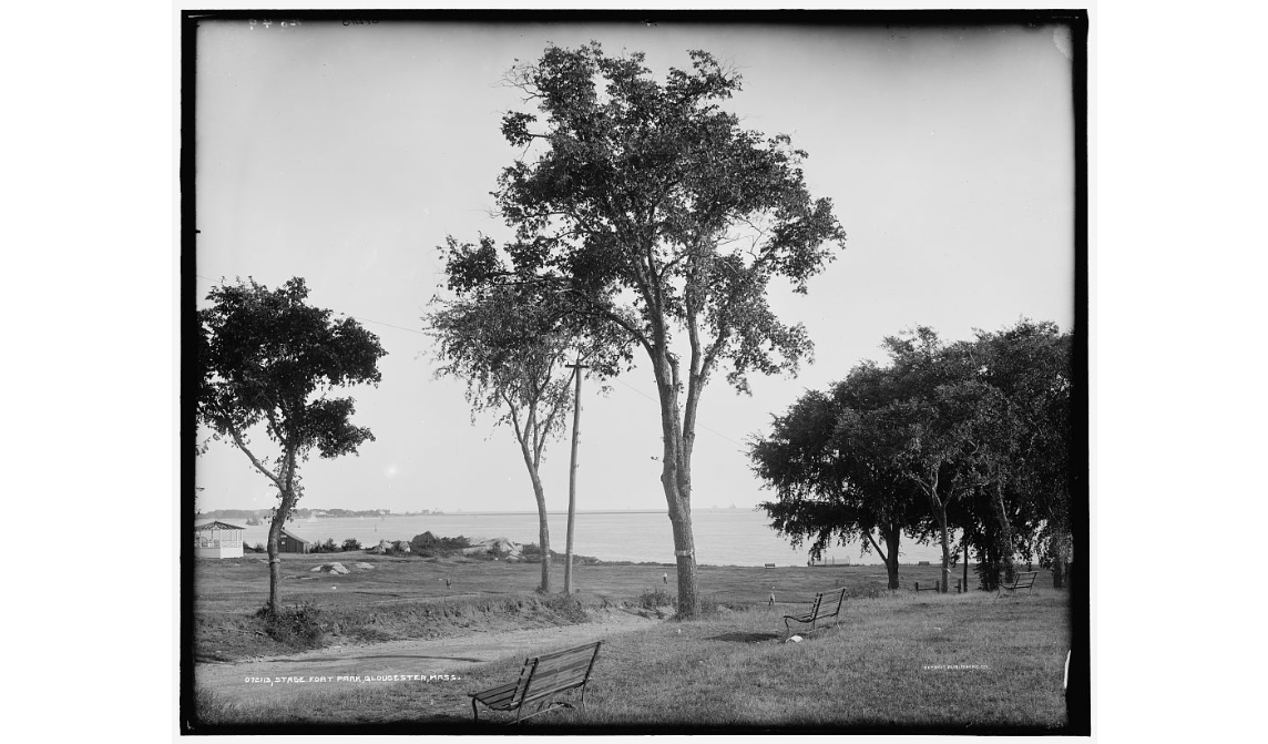
Here’s Stage Fort Park in 1901 with it’s grassy meadow expanse.
When you zoom in you can see the big ‘Battery K’- for the Civil War 1861 to 1865 Fort Conant.
And this weekend.
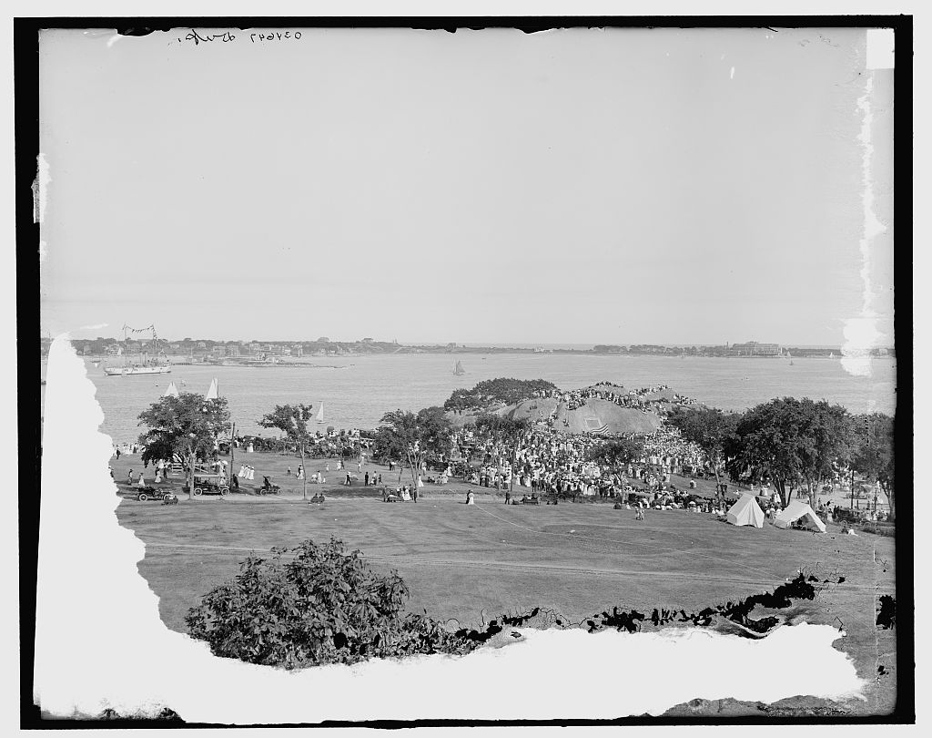
Here’s a gorgeous aerial photo from the 1907 Tablet Rock dedication. There are several modes of transportation by land and sea. The well worn road was ground in from years of steady use, carriage trade and automobiles in this picture. The road is still prominent today.
Note the tents in this one.
Here’s another angle and a closer picture from the ground
John Hays Hammond, Sr. with his daughter Natalie (not looking happily back at the photographer). She pulled back the cord for the reveal. Hammond orchestrated and compelled the press coverage.
I’ll go into more details about the commission with Part II.
Here’s a detail of the plaque in 1907
Spread The GMG Love By Sharing With These Buttons:
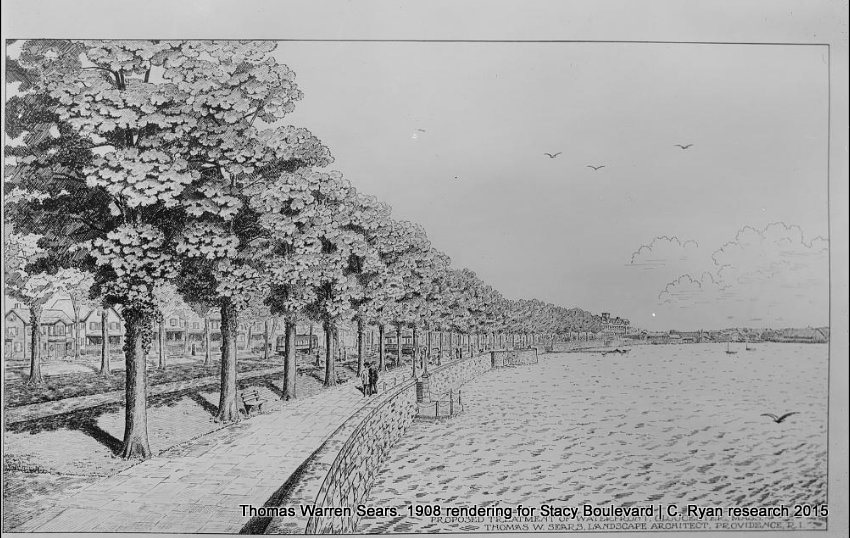
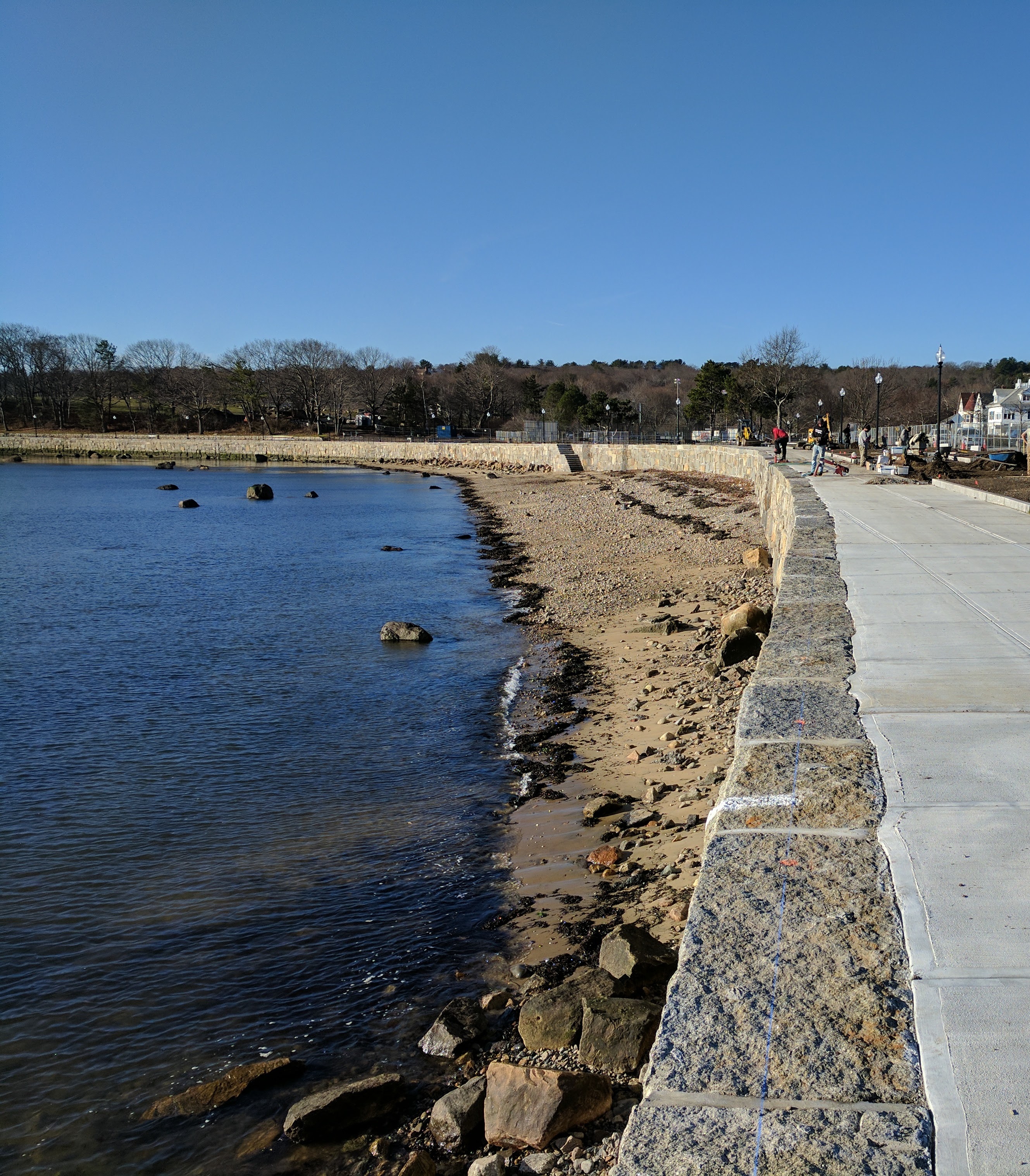
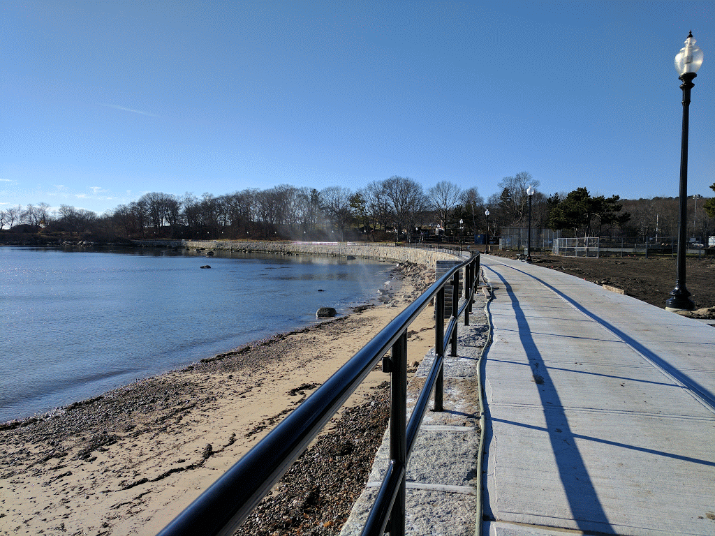
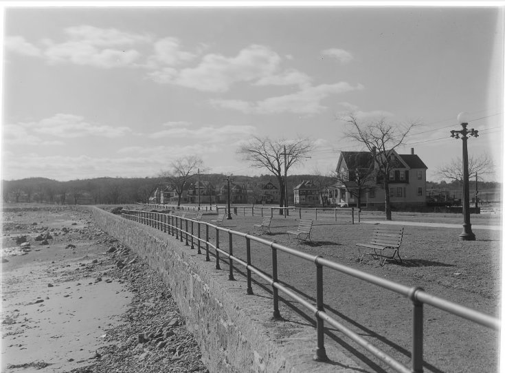
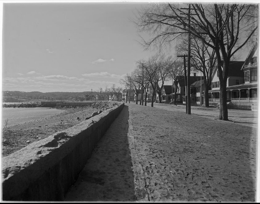
The Gloucester Daily Times published this image in 1923 with the photo caption: “Now Under Construction on the Southern Side of Western Avenue, this Project When Completed Will Give Gloucester one of the Finest Approaches of Any City on the Atlantic Seaboard.” The meticulously hand drawn credit within the drawing itself caught my eye as much as the drawing: “Proposed Treatment of Waterfront, Gloucester, Mass. Thomas W. Sears Landscape Architect, Providence RI”. Thomas W. Sears was a remarkable 20th Century landscape designer. The modern Boulevard work completed in 2014-17 gracefully carries out and returns to the original dreams for the Western Avenue highway and park that are more than a century in the making.
Thomas Warren Sears (1880-1966) preliminary designs for Gloucester’s future Boulevard
Thomas Warren Sears was born in 1880 in Brookline, Massachusetts, and grew up in this elegant abode at the corner of Beacon and Charles Street. This black and white house portrait was shot in 1897.
Here’s a Google street view photo for comparison today.
After being ousted from the New York City parks department, the ‘father of American landscape design’, Frederick Law Olmsted (1822-1903), launched his business a ten minute walk from the Sears family home. The headquarters at 99 Warren Street was named “Fairsted” and was in operation until 1979 when it was declared a National Historic Site and transferred to the National Parks.
If there was no neighbor connection early on, a professional one came soon: Sears worked for the Olmsted Brothers immediately after receiving two degrees from Harvard– his BA in 1903 and his BS in 1906. (There may have been an earlier Brookline connection.) Rather quickly Sears left to set up his own firm: first in Providence, RI, when he did work for Gloucester’s Boulevard, and not long after in Philadelphia. In 1911 he gave a talk for the Proceedings of the Engineers’ Club of Philadelphia 28 (April 1911):147-158., “The Functions of the Landscape Architect in Connection with the Improvement of a City”available online as part of an urban planning anthology compiled by John W. Reps, Professor Emeritus, Cornell University. I wonder if he shared his Gloucester photographs as part of his talk?
“There are two main approaches to cities: (1) On water by boat, and (2) on land by railroad. Along both of these lines of approach land should be taken for public use, and for very different reasons. Take first the use of water fronts: Unless some provision is made for the public, the whole water front, whether it be river or harbor, may be usurped by commercial enterprise and the public deprived of ever seeing the water except when aboard a boat. In certain cases, as in New York, where the water front must of necessity be utilised for dockage, a combination of commercial and public use may be successfully employed. There the docks are owned by the city and leased by the steamship companies; in this way their appearance can be controlled. At present it is planned to build on the tops of these docks huge recreation parks which may be used by the public.”- 1911 Thomas W. Sears
Mike Hale’s contemporary perspective shares a similar philosophy with Sears:
“An effort has been made in this paper to show clearly that landscape architecture is utilitarian quite as much as esthetic; that whatever one is designing, whether it be a city plan or any of the elements in a city, the design should be governed by use as much as beauty.” – 1911 Thomas W. Sears
By 1917 Sears was commissioned regularly and had a long, full career including notable designs for the Reynolda estate now part of Wake Forest University, Winston-Salem, North Carolina, and the wildly influential outdoor amphitheater for Swarthmore College, the Scott Outdoor Auditorium. His work in Gloucester is rarely mentioned.
Since the Gloucester drawing was marked ‘Providence’, I knew the drawing was done long before the 1923 construction. I tentatively dated the schematic ca.1910. Thankfully Thomas Warren Sears was a photographer, too. Turns out that this image is a Sears’ photograph of a lovely Sears’ design. The glass negative is dated 1908 which squares with his professional career timeline.
ALL NEW LED LIGHTS
One of the modern design elements is the welcome ornamentation of lights. They feel like they were always here because line is such an essential part of design and they add the vertical visual interest. When I saw the new light bases I thought of the line of trees in the Sears drawing. I love the mix of natural and formal design in his rendering, but am equally gobsmacked by the sweeping open vista. Both are sensitive approaches and part of the context of the Boulevard’s build.
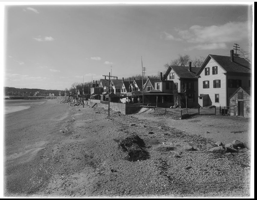
Thomas Warren Sears photographed Western Avenue for his preparatory work. See the homes along the beach that were later removed for the construction of the Boulevard; distant vistas to the Surfside Hotel (built after Pavilion burned) and Stage Fort park; and Western Avenue street scenes looking east and west before the road was widened.


")
")

")


")
")
")
")
")
")