Gloucester, Mass.- Great teacher at Gloucester High School, Shaun Goulart, creates a local history scavenger hunt trivia game for his 9th grade students that takes place weekly for 6 weeks. We’re taking the challenge one week after the students. Good luck!
ANSWERS TO SHAUN GOULART’S LOCAL HISTORY TRIVIA WEEK THREE
How did you do? Week three was all about some famous Gloucester FIRSTS and there were many locations. Stop here if you prefer to go back to see Week 3 questions only.
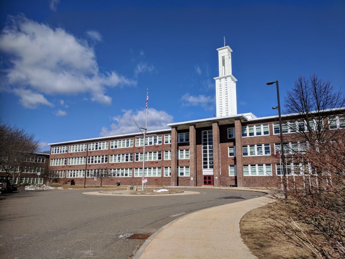
1)The location of Gloucester’s first “Four Year High School”
Principal Albert Bacheler CENTRAL GRAMMAR
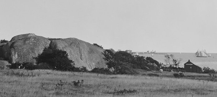
2)The location of Gloucester’s first Brick Building?
PURITAN HOUSE built in 1810by Col. James Tappan* is a historic house at 3 Washington Street and 2 Main Street. Also known as: Tappan’s Hotel, Gloucester Hotel (“Tappan’s Folly”), Atlantic House, Mason House, Community House, Capt Bills (1960s-70s), Puritan House & Pub (1977), Blackburn Tavern (1978-00s) *Tappan was taught by Daniel Webster
Excerpt from prior GMG post (read it here) about scenic tours by bike 1885: “And now let’s take our wheel for a short run along our harbor road to East Gloucester, and note the many points of interest on the way. The start is made at the Gloucester Hotel–the headquarters of all visiting wheelmen in the city–at the corner of Main and Washington streets; from thence the journey takes us over the rather uneven surface of Main street, going directly toward the east. In a few minutes we pass the Post Office on the left, and soon leave the noisy business portion of the street behind us, then, e’re we are aware of it, we reach and quickly climb the slight eminence known as Union Hill…” This brick building at Main and Washington now features Tonno Restaurant. Notice the chimneys and same stairs as when it was the Gloucester Hotel. The Blackburn Tavern sign was just marketing; this building has no connection. Blackburn’s Tavern is now Halibut Point restaurant at the other end of Main Street.
3)The first schoolmaster and town clerk’s house. (private property do not trespass)
“RIGG’S HOUSE” 27 Vine Street (Annisquam) Thomas Riggs House purchased in 1661
oldest house on Cape Ann, Gloucester, MA
4)A list of the first recorded Gloucester fishermen lost at sea. (Hint: 1716)
Look under the year on cenotaph surrounding Man At Wheel
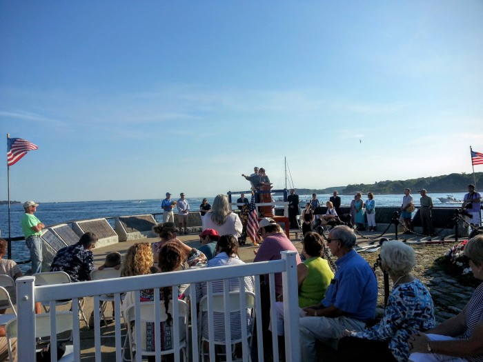
Mayor Romeo Theken, annual Fisherman’s Memorial Service, 2016
5)The location of the first carillon built in America.
Gloucester, Mass.- Great teacher at Gloucester High School, Shaun Goulart, creates a local history scavenger hunt trivia game for his 9th grade students that takes place weekly for 6 weeks. We’re taking the challenge one week after the students. Good luck!
ANSWERS TO SHAUN GOULART’S LOCAL HISTORY TRIVIA WEEK TWO
How did you do? Week two delved into scenes of historic battles. I’ve added some background. Stop here if you prefer to go back to see Week 2 questions only from 3/17/19
WEEK 2: DEFENDING GLOUCESTER Location #1
Who was the first governor of Massachusetts Bay Colony? ANSWER – ROGER CONANT
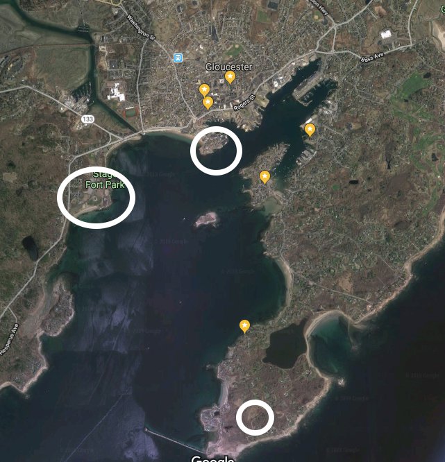
Go to the location of the fort named after him and take a picture with a member in it. *Stage Fort Park “Fisherman’s Field”
Bronze tribute plaques embedded in Tablet Rock at Stage Fort Park detail the site’s history and were commissioned and unveiled at different times. The monumental and stunning Founders plaque from 1907 on Tablet Rock itself is in fantastic condition. Two DAR plaques were inlaid on the glacial outcroppings past half moon beach on the way to the cannons. The Fisherman’s Field (ca.1930) is so worn it’s nearly indecipherable, though that’s part of its charm. The plaque compels close inspection, lingering and discovery. It’s a fun family activity for anyone who likes a challenge. For those who want help reading the content, I transcribed it back in 2010. Scroll down below the “read more” break in this post to open.
Stage Fort Fisherman’s Field plaque honoring all actions. My attribution is Harriet Hyatt_plaque refers to restoration of area 1930 by DAR
Revolutionary War tribute commissioned by DAR and installed 2013
During which war did it receive this name? ANSWER – FORT CONANT during the Civil War
When you zoom in on this 1901 photograph, you can see the big ‘Battery K’- for the Spanish American War (Camp Hobson) Fort conant during Civil War
Scrutiny
1901 before the Tablet
Gloucester vs Plymouth / Captain John Hewes vs Miles Standish
DAR plaques marvelous glacial outcroppings Stage Fort Park
Founders Plaque
Gloucester HarborWalk #32
Location #2
location 2 courtesy photos
Take a picture at Fort Point with the former location of the Coast Guard Aviation Station behind you (must be visible in the picture) ANSWER – TEN POUND ISLAND
What was the fort called on Fort Point? ANSWER – FORT DEFIANCE Fort Point Hill, Fort Lillie (Lily)
Name a war it was utilized in. ANSWER – Efforts to fortify as early as 1703 (see Pringle) ATTACK OF CAPTAIN LINDSAY (OR LINZEE) 1775 –population about 5000 –REVOLUTIONARY WAR, WAR OF 1812, CIVIL WAR
“In 1743, what is known as the old fort on Commercial Street, now encroached upon and surrounded by buildings, was completed. On this point, well selected strategically, is a hill which effectually commands the inner harbor. In 1742 and 1742, the General Court appropriated 527 pounds to defray the cost of fortification. Breastworks were thrown up and eight 12-pounders placed in position in the fort. The immediate cause of its erection was the fear of French incursions, but these fears were never realized. An effort had been made as early as 1703 to fortify the place, but the petition of the selectmen to the General Court for an appropriation for the purpose was refused. The petition shows that he harbor, even at that early date was extensively frequent for shelter, and was “very seldom free from vessels.”
“In order to be better prepared for future assaults breastworks were thrown up at Stage Fort, the Cut, Duncan’s Point and Fort Point. This, however was the last attack by sea or land that the people experienced.”
Location #3
From Fort Point go to the location of the seven-gun earthwork battery and barracks in ramparts field. Take a picture with the old towers in the background (do not go on private property) ANSWER – EASTERN POINT FORT by eminent domain, Ramparts Field Road Fort Hill
Name a war it was utilized in ANSWER – CIVIL WAR
“Immediate action was taken toward the erection of fortifications. Land at Eastern Point, belonging to Thomas Niles was acquired by the government, and earthwork fort erected and manned…”
Screenshot
Screenshot Google Earth with all three above locations in it and circle them. Submit the image.


")
")
")
")
")
")