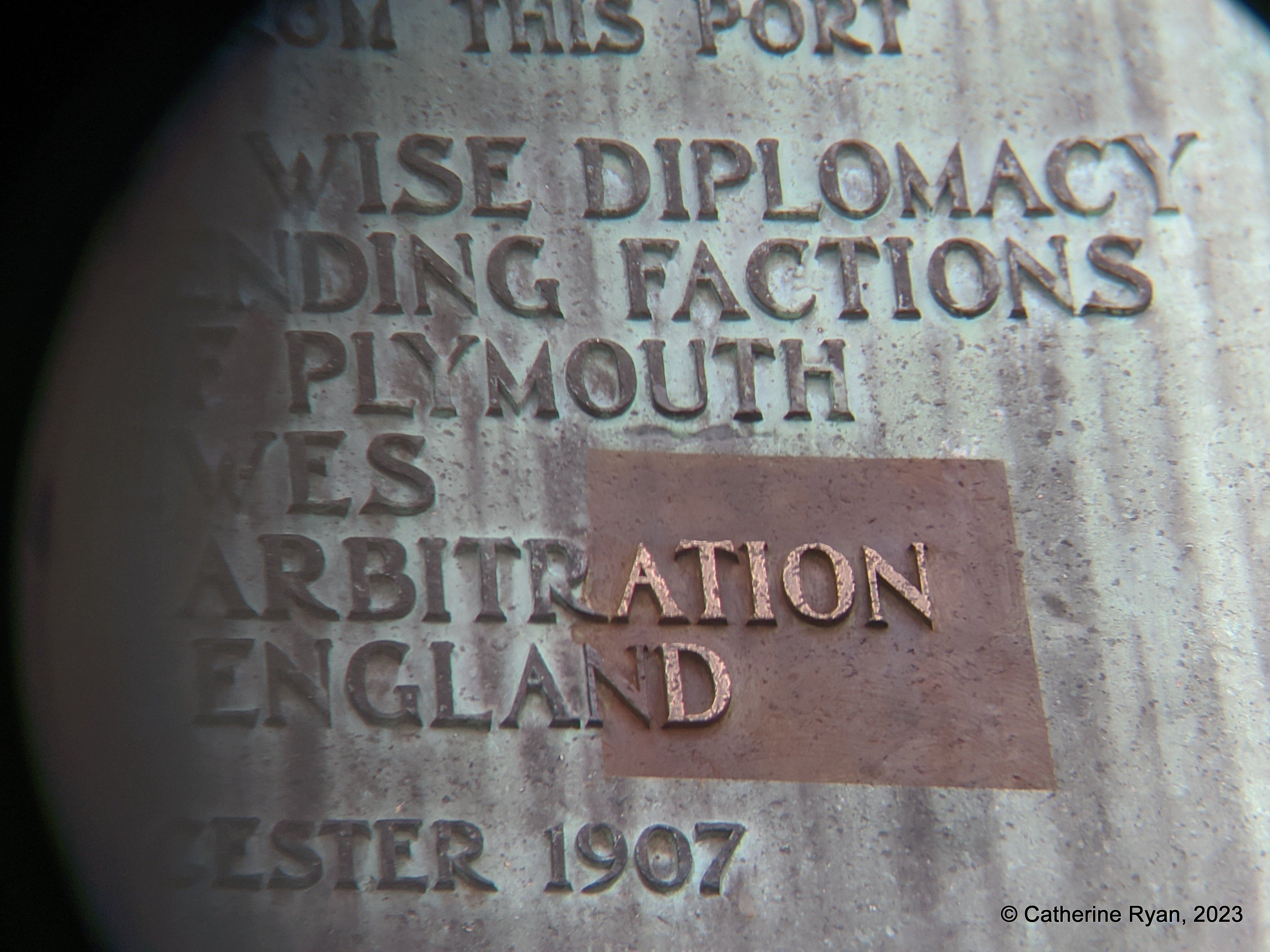
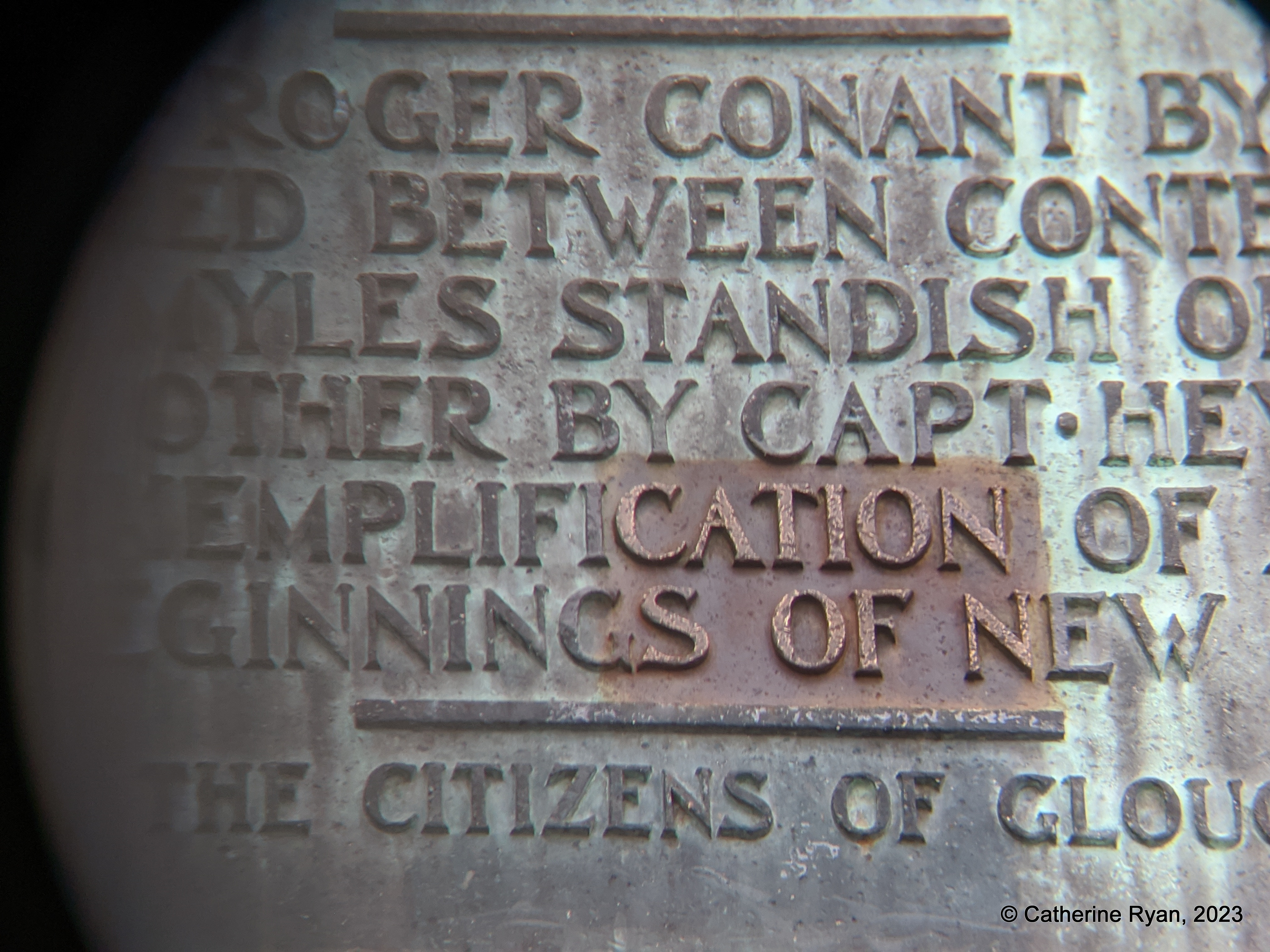
Part 2. “NOTABLE”. “EXEMPLIFICATION”. “ARBITRATION”.
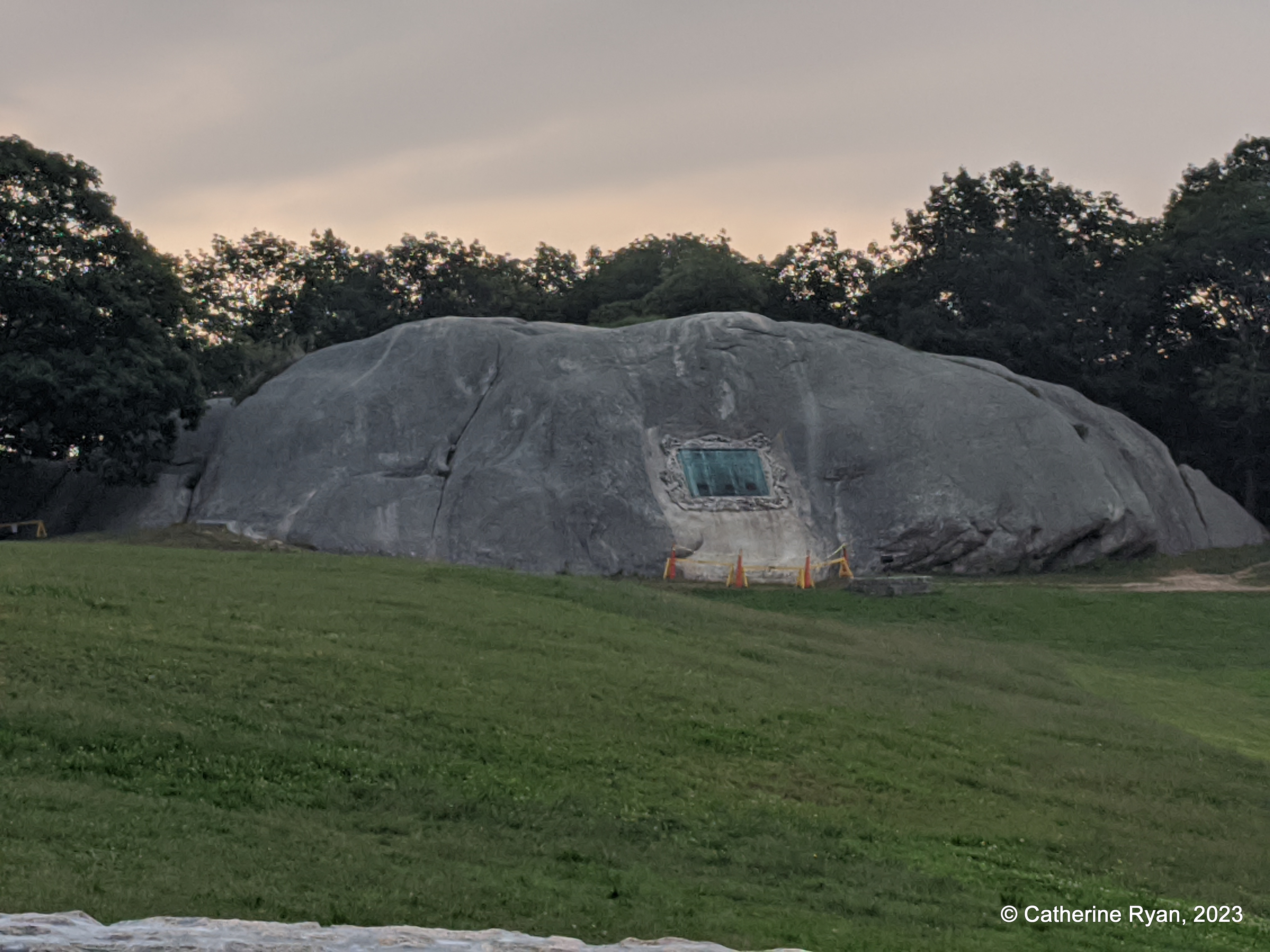
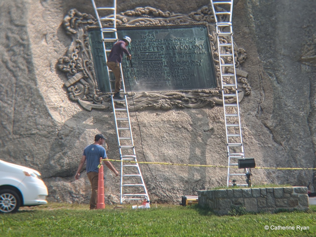
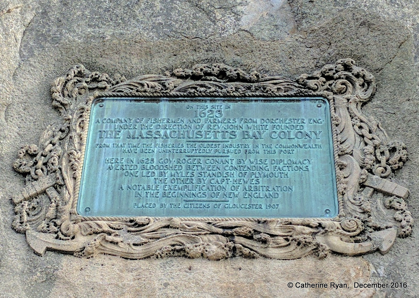
Three test patches are visible on the commemorative bronze plaque set into Tablet Rock. Along with surface patina aesthetic choices, test patches are left to cure or age to see their impact. When considering care and protection for public art, there is no singular approach. There is no other American commemorative tablet that’s so colossal, set into a glacial outcropping in this precise angle and manner, and susceptible to its surroundings and climate over this length of time. Hence the test patches.
Daedalus is a renowned sculpture conservation firm and will approach this work with respect.
Money was raised to address the plaque and patination (some had preference for a brown finish) Gloucester Daily Times, 2016, and then that project was paused. As far as I know, funds were not returned nor redirected for restoration of the city’s art deemed in distress. At the time William Taylor addressed the verdigris:
“As an antique dealer for decades who dealt many times with bronzes and patinas I completely agree that the tablet should not be restored. While I applaud…well-meaning and generous inclinations not only does natural oxidization form a protective surface it looks appropriate and should not be fiddled with. Restoration is too expensive and absolutely not necessary. Cleaning it would remove many decades of well acquired history.
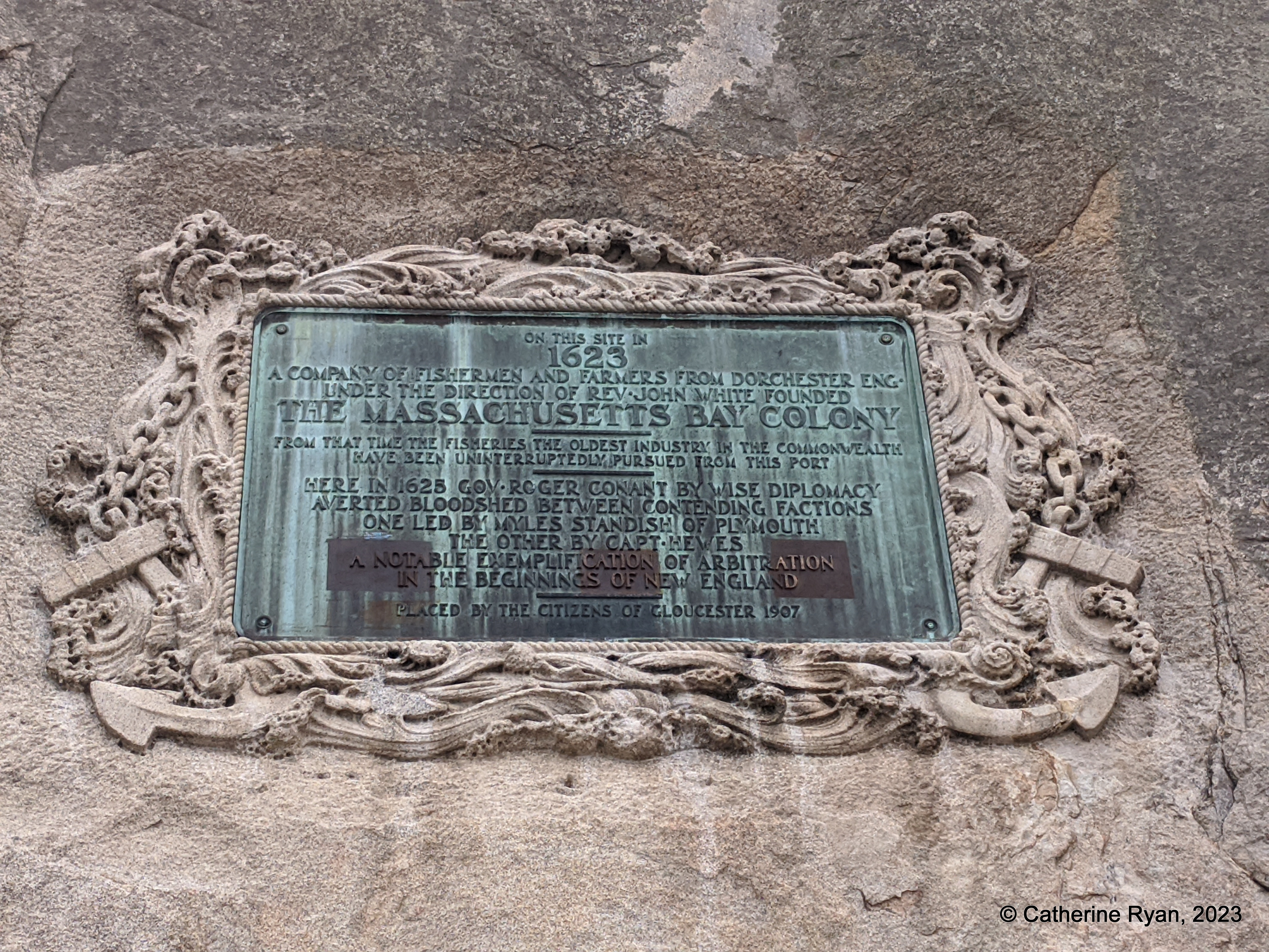
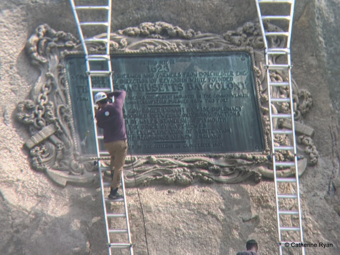
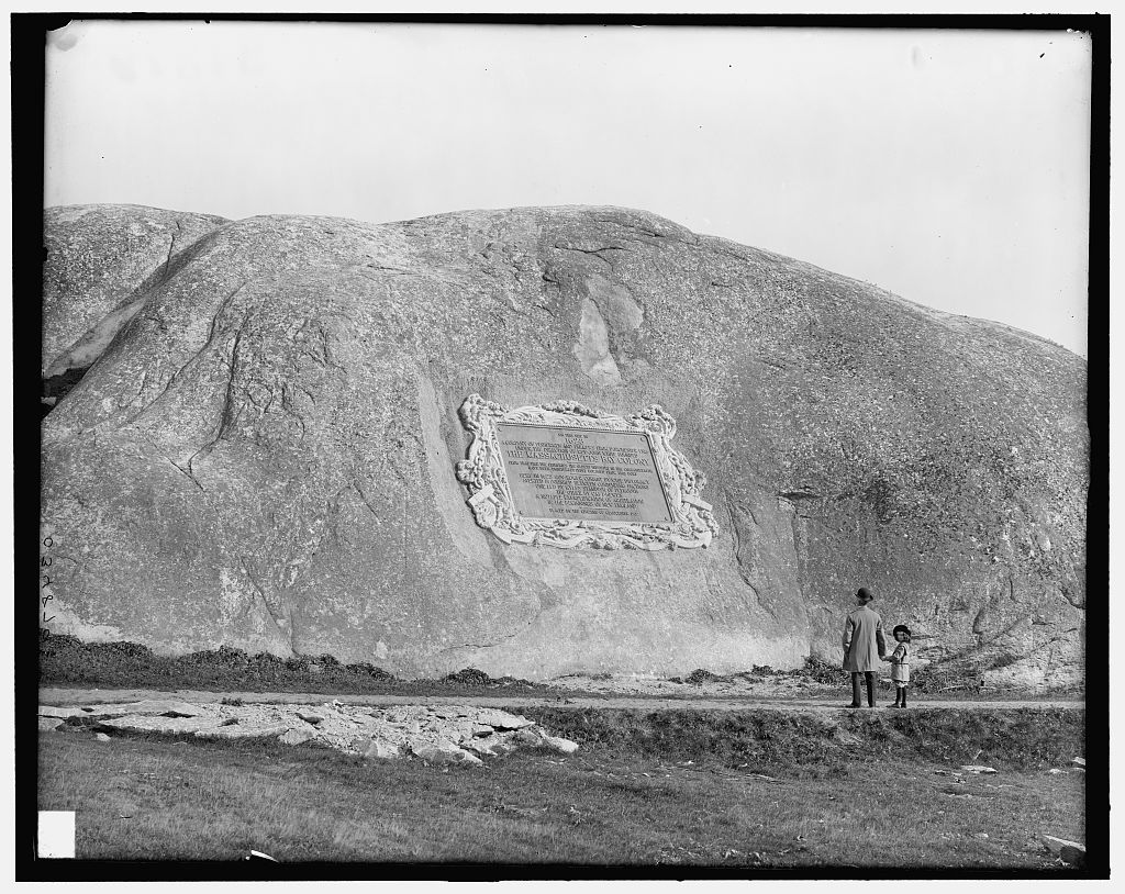
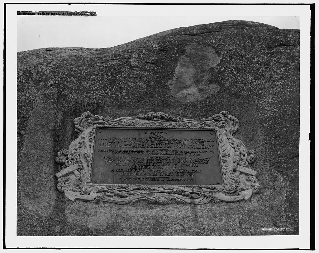
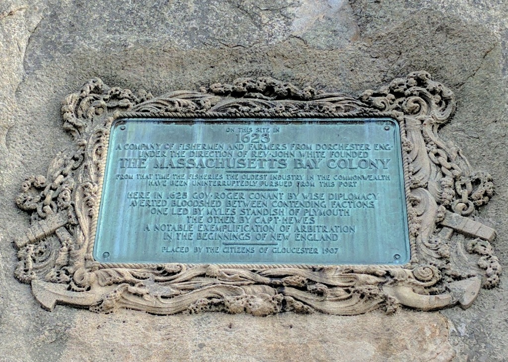
The enormous 20th Century plaque on Tablet Rock in Stage Fort Park commemorating the first permanent European settlement, the “Founding of the Massachusetts Bay Colony in 1623”, was dedicated in August 1907. James R. Pringle was designated to write the inscription. The execution of the design and bas relief border was by Eric Pape.
“The nautical scheme of decorative framework and embellishment was the composite suggestion” of various committees dating as far back as the 1880s.
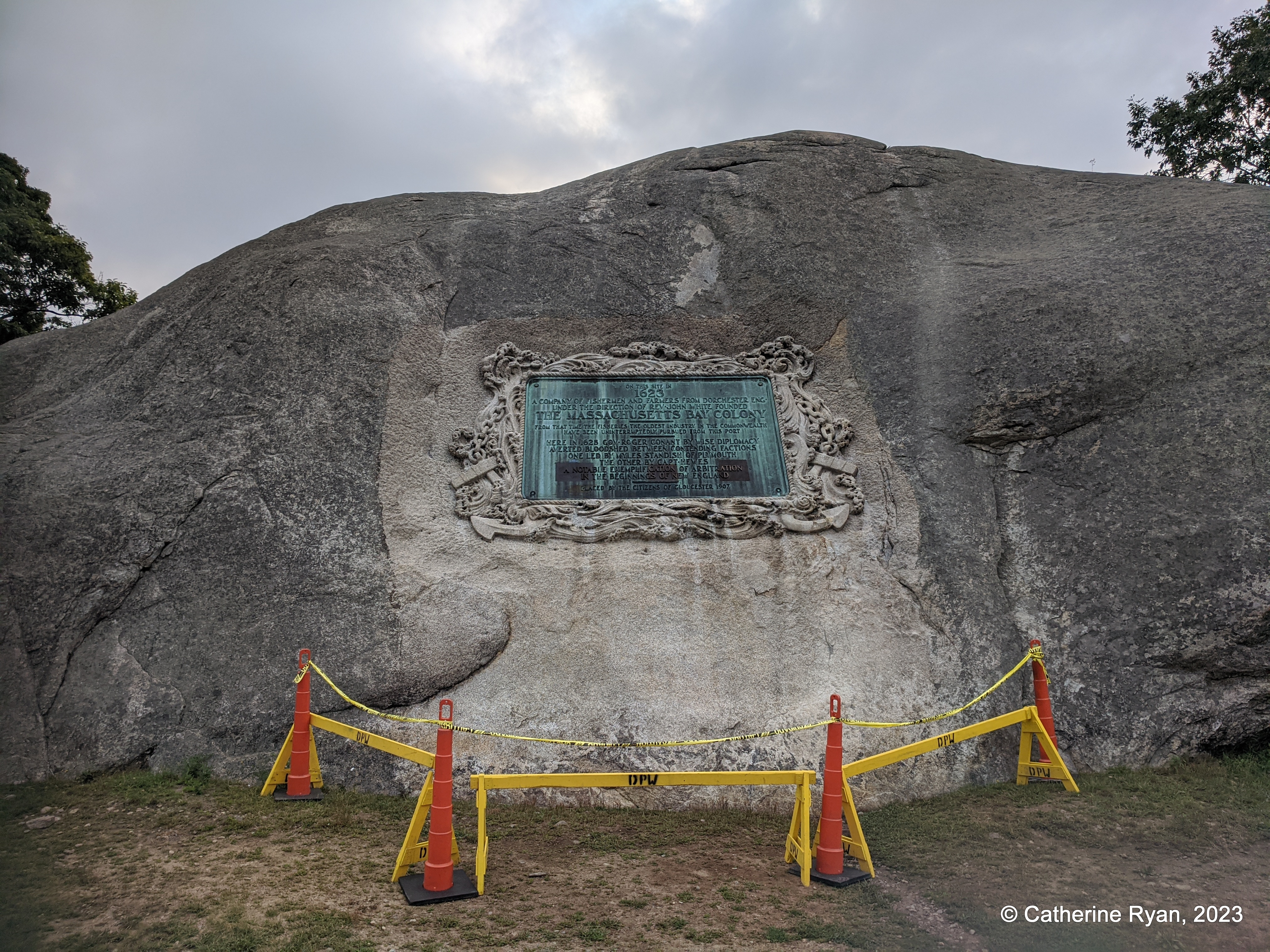
Founders plaque – tablet rock photo C. Ryan 2016
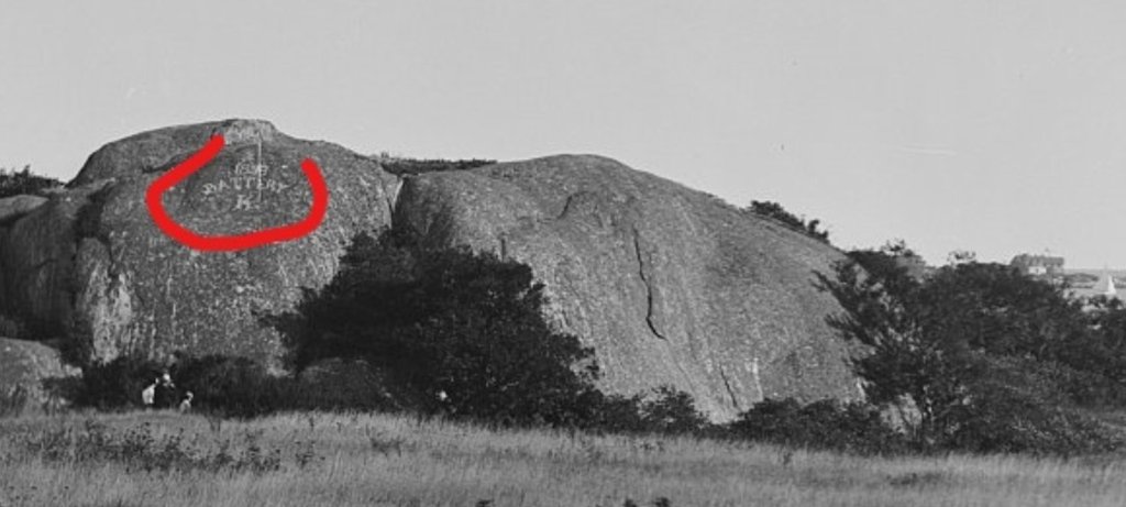
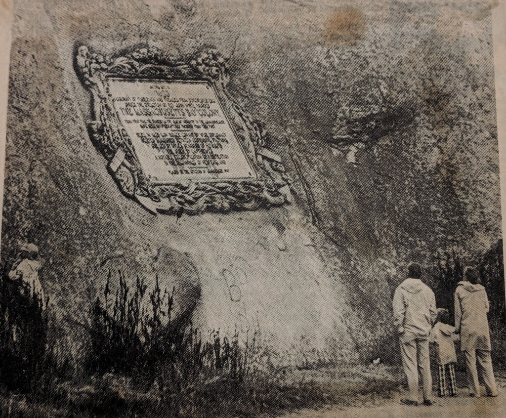
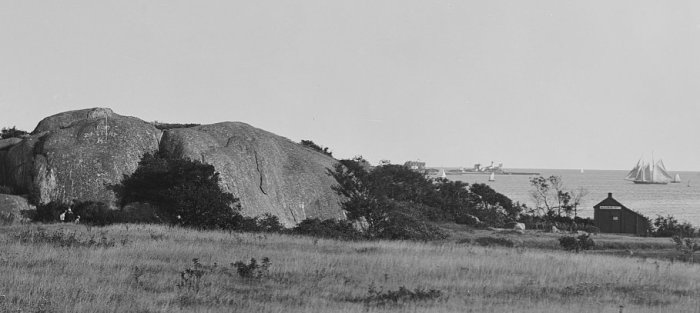
Image block documenting how Tablet Rock looked pre bronze tablet through today: before the plaque, 1901 (branded Battery K still visible); 1907 dedication, Library of Congress (Hammond with his daughter Natalie Hammond); 1970s; 1974 (graffiti beneath); 2016; 2019. Note the rectangular area beneath the plaque was lightened at the time of installation. The border carving degraded. The dark streaks accelerated after 2020 (note the verdigris patina 2016, 2019, etc)
Gloucester, Mass.- Great teacher at Gloucester High School, Shaun Goulart, creates a local history scavenger hunt trivia game for his 9th grade students that takes place weekly for 6 weeks. We’re taking the challenge one week after the students. Good luck!
ANSWERS TO SHAUN GOULART’S LOCAL HISTORY TRIVIA WEEK TWO
How did you do? Week two delved into scenes of historic battles. I’ve added some background. Stop here if you prefer to go back to see Week 2 questions only from 3/17/19
WEEK 2: DEFENDING GLOUCESTER Location #1
Who was the first governor of Massachusetts Bay Colony? ANSWER – ROGER CONANT
Go to the location of the fort named after him and take a picture with a member in it. *Stage Fort Park “Fisherman’s Field”
Bronze tribute plaques embedded in Tablet Rock at Stage Fort Park detail the site’s history and were commissioned and unveiled at different times. The monumental and stunning Founders plaque from 1907 on Tablet Rock itself is in fantastic condition. Two DAR plaques were inlaid on the glacial outcroppings past half moon beach on the way to the cannons. The Fisherman’s Field (ca.1930) is so worn it’s nearly indecipherable, though that’s part of its charm. The plaque compels close inspection, lingering and discovery. It’s a fun family activity for anyone who likes a challenge. For those who want help reading the content, I transcribed it back in 2010. Scroll down below the “read more” break in this post to open.
Stage Fort Fisherman’s Field plaque honoring all actions. My attribution is Harriet Hyatt_plaque refers to restoration of area 1930 by DAR
Revolutionary War tribute commissioned by DAR and installed 2013
During which war did it receive this name? ANSWER – FORT CONANT during the Civil War
When you zoom in on this 1901 photograph, you can see the big ‘Battery K’- for the Spanish American War (Camp Hobson) Fort conant during Civil War
Scrutiny
1901 before the Tablet
Gloucester vs Plymouth / Captain John Hewes vs Miles Standish
DAR plaques marvelous glacial outcroppings Stage Fort Park
Founders Plaque
Gloucester HarborWalk #32
Location #2
location 2 courtesy photos
Take a picture at Fort Point with the former location of the Coast Guard Aviation Station behind you (must be visible in the picture) ANSWER – TEN POUND ISLAND
What was the fort called on Fort Point? ANSWER – FORT DEFIANCE Fort Point Hill, Fort Lillie (Lily)
Name a war it was utilized in. ANSWER – Efforts to fortify as early as 1703 (see Pringle) ATTACK OF CAPTAIN LINDSAY (OR LINZEE) 1775 –population about 5000 –REVOLUTIONARY WAR, WAR OF 1812, CIVIL WAR
“In 1743, what is known as the old fort on Commercial Street, now encroached upon and surrounded by buildings, was completed. On this point, well selected strategically, is a hill which effectually commands the inner harbor. In 1742 and 1742, the General Court appropriated 527 pounds to defray the cost of fortification. Breastworks were thrown up and eight 12-pounders placed in position in the fort. The immediate cause of its erection was the fear of French incursions, but these fears were never realized. An effort had been made as early as 1703 to fortify the place, but the petition of the selectmen to the General Court for an appropriation for the purpose was refused. The petition shows that he harbor, even at that early date was extensively frequent for shelter, and was “very seldom free from vessels.”
“In order to be better prepared for future assaults breastworks were thrown up at Stage Fort, the Cut, Duncan’s Point and Fort Point. This, however was the last attack by sea or land that the people experienced.”
Location #3
From Fort Point go to the location of the seven-gun earthwork battery and barracks in ramparts field. Take a picture with the old towers in the background (do not go on private property) ANSWER – EASTERN POINT FORT by eminent domain, Ramparts Field Road Fort Hill
Name a war it was utilized in ANSWER – CIVIL WAR
“Immediate action was taken toward the erection of fortifications. Land at Eastern Point, belonging to Thomas Niles was acquired by the government, and earthwork fort erected and manned…”
Screenshot
Screenshot Google Earth with all three above locations in it and circle them. Submit the image.


")
")
")
")
")
")


