Last time Bertoni, York and Foley Road sewer work done, Rt. 128 was coming in. See the original A Piatt AndreW Bridge plans Circa 1950 #PublicWorks #GloucesterMA DPW

With thanks to Mike Hale, Dir. Public Works; Matt Coutu, Civil Engineer with New England Civil Engineering thru DPW; and Police Sergeant Conners.

At this time in July, Gloucester Public Works is generally midway into a construction season. Not this year. The rain has caused a “knotted web of deficiencies,” impacting routine work such as patching and pothole repair, outside painting, line & crosswalk painting, and summer paving which is “weeks and weeks behind”. Mowing wet grass or while it’s raining isn’t a good idea. And when the sun comes out the grass takes off. So that’s a visible delay. Still, DPW is plugging away at smaller projects around town, at the waste water plant, and pumping station projects. Most Utility work is on schedule.

Even before all this rain, the 2021 schedule demanded flexibility. DPW projects are unseen in the best of times, and can go unrecognized. Gloucester DPW worked through the pandemic. People forget that they were essential services. Prioritizing projects has been key (think critical events as in hazards or special events downtown). Also pacing and flexibility:

“The past 18 months have been taxing on these guys. Mistaken belief still out there that everyone had quarantine off. They need vacation this year. Didn’t get it last year. I’m mindful of burnout. So at times we’ll be short. Could be a specialty, supervisory, labor or machine operator job. They’re all important. The edges may be where you start assembling puzzle pieces, but you’re still going to need the outside and center pieces to be complete.”

Mike Hale, Dir. Public Works, July 2021 addressing holes if any in DPW operation

Essential workers, dangerous jobs – lest we forget | TRENCH BOXES — akin to mine shaft collapse prevention — for utilities and road work

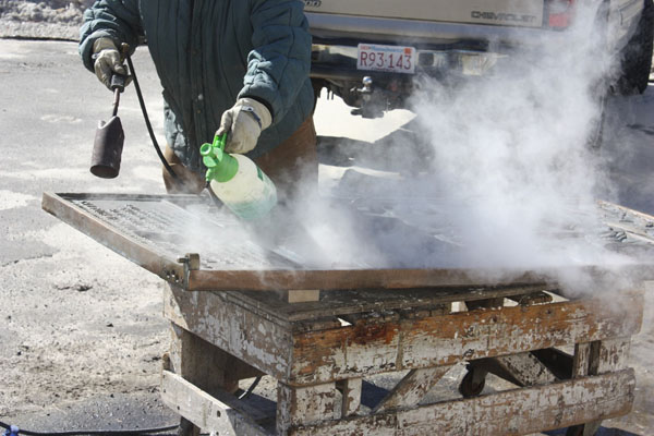
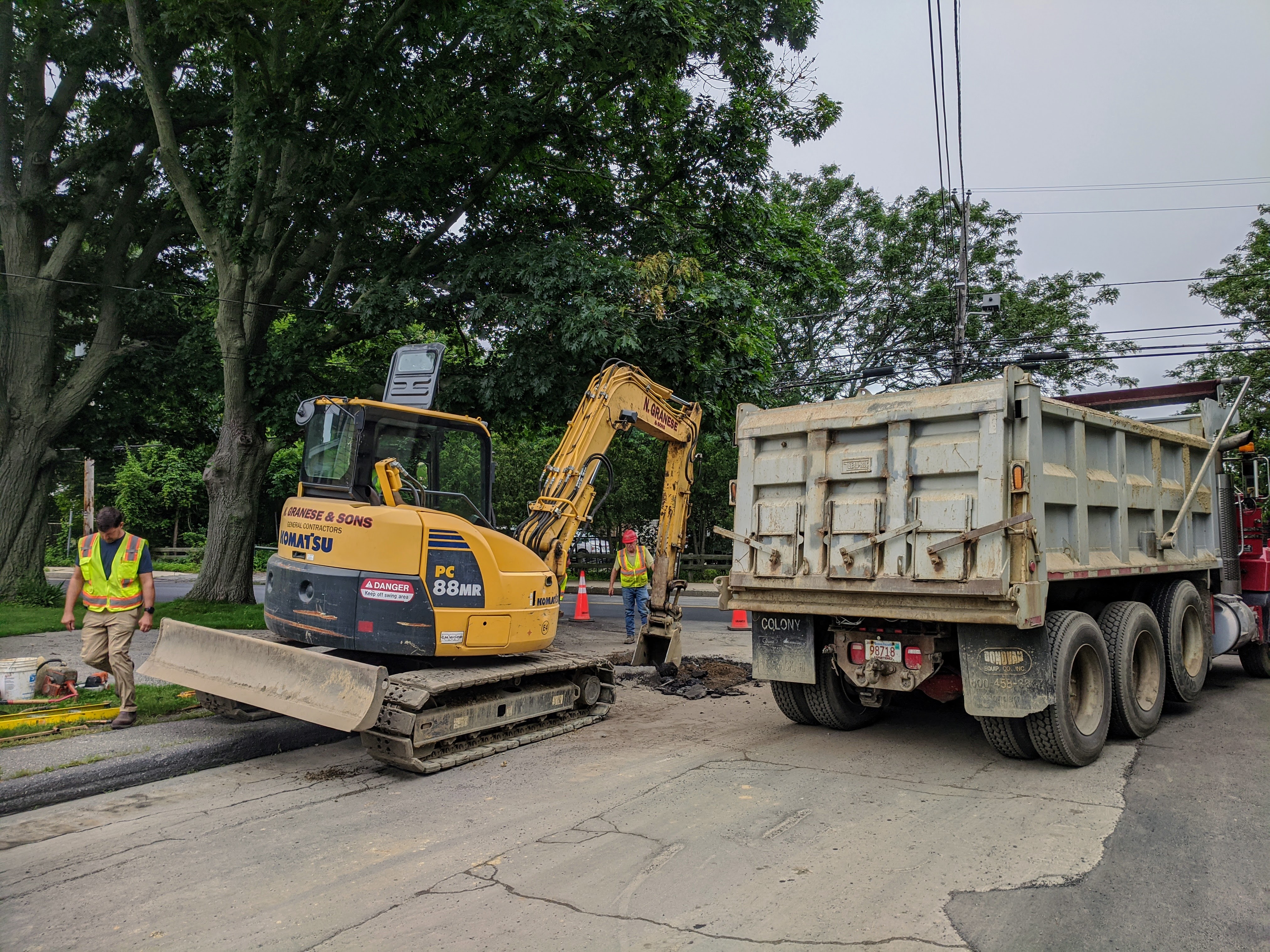
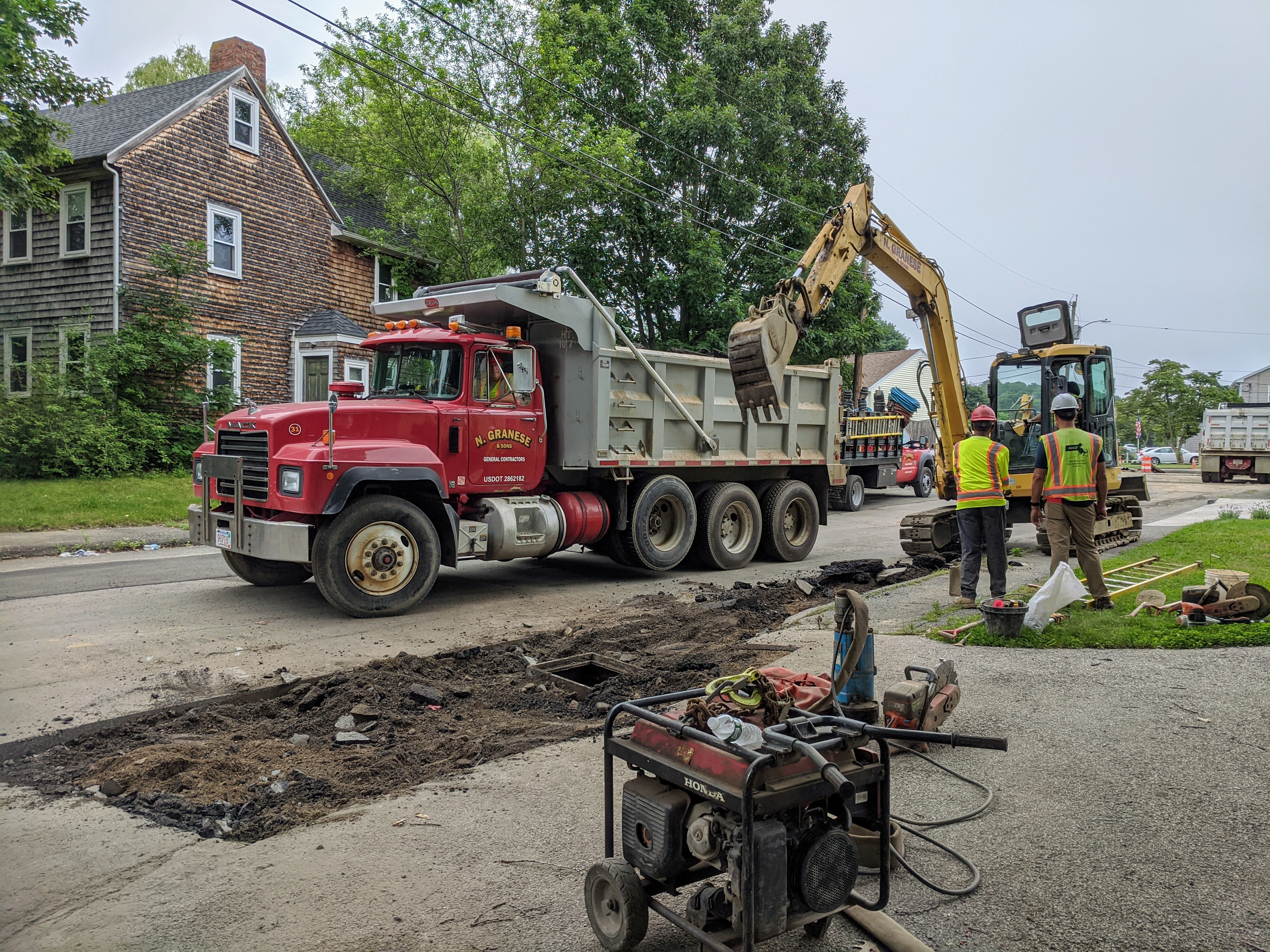
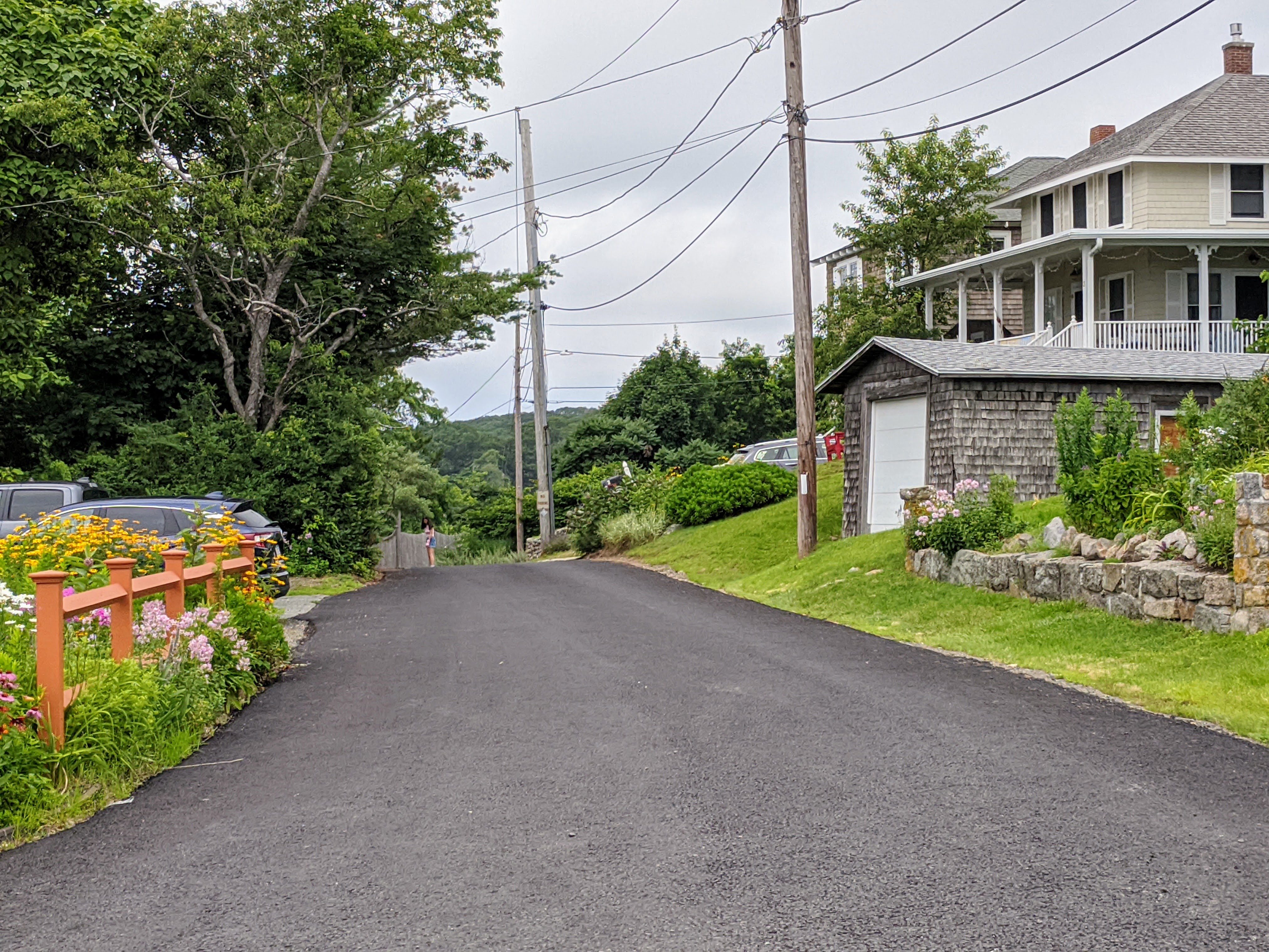
Bertoni neighborhood water & sewer project 2021

Gas, sewer, and water lines have all been removed, redirected and replaced. Clay tile pipe (sewer) is notorious for ground water intrusion, and cast iron (water) for tuberculation*– New PVC will increase run time and water quality.

  • I had to ask. *TUBERCULATION: “Accumulation of minerals inside pipe decreases volume and impacts water quality.”

DPW is pumped about the new pump!

The former configuration ran beneath Rt. 128. Now that it’s been re-directed and running to a newer location off Poplar/DPW campus, there will be a significant savings both for the life of the pump and electricity.

“The Gloucester Ave. sewer pump station, during wet weather and high ground water, would run in excess of 12 hours per day, some days even longer. Running time for the newer one has been cut down to 6 hours a day.”

Mike Hale

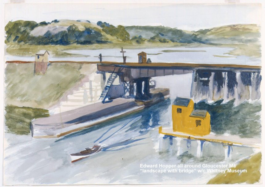
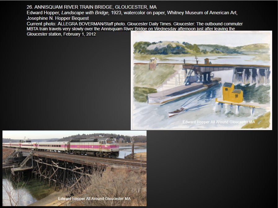
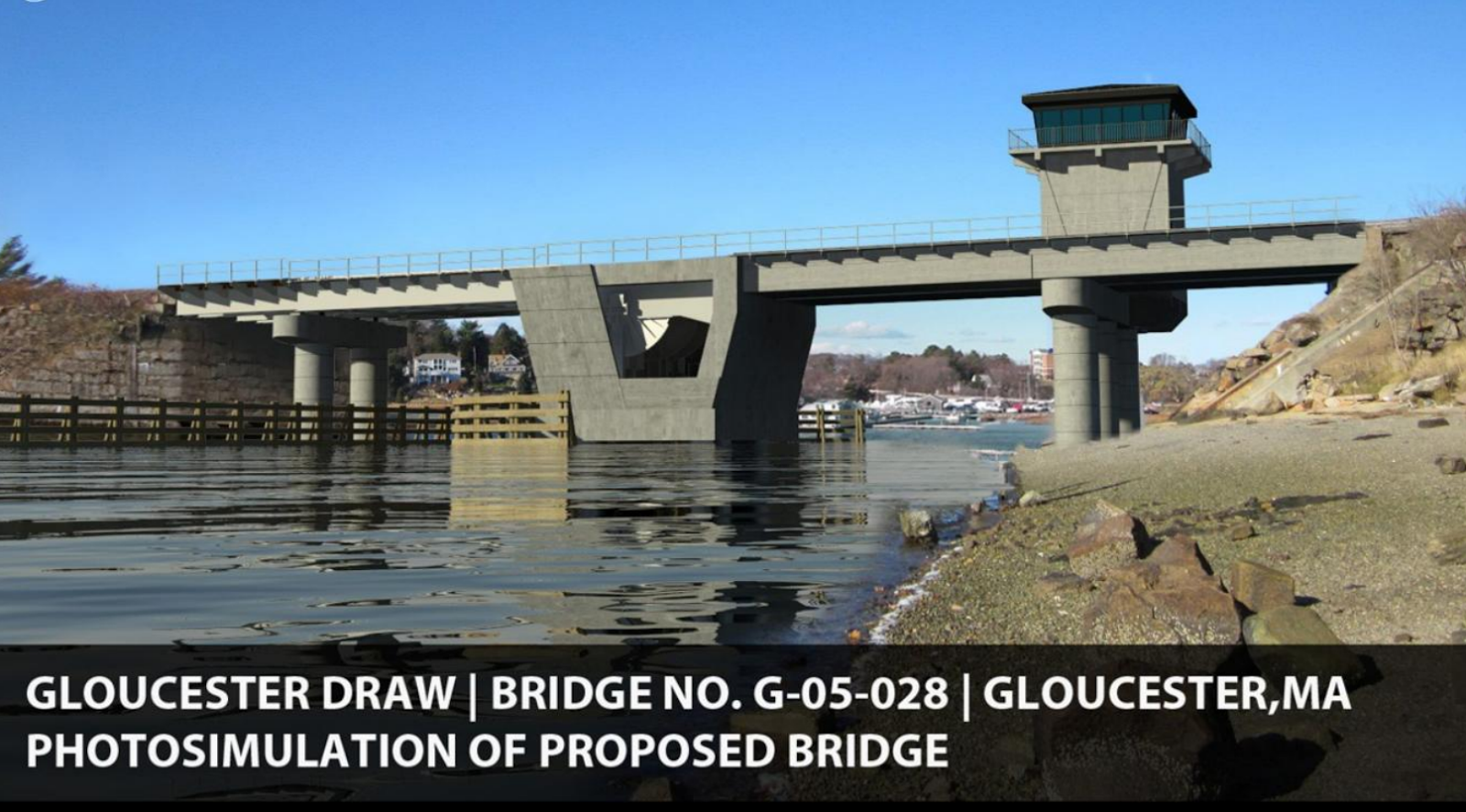
Looking Back – February 1947

The Gloucester 2.5 mile highway construction was delayed “indefinitely”, because the bids for the approach (to a new bridge across Annisquam River) came in too high. The lowest bid was $1,285,776 and the cost was fixed at $300-$500,000.

August 1950

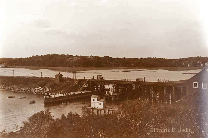
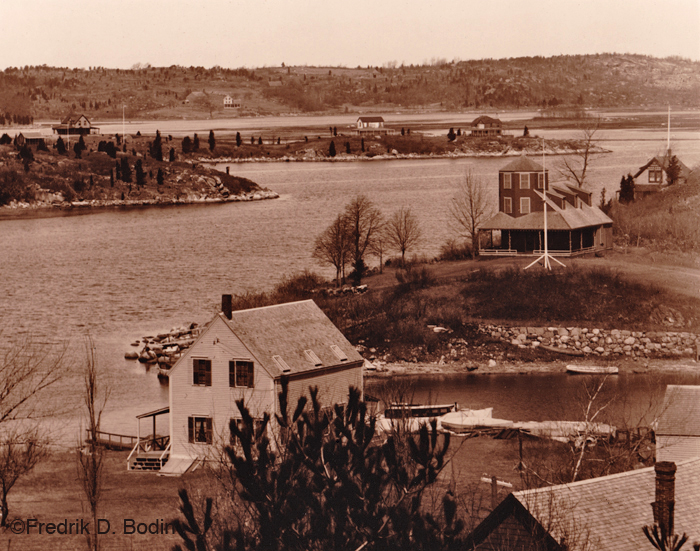
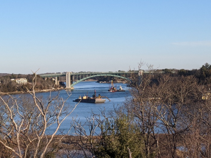
“…Much to the joy of thousands of beleaguered year-round and Summer residents, it was announced that the gap in the new high level bridge over Annisquam River was closed at 9a.m. by Bethlehem Steel Corporation.

The great significance was that it meant that it will not be too long before auto traffic will be flowing over this this improved entrance and exit to Gloucester, eliminating the two mile long traffic jams that have brought despair to motorists caught in the frequent openings of the low level Richard Blynman Bridge over the same river.

A sense of joy and relief was also experienced by the two Bethlehem officials in charge of the superstructure contract–Construction Engineers John P. McGonigle and Charles L. “Lonnie” Stroble. For as the 52-foot long, 44 ton piece of steel known as the central arch rib, south side, was lowered into place, their worry was whether or not it would fit. It did. 100 percent… The entire bridge is 860 feet long…

The superstructure contract, let by the State Department of Public Works to Bethlehem Steel is for $1,232,479.90.”

Boston Globe, Aug. 1950

1958 – RT. 128 Construction

Boston Globe focus on Rt. 128 by K. S. Bartlett features Gloucester, Ma.

“Approximately $1 million a mile for 65 miles of the great three-quarter circle from Gloucester on the North Shore to the high speed interchange in Braintree where it will meet the Southeast Expressway coming south from Boston. Cost of the 65 miles, all competed or now under construction, is a bit less than $65 million. That covers land damages, engineering, planning and construction costs since Route 128’s start back in 1936.”

“Rt. 128 has earned name, “Avenue of Modern Industry”: Million Dollar a Mile Gold Road” by K.S. Bartlett, Boston Globe

photo descriptions:

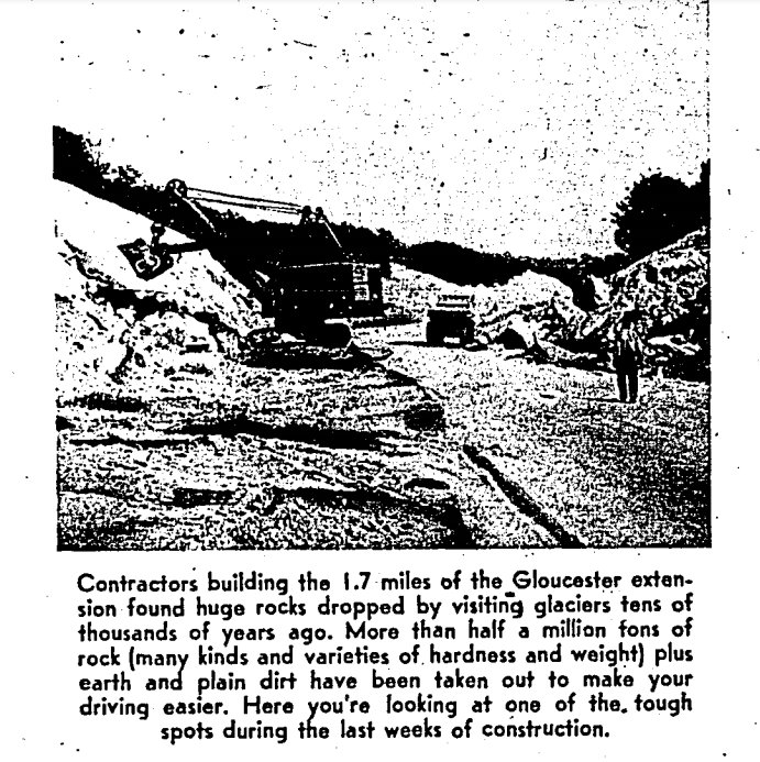
“Contractors building the 1.7 miles of the Gloucester extension found huge rocks dropped by visiting glaciers tens of thousands of years ago. More than half a million tons of rock (many kinds and varieties of hardness and weight) plus earth and plain dirt have been taken out to make your driving easier. Her you’re looking at one of the tough spots during the last weeks of construction.”

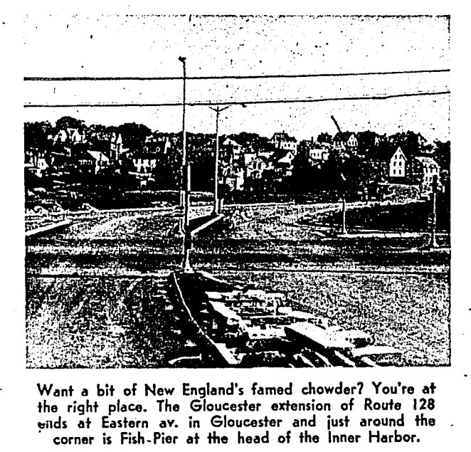
“Want a bit of New England’s famed chowder? You’re at the right place. The Gloucester extension of Route 128 ends at Eastern Avenue in Gloucester and just around the corner is Fish-Pier at the head of the Inner Harbor.”

The approach to the bridge they dubbed “Rail Cut Hill”.

Original plans pre 1953, 1953, & 1954

Some of the homes date from this time. Department of Public Works, Gloucester, MA. Higher resolution PDF here – or lower resolution images below

ca. 1950 (scan from original)

1953

1954

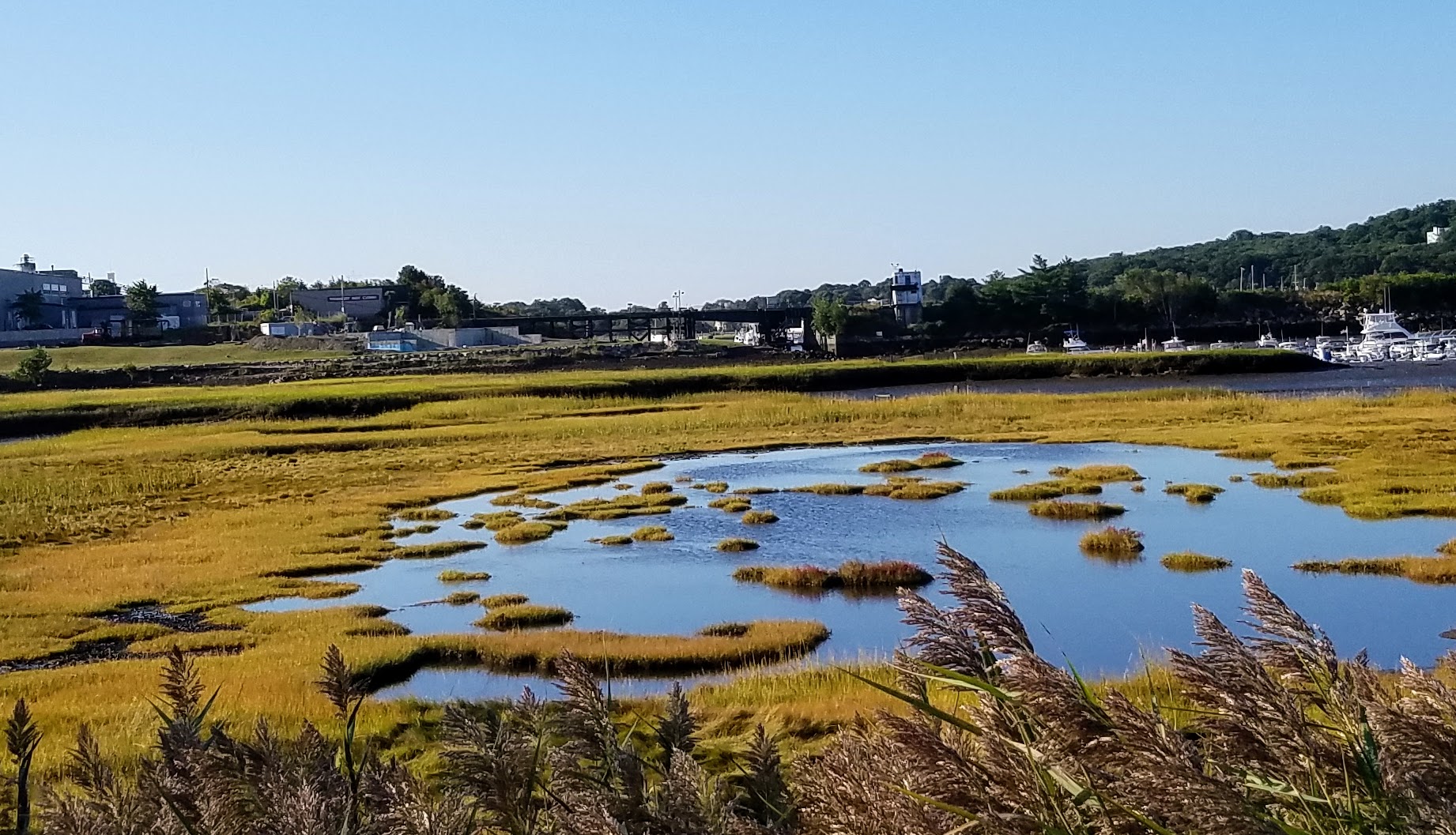
2021 Bertoni neighborhood

Approximately 3 months project nearing completion (thanks to digging into standard clay rather than granite ledge). This week, the crews have reached the storm water drain reconfiguration stage.

View from Bertoni Rd. to RT. 128. Old clay sewer line deliberately closed 2021. Bertoni Rd. is a dead end street that originally connected to Gloucester Avenue (on the other side of the highway)

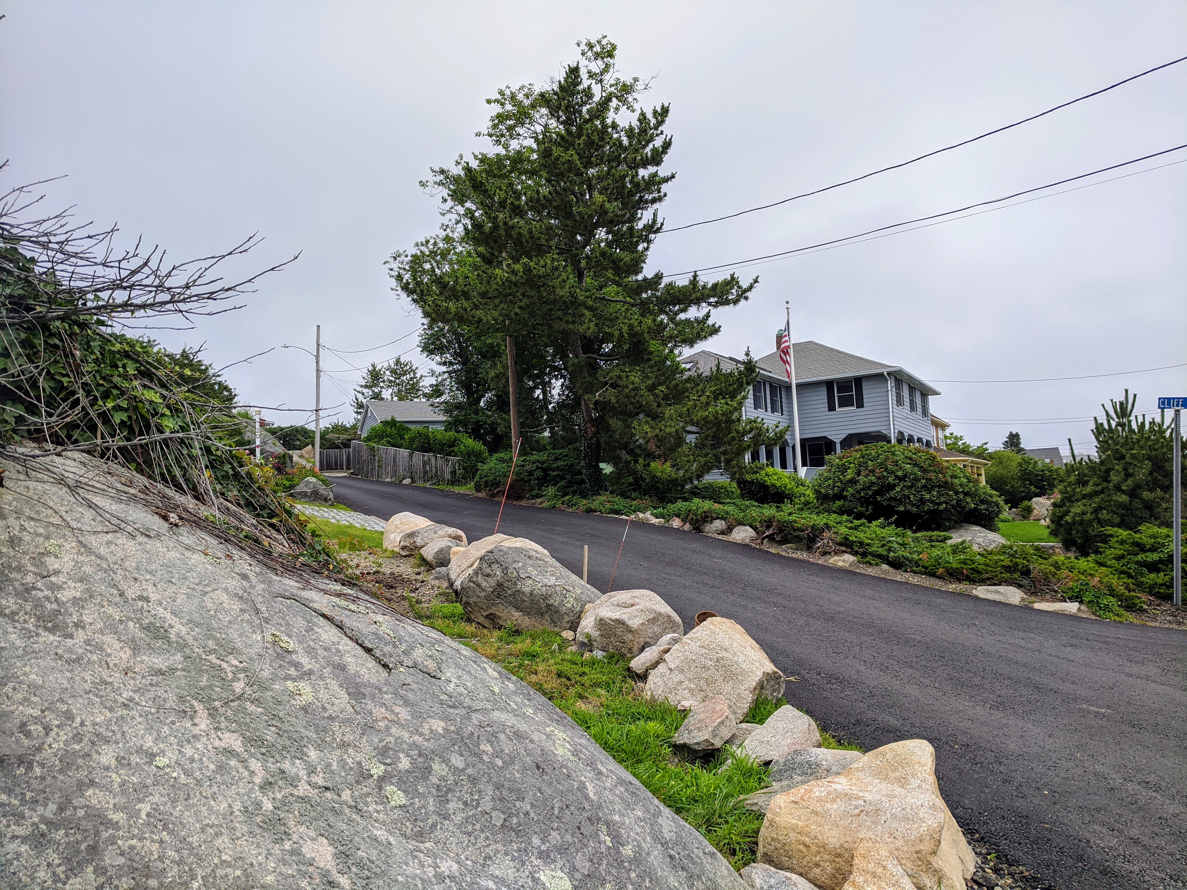
Salt Island Road | Brier (Briar) Neck neighborhood

In contrast, Salt Island Road, Brier/Briar Neck neighborhood took six months for similar work because of granite ledge and compact density.

Annisquam River dredging 2020: closeup views from the boats and across to A. Piatt Andrew bridge #GloucesterMA

Here are some views across Annisquam River to A. Piatt Andrew bridge to show relative scale and position of the Annisquam River Dredging operation in February 2020. The Annisquam River dredging project began back in October 2019 and will continue into next year, however it’s not continuous. It’s overseen by the U.S. Army Corps of Engineers. The first dredging sections began in October 2019 (north of the 128 bridge, by Lobster Cove and Thurston Point), and will finish up next Friday (February 28, 2020), following two extensions. Dredging will resume sometime in the fall, likely October 2020.  They’re moving in the direction of the Cut right now. The operations run 24 hours a day with two 12 hour shifts. There are lots of local hires manning the rigs. Cessation by Friday is definite. “There won’t be a third extension because of the flounder spawning season,” says Paul Vitale, captaining one of the push boats for Patriot Marine, a Coastline Consulting sub-contractor.

The equipment you might see before they begin disappearing by the end of this week  are the following:

  • Three barge dredges operating excavators; one is a self loader designed to go in spots where there’s not enough space (There’s still a chunk to do between the train bridge and the cut bridge. The self loader will be doing that.)
  • Three dump scows (also barges) where they put the mud that they load into and cart away to very specific dump sites in Ipswich Bay (they have 5 or 6 compartments and doors that open up on the bottom like coal cars)
  • Roy Boys and Nancy Anne, two tug boats that do the dump runs primarily to Ipswich Bay, carting the scows back and forth
  • Three push boats – two manuevering with each dredge plus one (to help move or ready if there’s a breakdown)

When the project is completed, the U.S. Army Corps of Engineers will remeasure and update charts. Buoys will be in new spots. But that’s still a long way off.  Fun facts: the scooped sediment was sandier by Thurston Point and muddier at the bend where they’re situated now. There are sensors and computers linked up on barges and scows for monitoring the dump runs, and future research and tracking. The grants obtained for this massive dig were written long before the March trio of storms struck Good Harbor Beach and Long Beach.


Closeup views from the barges and vessels courtesy photos below:


Mayor Romeo Theken shared the City of Gloucester dredging announcement here November 8, 2019.

About the dredging:

The U.S. Army Corps of Engineers, New England District is proposing to perform maintenance dredging of the Annisquam River Federal navigation project (FNP) in Gloucester, Massachusetts. The city of Gloucester is the local sponsor and requested this dredging.

The proposed work involves maintenance dredging of portions of the 8-foot-deep Mean Lower Low Water (MLLW) channel and anchorage, plus authorized overdepth dredging in the Annisquam River FNP. 

“Natural shoaling processes have reduced available depths to as little as 1.0 foot in portions of the 8-foot MLLW channel and anchorage making navigation hazardous or impossible at lower stages of the tide,” said Project Manager Erika Mark, of the Corps’ New England District, Programs/Project Management Division in Concord, Mass. “Maintenance dredging of approximately 140,000 cubic yards of sand and some gravel from approximately 20 acres of the authorized project area will restore the FNP to authorized dimensions.”

A private contractor, under contract to the government, will use a mechanical dredge and scows to remove the material and then transport it for placement at the Ipswich Bay Nearshore Disposal Site (IBNDS) and the Gloucester Historic Disposal Site (GHDS). Approximately 132,500 cubic yards of sandy material will be placed at the IBNDS and the remaining 7,500 cubic years of sand and gravel material will go to the GHDS. Construction is expected to take between 3-4 months between Oct. 1, 2019 and March 15, 2020.

Proposed work is being coordinated with: U.S. Environmental Protection Agency; U.S. Fish and Wildlife Service; National Marine Fisheries Service; Massachusetts Office of Coastal Zone Management; Massachusetts Department of Environmental Protection; Massachusetts Division of Marine Fisheries; Massachusetts Historical Commission; Massachusetts Board of Underwater Archaeological Resources; Mashpee Wampanoag Tribe; Wampanoag Tribe of Gay Head (Aquinnah); and city of Gloucester harbormaster. An Environmental Assessment is being prepared.

The public notice, with more detailed information, is available for review on the Corps website at http://www.nae.usace.army.mil/Missions/Navigation/Public-Notices/.

Does the #MBTA new design for the #Annisquam River bridge look like a prison tower to you?

MBTA Gloucester bridge sim

The tower and the scale of the concrete column brought to mind the opening scenes of Dr. Zhivago with Alec Guinness looking for his niece. Here’s a TCM film clip to give you some idea of what I mean despite cutting off right before the pan up to the guard tower.

Dr Z still


Here’s how the Annisquam bridge looks today.

20170909_080624


Mostly great gorgeous marsh.

Its scale suits the site and often disappears. American artist Edward Hopper painted a close up in 1923.

landscape-with-bridge-watercolor-whitney1

There are four significant Edward Hopper artworks that are related to the commuter train he took from NYC to Gloucester, MA. I sent the images to Fay Spofford & Thorndike for their reference as in my professional experience any architects and engineers that I’ve worked with were keen on historic links. They couldn’t have known this one. Until I corrected the records in 2011, the Hopper watercolor was misattributed as an unidentified landscape, likely Maine or Massachusetts. It’s definitely Massachusetts–the Annisquam River train bridge in Gloucester, MA, to be precise. If you live here, you know that scene by heart. Hopper captured most every gateway to Gloucester. A 2012 photograph by Allegra Boverman reporting on bridge damage for the Gloucester Daily Times, zoomed in just so, helped me illustrate the match.

Catherine Ryan identifying Edward Hopper Annisquam River Bridge

I also shared the exciting Hopper news and connections with then Mayor Kirk, community development, Senator Tarr, the Gloucester Daily Times, and the Boston Globe. I wasn’t speaking to them about the design as I felt the state and the architects and engineers would be on that.

I have no idea when that distinct yellow shack–a mini me Cape Ann motif– was no longer there: perhaps it could be recreated, or a nod to the A Piatt Andrew bridge could be referenced with some planning? Maybe some of the diagonals of the old structure, or some other New England elements at the abutment sides could be incorporated into the design?

A couple of years later, I found an old Good Morning Gloucester post by Fredrik D. Bodin. There’s no mistaking that two level shack! I wish I could have spoken with him about the Curtis photograph.

a8767_017wm FRED BODIN little yellow house motif like and new england building on right

I don’t suggest that the treacherous bridge needs to be “preserved” or want to impede progress.  However, if there is a small way that the design can tip its hat to Hopper, Gloucester, New England…why not? It is a landmark, a beacon for Cape Ann.  It’s very exciting that the project is going out to bid. I hope the winning firm mitigates the design to temper any possible prison comparison. Leave the pier-column design but adjust the tower? Can it be both structurally sound and inspiring?

A. Piatt Andrew Bridge Doors on Display at Cape Ann Museum

A. Piatt Andrew Bridge Doors on Display at Cape Ann Museum

Free admission for Cape Ann residents on April 18

GLOUCESTER, Mass. (April 10, 2015) – Two of four bronze doors from the granite faced pylons on top of the A. Piatt Andrew Bridge which brings Route 128 over the Annisquam River and into Gloucester are currently on display at the Cape Ann Museum. The doors were removed from the bridge late last year for much need conservation work and this will be the first time in over half a century that the public will be able to view the doors up-close.

Designed by sculptor John F. Paramino (1889-1956), the doors were cast at the T. F. McGann & Sons foundry in Boston in 1950. One honors the bridge’s namesake, A. Piatt Andrew (1873-1936), founder of the American Field Service, a U.S. Congressman from this district, director of the U.S. Mint and a long-time Gloucester resident. The second door celebrates the history of Cape Ann and in particular the fishing industry. John Paramino was born in Boston in 1889 to immigrant parents and studied modeling at the North Bennet Street School. He continued his studies under Augustus Saint-Gaudens and Bela Pratt and by 1916 had his own studio in Boston. Examples of Paramino’s public sculptures are scattered across Boston and include The Founders Memorial (1930) and the World War II Memorial in the Fenway (1947-1948).

Route 128, officially known as the Yankee Division Highway, was built between 1936 and 1958 on its current alignment as a bypass route around Boston. It was the first circumferential highway around a major U.S. city and now incorporates sections of I-93 and I-95. The A. Piatt Andrew Bridge is the crowning achievement of the decades-long Route 128 construction project and serves as a gateway to Cape Ann.

The Cape Ann Museum is pleased to offer Cape Ann residents free admission to the Museum on Saturday, April 18, in order that all may view the doors. In addition, the Museum will offer a narrated walking tour highlighting outdoor public sculptures in downtown Gloucester. The tour will be held on Saturday, May 23 at 10 AM. Tickets are $10 for Museum members and $20 for non-members. Space is limited, reservations are required. Reservations and tickets at (978)283-0455 x10 or info@capeannmuseum.org.

This project is a collaboration between the Massachusetts Department of Transportation, the City of Gloucester and the Gloucester Committee for the Arts, and the Cape Ann Museum.

Print quality images available on request.

A. PIATT ANDREW BRIDGE DOORS ON DISPLAY AT CAPE ANN MUSEUM!

Comsos 12 ©Kim Smith 2014 copyDon’t miss this rare opportunity to see the stunning bas-relief A. Piatt Andrew bridge doors up close!!

Free admission for Cape Ann residents on April 18

Two of four bronze doors from the granite faced pylons on top of the A. Piatt Andrew Bridge which brings Route 128 over the Annisquam River and into Gloucester are currently on display at the Cape Ann Museum. The doors were removed from the bridge late last year for much need conservation work and this will be the first time in over half a century that the public will be able to view the doors up-close.


skylight-studios-bridge-doors-conservation-2015-03-19_ hDesigned by sculptor John F. Paramino (1889-1956), the doors were cast at the T. F. McGann & Sons foundry in Boston in 1950. One honors the bridge’s namesake, A. Piatt Andrew (1873-1936), founder of the American Field Service, a U.S. Congressman from this district, director of the U.S. Mint and a long-time Gloucester resident. The second door celebrates the history of Cape Ann and in particular the fishing industry. John Paramino was born in Boston in 1889 to immigrant parents and studied modeling at the North Bennet Street School. He continued his studies under Augustus Saint-Gaudens and Bela Pratt and by 1916 had his own studio in Boston. Examples of Paramino’s public sculptures are scattered across Boston and include The Founders Memorial (1930) and the World War II Memorial in the Fenway (1947-1948).

skylight-studios-bridge-doors-conservation-2015-03-19_ eRoute 128, officially known as the Yankee Division Highway, was built between 1936 and 1958 on its current alignment as a bypass route around Boston. It was the first circumferential highway around a major U.S. city and now incorporates sections of I-93 and I-95. The A. Piatt Andrew Bridge is the crowning achievement of the decades-long Route 128 construction project and serves as a gateway to Cape Ann.skylight-studios-bridge-doors-conservation-2015-03-19_ a

The Cape Ann Museum is pleased to offer Cape Ann residents free admission to the Museum on Saturday, April 18, in order that all may view the doors. In addition, the Museum will offer a narrated walking tour highlighting outdoor public sculptures in downtown Gloucester. The tour will be held on Saturday, May 23 at 10 AM.  Tickets are $10 for Museum members and $20 for non-members. Space is limited, reservations are required. Reservations and tickets at (978)283-0455 x10or info@capeannmuseum.org.

skylight-studios-bridge-doors-conservation-2015-03-19_ bThis project is a collaboration between the Massachusetts Department of Transportation, the City of Gloucester and the Gloucester Committee for the Arts, and the Cape Ann Museum.

skylight-studios-bridge-doors-conservation-2015-03-19_ cPhotos courtesy of Skylight Studios, March 2015.

The Cape Ann Museum tells multiple stories, all relating to Cape Ann. Founded in 1873, the Museum’s collections represent the history of Cape Ann, its people, its industries, its art and culture. For a detailed media fact sheet please visit www.capeannmuseum.org/press.

The Museum is located at 27 Pleasant Street in Gloucester. Hours are Tuesday through Saturdayfrom 10:00 a.m. to 5:00 p.m., and Sundays from 1:00 p.m. to 4:00 p.m. Admission is $10.00 adults, $8.00 Cape Ann residents, seniors and students. Youth (under 18) and Museum members are free. For more information please call: (978)283-0455 x10. Additional information can be found online at www.capeannmuseum.org.

 *   *   *

Friend me on Facebook and follow me on TwitterInstagram, and Vine. You can also subscribe to my design website at Kim Smith Designs, and film’s websites at Beauty on the Wing ~ Life Story of the Monarch Butterfly, Gloucester’s Feast of Saint Joseph Community Film Project, and Life Story of the Black Swallowtail Butterfly.

Trenel Cove, circa 1915

You've seen Trenel Cove on Wolf Hill many times, commuting onto or off of Cape Ann island. The A. Piatt Andrew Bridge (Route 128) connects us with the mainland. It spans the Annisquam River from Rust Island on the left to just beyond the house with the turret on the right (Wolf Hill). Trenel Cove is in the foreground, and was where a small ferry operated. It's now a Gloucester Public Landing (see #11): http://www.gloucester-ma.gov/DocumentCenter/Home/View/426
You’ve seen Trenel Cove on Wolf Hill many times, commuting onto or off of Cape Ann island. The A. Piatt Andrew Bridge (Route 128) connects us with the mainland. It spans the Annisquam River from Rust Island on the left to just beyond the house with the turret on the right (Wolf Hill). Trenel Cove is in the foreground, and was where a small ferry operated. It’s now a Gloucester Public Landing (see #11): http://www.gloucester-ma.gov/DocumentCenter/Home/View/426