
Tag: Good Harbor Beach

Around Town #23
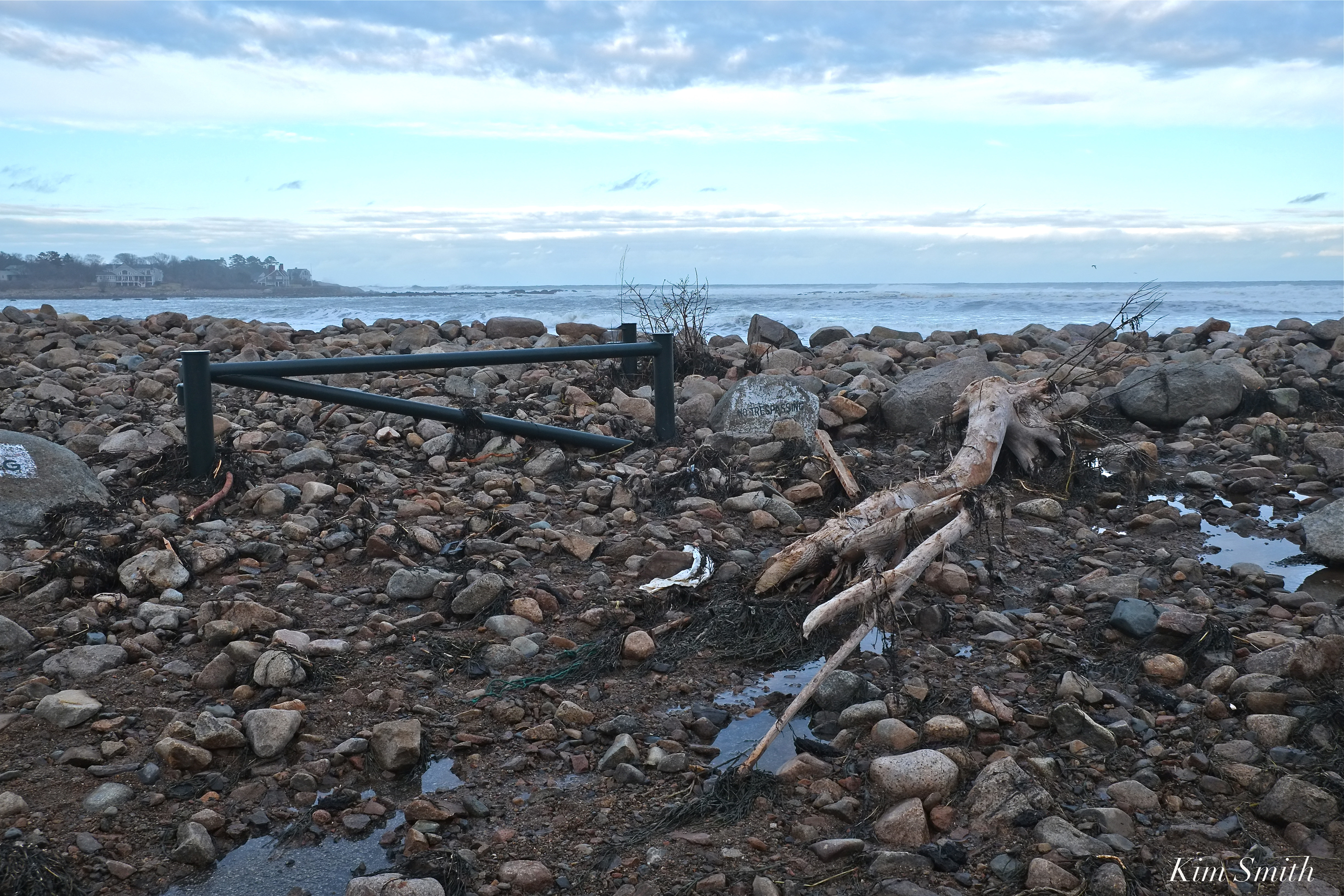
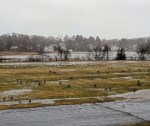
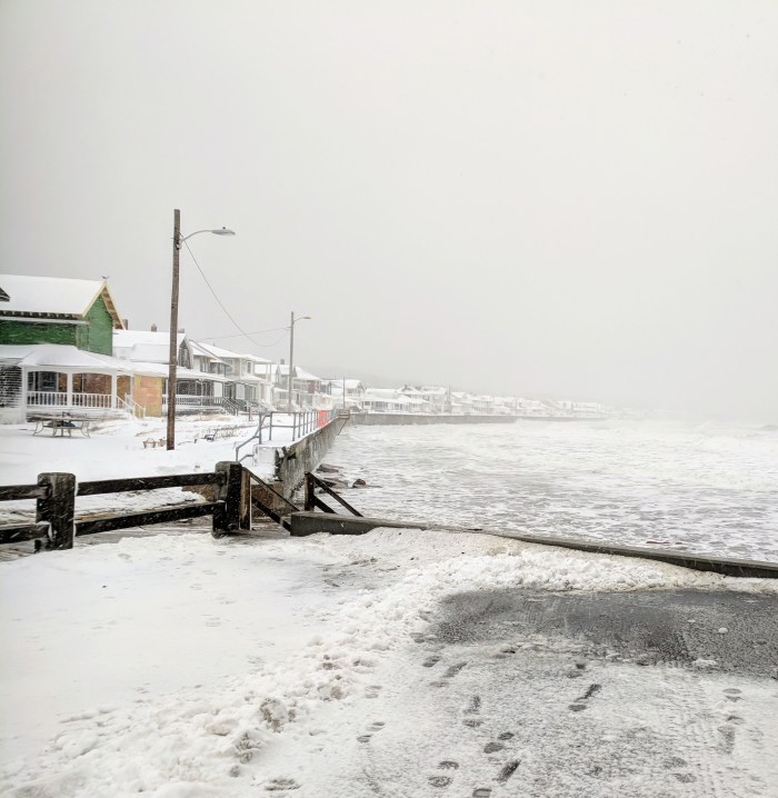
Birds in surf and What’s left of the dunes and the bridge at Good Harbor beach.


Spread The GMG Love By Sharing With These Buttons:

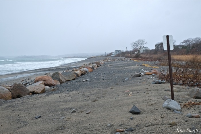
Clear Evidence of the Destructive Force of Global Warming on the Massachusetts Coastline and How This Negatively Impacts Local Wildlife -By Kim Smith
 Female Piping Plover Sitting on an Egg
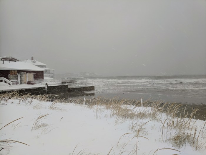
The recent winter storms of 2018 have provided empirical evidence of how global climate change and the consequential rising sea level is impacting the Massachusetts coastline. Whether broken barriers between the ocean and small bodies of fresh water, the tremendous erosion along beaches, or the loss of plant life at the edge of the sea, these disturbances are profoundly impacting wildlife habitats.
The following photos were taken after the March nor’easter of 2018 along with photos of the same areas, before the storm, and identify several specific species of wildlife that are affected by the tremendous loss of habitat.
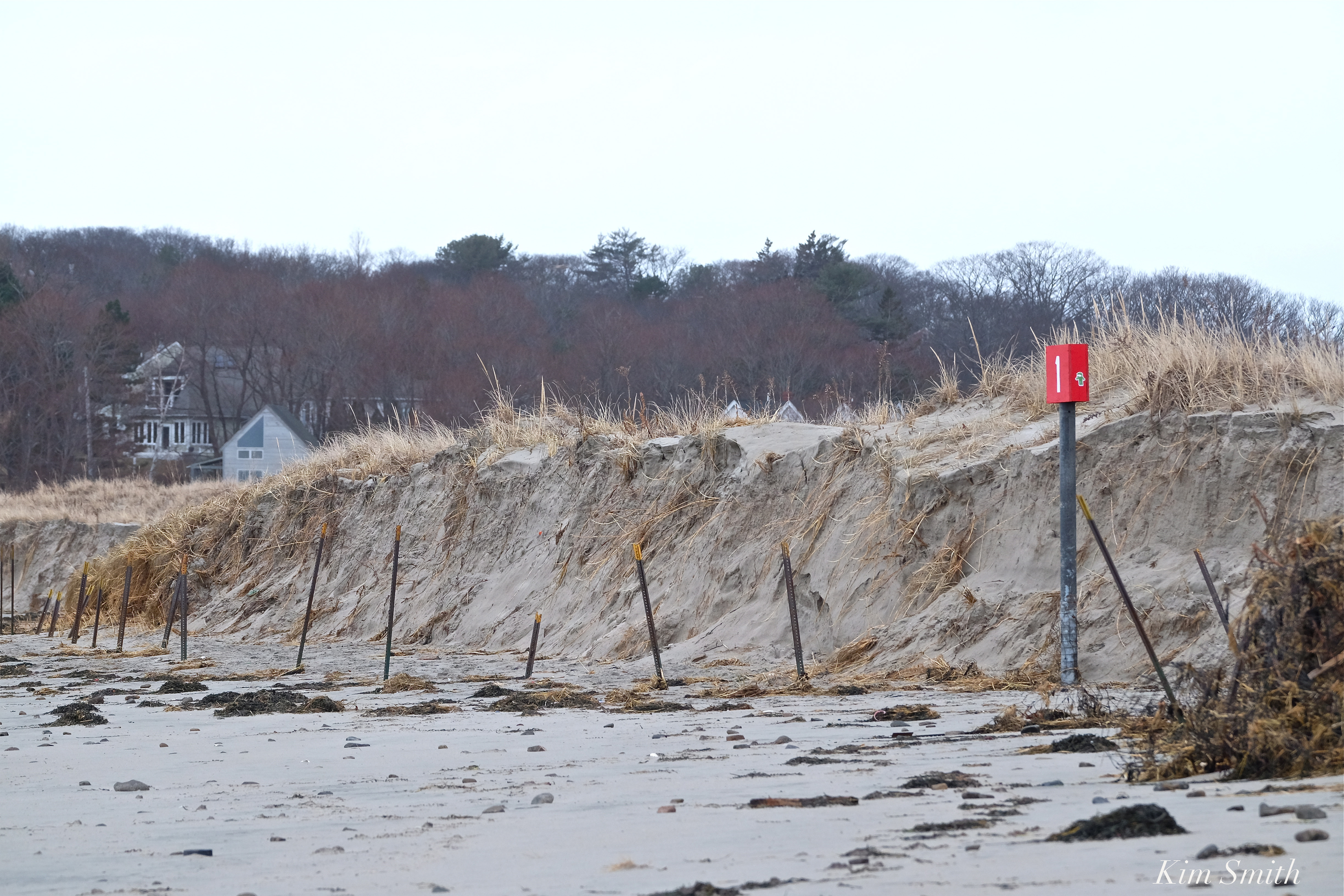
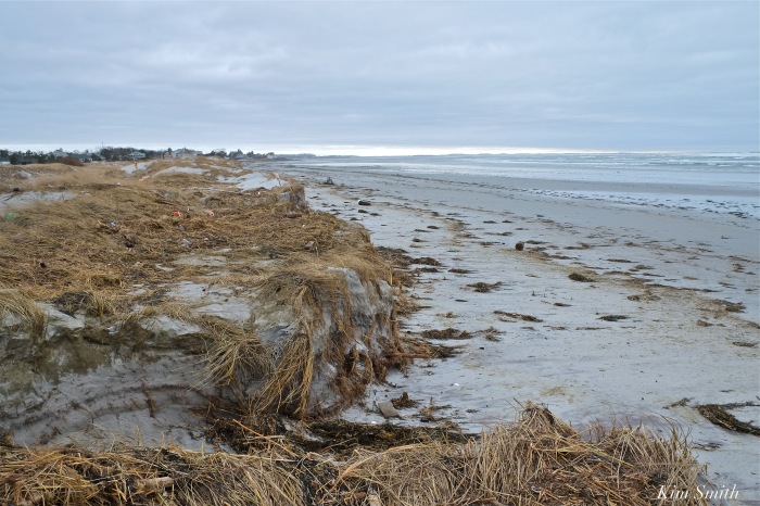
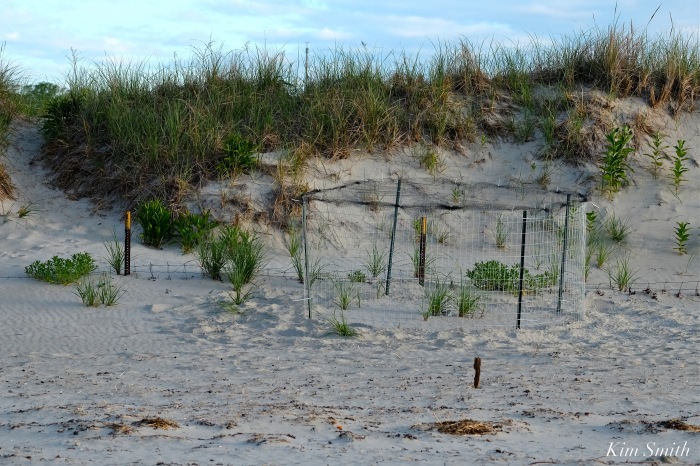
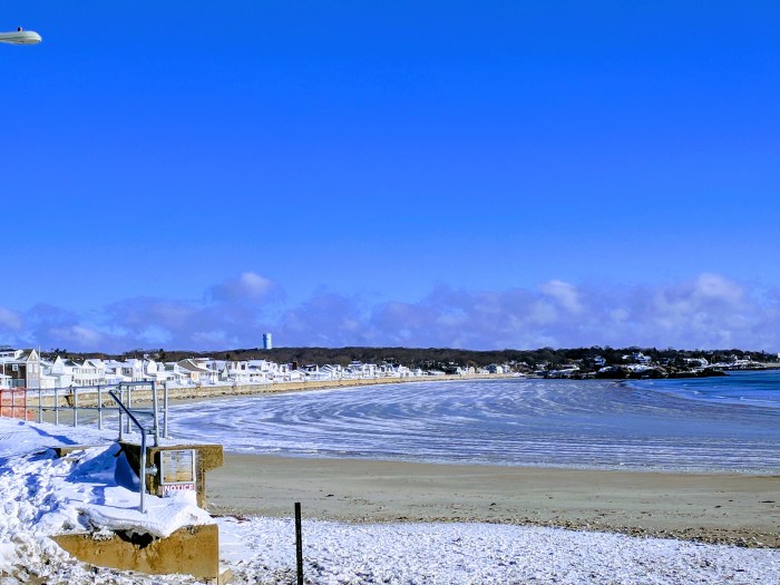
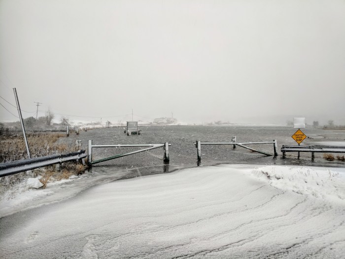
Barrier Beach Erosion
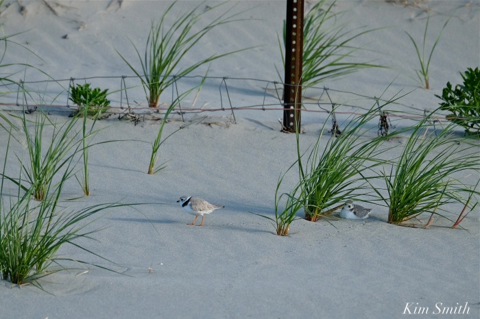
Nesting species of shorebirds such as Piping Plovers require flat or gently sloping areas above the wrack line for chick rearing. Notice how the March nor’easter created bluffs with steep sides, making safe areas for tiny chicks nonexistent.
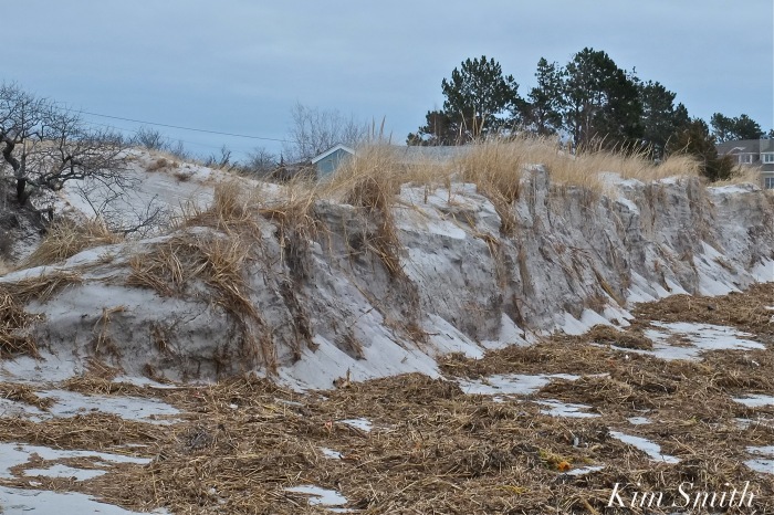

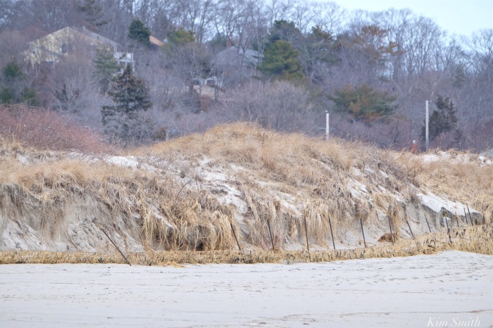
You can see in the photos of Good Harbor Beach (top photo and photos 3 and 4 in the gallery) that the metal fence posts are completely exposed. In 2016, the posts were half buried and in 2017, the posts were nearly completely buried. After the recent storms, the posts are fully exposed and the dune has eroded half a dozen feet behind the posts.
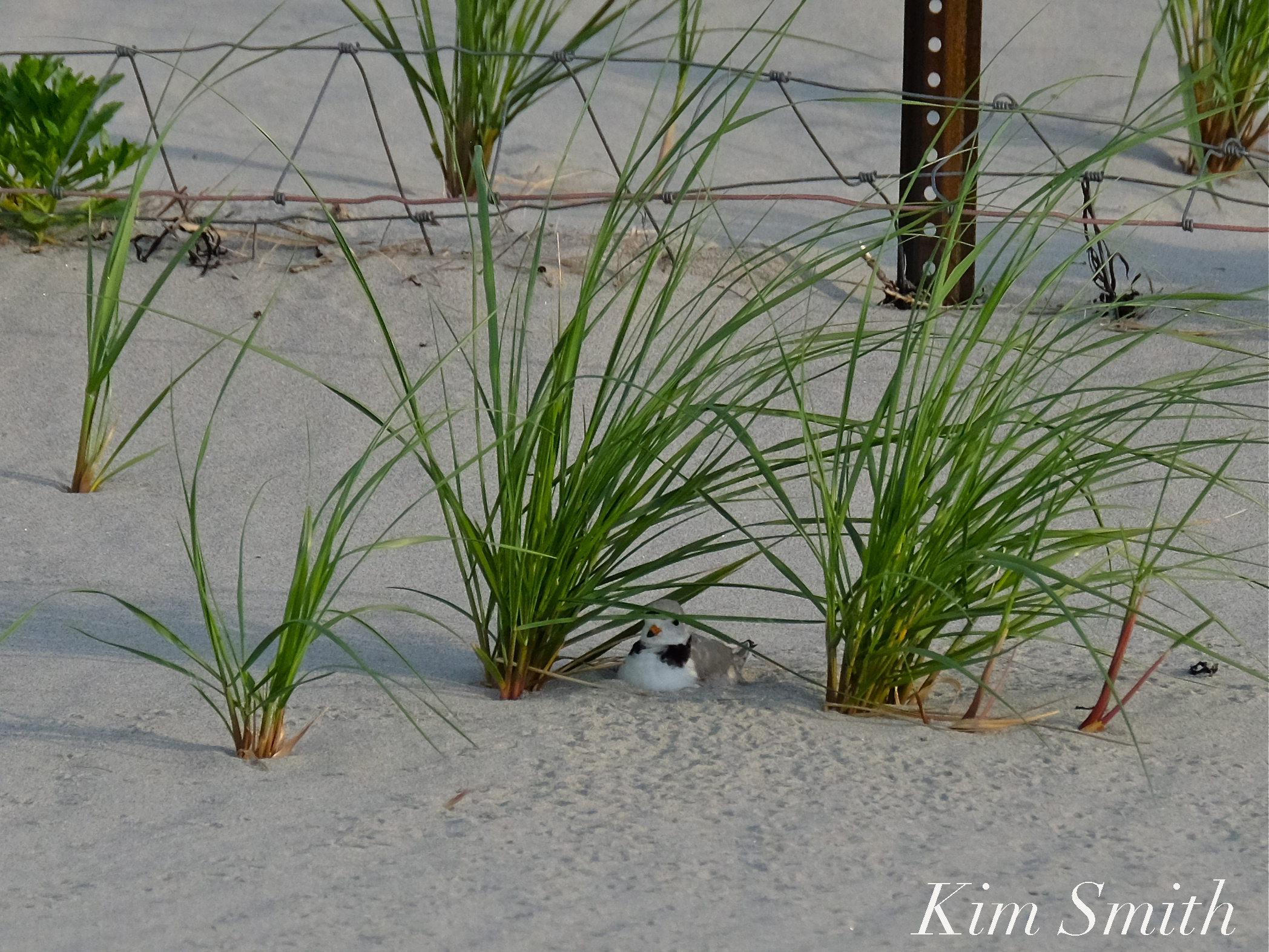 In the photo of the male Piping Plover sitting on his nest from 2016 the metal posts are half buried.
Although scrubby growth shrubs and sea grass help prevent erosion, the plants have been ripped out by the roots and swept away due to the rise in sea level.
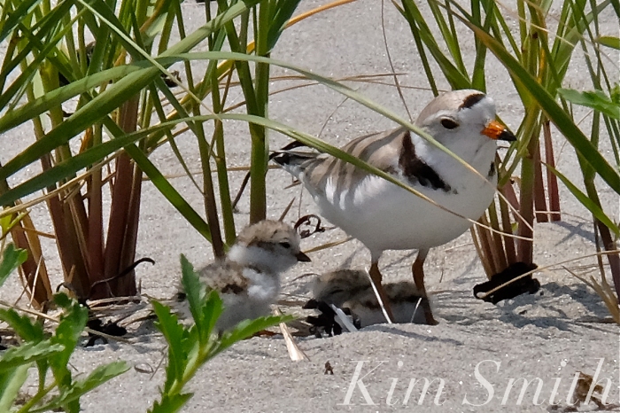
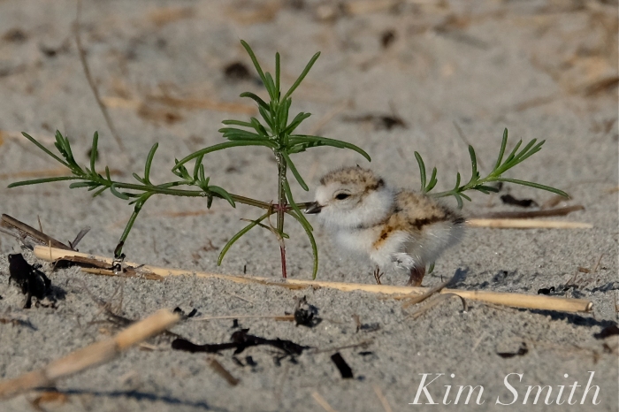
Plants draw tiny insects, which is food for tiny chicks, and also provide cover from predators, as well as shelter from weather conditions. If the Piping Plovers return, will they find suitable nesting areas, and will plant life recover in time for this year’s brood?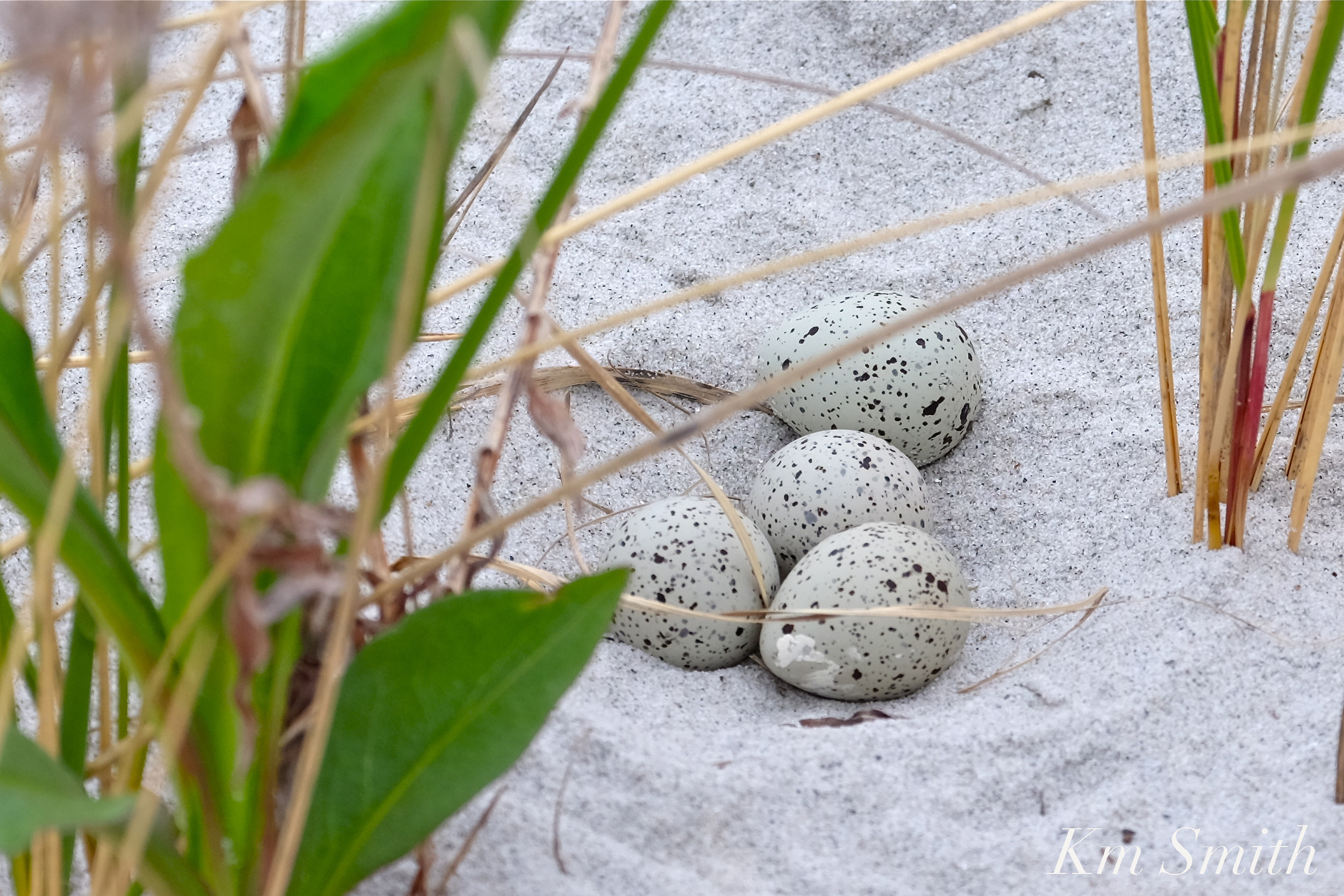 Other species of shorebirds that nest on Massachusetts’s beaches include the Common Tern, Least Tern, Roseate Tern, American Oyster Catcher, Killdeer, and Black Skimmer.
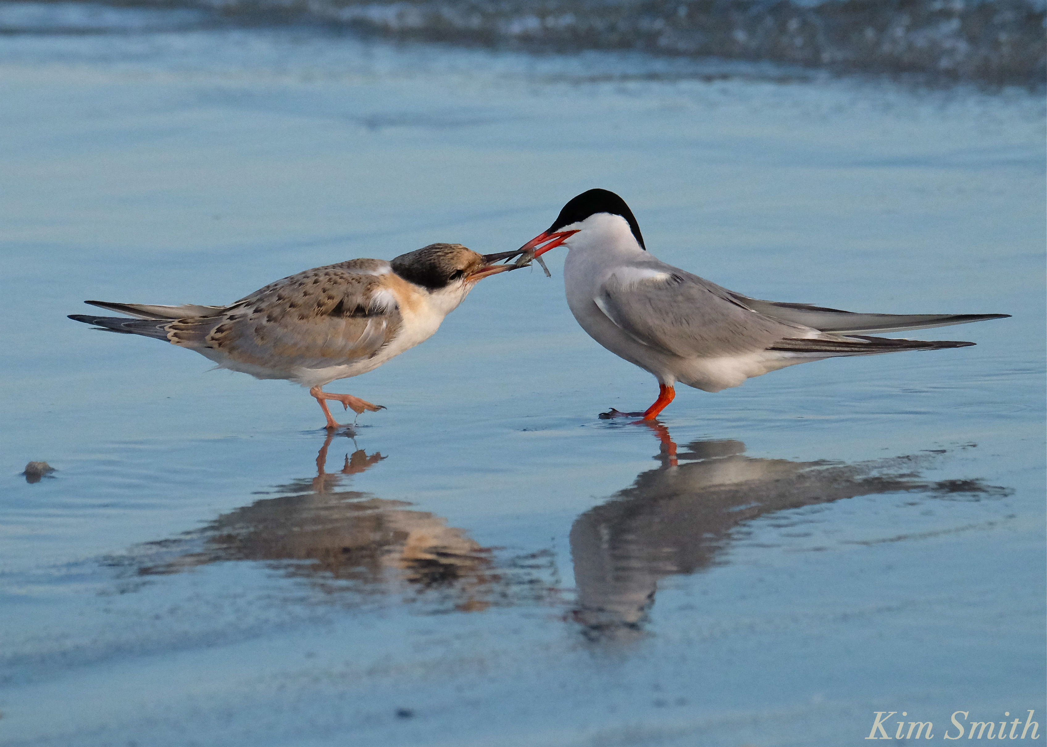 Common Tern parent feeding fledgling
Where Have All the Wildflowers Gone?
 Female Monarch Depositing Egg on Common Milkweed Leaf
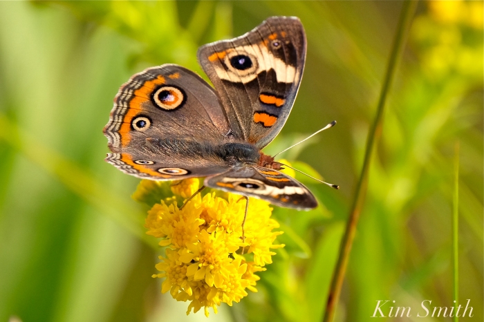
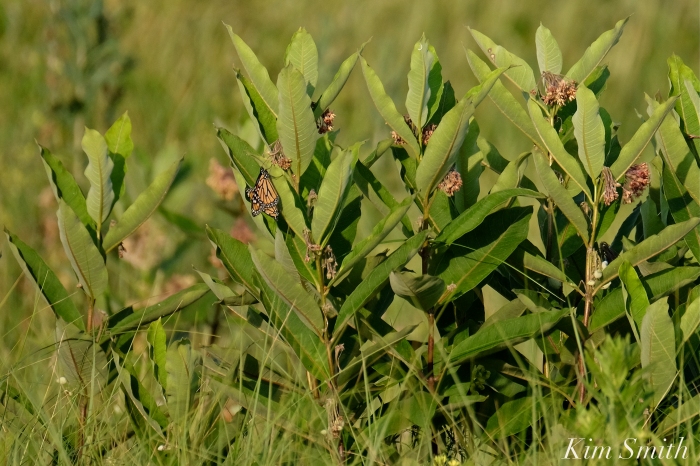

Wildflowers are the main source of food for myriad species of beneficial insects such as native bees and butterflies.
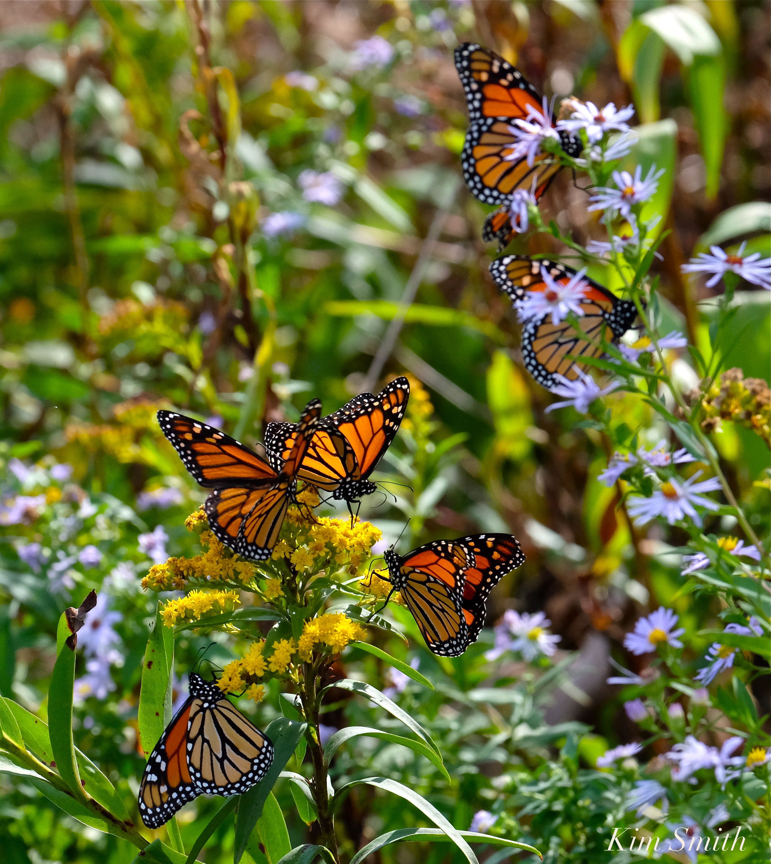 Monarch Butterflies arriving on our shores not only depend upon milkweed for the survival of the species, but the fall migrants rely heavily on wildflowers that bloom in late summer and early fall. Eastern Point is a major point of entry, and stopover, for the southward migrating butterflies. We have already lost much of the wildflower habitat that formerly graced the Lighthouse landscape.
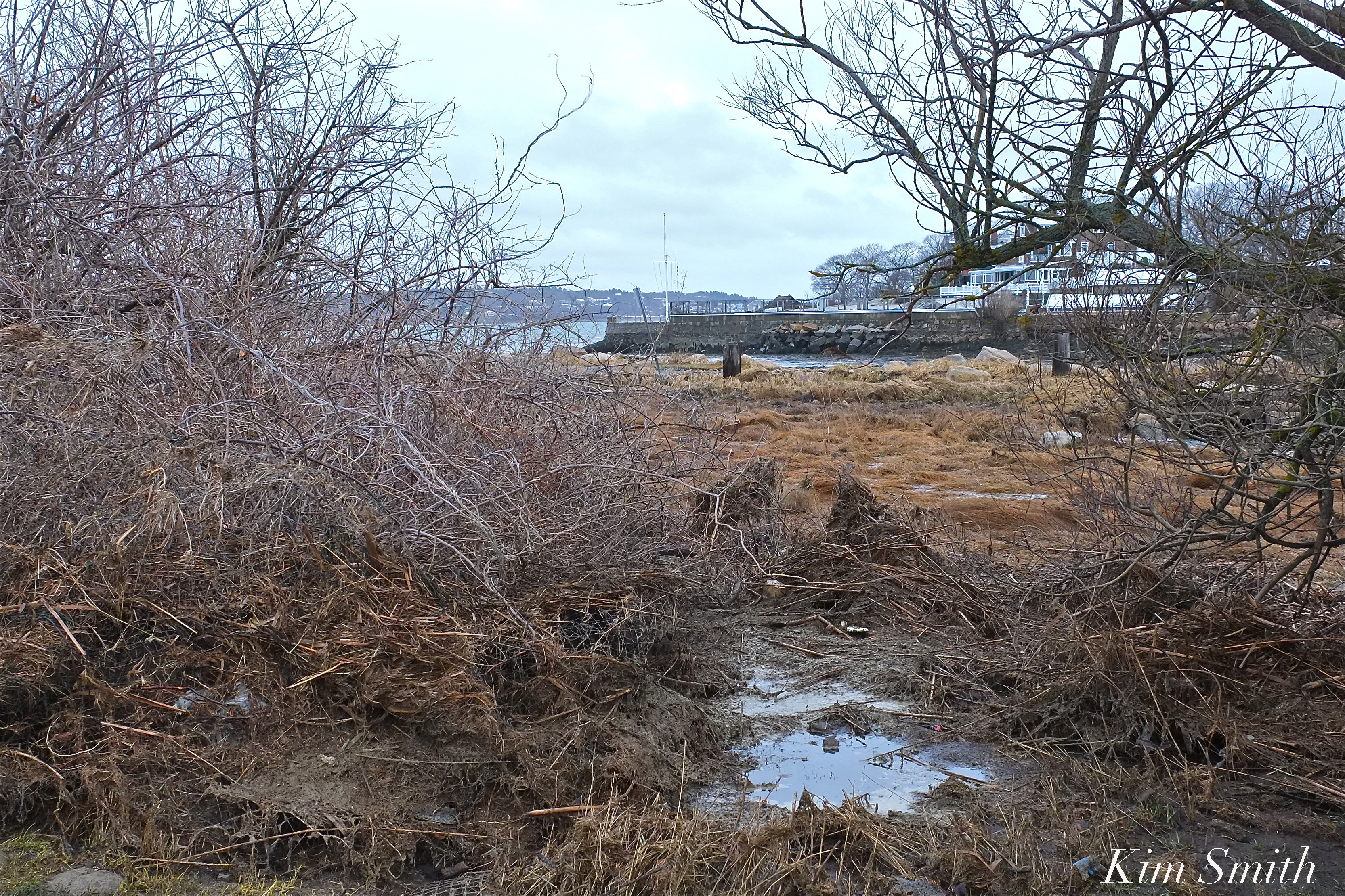 Masses of sea debris from the storm surge washed over the wildflower patches and are covering much of the pollinator habitat at the Lighthouse.
Broken Barriers
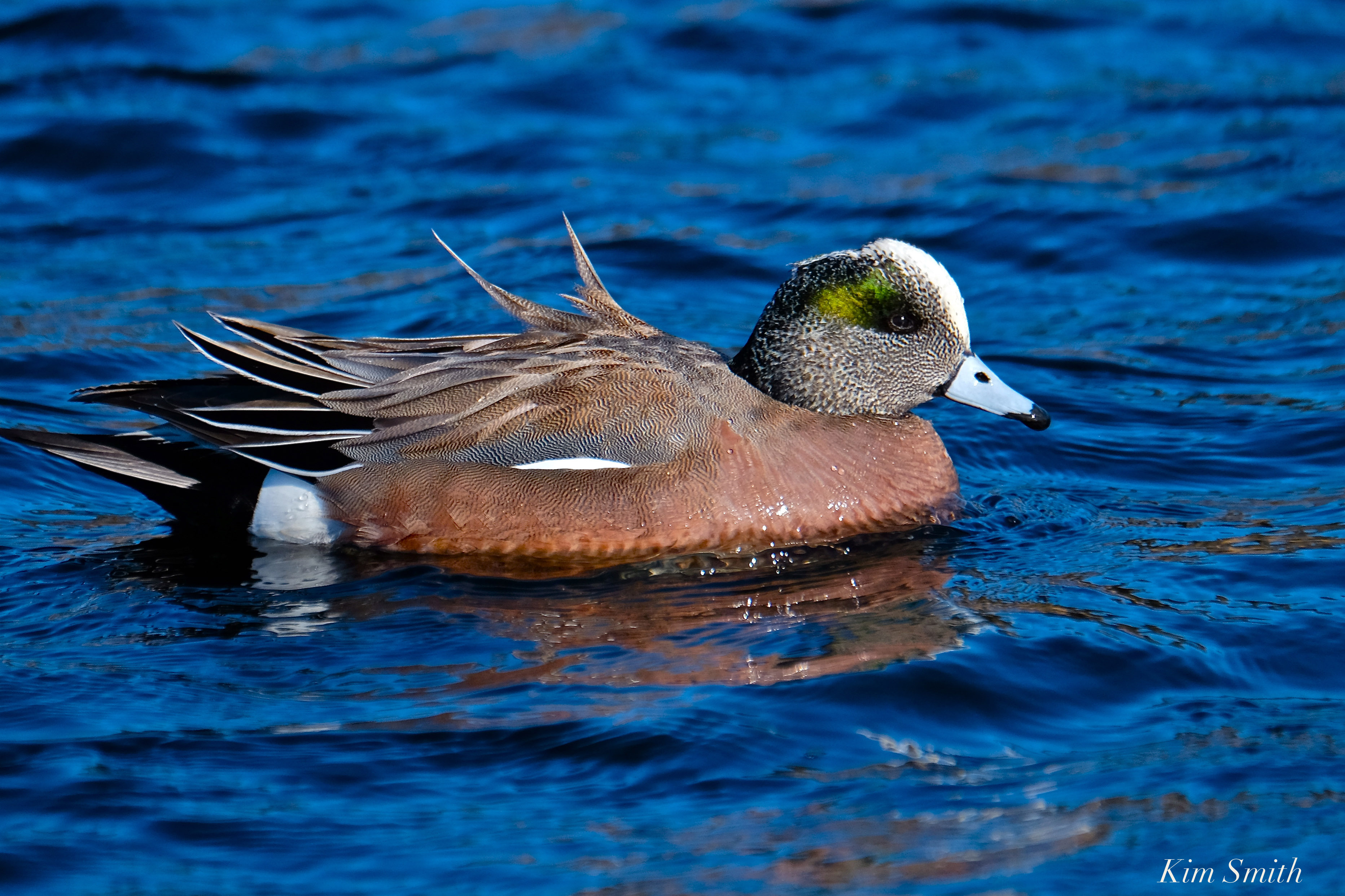 American Wigeon Migrating at Henry’s Pond
Barriers that divide small bodies of fresh water from the open sea have been especially hard hit. The fresh bodies of water adjacent to the sea provide habitat, food, and drinking water for hundreds of species of wildlife and tens of thousands of migrating song and shorebirds that travel through our region.
 The newly rebuilt causeway between Niles Pond and Brace Cove was breached many times during the nor’easter. The causeway is littered in rocks and debris from the sea.
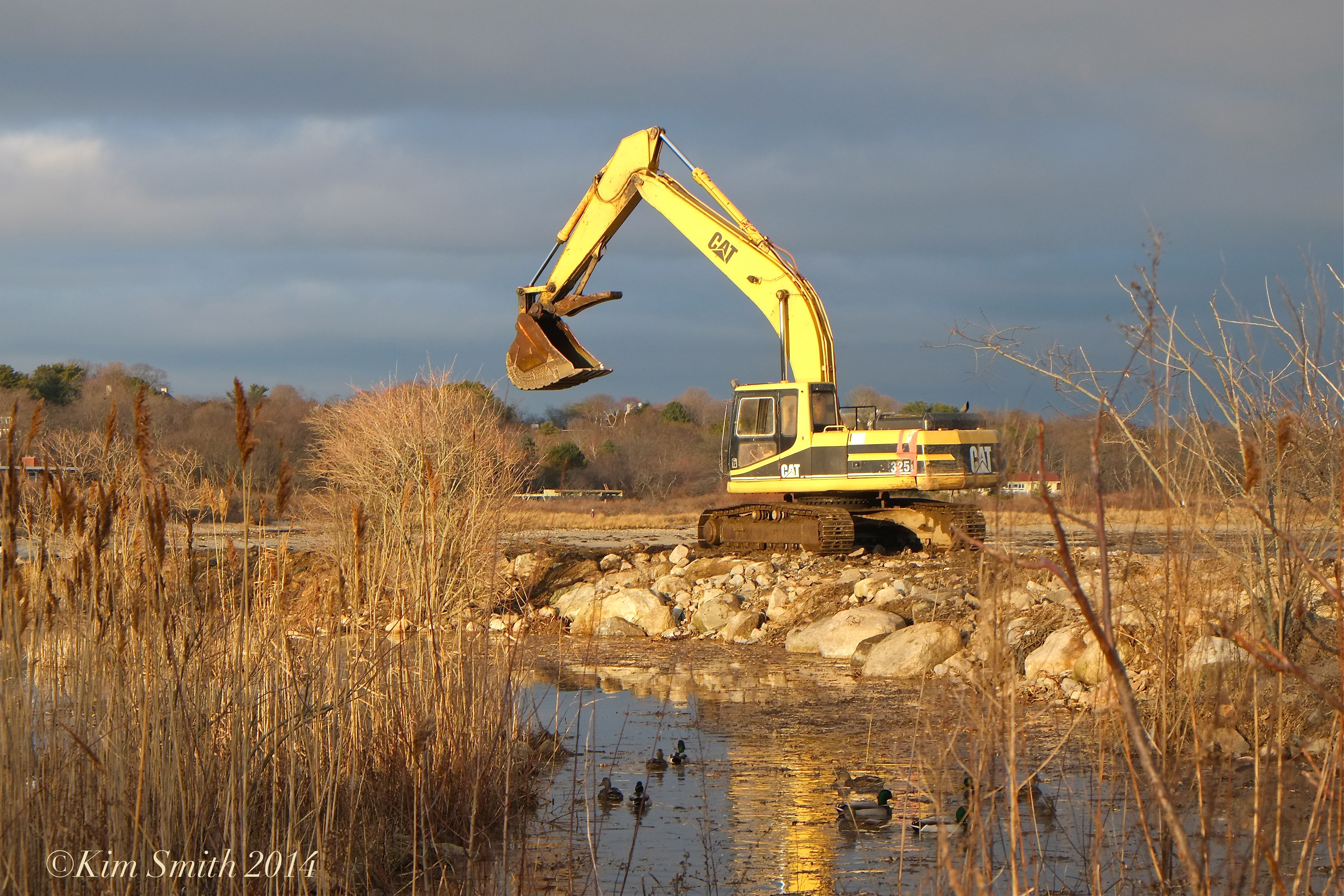 The causeway being rebuilt in 2014.

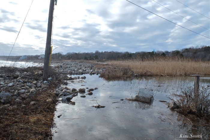
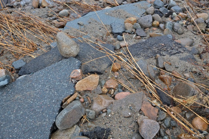
The road that runs along Pebble Beach, separating the sea from Henry’s Pond has been washed out.
 The footsteps in the sand are where the road ran prior to the storm.
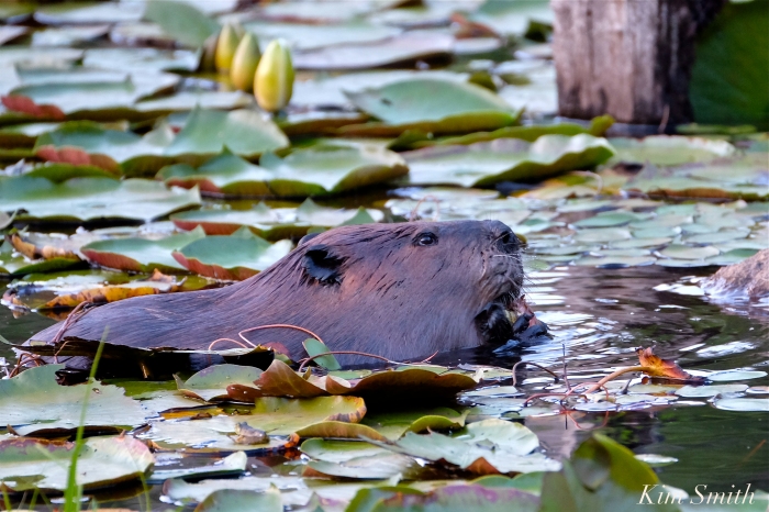

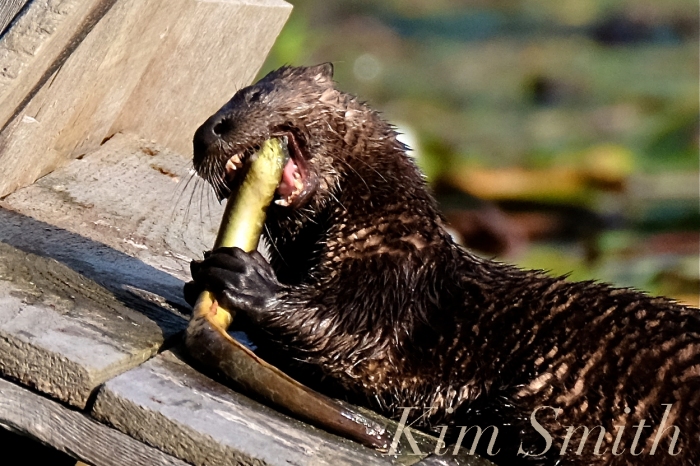
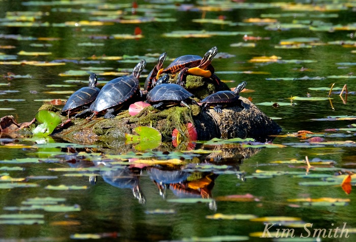
Mallards, North American Beavers, Muskrats, North American River Otters, and Painted Turtles are only a few examples of species that breed in Massachusetts fresh water ponds and wetlands. All the wildlife photos and videos were shot on Cape Ann.
 Migrating Black-bellied Plover
Cape Ann is hardly alone in coping with the impact of our warming planet and of rising sea level. These photos are meant to show examples of what is happening locally. Regions like Plymouth County, which include Scituate and Hingham, have been equally as hard hit. Plum Island is famously heading for disaster and similar Massachusetts barrier beaches, like Cranes Beach, have all been dramatically altered by the cumulative effects of sea level rising, and recently accelerated by the devastating winter storms of 2018.
To be continued.

Impassable Road to Plum Island
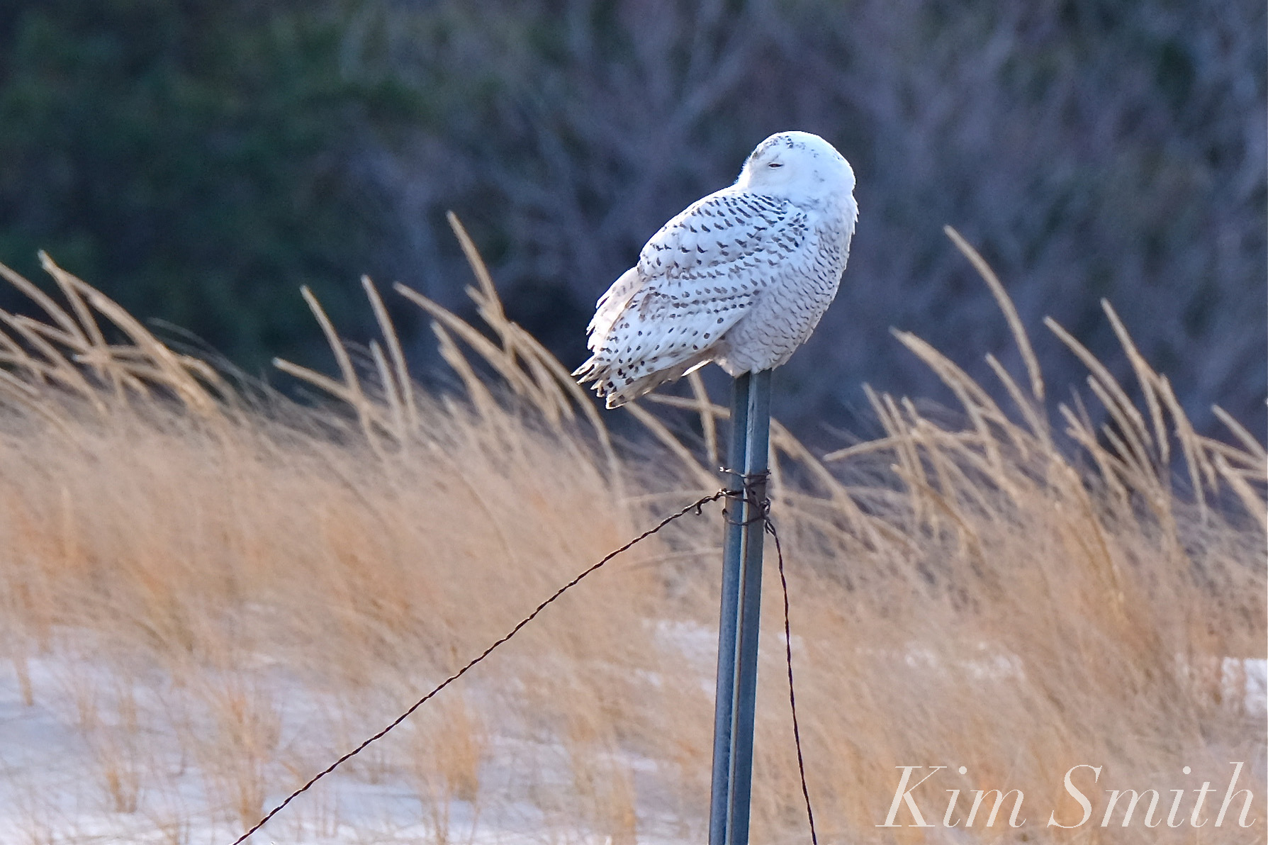 Snowy Owl Cranes Beach
Spread The GMG Love By Sharing With These Buttons:

TO THE PERSON WALKING HER DOG IN THE DUNES AT GOOD HARBOR BEACH THIS MORNING GIVING ME DIRTY LOOKS
While photographing and filming at Good Harbor Beach this morning, a woman walking in the dunes with her dog off leash was giving me super dirty looks, while she was ignoring the guidelines. As if the dunes aren’t already in enough trouble from the recent storm.
This sign is for you! 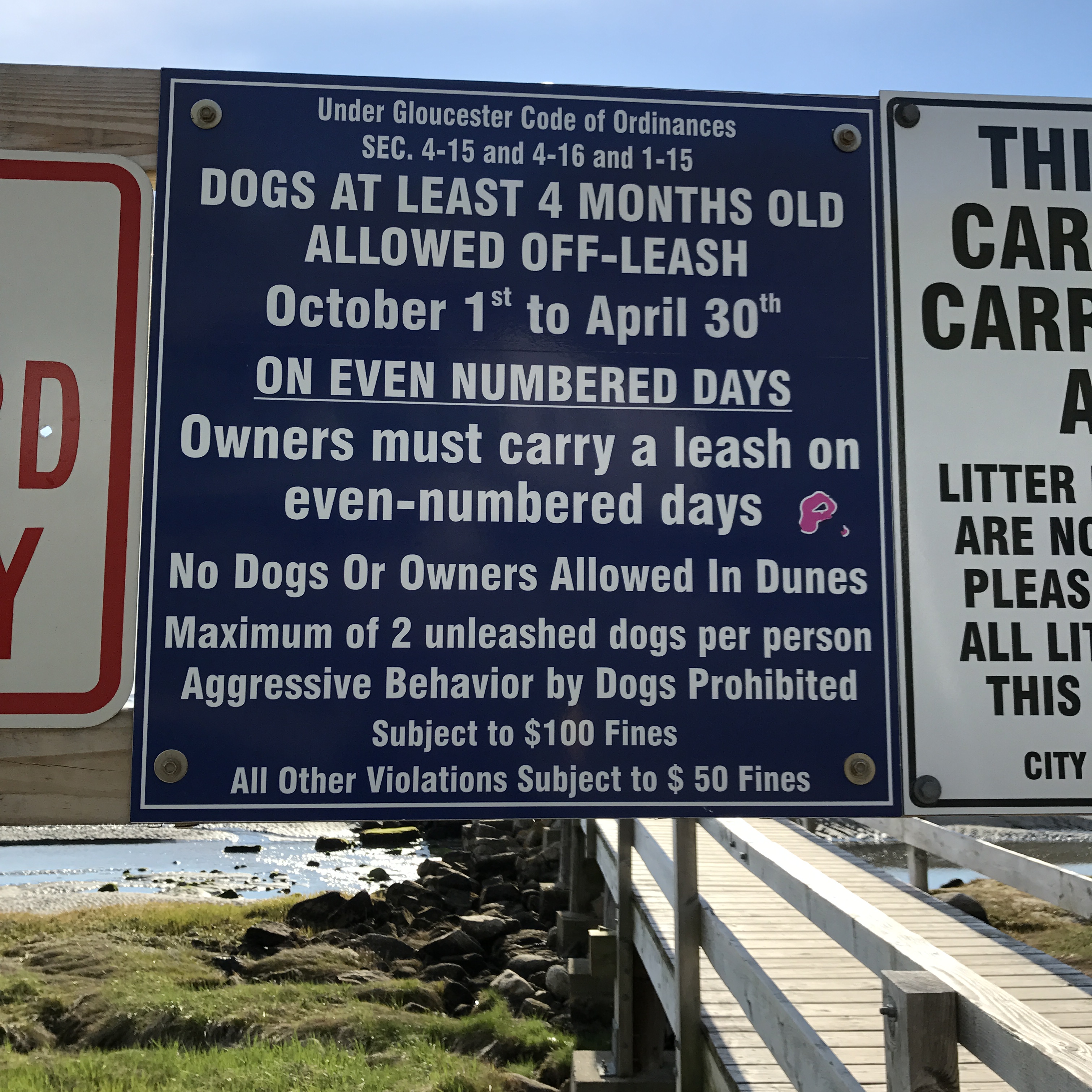
Spread The GMG Love By Sharing With These Buttons:

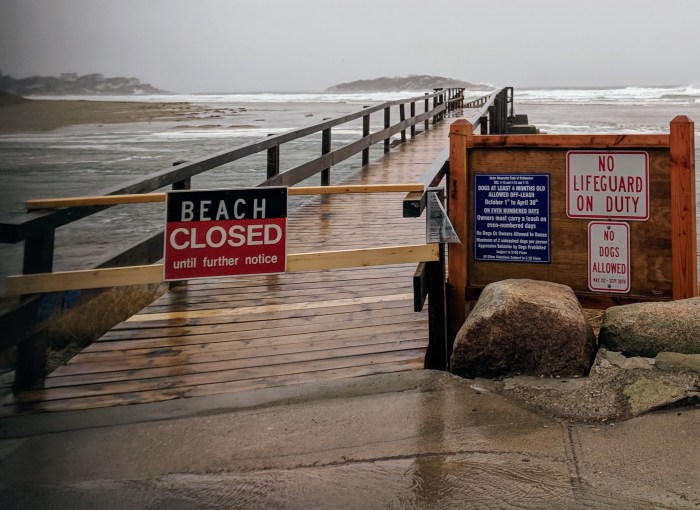
Footbridge Rebuilt Feb 2013 – Time for another Fix


Spread The GMG Love By Sharing With These Buttons:

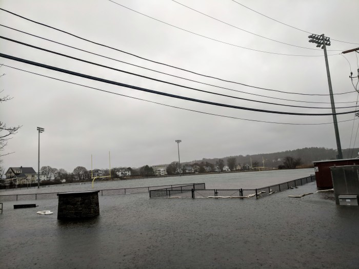
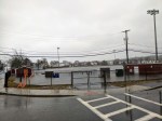
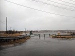
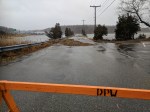
Coastal flooding roads closed & New Balance Field at Newell Stadium
Receding now- 3 hours after high tide

Spread The GMG Love By Sharing With These Buttons:

Life of Riley – Nor’easter storm #GloucesterMA
March 2, 2018. Riley so far (photos and 2min video low tide 8:30–11:15AM,the first high tide)
Continue reading “Life of Riley – Nor’easter storm #GloucesterMA”
Spread The GMG Love By Sharing With These Buttons:

Good Harbor beach – What a View


Spread The GMG Love By Sharing With These Buttons:

day one and day two
What a difference a day makes…


Spread The GMG Love By Sharing With These Buttons:

#GloucesterMA athletes: Countdown to Cheerleading Conference Championship at GHS Sunday
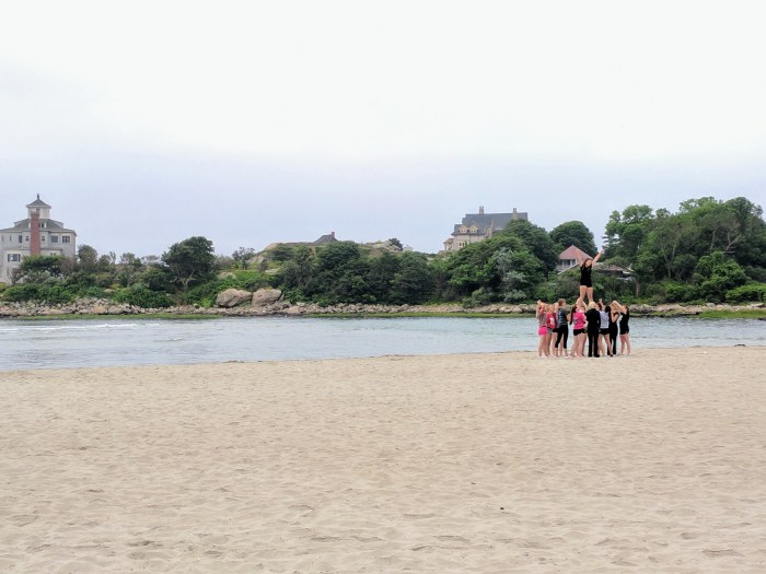
Reminder & invitation From Principal Cook and GHS Athletic Director Julie Smith
“To the Gloucester Community:
We hope this finds you well and enjoying February vacation!
This is a special message to all residents of Gloucester and surrounding communities due to a special event happening at Gloucester High School this Sunday, February 25th at 4:30pm.
Gloucester’s State Champion Cheerleading team will compete AT HOME in the Cape Ann League/Northeastern Conference Championships. This is a rare opportunity to see the amazing GHS Cheer athletes up close as they take on their League rivals. Click this link to view the teams’ order of appearance on Sunday: Order of Appearance.pdf
Doors open at 3:30pm. Tickets are $5.00 for Students and Seniors, $7.00 for Adults.
See you there!
James Cook, GHS Principal and Julie Smith, Athletic Director
P.S. Spring 2018 GHS and O’Maley Athletics Registration opens soon…stay tuned!”
#GoGloucester!
Spread The GMG Love By Sharing With These Buttons:


Summer Beach Traffic and Parking Part 2 – high tech and common sense Good Harbor Beach, Long Beach, Stage Fort, Great Marsh
This is a follow up about the public meeting held by Gloucester City Councilor Scott Memhard February 15, 2018 at Gloucester Lyceum & Sawyer Free Public Library on beach traffic and parking with a focus on his ward. This post includes Councilor Memhard’s meeting notes, and the Beach & Traffic Ad Hoc committee presentation to City Council. Look for information and maps related to Long Beach, Good Harbor Beach, Stage Fort Park, and more. Chances are your ideas or concerns were mentioned–doublecheck for yourself. Future public meetings to be announced.
Here’s the presentation packet to the City Council from the Gloucester Beach Parking and Traffic Ad Hoc Committee, January 2017


Here’s Councilor Memhard’s recap of the Summer Beach and Traffic public meeting held at Sawyer Free Library February 16, 2018 (advertised in the Beacon, Gloucester Daily Times, and elsewhere long in advance):
“The Ward 1 Beach Parking Ordinance community meeting last night at the library was well attended. We had a lively airing of concerns and opinions, addressing the specific Parking Ordinance proposed changes, and general, wide-ranging discussion of the problem and various potential solutions, including:
> expanded off-site parking* and trolly/bus service to the beaches;
> better signage notifying drivers that lots are full and closed, with posted directions to alternate parking options; and
> other practical steps to relieve severe safely, access, and disruption from on-street parking congestion in our beach neighborhoods.“
*park n ride options would ease traffic especially with smartphone reservations/options. Locales like Rockport, Manchester, Provincetown limit cars. Several lots mentioned maximizing extant options such as negotiating with Stop&Shop, Shaws, Fuller, Blackburn, schools, etc. Stage Fort Shuttle already established and more train/bike. Train-trolley services have a rich history here.
ENFORCEMENT, HIGHER PARKING TICKETS, JULIE BROE 🙂
Spread The GMG Love By Sharing With These Buttons:

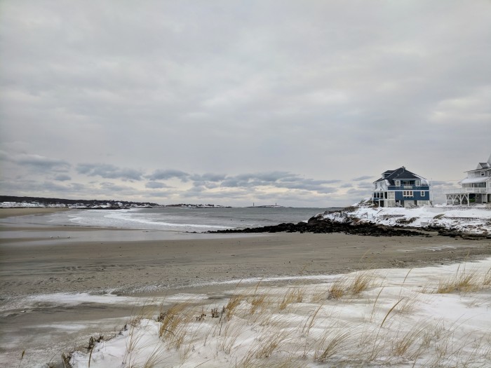
Good Harbor Beach at low tide
 It was warm on Wednesday, well it was 49 degrees, so I went for a walk on Good Harbor Beach. As always it never disappoints.
Spread The GMG Love By Sharing With These Buttons:

It is always about the light

Spread The GMG Love By Sharing With These Buttons:

Good Harbor and Magnolia on Thursday
On Thursday with the sun and less wind, Good Harbor had lots of surfers, Stand Up Paddle boarders and walkers taking advantage of the sunshine. The below paddle boarder was actually in Magnolia Harbor.


Spread The GMG Love By Sharing With These Buttons:

Good Harbor with a dusting of snow clouds

Spread The GMG Love By Sharing With These Buttons:

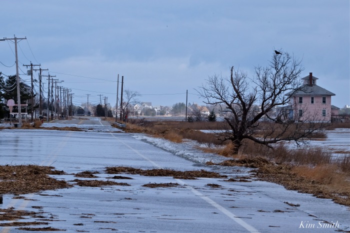
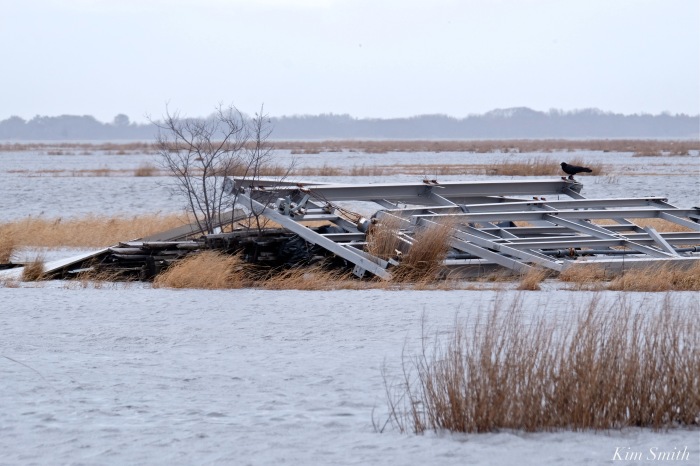
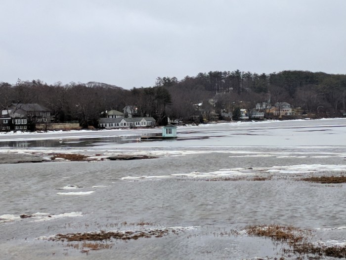
Little houseboat in the great frozen salt marsh #Gloucester MA
A photo journal after the storm documenting and comparing a few iconic and sweeping Gloucester vistas on January 7, 2018, when all was white ice frozen, and again after the Great Thaw on January 13 2018.
Gloucester Motif- the house boat in view just before the turn off at Nichols
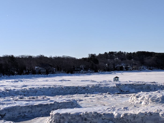
The Little House boat in the great frozen salt marsh reminded me of a mash up of two of Virginia Lee Burton’s children’s picture books inspired by Gloucester — Little House and Katy and the Big Snow. Here’s the little floating houseboat after the thaw at low tide January 13, 2018.
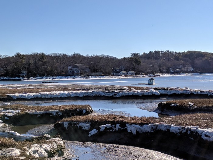
At high tide earlier in the day, January 13
Good Harbor Beach drive by three days after the storm
Good Harbor Beach salt marsh drive by one week after the storm and great thaw
Below the read more break: additional winter comparison photos (icebergs on the marsh by Lobster Land, Good Harbor Beach parking lot, Good Harbor Beach salt marsh, Stoney Cove pier at Little River & Annisquam River)
Continue reading “Little houseboat in the great frozen salt marsh #Gloucester MA”
Spread The GMG Love By Sharing With These Buttons:

sea smoke, beach and coast | beauty after the storm
Off Good Harbor Beach Gloucester, MA
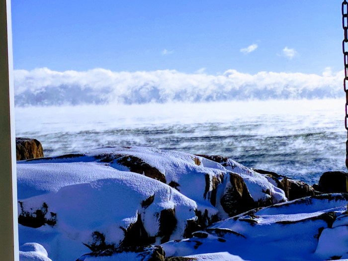
First for me-With the low temperatures, a white rainbow arch of thin ice dressed the entire length of Long Beach at low tide.
Spread The GMG Love By Sharing With These Buttons:

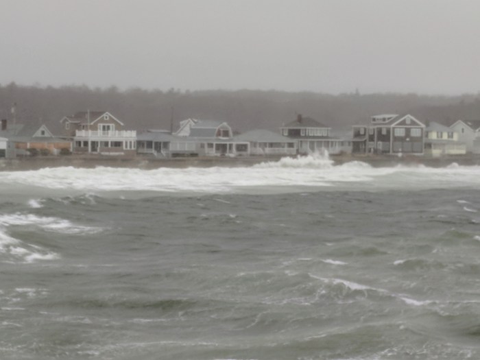
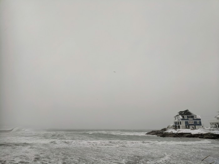
STORM video and the morning after #GloucesterMA Good Harbor Beach and Long Beach
Thinking of those dealing with no power, evacuation and such destructive, icy flooding.
January 5, 2018 vs Storm January 4, 2018
Today here come the surfers
Rocks have clear icy layers and crunch pack, some pockets of drift


I’m following up on yesterday’s post, which was stopped midstream as we lost power. Scroll below for quick snaps and videos from my walk to Good Harbor Beach, Long Beach, and side streets.
GOOD HARBOR BEACH 1.4.18
About 2PM January 4, 2017 (high tide was several hours earlier)
Good Harbor Beach on sand looking out to Salt Island (from Good Harbor Beach Inn side of beach) Yes, the waves were rolling over the wall up to the homes but infrequently at this time. I don’t know what it was like at high tide.
(more Good Harbor Beach and Long beach below the break)
Continue reading “STORM video and the morning after #GloucesterMA Good Harbor Beach and Long Beach”
Spread The GMG Love By Sharing With These Buttons:

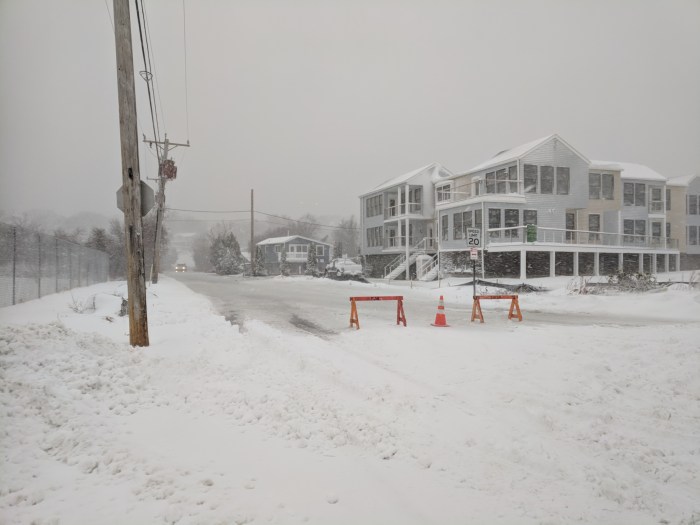
Bomb cyclone winter storm: Good Harbor Beach, Long Beach, Witham Street #GloucesterMA North of Boston
UPDATED- link to post2 January 5th with video
2:15PM slush pond roads and closed by Witham and Thacher and Good Harbor Beach parking lot. Power outages this way.


GOOD HARBOR BEACH
Ocean is up on the deck outside the Good Harbor Beach Inn snack bar, though not to the street
LONG BEACH
There go the staircases
**Video coming when power-wifi back**
Spread The GMG Love By Sharing With These Buttons:

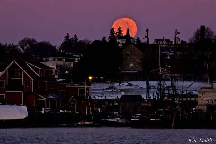
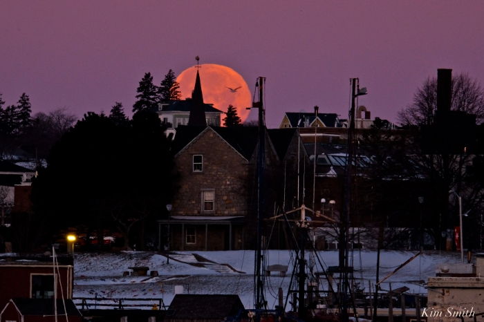
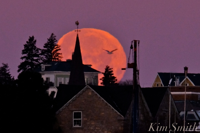
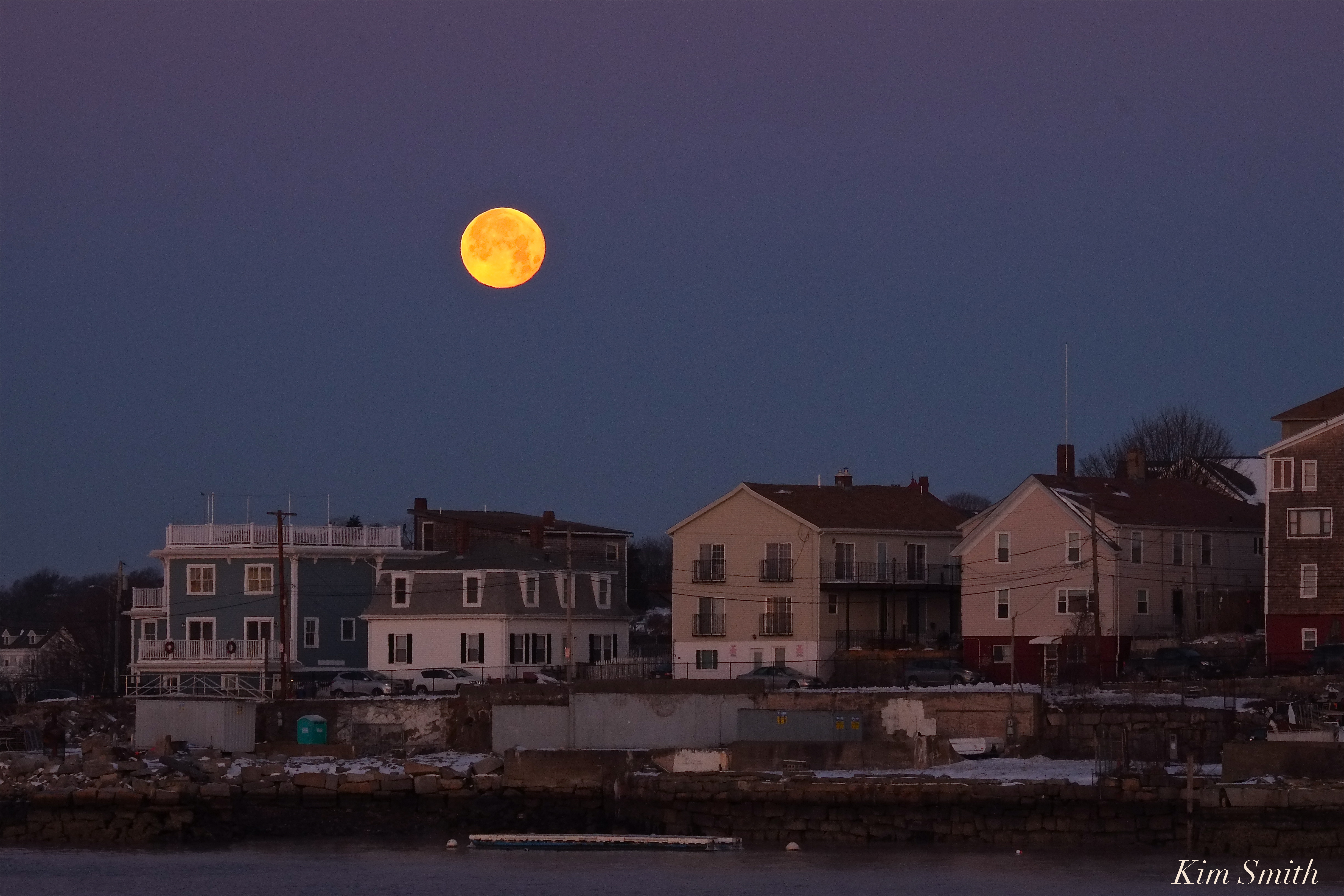
FULL WOLF MOON OVER GLOUCESTER
Beautiful January Wolf Moon rising and setting over Gloucester.
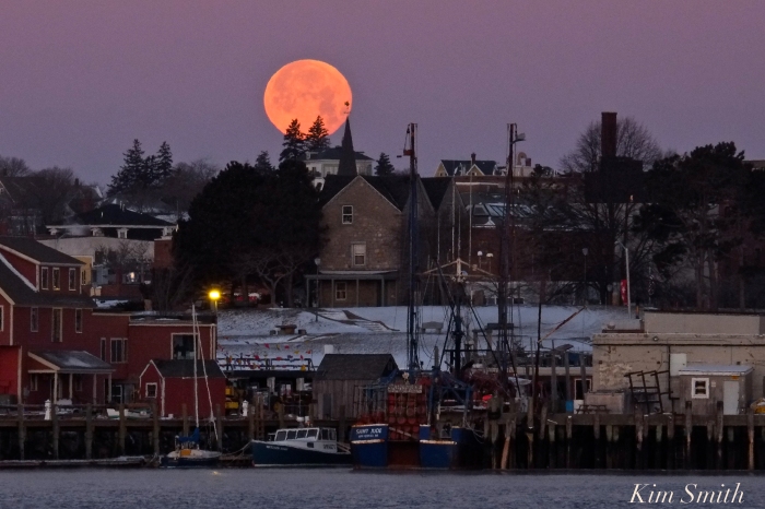
Moonsetting over the Harbor
 Moonset over the Fort
https://www.instagram.com/p/Bdbmr8uFgVN/

