Winter Storm flooding photos: Aftermath #GloucesterMA Long Beach

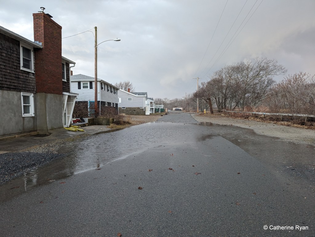
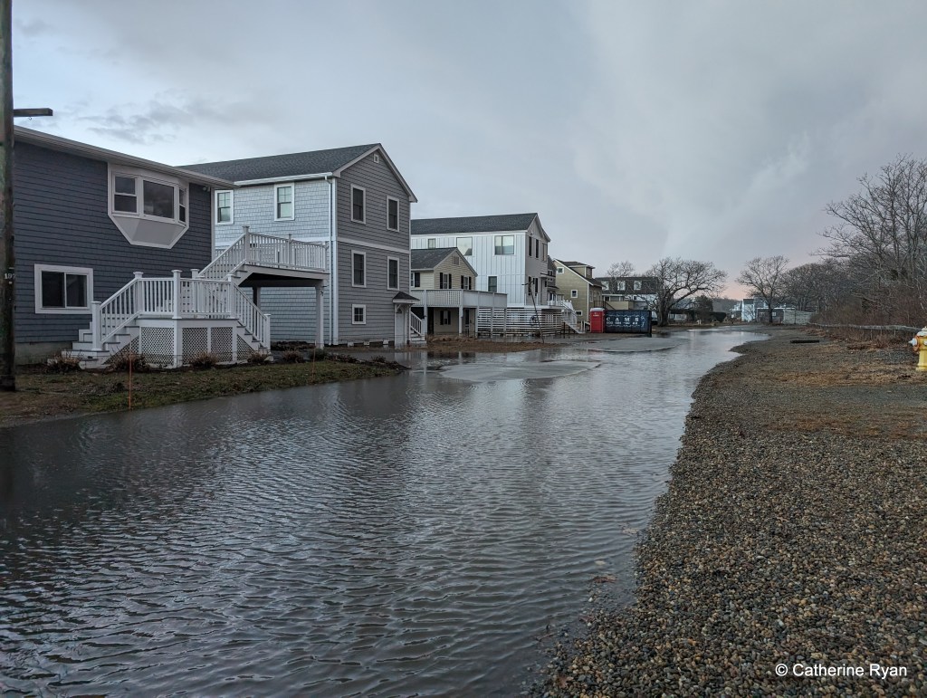
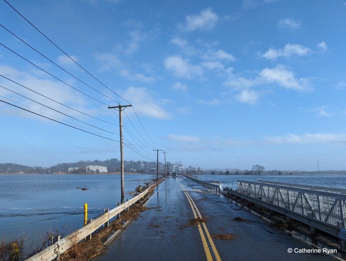
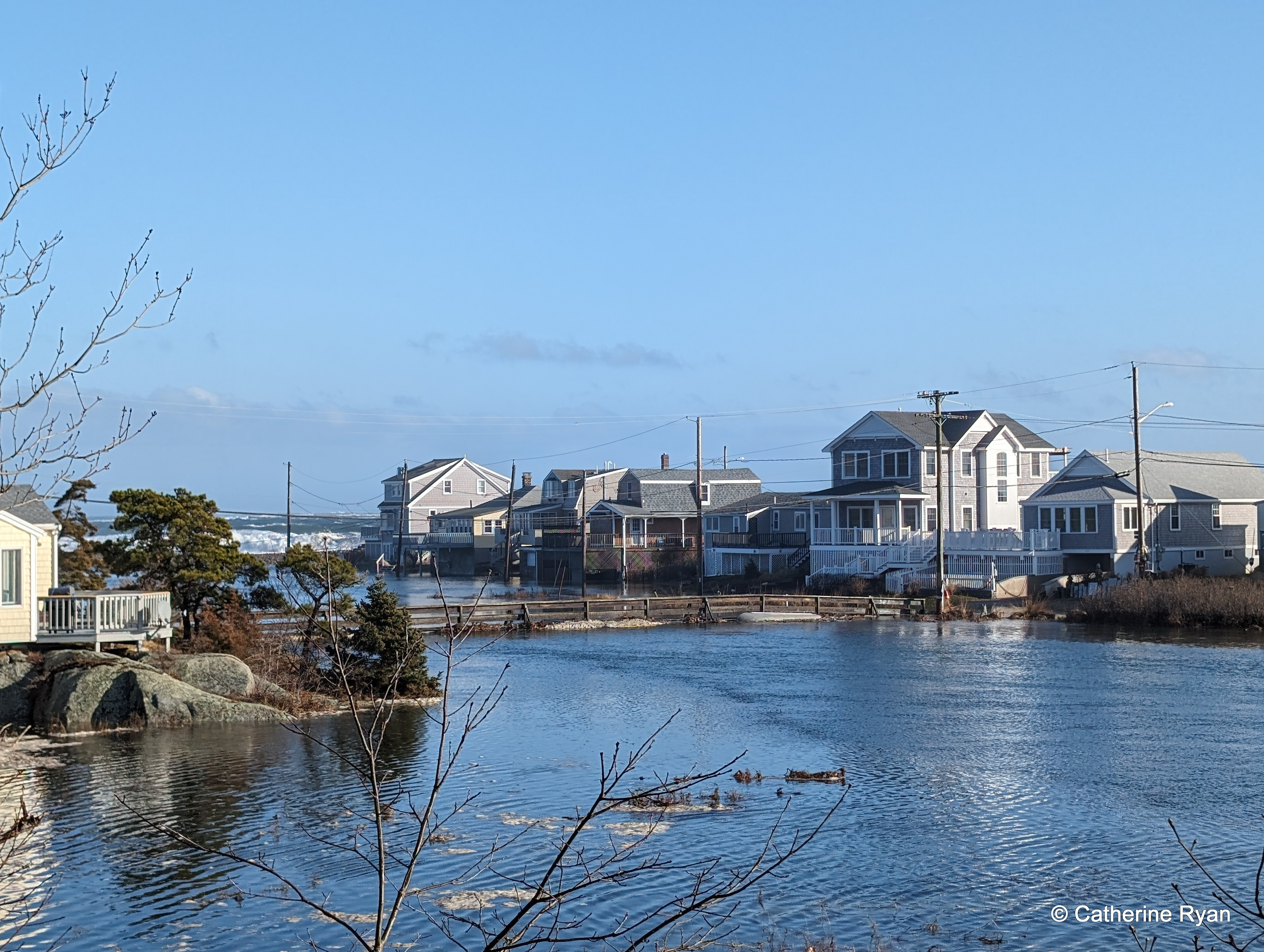
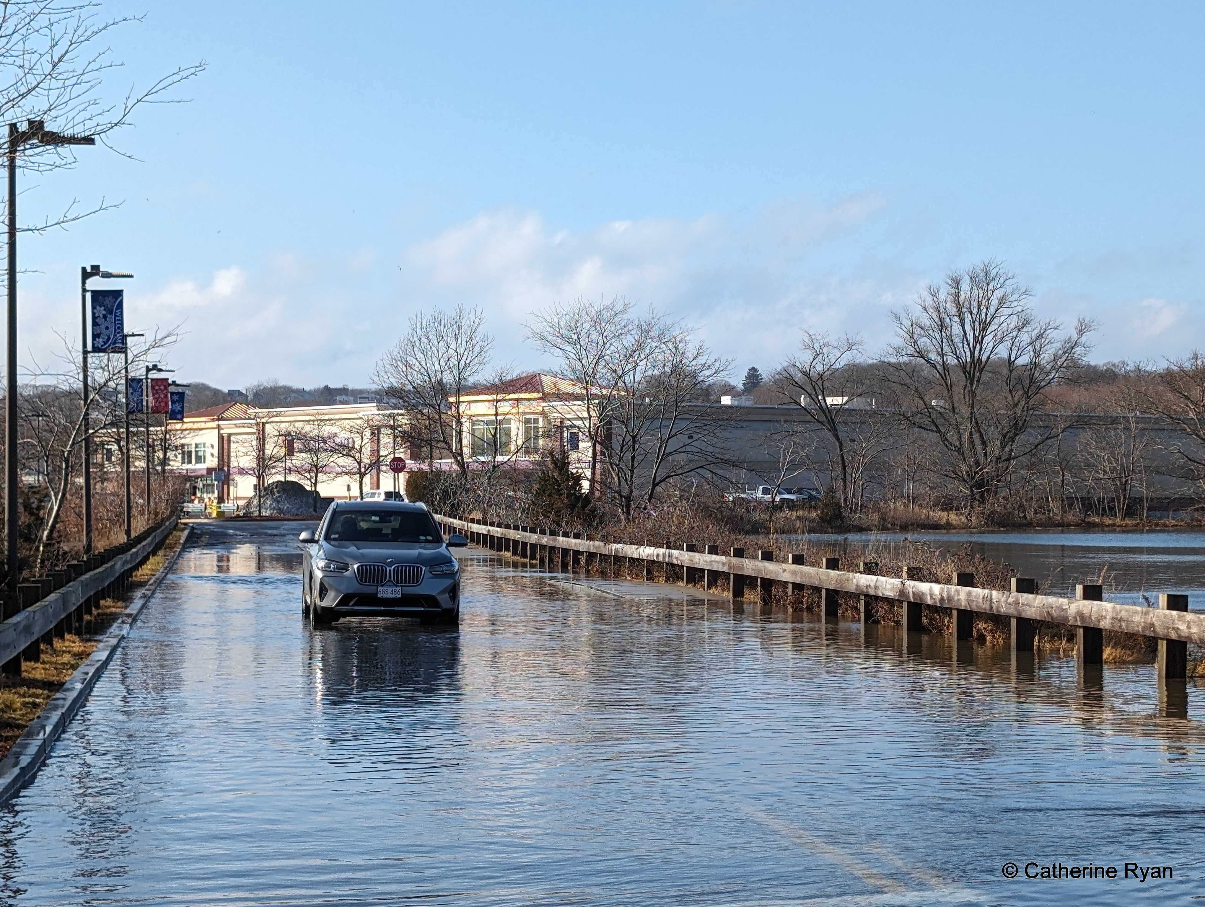
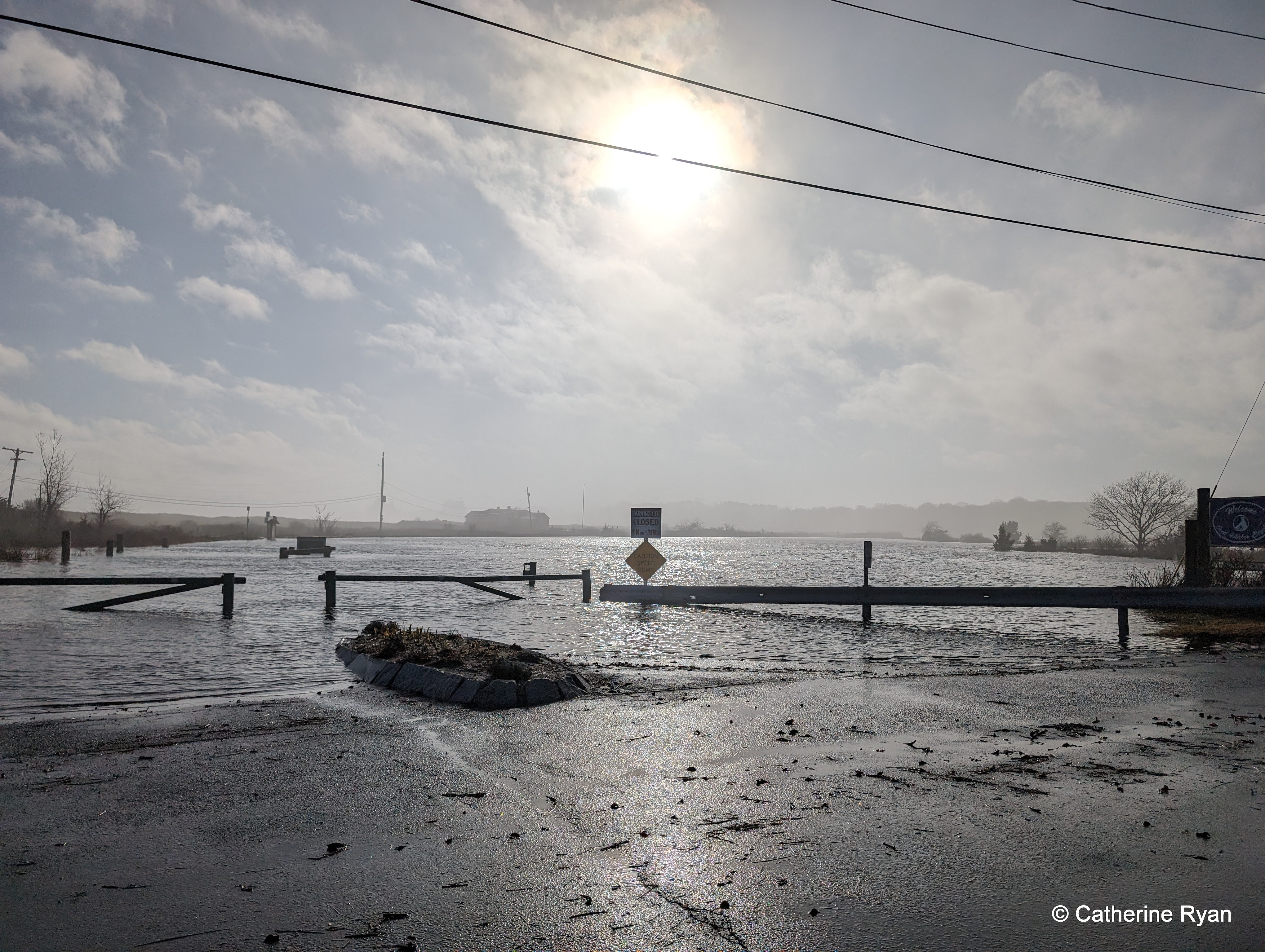
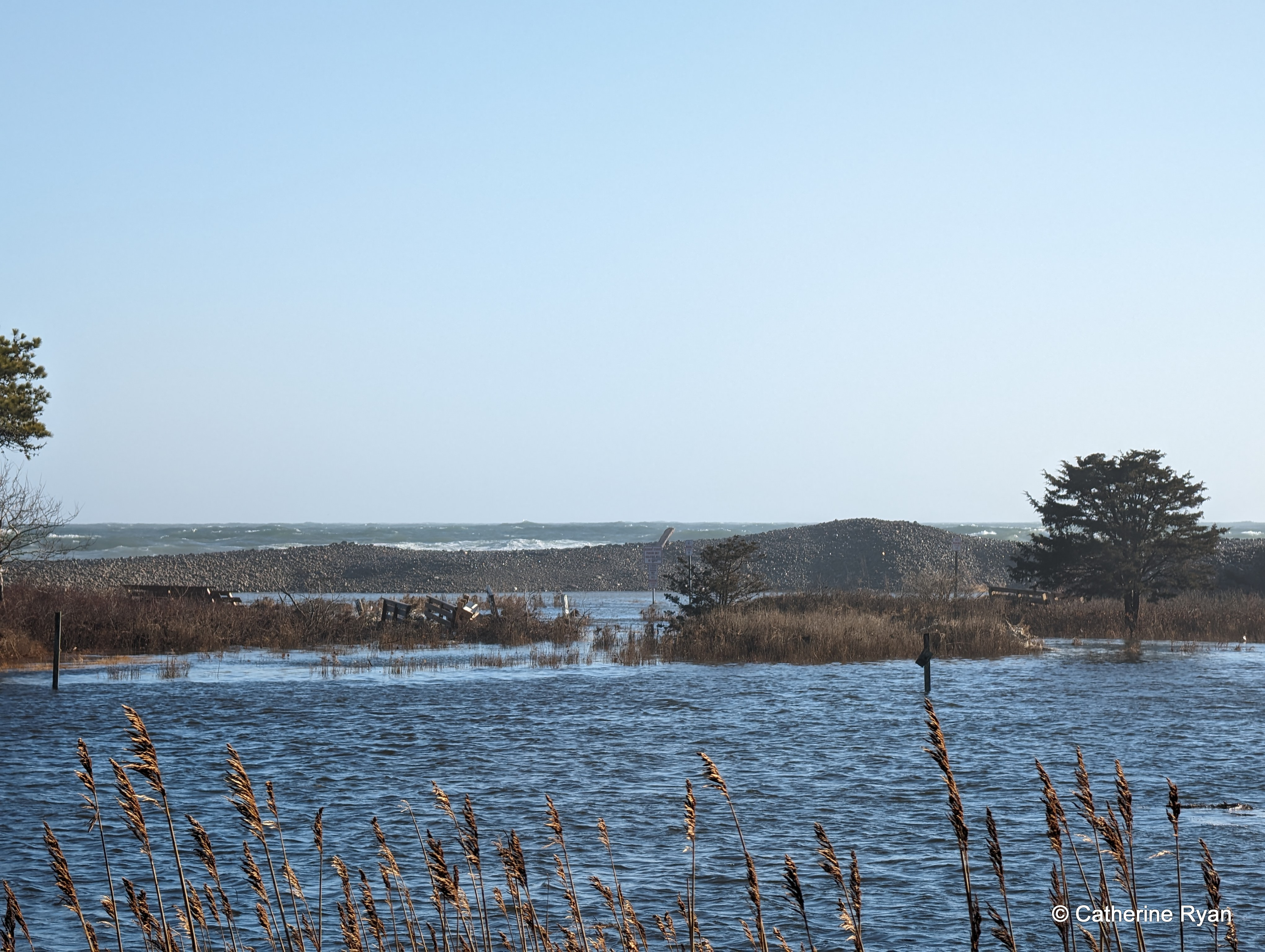
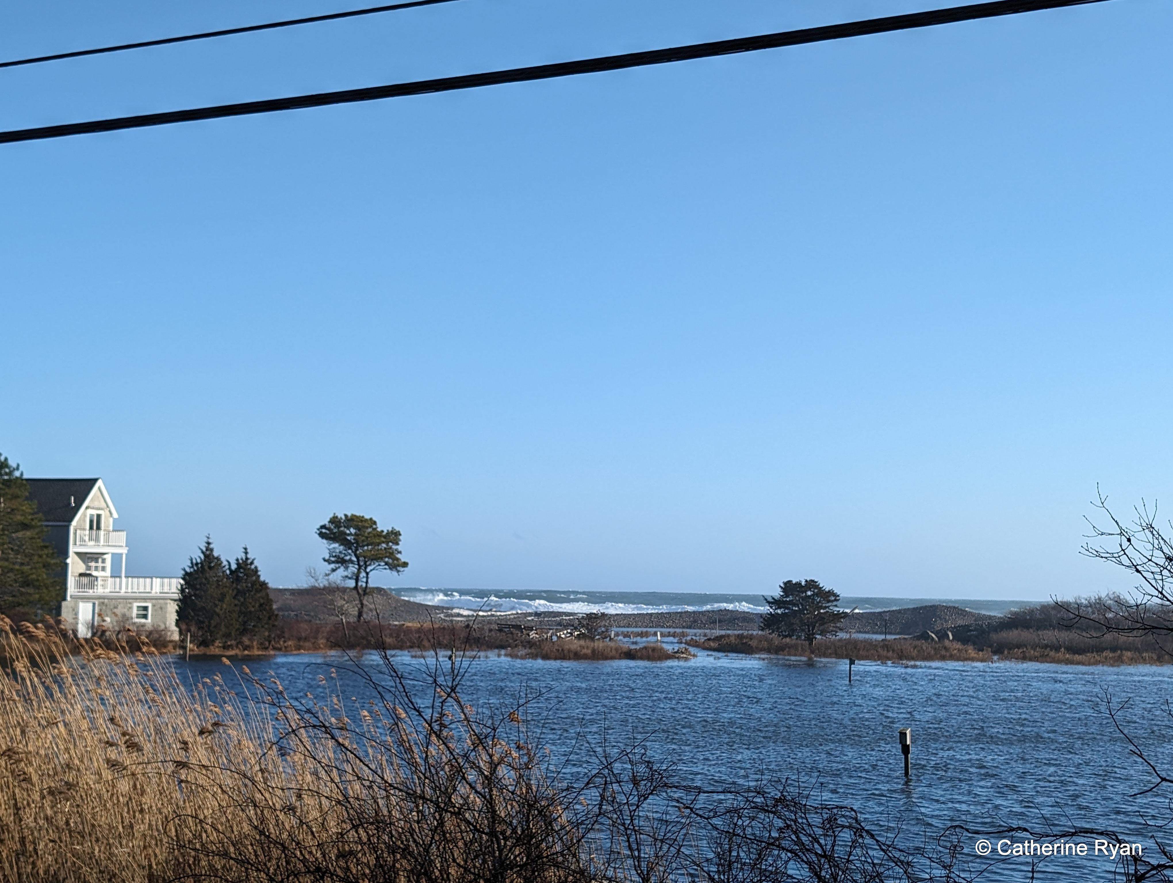
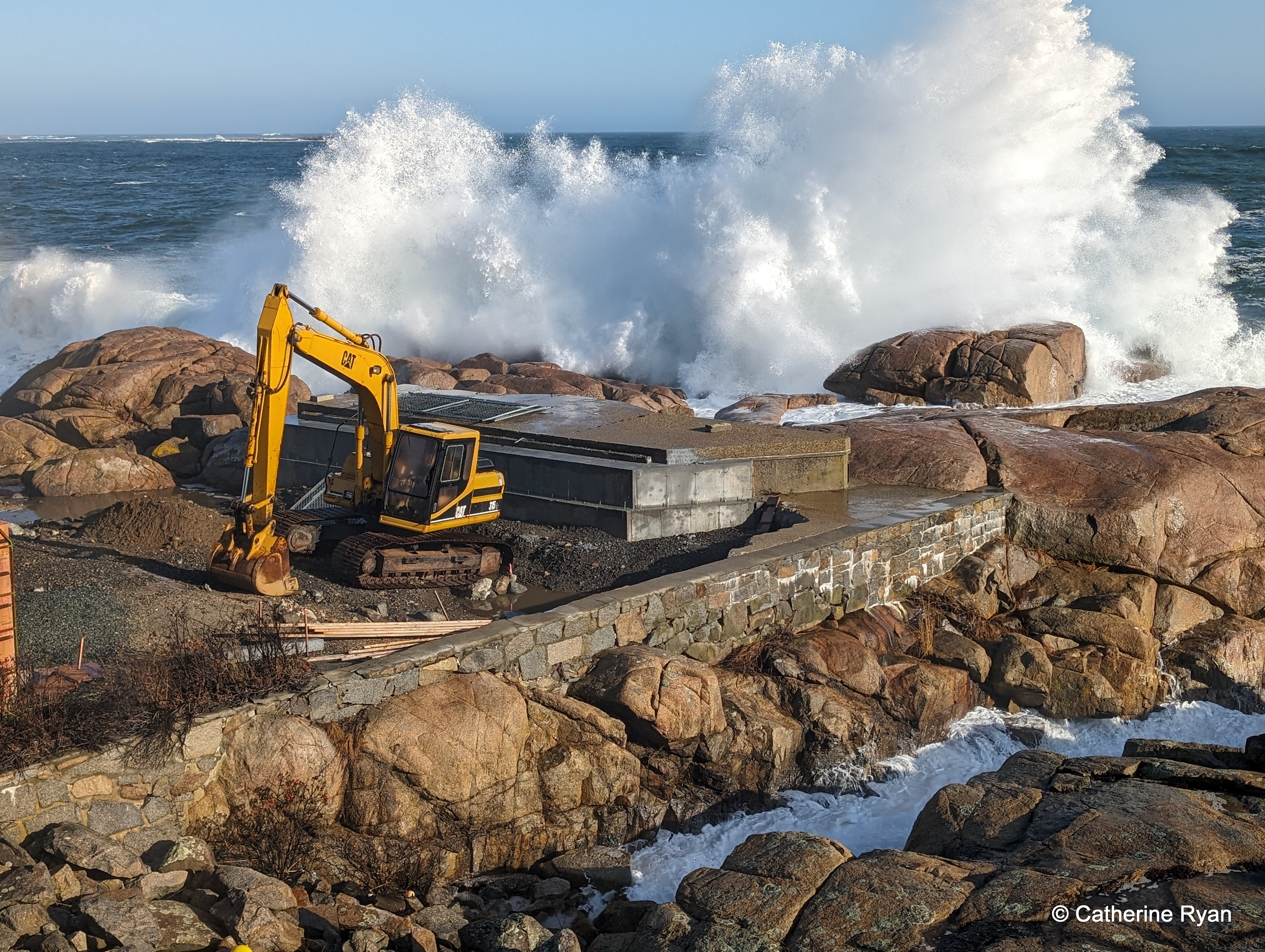
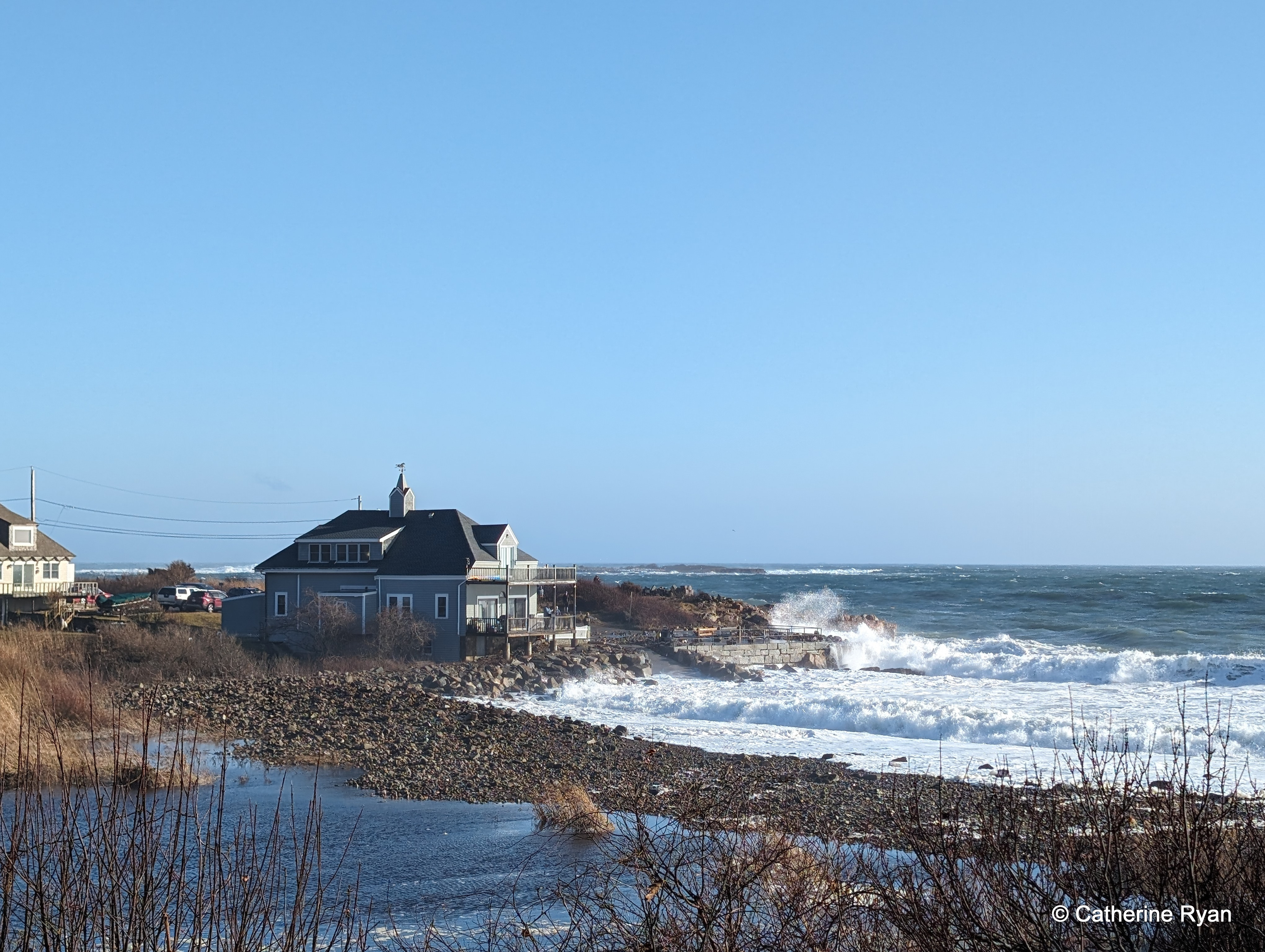
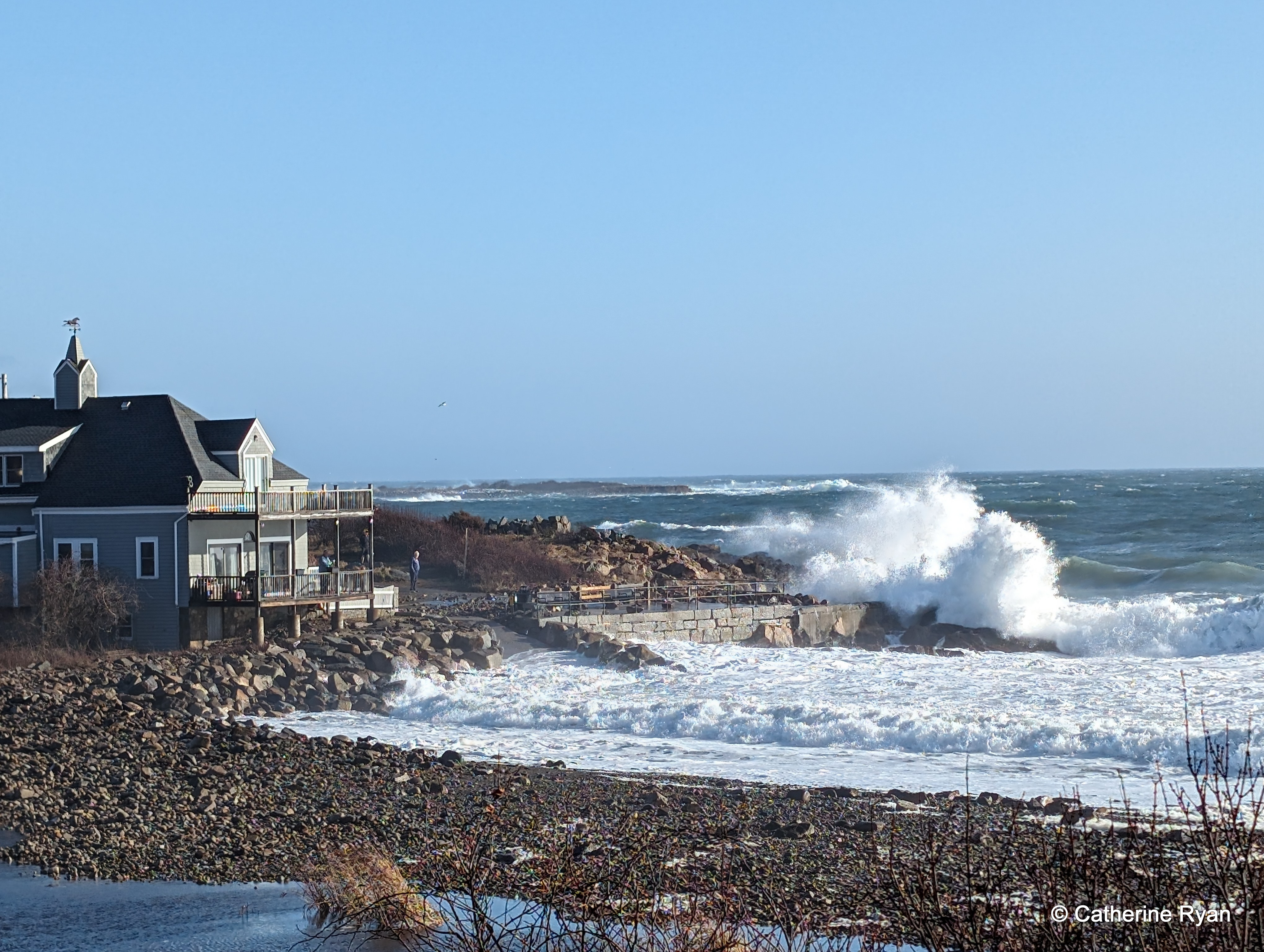
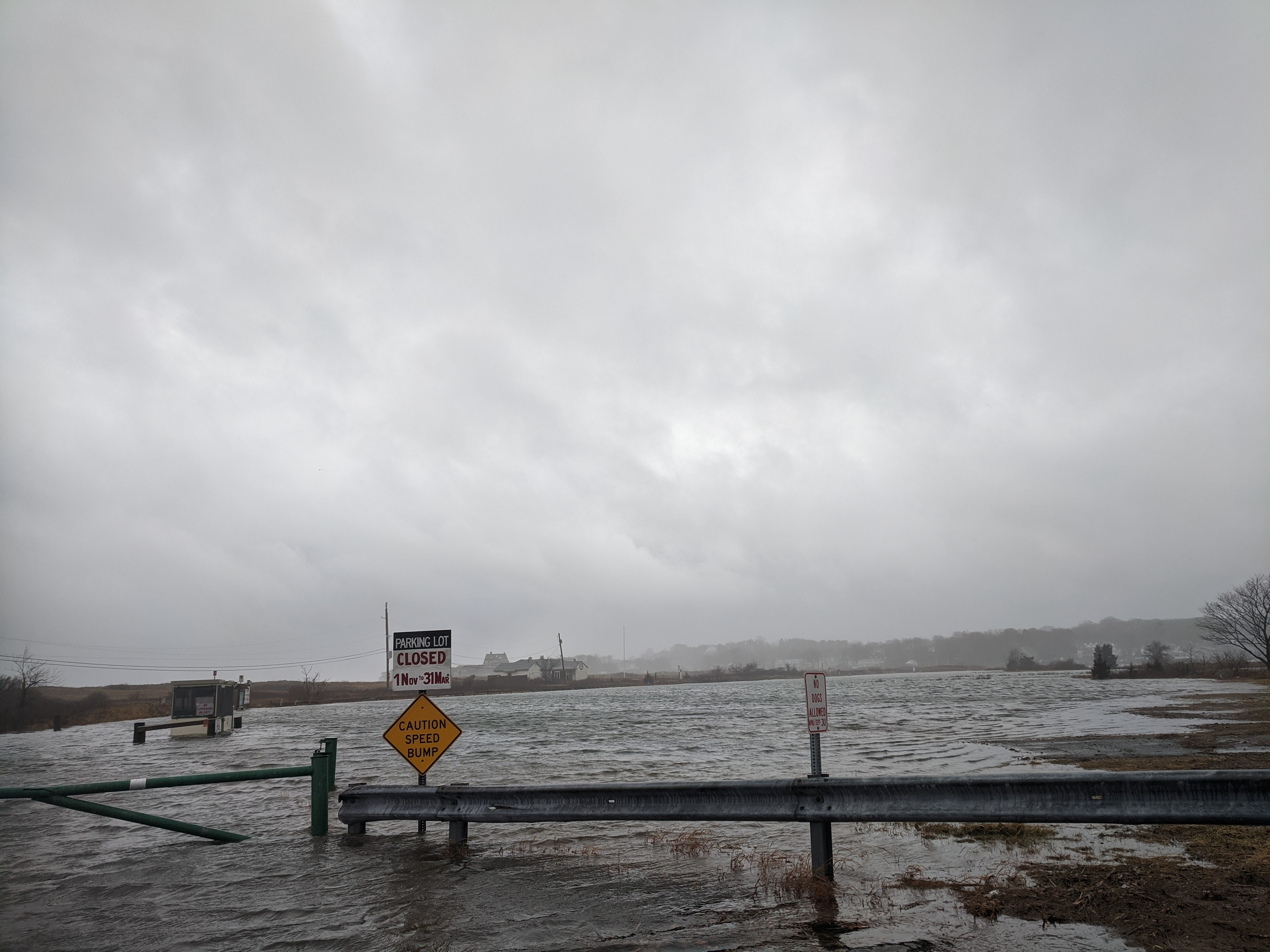
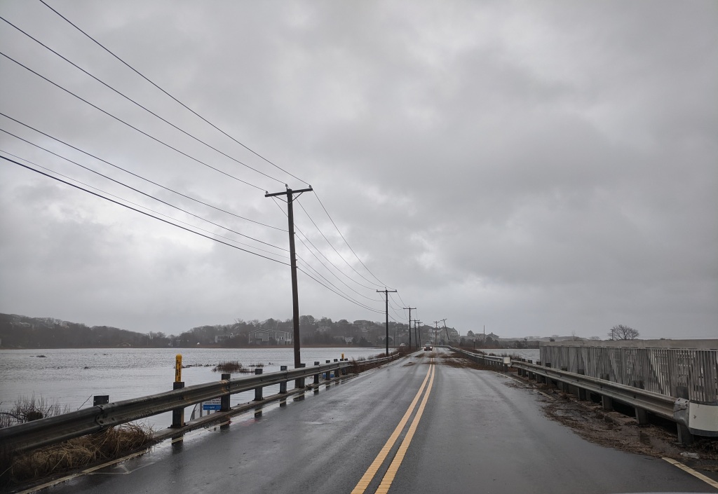
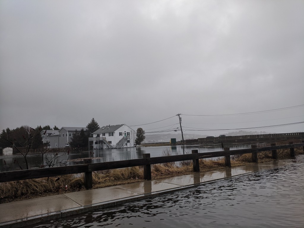
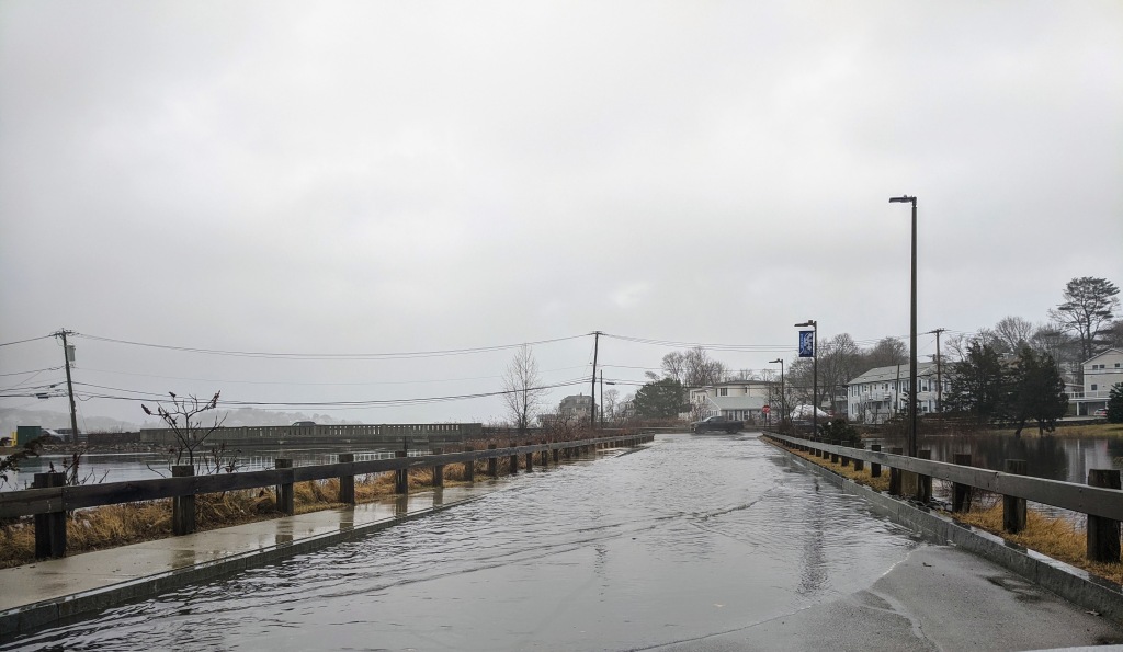
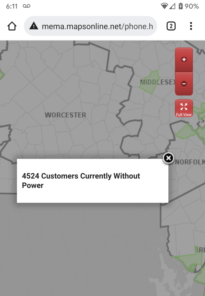
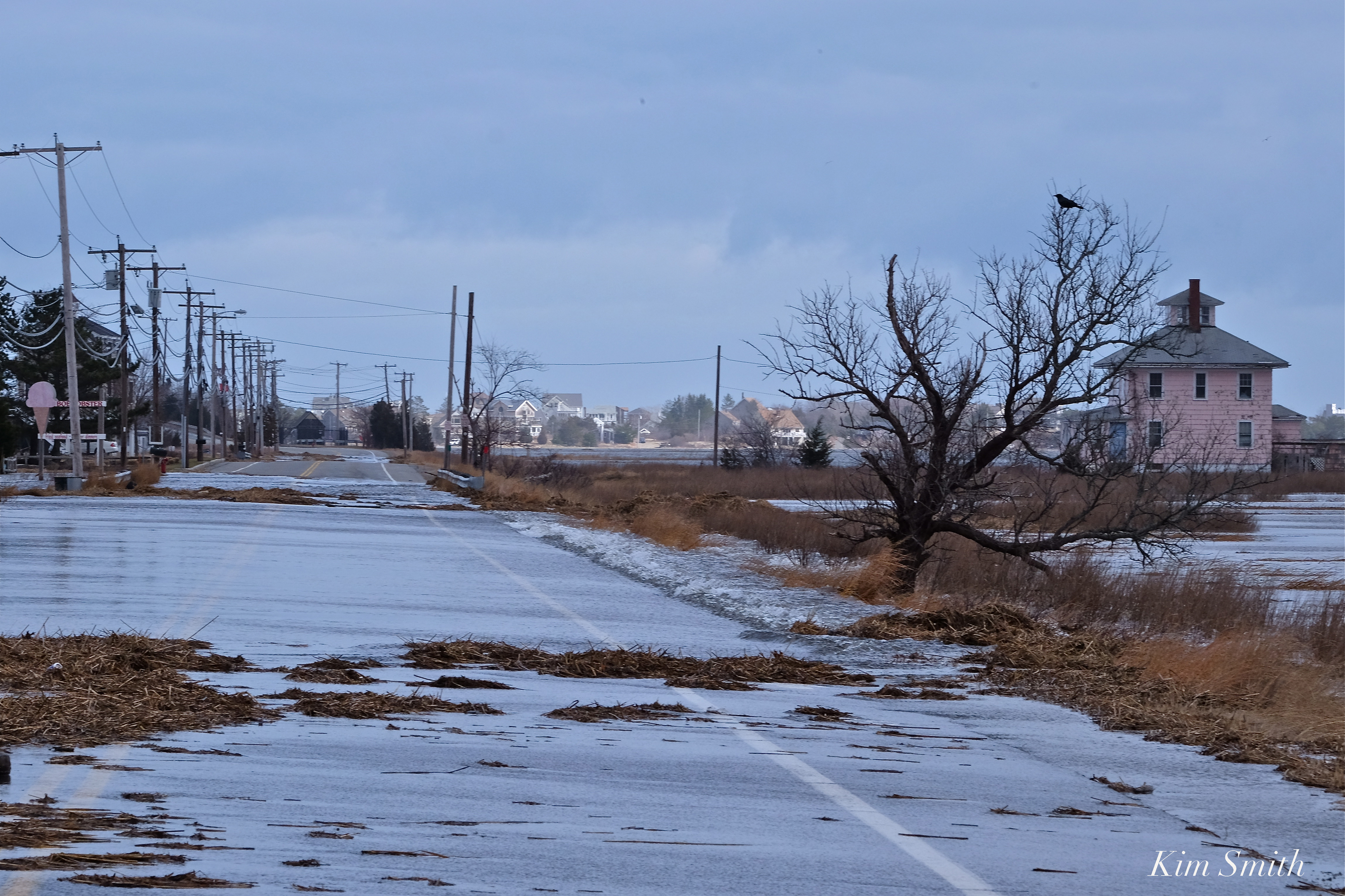
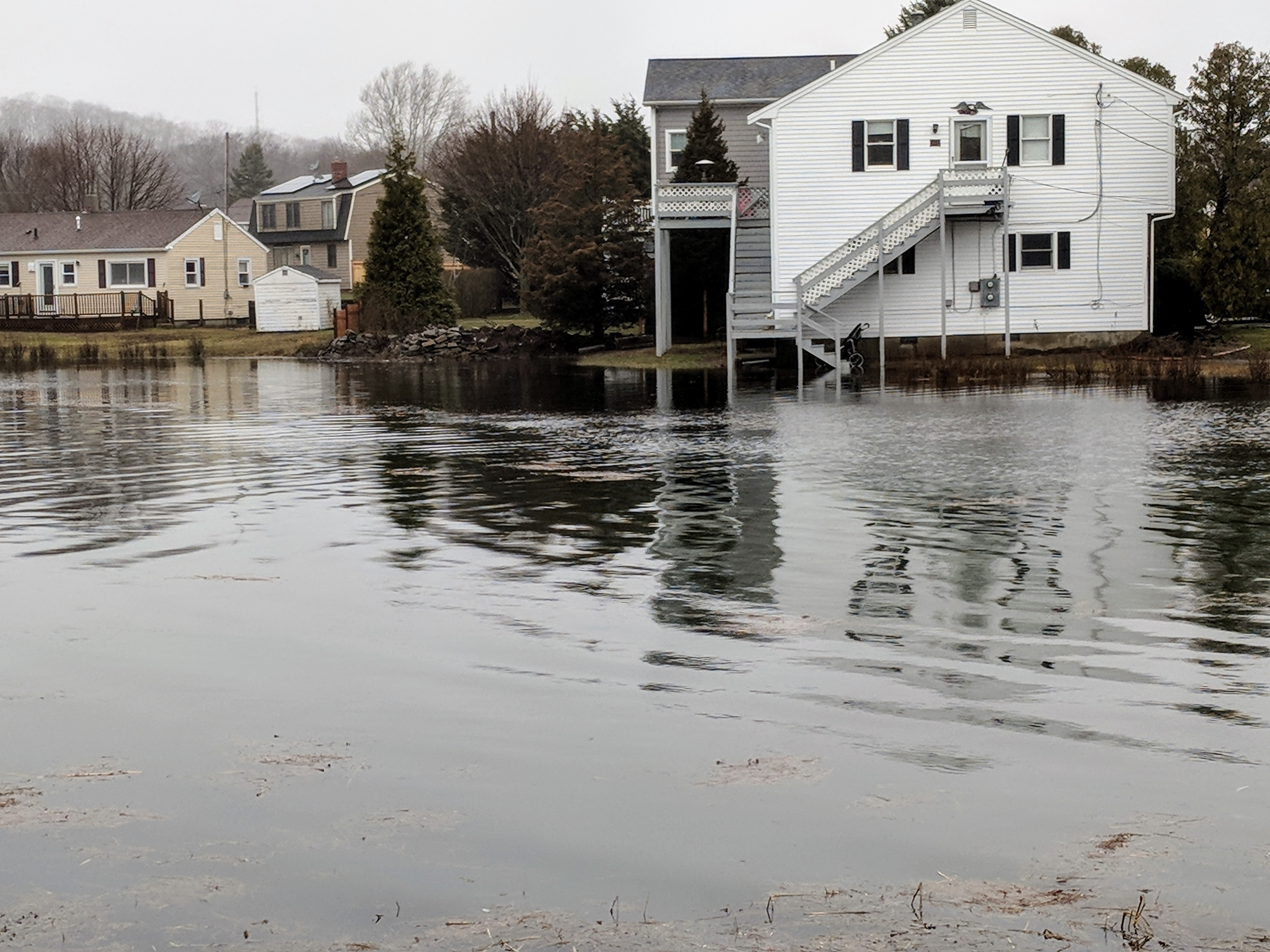
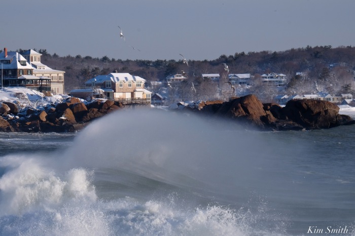
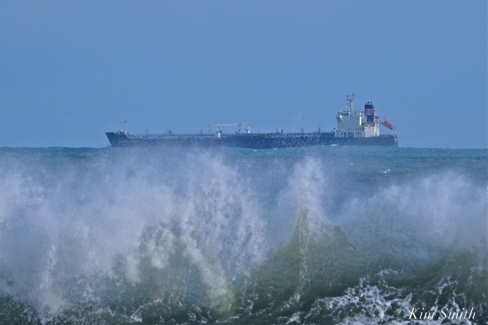
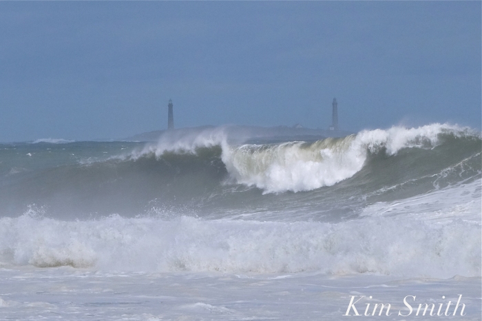
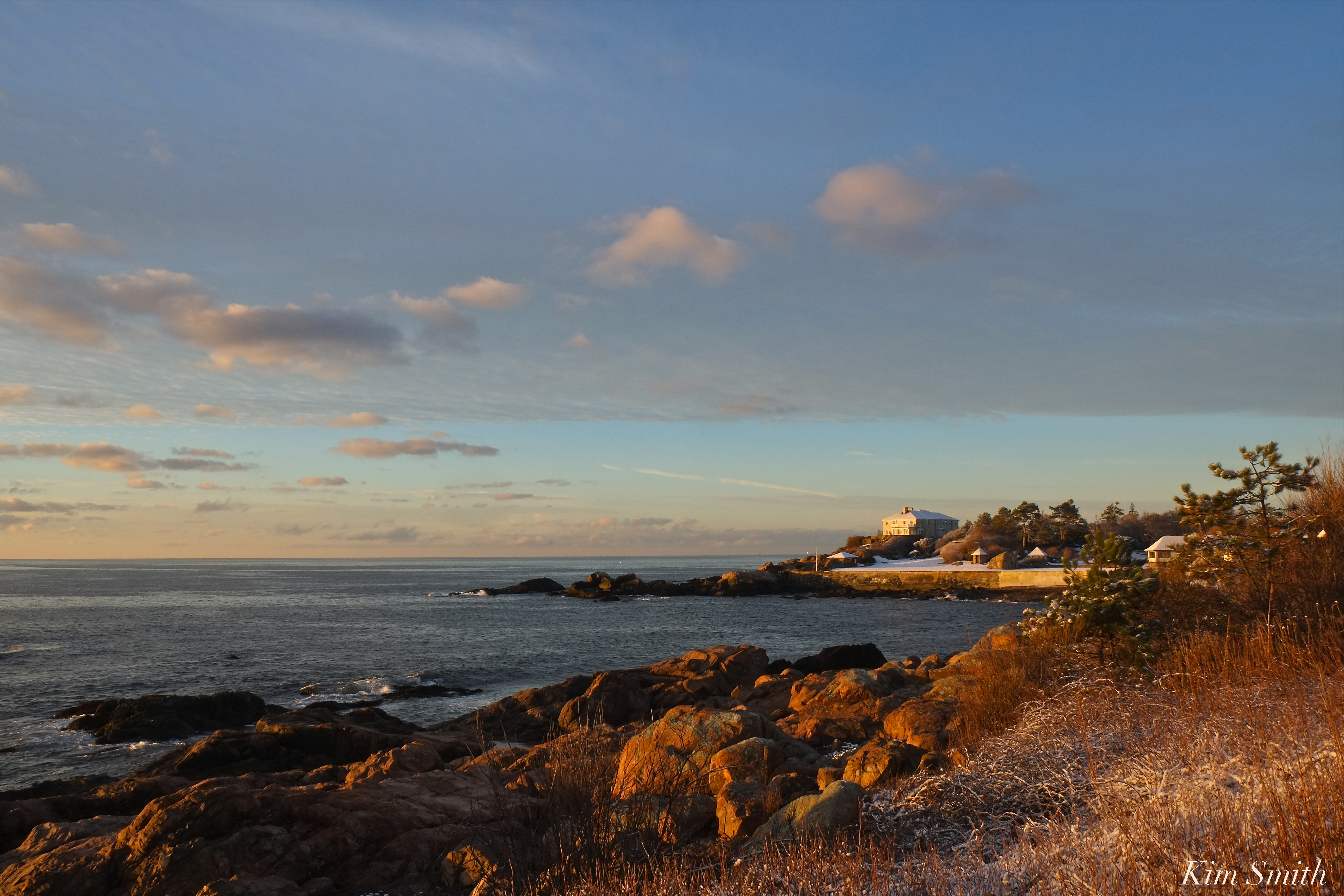
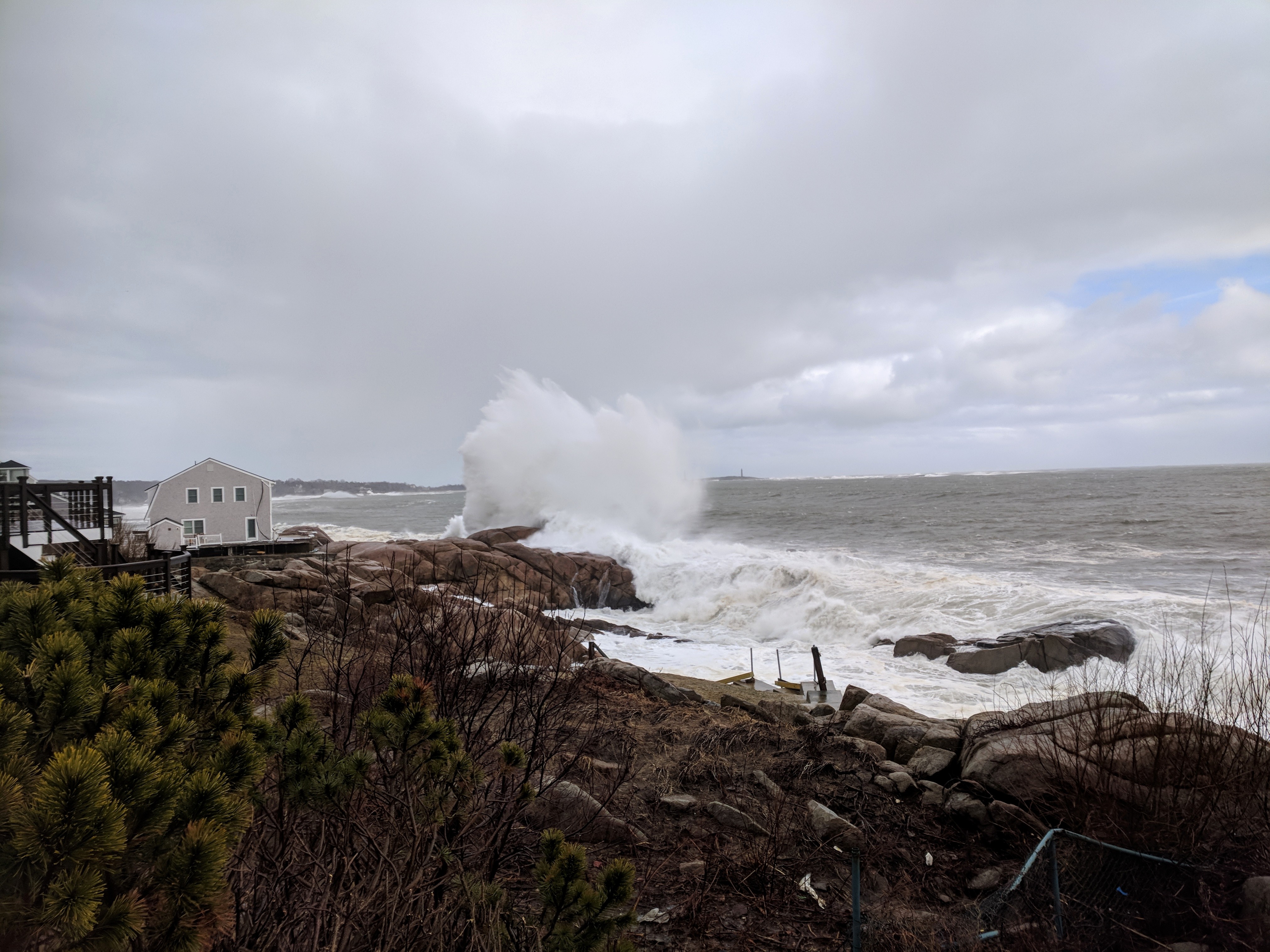
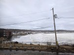
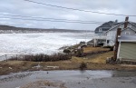
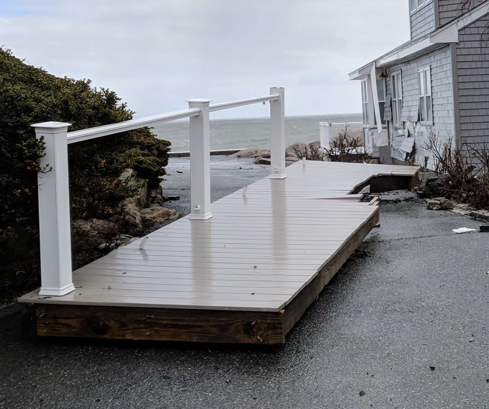
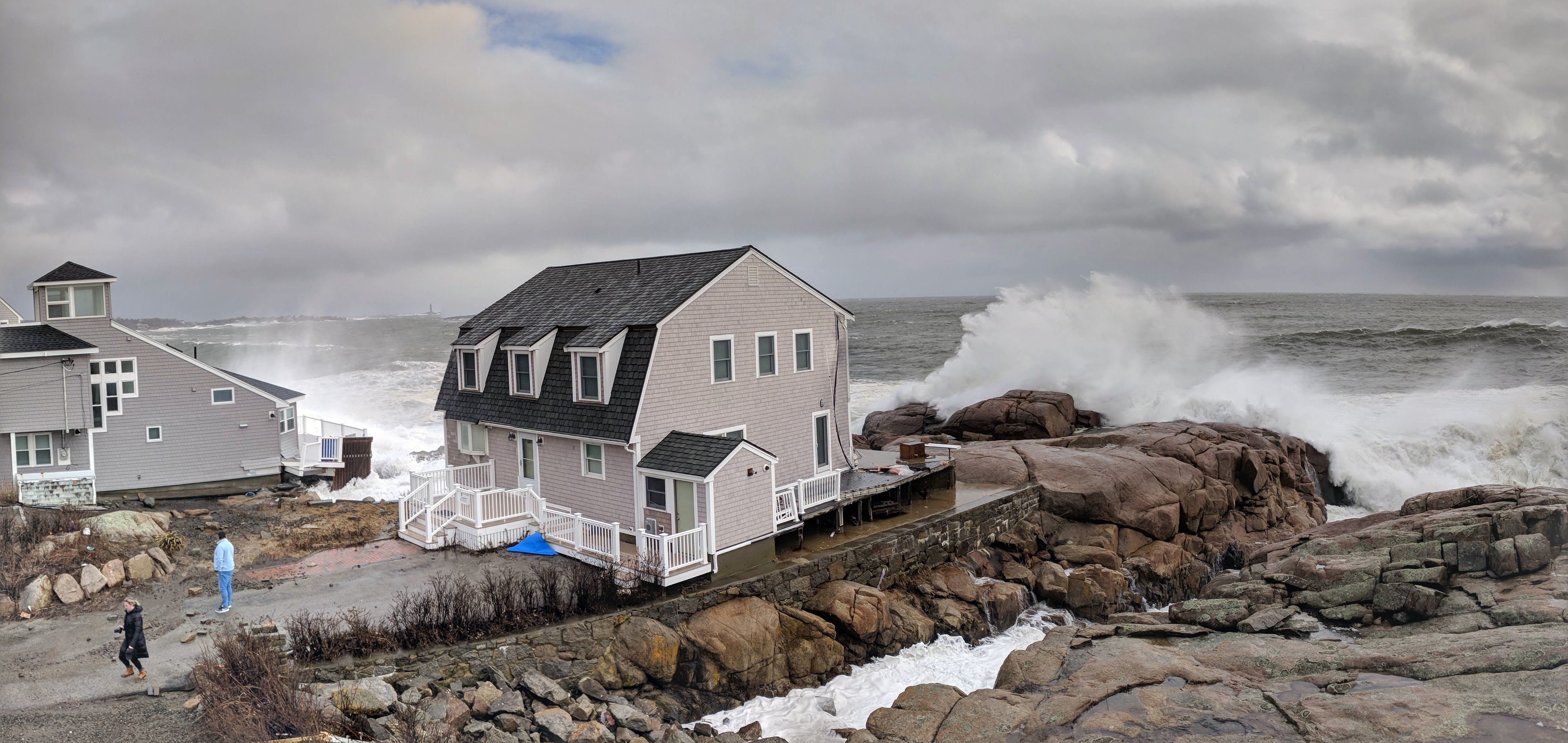
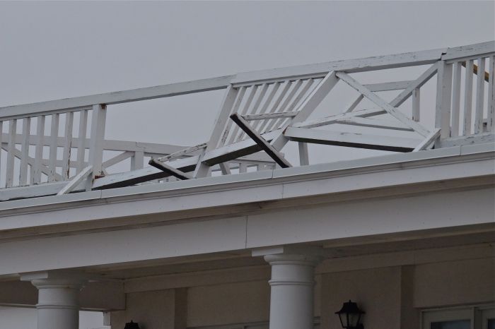
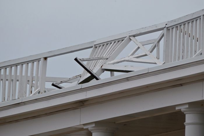
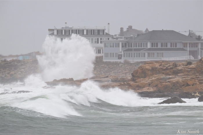
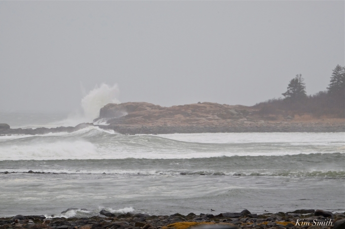
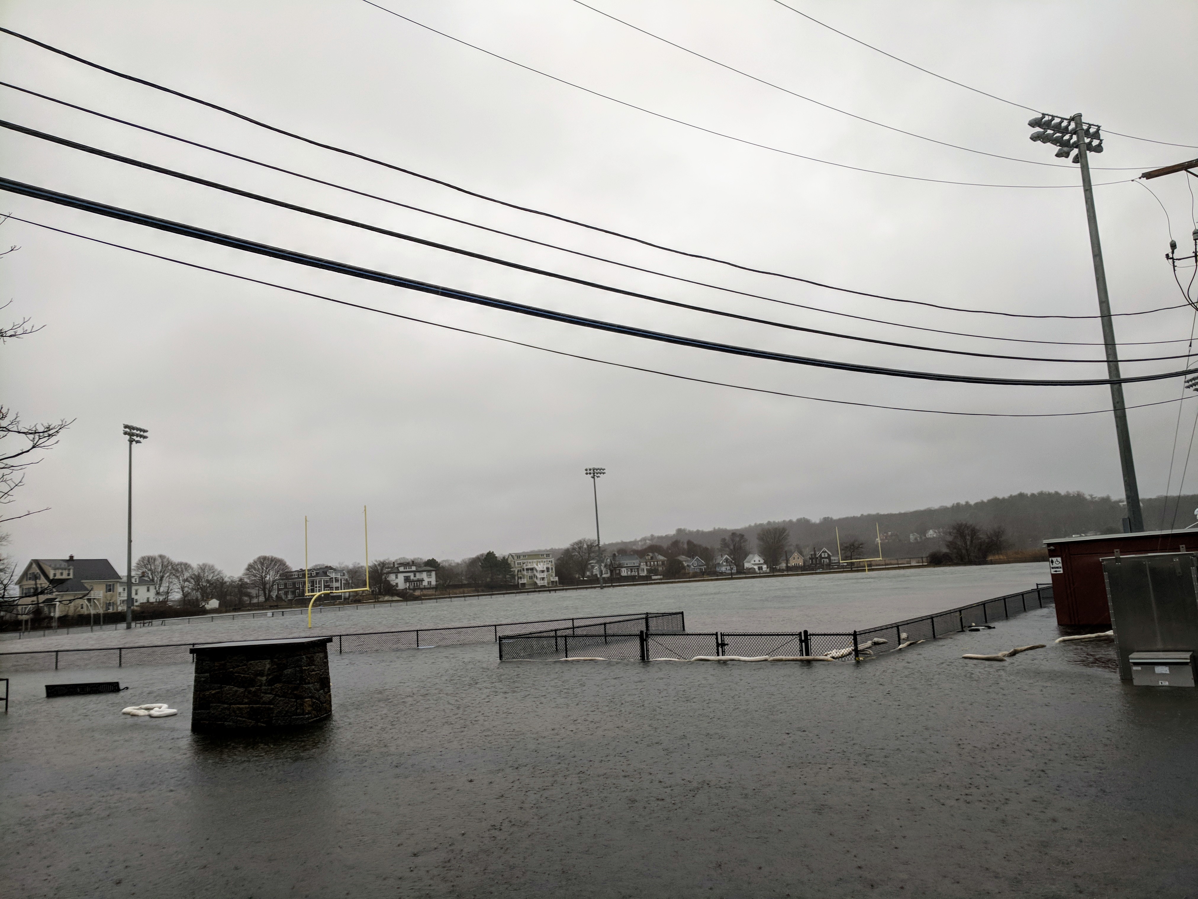
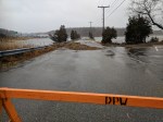
According to officials, the coastal flooding was worse in some sites prone to high tide flooding than they had experienced in past storms. The impact is going to take time to assess.

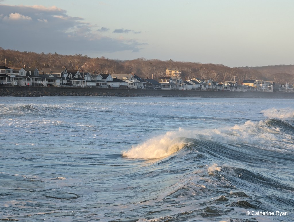
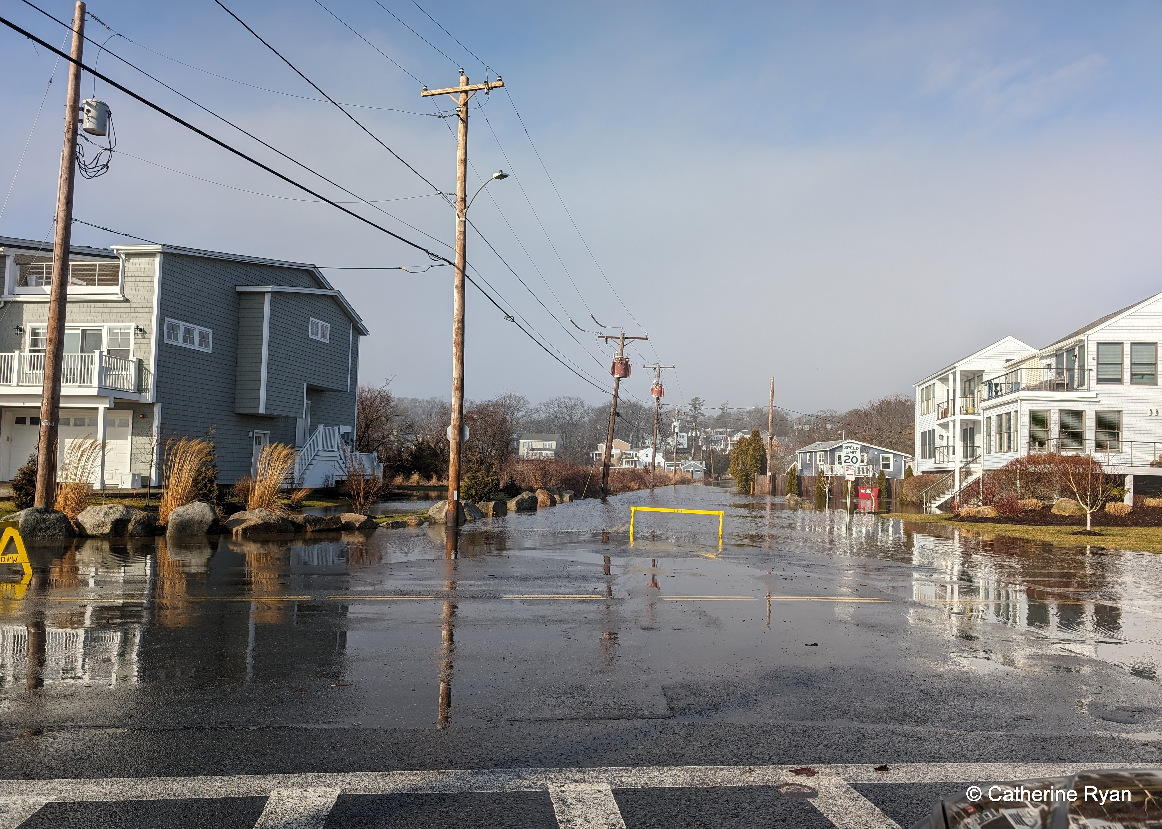
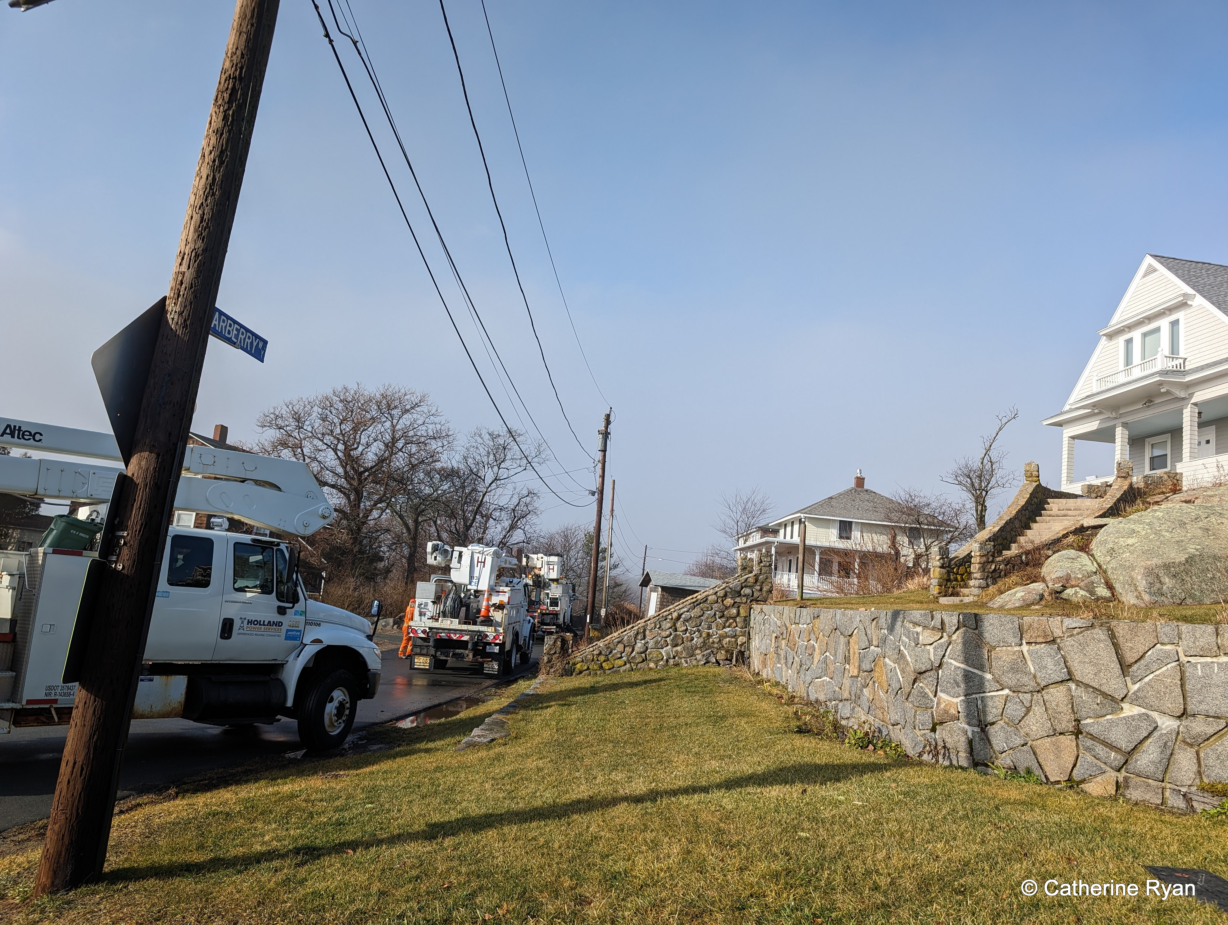
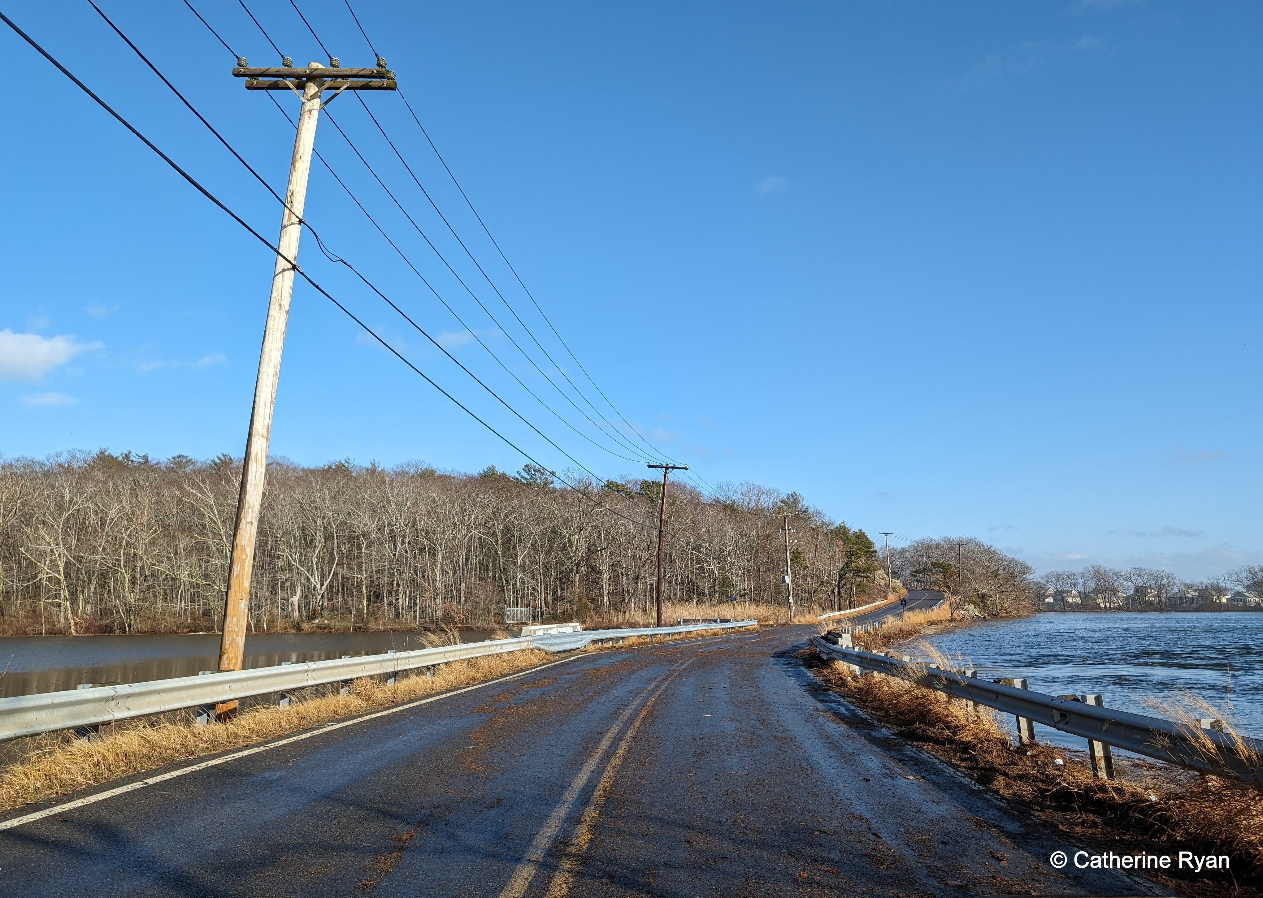
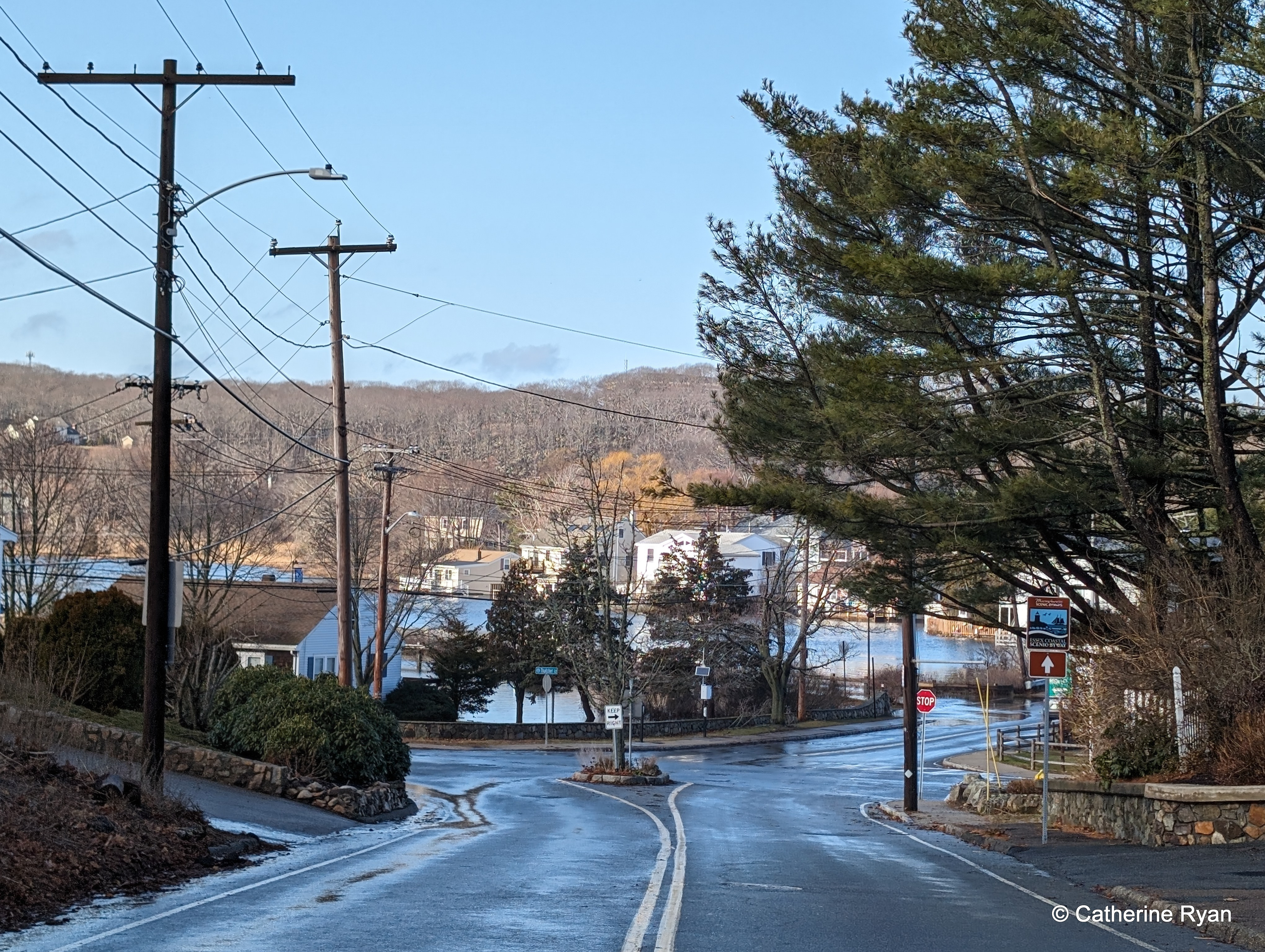
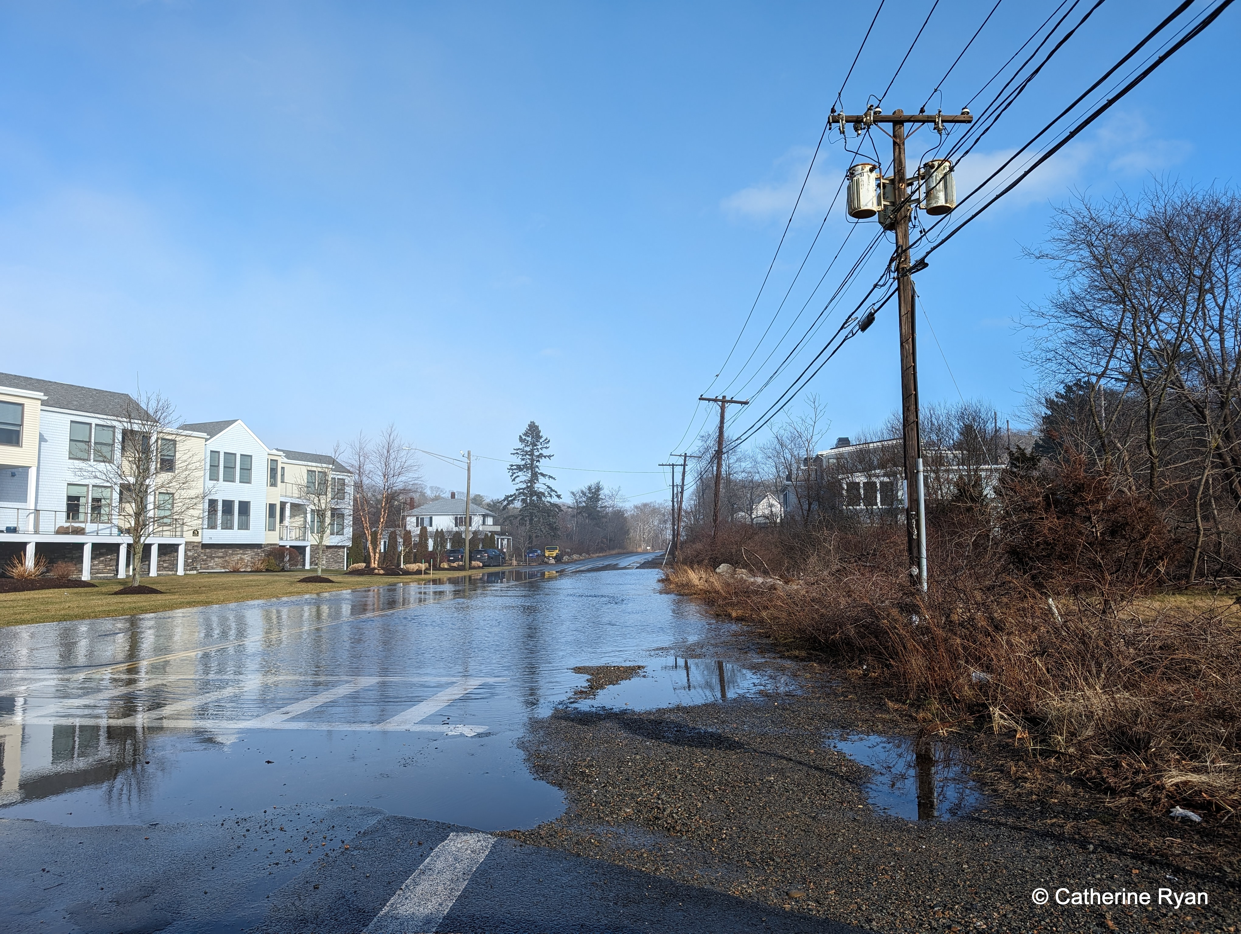
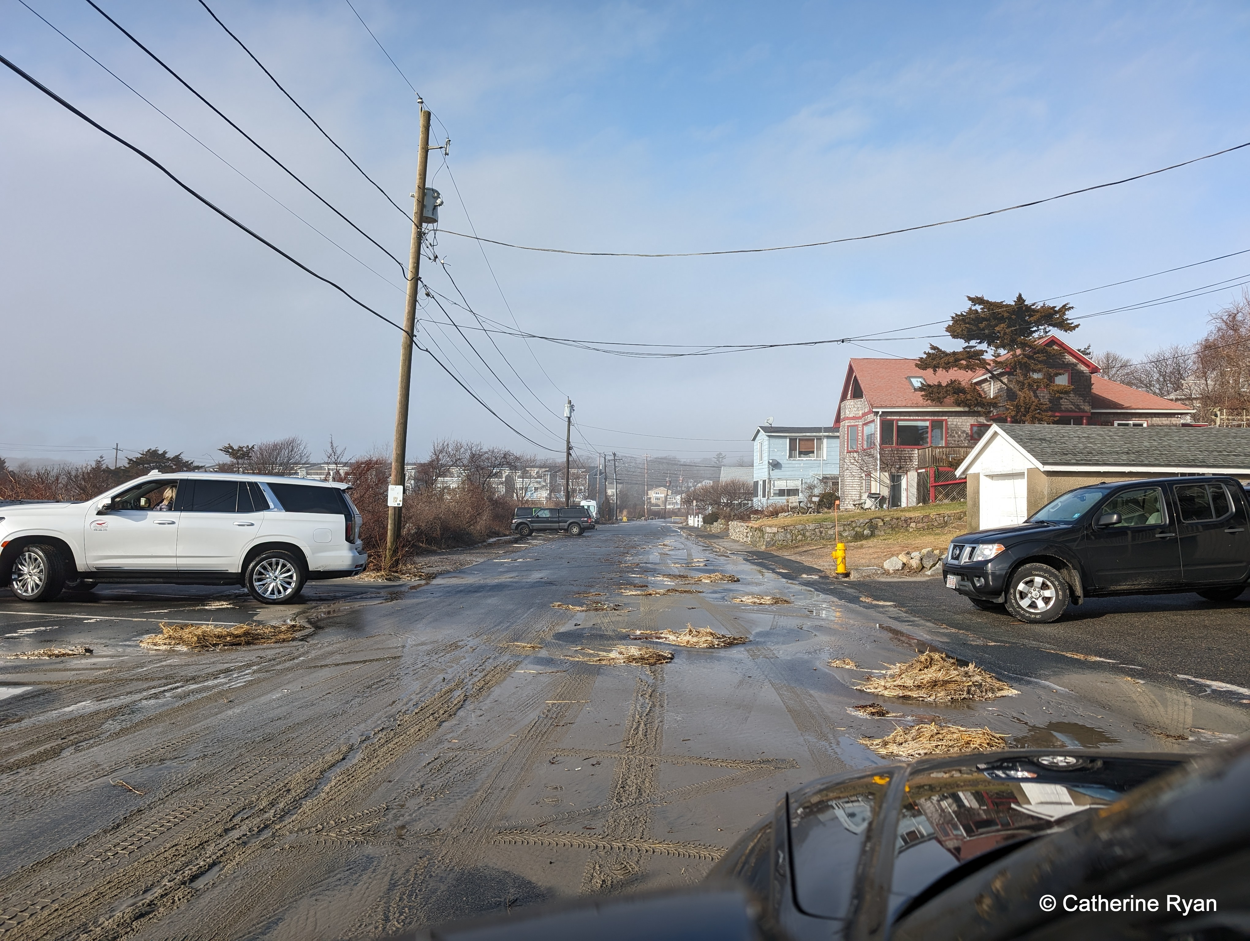
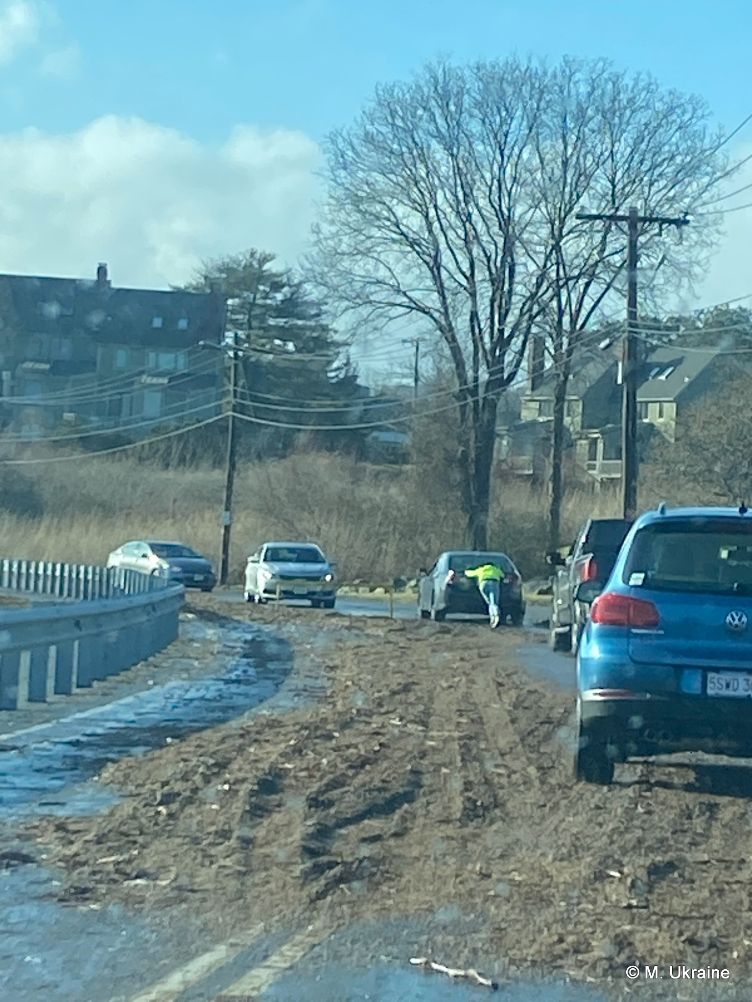
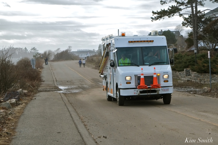
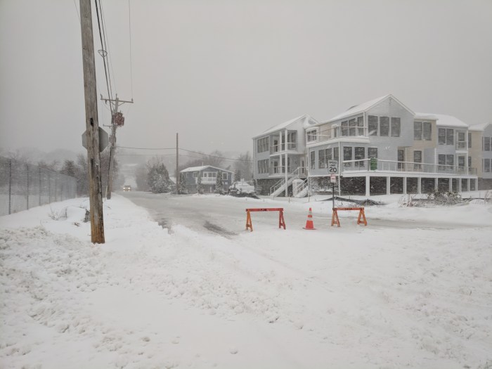
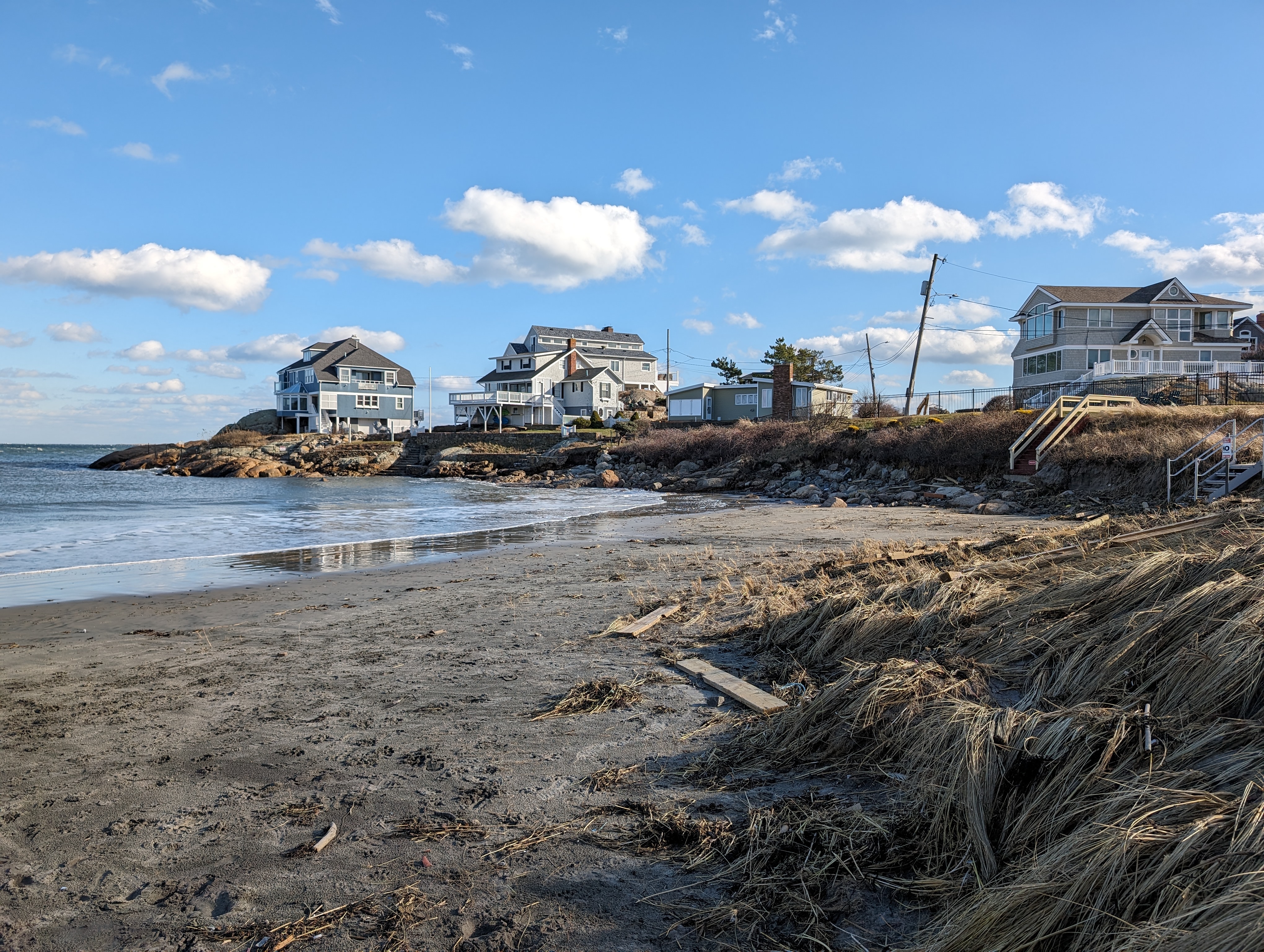
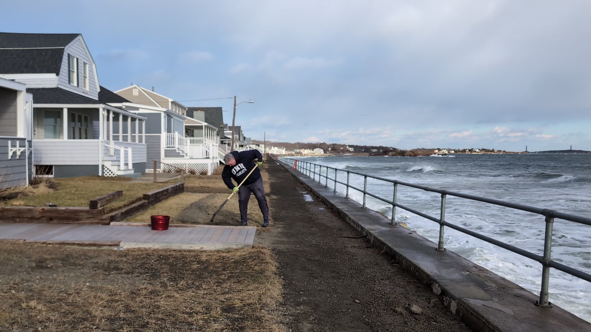
In the meantime, congratulations to DPW and city services. Making roads safe was addressed immediately by Gloucester DPW. On Thatcher Road, the clean up was instant. How did this storm surge impact your neighborhood? I spoke with 20 residents around Long Beach (in East Gloucester and Rockport) and every one of them felt that this storm did not cause as much damage as the year with the trio of March storms. However, homeowners closer to Gap Head cove in Rockport felt it was the worst they’d ever experienced.

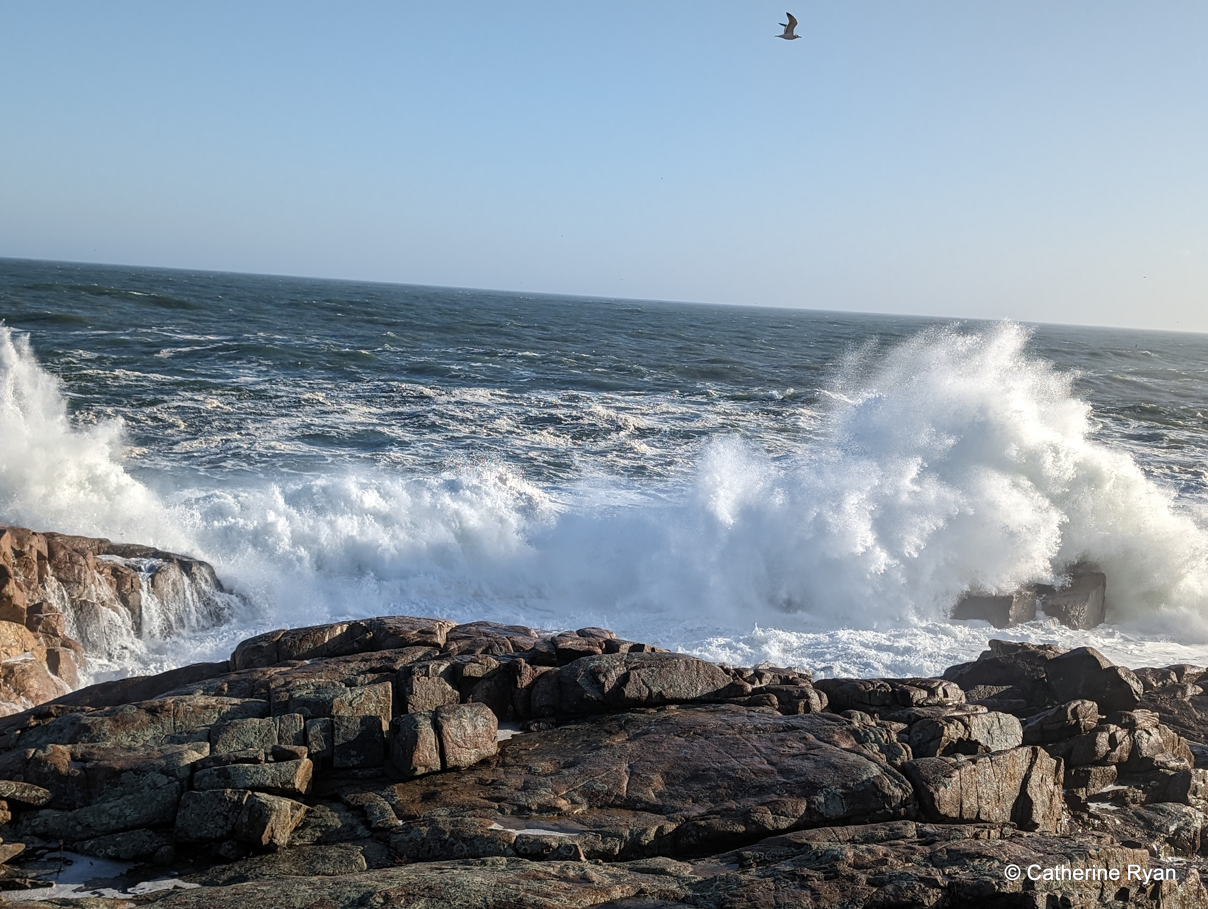
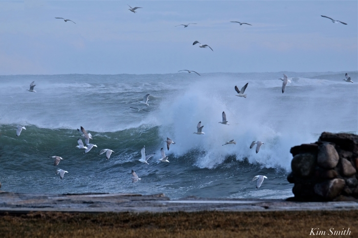
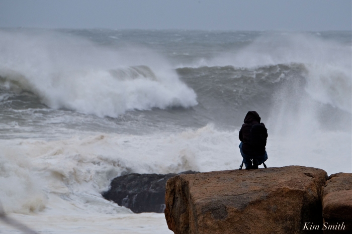
“The waves kept coming,” they said.
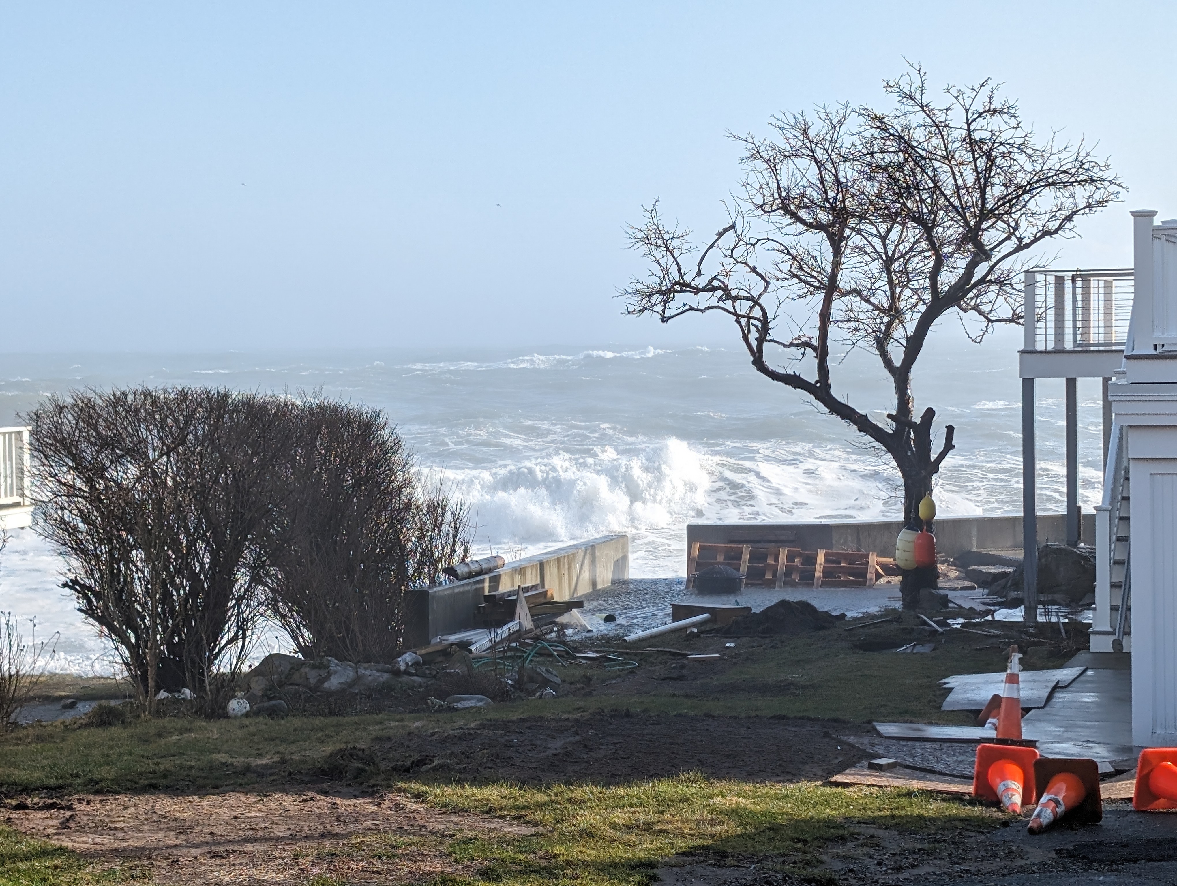
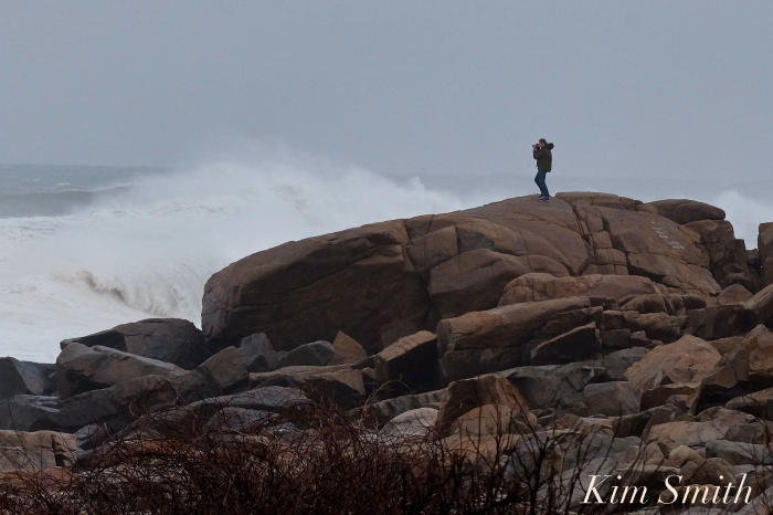
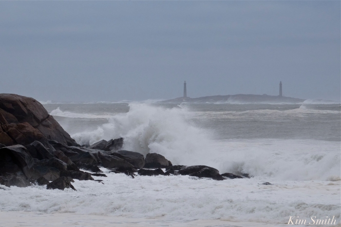
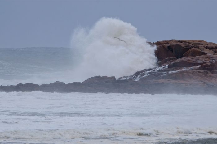
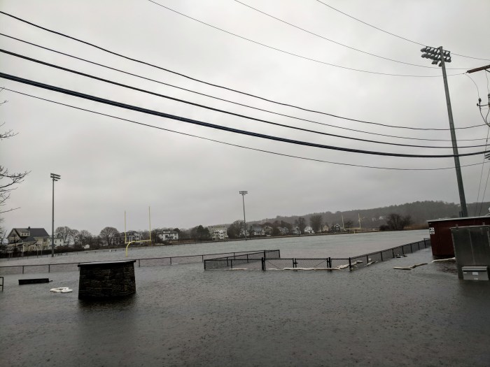
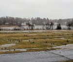
Jan. 14 – Day 2

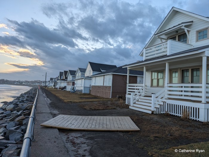
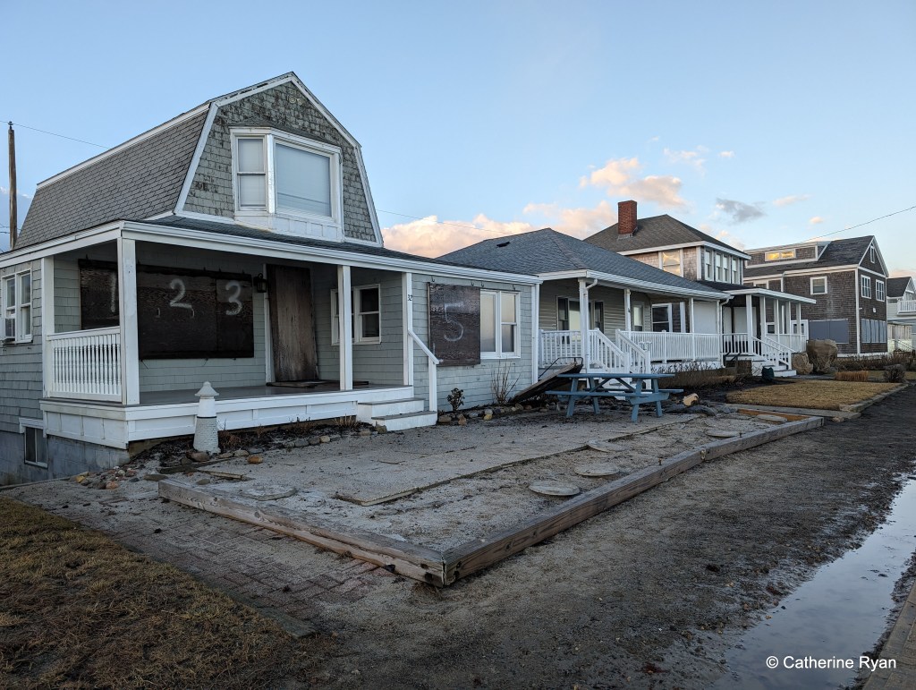
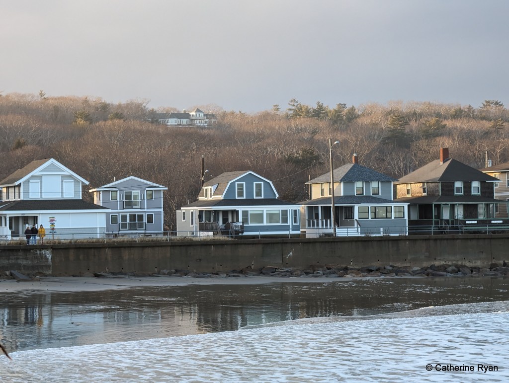
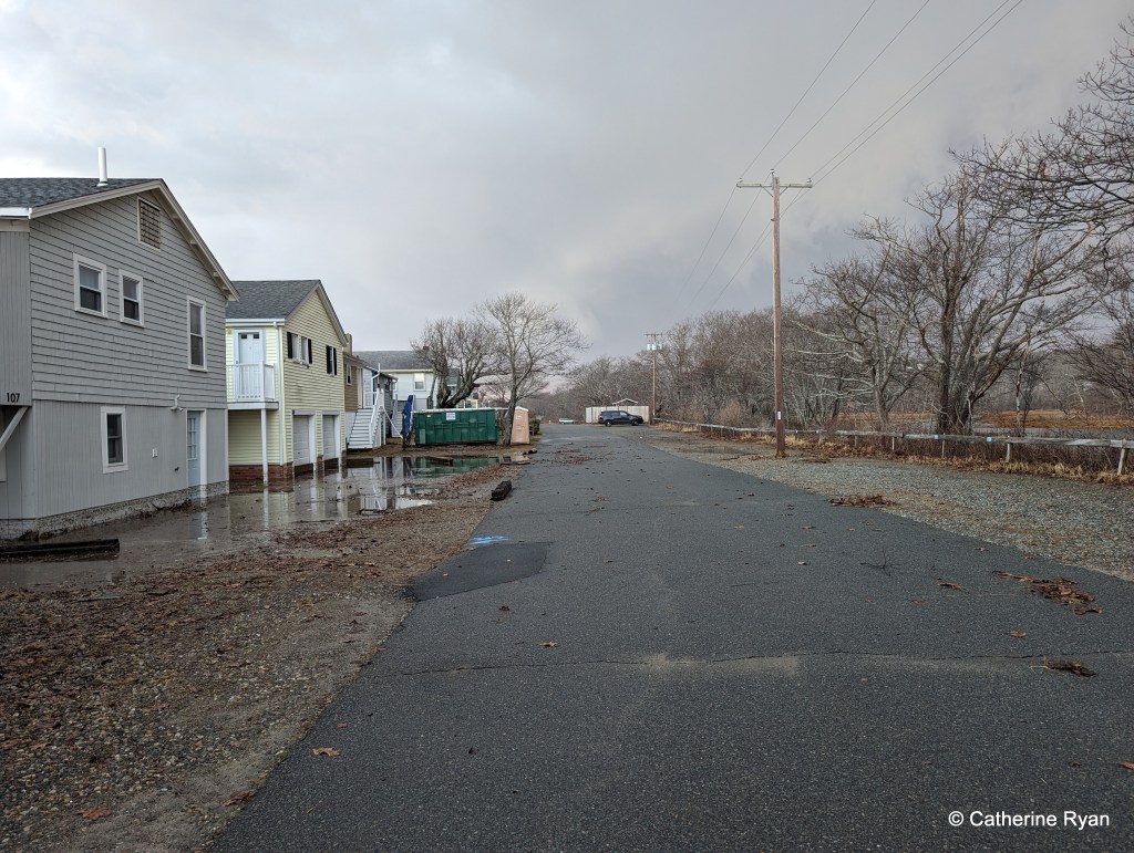
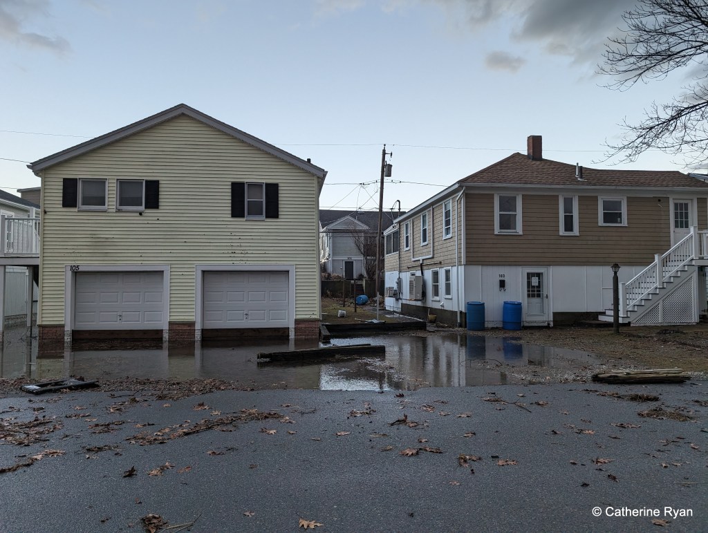
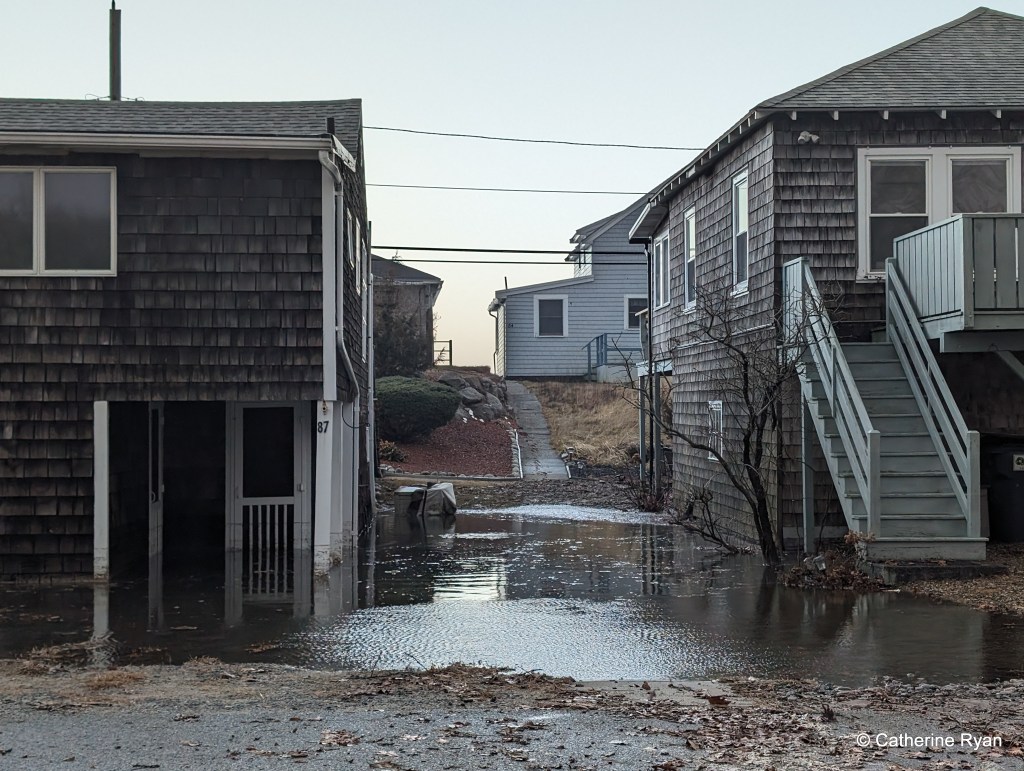
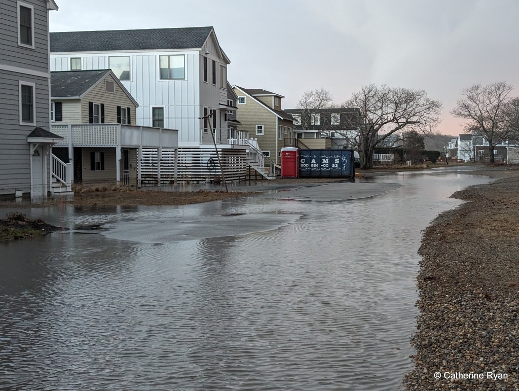
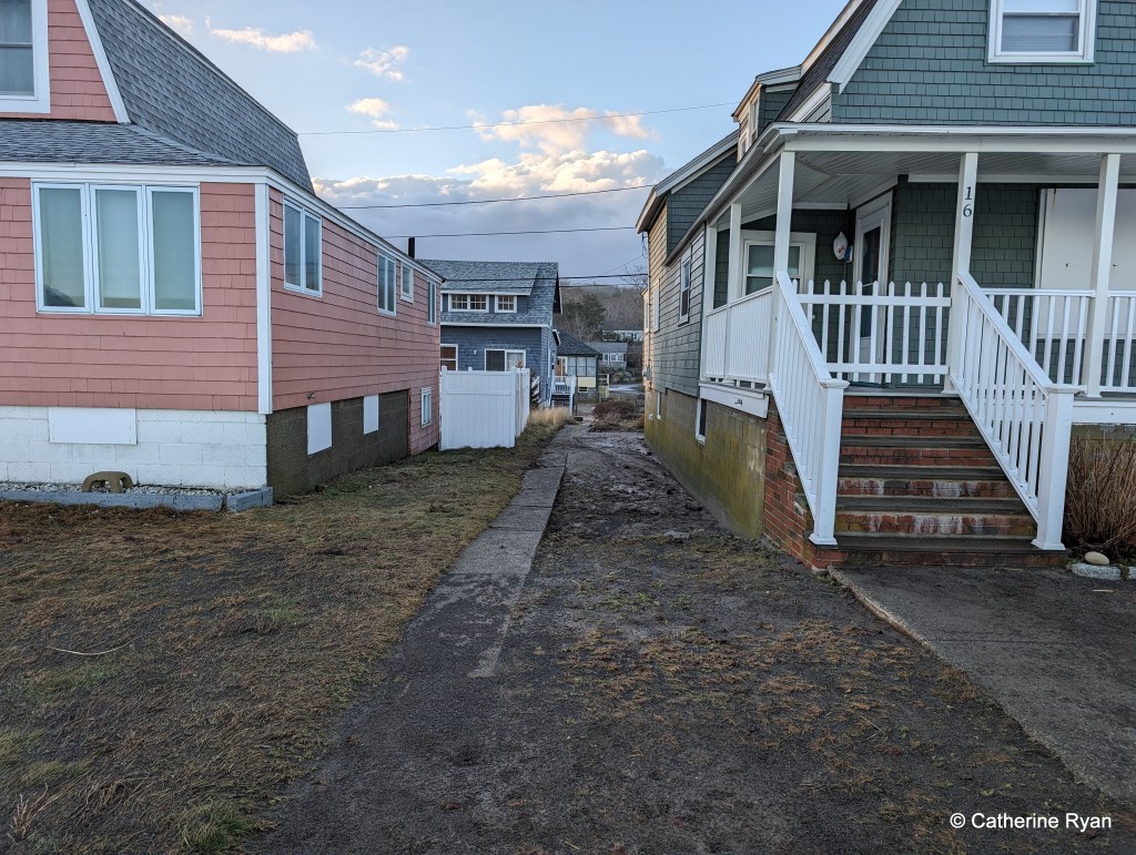
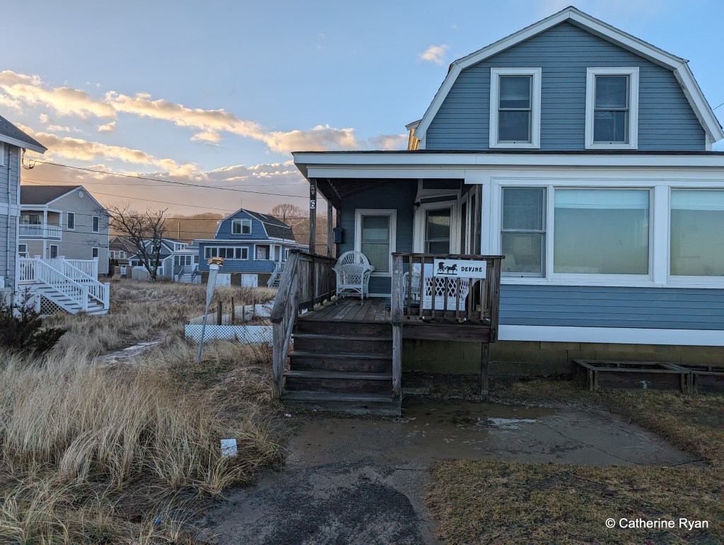
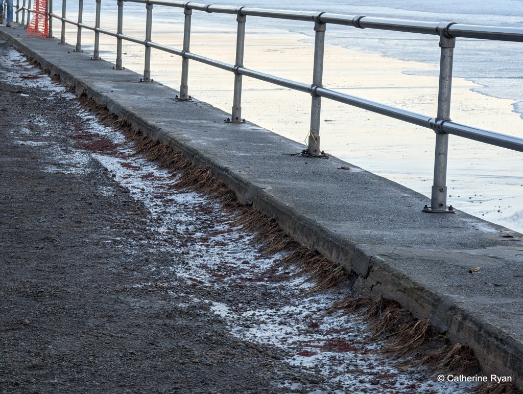
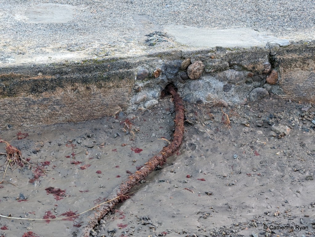
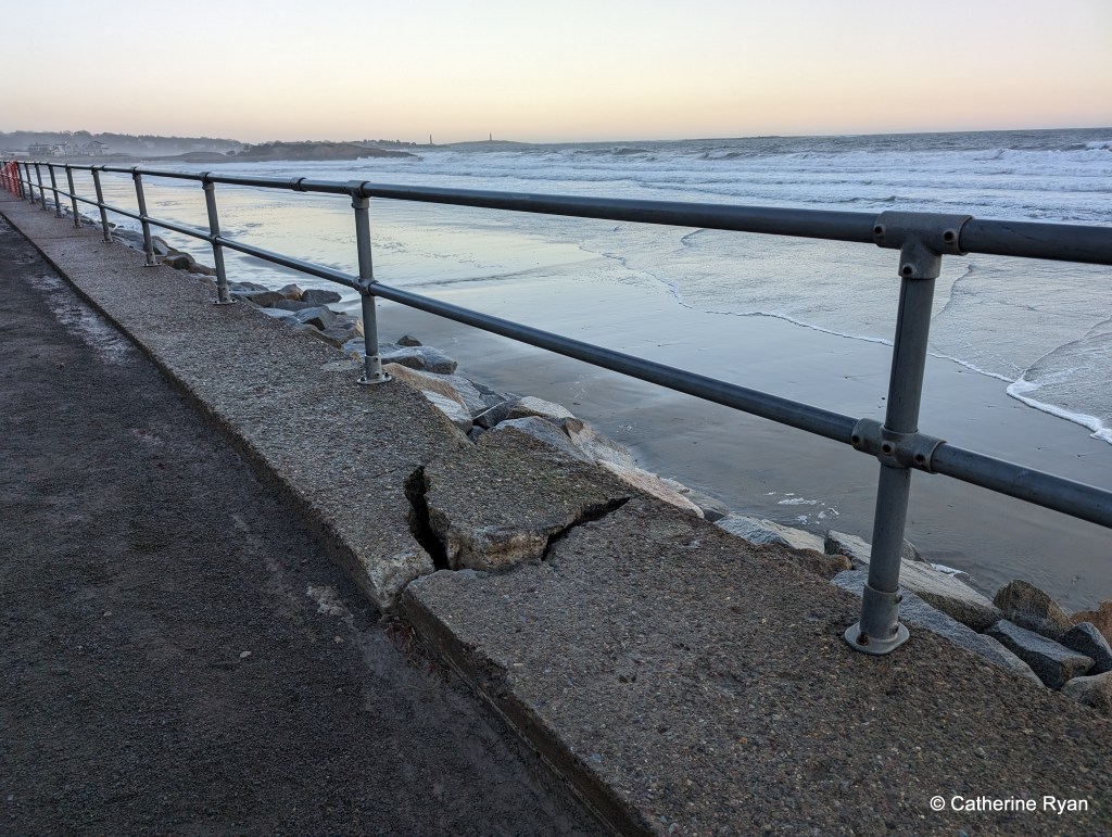
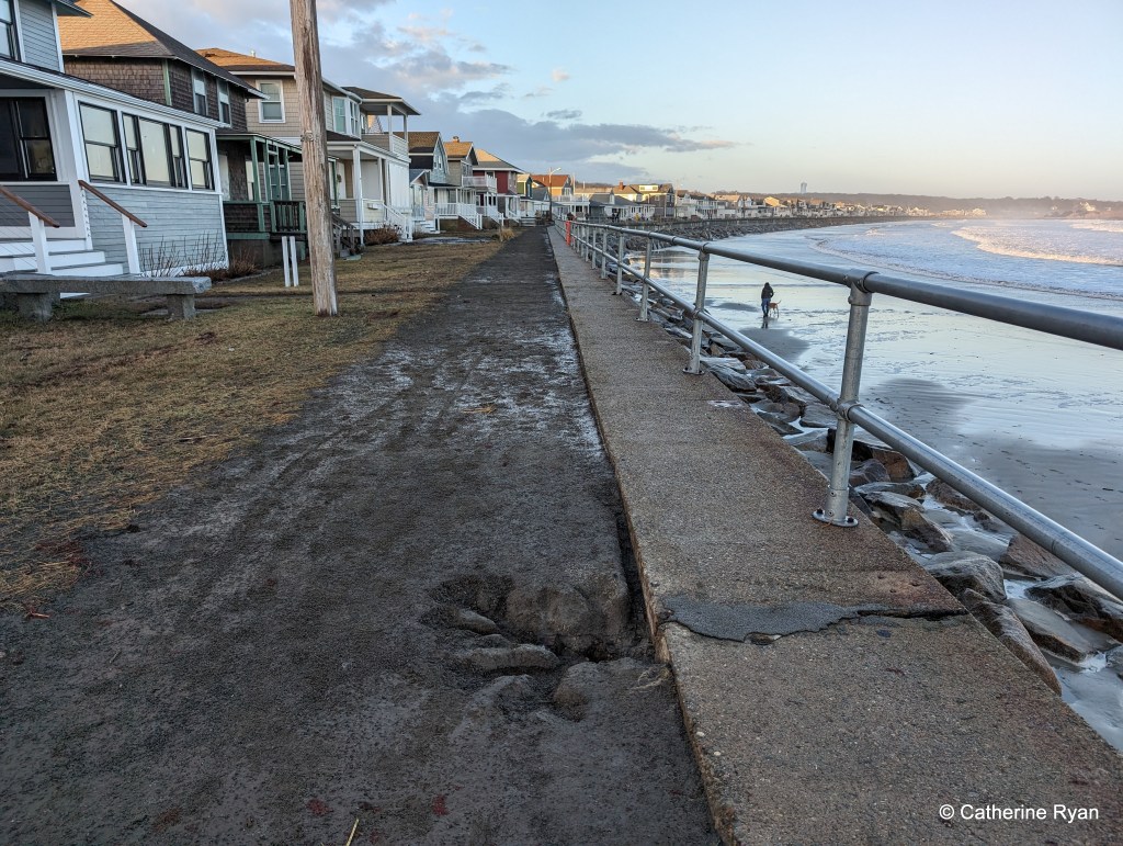
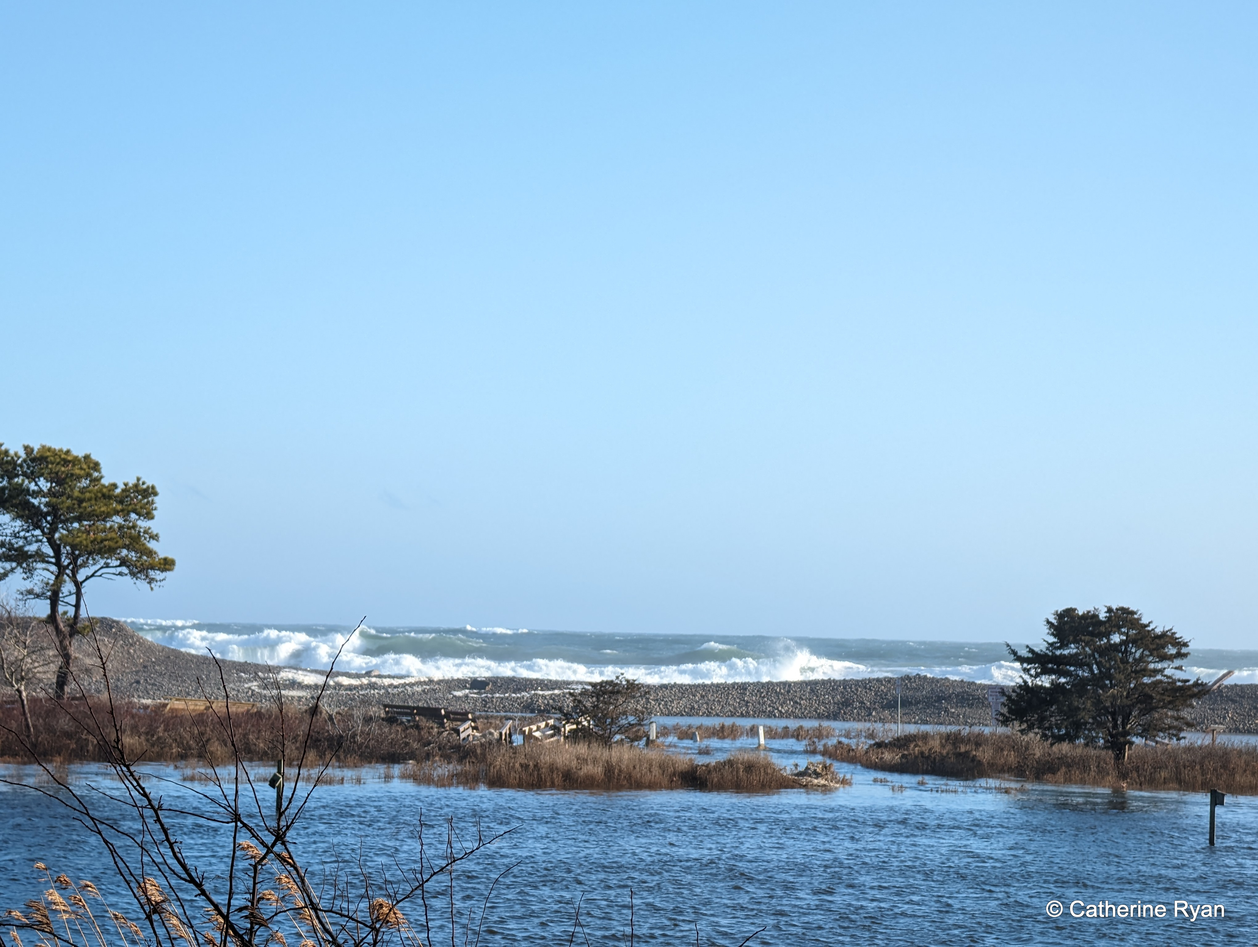
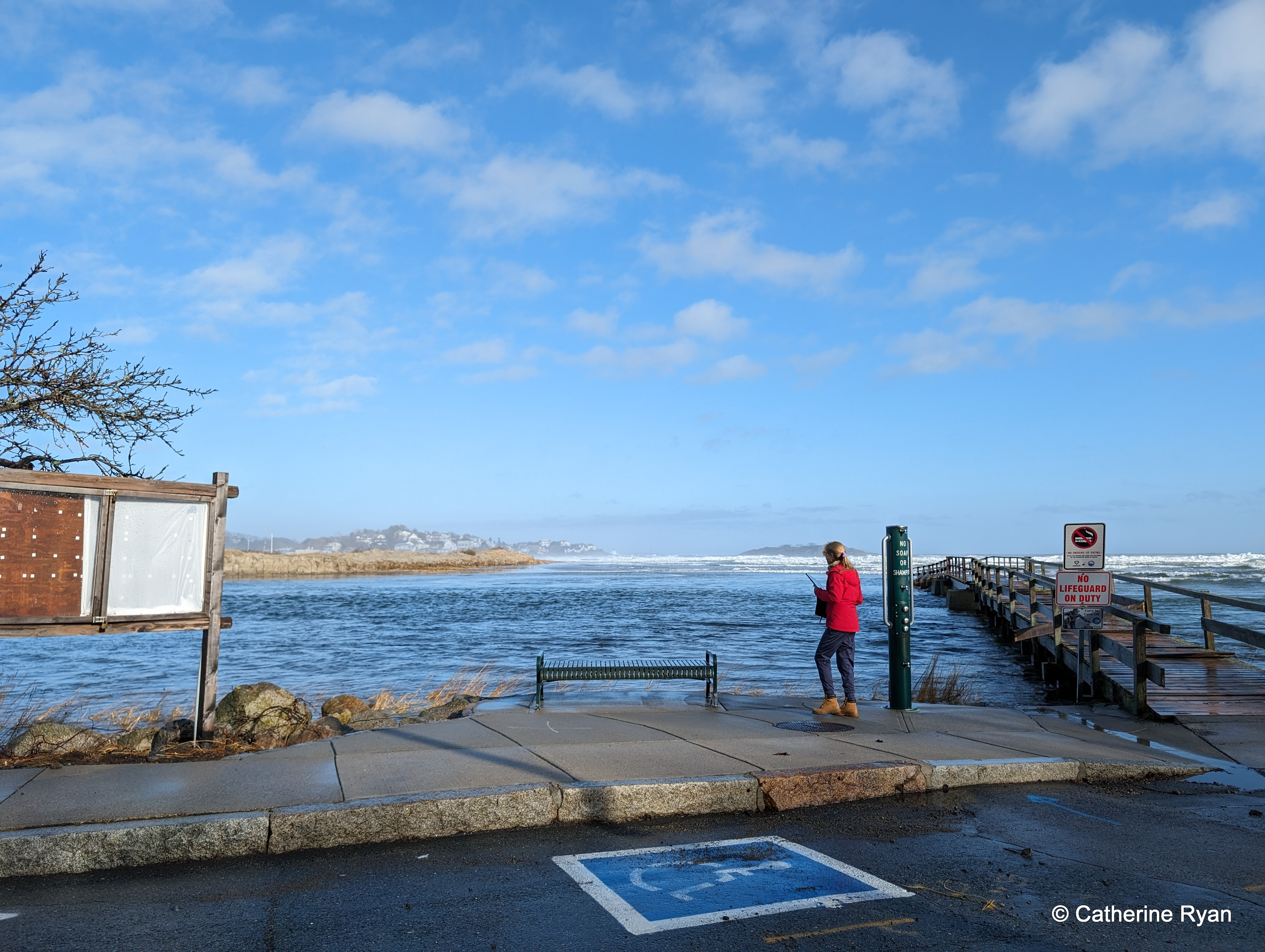
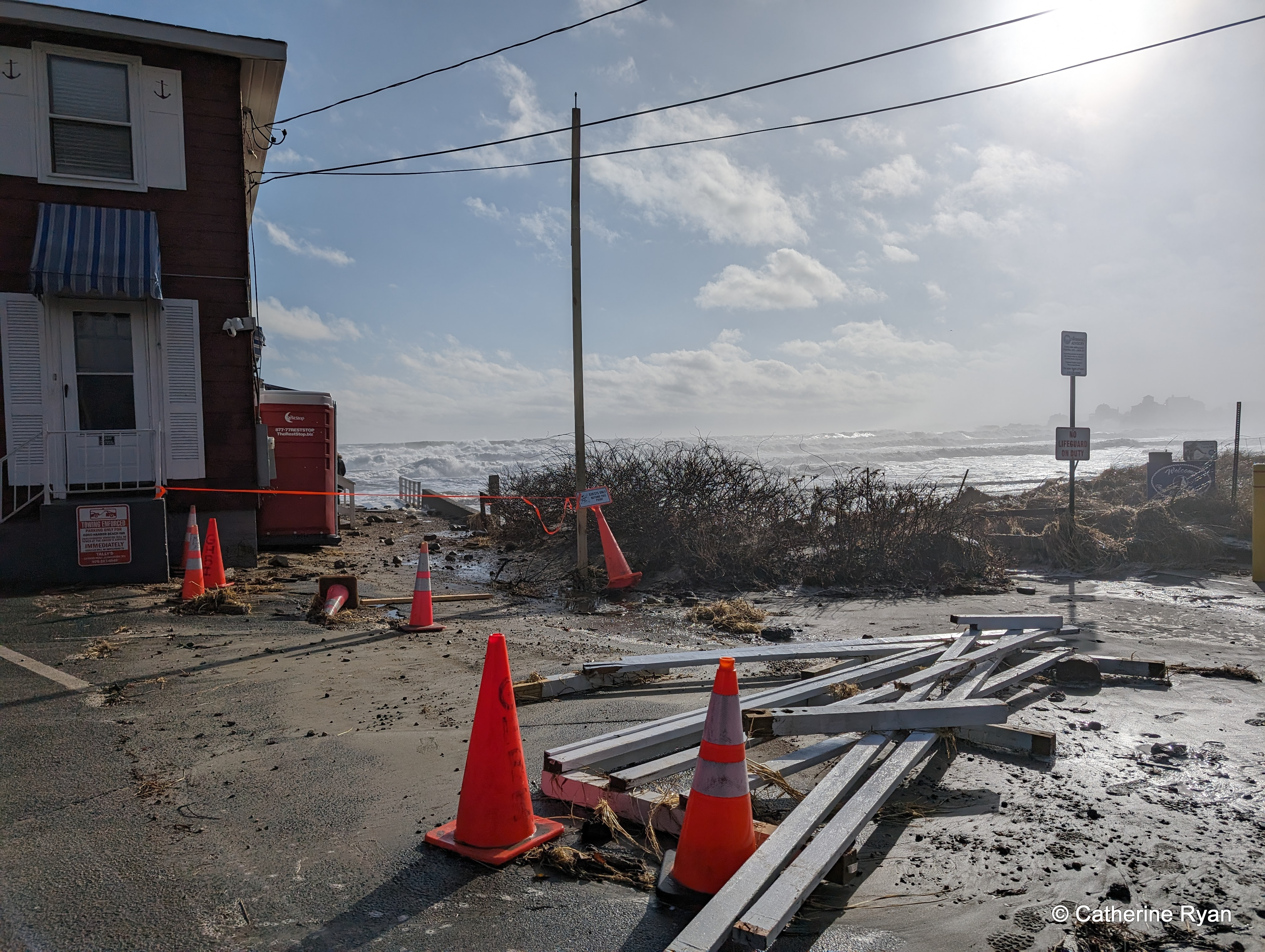
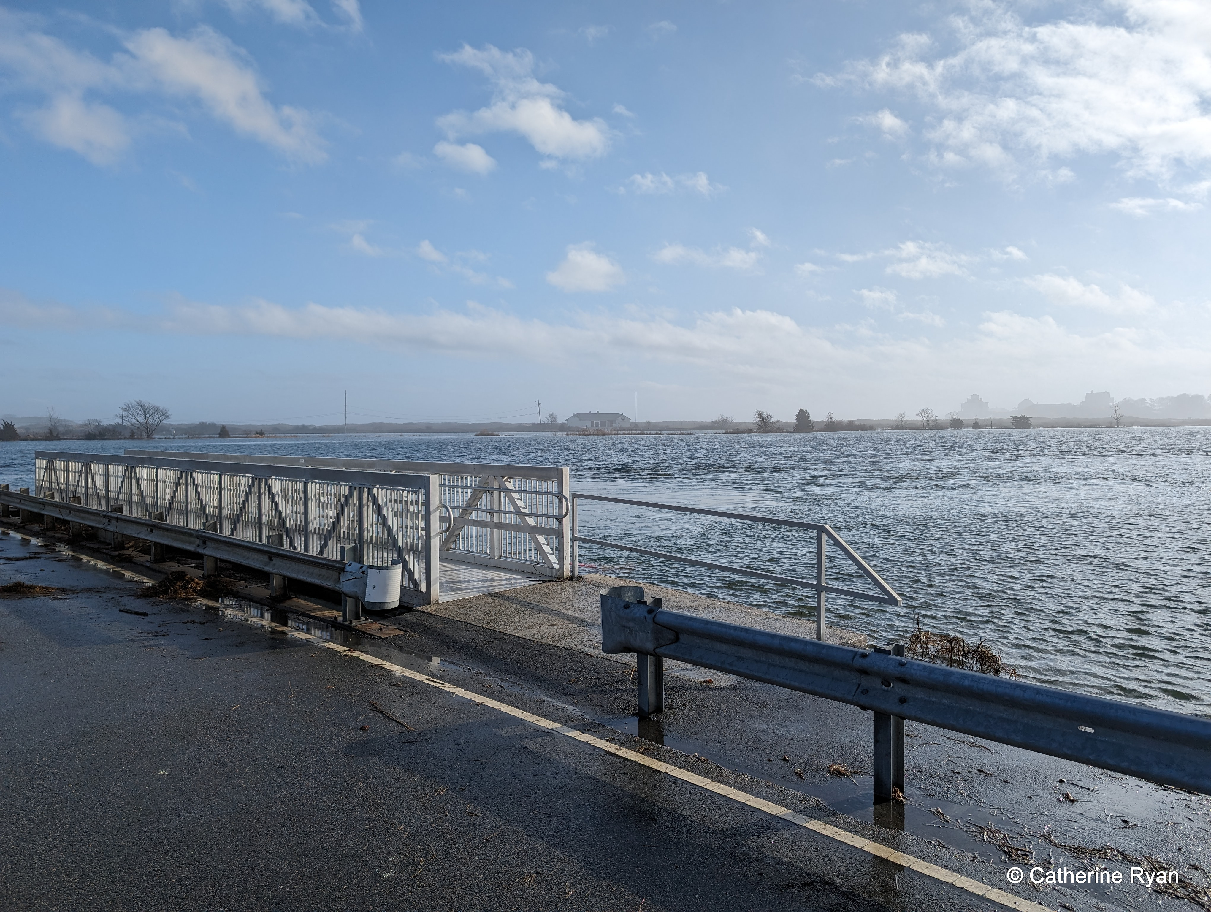
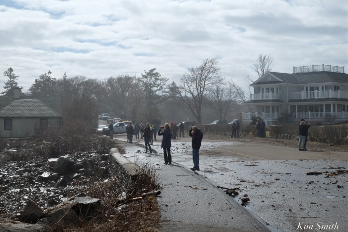
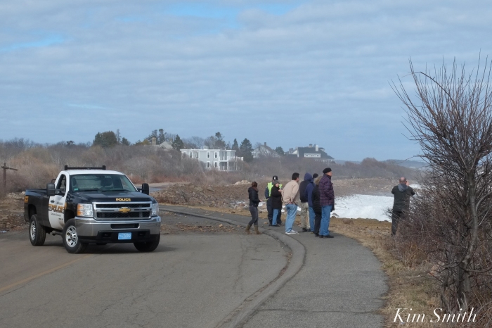
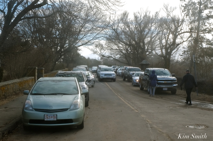
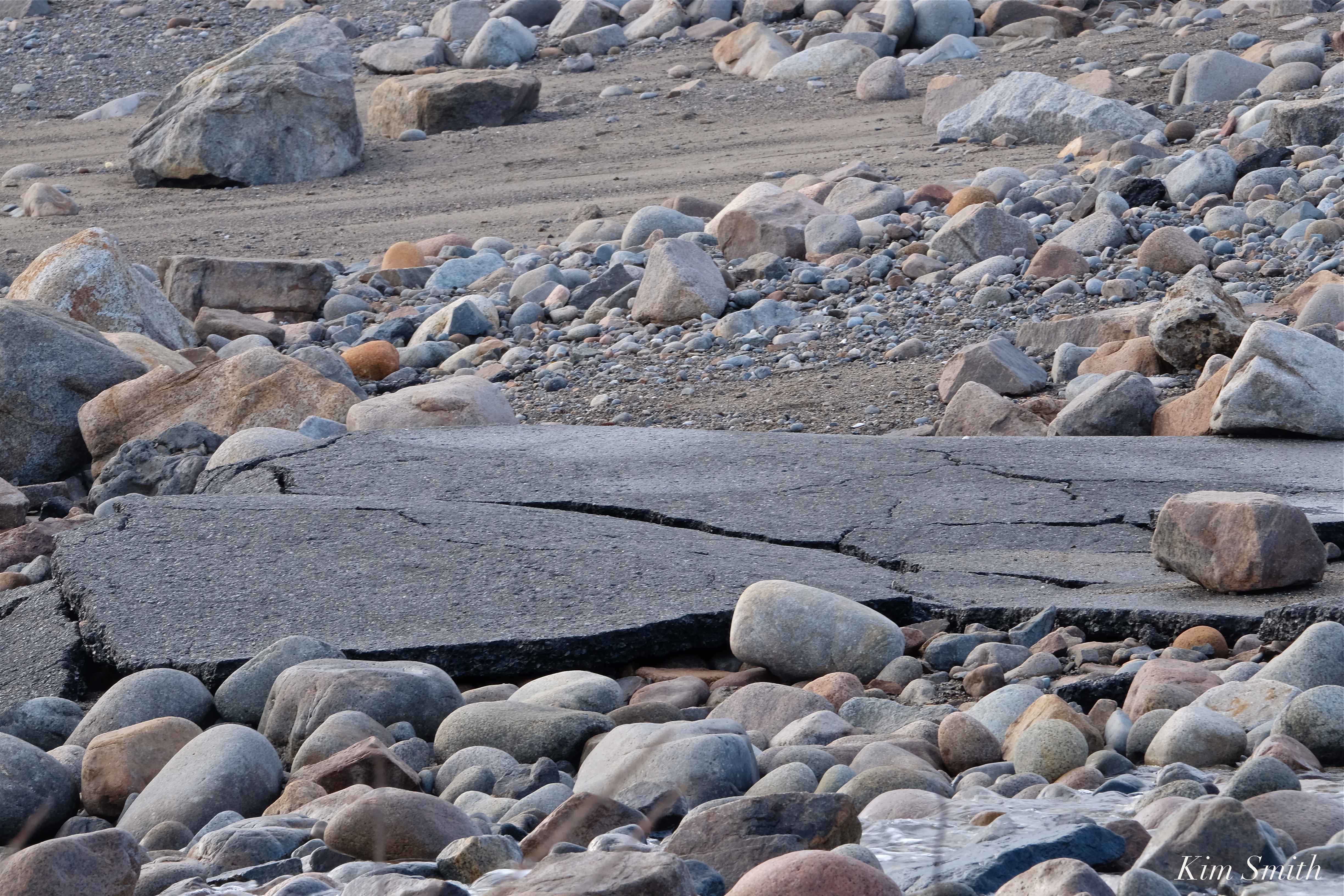
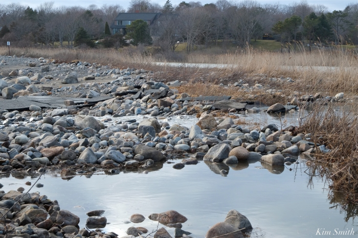
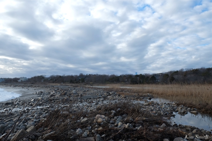
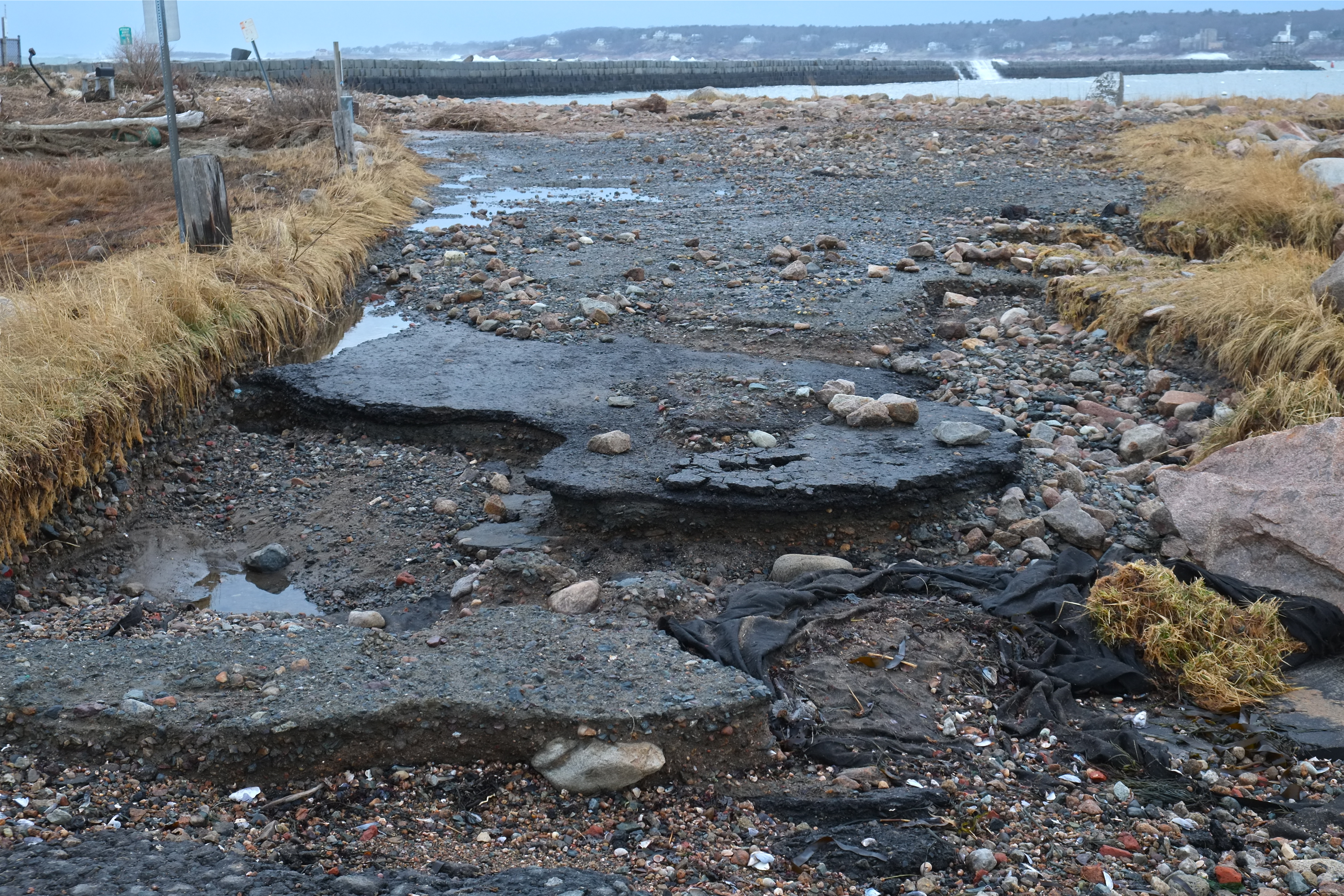
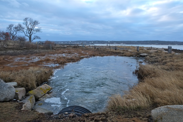
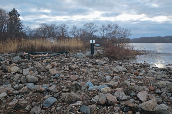
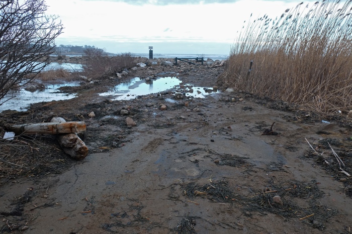
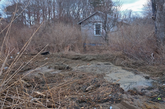
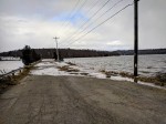
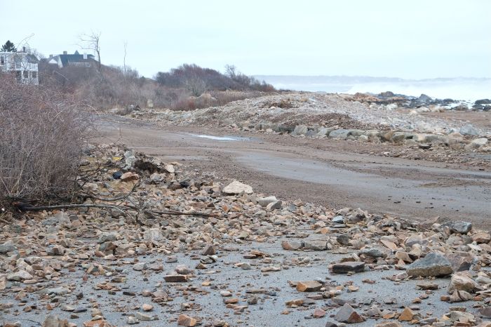
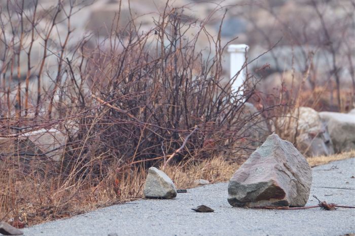
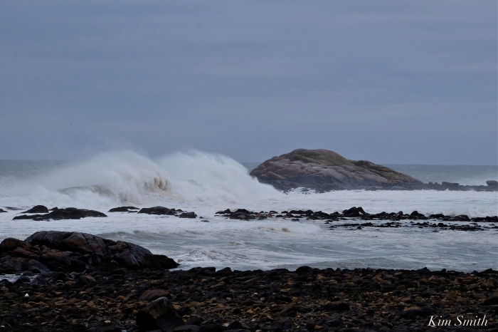
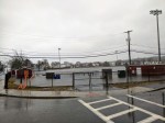
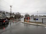
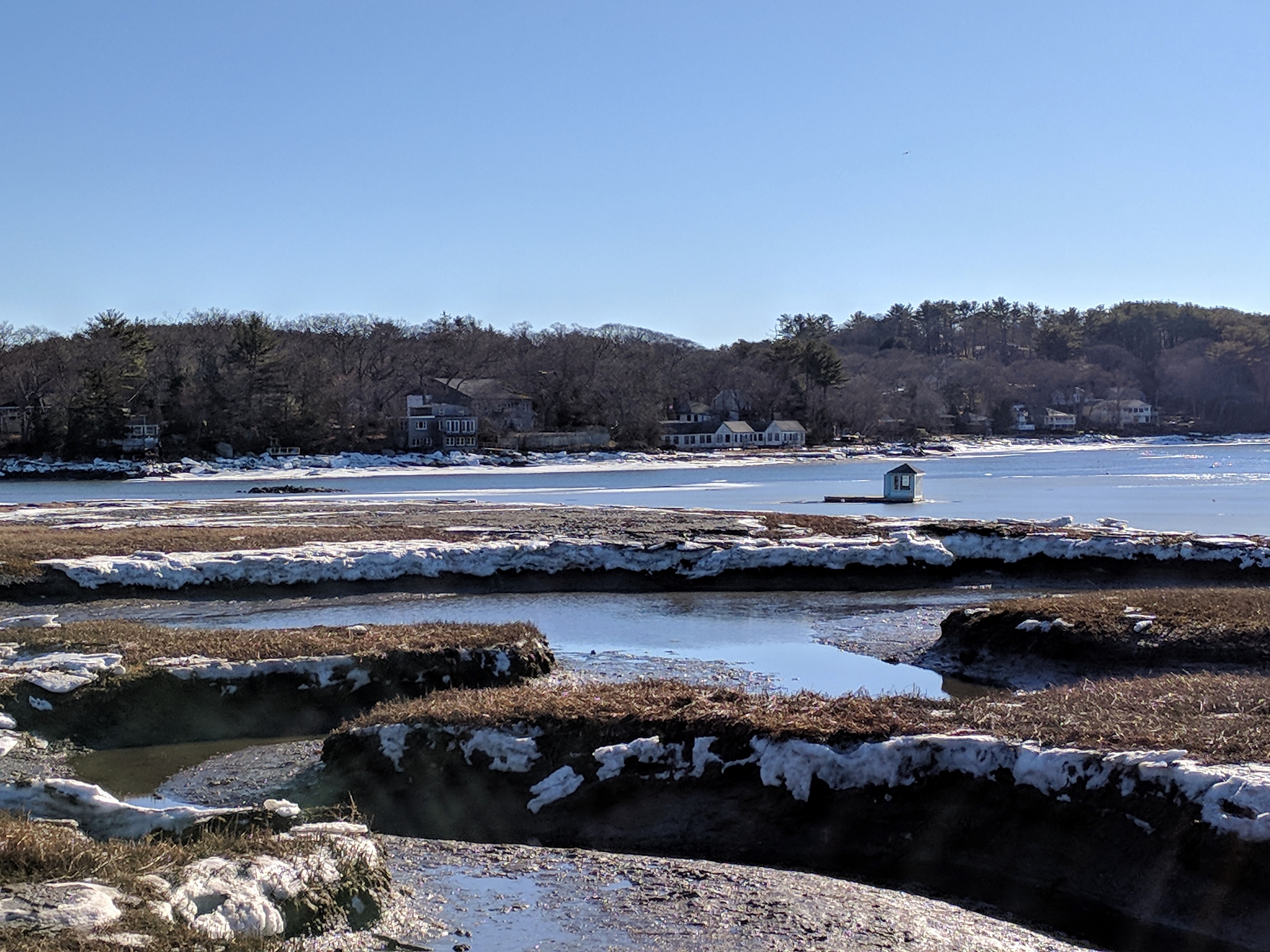
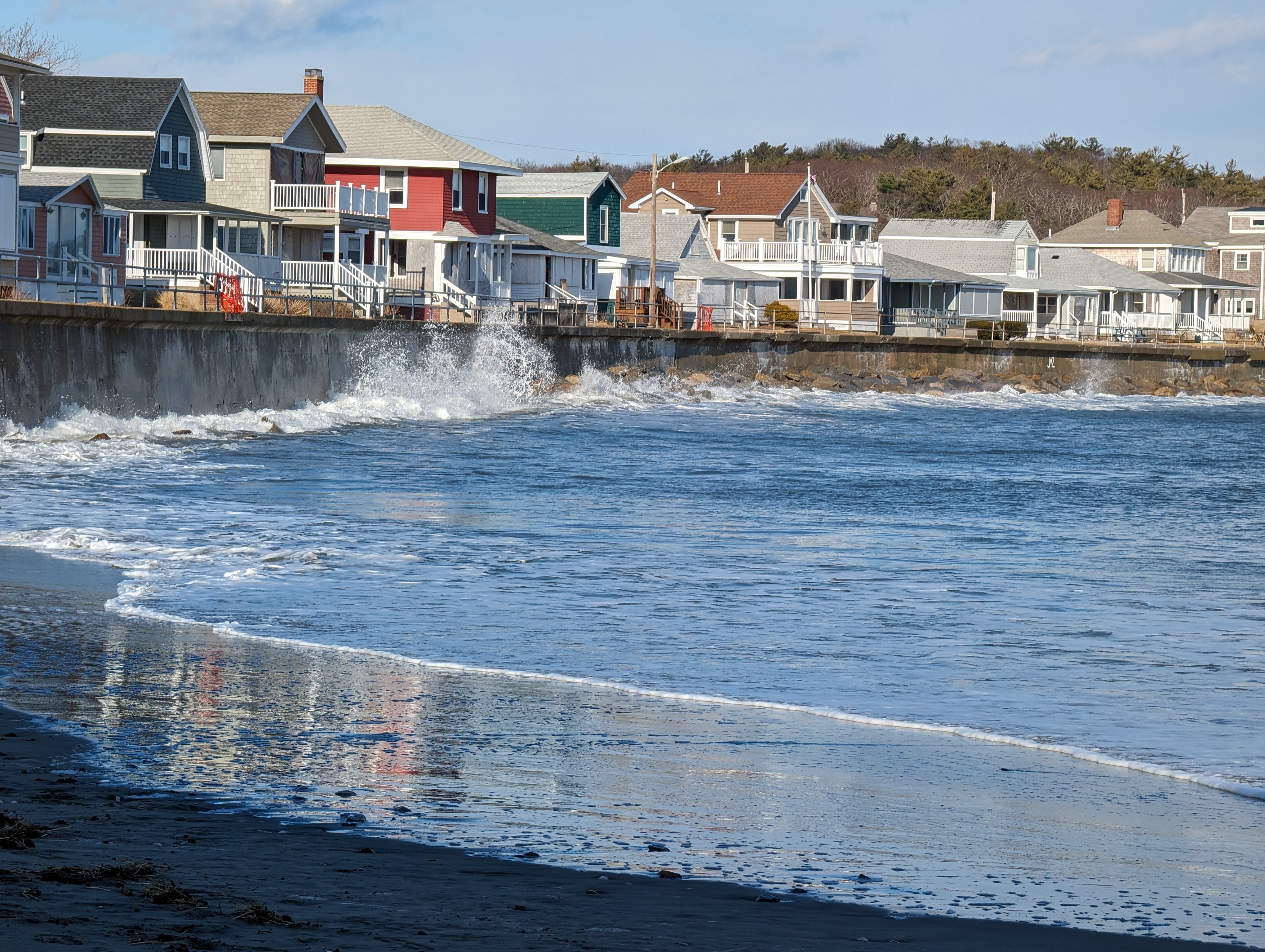
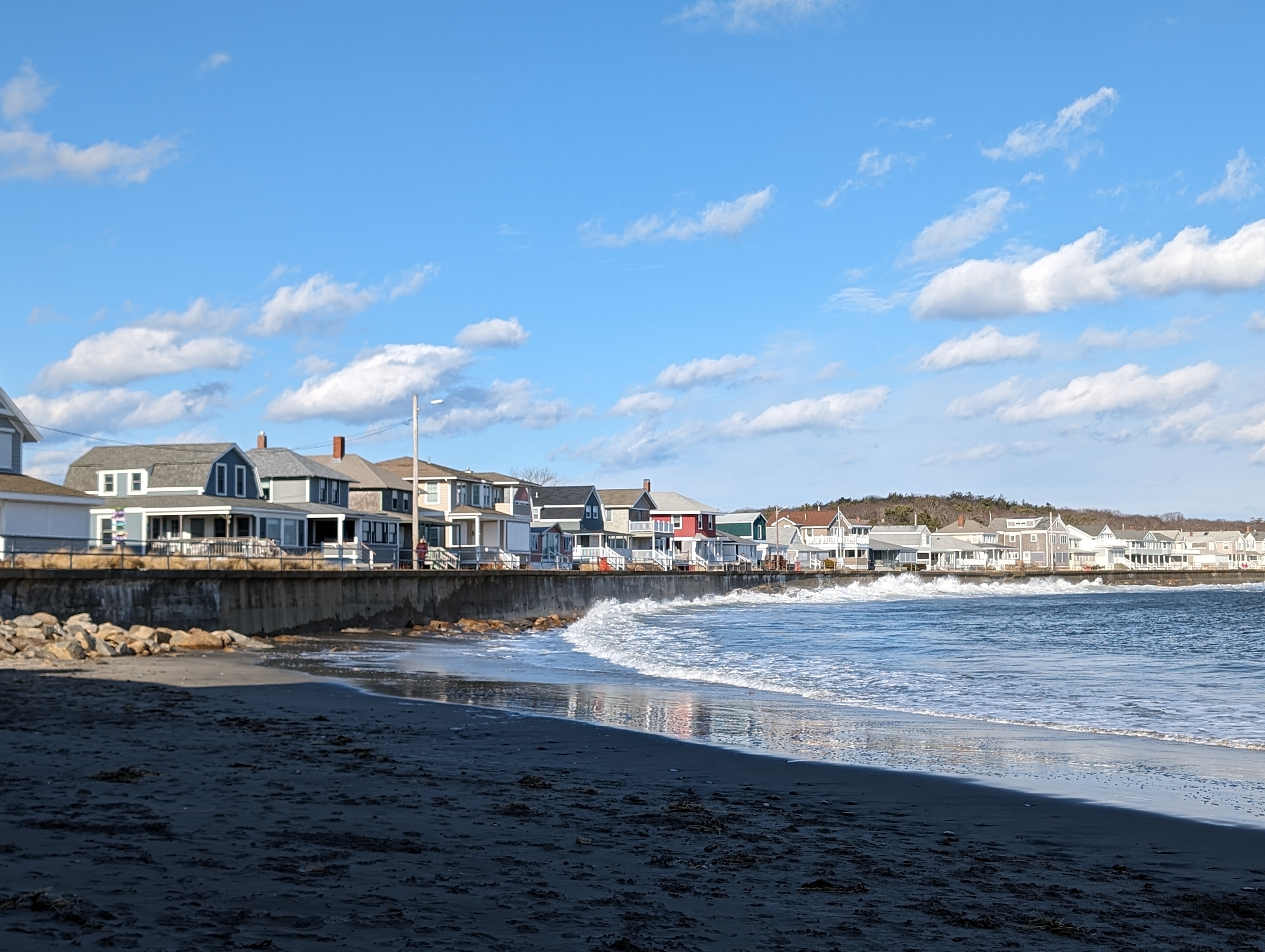
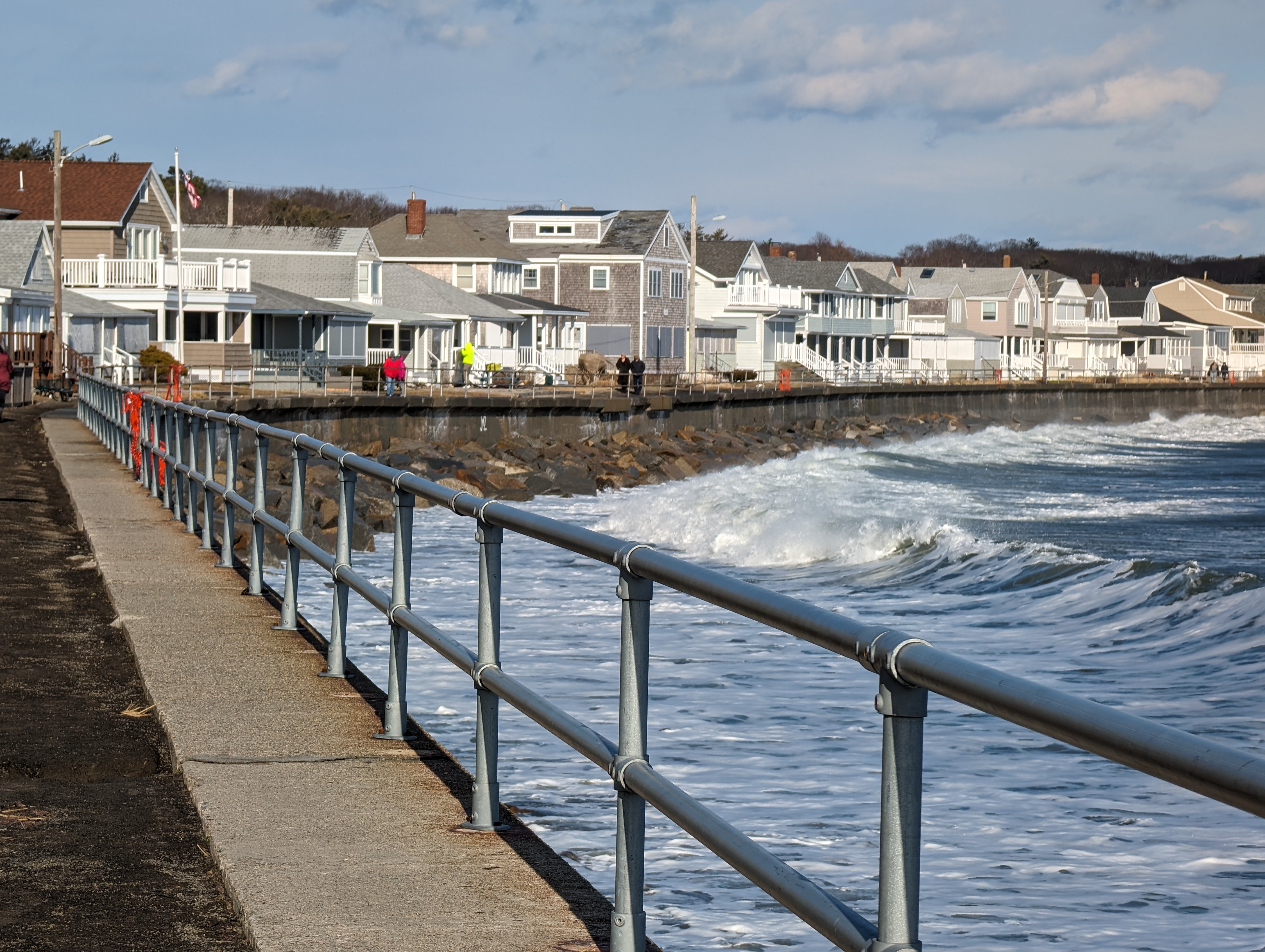
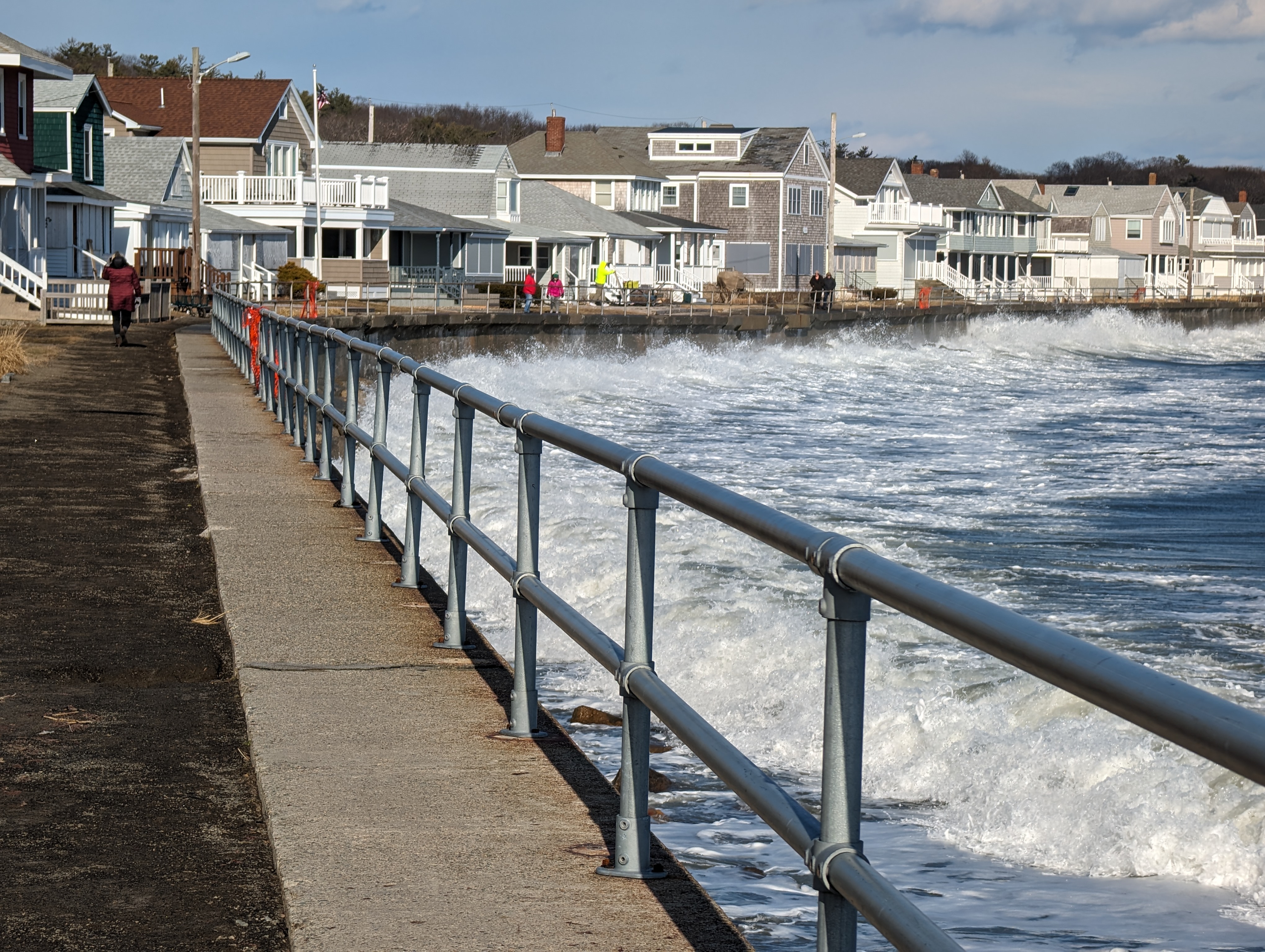
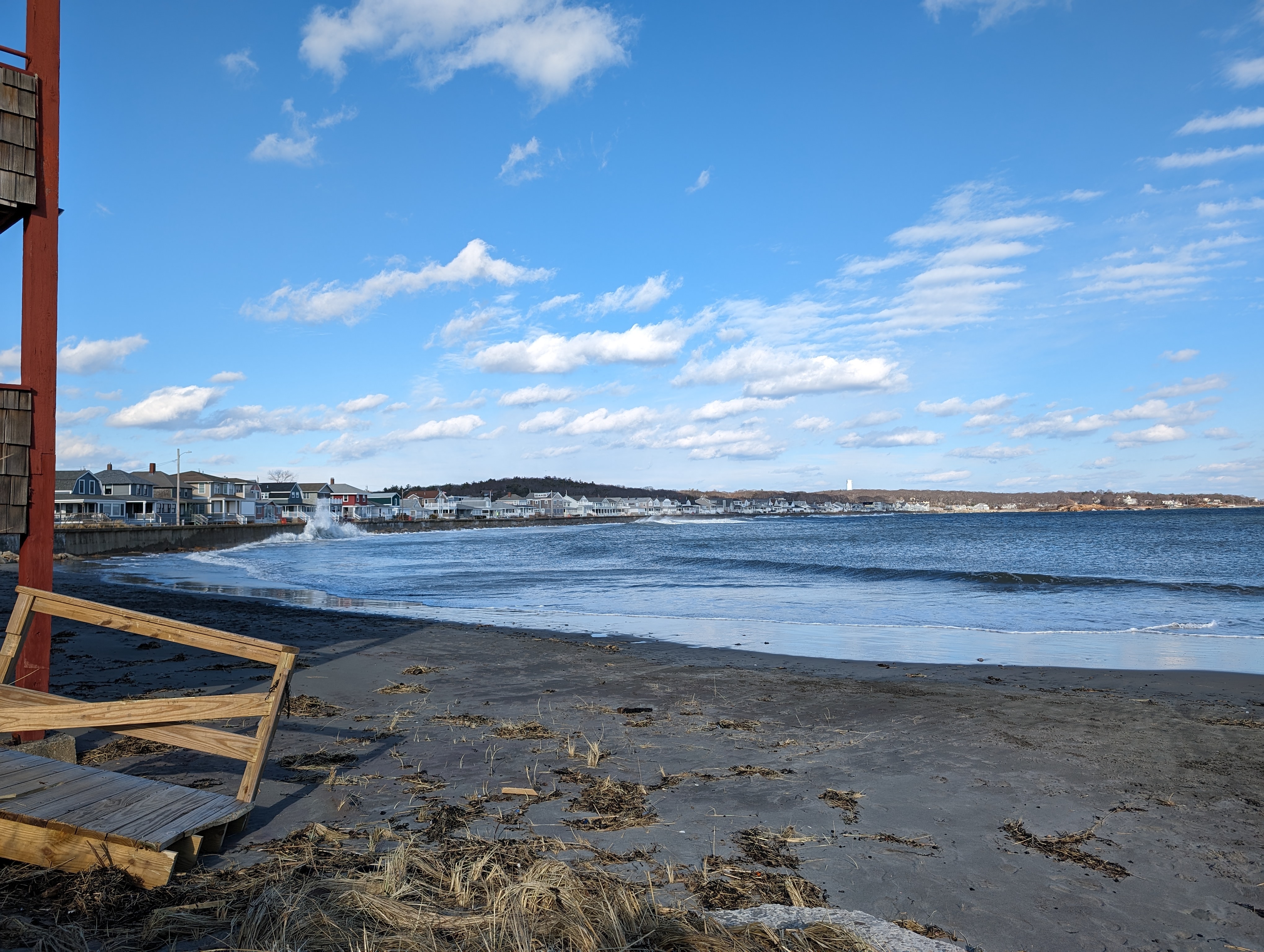
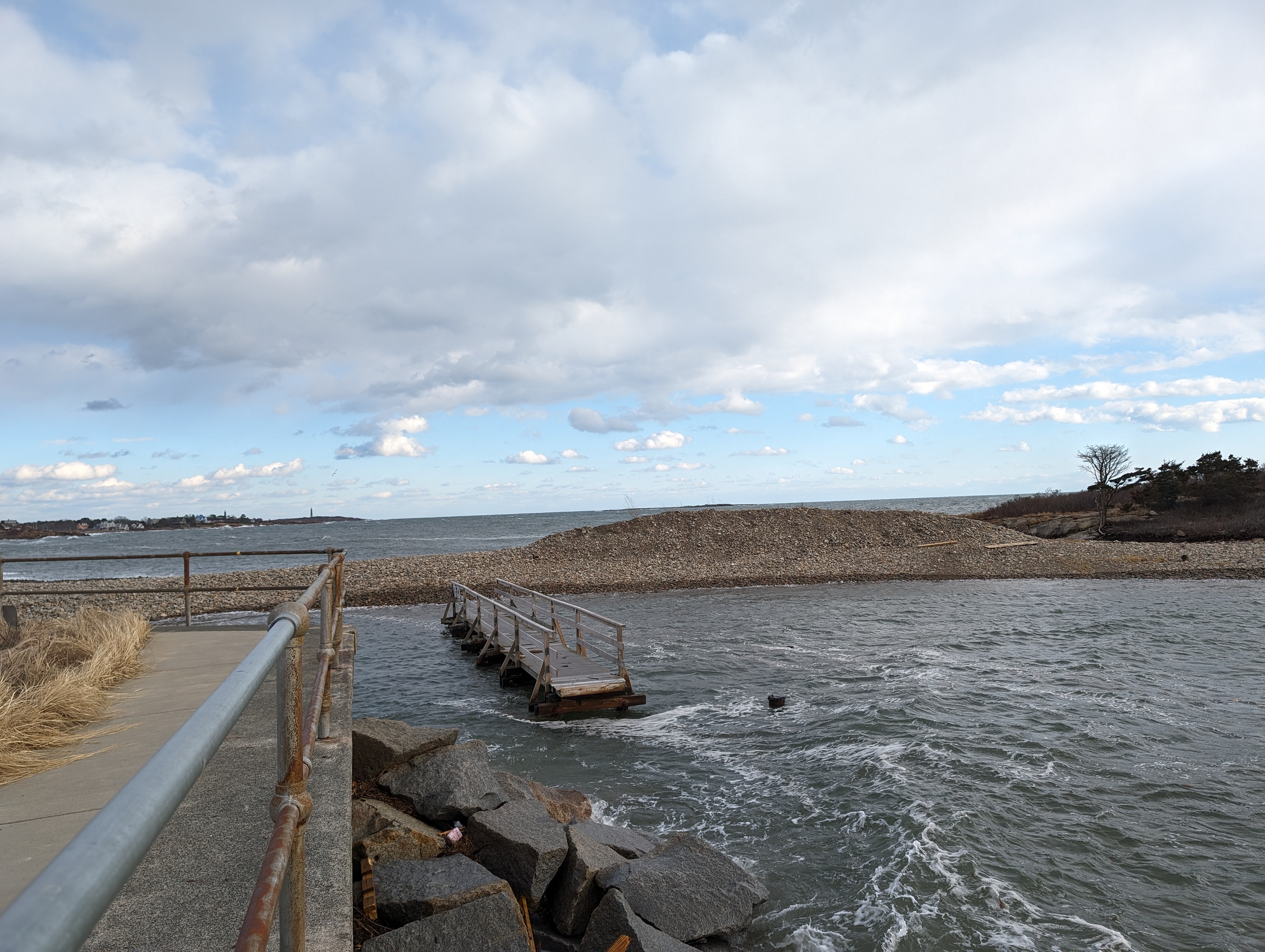
Photos: Aftermath. Day 2. High Tide #3. Coastal cleanup continues swiftly. On Long Beach, Saturday’s midnight high tide #2 punched out a few more holes along the walkway, shortened the berm height a couple of feet, yanked off the winter stairs, and displaced additional sand. There are sequential extra Long Beach photos for residents who are away.

Video clips


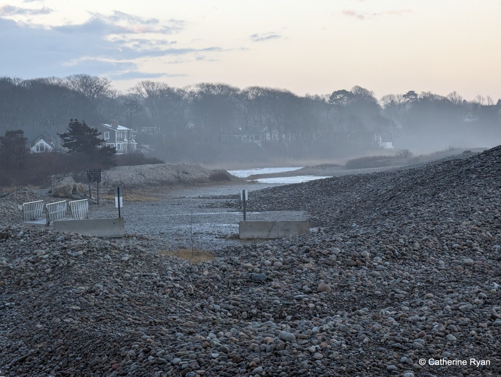
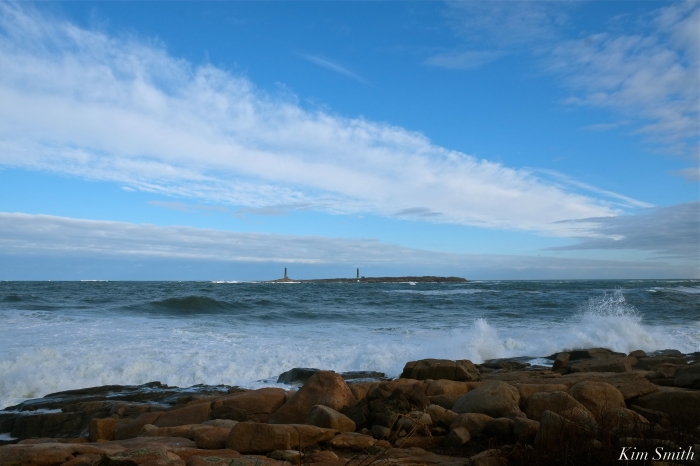
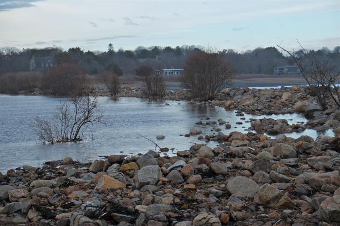
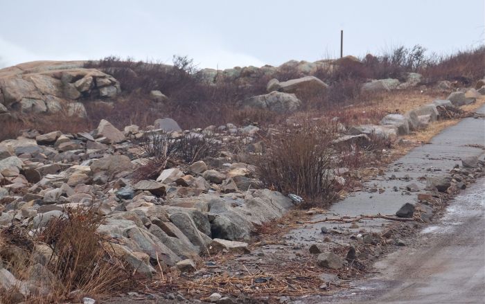
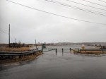
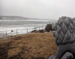
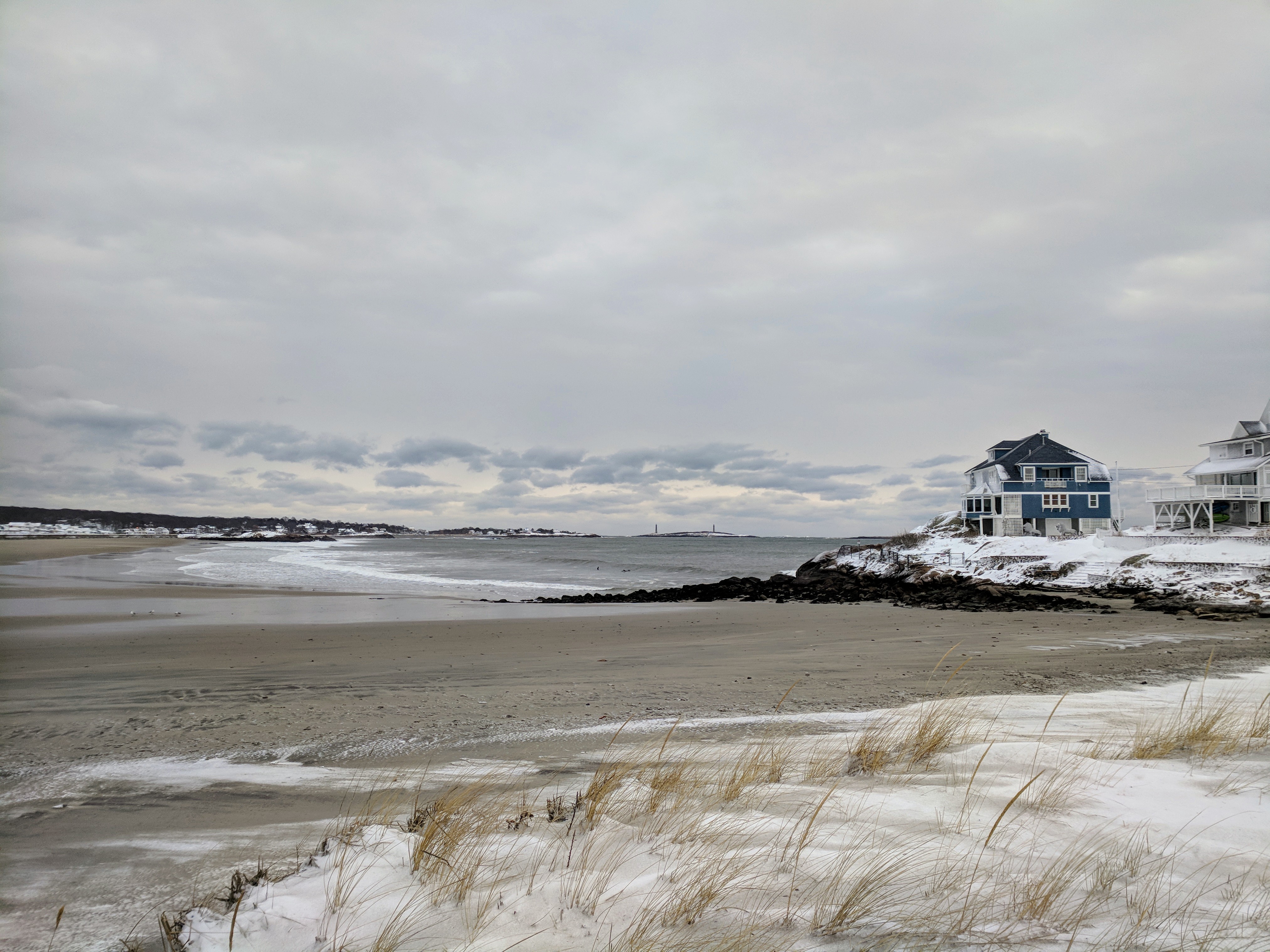
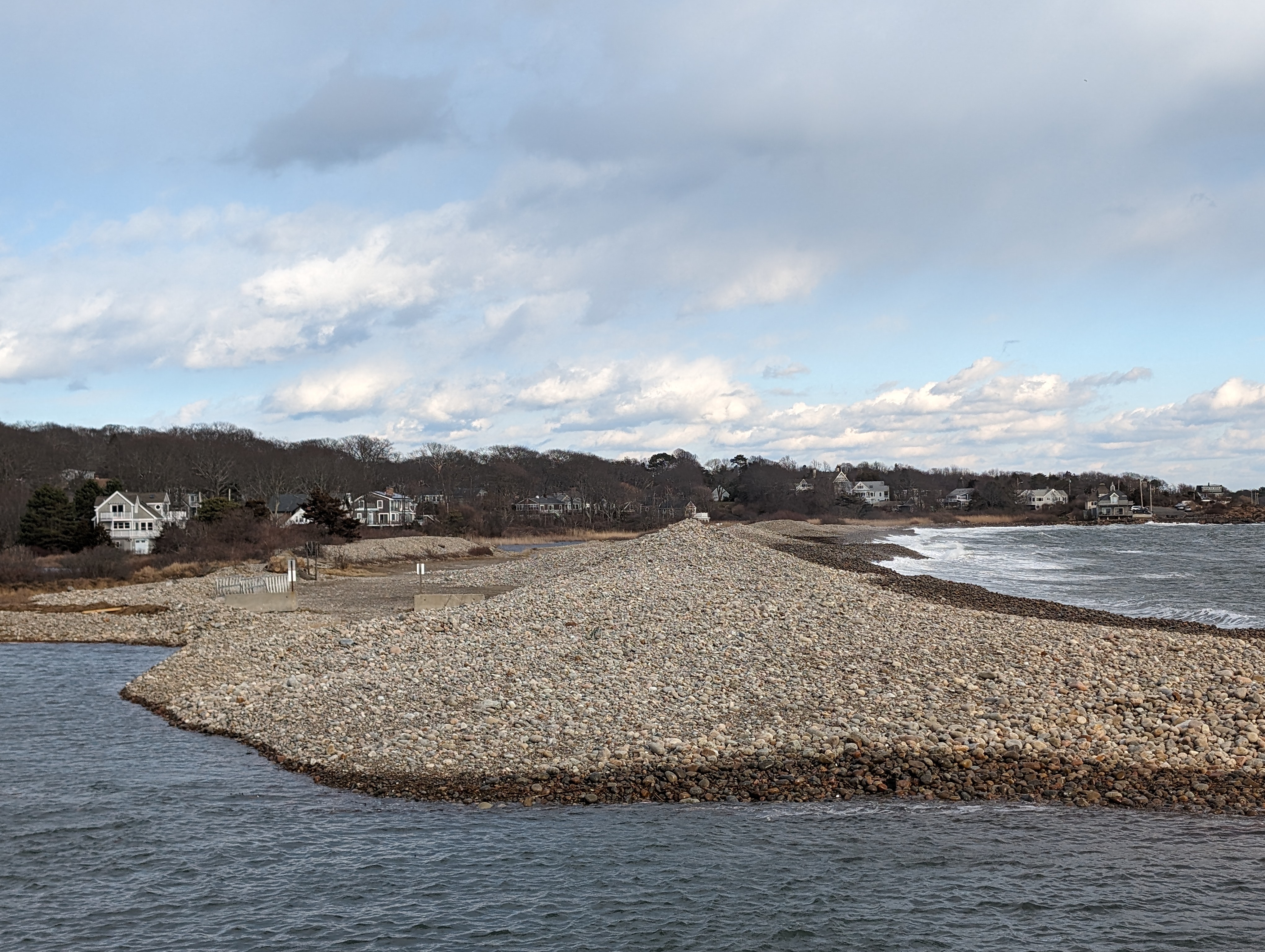
Rip rap reflections at 8AM low tide Jan 14, 2024

Winter storm flooding photos Long Beach

photos Jan. 13, 2024, about 4pm–four hours after high tide–when the ocean receded: some views and condition of the Long Beach seawall, front row cottages, and behind the cottages.

Note: The packed and tamped soft surface atop the seawall walkway was stripped away and a narrow gully was carved along its length. The path is entirely clear and walkable (albeit one front cottage deck which was lifted and traveled some) although a bit uneven and raw. The concrete hard stretch fared better. There was 1 debris chunk and two damaged spots on the concrete section. On the beach, the rip rap is entirely exposed (which happens every winter). The popple berm between Long Beach and Cape Hedge is shorter, but still standing. Four hours after high tide the road out back was more dry than not. Every storm is different.

Winter storm flooding photos #GloucesterMA

The marshes work wonders during extreme storms

photos January 13, 2024, two hours after high tide: At the back of Good Harbor Beach over to Cape Hedge (roughly Thatcher Road between Stop & Shop, Good Harbor Beach, Long Beach, and Cape Hedge). Streets were impassable for about two hours–flooded by feet of water not inches. Barriers, DPW crews, utility and emergency crews are repairing, clearing, and pushing cars. The last time the floods breached the berm at Cape Hedge was the March 2012 storms. I was away for the prior flooding this week, and have not seen other neighborhoods today.

GMG readers shared video and photos from their views

Courtesy photos shared with GMG: Good Harbor Beach; Greasy Pole

And just like that, Izzy storm wind dropped After high tide #GloucesterMA

11:30AM. Tide surge – area coastal flooding in typical spots.

Cars lightly backed up heading on to Nautilus for Atlantic/back shore drive

p.s. If you’re heading to CVS and Stop & Sho,p use the Charlie’s entrance.

power outages in Mass. right now | windy Izzy, first winter storm 2022

Gloucester, Ma.

  • Temp: 40°F right now
  • Sunrise: by 7:10
  • Next high tide: about 10:45 AM- the surf is high already
  • Steady whipping winds, through 12-1pm
  • Massachusetts power outages 6:11 (pics below): 4524
  • Massachusetts power outages 6:45AM: 9814
  • Cape Ann power outages: Essex

Before daybreak January 17, 2022 Massachusetts, the MEMA Massachusetts power outage map shows under 5000 out as this wind whipping–and warm here–storm continues, and the morning reports come in. Brownouts by me. Tally about doubled in 30 minutes.

MEMA phone here: mema.mapsonline.net/phone.html

MEMA desktop here

THE HOUSE BUILT OF SPITE

Pink house, pink cloud squiggles, pink marsh sea – 

The lonely pink house of Plum Island’s Great Marsh is today only visited by hawks and Snowy Owls perching to scan the surrounding vista for their next meal.

Local lore has it that the house was built in 1922 by a couple who were in the process of divorcing and sorting their affairs. The wife asked that the husband build a replica of their Newburyport family home. She did not say where the house was to be sited. Out of spite, he built the house atop the isolated salt marsh, with only saltwater plumbing.

The Pink House has not been occupied since the early 2000s and looks worse with each passing year. Last winter I was at the refuge for a program held at the PRNWR headquarters. After the event I tried to drive towards Plum Island but with sea water gushing in from the marsh, the road in front of the house was flooded and much too dangerous to travel.

The house is FREE, if only you will either take it off the marsh or give Parker River National Wildlife Refuge a few acres of comparable land. The second option allows for the house to stay in its current location. Read more here: Free Pink House of Newbury: Take Me I’m Yours

street flooding, whistling winds, high tides

April 16, 2018 spring storm

Spring storm more high tides wind flooding Apri 16 2018 Gloucester MA ©c ryan 123203 (5).jpg

more photos Continue reading “street flooding, whistling winds, high tides”

MARCH NOR’EASTER #GLOUCESTER MA ATLANTIC OCEAN EXPLODING WAVES, SPINDRIFTS, AND THE PRICE TO PAY


Eastern Point

Shoreline, home, and garden have been hard hit by the third nor’easter to take place this March. The waves and spindrifts were magnificent, taking a short drive around the back shore this morning, but it was difficult to observe the further damage to coastline habitats.

ATLANTIC OCEAN WAVE WATCHING -EXPLODERS, BANGERS, ROLLERS, CRASHERS, AND SONIC BOOMERS – #GLOUCESTEMA #ROCKPORTMA MARCH NOR’ESTER STORM RILEY -By Kim Smith

https://www.instagram.com/p/Bf7CK96lzfT/

The best wave watching Sunday afternoon was from Atlantic Road, especially when the light turned silver-gray-violet. The mist from the pounding waves filled the air, creating a beautiful diffused quality. It was mesmerizing to see the waves hurling against the rocky coastline. Often the force was so loud, it sounded like a sonic boom had exploded. Atlantic Road was closed to car traffic while pedestrians strolled the road as though a promenade. After watching the full force of the waves during high tide, I headed over to Straitsmouth Island in Rockport. Less in strength, but still spectacular to watch.


BEFORE AND AFTER ATLANTIC ROAD ESTATE MARCH NOR’EASTER STORM RILEY -By Kim Smith

Atlantic Road estate, after a relatively mild storm last week.

Sunday afternoon, after March Nor’easter Riley.

DISASTER AT PEBBLE BEACH #ROCKPORTMA MARCH STORM NOR’EASTER RILEY

After filming the explosive waves on Atlantic Road yesterday afternoon for various documentary projects, I headed over to Henry’s Pond to check on Mr. Swan’s whereabouts. Expecting to see and film some damage to the road that divides Henry’s Pond and Pebble Beach, which often occurs after storms, especially nor’easters, I was completely overwhelmed by the destruction found at Pebble Beach. The road is gone; the worst I have ever seen, and I couldn’t make it to the Pond because it was simply too dangerous to climb over the slippery, jiggley rocks and seaweed.


BREAKING: EASTERN POINT LIGHTHOUSE ROAD WASHED AWAY AND PARKING LOT LITTERED WITH STORM SURGE DEBRIS; DO NOT DRIVE DOWN, NOWHERE TO TURN AROUND! #GLOUCESTERMA NOR’EASTER RILEY

It appears as though the Eastern Point Lighthouse parking lot and road were hit with surges from both the harbor side and from the Atlantic, washing away the road and leaving the area littered with surge debris, mostly rocks, seaweed, and seagrass. The storm drain, which formerly ran under the road, is now completely exposed. At low tide early this evening, the marsh was still completely flooded.

If you are planning on checking on the EPLighthouse, park your car and walk. Several folks got stuck as there is nowhere to turn around under the current conditions.

Flooded marsh

Storm clouds lifting

BREAKING: BRACE COVE-NILES POND CAUSEWAY ANNIHILATED, NILES POND FLOODING #GLOUCESTERMA NOR’EASTER RILEY

The beautiful newly constructed causeway that separates Niles Pond and Brace Cove, which was rebuilt several years ago, is now a jumble of rocks and boulders. Niles Pond Road is narrowing from the sea water surging into the Pond. The water has nowhere to go. The road to the Retreat House is impassable.  The destructive force of climate change is rearing its ugly head in our own backyards and a fifth super high tide is expected again tonight. 

https://www.instagram.com/p/Bf61crQFsmc/

LIVE high noon ferocious storm damage Riley day 2

IMG_20180303_115927

Third tide

IMG_20180303_115514

Scenes from high noon, flooding into streets and homes; coastal homes damaged still more with this third tide, day 2 nor’easter storm Riley. Long Beach seawall holds back relentless surf

IMG_20180303_112223 photogs run back.jpg

#GLOUCESTERMA RILEY STORM DAMAGE ATLANTIC ROAD PASS AT OWN RISK, GOOD HARBOR BEACH FOOTBRIDGE DAMAGE, PHOTOGRAPHERS WITH DEATH WISH, CHURNING SEAS, YOU WANTED TO BUILD A HOUSE WHERE?, AND THE THIRD SUPER HIGH TIDE ON THE WAY

Popples and debris are littering Atlantic Road, the footbridge sustained damage to the last half, fences and trees are down throughout the neighborhood, and the seas are gaining in ferocity, with the third of the super high tides expected at noon. Please be safe, the wind is mighty powerful this morning and their are potential projectiles everywhere.

Good Harbor Beach Footbridge damaged.

Extensive damage to the railings at the Ocean House Inn, our Snowy Owl Hedwig’s current favorite perch. No sign of her the past few days, but Hedwig is so resourceful, we are hoping for the best.

BANGERS, CRASHERS, COASTAL FLOODING, BEACON MARINE BASIN, PIRATE’S LANE, AND THE GOOD HARBOR BEACH FOOTBRIDGE BOMBOGENESIS RILEY NOR’EASTER #GLOUCESTERMA

Meteorologists predict flooding from Nor’easter Riley could be the worst in Boston’s history. The storm is strengthening and the waves were much bigger this afternoon as the tide was going out. Be safe friends.The Good Harbor Beach Footbridge is intact at 4pm, despite mid-day flooding.

City Hall and the Paint Factory March Nor’easter RileyFV Capt. Joe leaving the Marine Railways and heading for the State Fish Pier at daybreak.

Just another day for a pair of male and female Common Eiders

Coastal flooding roads closed & New Balance Field at Newell Stadium

Receding now- 3 hours after high tide

IMG_20180302_134348


Little houseboat in the great frozen salt marsh #Gloucester MA

A photo journal after the storm documenting and comparing a few iconic and sweeping Gloucester vistas on January 7, 2018, when all was white ice frozen, and again after the Great Thaw on January 13 2018.

Gloucester Motif- the house boat in view just before the turn off at Nichols

Little house boat in the great frozen salt marsh - Gloucester MA January 7 2018 three days after historic winter storm © c ryan_095245


The Little House boat in the great frozen salt marsh reminded me of a mash up of two of Virginia Lee Burton’s children’s picture books inspired by Gloucester — Little House and Katy and the Big Snow. Here’s the little floating houseboat after the thaw at low tide January 13, 2018.

Little house boat in the great salt marsh - Gloucester MA January 13 2018 after thaw from historic winter storm © c ryan__133100

At high tide earlier in the day, January 13

Little house boat in the great salt marsh - Gloucester MA January 13 2018 after thaw from historic winter storm © c ryan__072700.jpg

Good Harbor Beach drive by three days after the storm


Good Harbor Beach salt marsh drive by one week after the storm and great thaw


Below the read more break: additional winter comparison photos (icebergs on the marsh by Lobster Land, Good Harbor Beach parking lot, Good Harbor Beach salt marsh, Stoney Cove pier at Little River & Annisquam River)

Continue reading “Little houseboat in the great frozen salt marsh #Gloucester MA”

Gloucester House restaurant storm picture

Gloucester House Gloucester MA January 4 2018

STORM video and the morning after #GloucesterMA Good Harbor Beach and Long Beach

Thinking of those dealing with no power, evacuation and such destructive, icy flooding. 

January 5, 2018  vs Storm January 4, 2018

Long Beach Gloucester MA side morning after blizzard IMG_20180105_07 © c ryan

IMG_20180104_135743

Today  here come the surfers


Rocks have clear icy layers and crunch pack, some pockets of drift


I’m following up on yesterday’s post, which was stopped midstream as we lost power. Scroll below for quick snaps and videos from my walk to Good Harbor Beach, Long Beach, and side streets.

GOOD HARBOR BEACH 1.4.18

About 2PM January 4, 2017 (high tide was several hours earlier)

Good Harbor Beach on sand looking out to Salt Island (from Good Harbor Beach Inn side of beach) Yes, the waves were rolling over the wall up to the homes but infrequently at this time. I don’t know what it was like at high tide.


(more Good Harbor Beach and Long beach below the break)

Continue reading “STORM video and the morning after #GloucesterMA Good Harbor Beach and Long Beach”