Sawyer Free Library Announces New Staff to their Team

Sawyer Free Library's avatarCape Ann Community

The Gloucester Lyceum and Sawyer Free Library (SLF) is pleased to announce the appointment of four new additions to its staff. Julie Travers has recently joined SFL as a new Community Librarian. Katelyn Rivela is the new Library Assistant in the Children’s Room, and Leah Svensson is the new Library Assistant at the 1st Floor Service Desk.Annemarie Sanfilippo was recently appointed to the position of Administrative Assistant. Also, Joann Dunajski was promoted to a newly created position, Library Public Technology Assistant.

“I am beyond pleased to welcome such an exceptional and experienced group of professionals to our dedicated and talented staff at the Sawyer Free Library,” stated Jenny Benedict, the Library Director. “Their innovative thinking, commitment to the community, and boundless enthusiasm will only help us better support our patrons of all ages, diverse and growing needs and connect them with ideas…

View original post 718 more words

Maura Briggs : Harlequin duck near the footbridge at Good Harbor Beach

Good morning. I spotted this harlequin duck near the footbridge at Good Harbor Beach. I thought it quite pretty and I had never seen one before although I walk there nearly every day

Let’s Talk Womxn Event

In honor of starting their most recent chapter in the Greater Boston Area, Let’s Talk Womxn has organized an event for March 8th, including a multi-restaurant tasting dinner provided by 17 local Massachusetts restaurants, as well as a zoom conversation lead by Maura Healey and 30 women restauranteurs of Boston. Tickets can be purchased on the link below until March 4th. https://www.exploretock.com/letstalkboston/
Tickets include a 4-course meal for two, and the zoom link for March 8th. Just to clarify, Turner’s in Melrose is the North Shore pick up location, not Turner’s in Salem (there has already been some confusion about this).

Have you seen the new hand made items at Arts Abound?

Arts Abound, 21 C Lexington Avenue, magnolia, Gloucester, MA  01930, has some great handmade art works.  This gallery is a wonderful little store to shop safely and enjoy the local artwork.

Blanket

Glass Ware

Pillow and beach towel

Beautiful photo from Laurinda Butcher

Store

You can take a change to win this great photo and the proceeds go to the Open Door.  Photo by Laurinda Butcher

Artists Jacqueline Ganim-DeFalco and Leslie Heffron are pleased to announce a month-long exhibit hosted by the Jane Deering Gallery

Artists Jacqueline Ganim-DeFalco and Leslie Heffron are pleased to announce a month-long exhibit hosted by the Jane Deering Gallery in downtown Gloucester, MA.   The exhibit is poignantly titled, A Line in the Sand.   As working artists on Cape Ann, Ganim-DeFalco and Heffron have drawn their own lines in the sand through keen observation and commitment.   The exhibition presents interpretations of the seaside through Heffron’s paintings and Ganim-DeFalco’s Wearable Art.

Along the water’s edge at the incoming tide a line is drawn. On one side of that elusive line is the ever-changing, unpredictable ocean. On the other side, among the sand’s crystals, treasures are revealed – a luminescent piece of sea glass or a piece of a lobsterman’s line peeking out.

“While seeking these treasures, we observe both the beauty and banality of the world, interpreting what we see and feel in new and meaningful ways, and create timely works of art that tell the story,” express the combined sentiments of both artists.

Over the past year, Heffron — from her perch on Pigeon Cove — observed the daily work of local lobstermen, capturing the essence of their toil and expressing their experience in acrylic paintings of both abstract and realistic renderings.  Consider these paintings portraits of a working life at the sea.

Ganim-DeFlaco has created a new line of jewelry for this themed event — dramatic pieces of sea glass outlined in leather which break a design barrier in their wake. The artist will also showcase her collection of one-of-a-kind hair accessories and jewelry that are the foundation of Cape Ann Designs.  

Join these artists at the Jane Deering Gallery for the month of April to share this experience and take home your piece of Cape Ann’s natural beauty.

Jacqueline Ganim-DeFalco is a member of the Cape Ann Artisans and a founding member of the seARTS Wearable Art Group. Most recently, her work was included in Rocky Neck’s winter show, Exuberance.  The artist’s work is featured in the book Passion for Sea Glass. Since 2002, she has maintained a studio on Cape Ann. 

Leslie Heffron is a graduate of the School of the Museum of Fine Arts, Boston. She considers herself a large-scale colorist and is particularly interested in how colors interact with each other on a surface.  Her work has been exhibited at the White House, Washington DC; the Allentown Art Museum, Allentown, Pennsylvania; and in numerous galleries throughout the U.S. 

Jane Deering Gallery presents contemporary art by established and emerging artists, both national and international.  The gallery has a strong interest in artists living and working on Cape Ann, Massachusetts, an area rich in artistic heritage.  The gallery first opened in 2002 on Cape Ann.  The gallery also has a focus on contemporary California artists and shows a selection of international artists represented by Purdy Hicks Gallery of London UK.

A Line in the Sand| An Exhibition hosted by the Jane Deering Gallery

19 Pleasant Street, Gloucester, MA 01930

JaneDeeringGallery.com

Jacqueline Ganim-DeFalco – Sea Glass Wearable Art & Leslie Heffron Painter 

April 3-30th Thursdays-Saturdays 1-6PM

April 2nd: Preview by invitation only.

Appointments encouraged during or outside of hours.  Gallery maximum 3 persons at a time| 

COVID Compliant  

Contact:

jackie@capeanndesigns.com 978-283-8333 (LL)  CapeAnnDesigns.com

leslie@leslieheffron.com– 484-201-0026 (M) LeslieHeffron.com

Steve Henderson Has Some Nice Things To Say About The GloucesterCast

Great show. I’m still cracking up when the guys tasted the “Duck Liver”. Guess it’s safe to say it didn’t taste like chicken.

Steve Henderson
The Villages, FL … for 12 yrs
Don’t believe everything you hear about us
❤️💙🎣🇺🇸🦅🚀

The GMGI Science Hour with Aquanaut Dr. Shirley Pomponi: Thursday, March 4th at 7:30pm

Gloucester Marine Genomics Institute's avatarCape Ann Community

Please join us via Zoom this Thursday, March 4th to hear from Dr. Shirley Pomponi, research professor, ocean explorer, and part-time aquanaut, as she describes her experience living in the underwater laboratory Aquarius for nine days in 2019. Dr. Pomponi was selected to participate in one of NASA’s Extreme Environment Mission Operations (NEEMO), testing out techniques and protocols for future space missions.

You can read about Dr. Pomponi and what you can expect from her fascinating talk on our website, and can register for the talk here.

Please reach out to Ashley Destino at ashley.destino@gmgi.org with any questions.

View original post

HUBBARD ADVISORS

robinjeanhubbard's avatarCape Ann Home

ARE YOU WORRIED ABOUT RUNNING OUT OF MONEY? WILL YOU OUTLIVE YOUR MONEY OR WILL IT OUTLIVE YOU?

I am a financial advocate. What does that mean? I find solutions for people’s money problems. Income doesn’t last forever, but taxes do. If I can show you how important it is to do planning now, so you can stay in control of your future, would you be interested in that conversation? Call me today and in just 15 minutes I’ll speak to your concerns. (978)290-2462

CLICK HERE TO FILL OUT A REQUEST FOR A CONSULTATION OR DOWNLOAD A FREE FINANCIAL QUESTIONNAIRE TODAY. Or simply call me at (978)290-2462.

Robin Hubbard is a financial advocate, consultant, planner and coach for individuals, businesses, and business investors. An agile, refreshing alternative to franchise firms, I don’t push product but find solutions for individual needs and ambitions.

View original post

Rust Island visitors (Bald Eagles)

The attached picture was taken 2 weeks ago as two of our newer Cape Ann residents settled in a tree at the point of Rust Island looking down on the Annisquam on one side and Jones Creek on the other.  It was taken with my iPhone through the lens of a spotting scope at 50 magnification. 

Rick Talkov

Windy day after traps hauled–pat morss

Gloucester lobster boats came in over the weekend loaded down with their traps, to beat the March 1st temporary moratoriaum during the Right Whale migration.

NW gusts to 60 knots, creating a turquoise Gloucester Harbor
Freezing spray on the Eastern Point side
The lobster fleet is in for the Right Whale moratorium
Store them wherever you can
Just a portion of the East Gloucester sea of traps
Female House Sparrow surveys a new food source
Males have found a bounty in the trap lines
The fishing fleet isn’t affected – Capt. Joe headed out into the fog

A walk on Salisbury Reservation with seals, waves and purple sand

Salisbury Beach Geology and Barrier Island Dynamics

The following is from the publicly released document “Salisbury Beach State Reservation Barrier Beach Management Plan 2008” Masschusetts DCR.

Pre barrier island past

Salisbury Beach is a barrier beach that is separated from the mainland by a large salt marsh which contains several tidal creeks. The physical area known as Salisbury Beach was created by the reworking of sediments deposited by glaciers as they melted and receded to the north 15,000 to 18,000 years ago. As it receded, the glacier left bedrock deposits which are present in small areas at the southern part of the Reservation, near the mouth of the Merrimack River. The source of the sand at the beach was historically a paleodelta deposited offshore as the glacier receded.

Barrier Island formation

The development of barrier beach/dune systems began approximately 6,300 years Before Present (B.P.). As previously described, prior to 10,500 B.P., the region was under an ice age load which caused a general subsidence. During the waning of the glacier, first the sea level rose significantly above coastal lowlands, and then the land rebounded and became elevated higher than average sea levels. As the sea rose, it eroded glacial deposits offshore which formed the foundation of a barrier beach/dune system. This underlying foundation consists of glacio-marine clay which is located at depths of 40 feet or more.

Sand and gravel carried along the shore by waves and currents subsequently accumulated on top of the clay to form a spit. The area between the spit and the mainland was mostly open water. Over time, sea-level rose and the spit continued to enlarge and migrate westward. The protected bay behind the spit filled in with sand, became shallow and developed into a salt marsh.

Barrier Island Dynamics

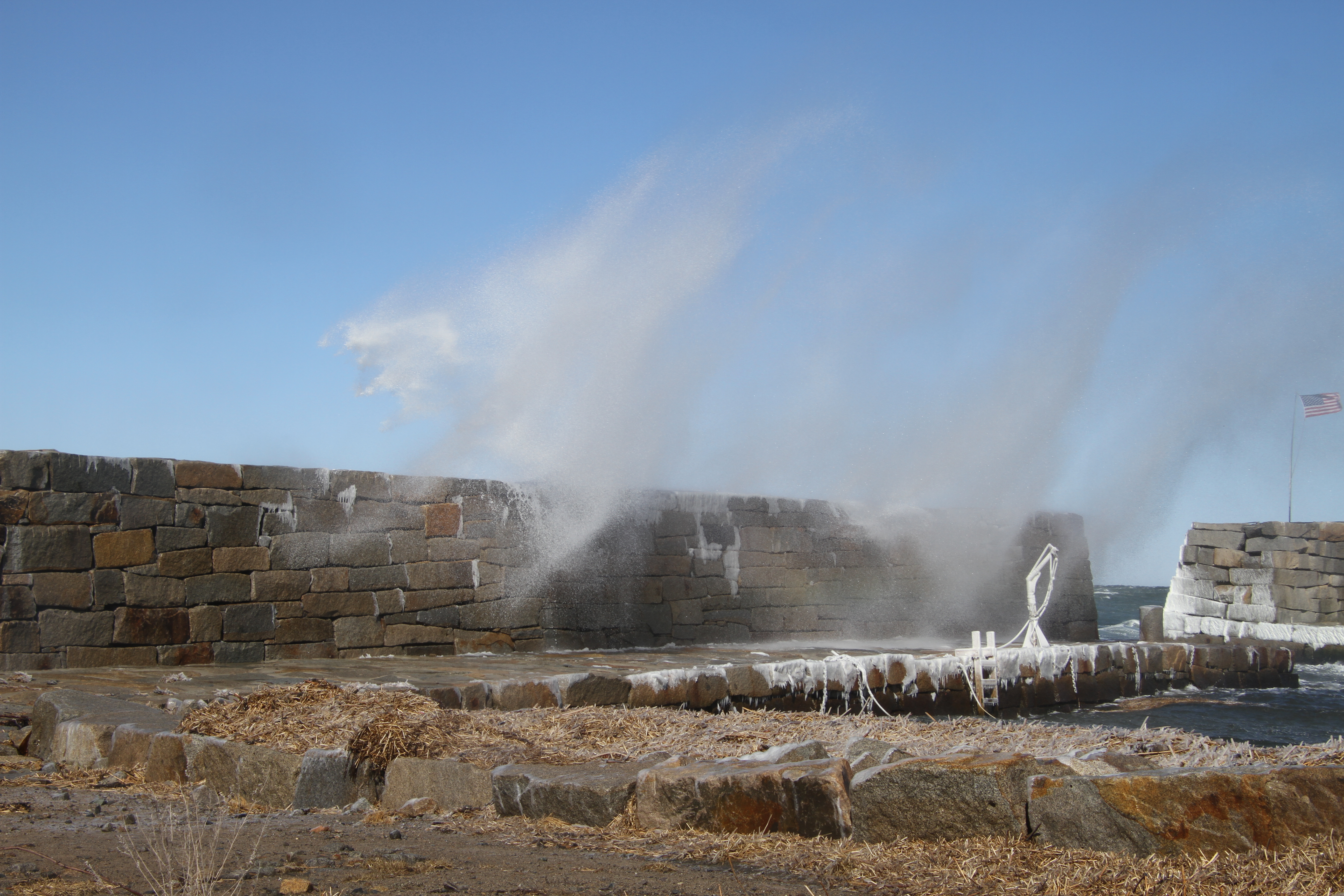
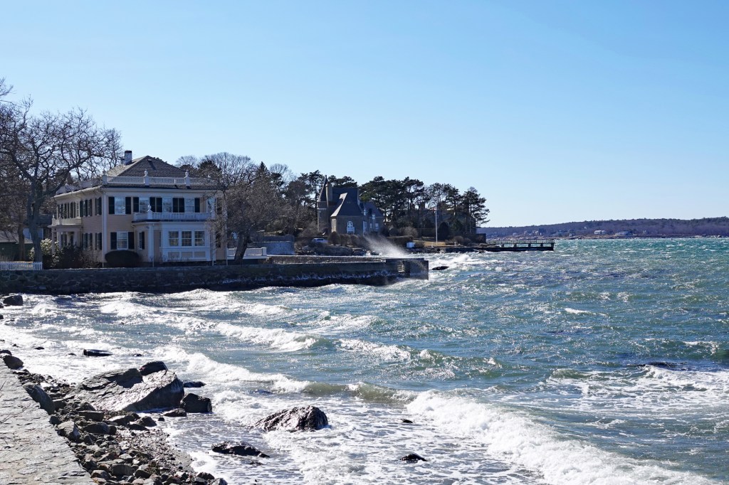
Beaches are always in a state a flux. Climate, the intensity of the winds and currents, storms, available sediment supply and land-use determine the profile of the beach. The sand that accumulates on beaches comes from northern mountain boulders (often transported by rivers) which were finely ground first through years of glaciation and water by erosion as a result of storms and frost. The littoral current which runs from north to south during north/northeast winds transports sand down the coastline. This current is powerful, and the undertows and rip currents act like huge conveyer belts carrying sand southward to replenish beaches further down the coastline. If the littoral current is obstructed by structures such as jetties and groins, the beach will balloon out to the north of the obstruction “damming up” the littoral drift which would have replenished the beach to the south. Similarly, transport of sand in the onshore or offshore direction (cross-shore transport) results in an adjustment of the beach toward an equilibrium profile. The major source of cross-shore sediment transport comes from the paleodelta located offshore of the Merrimack River. High waves and water levels during storms result in accelerated and modified longshore and cross-shore sediment (sand) transport processes.

Not only do dunes protect inland areas but they supply sand to the adjacent beach system, thereby increasing its ability to dissipate storm waves. By absorbing much of the force of the waves, dunes provide protection to landward areas from storm damage and flooding.

A healthy barrier beach system contains primary dunes and secondary dunes. If the sand dunes at Salisbury Beach were free from human interference, predictable geological processes would occur. High energy storm waves attack the beach and dune face. Sand is transported in an offshore direction to build sandbars. The decreased depth of the offshore area causes waves to break further offshore and away from the dune face. Less energetic waves, consequently, directly hit the beach and dunes. Vegetation on the dunes provide stability through its root system that holds the sand in place and by trapping windborne sand particles blown from the dry portion of the beach, increasing the volume of sand in the dune.

The dynamics of Salisbury Beach’s barrier island dunes and beaches.

The sand dunes at Salisbury Beach are moving westward with a motion similar to that of a bulldozer tread: a rolling, “going over itself” motion. Some natural factors, such as rising sea level, make this process inevitable, while others, such as littoral drift and dune vegetation, make it a relatively slow process. Storms can create changes very quickly. However, human activities also accelerate this process. People, with their desire to visit or live on the beach, often destroy the very resource that attracts them and the resources that provide storm buffering and flooding protection.A jetty located north of the Reservation in Hampton, New Hampshire, currently interrupts the flow of sand onto the northern section of Salisbury Beach. The beach is steeper south of this barrier. The jetty along the northern shore of the Merrimack River, provides protection to the navigation channel into and out of the Merrimack River and obstructs the flow of sand to the south towards Plum Island.

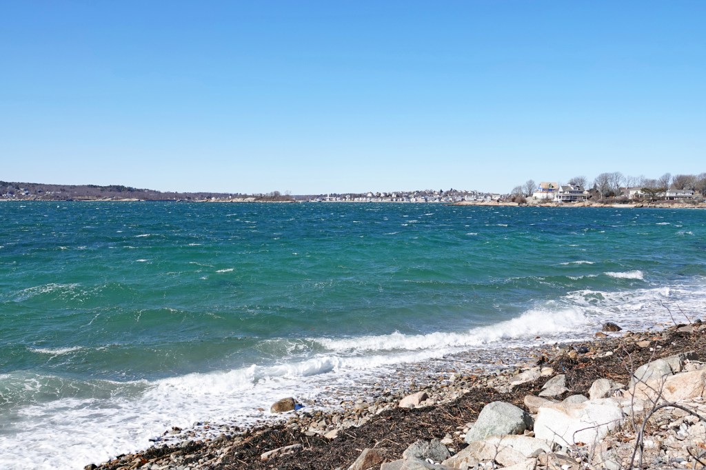
Beaches typically migrate landward due in large part to reduced sediment supply and rising sea-levels. The rate of relative sea level rise is currently about one foot per 100 years; however, the Intergovernmental Panel on Climate Change (IPCC) predicts that sea-level rise and its risk to coastal resources will accelerate over the next 100 years. Conservative projections of sea-level rise by the end of the century range from 4 to 21 inches, while projections given a higher emissions scenario range from 8 to 33 inches (CHC, 2007). Given on-going coastal issues and climate change, land mass forms in this dynamic system will constantly change over periods of time.