Long Beach status: sand creeps back, no stairs, more damage at seawall and walkway

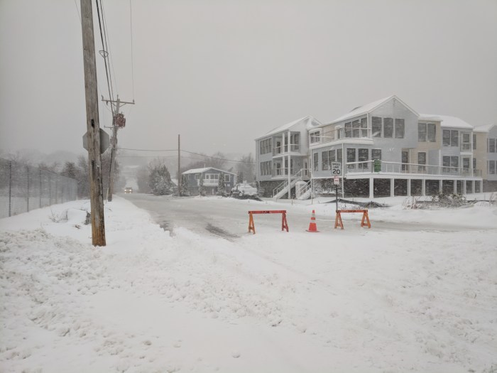
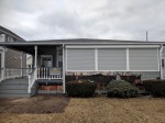
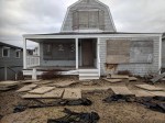
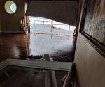
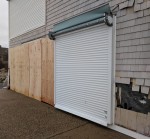
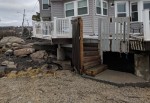
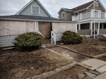
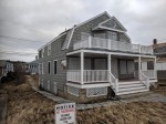
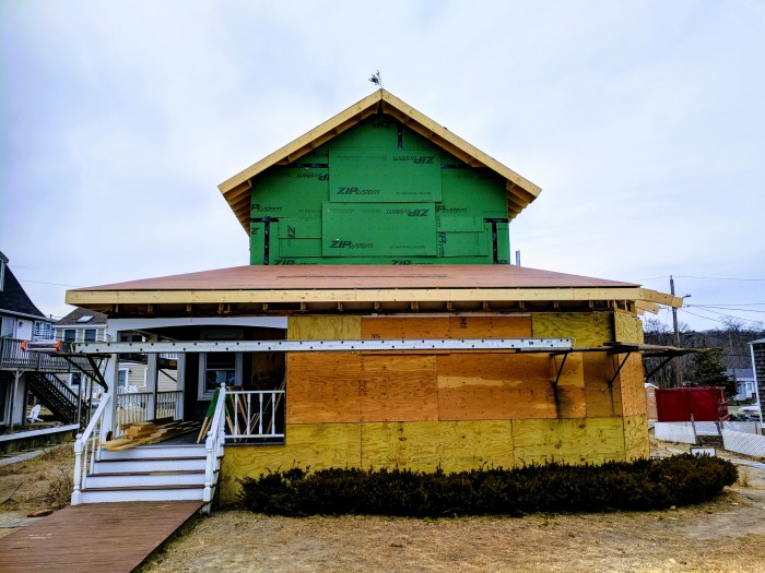
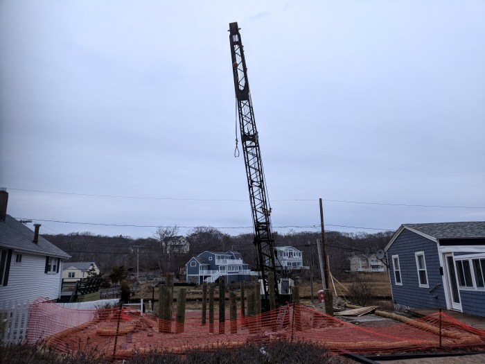
Photo journal documenting rapid damage and repairs post trio of winter storms as of May 2018.
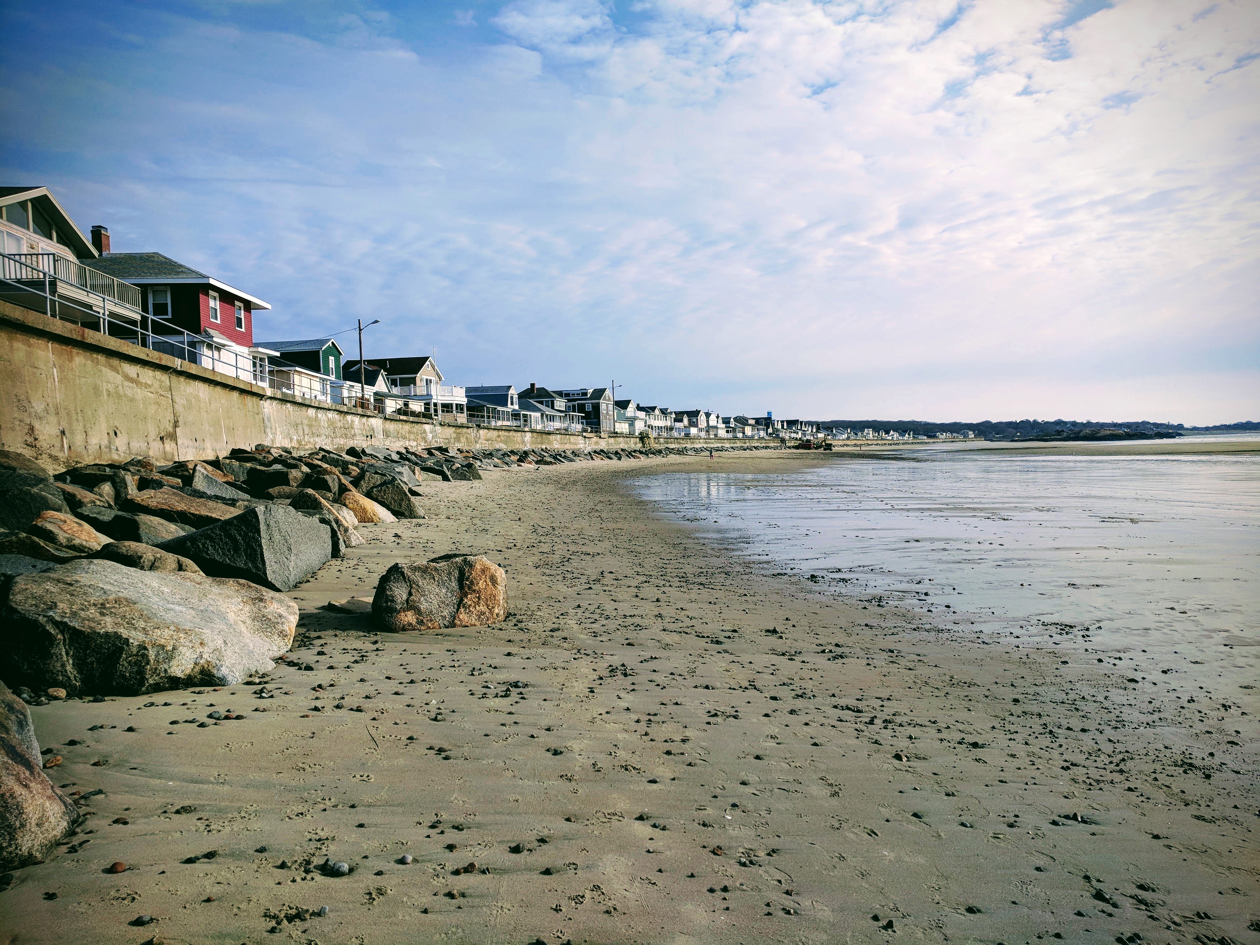
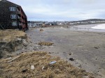
sunrise_ May 2018_flawed and beautiful Long Beach seawall promenade Gloucester Rockport Ma  ©c ryan.jpg

Sand

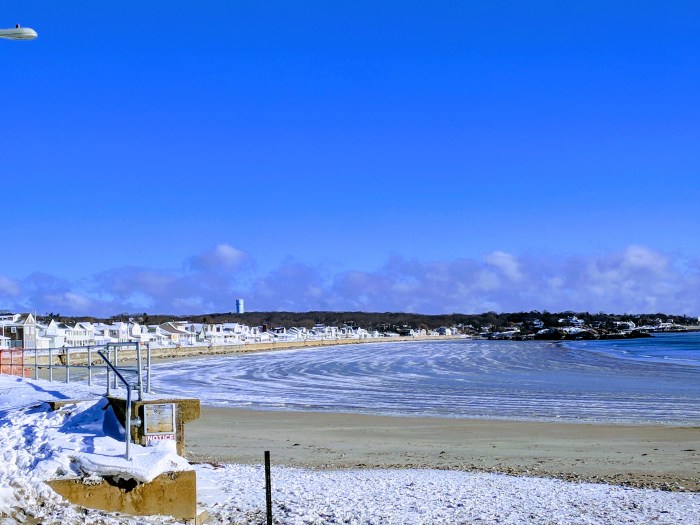
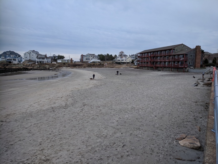
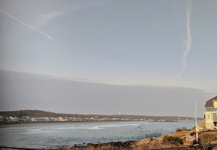
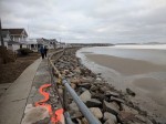
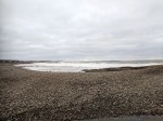
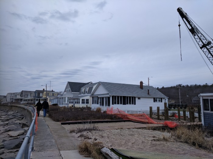
is creeping back, truly. (view looking across to Gloucester side) 

sand creeping back Long Beach Mass after winter storms May 16 2018 ©c ryan.jpg

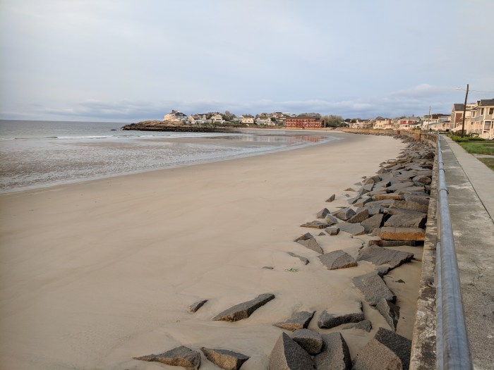
(sand migrating back- view looking to Rockport– see 2017 post about  Long Beach annual shifting sands )

Sand migrates back center of Long Beach MA - even with winter storm erosion- 20180516- ©c Ryan.jpg

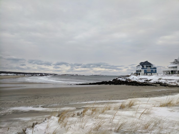
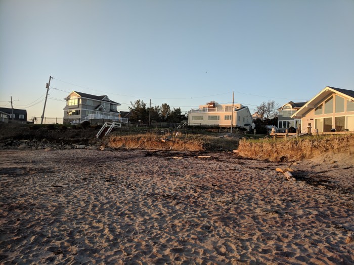
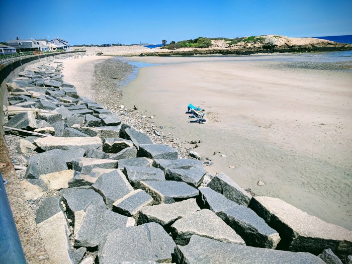
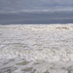
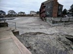
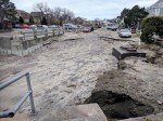
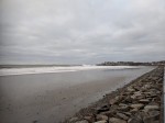
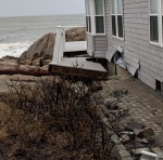
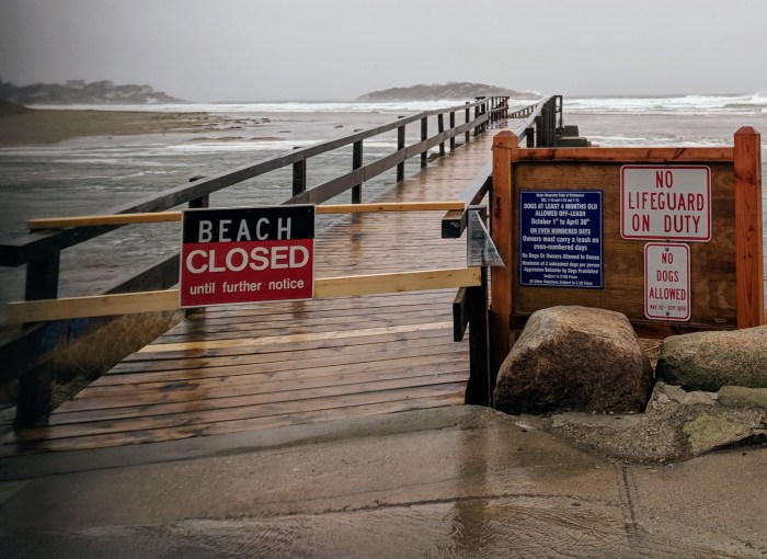
beach erosion was significant
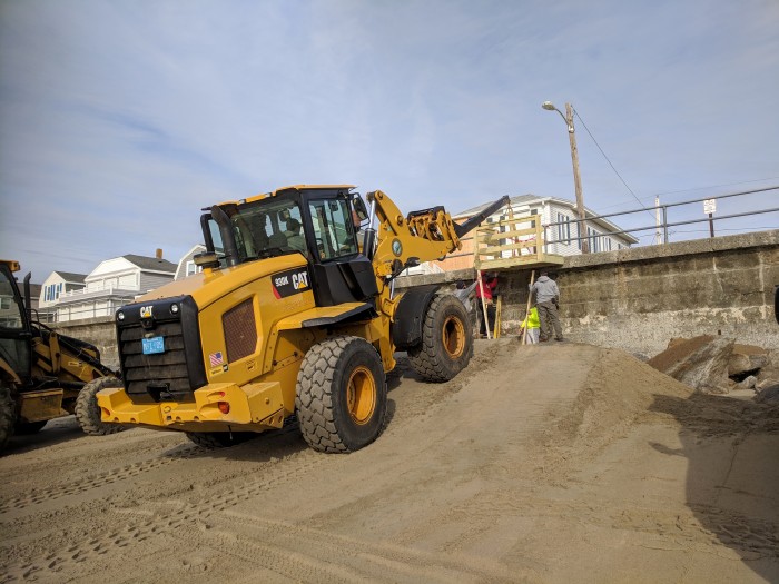
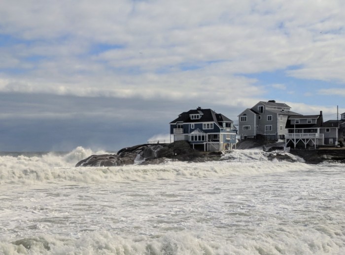
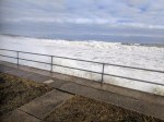
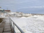
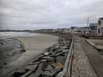
Damage continues

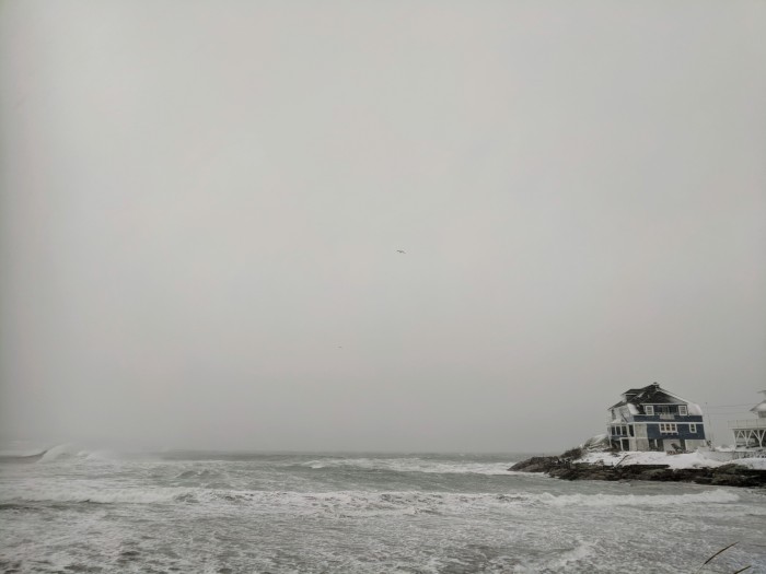
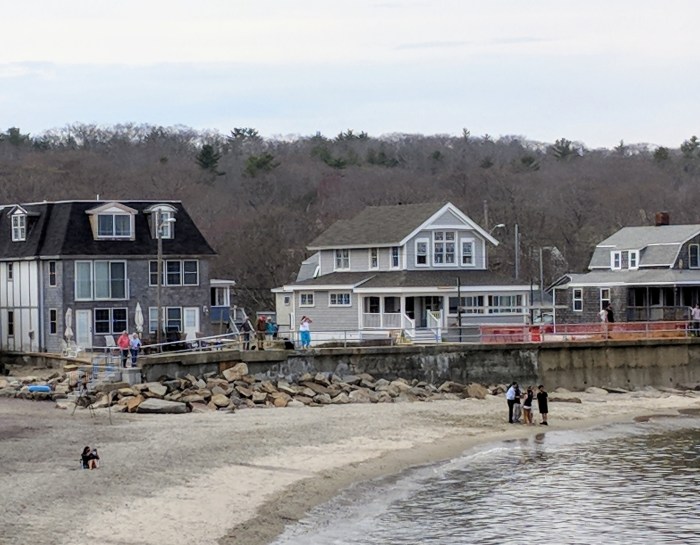
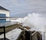
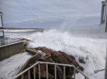
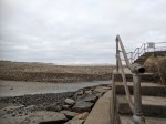
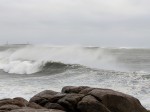
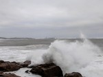
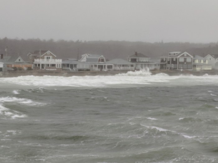
Spring tides slam the Long Beach seawall.

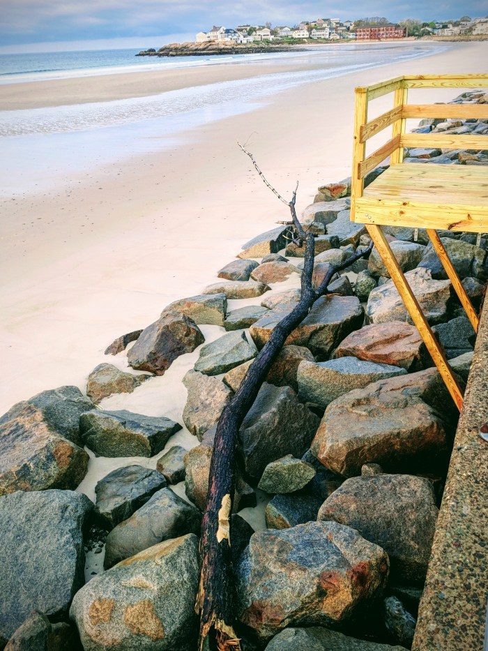
photo: A tree tossed up like a toothpick atop the rip rap helps to illustrate the ocean’s twice daily whollops.

tree tossed up like toothpick_May 16 2018 Long Beach Mass-strong high tides twice daily ©c ryan.jpg

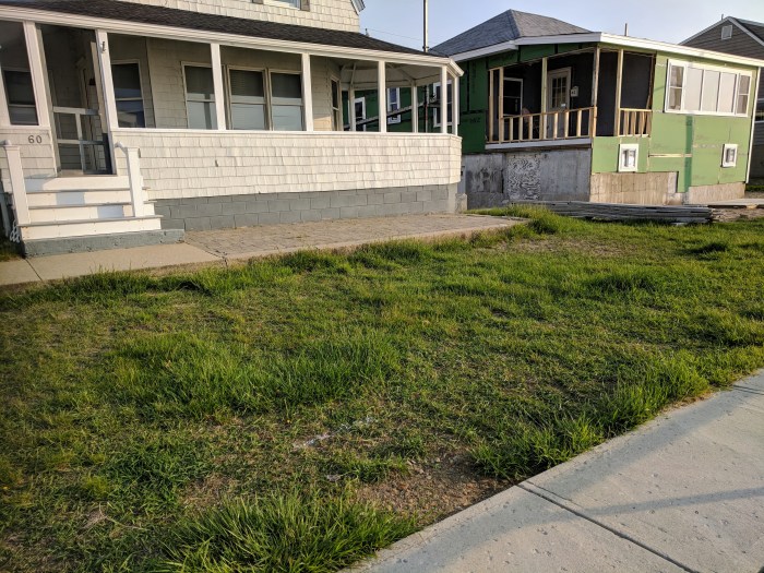
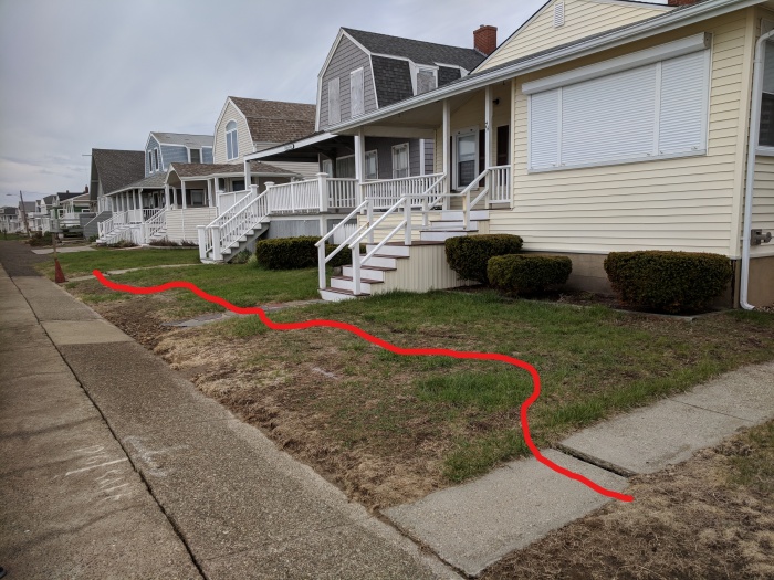
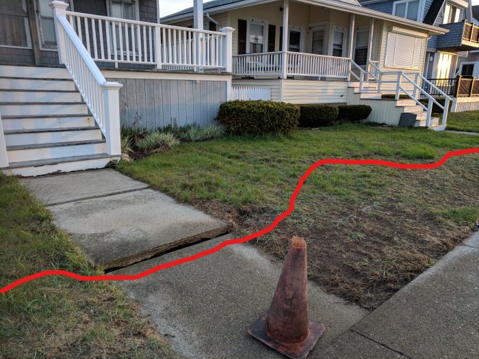
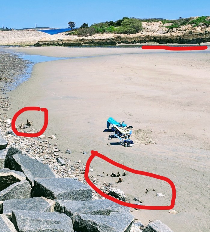
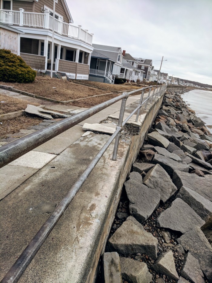
vulnerable spots clearly visible to the naked eye (I marked up two with red lines)

weak spots Long Beach seawall damage May 18 2018 _©c ryan.jpg

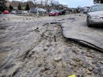
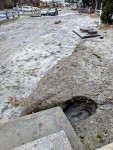
When the seawall opened up and heavy concrete sections balanced like hanging chads or individual playing cards, I was not surprised. The massive promenade had shown signs of strain.  Small fissures and tiny holes were noticeable before the winter storms accelerated its decline. Water finds a way in at high tides. The manmade wall is noticeably shifting and rumbling at a greater pace. Holes, cracks and breaks along the seawall expand, and new ones erupt. I can’t help conjuring up comparisons to Yellowstone’s boiling and unpredictable surface.  I imagine stakeholders are mapping details of their immediate landscape. Though beaten down, the promenade is walkable and sturdy. Tiny holes do expand rather alarmingly.
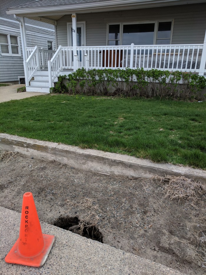
example –

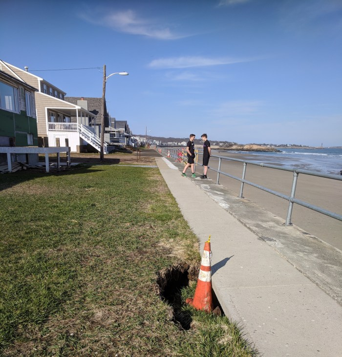
and another (filled)- the cone eventually dropped beneath the path
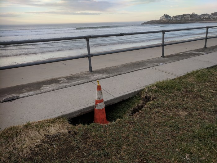
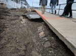
Fissures

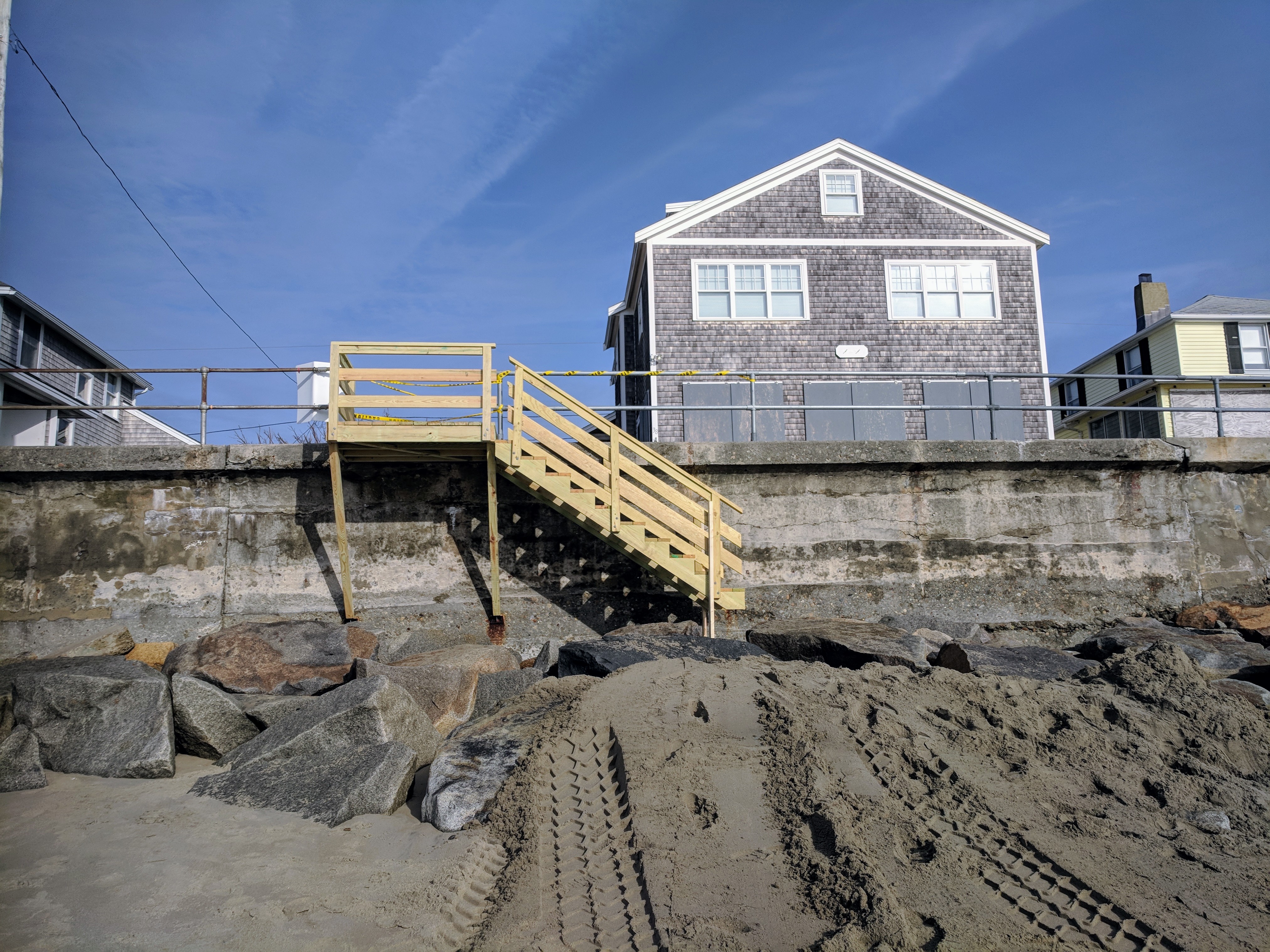
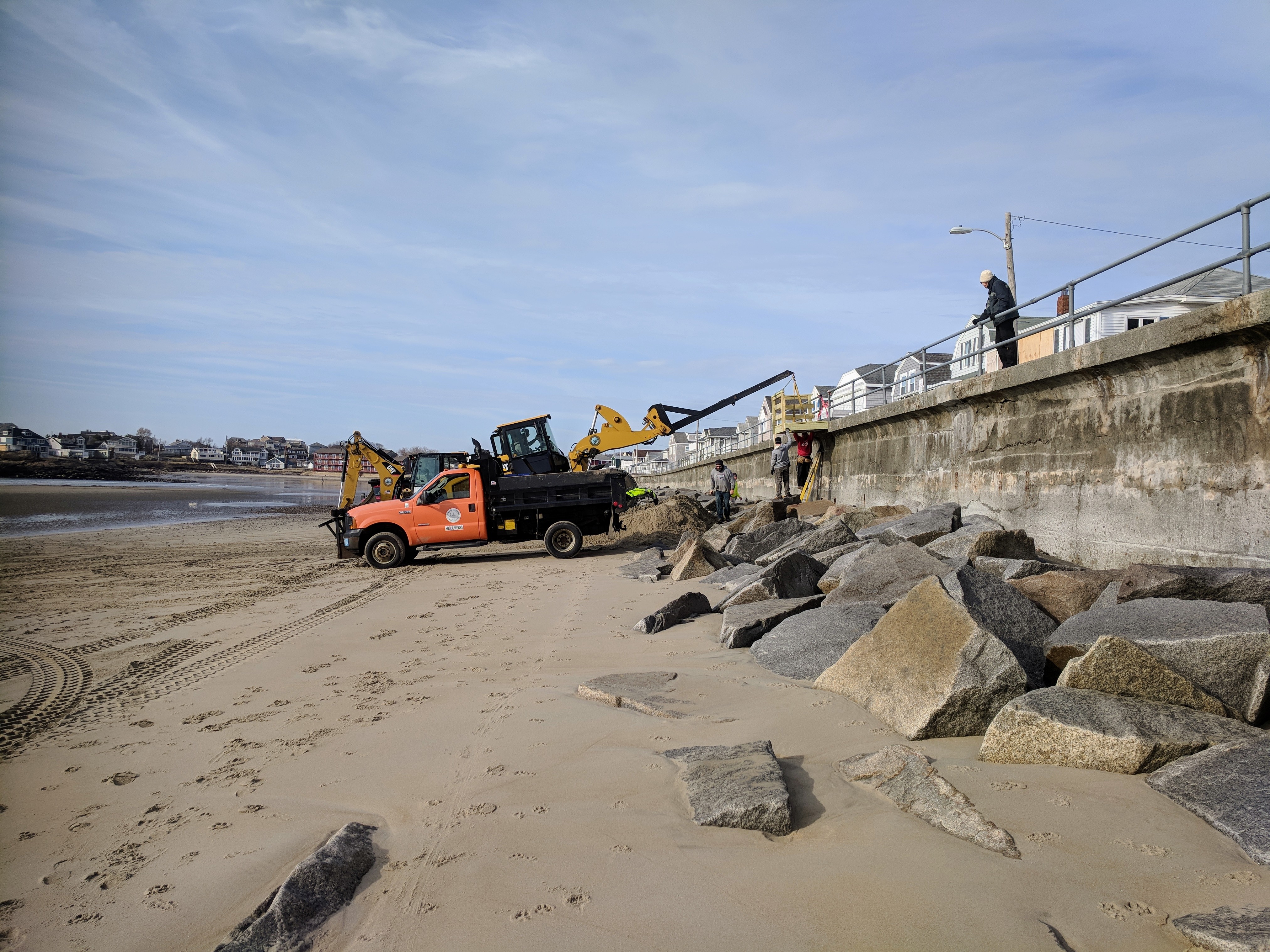
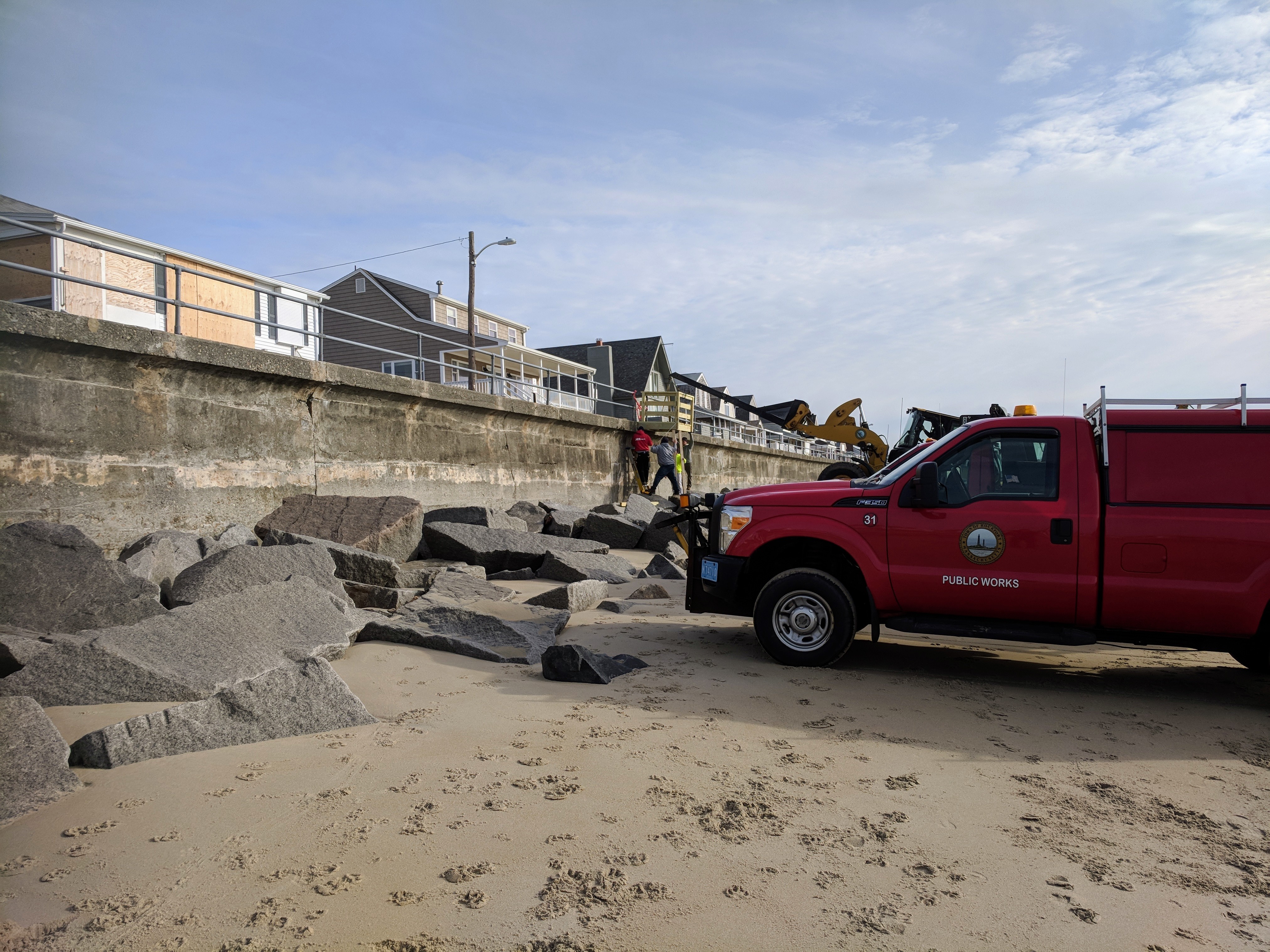
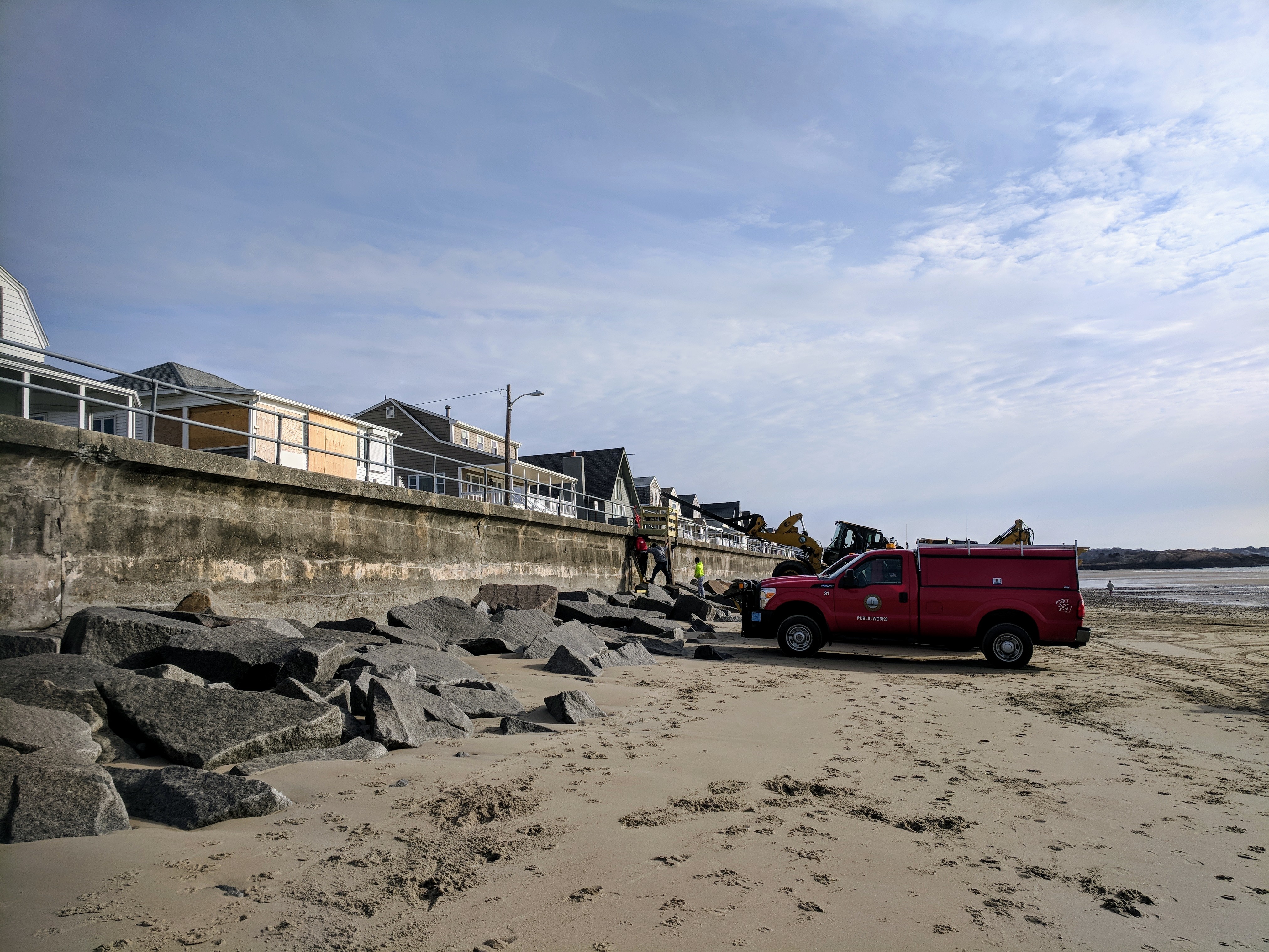
more photos (before-afters, repairs, boulder pyres, stairs or lack thereof, and nuisance popples) and videos of  seawall ramparts giant boulder shuffle

Continue reading “Long Beach status: sand creeps back, no stairs, more damage at seawall and walkway”

Long Beach, Mass: storm damage unearths submerged grove of mystery roots

Does anybody know the age of the mangrove-like roots that began to surface back in 2012 aside Eagle Rock and the creek? The 2018 winter storm erosion exposed more of a grove line parallel to the seawall. I am curious about the seemingly fossilized piercings and how the landscape may have looked before the beach we walk today.

more photos in my GMG post from 2016: Shore nature challenge: what are these? Long Beach Easter Island

Long Beach Massachustts after winter 2018 storm damage- mangrove like roots surface©c ryan_20180523_134700InkedLong Beach Massachustts after winter 2018 storm damage- mangrove like roots unearthed - detail marked up©c ryan_20180523_134700


shelter: the cottages of Long Beach | Erin Luman solo art show at Jane Deering Gallery

ERIN LUMAN shelter | the cottages of Long Beach

June 2018  Jane Deering Gallery, 19 Pleasant Street, Gloucester

reception June 2, 4-6pm

Jane Deering Gallery announcement ©c ryan_20180517_060740.jpg

MARTIN DEL VECCHIO VIDEO OF RIGHT WHALES FEEDING OFF OF LONG BEACH

Many thanks to Martin Del Vecchio for sharing his video and still images (see photos here) of the spectacularly beautiful pod of North American Right Whales feeding off of Cape Ann shores yesterday, May 4, 2018.

CHANNEL 5 WCVB STORY WITH RIGHT WHALES ON LONG BEACH

WCVB reporter Duke Castiglione was on Long Beach yesterday for the following story. Click on the link below to see Cape Ann locals and Castiglione at Long Beach!

http://www.wcvb.com/article/noaa-extends-emergency-bans-to-protect-endangered-right-whales/20181874

NOAA extends emergency bans to protect endangered right whales

WCVB: Federal authorities have extended a ban on trap gear closures for part of Cape Cod Bay to reduce the risk of right whales becoming entangled in trap gear.

Right whales are critically endangered and scientists say their population has been decreasing since 2010 due to continued mortality and low birth rates.

According to the National Oceanic and Atmospheric Administration, recent aerial surveys have observed upward of 100 right whales — about 25% of the known population — within Western Cape Cod Bay.

Officials said high plankton counts indicate the whales will likely remain in the bay into next week.

The whales have also been spotted off the coast of Cape Ann.

The Salem News reports Marblehead has been treated to some rare sightings of right whales over the past several days.

Right Whales are feeding along the Massachusetts coastline on their northward migration to feeding grounds off the coast of Nova Scotia, amongst other northern locations.

EXTREMELY IMPORTANT INFORMATION FOR OBSERVING EXTREMELY ENDANGERED RIGHT WHALES OFF THE CAPE ANN COASTLINE

Jennifer Goebel from NOAA writes,

It looks like the whales will be in town over the weekend and I was wondering if you’d be willing to remind people to watch out for them, report sightings to our hotline 866-755-6622, and to remind everyone about the 500-yard rule, which applies to everyone– swimmers, drones, boaters of every kind including kayakers, paddle boarders.

We have some info up here:

https://www.greateratlantic.fisheries.noaa.gov/stories/2018/05/03_watch_out_for_whales_.html

Thanks,

Jen

People watching whales from Cape Ann Motor Inn, Long Beach, Rocks

Cape Ann Marina guests can see whales from their rooms! Back home from work and spotted three whales immediately which means that some of the six right whales have been feeding more than ten hours HERE. It’s thrilling! I even saw one head to Salt Island and back. They check in and circle together. Two are lingering off Long Beach on the Gloucester side. When two and three are gliding along, stepped back one by one nearly together in a line, and moving fast, the legendary sea serpent stories did come to mind.

Nearly as much fun are the clusters of whale watchers at the waters edge like schooner race photos of yore. I added a short video with Long Beach cottages and the stretch of sand in the background to give another relational vantage.

Right whale watching from shores Gloucester MA_20180504_102716 ©c ryan (7)

Long Beach video to show relation to sand and seawall–they’re further out now with tide coming in

early morning post began 6:30am

Right whale watching from shores Gloucester MA©c ryan_20180504_103632.jpg

STUNNING CLOSEUP PHOTOS RIGHT WHALES FEEDING OFF LONG BEACH FROM MARTIN DEL VECCHIO

Martin writes, “The North Atlantic Right Whales that have been spotted around Gloucester spent the morning feeding just off Long Beach.  And I mean just off; in some cases, within 20 feet of the rocks.

There were at least four of them, which represents 1% of the global population of this extremely endangered species, which has been described as “on the brink of extinction” (https://www.washingtonpost.com/graphics/2018/national/amp-stories/right-whales-are-on-the-brink-of-extinction/).  This past year has been a tough one, with no confirmed live births, and more than a dozen deaths due to boat strikes and entanglements.
They seemed to my untrained eye to be adults, much larger than the juvenile who visited Bass Rocks in 2015 (https://www.youtube.com/watch?v=zJVnGpiwigY).  And unlike that whale, which seemed to be exploring and playing, these whales were feeding systematically.”
All photos copyright Martin DelVecchio
See Marty’s flicker album here for more North Atlantic Right Whale photos:

WHALES 5+ feeding between Salt Island & Long Beach visible from shore now! #GloucesterMA

Update: we spotted five or six right whales at 6:30AM just off the shore between Salt Island and Thacher. They remained feeding in the area for 11+ hours. Two crossed past the Rockport side of Long Beach, and back again. They were surprisingly fast at times! Post was updated during the day with more photos and videos. I hope some photogs with professional lens will be sharing soon.

five right whales visible from shore Gloucester MA May 4 2018©c ryan still from short video.png

30 seconds 4 right whales out of 6 off Gloucester Ma, Long Beach, Twin Lights in backgrounds


1 min video tracking 1 of 6 right whales


How close? This close: here’s another image from an FOB whales out her window!

FOB sent photo in to Good morning gloucester  whales out window IMG_8894.JPG

Is this Atlantic right whale detection app active?

Second post- close up

Third post after work– 3 whales still feeding here 11+ hours later!

https://goodmorninggloucester.wordpress.com/2018/05/04/people-watching-whales-from-cape-ann-motor-inn-long-beach-rocks/

Finally! some evening spring surfing on Long Beach and Main Street

©c ryan April 2018_094730 (5)

Dogtown Book Shop

©c ryan April 2018_094730 (12)

Repairing Long Beach Rockport Mass after storm damage|Busy New England DPW crews

Marveling at the tenacity of coastal towns- Cape Ann public works after winter storms are no joke.

Spring staircases

Rockport, Mass. The many access stairs for the Long Beach pedestrian walkway are put back each spring. Some years, the landing platforms on the sand side need repair. The 2018 winter storms pummeled each and every access point. Landings on sand and up top, the railings, and treads were entirely stripped. The rebuild for a few of the staircases will remain on hold until their immediate seawall areas are tended.

Water shoes this summer

From there to here: popples and rocks from the decimated barrier wall between Long Beach and Cape Hedge Beach were deposited along Long Beach.

March 9 2018 after storms - barrier wall swept away Long Beach ©c ryan _173957

REPAIR~4
barrier wall displaced and great swaths landed on Long Beach

Where’s the beach?

Spring 2018, the ocean is several feet deep at the rip rap line every high tide

spring high tides- the water seems extra deep at rip rap as if could dive in-ocean against seawall- no beach at all most day albeit low tide

Evolution of damage at beach barrier

Continue reading “Repairing Long Beach Rockport Mass after storm damage|Busy New England DPW crews”

Calm Before the Storm

This image was taken last Thursday before the storm came through, Long Beach did not look the same for the next few days.

Also a big thank you to Joey for making me part of the team. Hoping to share a lot more of my images with you all thank you for the support

Nor’Easter storm Riley high tide surges keep coming #GloucesterMA

Scenes and video from Long Beach, Gloucester, MA, just before high tide

Riley Nor'easter winter storm battering Gloucester MA Long Beach fifth high tide again© c ryan March 4 2018_123048 (3)


Paths of destruction winter storm damage Riley Long Beach #GloucesterMA

Damage everywhere we looked this morning, low tide, about 8am, March 4, 2018. With surf high at low tide, we expect the next high tide to surge more.

Guts of seawall exposed Winter Storm Riley March 4 2018 Gloucester MA Long Beach ©C Ryan _151948 (47)
Long Beach seawall sink holes

Long Beach seawall; Rockport Road; Gloucester and Rockport

Some evident damage to coastal homes in Gloucester MA and front row cottages by Long Beach pedestrian walkway. Surf inside and out found paths of entry.

The Long Beach pedestrian bridge was damaged. The boulder barrier seawall was cut down by half, maybe more.

dramatic change sea wall cut down by half Winter Storm Riley March 4 2018 Gloucester MA Long Beach ©C Ryan _151948 (32)

rip rap exposed as far as the eye can see, Long Beach (looking from Rockport back to Gloucester, MA) Note every platform from the stairs was ripped away

video of surf looking to Gloucester end of Long Beach. Would not risk this walk at storm high tides- note multiple crests with each surge Continue reading “Paths of destruction winter storm damage Riley Long Beach #GloucesterMA”

Riley Nor’Easter morning after second high tide #GloucesterMA: coastal damage homes and Long Beach seawall

Riley took bites out of the Long Beach seawall, and ripped out decks and fences wherever last night’s raging tide rushed. Debris strewn roads include large timber rails and rocks.

Morning after Riley second tide sea wall damage Long Beach _20180303_075741 © C Ryan (13)


Life of Riley – Nor’easter storm #GloucesterMA

March 2, 2018. Riley so far (photos and 2min video low tide 8:30–11:15AM,the first high tide)

IMG_20180302_095216

IMG_20180302_093610
Fishing boat returns to port March 2 2018 ahead of high tide

Continue reading “Life of Riley – Nor’easter storm #GloucesterMA”

Summer Beach Traffic and Parking Part 2 – high tech and common sense Good Harbor Beach, Long Beach, Stage Fort, Great Marsh

This is a follow up about the public meeting held by Gloucester City Councilor Scott Memhard February 15, 2018 at Gloucester Lyceum & Sawyer Free Public Library on beach traffic and parking with a focus on his ward. This post includes Councilor Memhard’s meeting notes, and the Beach & Traffic Ad Hoc committee presentation to City Council. Look for information and maps related to Long Beach, Good Harbor Beach, Stage Fort Park, and more. Chances are your ideas or concerns were mentioned–doublecheck for yourself. Future public meetings to be announced.

20170924_075528.jpg

Here’s the presentation packet to the City Council from the Gloucester Beach Parking and Traffic Ad Hoc Committee, January 2017

Here’s Councilor Memhard’s recap of the Summer Beach and Traffic public meeting held at Sawyer Free Library February 16, 2018 (advertised in the Beacon, Gloucester Daily Times, and elsewhere long in advance):

“The Ward 1 Beach Parking Ordinance community meeting last night at the library was well attended. We had a lively airing of concerns and opinions, addressing the specific Parking Ordinance proposed changes, and general, wide-ranging discussion of the problem and various potential solutions, including:

> expanded off-site parking* and trolly/bus service to the beaches;
> better signage notifying drivers that lots are full and closed, with posted directions to alternate parking options; and
> other practical steps to relieve severe safely, access, and disruption from on-street parking congestion in our beach neighborhoods.

*park n ride options would ease traffic especially with smartphone reservations/options. Locales like Rockport, Manchester, Provincetown limit cars. Several lots mentioned maximizing extant options such as negotiating with Stop&Shop, Shaws, Fuller, Blackburn, schools, etc. Stage Fort Shuttle already established and more train/bike. Train-trolley services have a rich history here.

ENFORCEMENT, HIGHER PARKING TICKETS, JULIE BROE 🙂

Continue reading “Summer Beach Traffic and Parking Part 2 – high tech and common sense Good Harbor Beach, Long Beach, Stage Fort, Great Marsh”

Long Beach MA: winter construction on front row cottages

Progress on some winter builds.

Crane at 142 Long Beach, front row cottage under construction, Jan 2018

IMG_20180128_145637

Long Beach _20180128_145550

BEFORE 142 Long Beach April 2017


4 Long Beach under reno, January 2018


BEFORE 4 Long Beach April 2017

Behind Longbeach Place

IMG_20180128_144100

At the back of Longbeach Place; and in the distance at the corner of Long Beach Road and Rockport Road

IMG_20180128_144231


sea smoke, beach and coast | beauty after the storm

Off Good Harbor Beach Gloucester, MA

Gloucester MA after storm sea smoke on the water crisp wintry morning beauty of New England IMG_20180107_091407

First for me-With the low temperatures, a white rainbow arch of thin ice dressed the entire length of Long Beach at low tide.

Long Beach with arch of thin layer of ice low tide IMG_20180107_092723

STORM video and the morning after #GloucesterMA Good Harbor Beach and Long Beach

Thinking of those dealing with no power, evacuation and such destructive, icy flooding. 

January 5, 2018  vs Storm January 4, 2018

Long Beach Gloucester MA side morning after blizzard IMG_20180105_07 © c ryan

IMG_20180104_135743

Today  here come the surfers


Rocks have clear icy layers and crunch pack, some pockets of drift


I’m following up on yesterday’s post, which was stopped midstream as we lost power. Scroll below for quick snaps and videos from my walk to Good Harbor Beach, Long Beach, and side streets.

GOOD HARBOR BEACH 1.4.18

About 2PM January 4, 2017 (high tide was several hours earlier)

Good Harbor Beach on sand looking out to Salt Island (from Good Harbor Beach Inn side of beach) Yes, the waves were rolling over the wall up to the homes but infrequently at this time. I don’t know what it was like at high tide.


(more Good Harbor Beach and Long beach below the break)

Continue reading “STORM video and the morning after #GloucesterMA Good Harbor Beach and Long Beach”