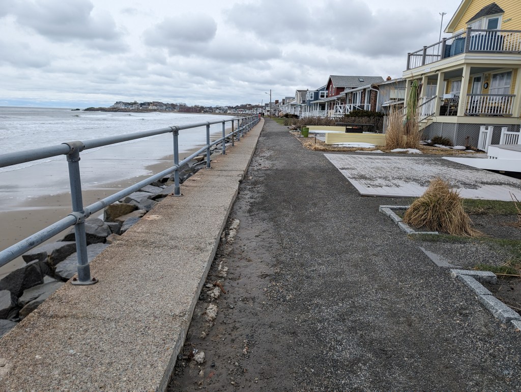
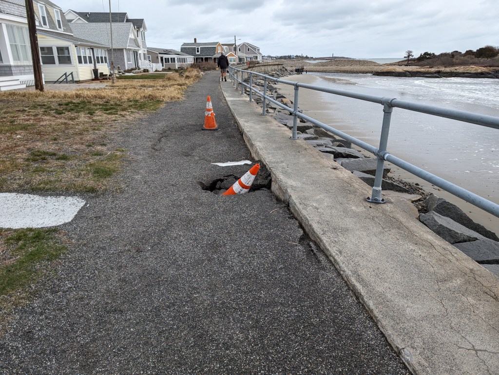
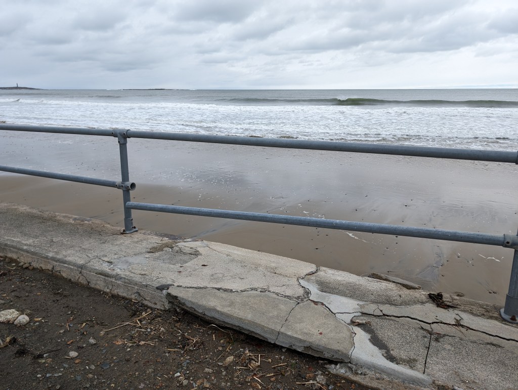
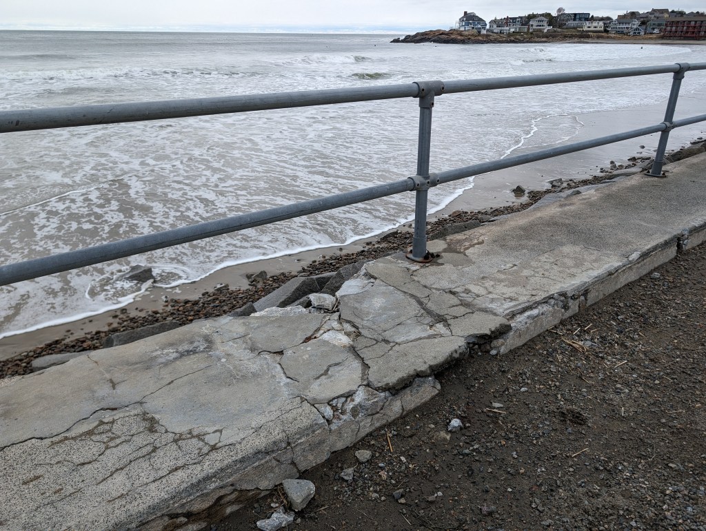
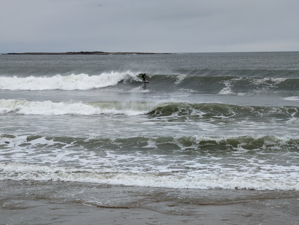
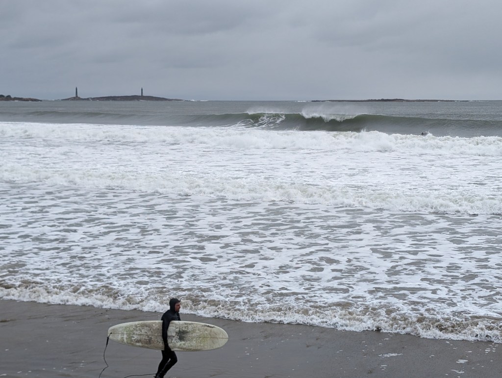
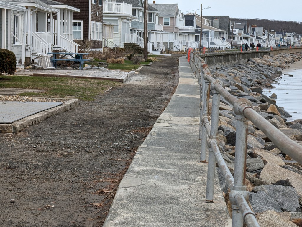
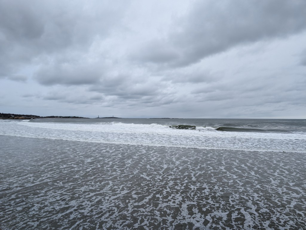
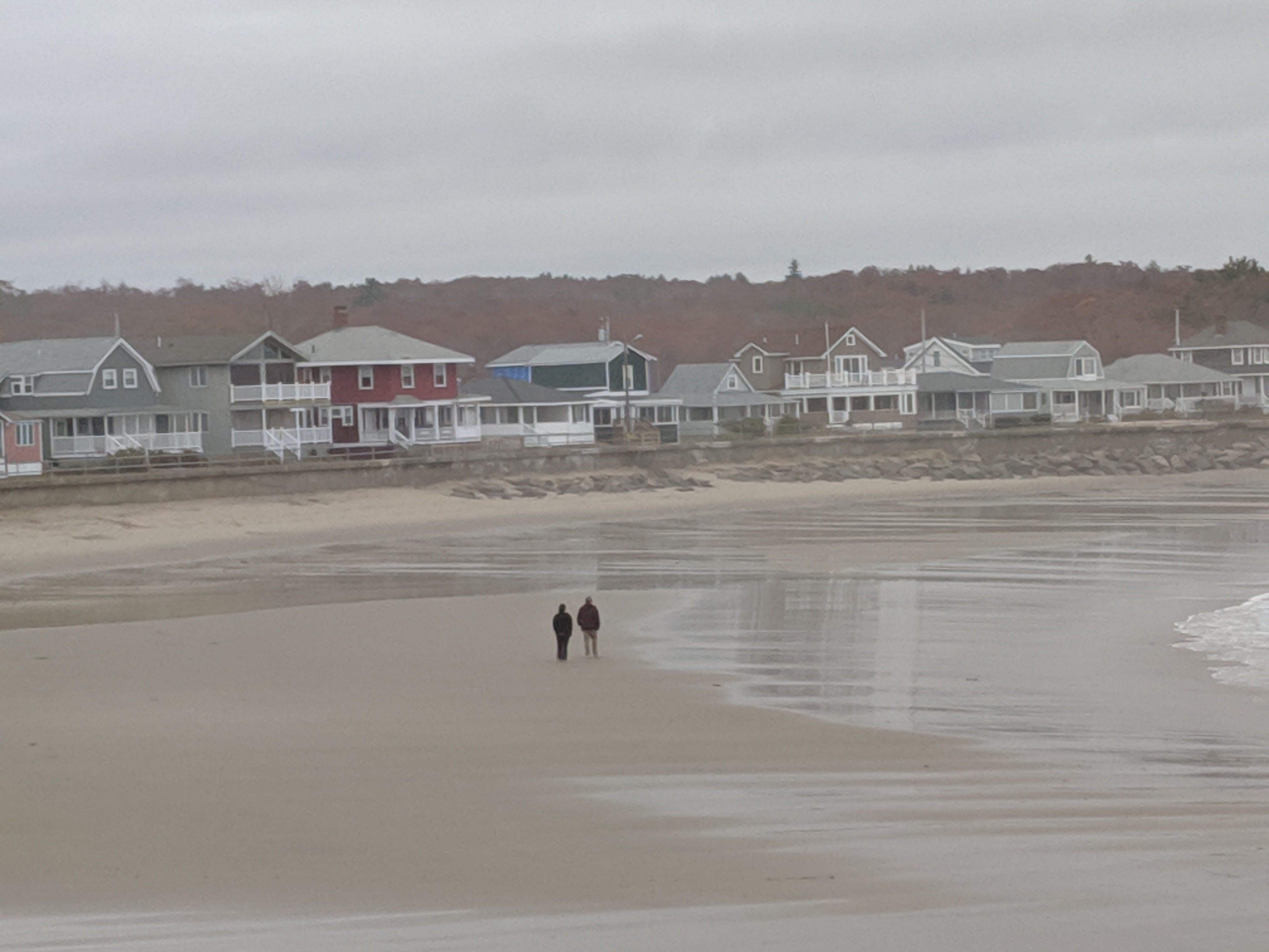
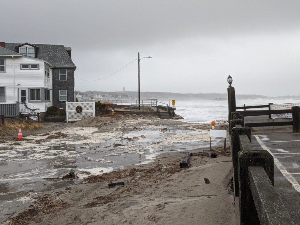
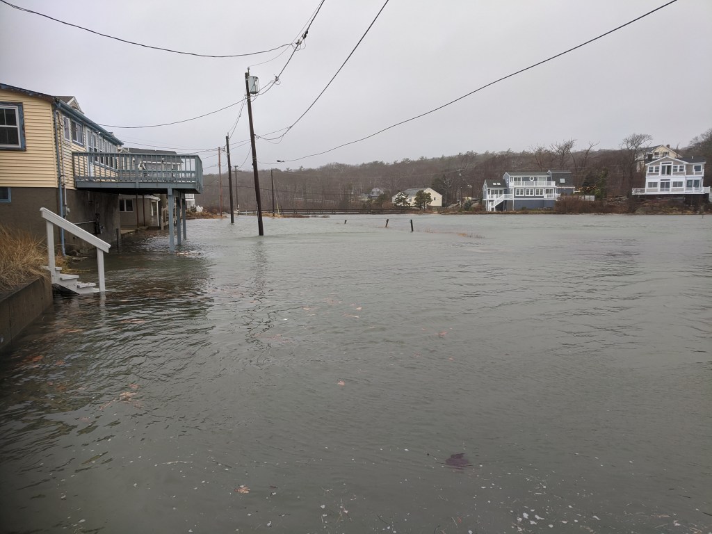
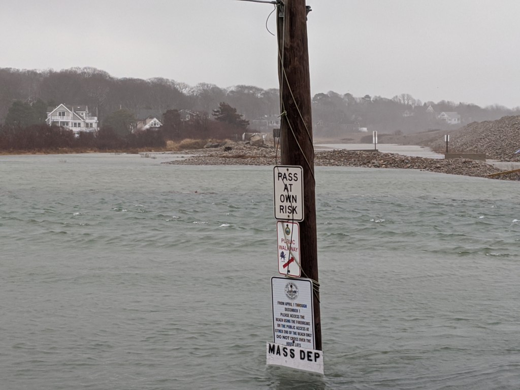
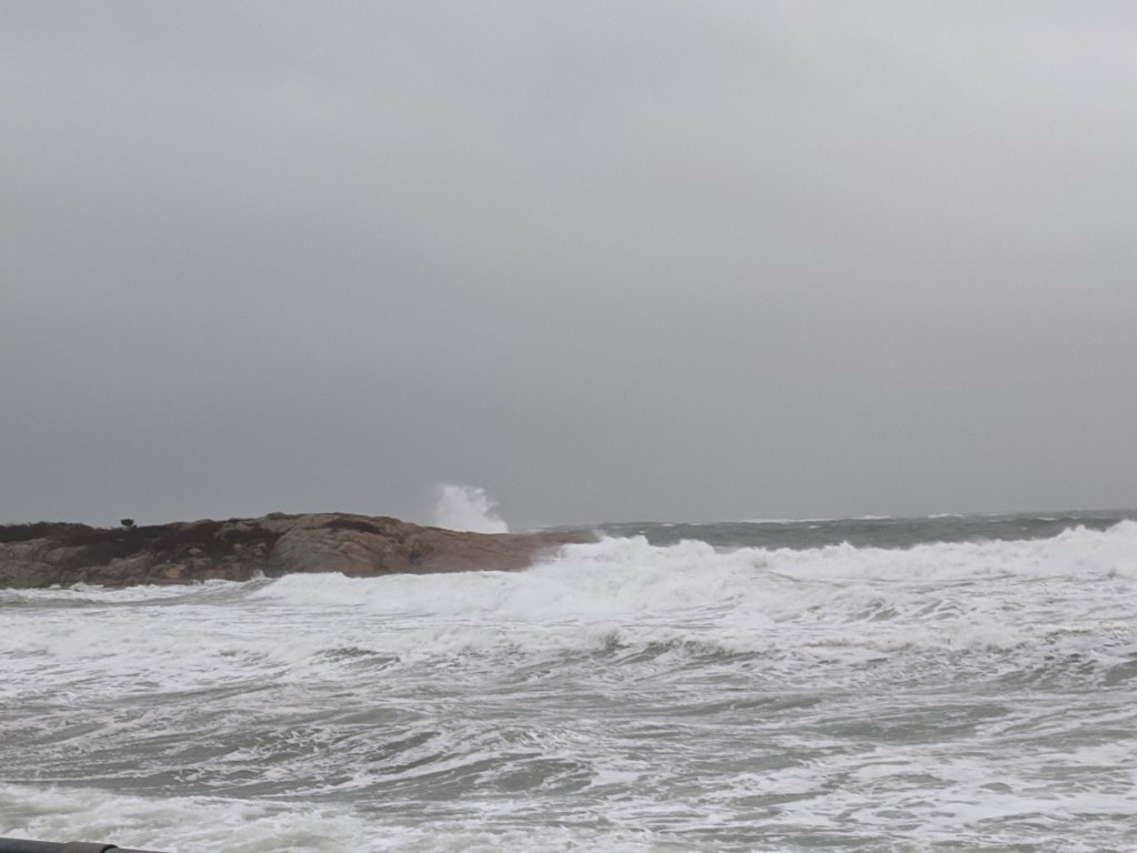
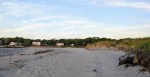
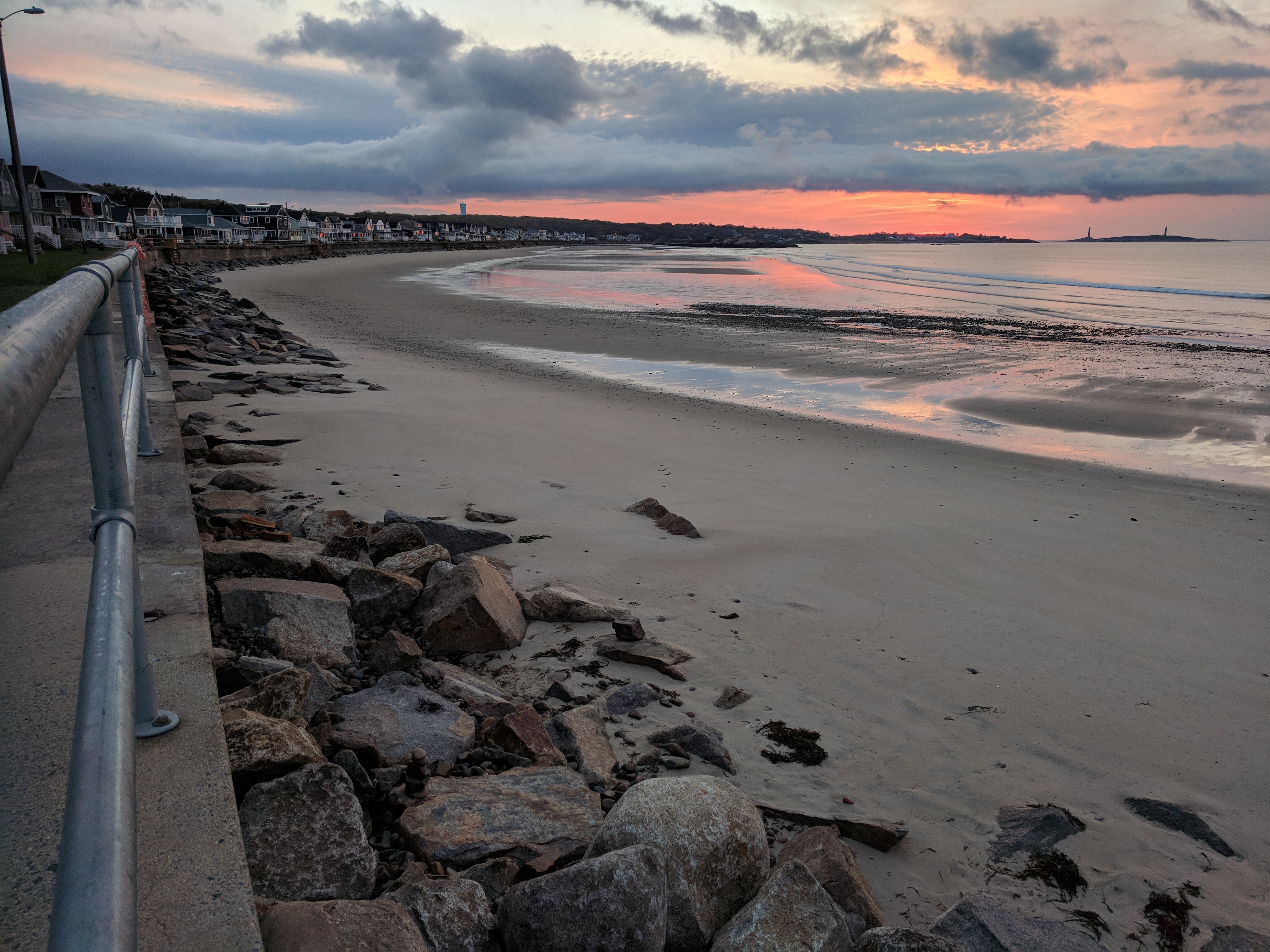
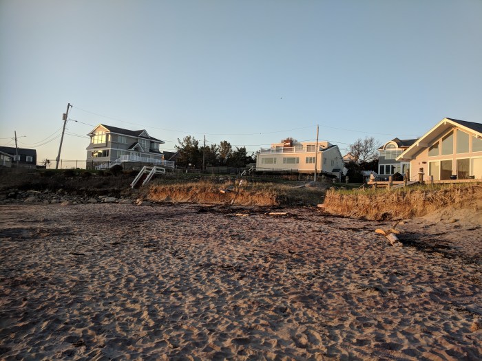
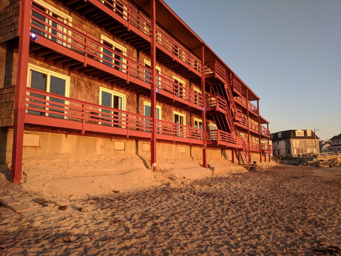
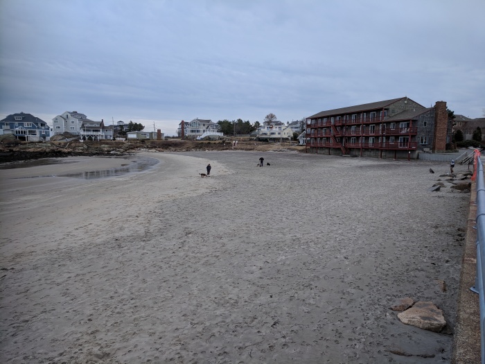
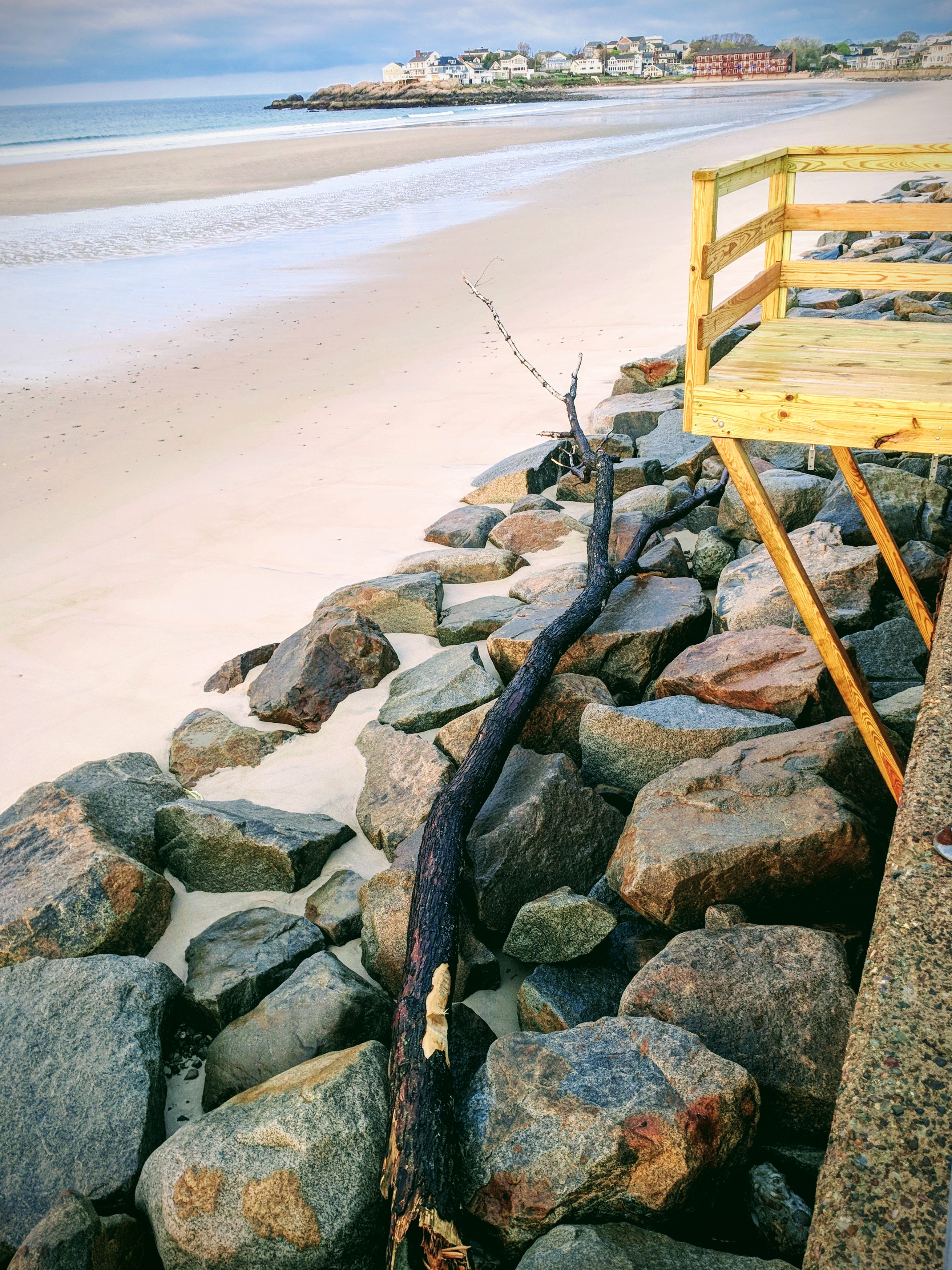
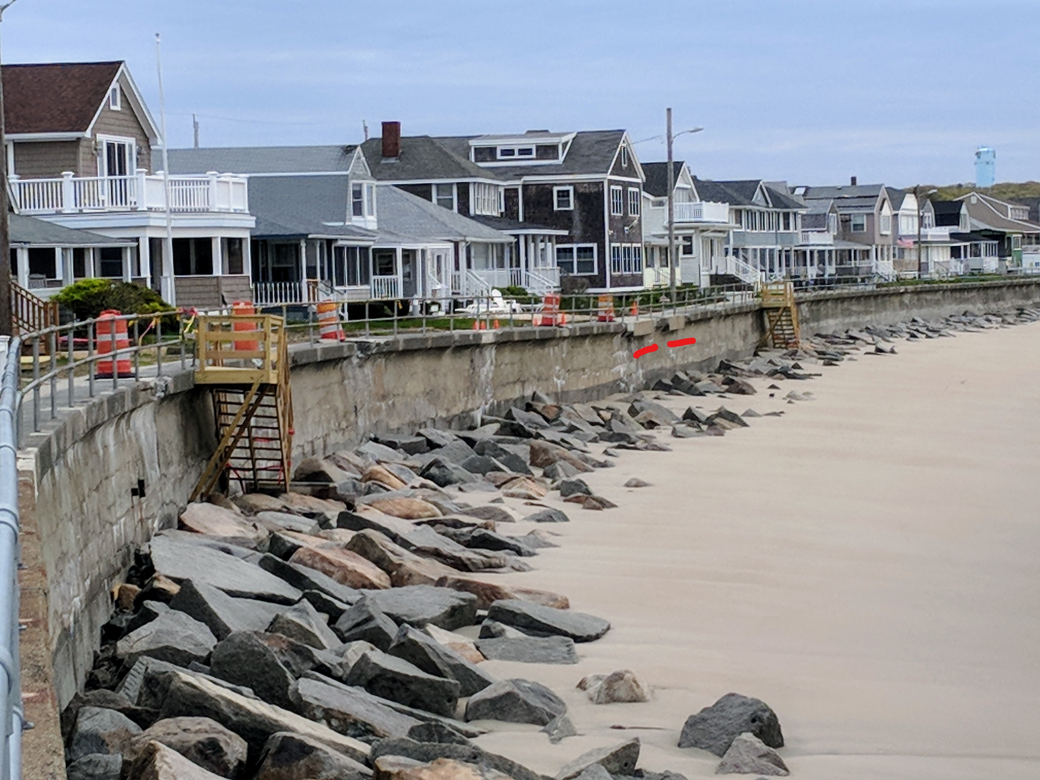
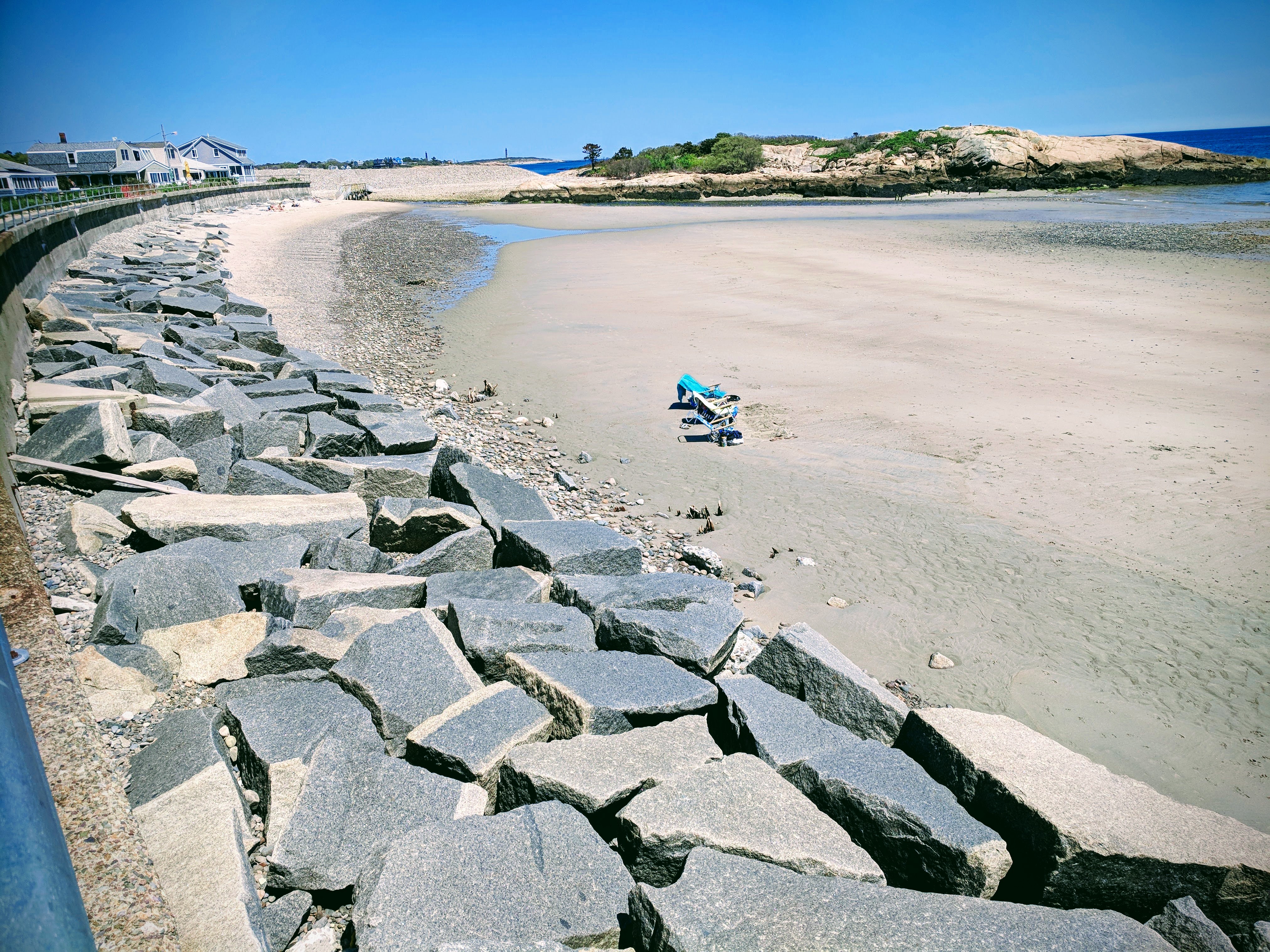
photos: Long Beach April 5, 2024
photos: Long Beach status April 2, 2024 https://goodmorninggloucester.com/2024/04/02/long-beach-seawall-conditions-2024/
My View of Life on the Dock
photos: Long Beach April 5, 2024
photos: Long Beach status April 2, 2024 https://goodmorninggloucester.com/2024/04/02/long-beach-seawall-conditions-2024/


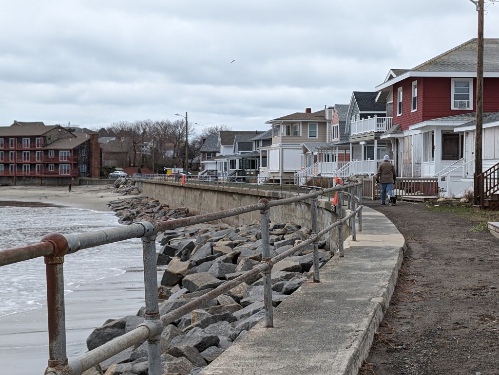
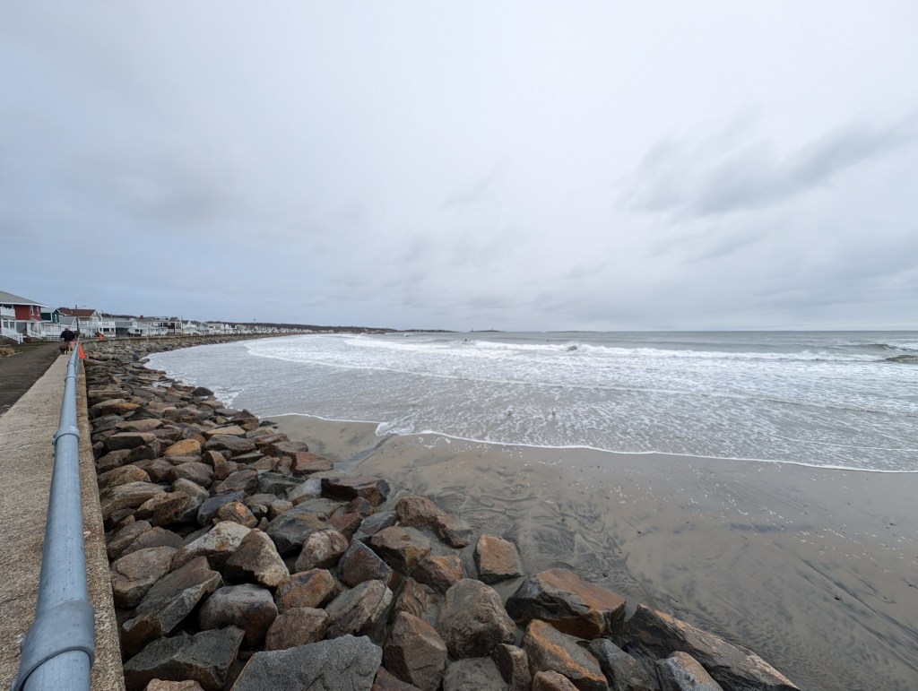
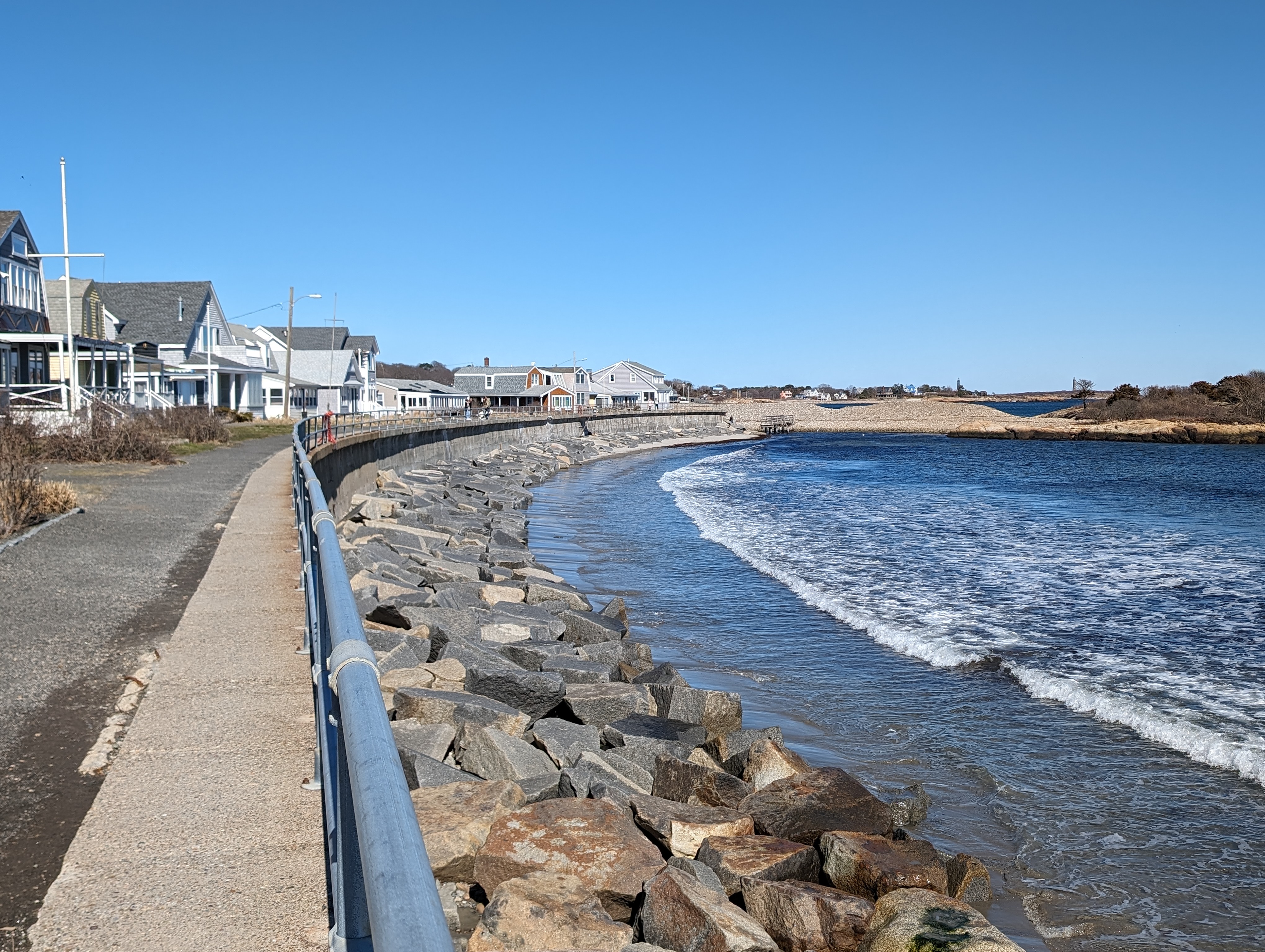
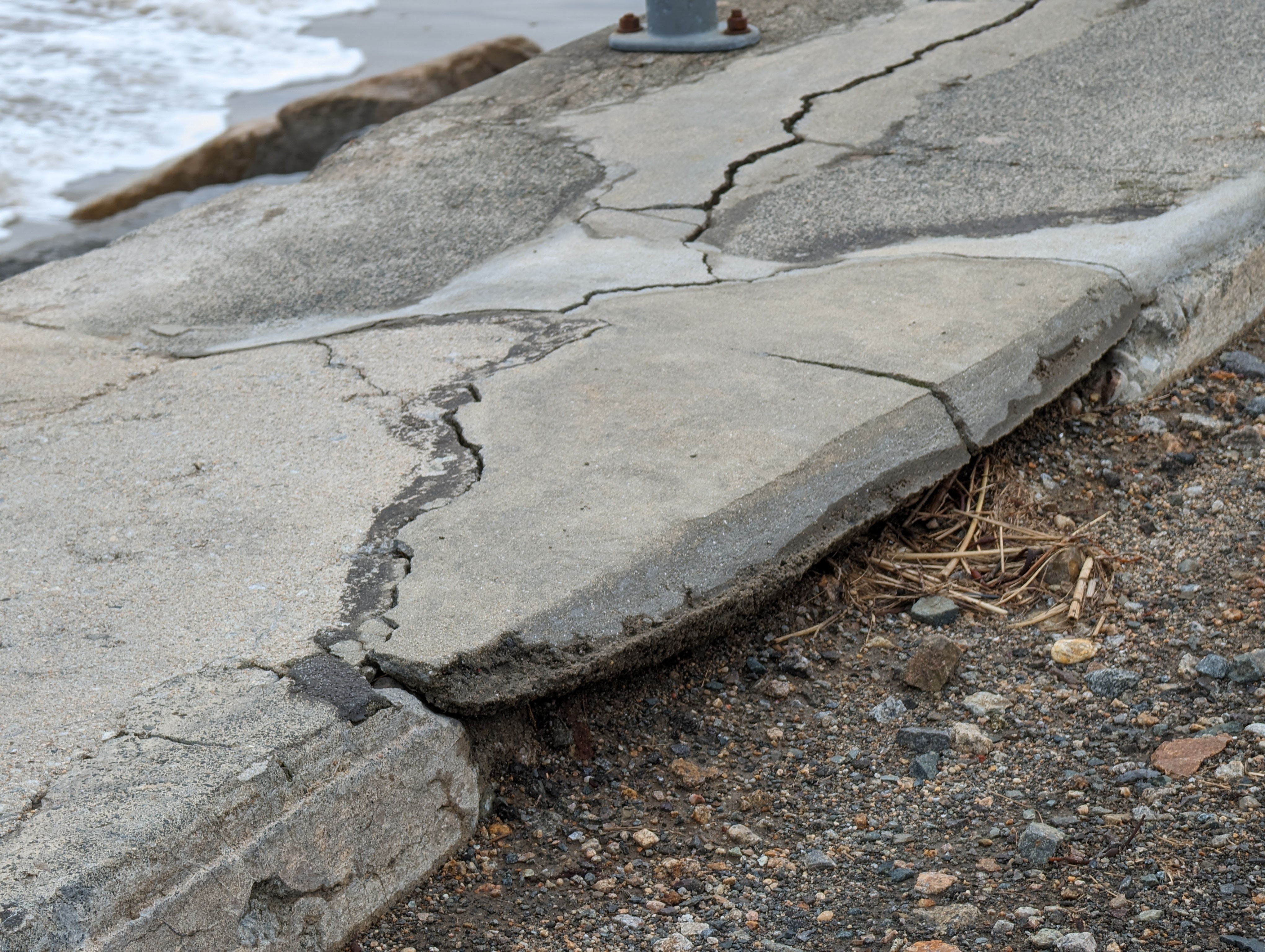
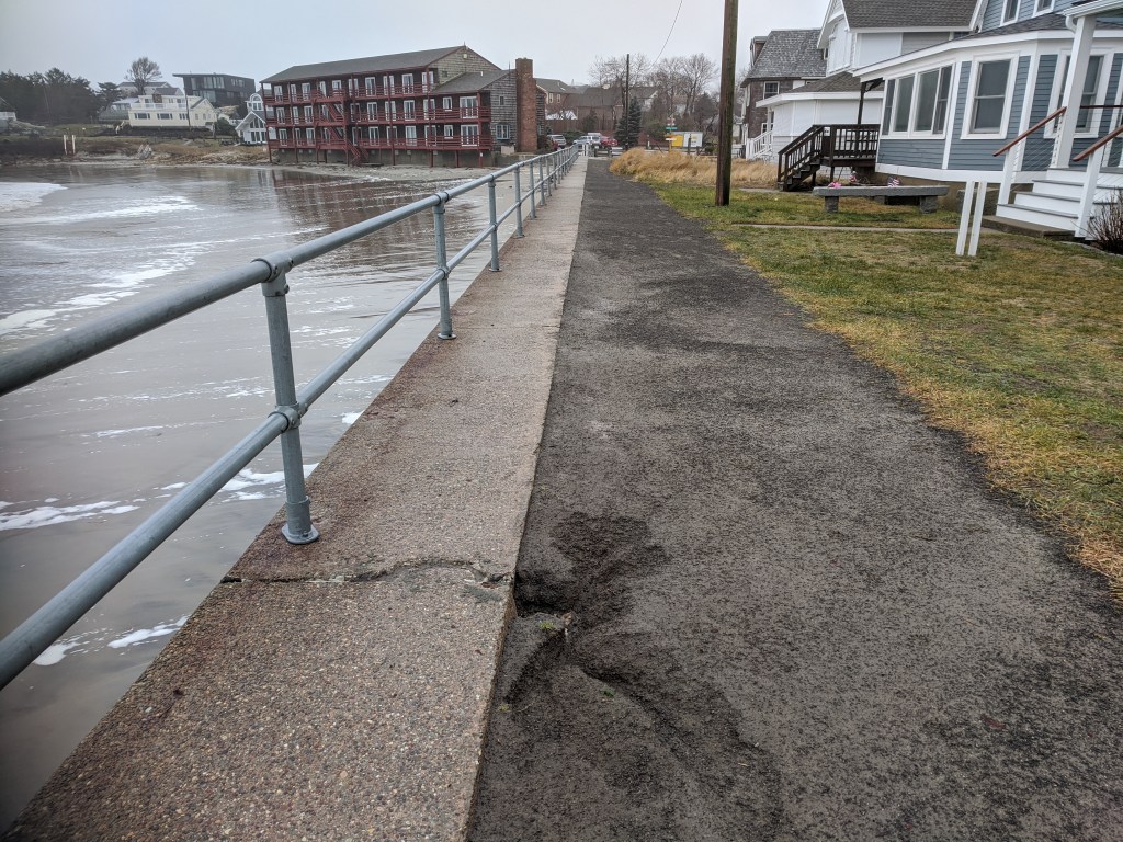
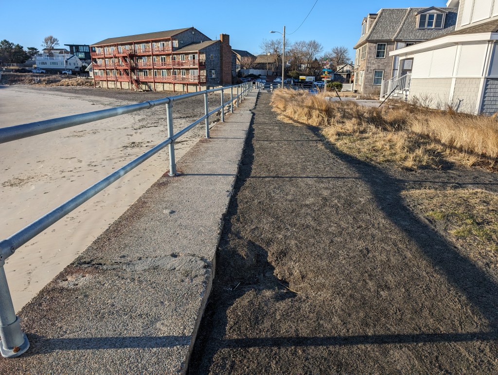
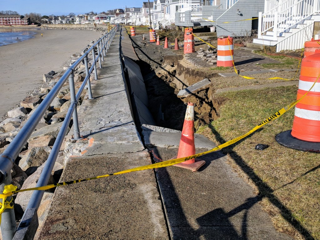
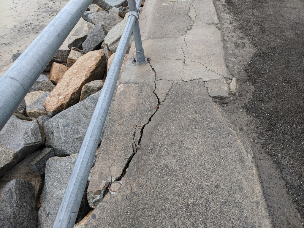
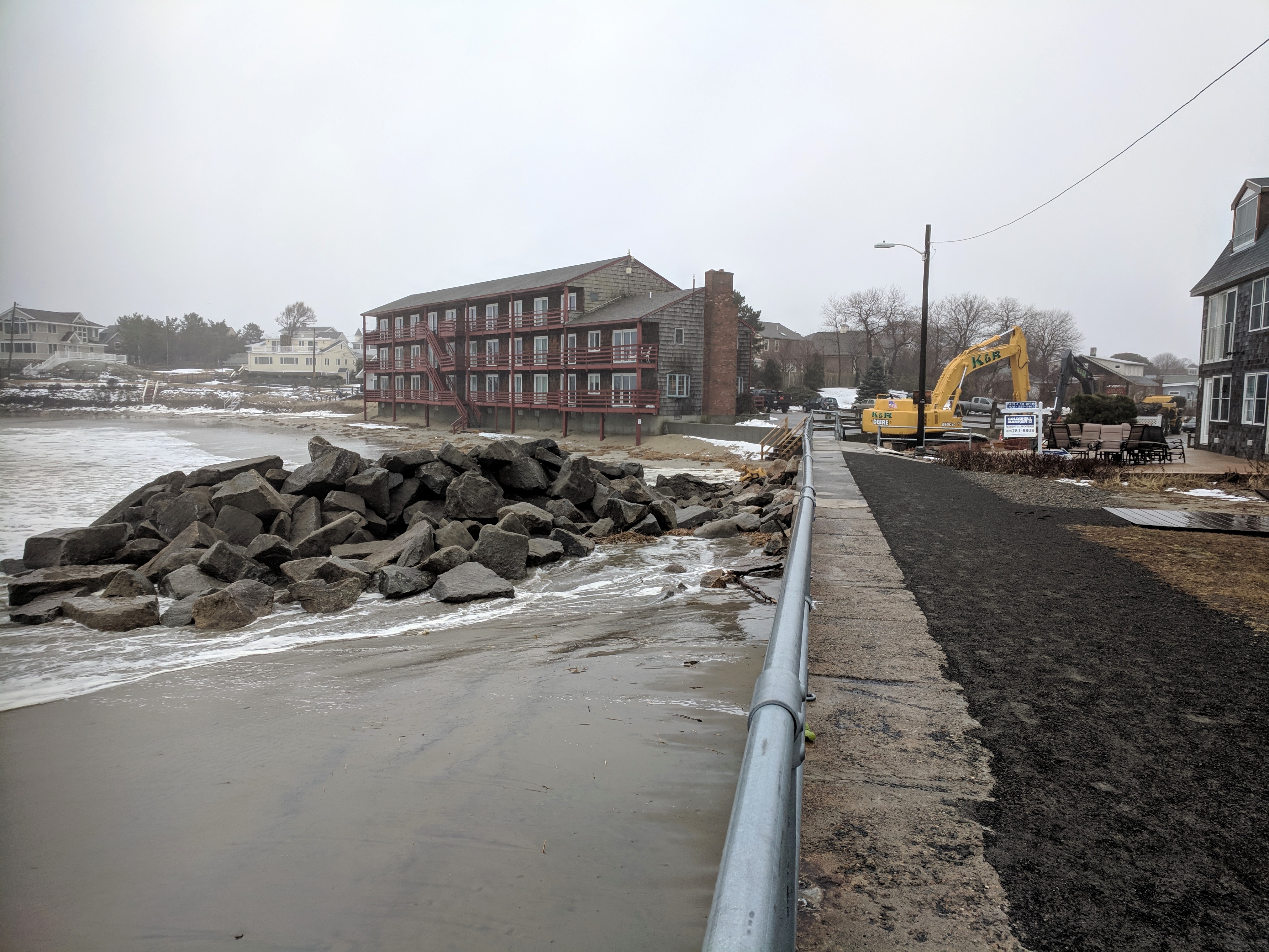
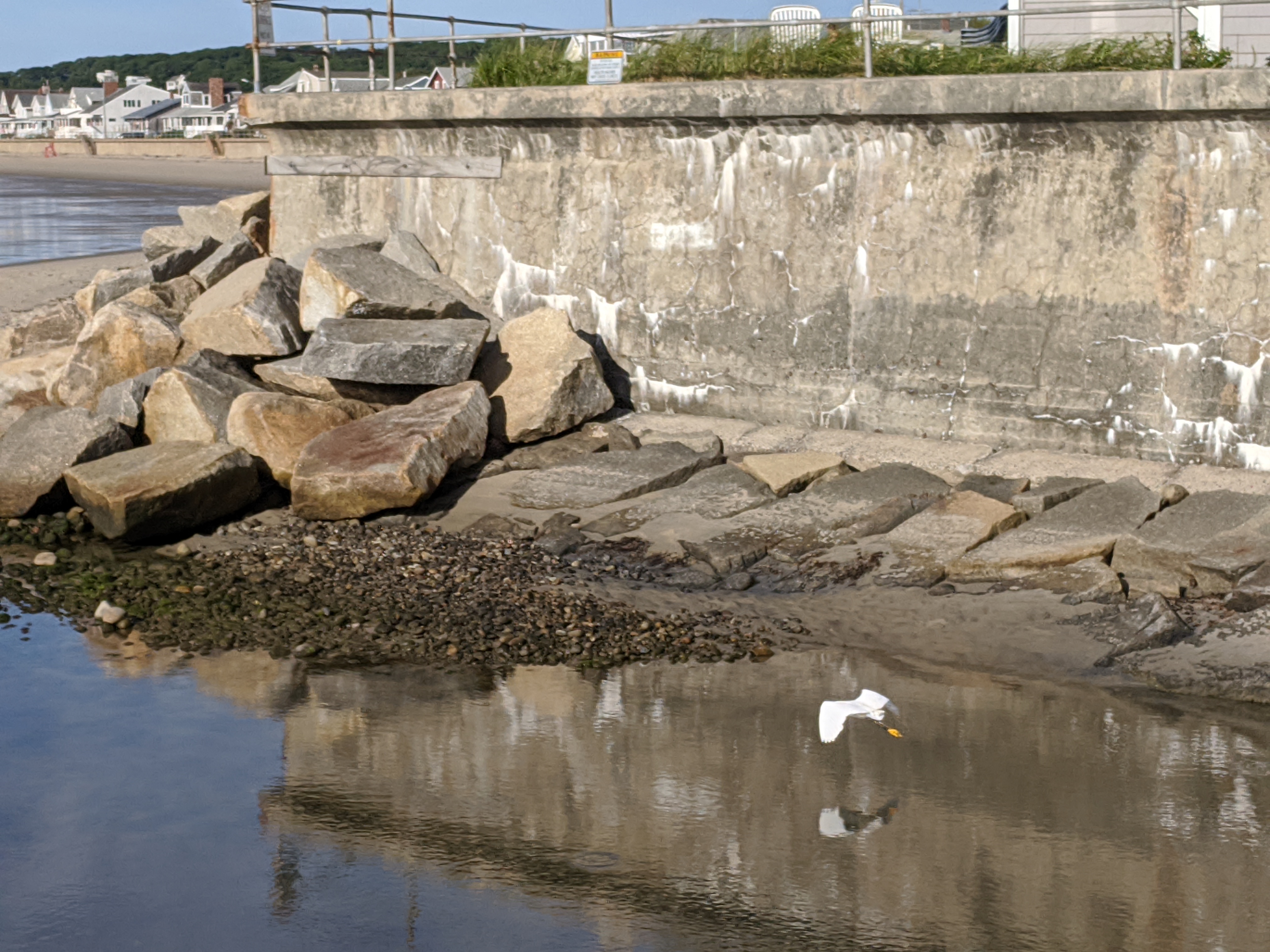
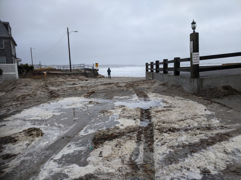
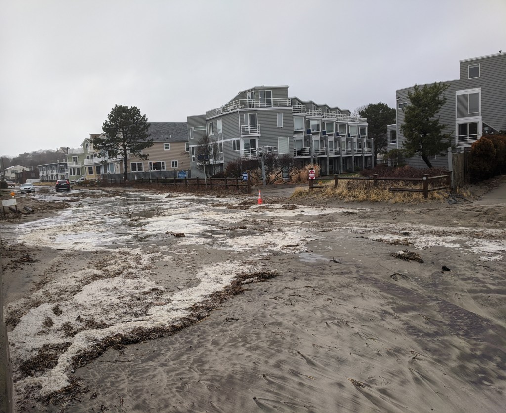
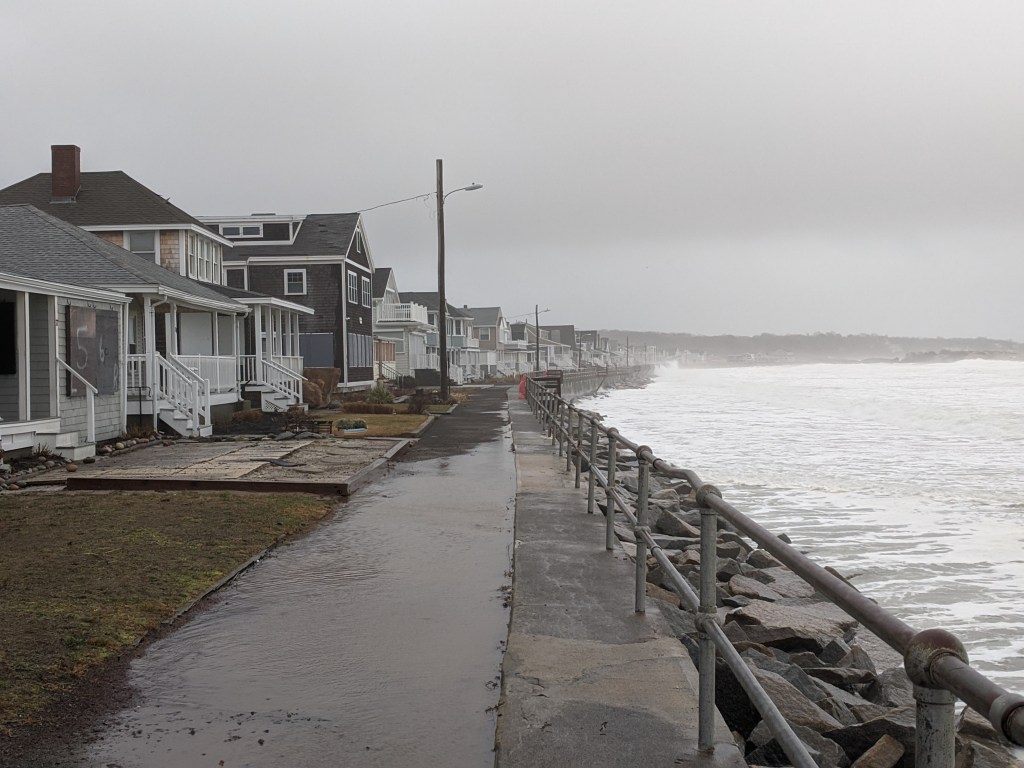
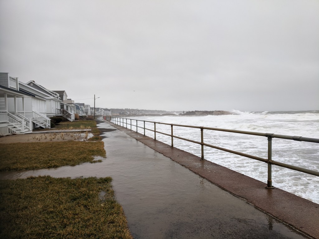
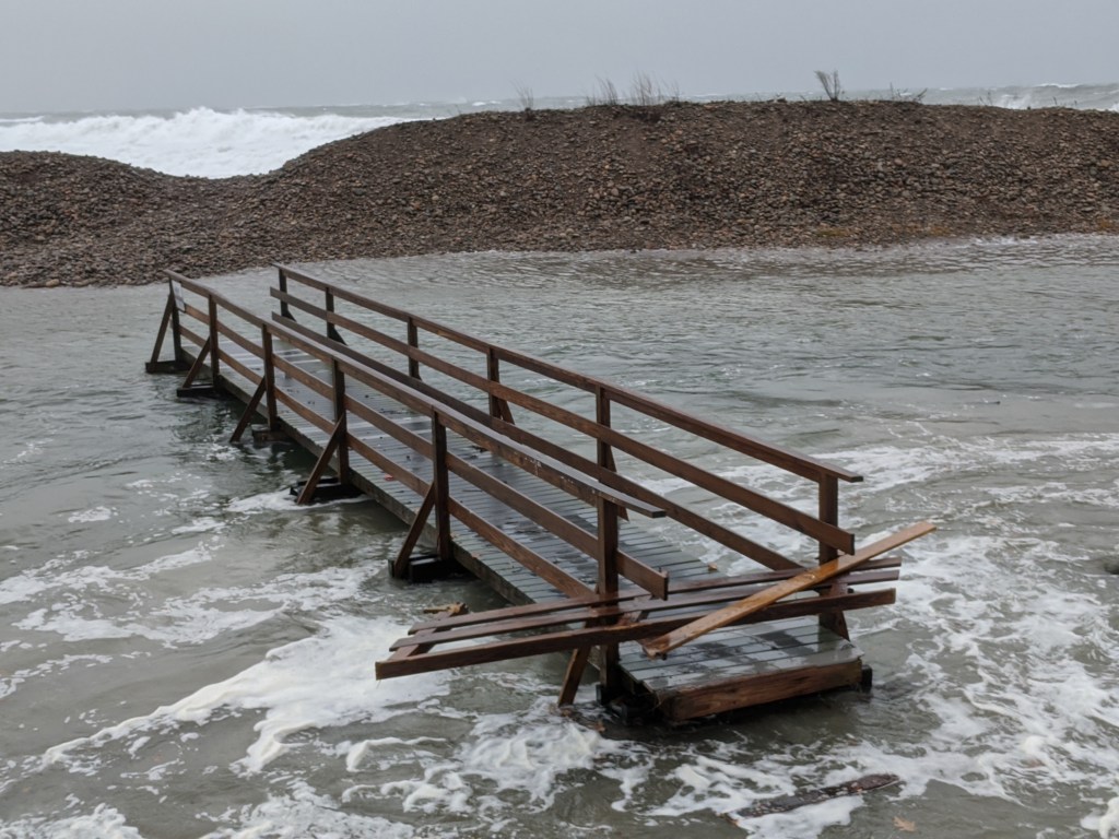
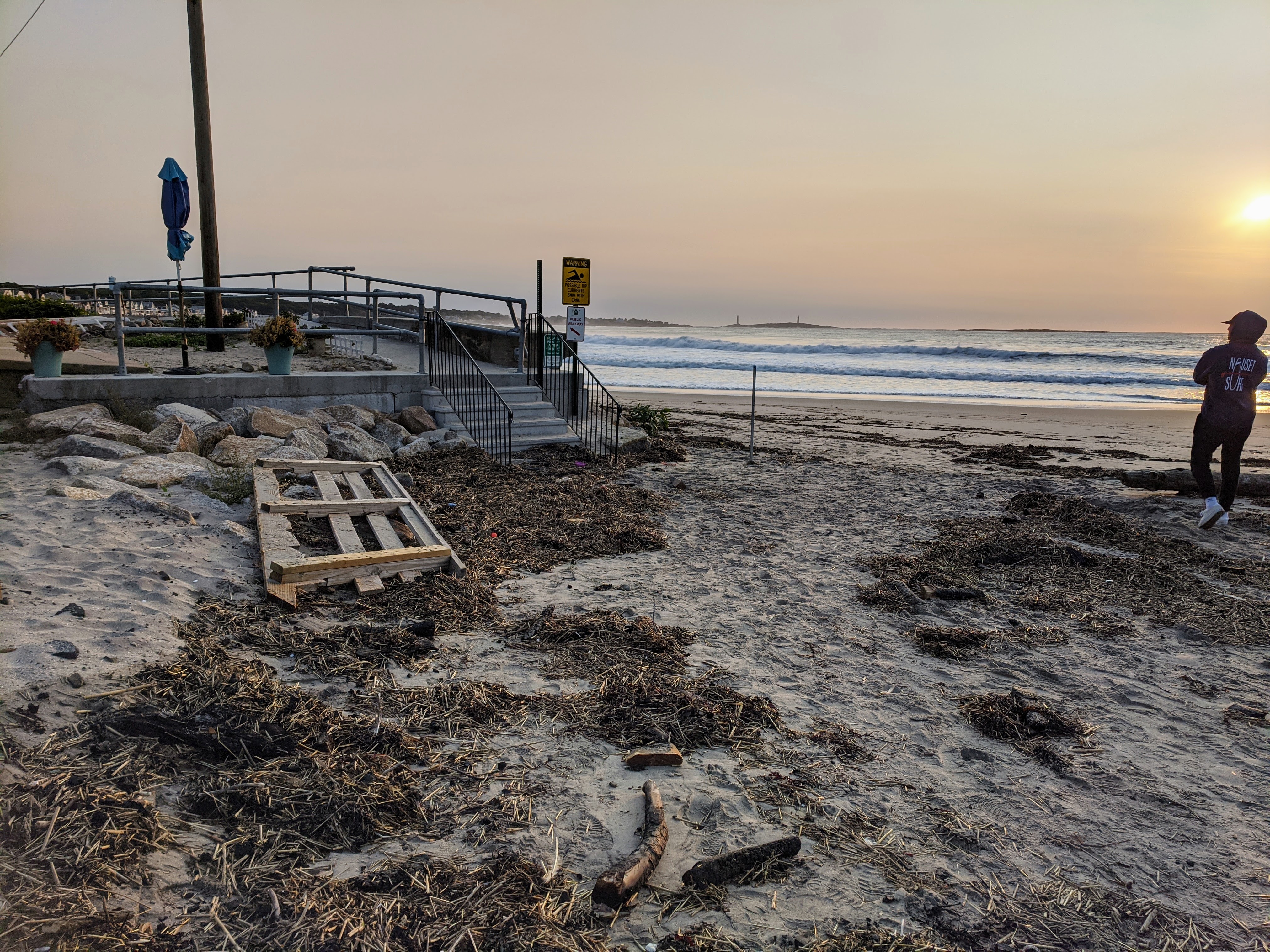
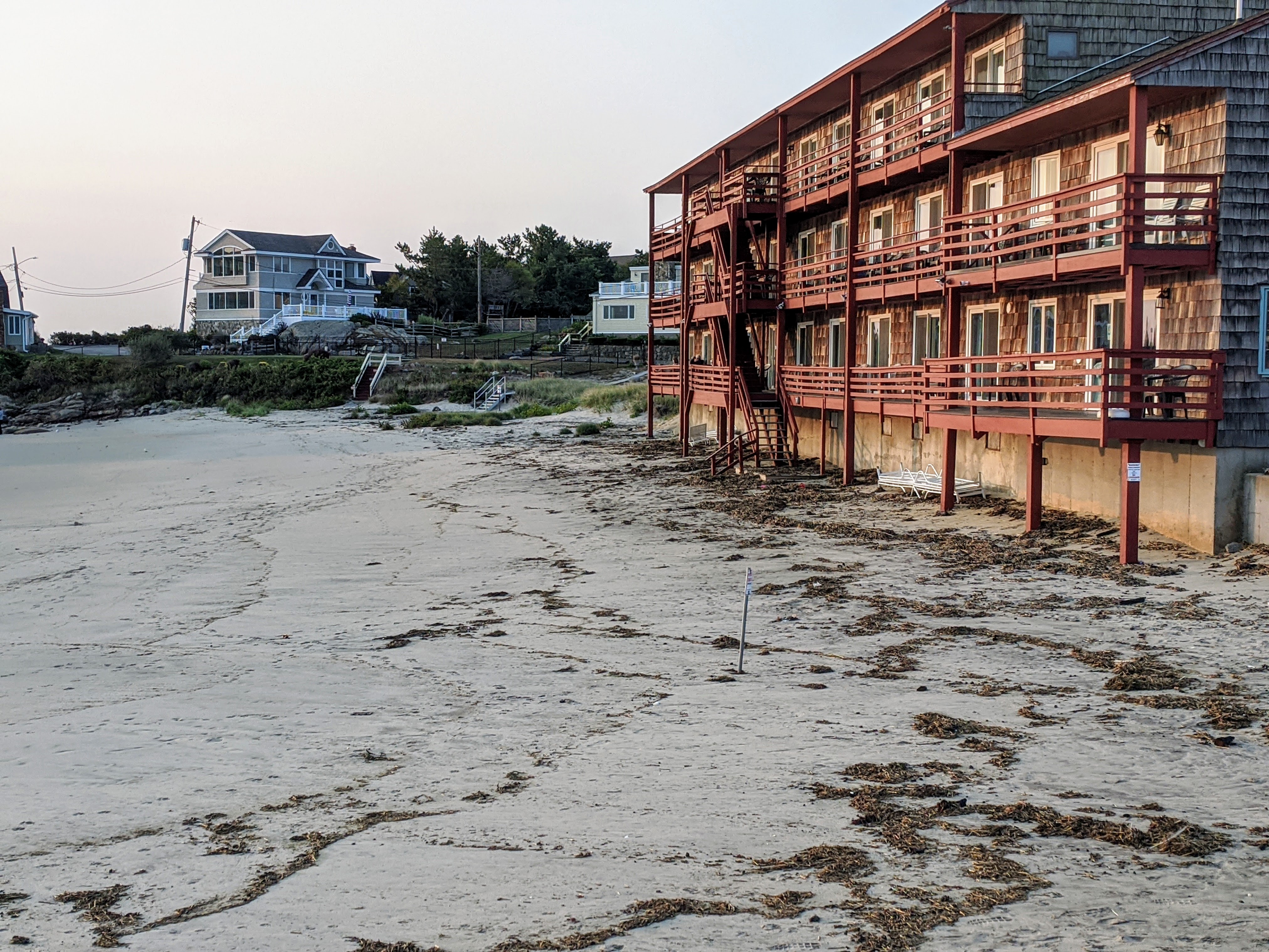
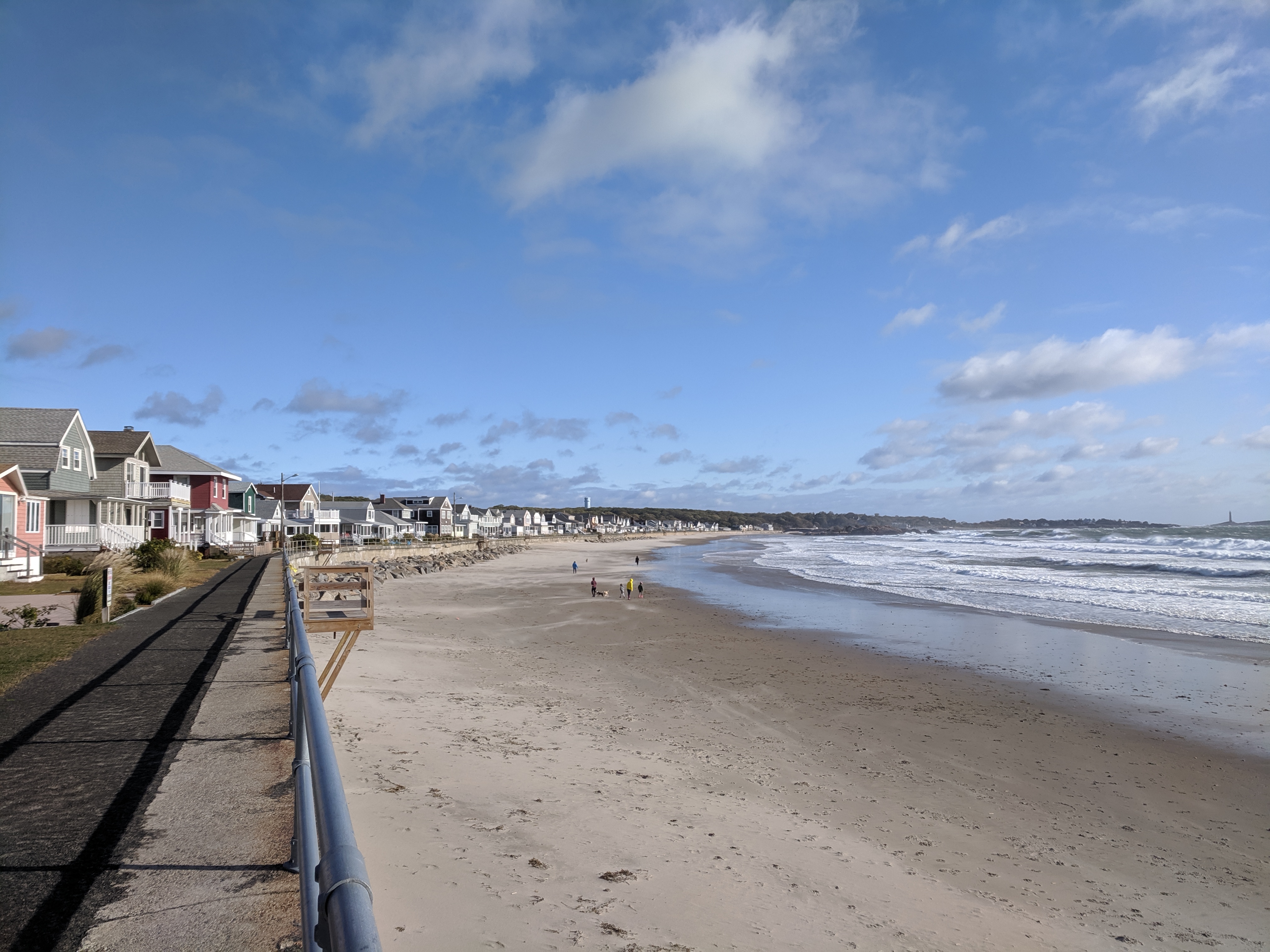
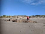
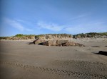
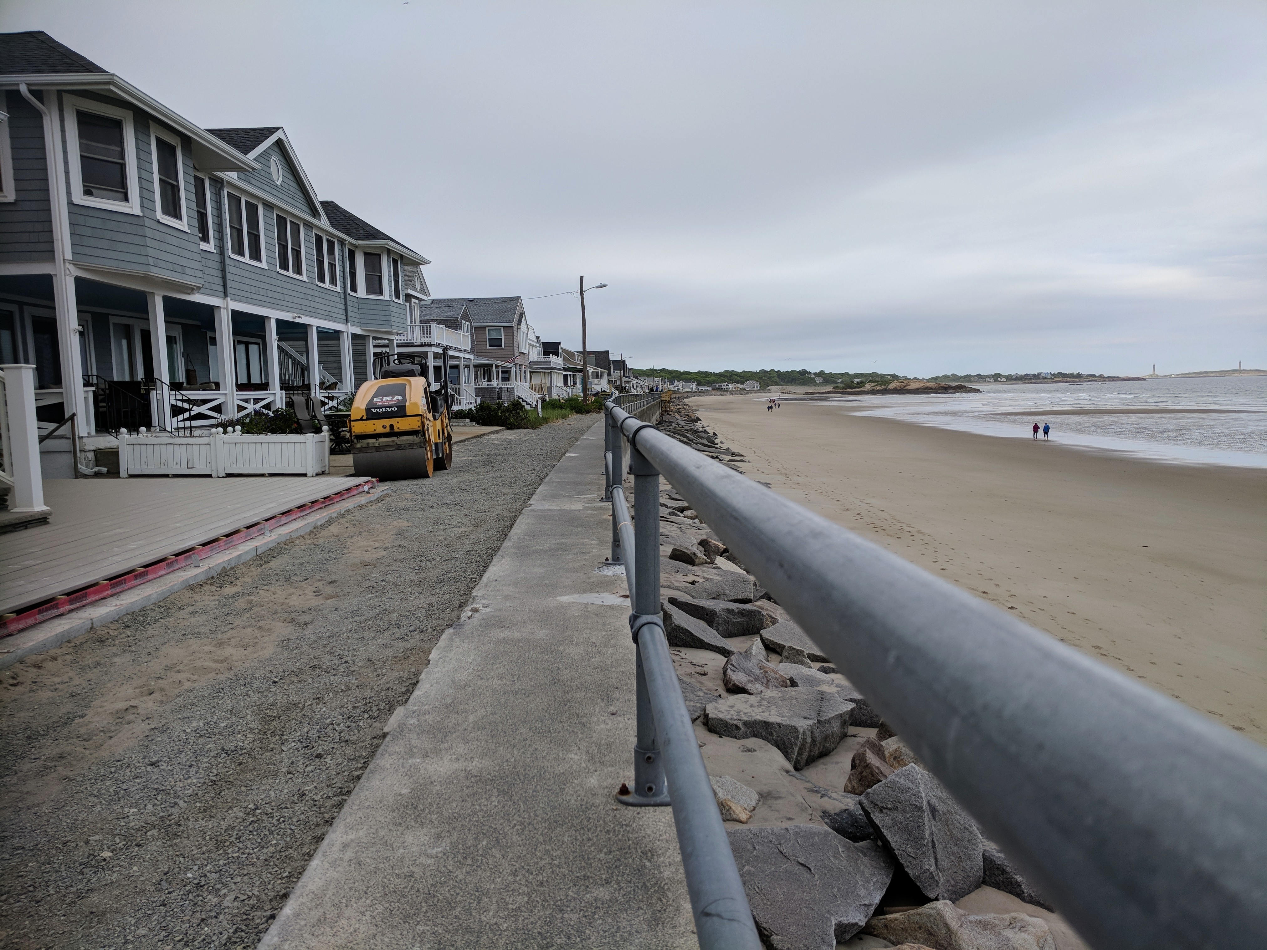
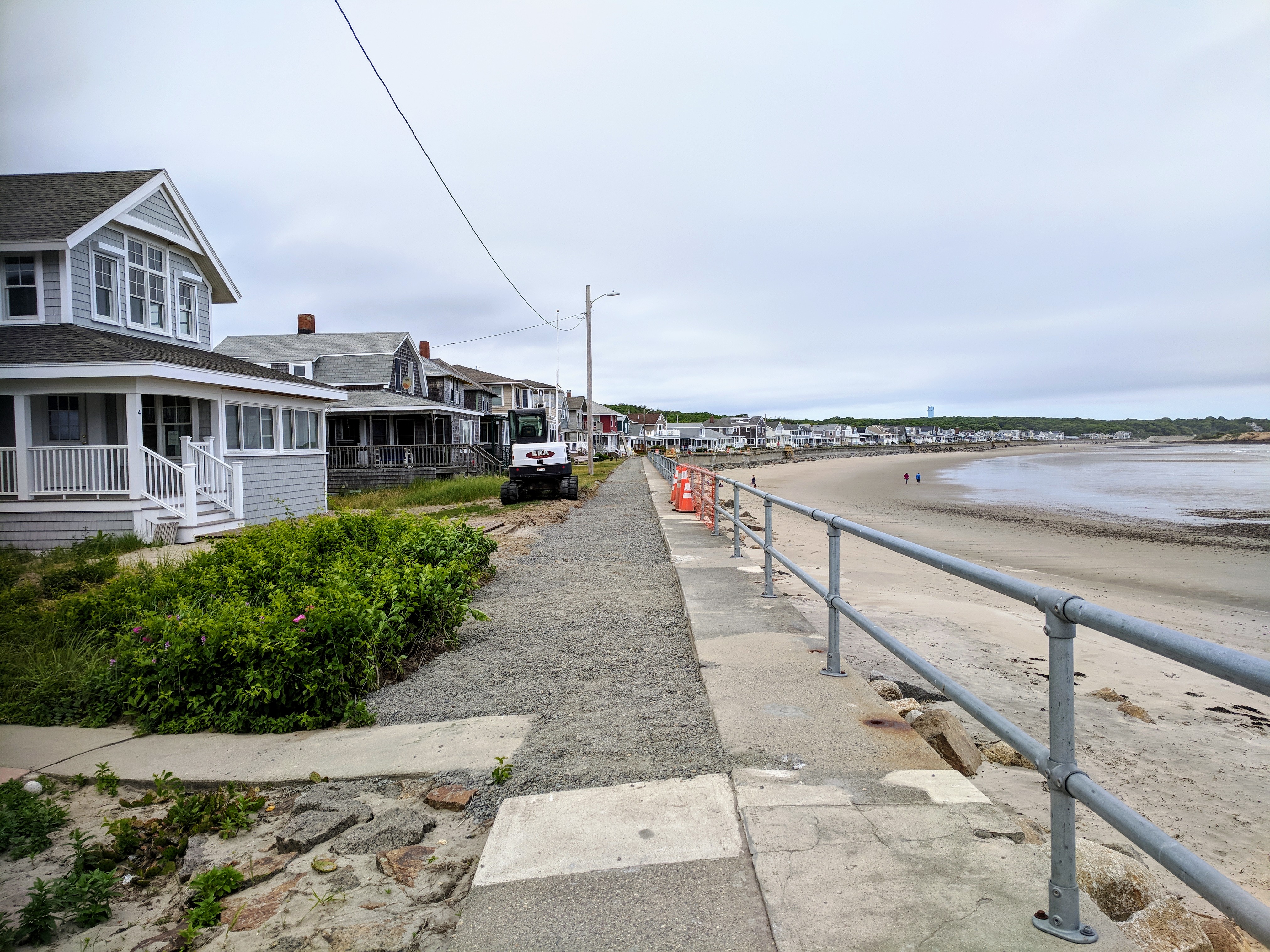
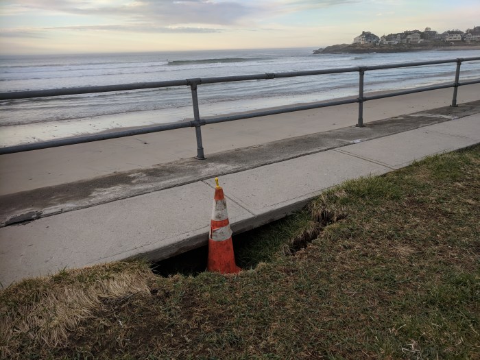
Photo series journaling the impact from the 2023-24 winter storms and tides. Much of the wall and walkway look great.
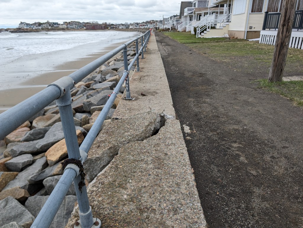
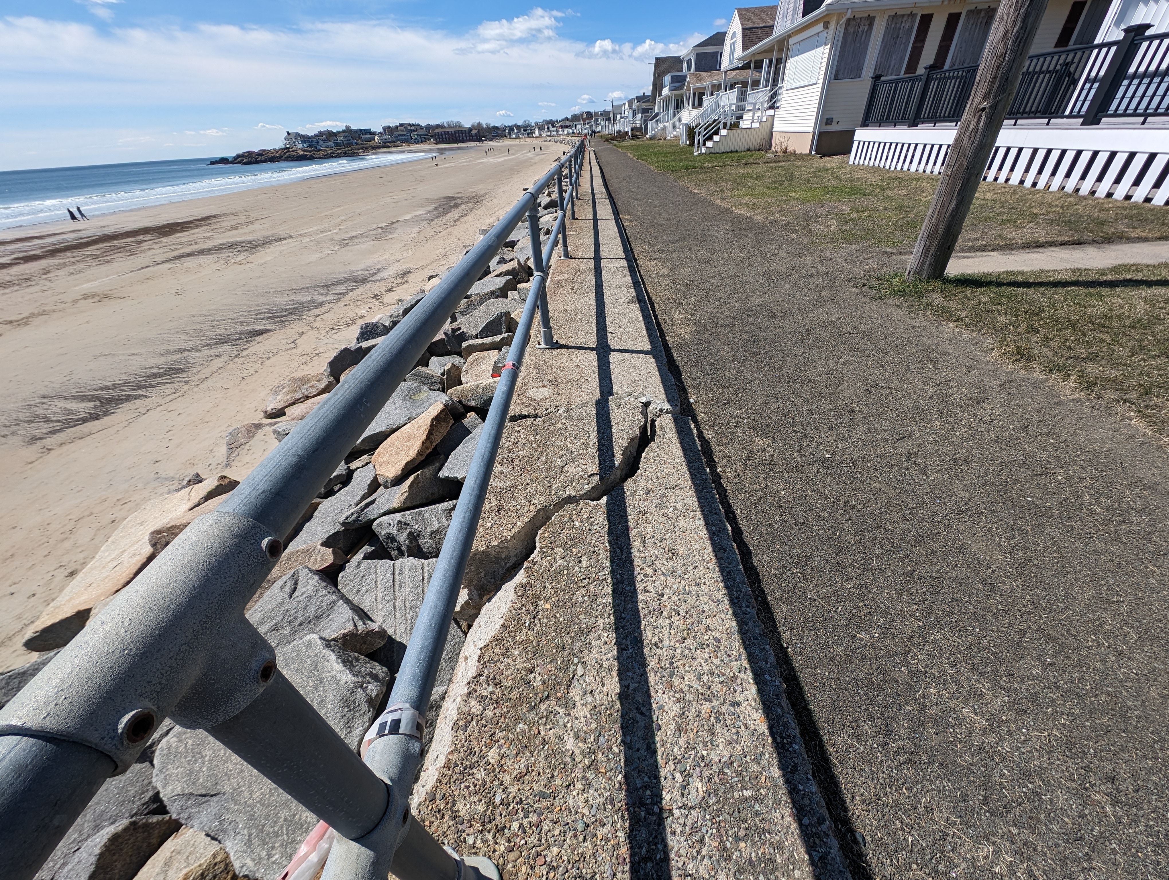
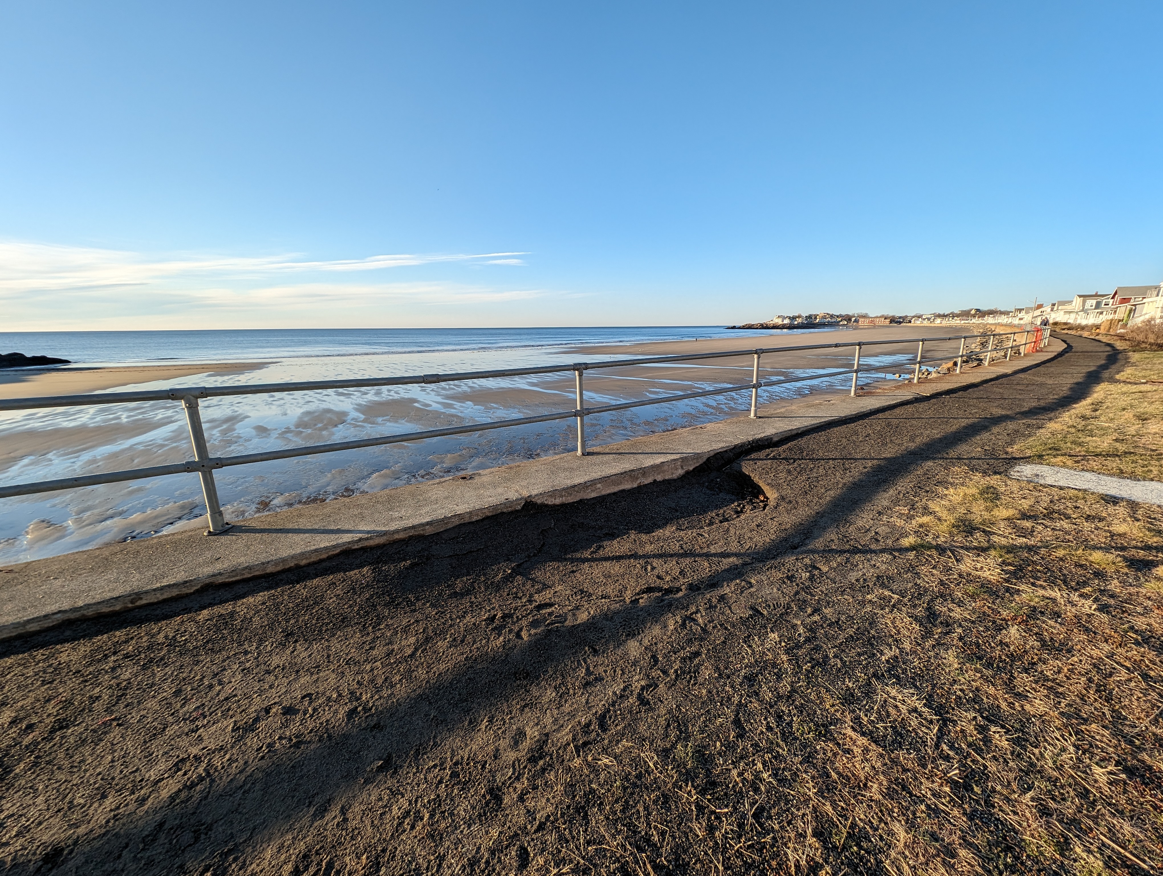
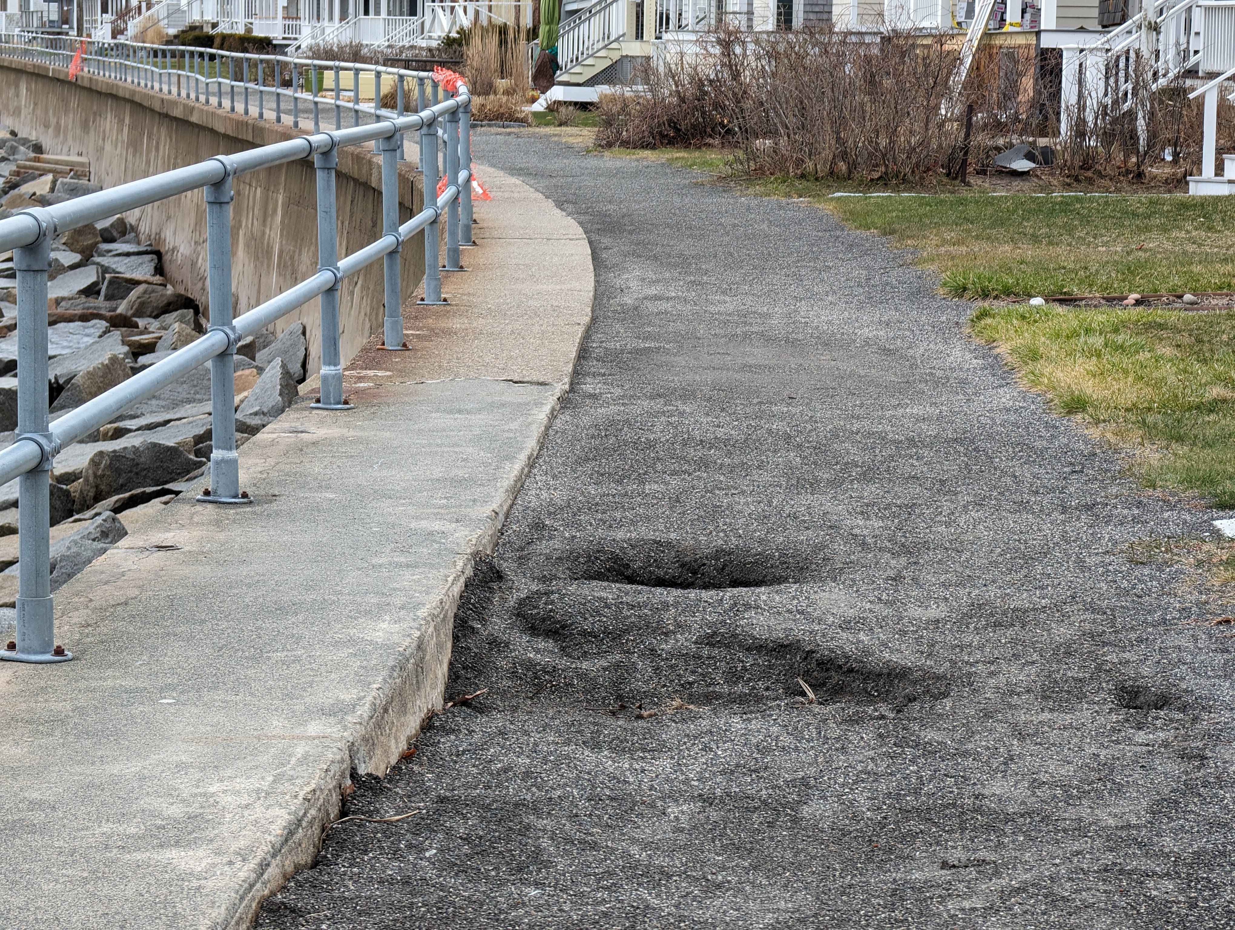
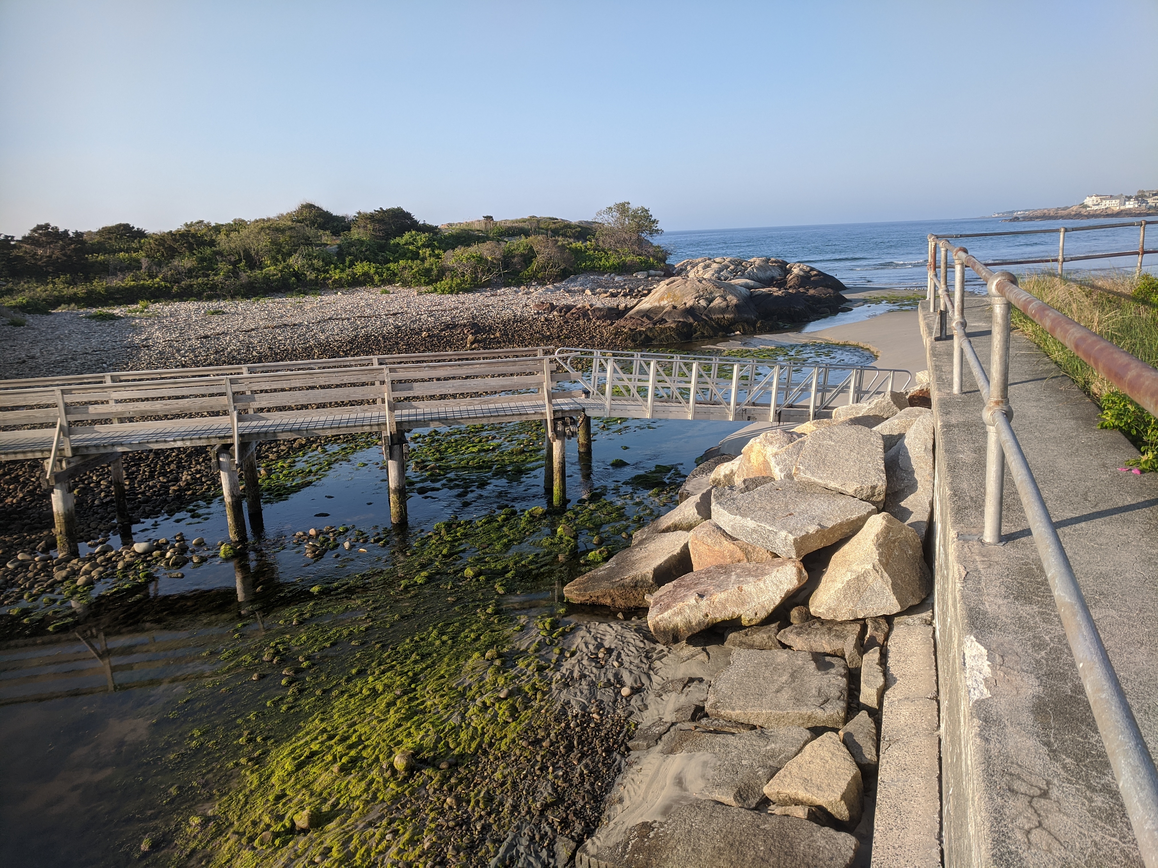
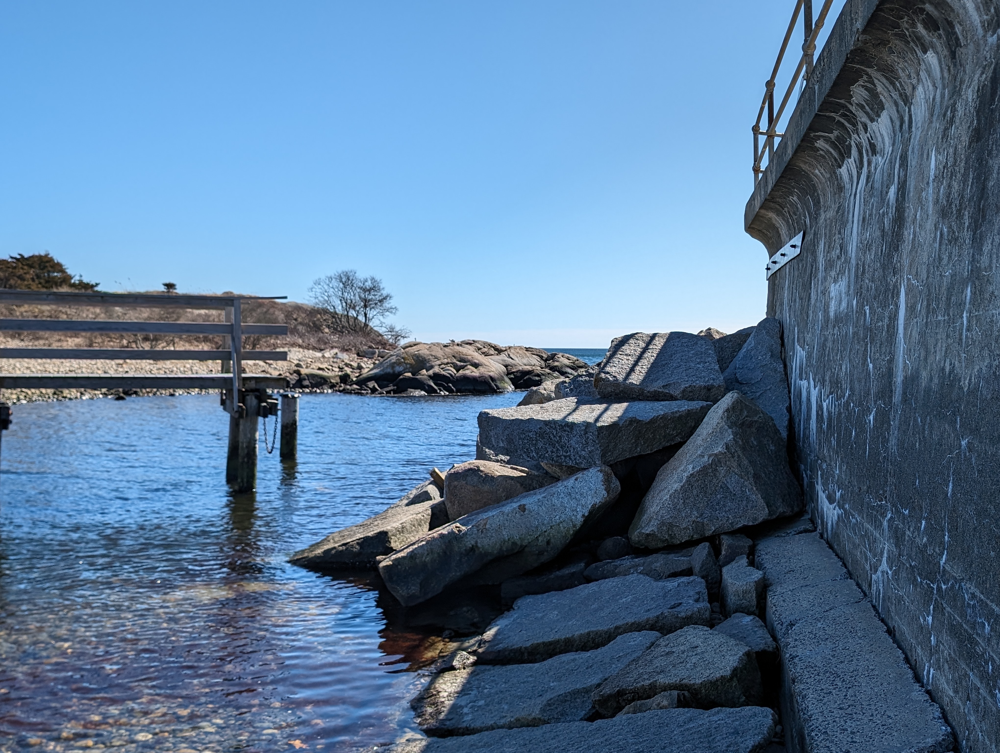
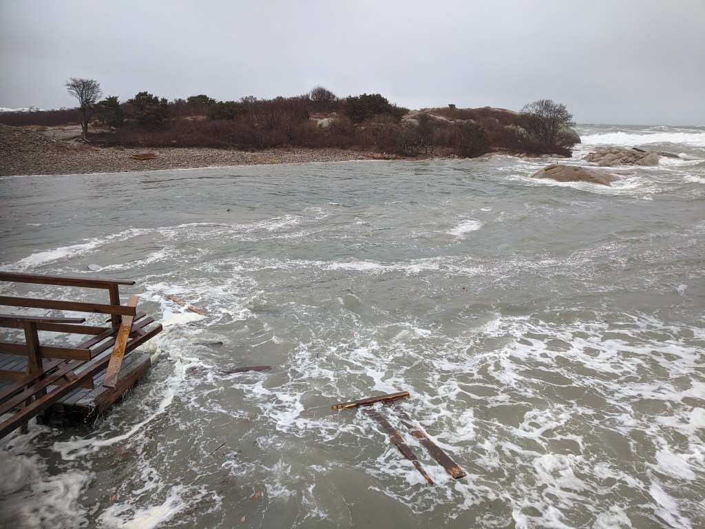
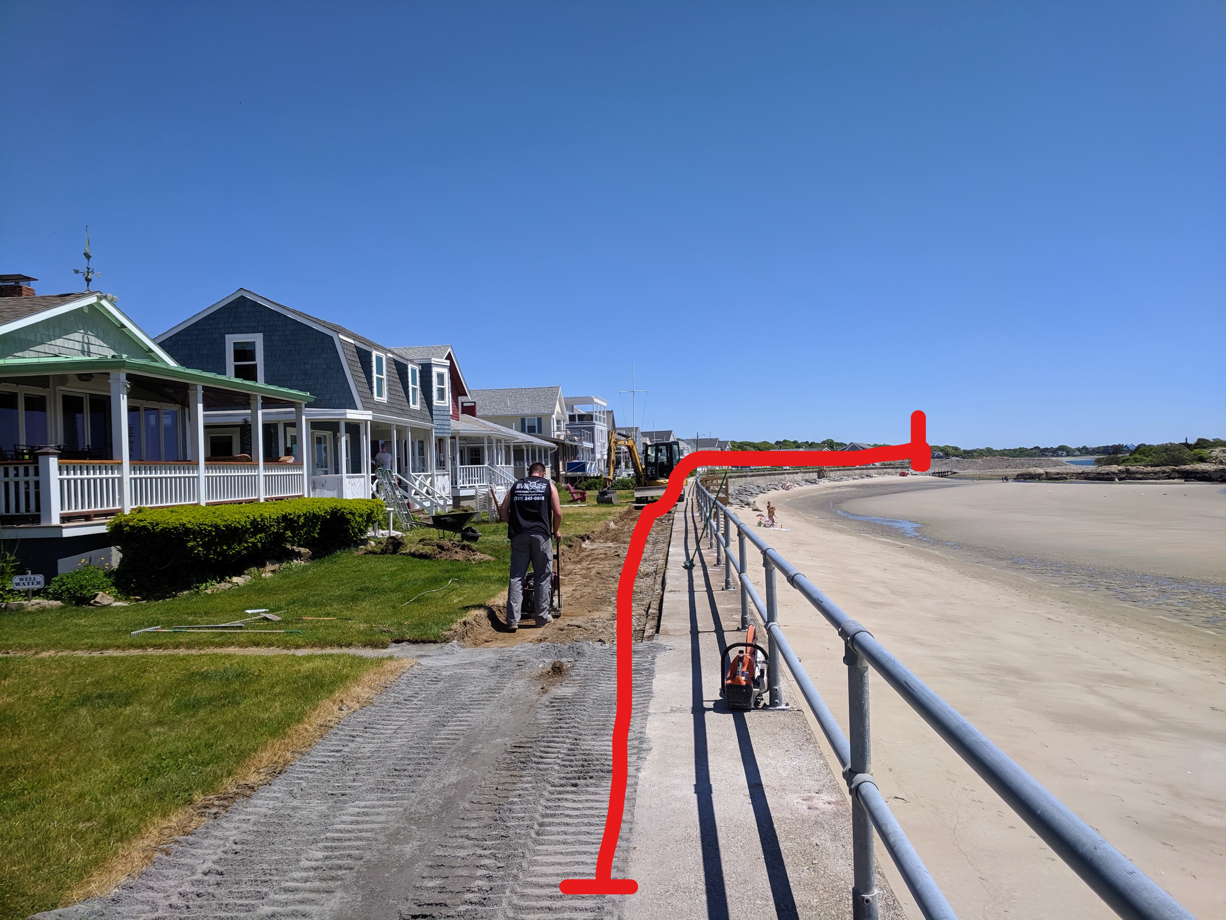
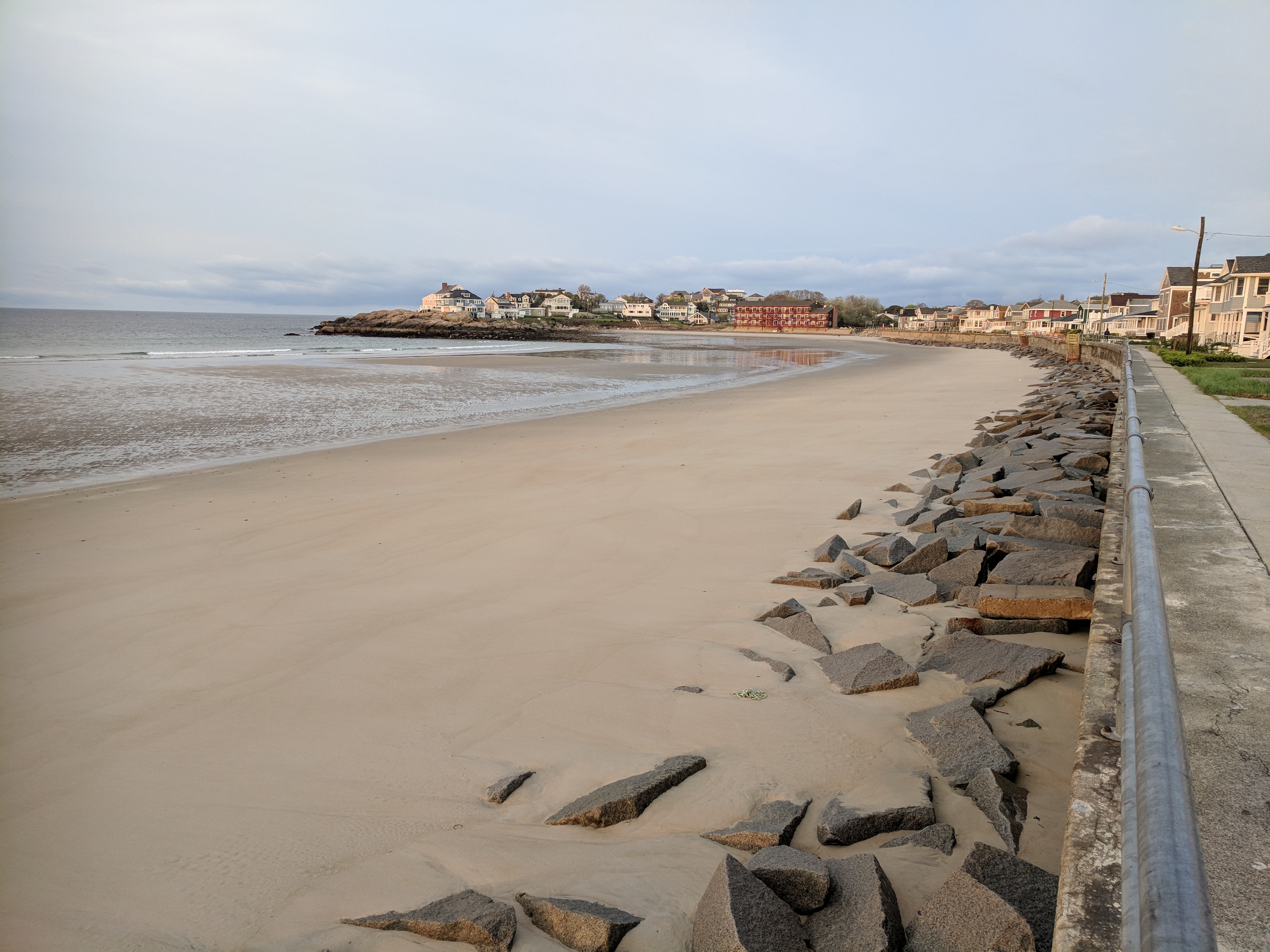
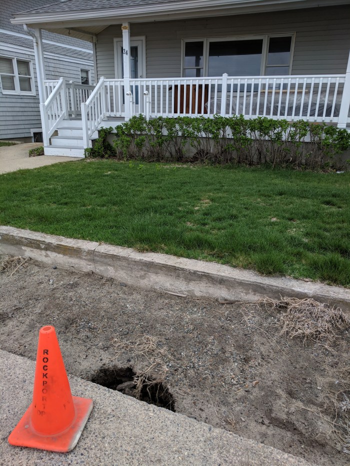
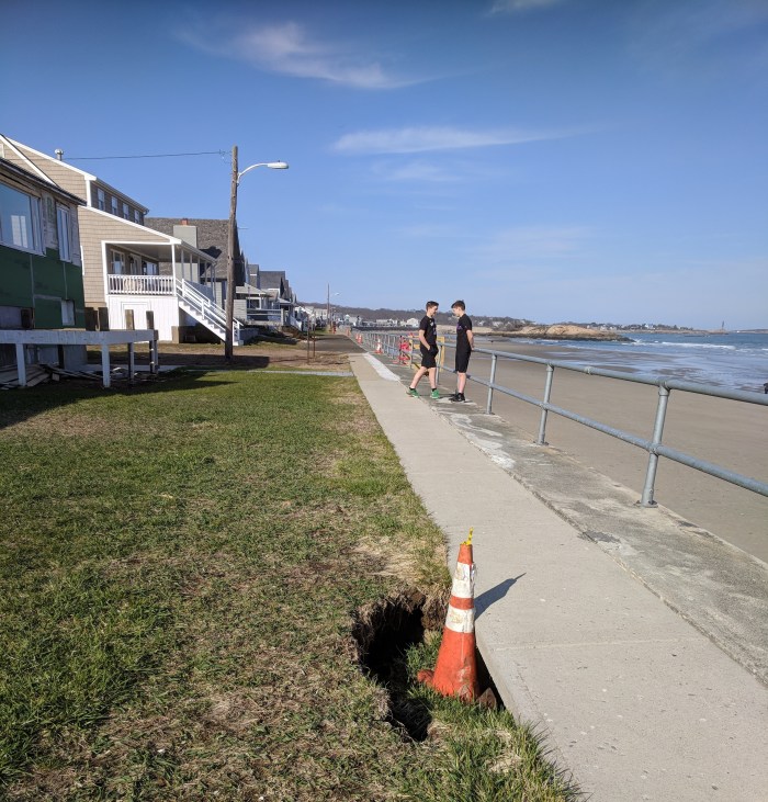
The packed soil walkway atop the Long Beach seawall shows a loss of 1″ to 6″ vertical height, scraped for stretches along most of the wall (and more than a foot high loss by the old hotel). There are new and old potholes and cracks in the concrete sections beneath the handrail, and a single rapidly enlarging sinkhole at the footbridge end which is ready for a caution cone or barrel.
pinch and zoom to enlarge; right click for description


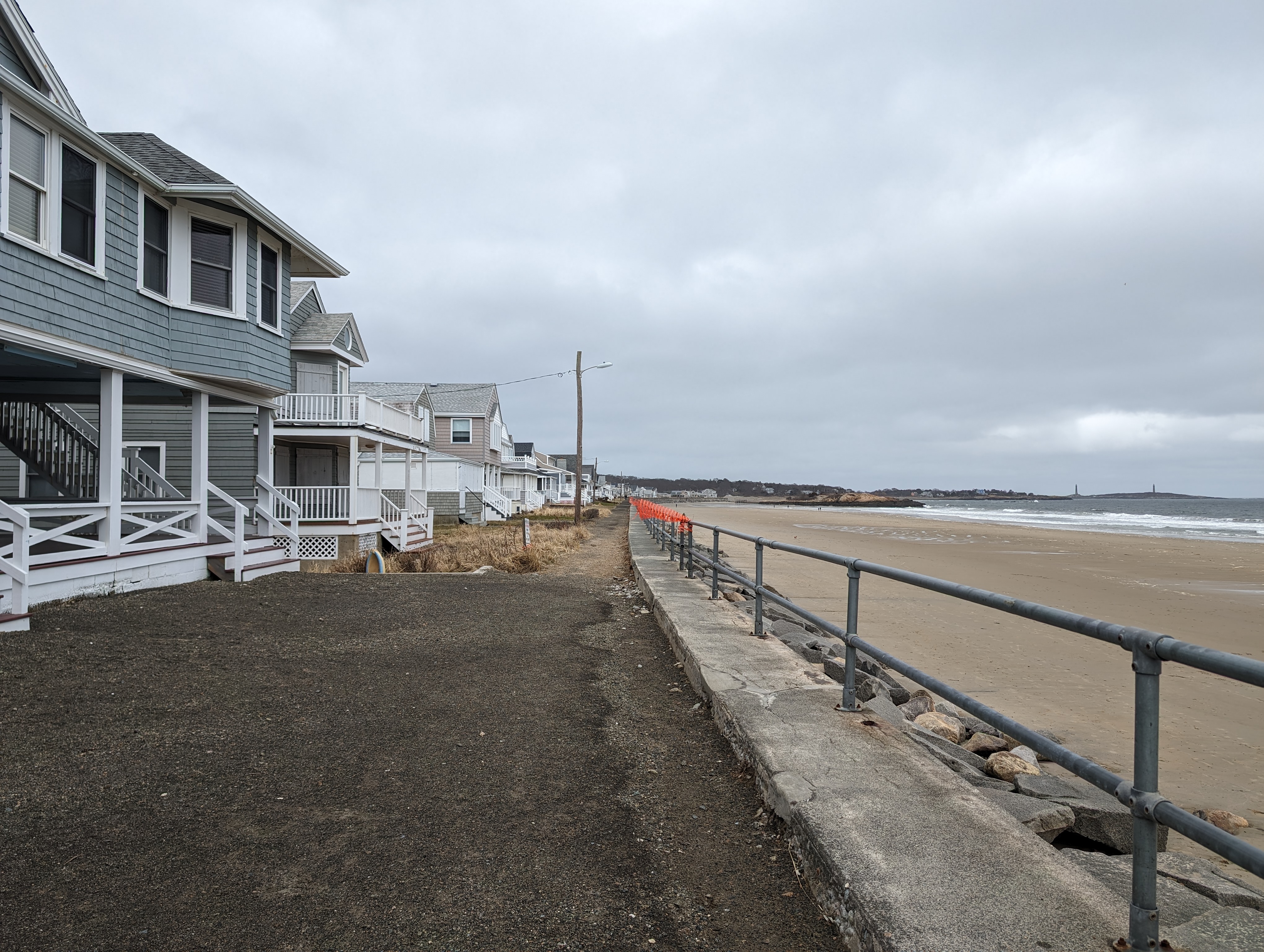

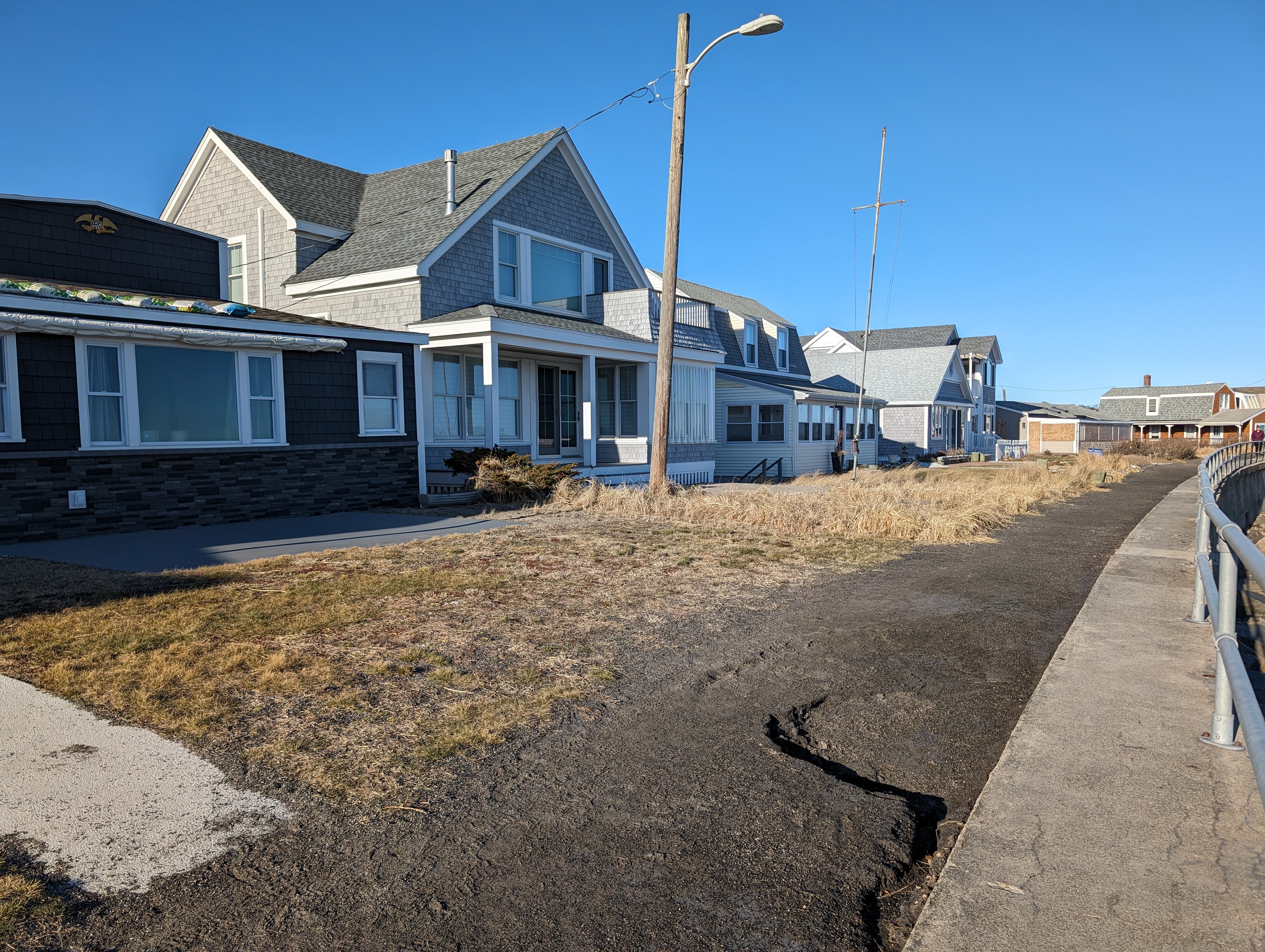
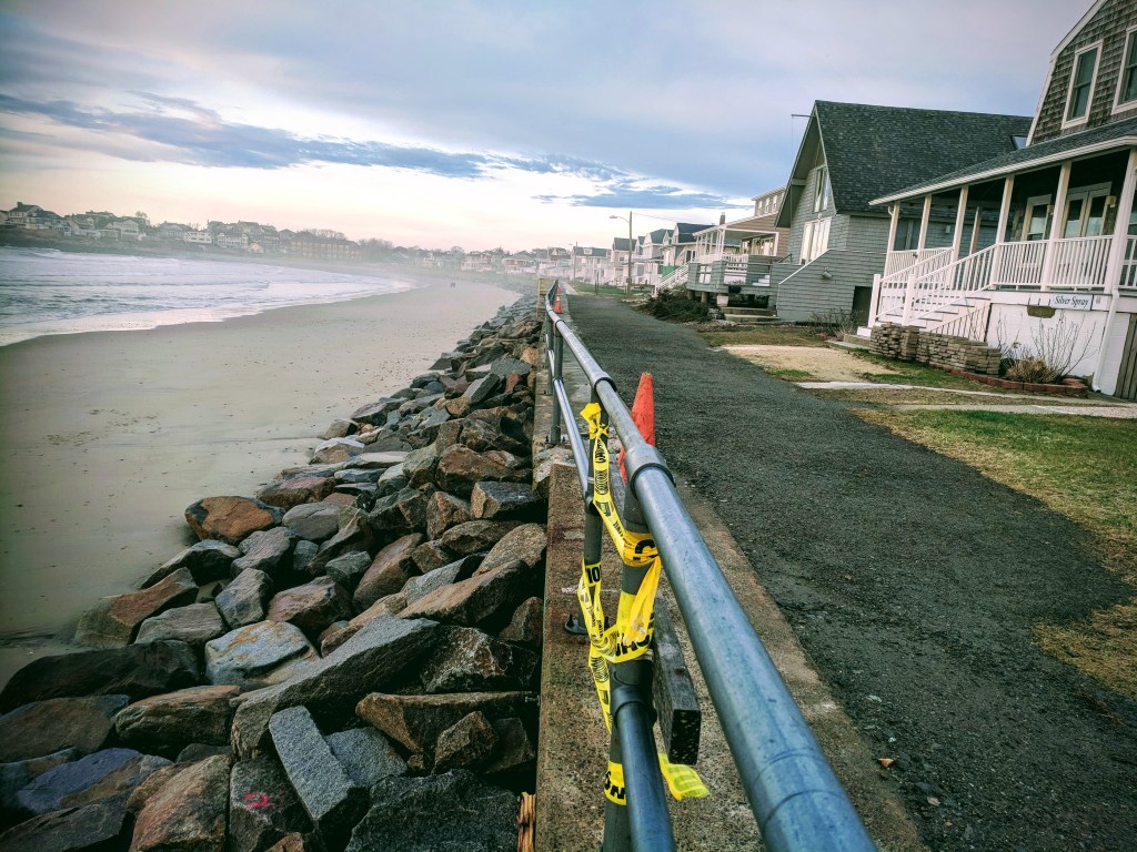
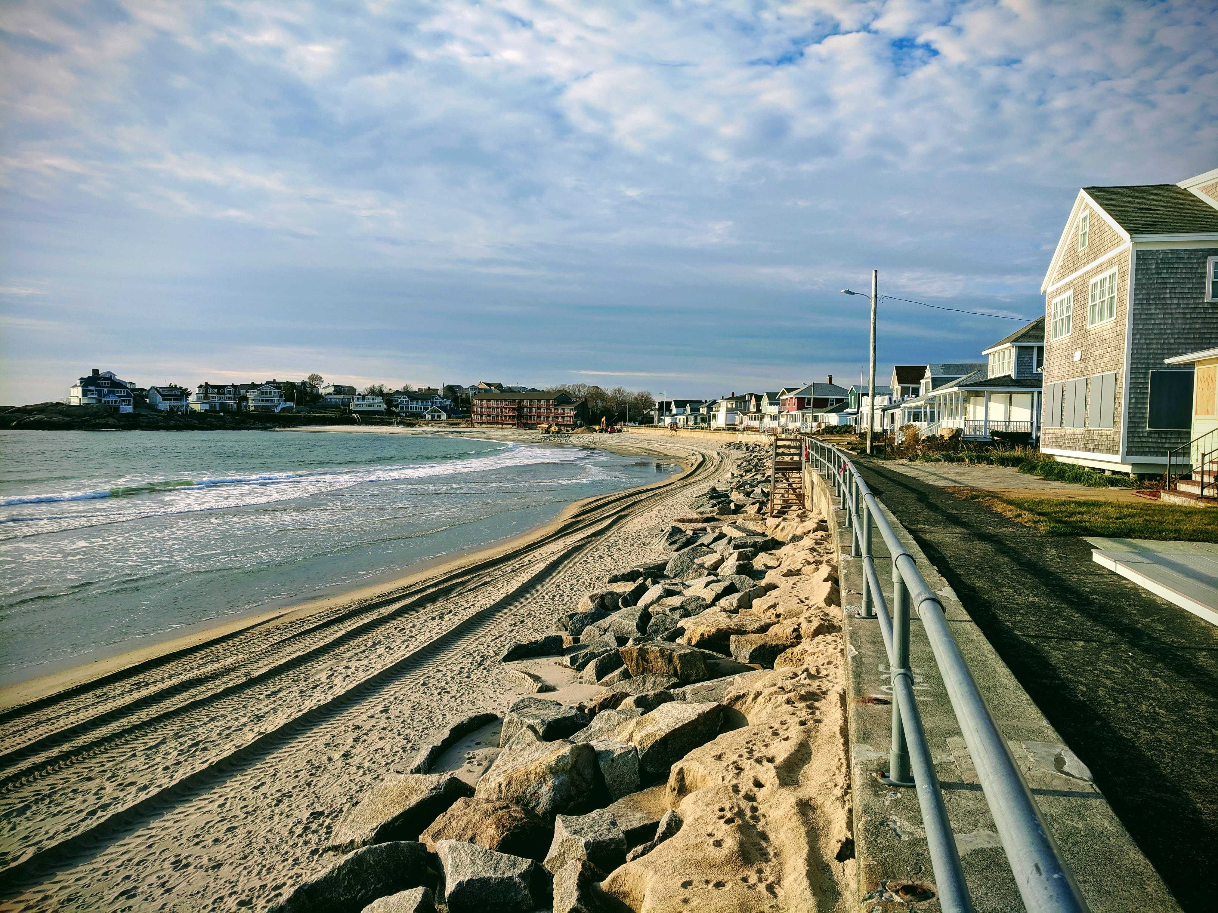
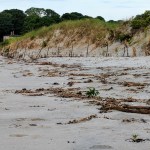
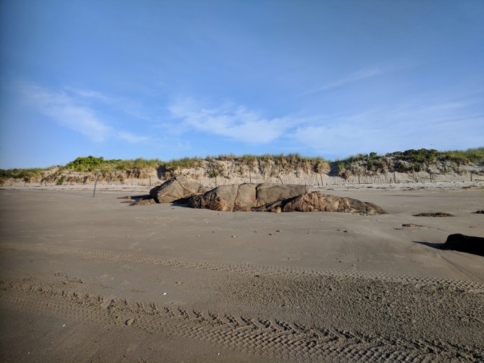
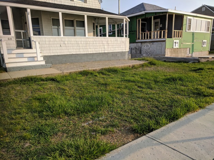
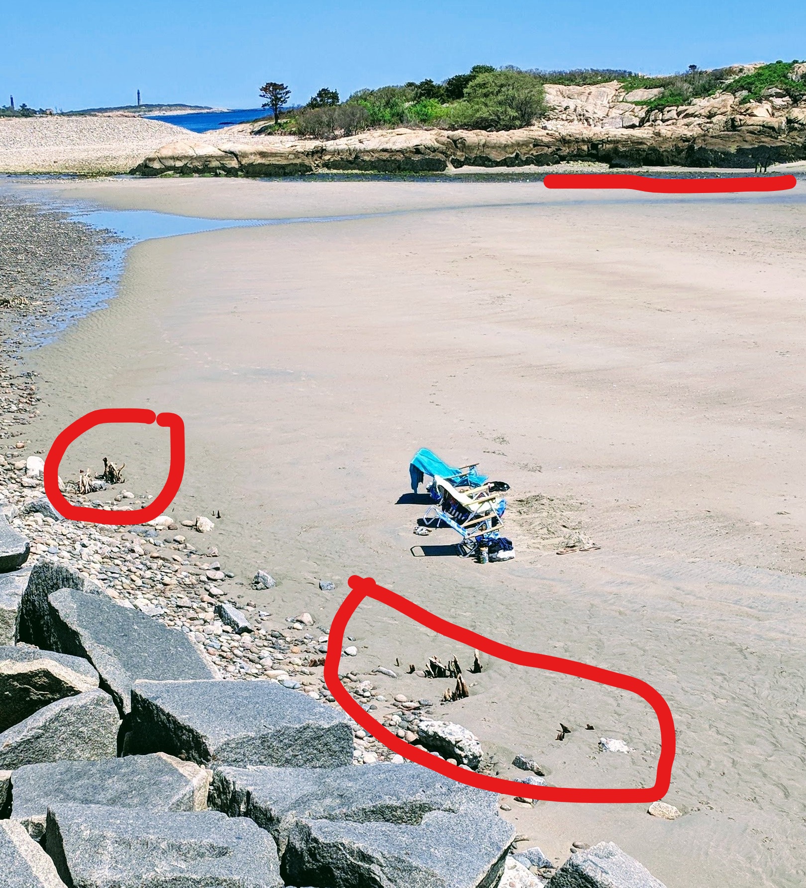
There are a few repeat vulnerable spots that have not grown rapidly (unlike the one in the photo block above).
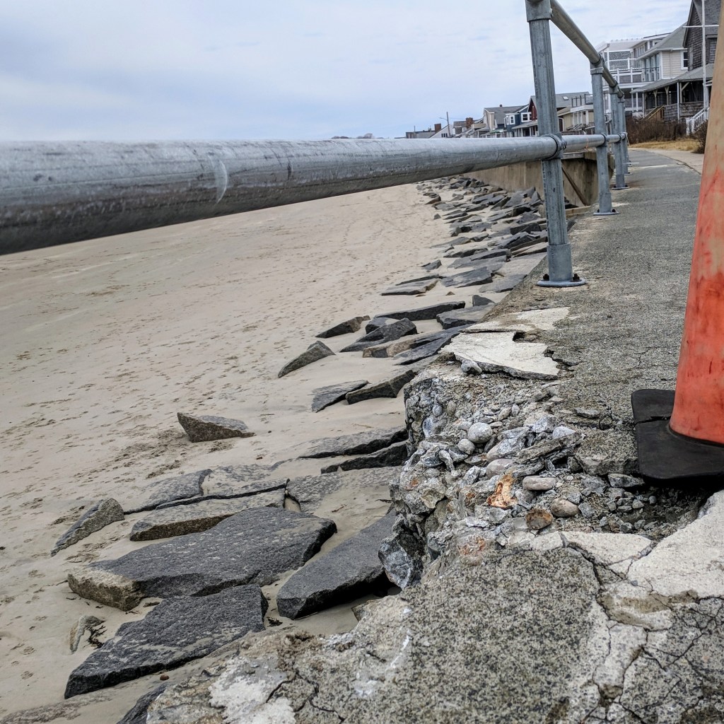
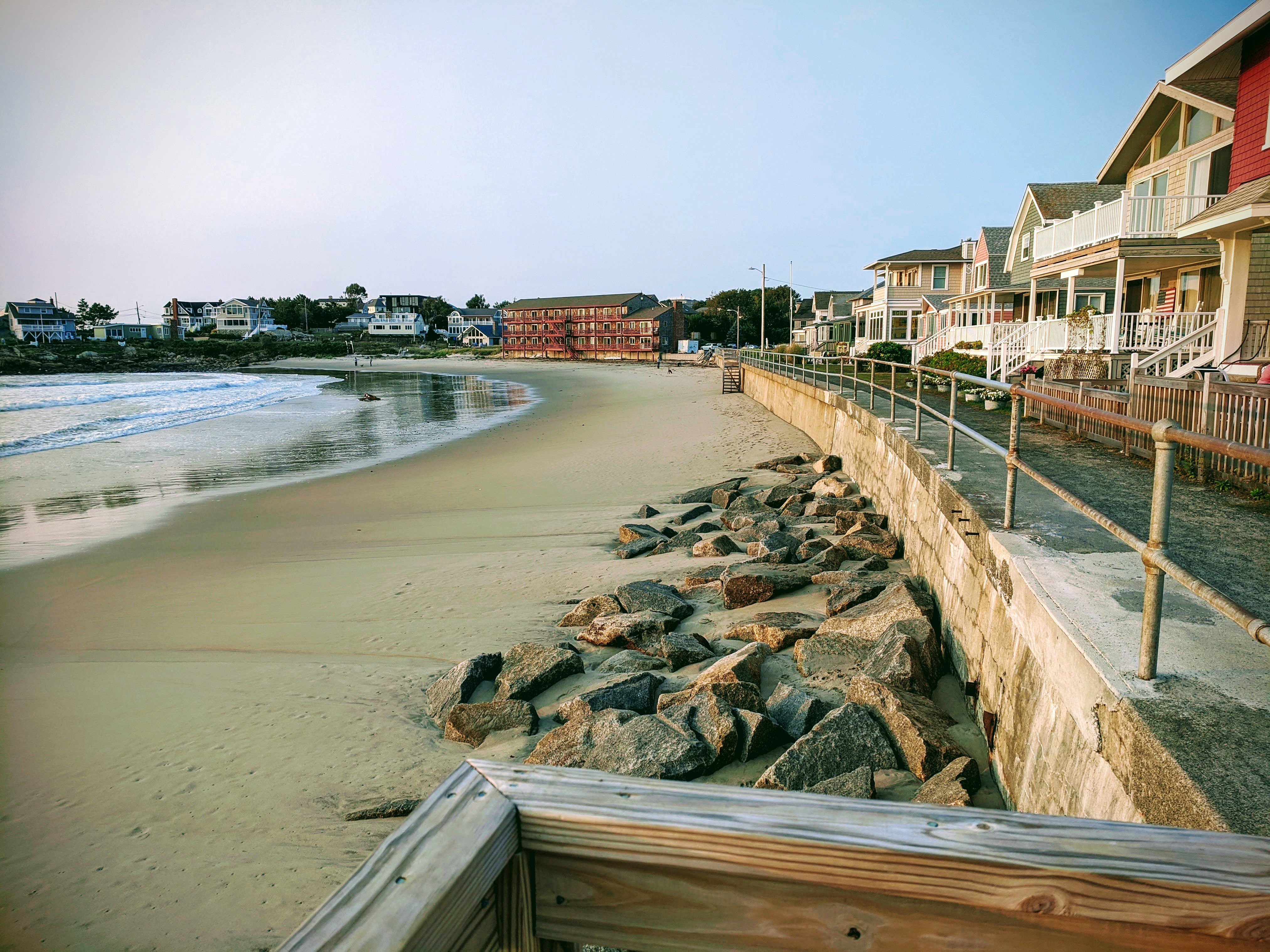
After a trio of March storms in 2018, the seawall pathway collapsed in two sections, revealing gaping chasms beneath (later filled). Fissures, cracks and seasonal pothole wear and tear were numerous. Thanks to immediate major repairs, the hollow underbelly sections were filled and packed down and the walkway widened pretty much the entire seawall. Rip rap boulders were shuffled into temporary pyres as extra wall support on the beach side.
photo caption: Same spot. Unlike the pathway which changed significantly, find the railing post to note the rough concrete chunk jutting out that has not changed.
Detail of the 2022 dislodged piece before/after
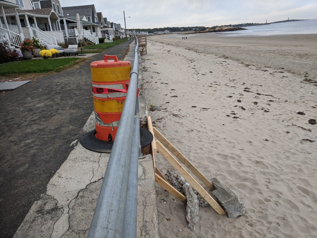
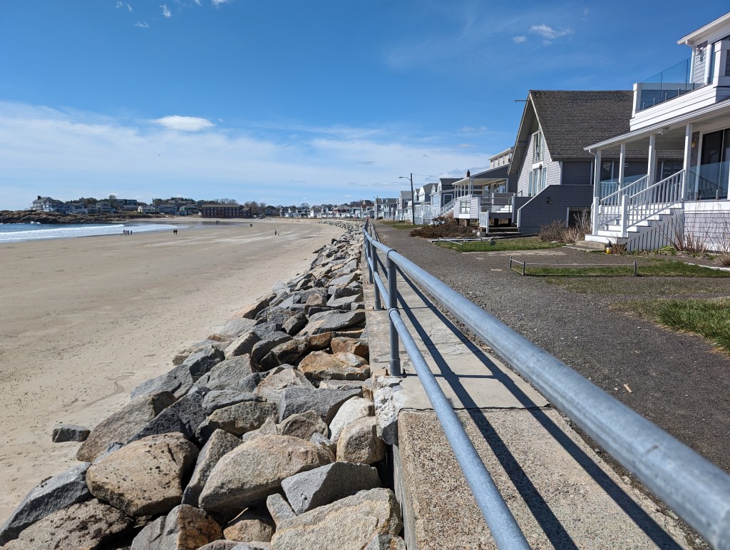
In 2019, hundreds of tons of boulders were added strategically, and later an impressive quantity of sand. Unsurprisingly the sand was devoured by tides and storms–even on the very day it was deposited, swept straight away. The rip rap–mostly unchanged–and new walkway have held.
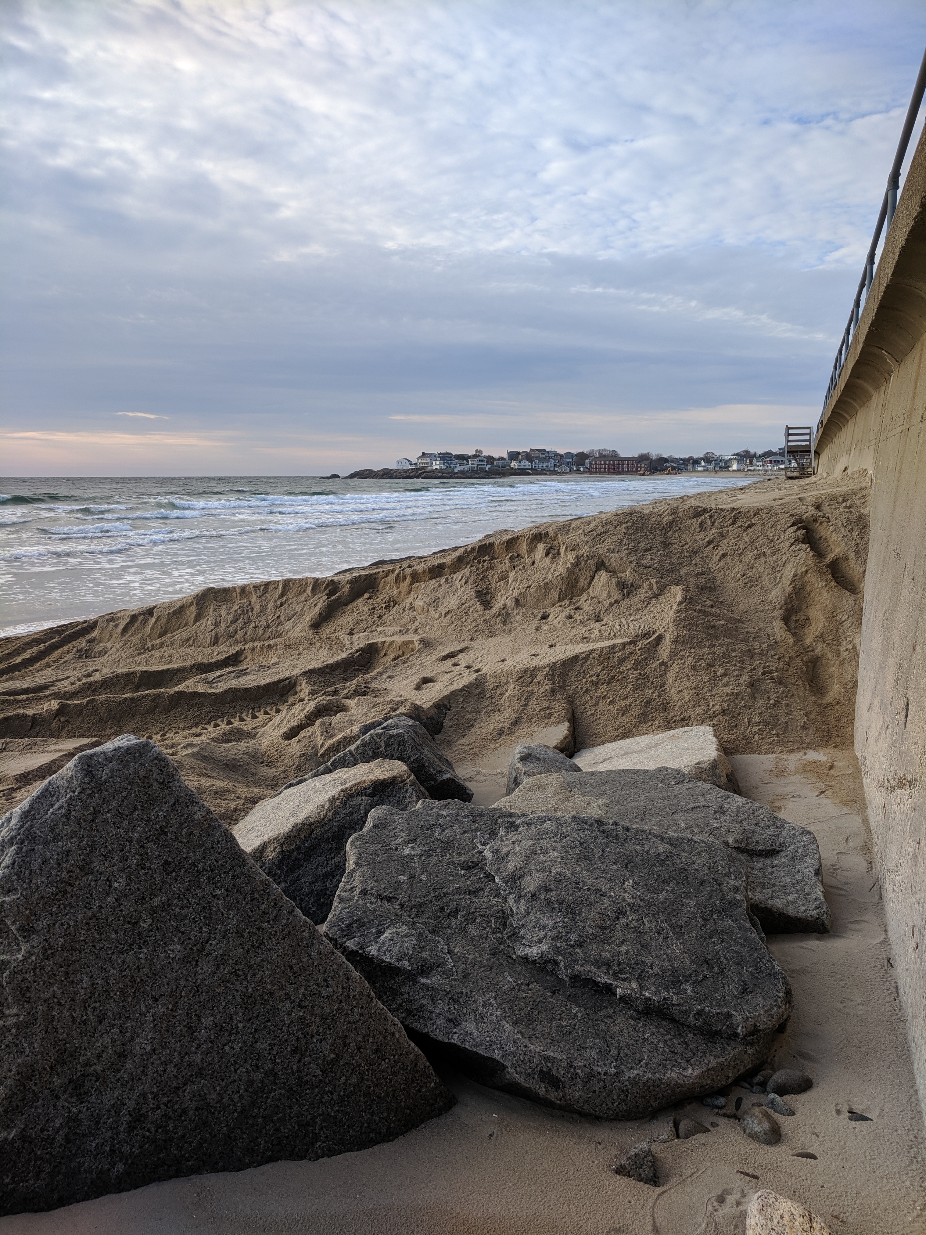
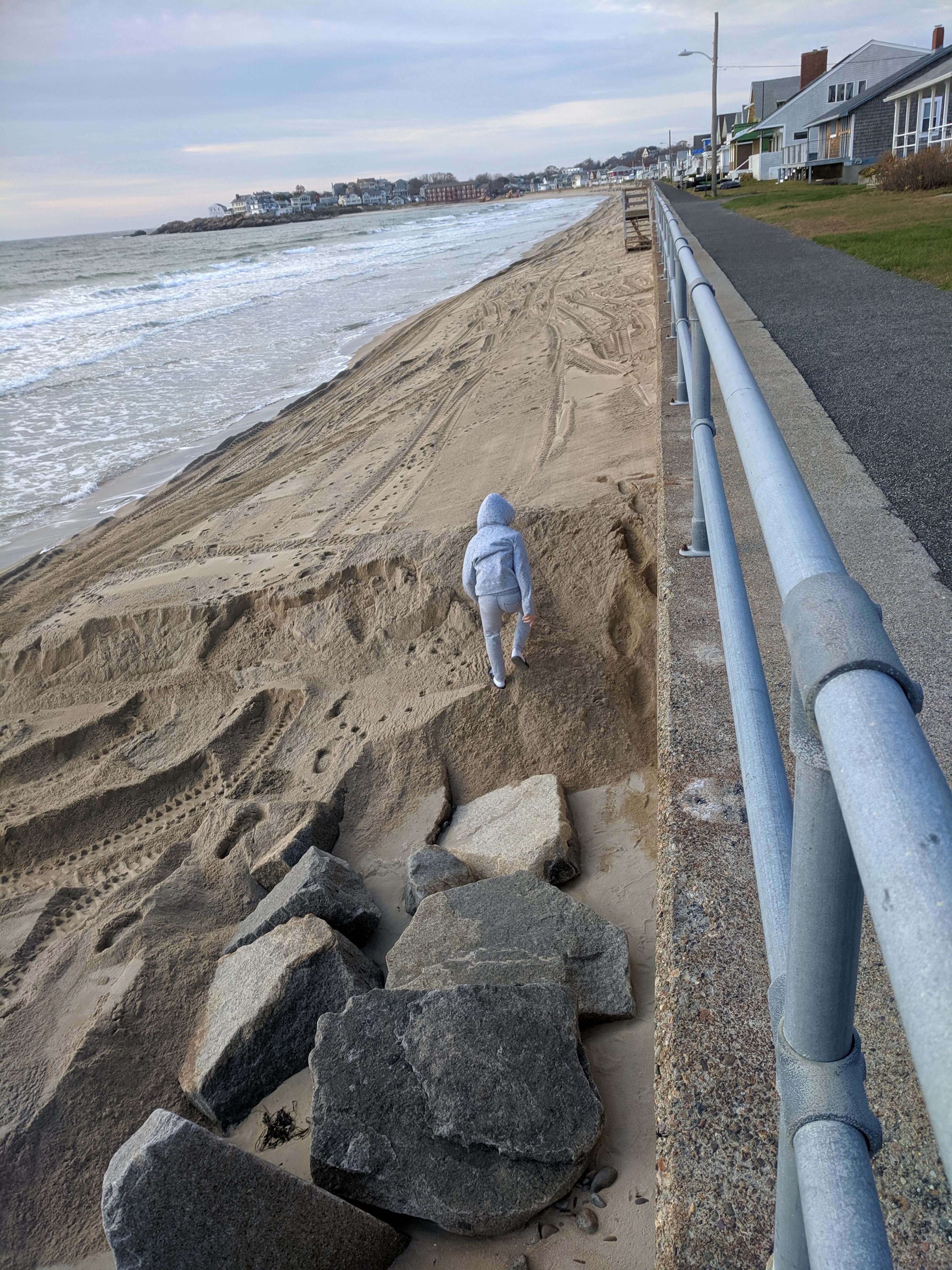

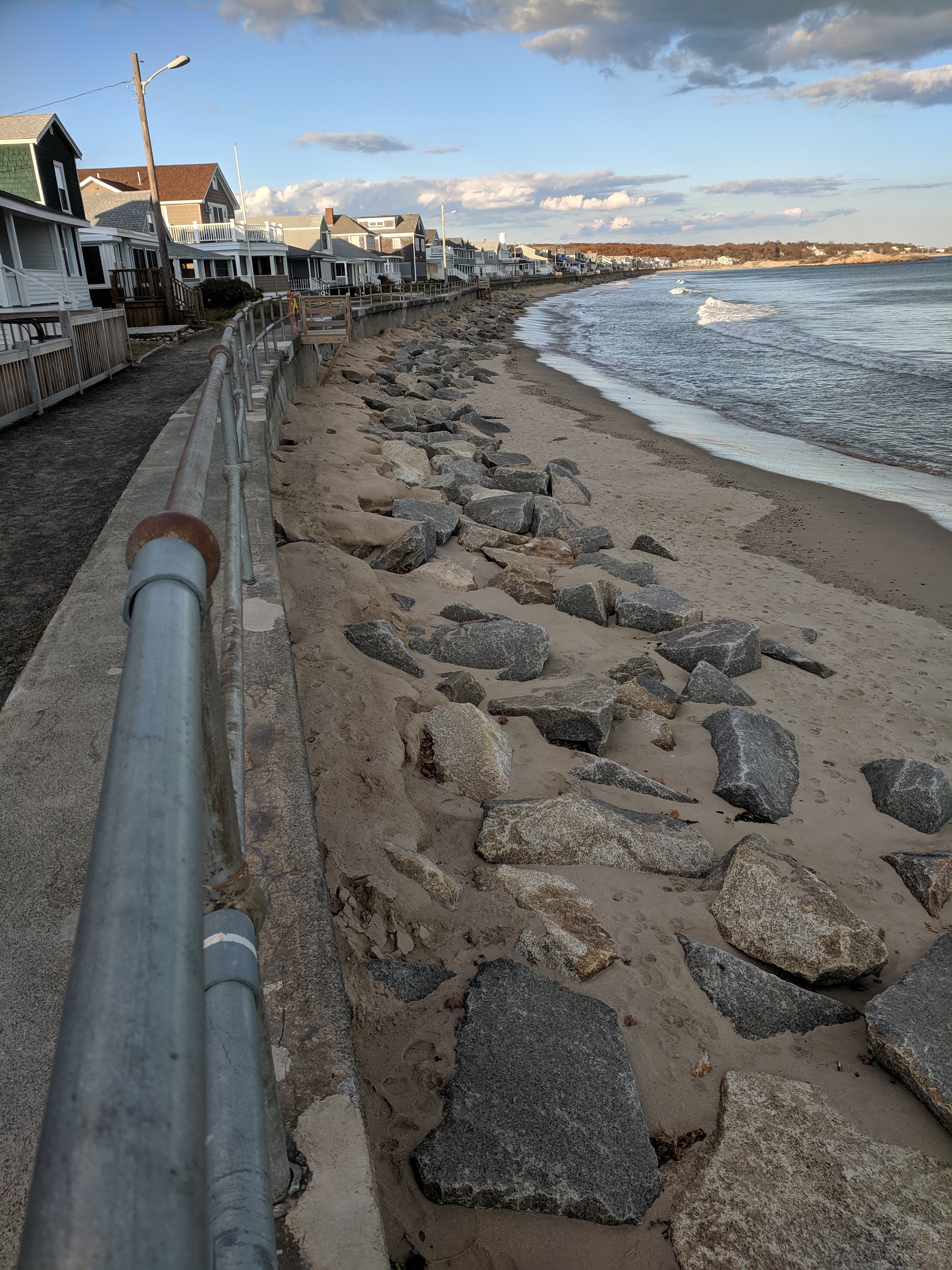
Boulder pile 2019 still here 2024. The big rocks work.
Before the 2018 winter storm trio, people discussed the pros and cons about raising the height of the seawall, removing it, and so on. After the major upgrades in 2018 and 2019, a town committee was established to study future options for the Long Beach cottages and seawall which wrapped up March 2022.
The 2024 Rockport Annual Town Meeting is scheduled for April 6, 2024.
The detailed Long Beach seawall schematics from 2020 can be found here:
Rockport DPW does annual maintenance. I can’t find updated plans and diagrams about the scope of the proposed next phase of the Long Beach seawall project, but will add them here if I do. Based on the estimated 2.8M award reported in the FEMA press announcement May 4, 2023 to be combined with the town’s match of 1.3M, perhaps it was solely repair and maintenance, and spots that had not been addressed in 2018 and 2019. It’s a long seawall! The 2020 schematic labels 350 feet of wall from roughly #58-#70 as damaged. After the path was tamped down, the bowing was visible.
After this winter, there are new additions (e.g. the vertical loss on the path and that sinkhole). That 2023 press release described a deeper wall section slated for reinforcement, but it doesn’t indicate how long or diagram where. It describes new stairs on the Gloucester side relocated within Rockport. I believe that the replacement stairs installed after the 2018 storm damage were temporary (still standing).
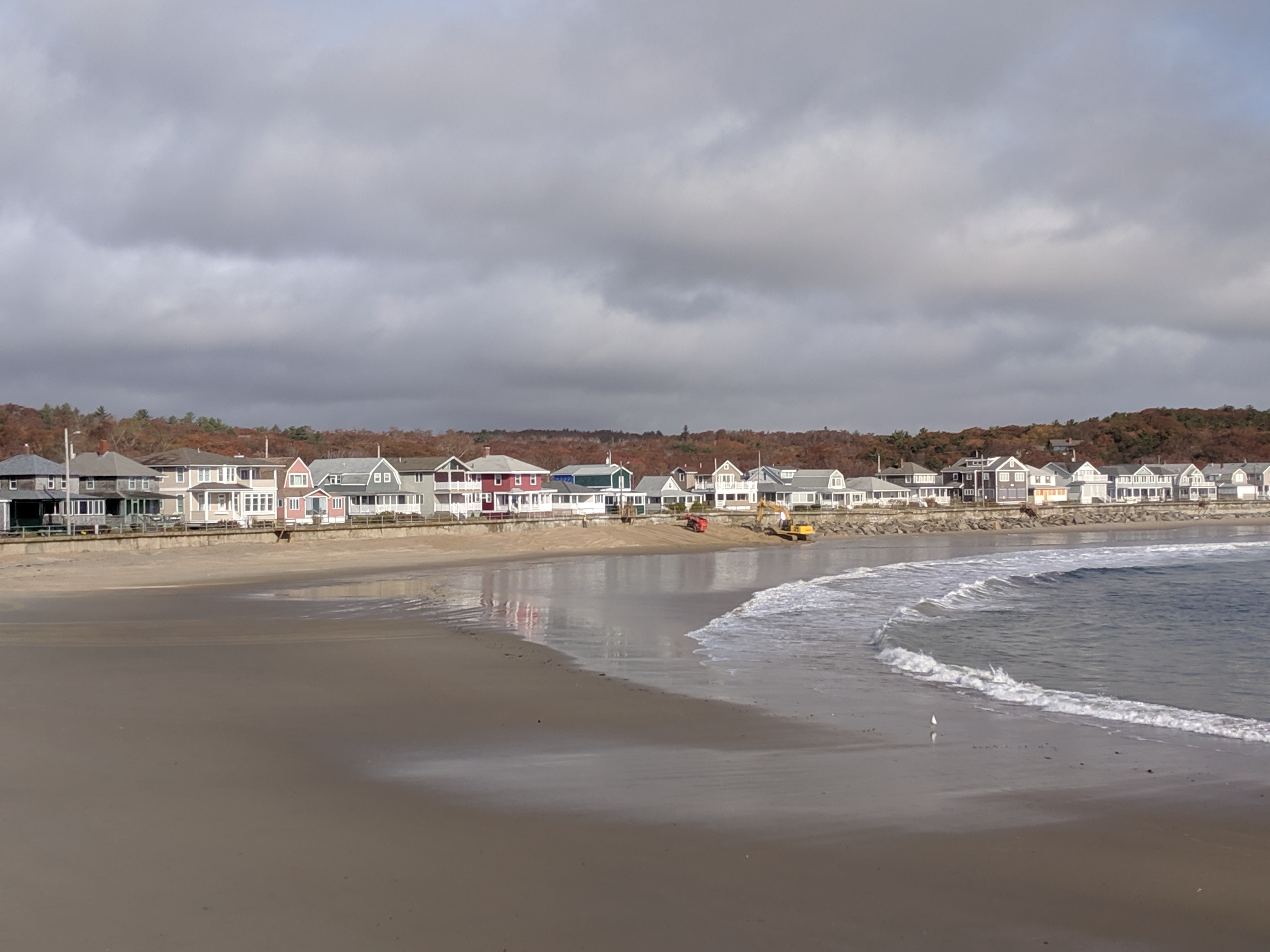
Rockport DPW response is swift and sure. Other than the sand, the infrastructure repairs and maintenance are strong and steady and coordinated with state and federal assistance.


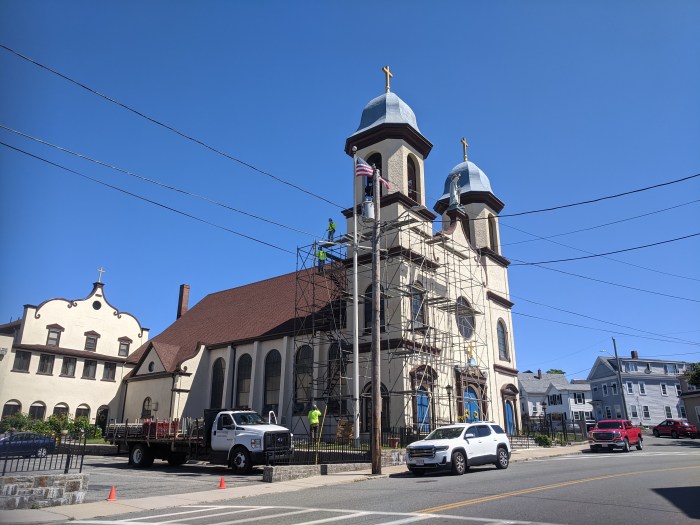
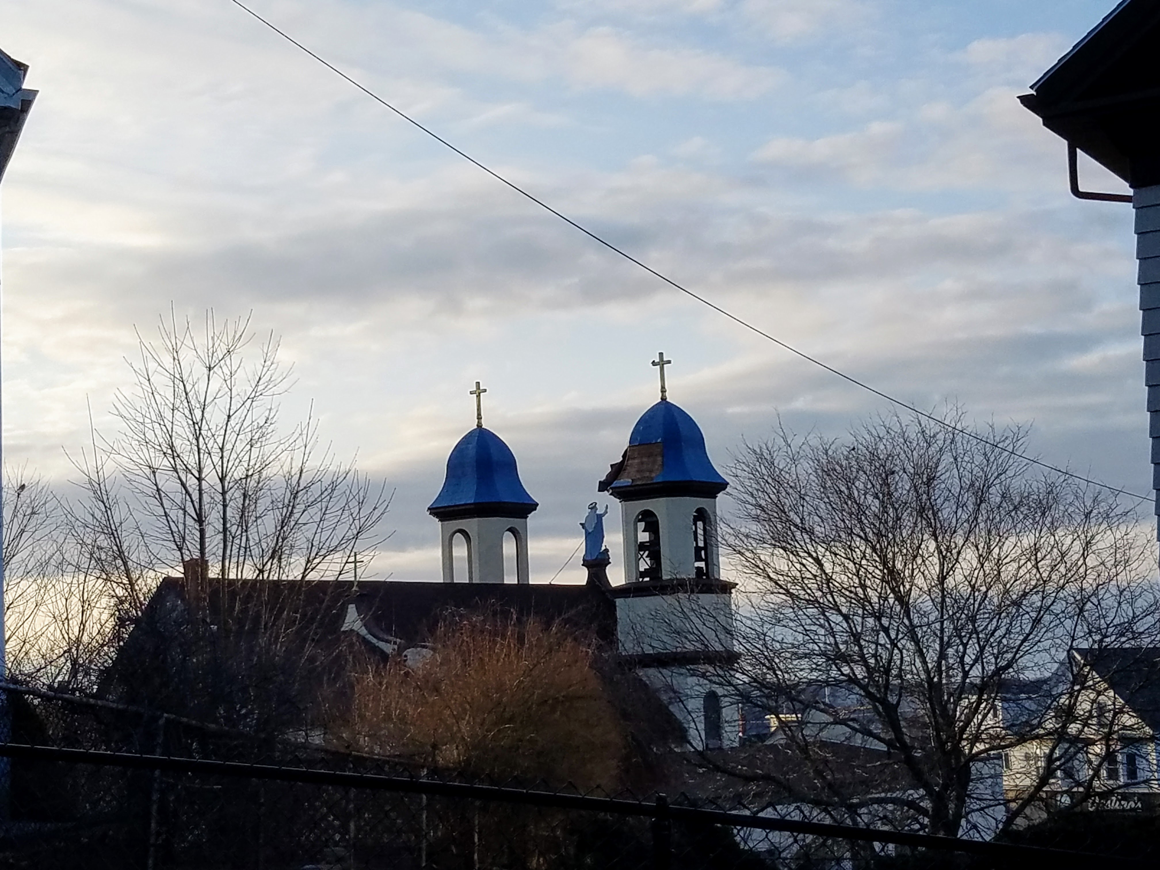
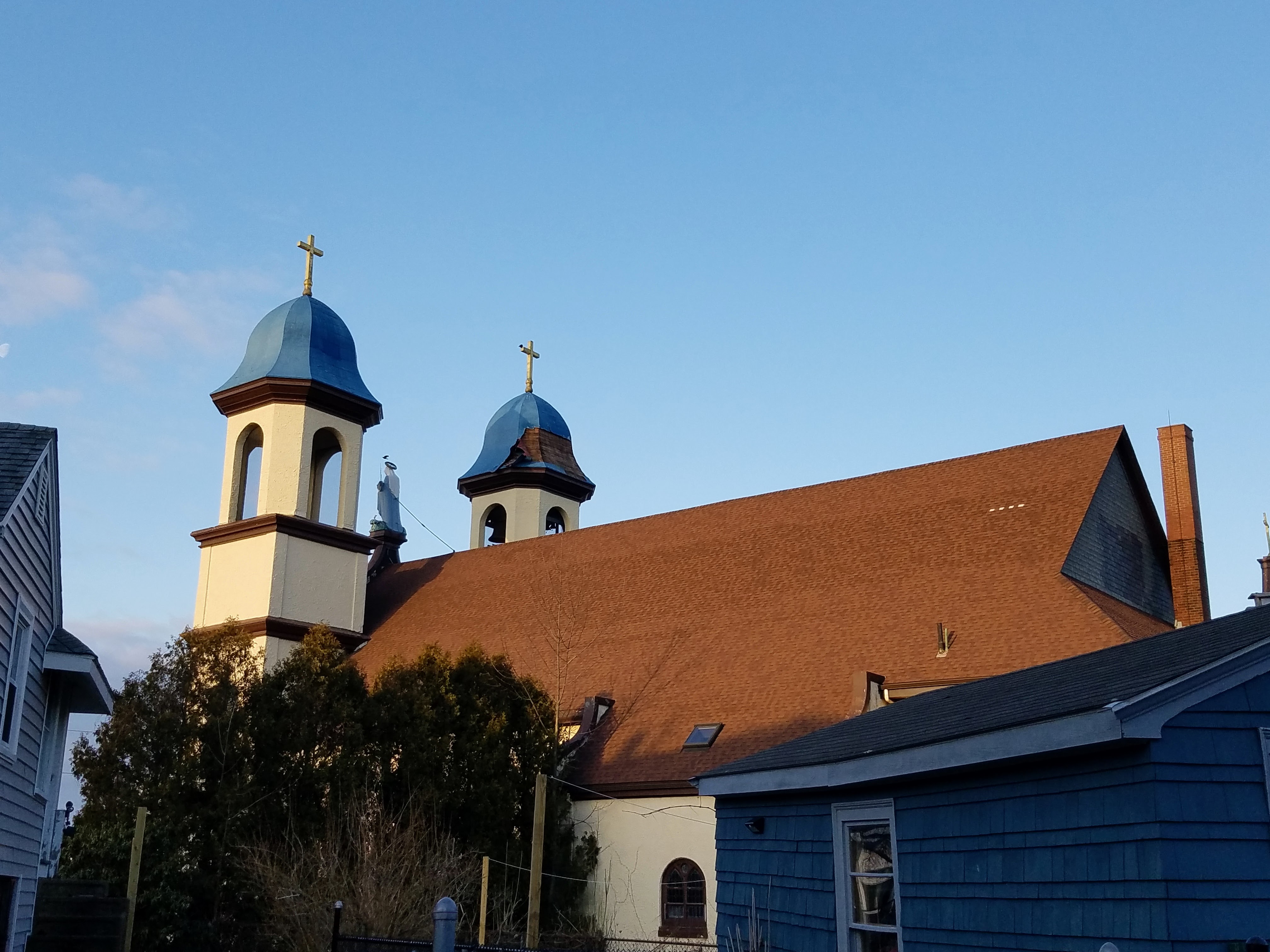
Level by level. New England Scaffolding says the ETA for the removal of the critical scaffolding set up for the storm damage repair to Gloucester’s Our Lady of Good Voyage landmark will happen by Monday, and for sure by Christmas.
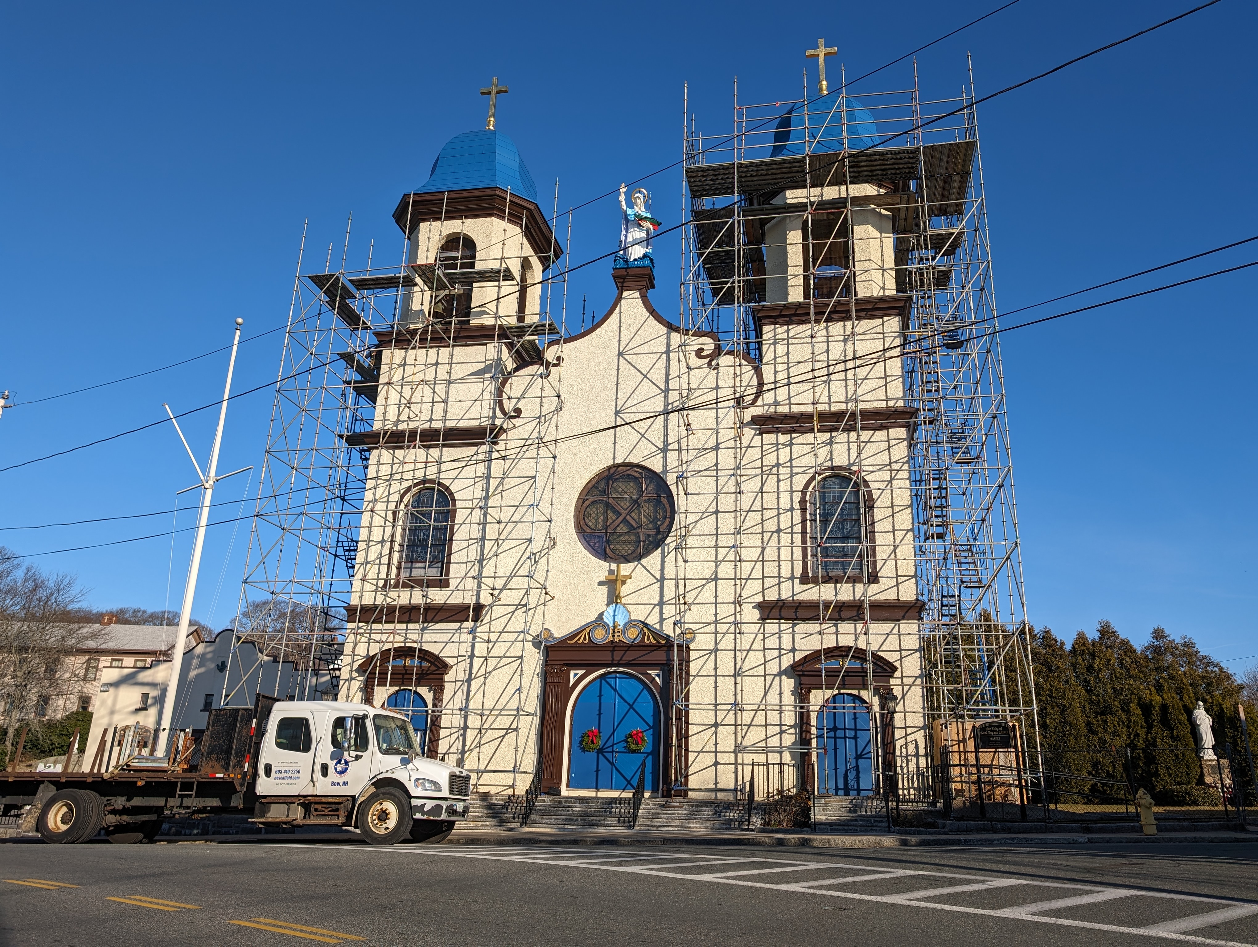
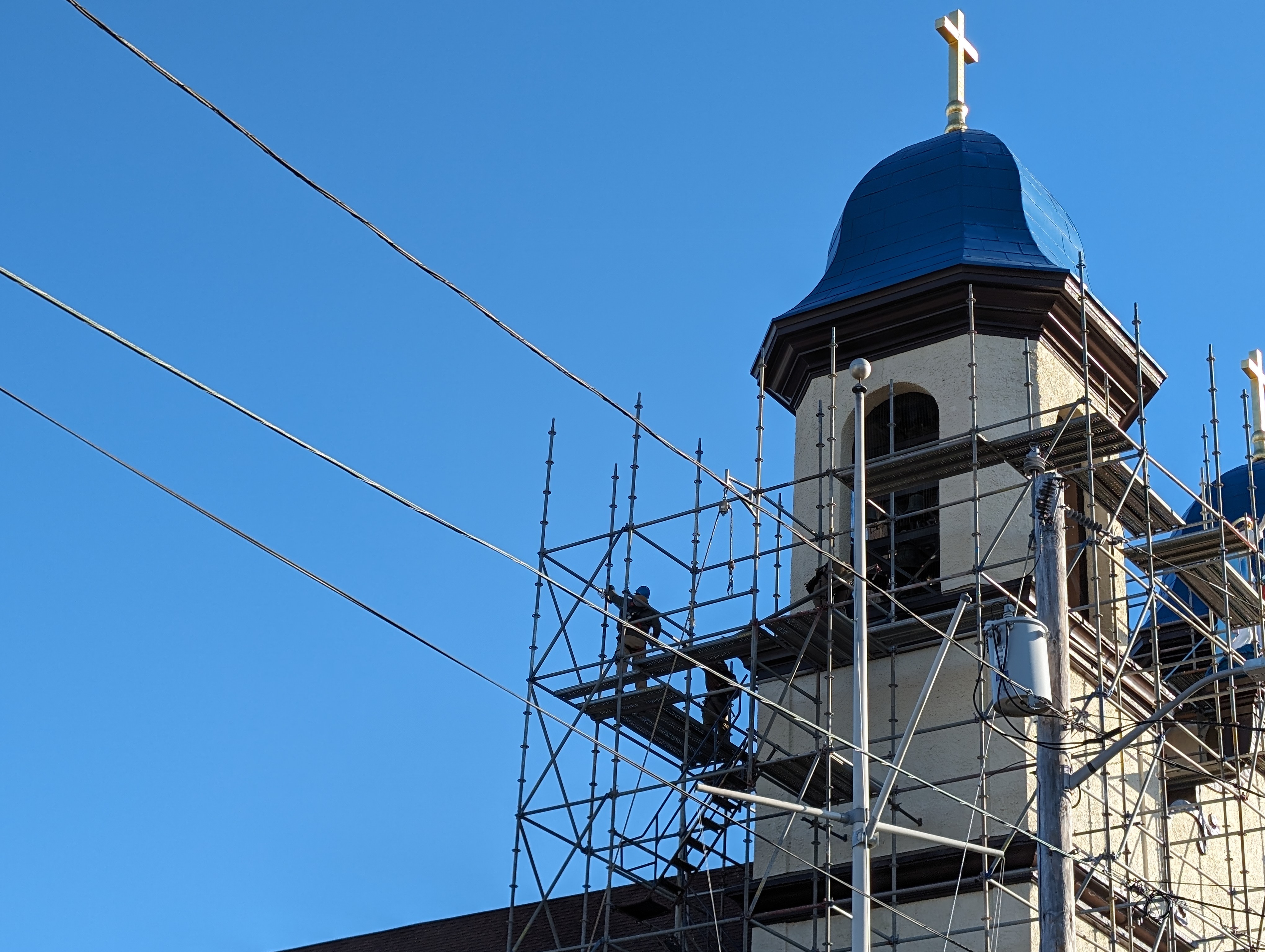

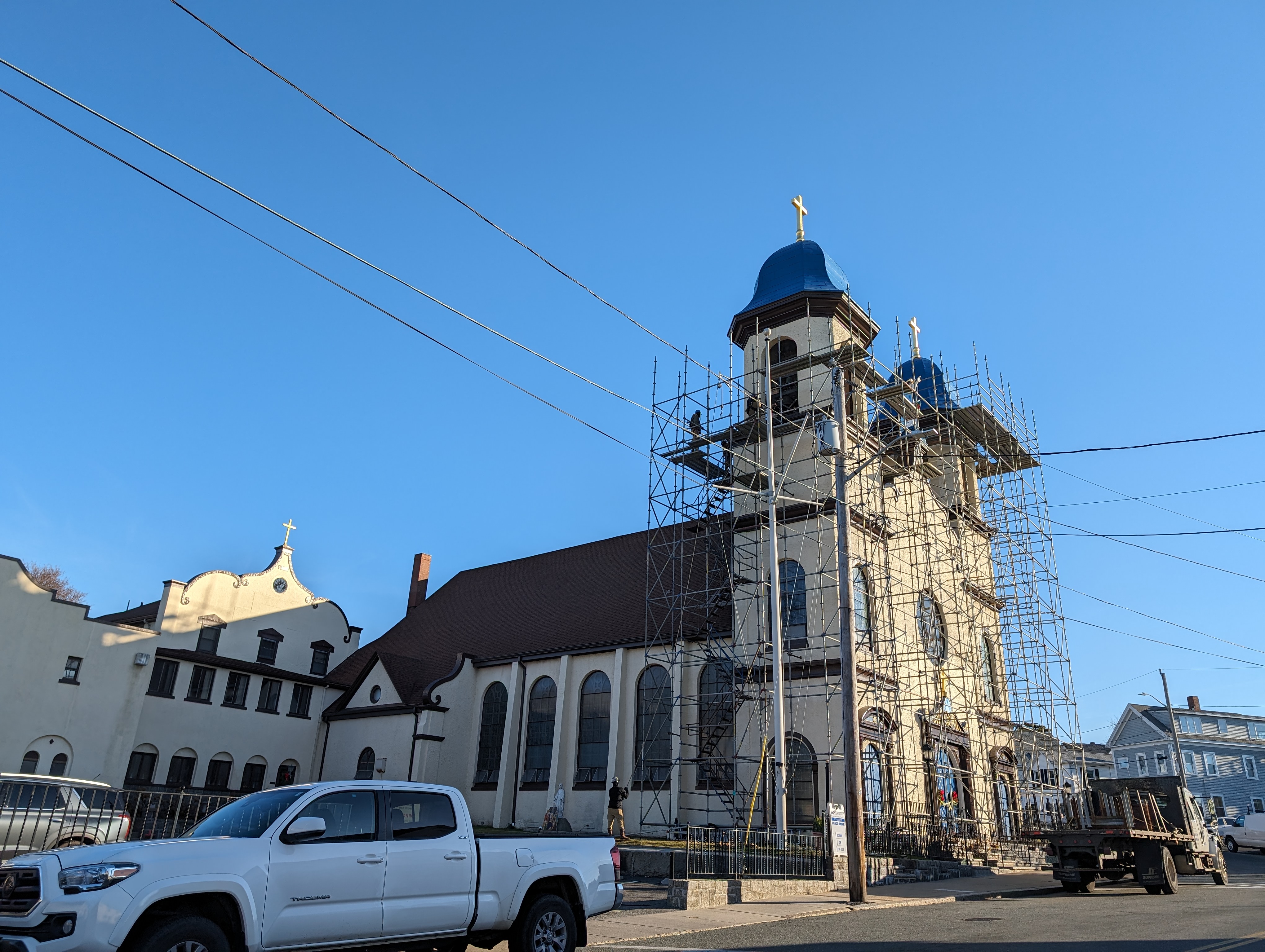
Images: Dec. 16, 2023. Scaffolding set up in August of 2023 is coming down. Beautiful and lofty work complete!
Images: 2021. Looking back Before repairs – storm damage


Great to see!

Photo: C. Ryan. Lofty repairs lifting spirit, Our Lady of Good Voyage, 143 Prospect St., Aug. 31, 2023. Gloucester, Mass.


Dec. 23, 2022
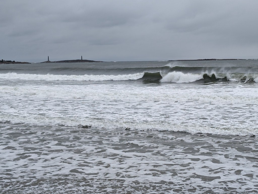
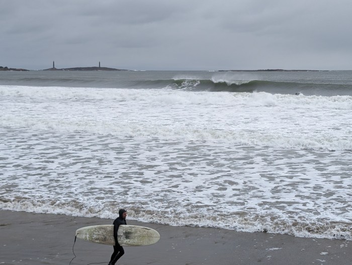
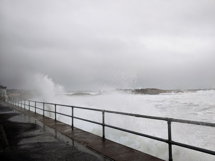
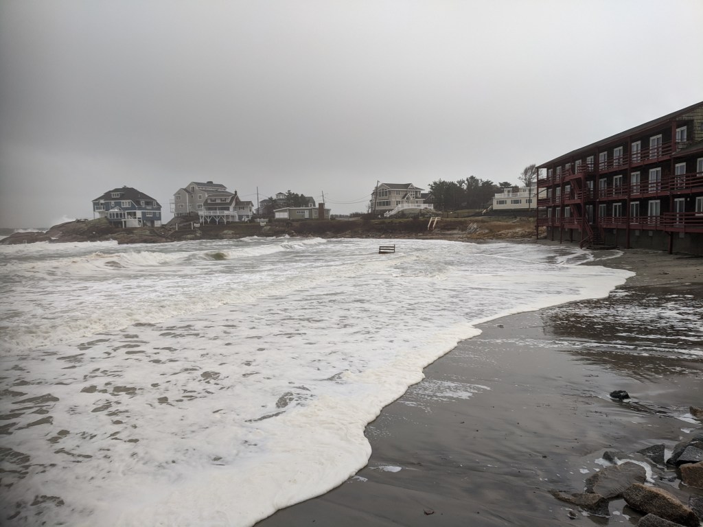
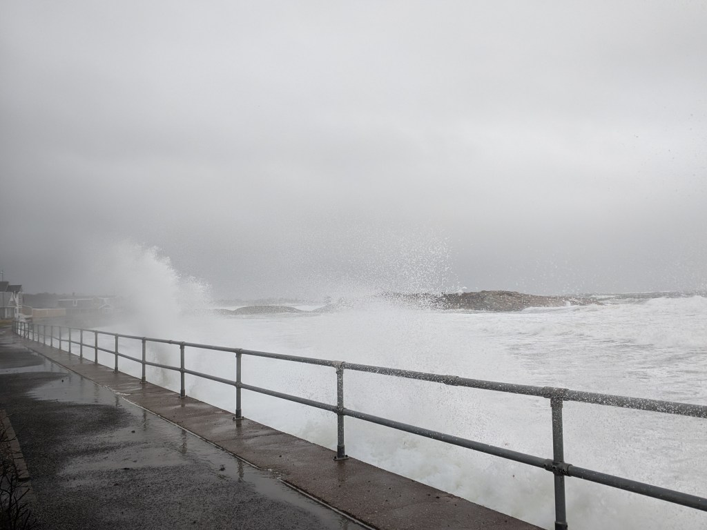
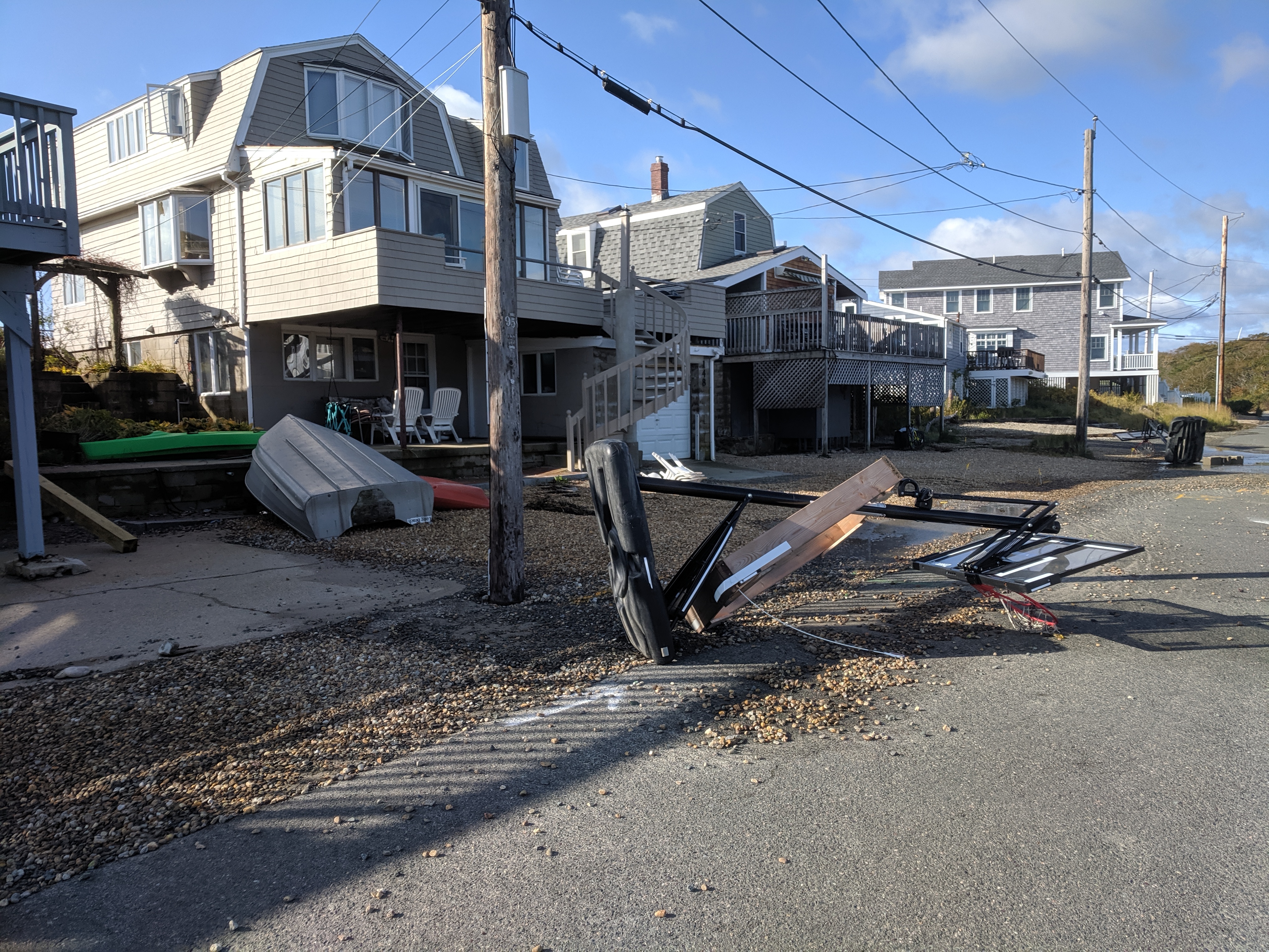
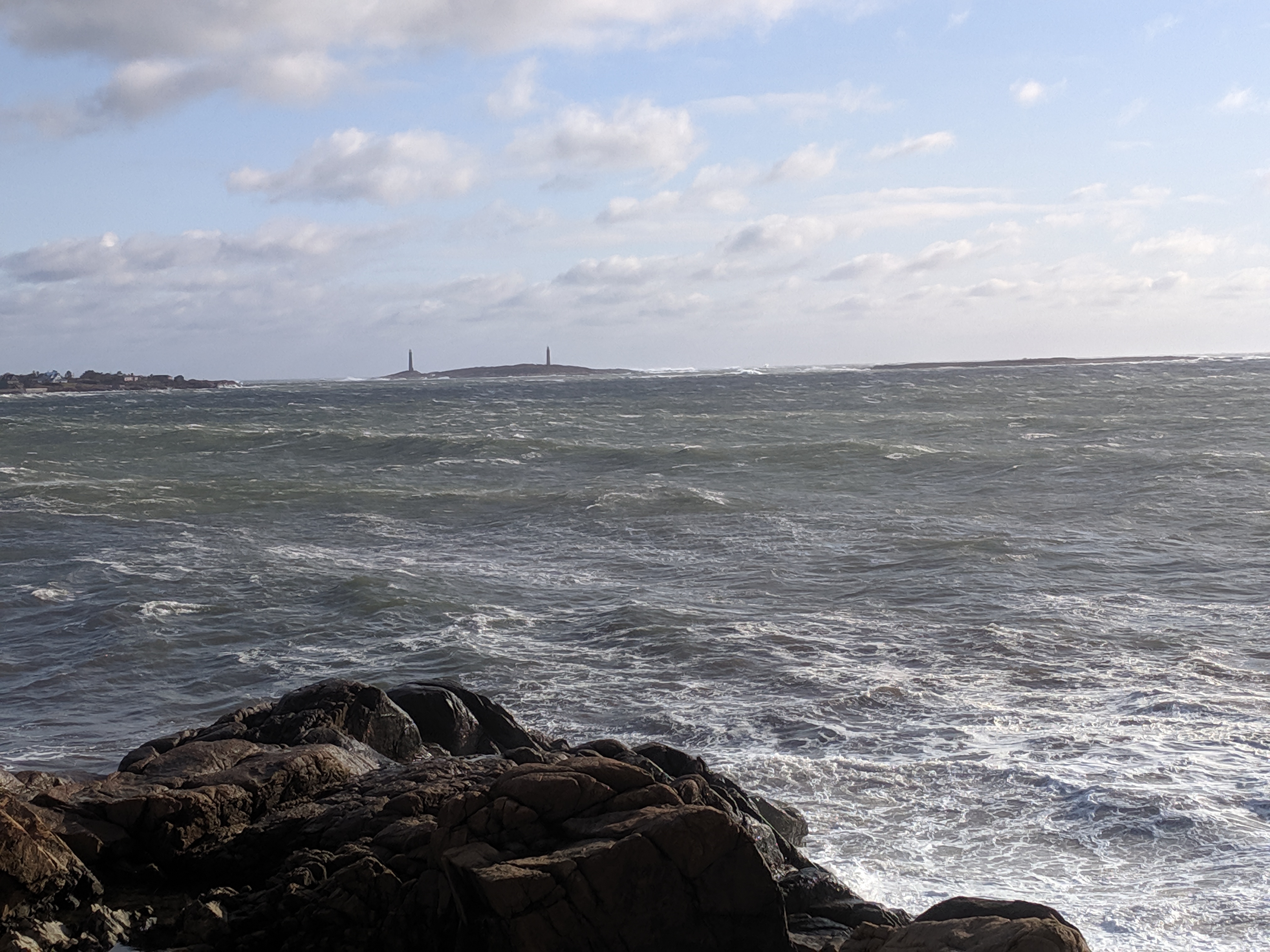
Views from winter storm walk an hour after high tide when the splash over waves settled back from the Long Beach seawall. The waves are not as huge as some storms. Still, stair and platform debris at both ends of the beach. Surge pushed back into the street. This is the 2nd of 3 high tides in the forecast.


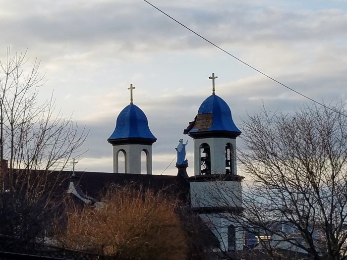
Efforts to mobilize repairs on the west tower blue dome of Our Lady of Good Voyage are underway. Photos show some of the damage to the inspiring tower that was sustained after the windstorm this week. If you wish to help the cause to restore, on line donations can be made at the church: https://ccgronlineolgv.churchgiving.com/ The Church, all of Gloucester & greater Cape Ann, and all the artists and admirers of Our Lady of Good Voyage around the world would surely appreciate the support!
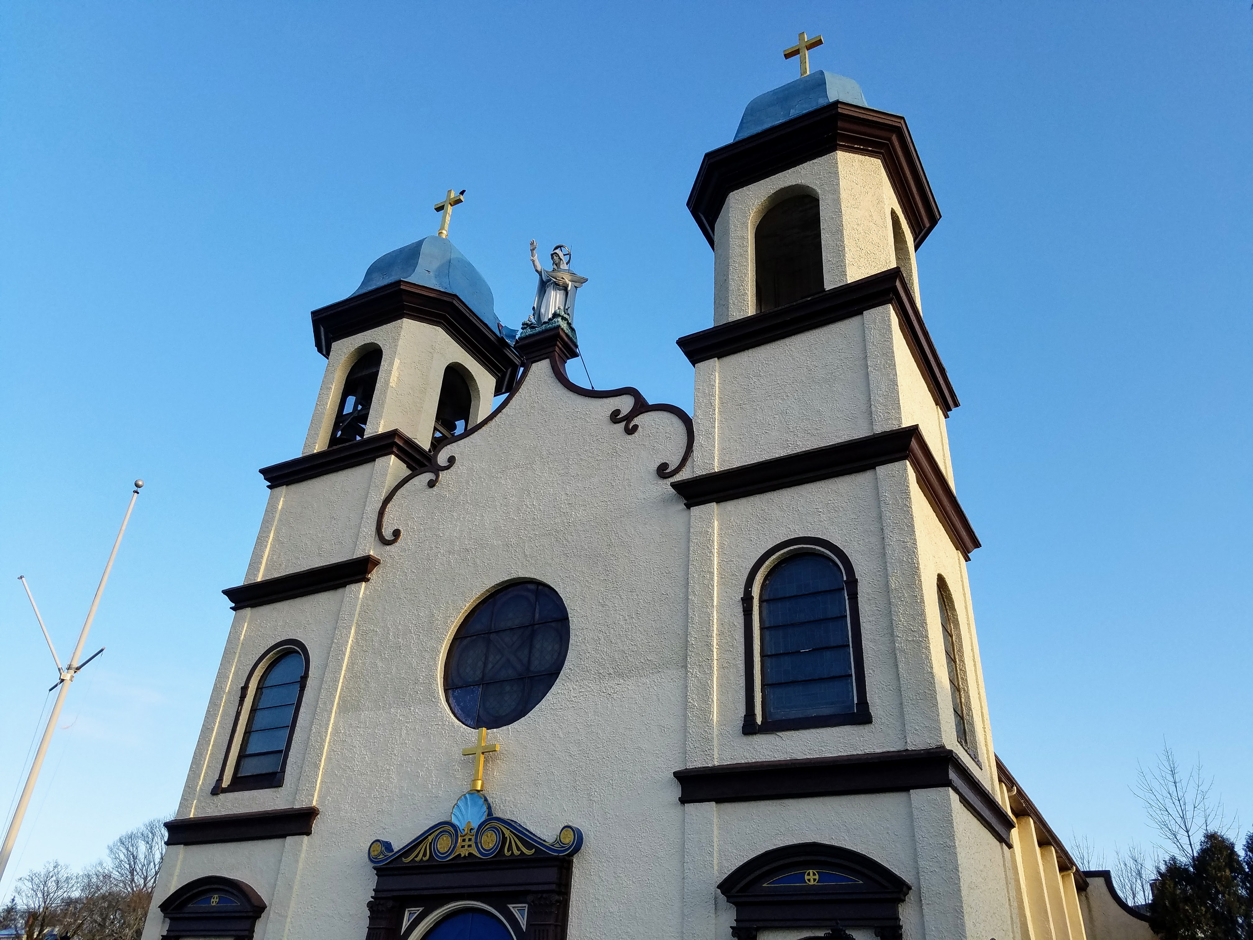
The Portuguese church of Our Lady of Good Voyage on Prospect Street in Gloucester is resilient. The church was re-built after a catastrophic fire in 1914. Thousands attended the laying of the cornerstone on May 24, 1915. (Less than ten years later, during the year of the city’s tercentenary, parishioners celebrated the mortgage liquidation.) One of our city’s most cherished buildings, the landmark was added to the National Historic Register of Historic Places in 1990.


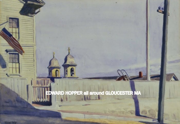
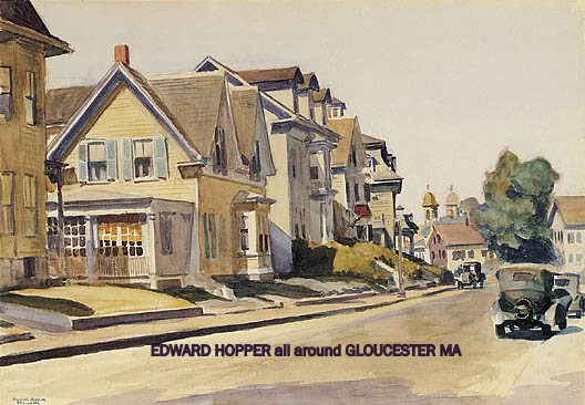

For more about Edward Hopper work in Gloucester, Mass. see here
For more about Gordon Parks work in Gloucester, Mass. see series 2012-14 here

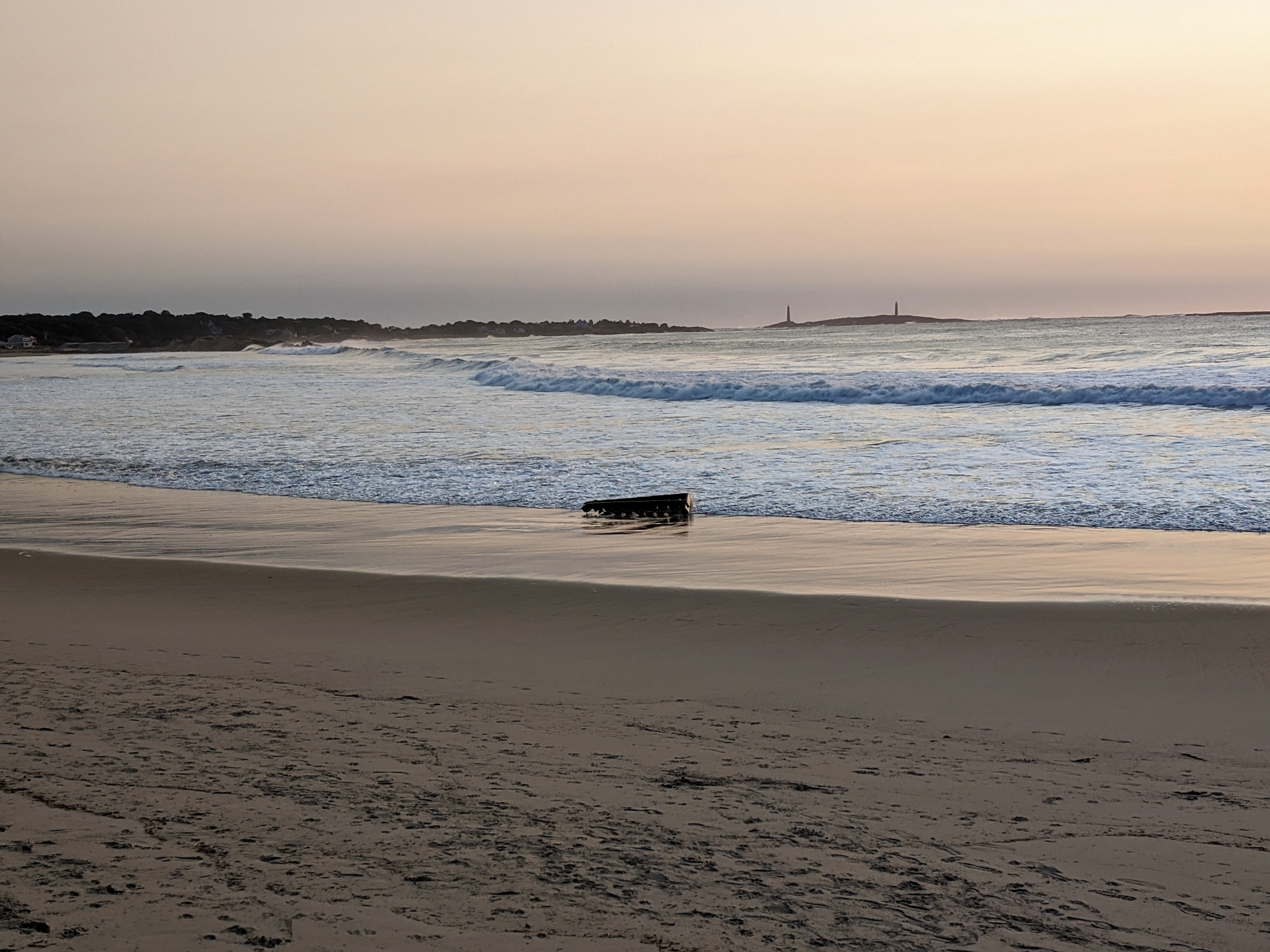
The Long Beach walkway was dry this morning: Storm Teddy did not surge up and over the seawall. Light debris was deposited on nearly spotless Long Beach. Beautiful rollers were distant as the tide was heading out.
photos 9/23/2020- click to enlarge to full size

Spotted less than ten shorebirds, three species. These tiny birds are migrating from the arctic and landing to rest and refuel. Give them space if you see them! The few I spotted were flushed off.
A smile path helps wildlife. Walk around (or pause if you have the time)
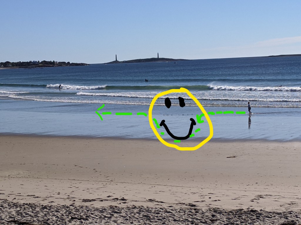
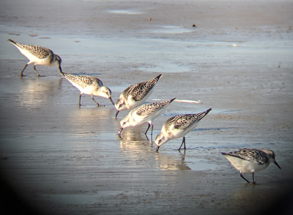
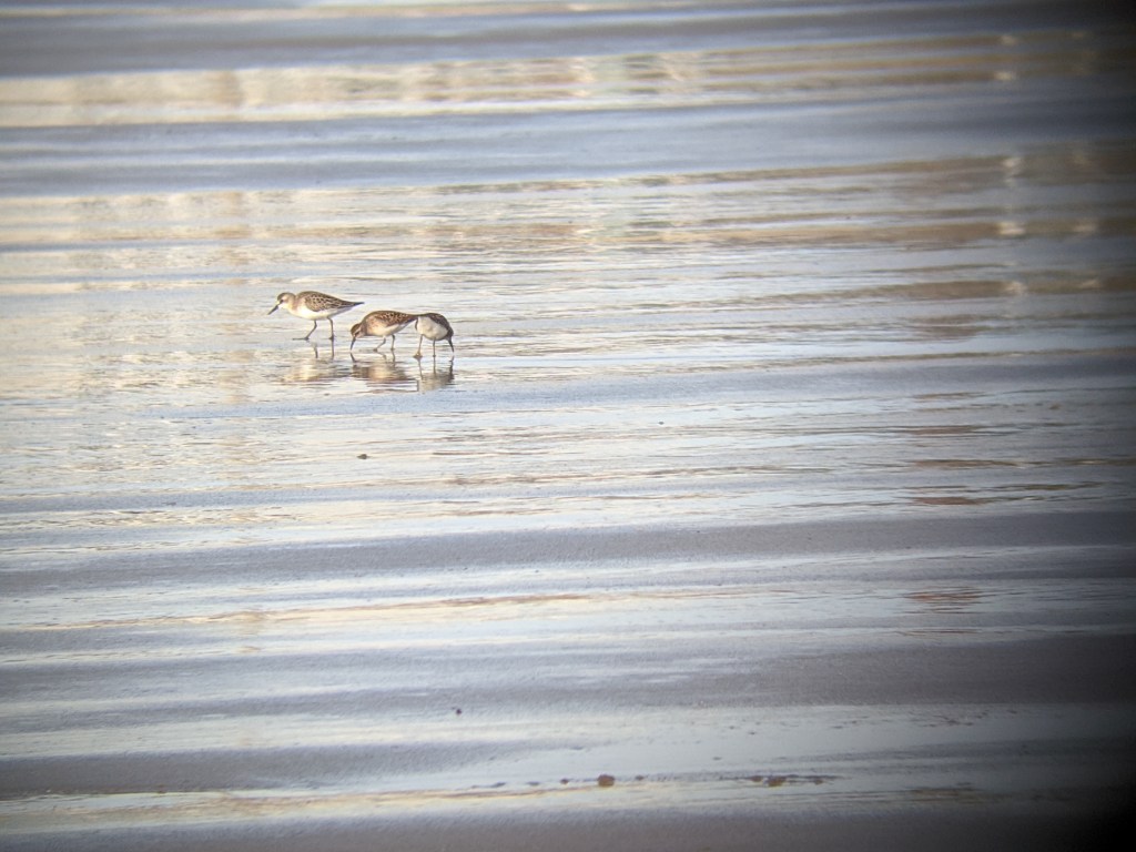
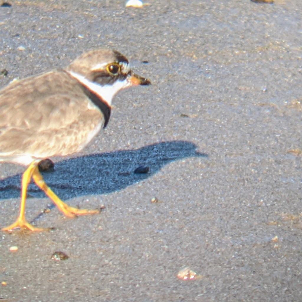
Shorebird visitors hanging out together today (sanderlings, semipalmated sandpipers and semipalmated plovs). Easy to add a smile path when you spot them.
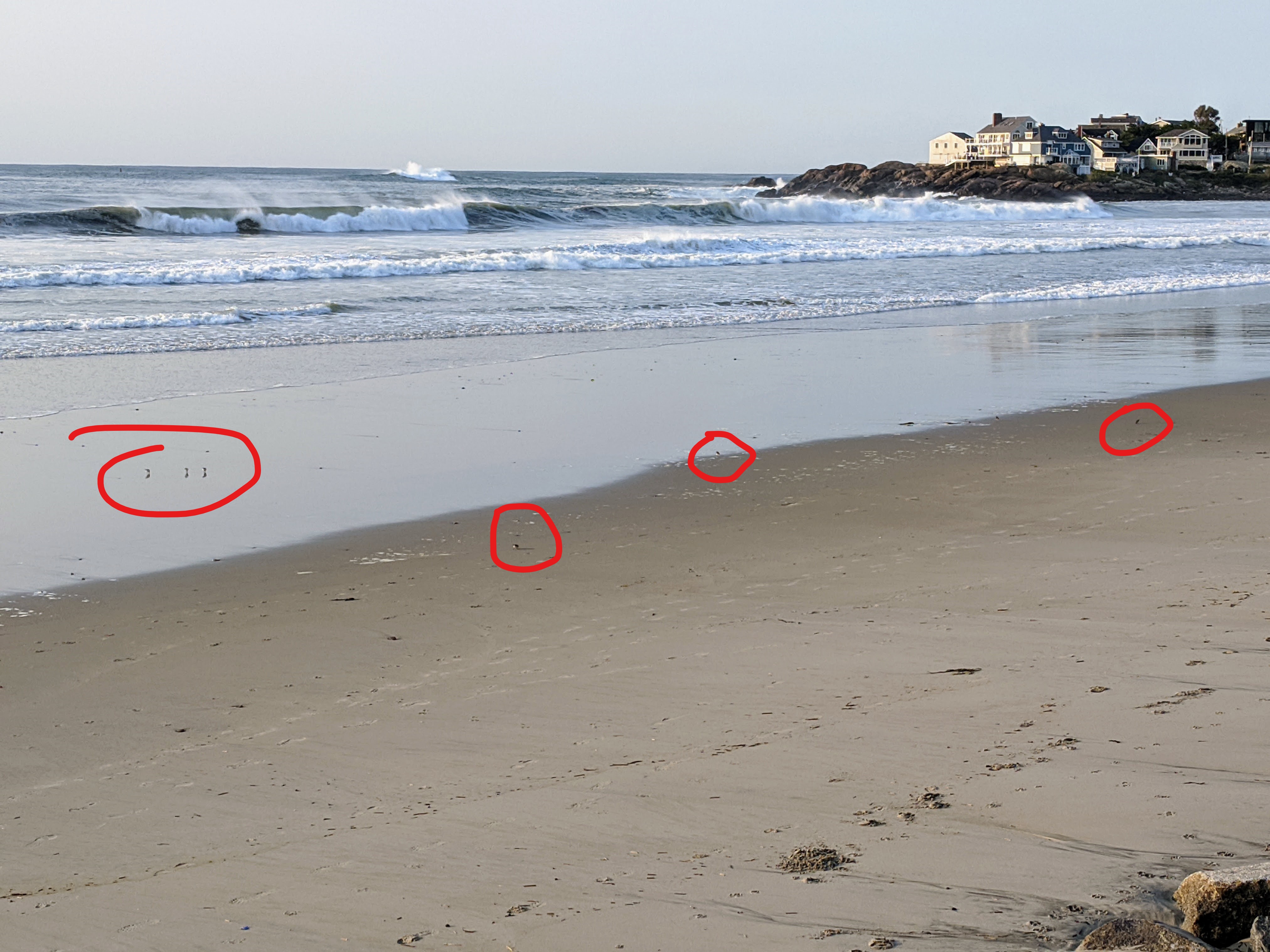
Below L-R: Sanderlings, semipalmated sandpipers, and semipalmated plover visiting 2020
Scenes of waves from Storm Teddy yesterday 9/22/2020 here

Long Beach riprap cleared of sand now
Sandstorm on beach sent us to the back of the Long Beach cottages. Strong winds continue.


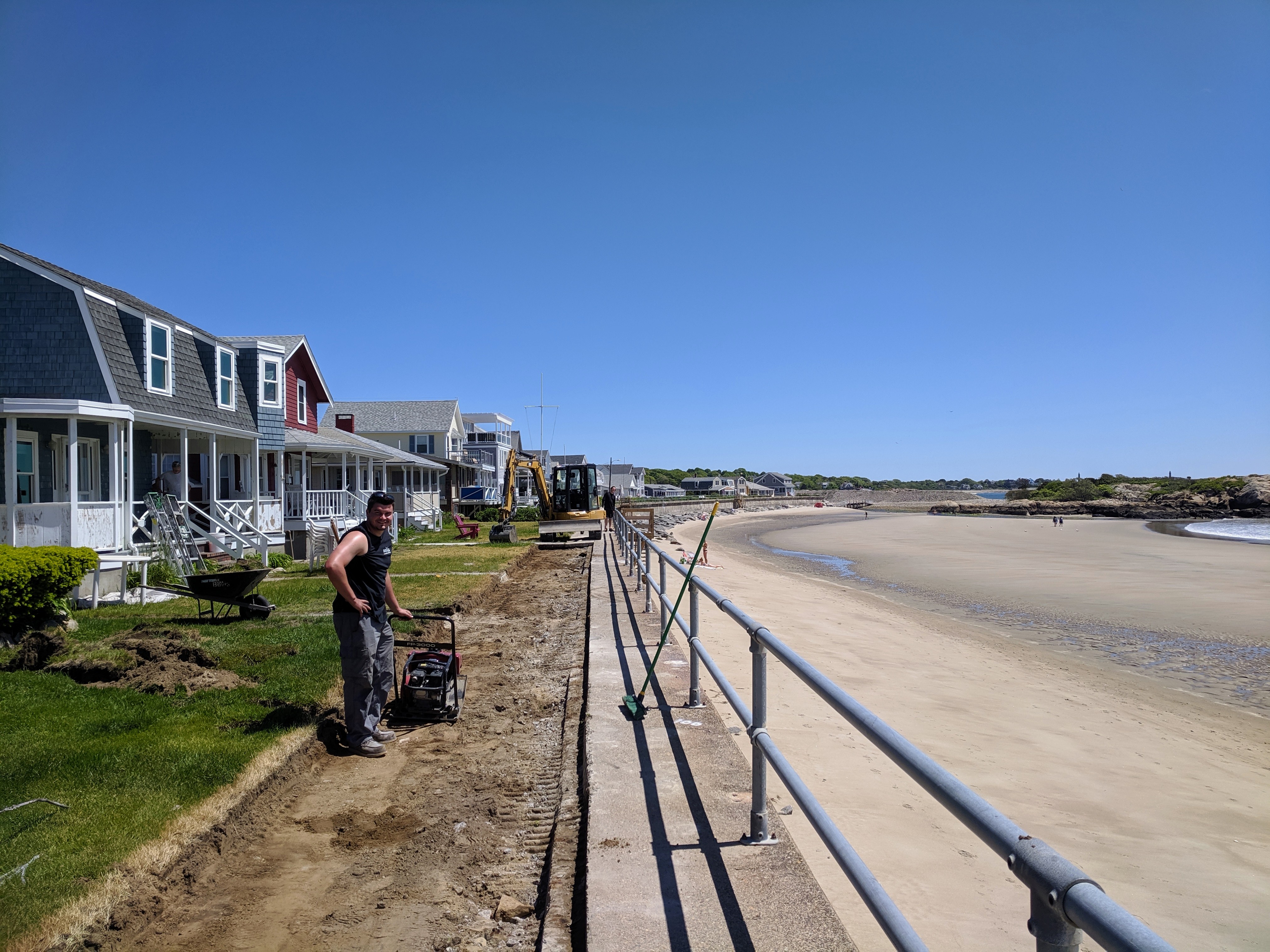
In 2018 Rockport widened much of the Long Beach seawall walkway beginning at the Gloucester side and stretching past the midpoint. Recently crews began extending this project straight through to the end point on the Rockport side. The work is expected to be completed in a couple of weeks.
Rocky explained it’s done in segments and moving right along.
")
")
")

Besides this big project, the getting ready for summer bustle is in full swing. Annual staircase return? Check! Front row cottage work? Check! New patio and masonry work by the former hotel (photos 2018 vs 2019 below) where the stone patio was compromised, various yardwork and private deck repairs are visible along the promenade.


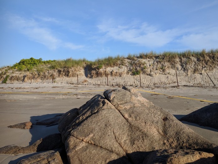
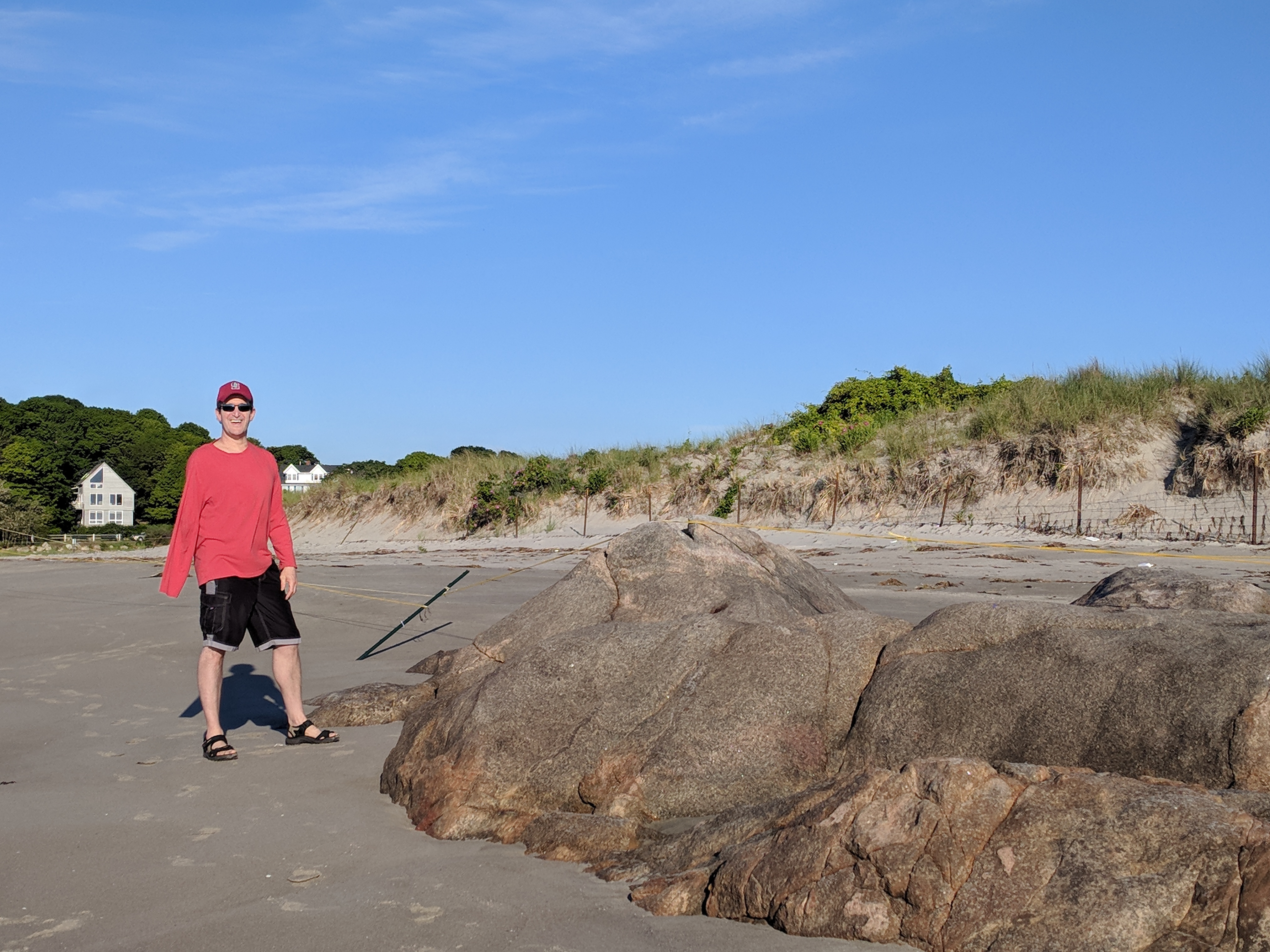
The 2018 winter storms exposed an expansive and blindingly obvious glacial outcropping by the footbridge side of Good Harbor Beach near the piping plover enclosure. In 2017 the feature was something more than a rock and I don’t mean scale. After two severe thunderstorms on July 8, 2017, one chick remained and the family acted strange. One of the parent plovers perched atop that rock for my entire shift, seemingly in mourning. The rock was a sheltering spot and helpful monitor landmark which it still is this year. This summer the rock revealed itself like a tip of an iceberg, and made Good Harbor Beach resemble a bit of Wingaersheek.
Here are a few Before (2017) and After (2018) comparisons. The photographs illustrate how much dry sand disappeared and how the beach was basically scrubbed of any scrub.


he’s 6′ to give you idea of scale
Wingaersheek Beach January 2018
reposting as I had some trouble uploading photos (prior)

The 2018 winter storms exposed an expansive and blindingly obvious glacial outcropping by the footbridge side of Good Harbor Beach near the piping plover enclosure. In 2017 the feature was something more than a rock and I don’t mean scale. After two severe thunderstorms on July 8, 2017, one chick remained and the family acted strange. One of the parent plovers perched atop that rock for my entire shift, seemingly in mourning. The rock was a sheltering spot and helpful monitor landmark which it still is this year. This summer the rock revealed itself like a tip of an iceberg, and made Good Harbor Beach resemble a bit of Wingaersheek.
Here are a few Before (2017) and After (2018) comparisons. The photographs illustrate how much dry sand disappeared and how the beach was basically scrubbed of any scrub.


lonely little scrub

Photos show the next stage in the seawall repair on the walkway (what the white spray paint meant). The promenade is two lanes: the ocean lane is a bit higher for now. Hooray!~more staircases are passable.

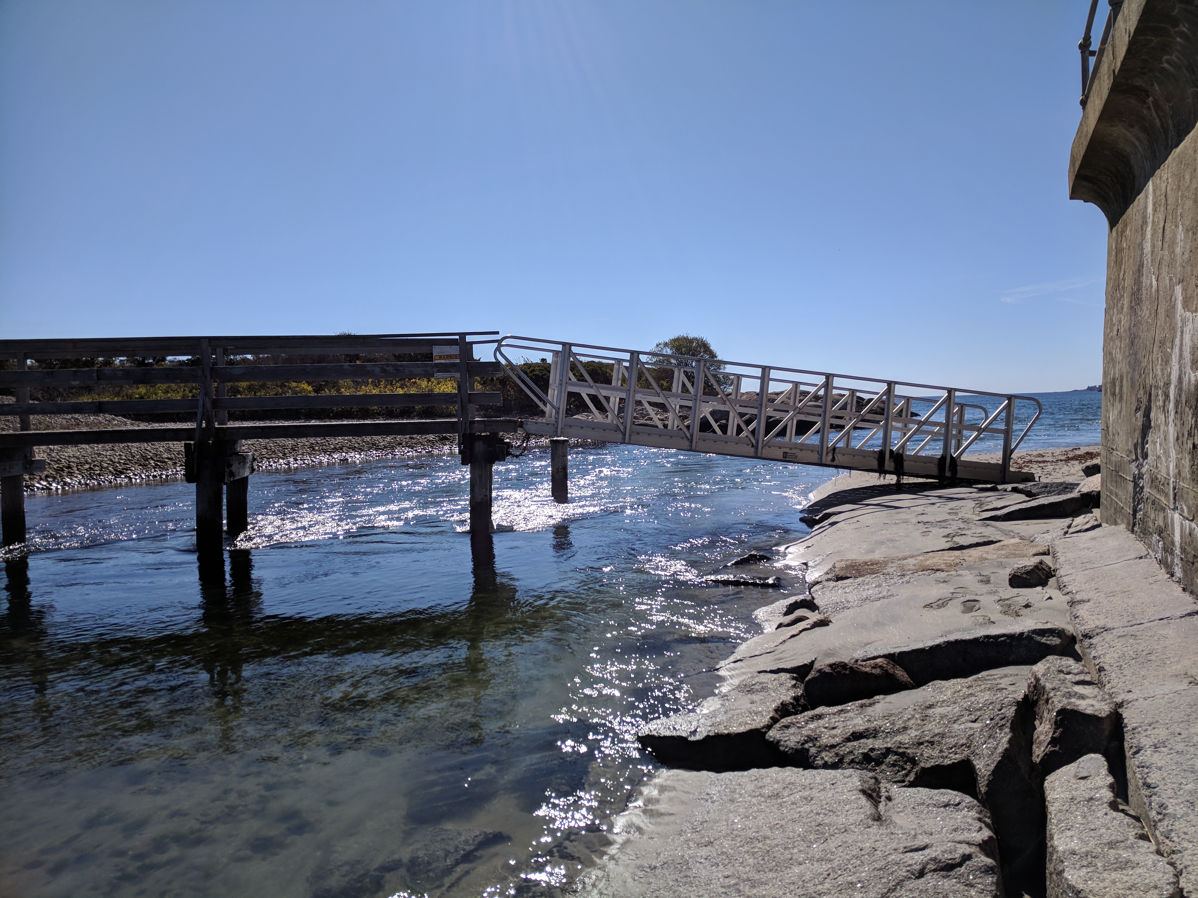
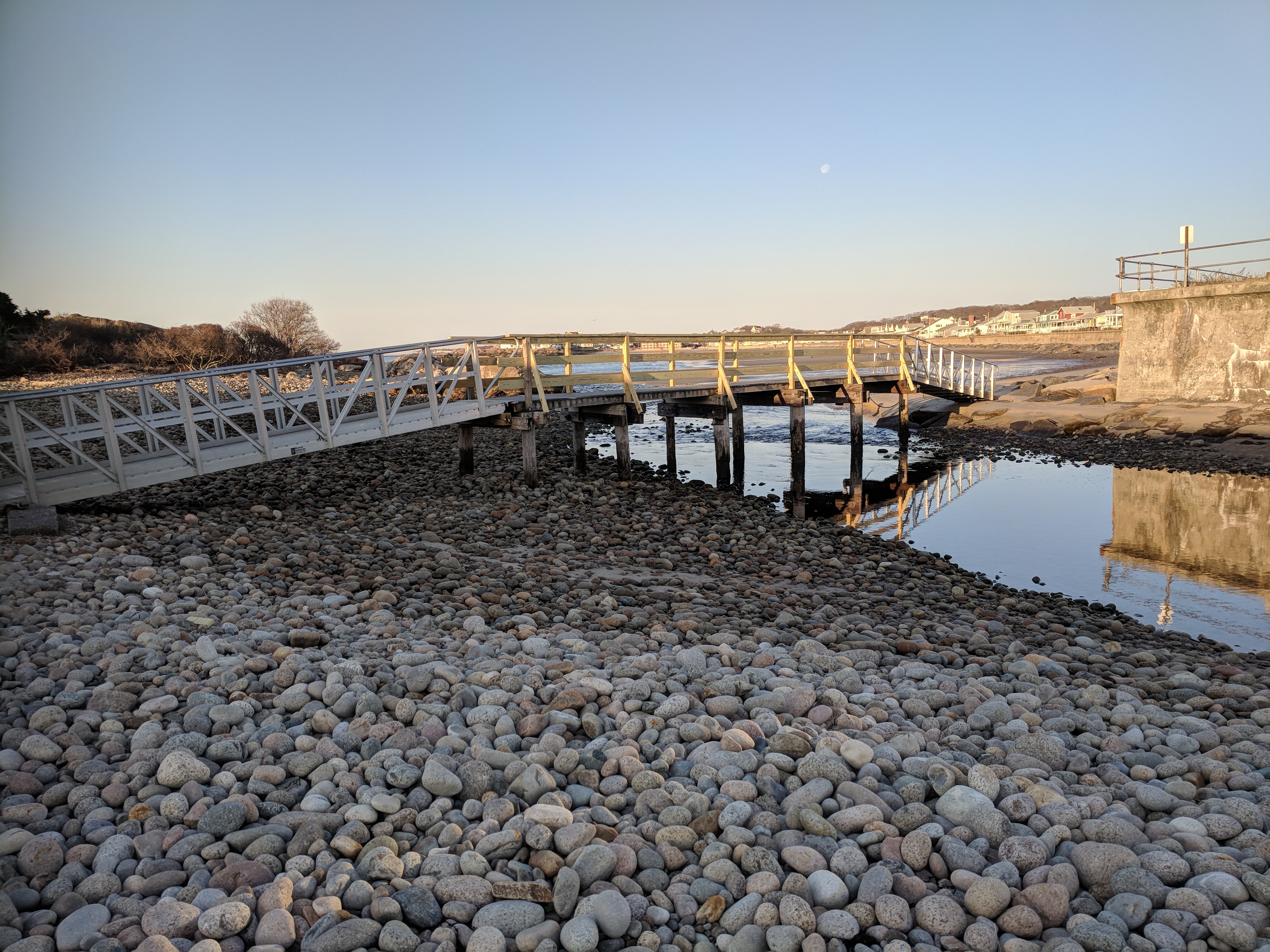
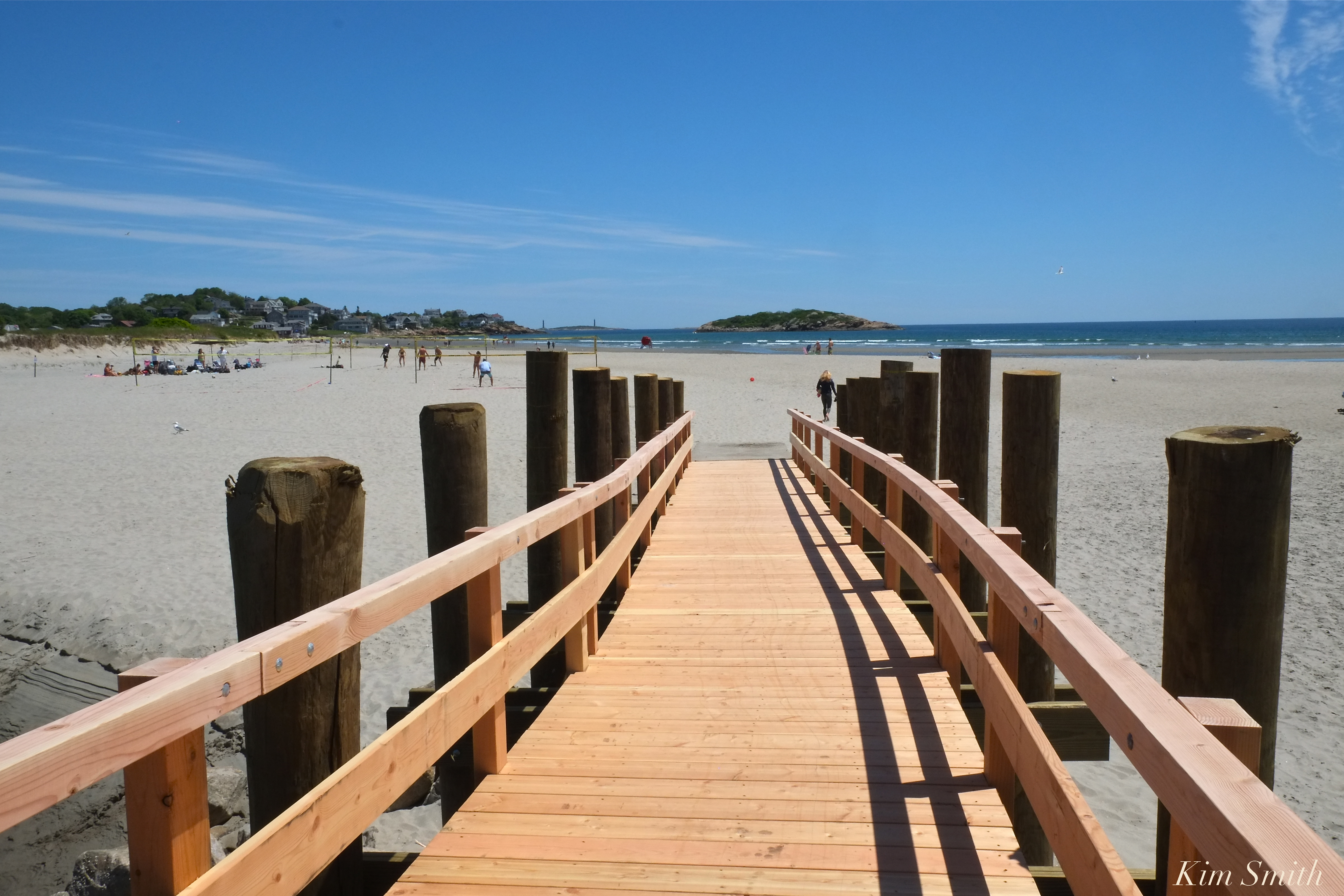 Thanks to the hard work and dedication of Phil Cucuru and Mike Tarantino, it appears as though the footbridge temporary bridge construction is complete. When we taped the podcast this morning, I was under the impression an inspection was required, which may be the case however, folks are using the bridge, and it looks perfect!
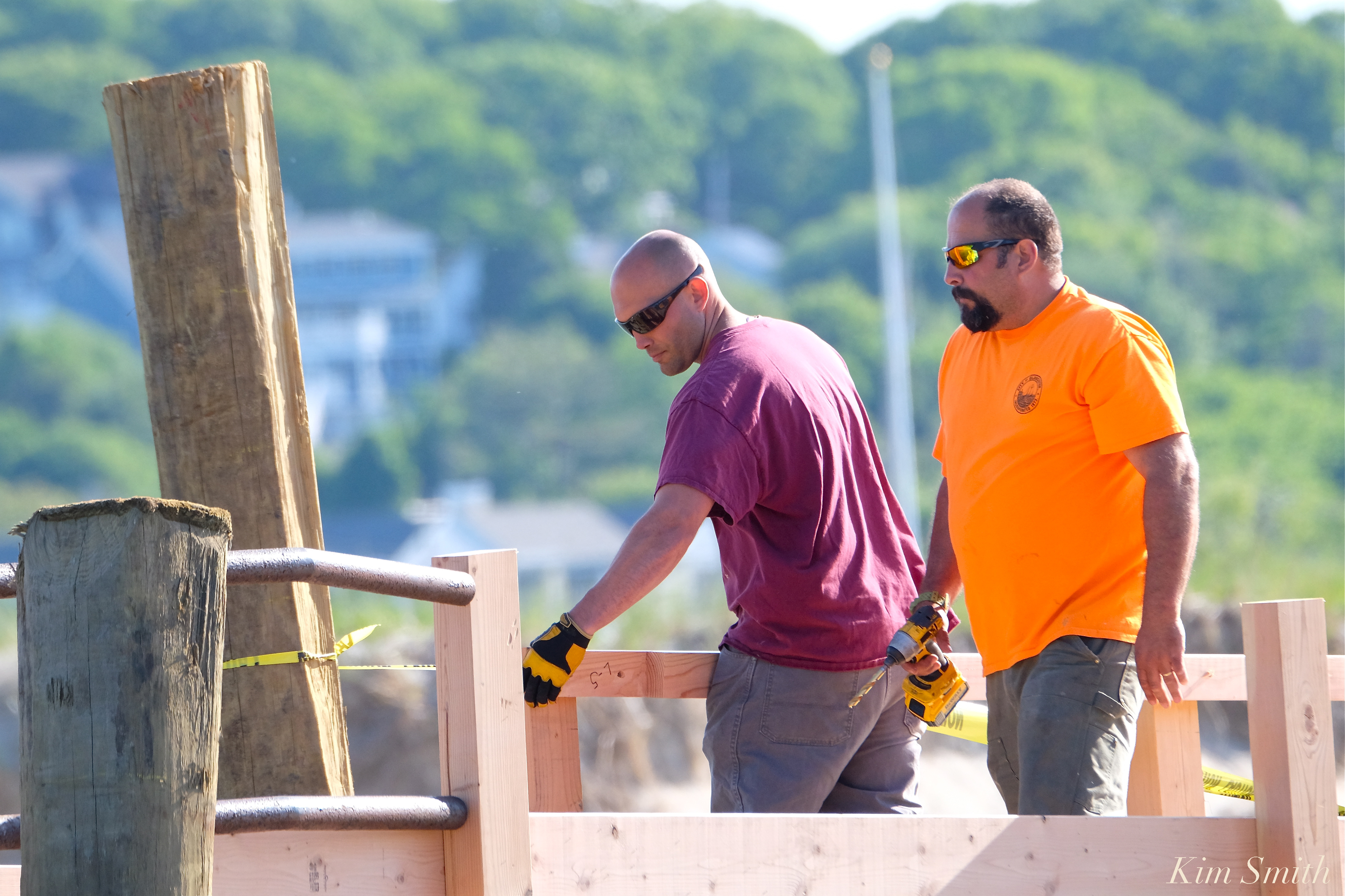 Great Work Phil and Mike!!!

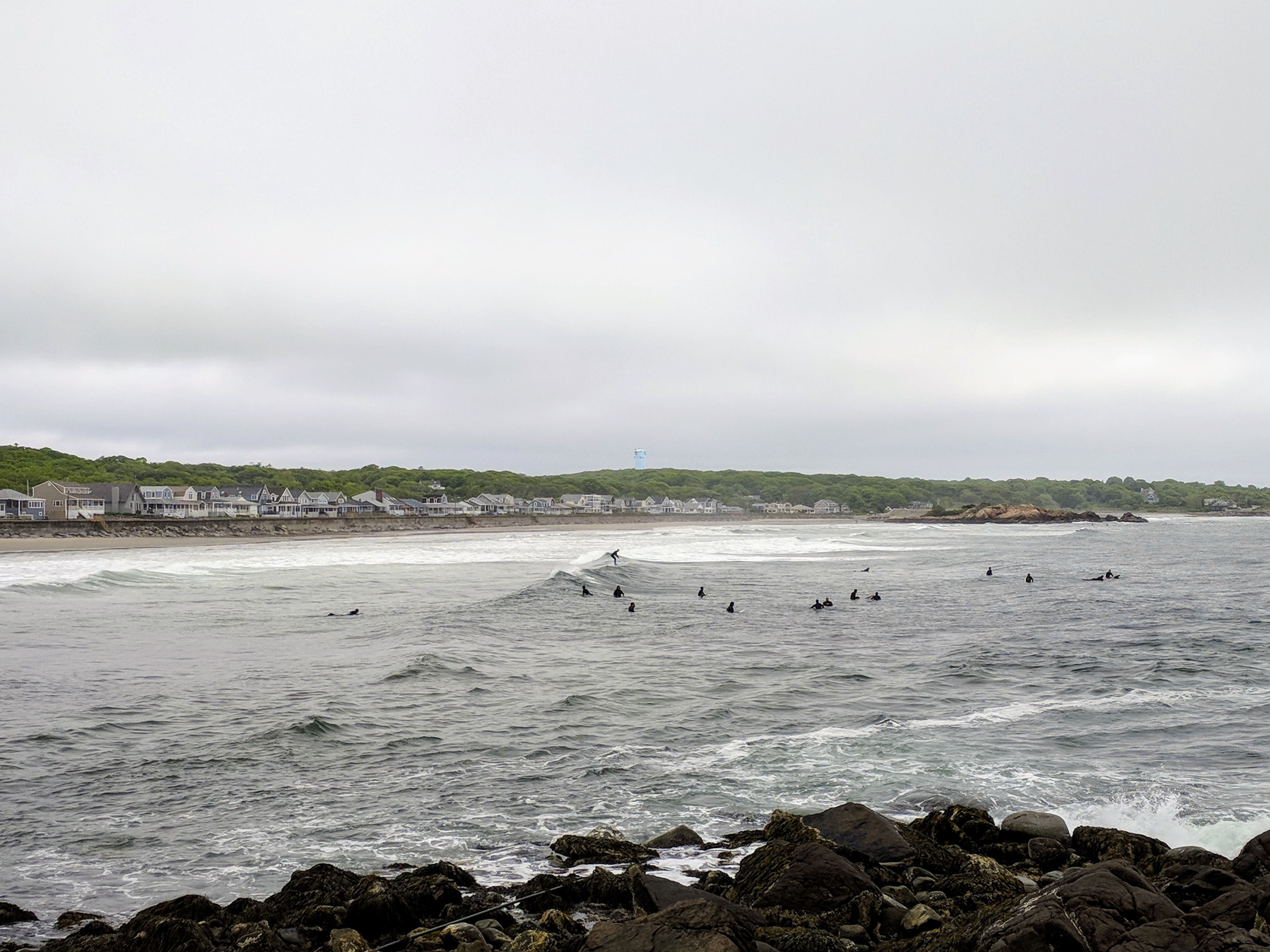

Photo journal documenting rapid damage and repairs post trio of winter storms as of May 2018.
is creeping back, truly. (view looking across to Gloucester side)
(sand migrating back- view looking to Rockport– see 2017 post about Long Beach annual shifting sands )
beach erosion was significant
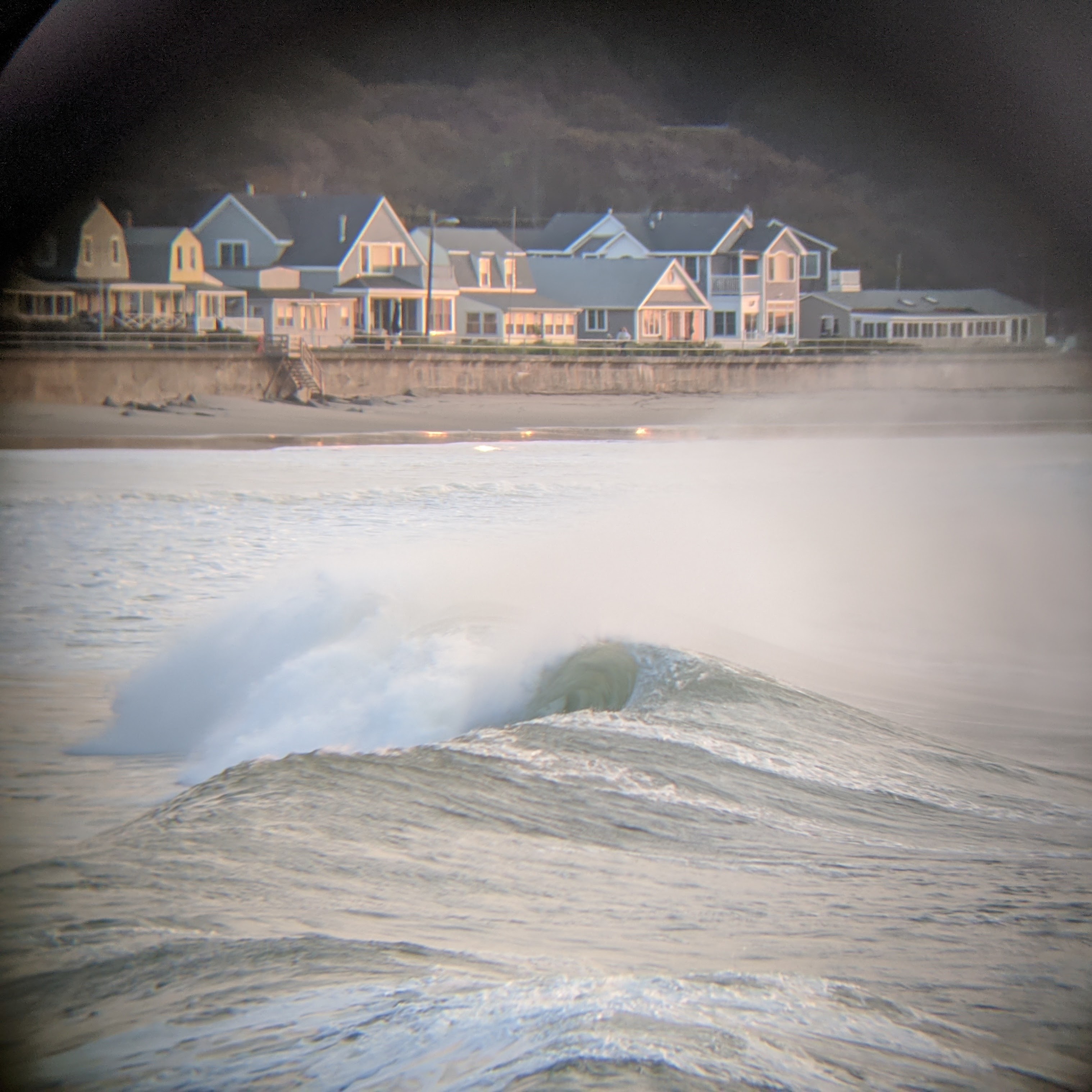
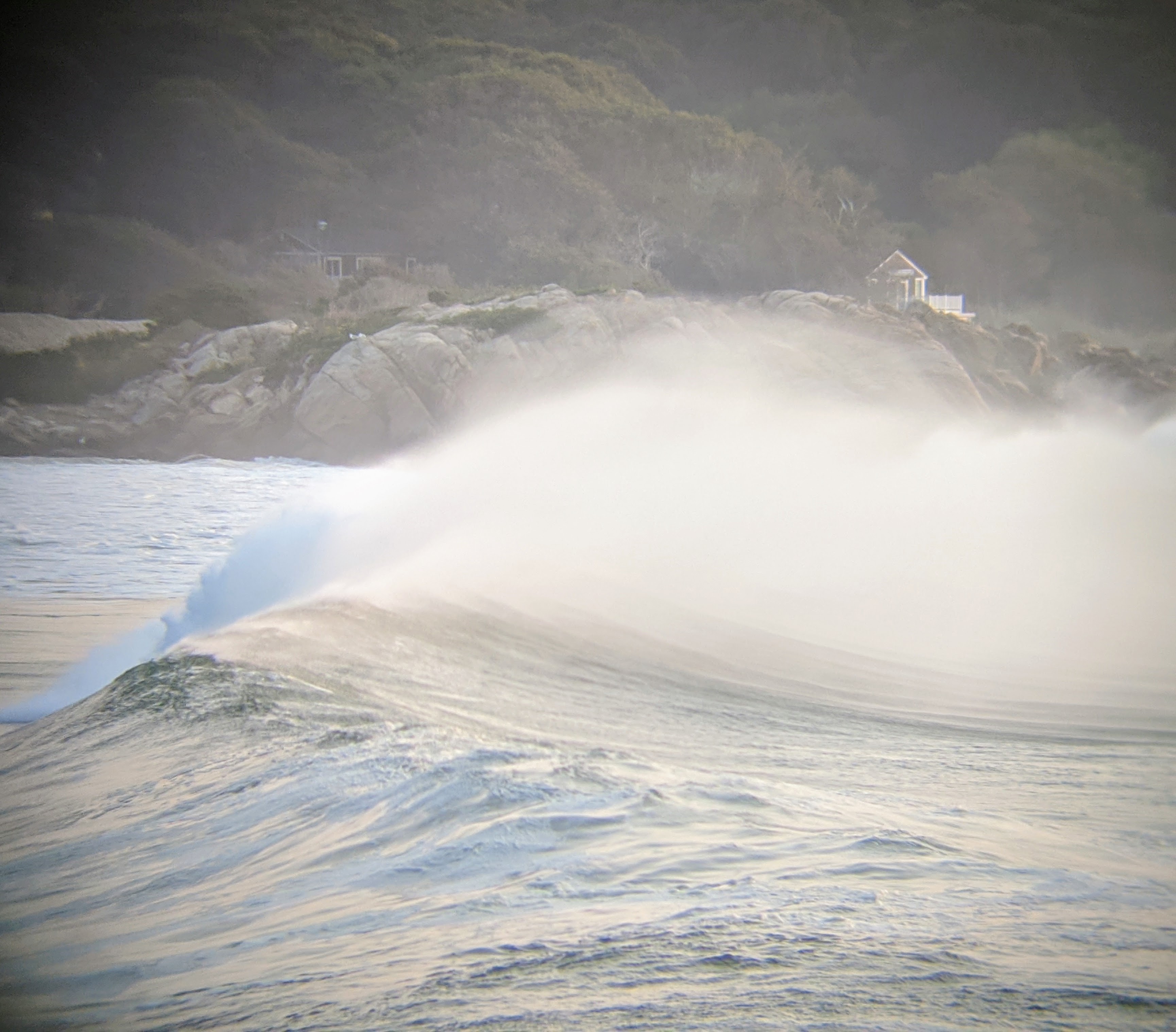
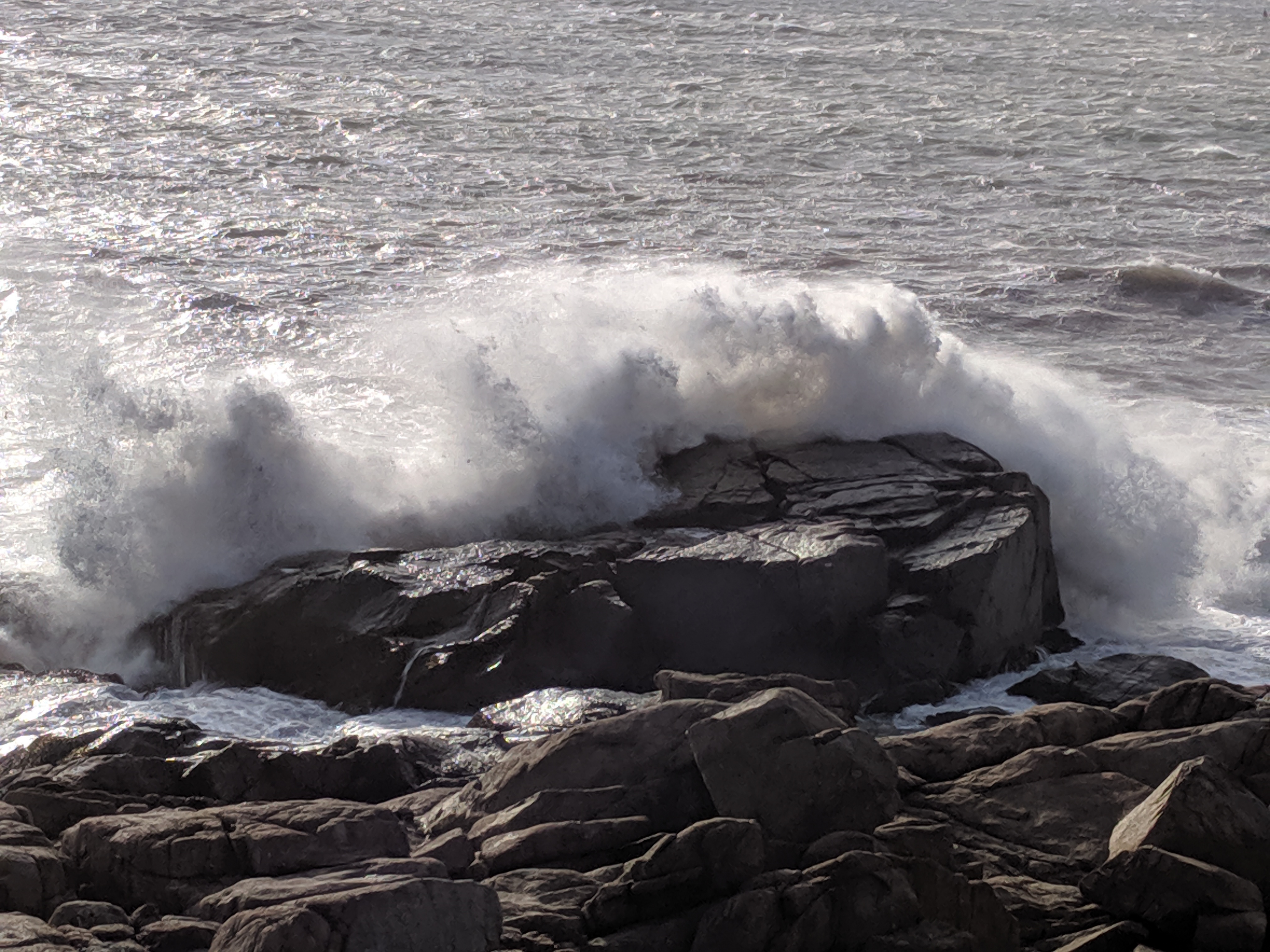
Spring tides slam the Long Beach seawall.
photo: A tree tossed up like a toothpick atop the rip rap helps to illustrate the ocean’s twice daily whollops.
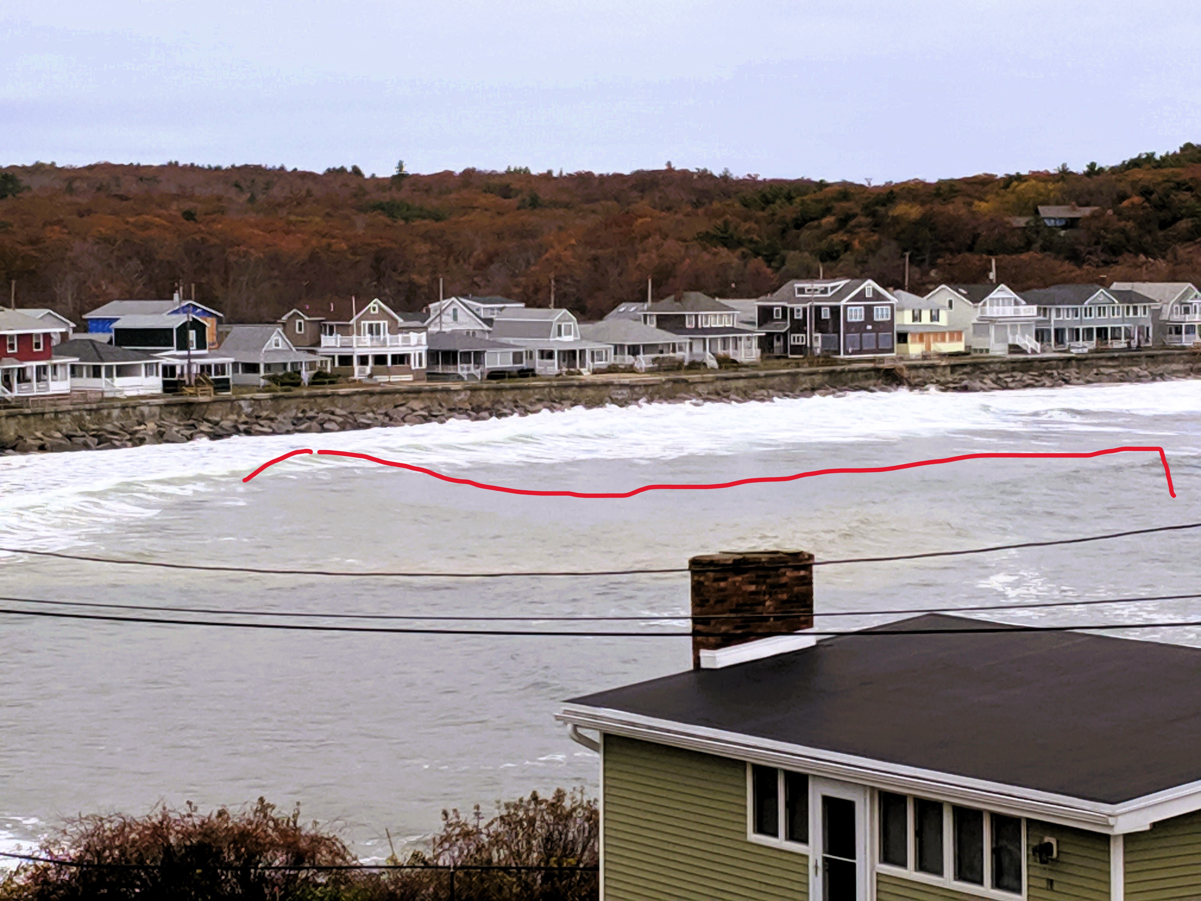
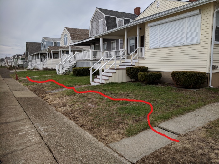
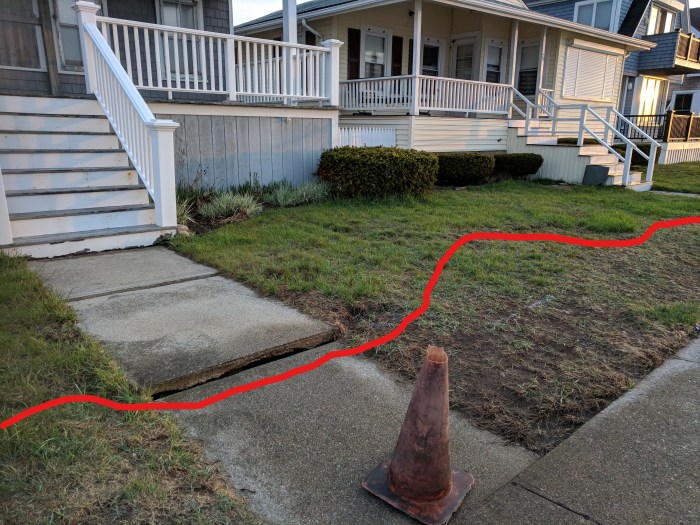
vulnerable spots clearly visible to the naked eye (I marked up two with red lines)
When the seawall opened up and heavy concrete sections balanced like hanging chads or individual playing cards, I was not surprised. The massive promenade had shown signs of strain. Small fissures and tiny holes were noticeable before the winter storms accelerated its decline. Water finds a way in at high tides. The manmade wall is noticeably shifting and rumbling at a greater pace. Holes, cracks and breaks along the seawall expand, and new ones erupt. I can’t help conjuring up comparisons to Yellowstone’s boiling and unpredictable surface. I imagine stakeholders are mapping details of their immediate landscape. Though beaten down, the promenade is walkable and sturdy. Tiny holes do expand rather alarmingly.
example –


and another (filled)- the cone eventually dropped beneath the path
Fissures


more photos (before-afters, repairs, boulder pyres, stairs or lack thereof, and nuisance popples) and videos of seawall ramparts giant boulder shuffle

Does anybody know the age of the mangrove-like roots that began to surface back in 2012 aside Eagle Rock and the creek? The 2018 winter storm erosion exposed more of a grove line parallel to the seawall. I am curious about the seemingly fossilized piercings and how the landscape may have looked before the beach we walk today.
more photos in my GMG post from 2016: Shore nature challenge: what are these? Long Beach Easter Island


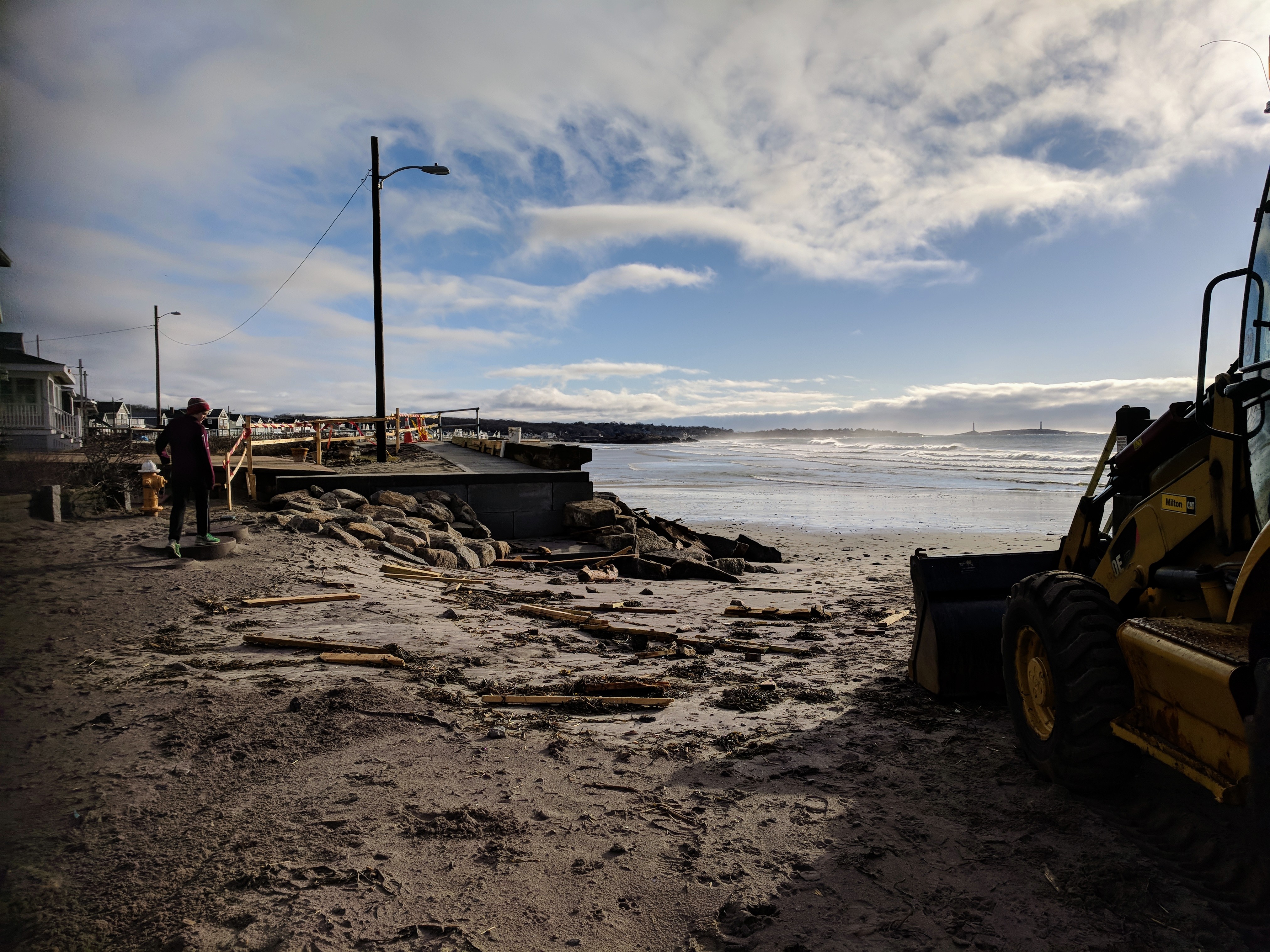
Sunny morning inspection following April 17, 2018 spring storm. DPW crews were racing to assess before the next incoming high tide. Gloucester-Rockport, Mass. Long Beach seawall and stairs were hit hard yesterday including a collapse. “I’ve never seen an aerial bend in the middle before.”

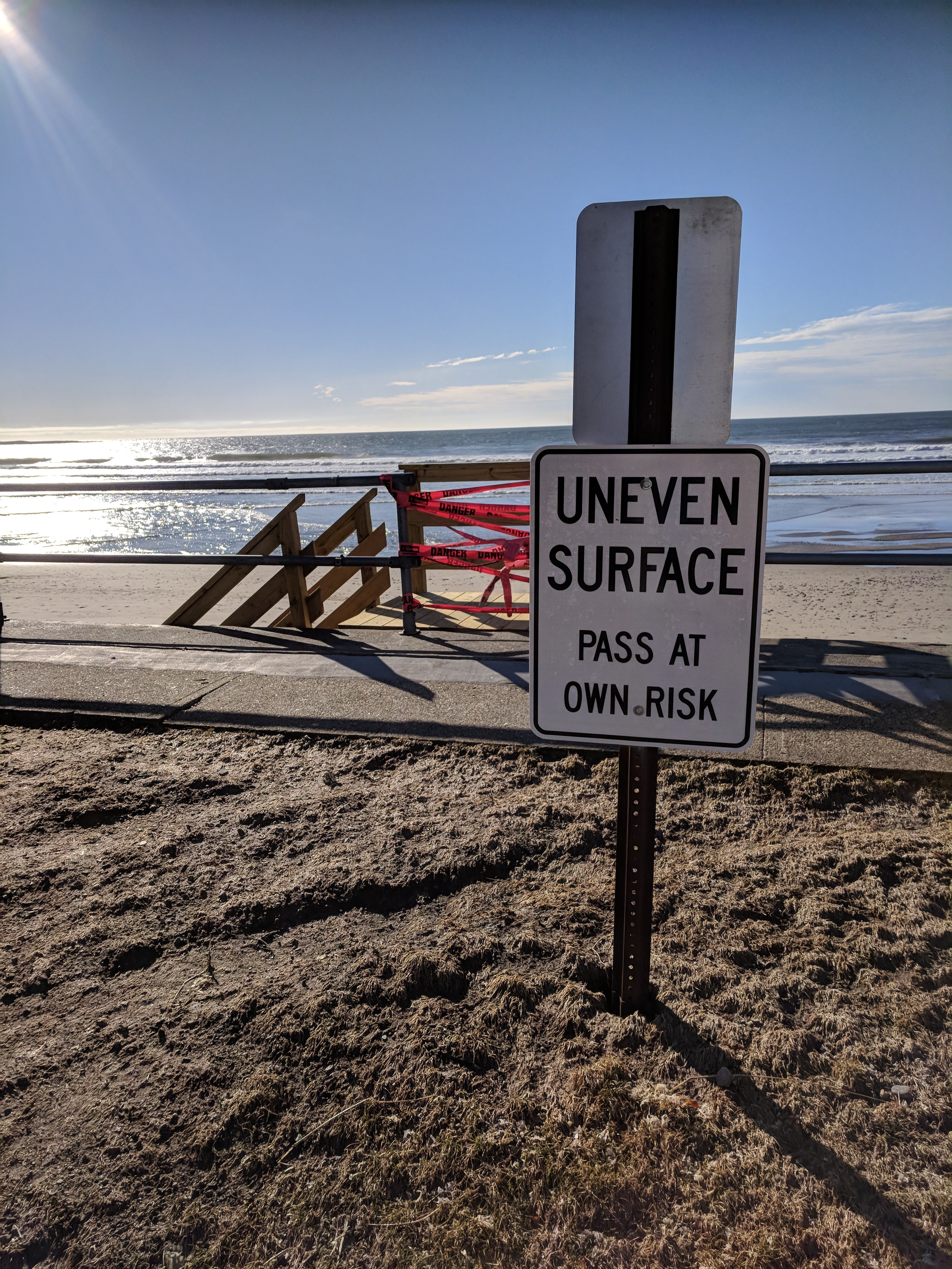
“Uneven surface- Pass at your own risk”
more photos (click to see full size)
Continue reading “Sinkholes on seawall: storm damages Long Beach”

https://www.instagram.com/p/BhH0mbvlUwo/
Shout out to Gloucester DPW’s Michael Silva and John Harris. This morning they removed all the rocks that were blocking the drainage pipe on Atlantic Road, near the Grapevine Road intersection. The rocks had been pushed into the drain by the March nor’easters.

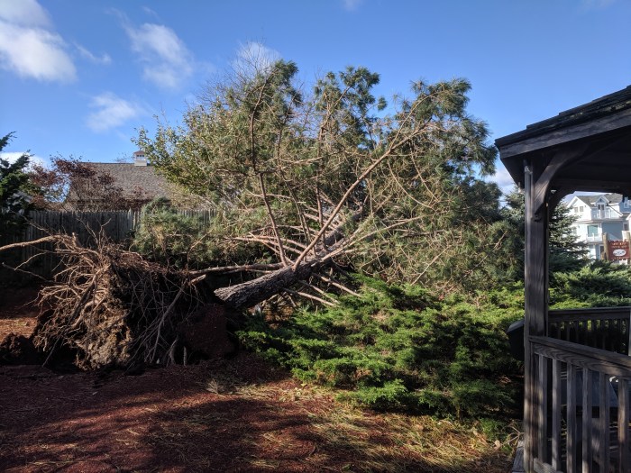
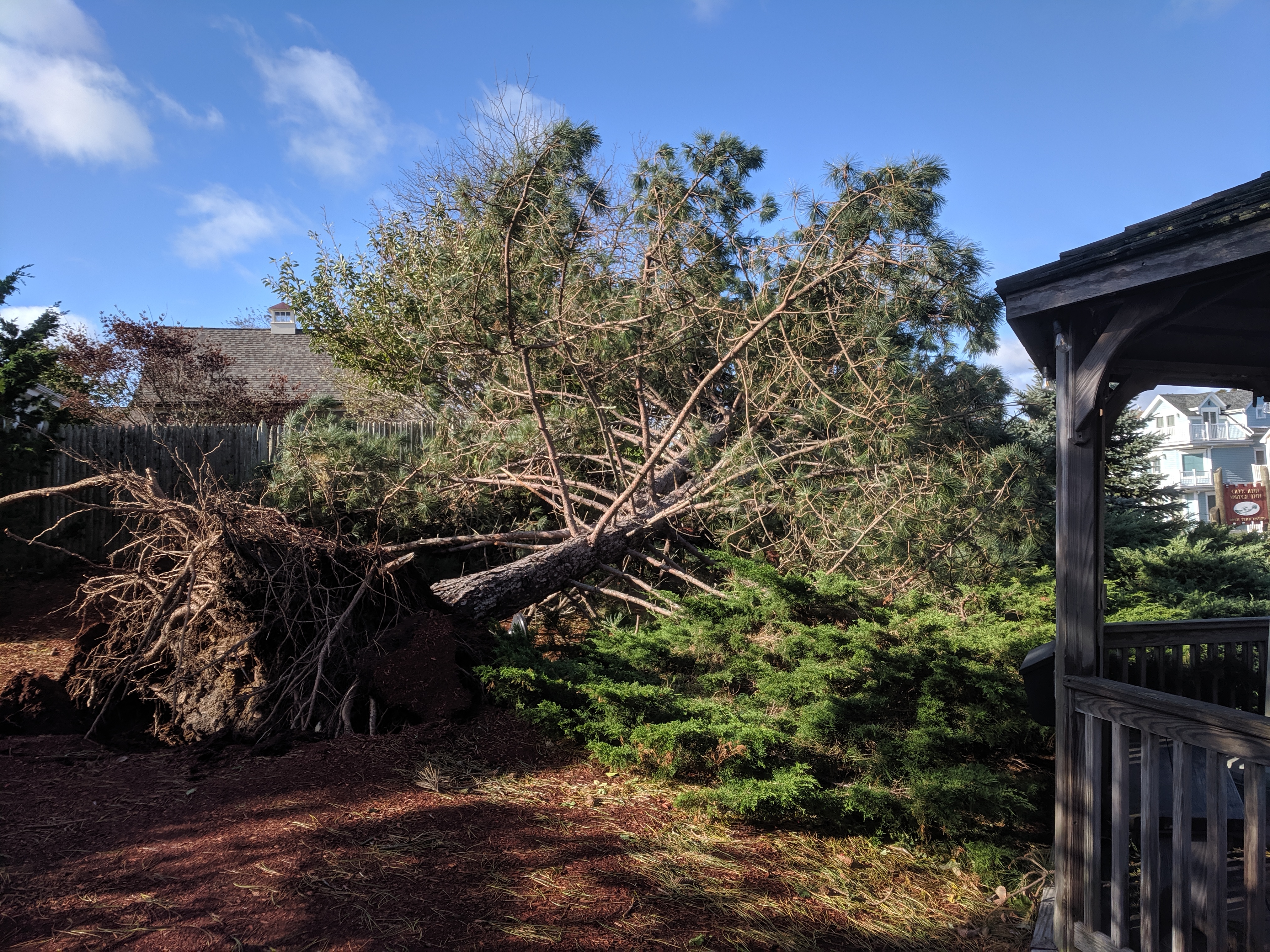
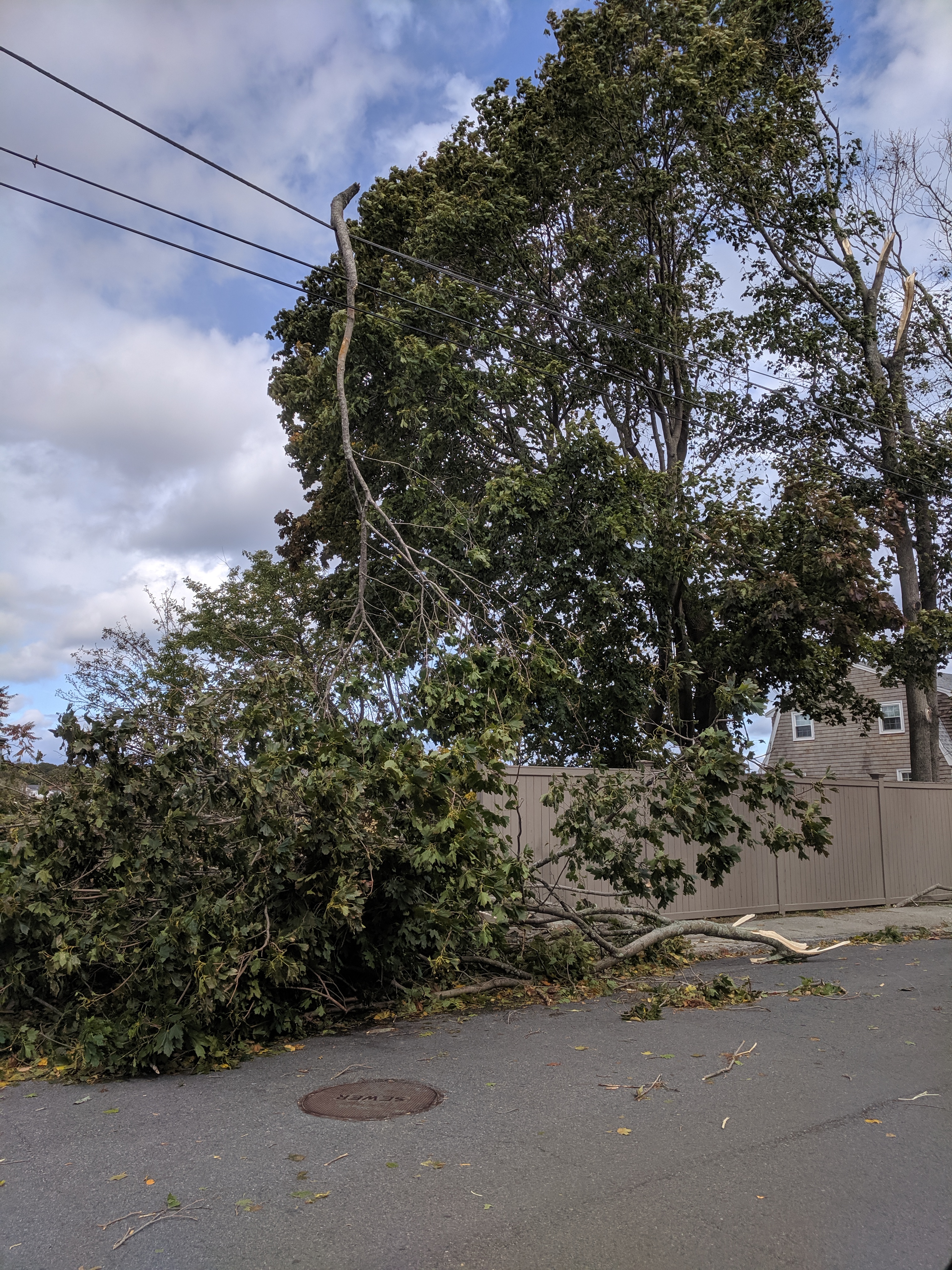
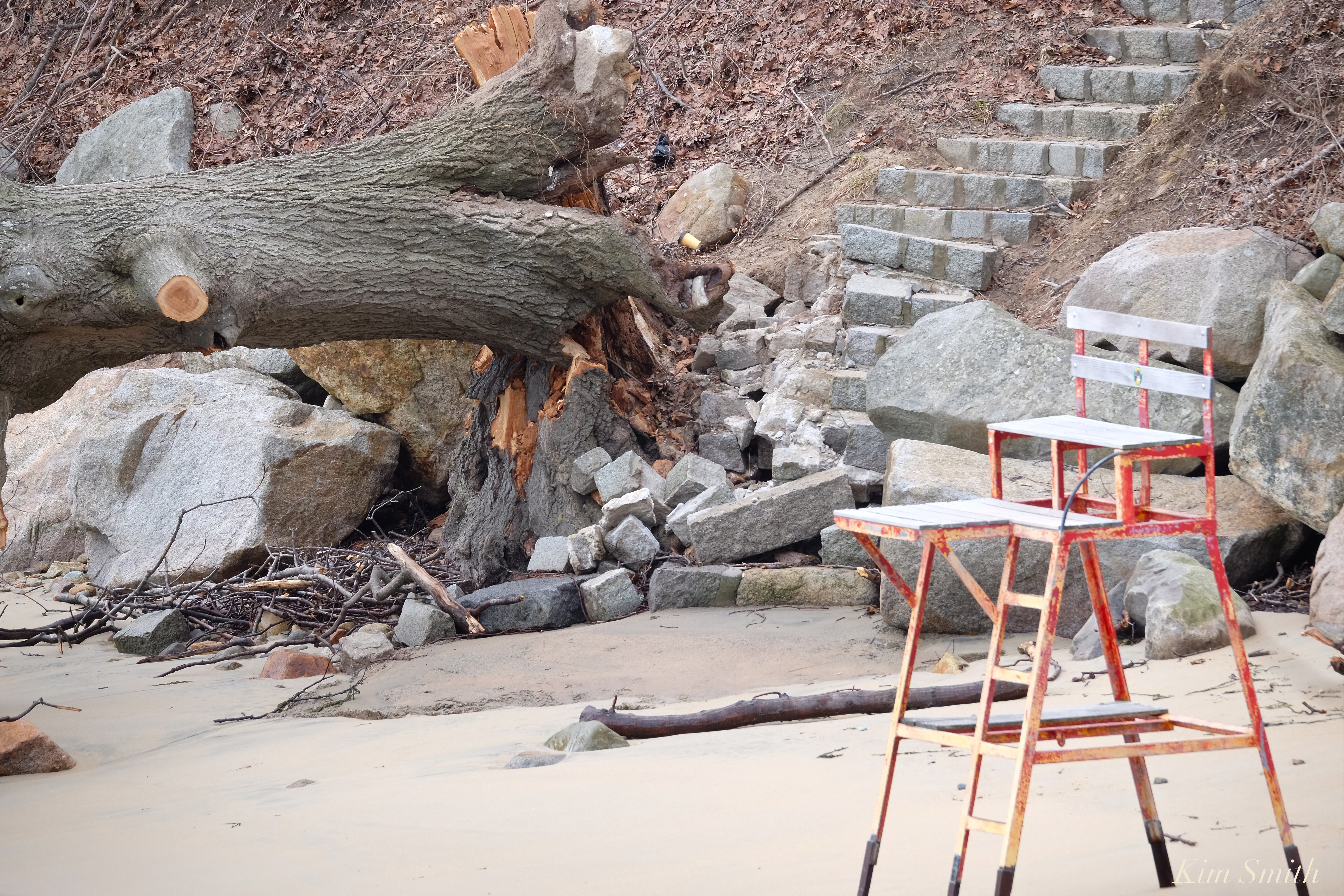 So very sorry to see the beautiful shade-providing old oak tree taken out by the nor’easters.
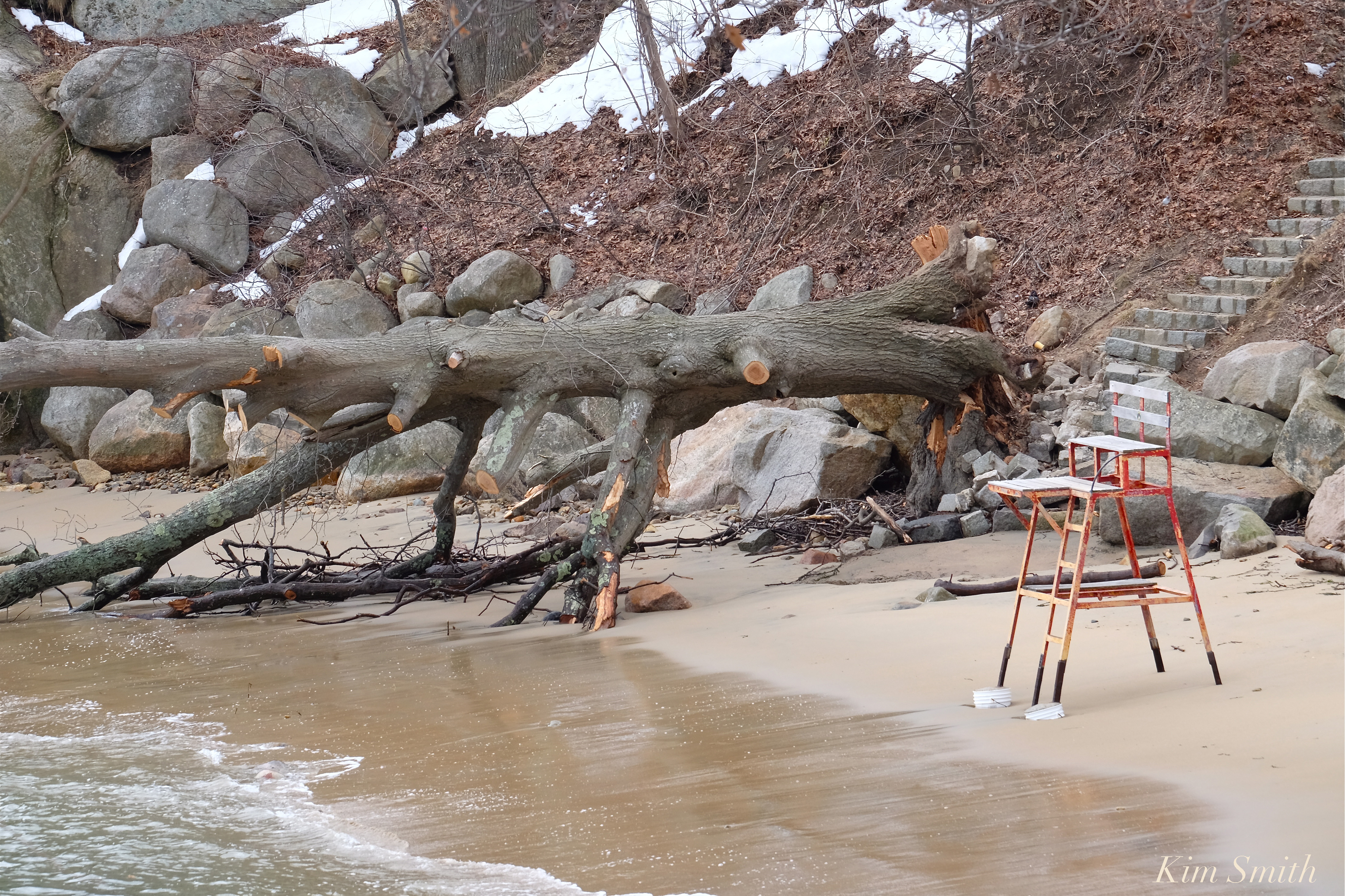 Cressy’s beach was hit hard, too, with mountains of rocks displaced and the ramp leading to the beach severely damaged. Both Stage Fort beaches sustained quite a bit of erosion.
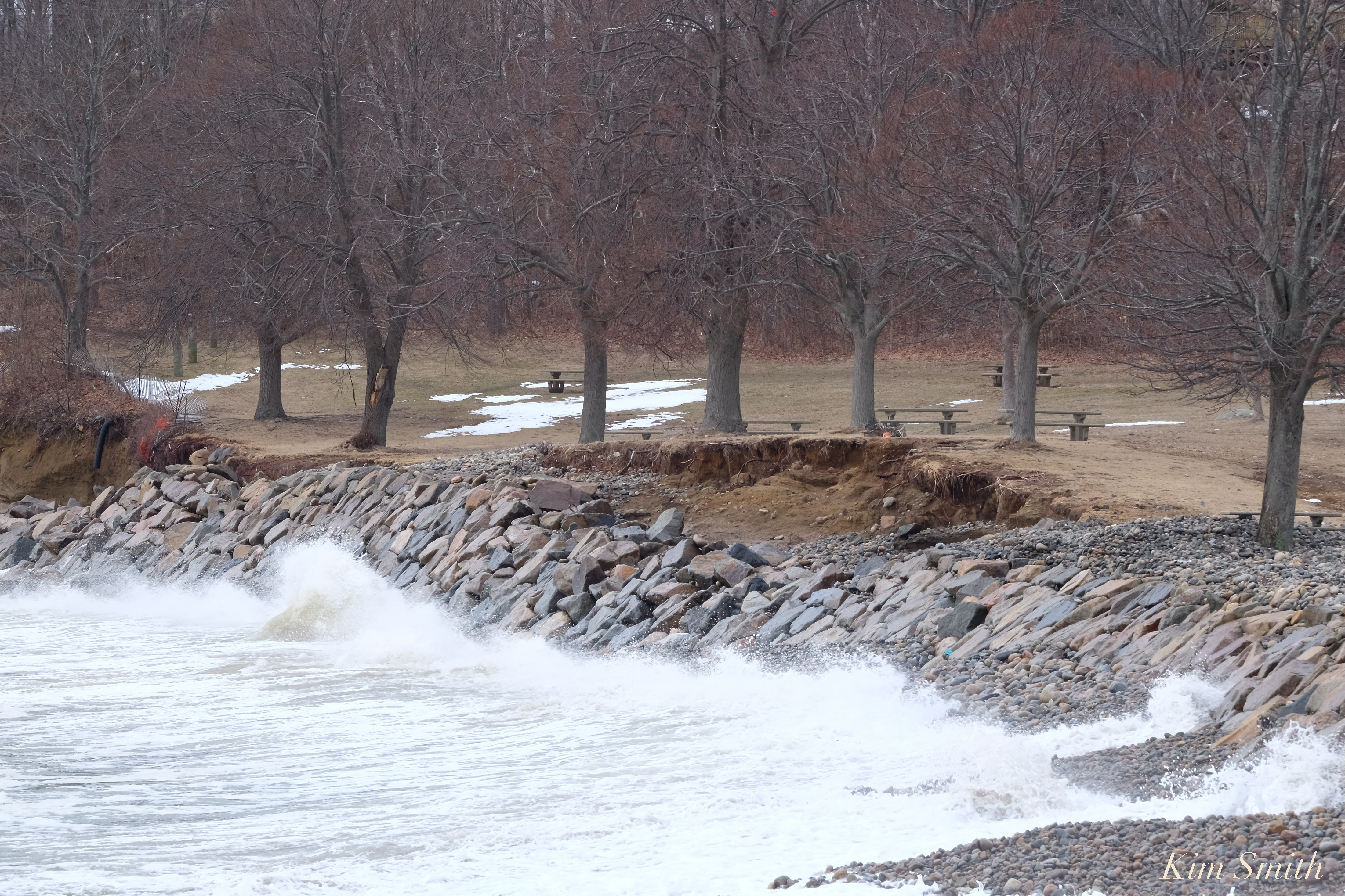

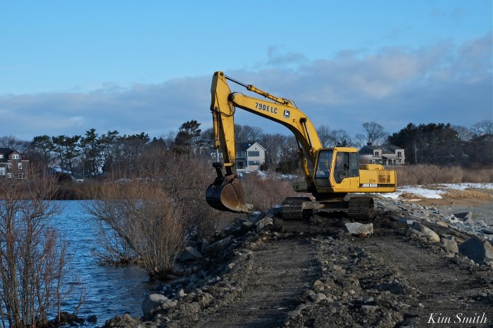
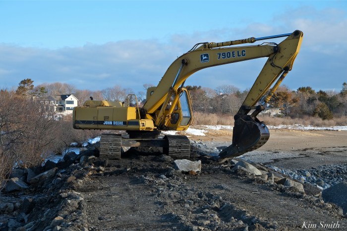
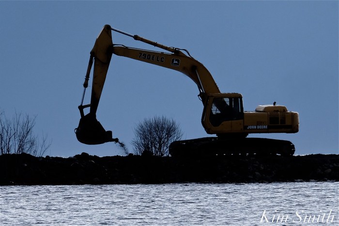
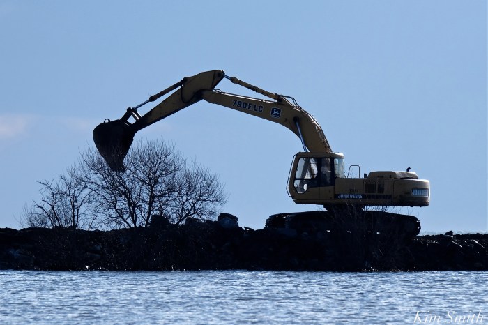
 The arduous work of rebuilding the Niles Pond Brace Cove causeway continues, despite the mid-week blizzard. I walked the causeway Tuesday night and then again the past several mornings–the pace of the restoration is fantastic and will soon be completed. Many, many thanks to the generous residents of Eastern Point who are striving to keep Niles Pond from being engulfed by the sea.
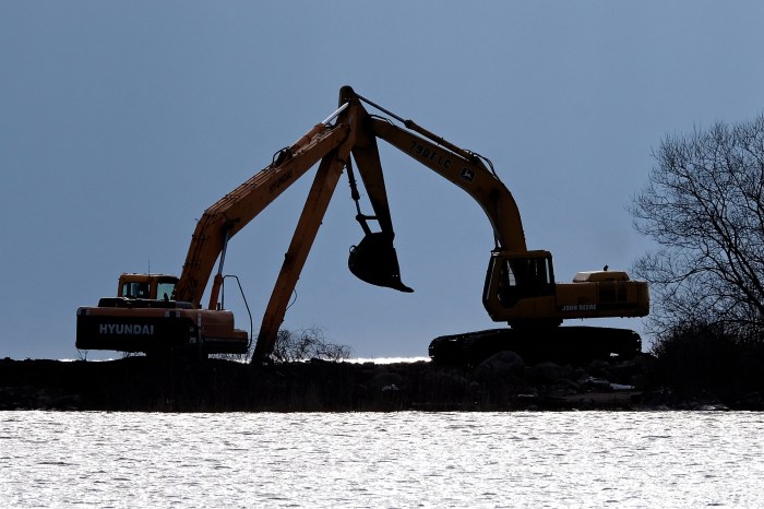
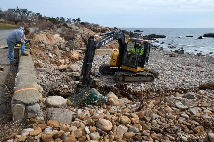
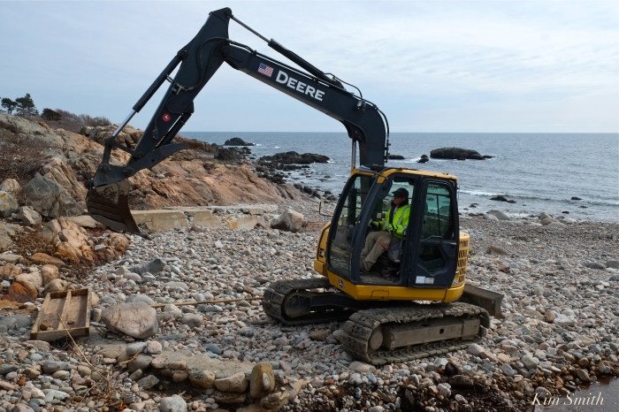
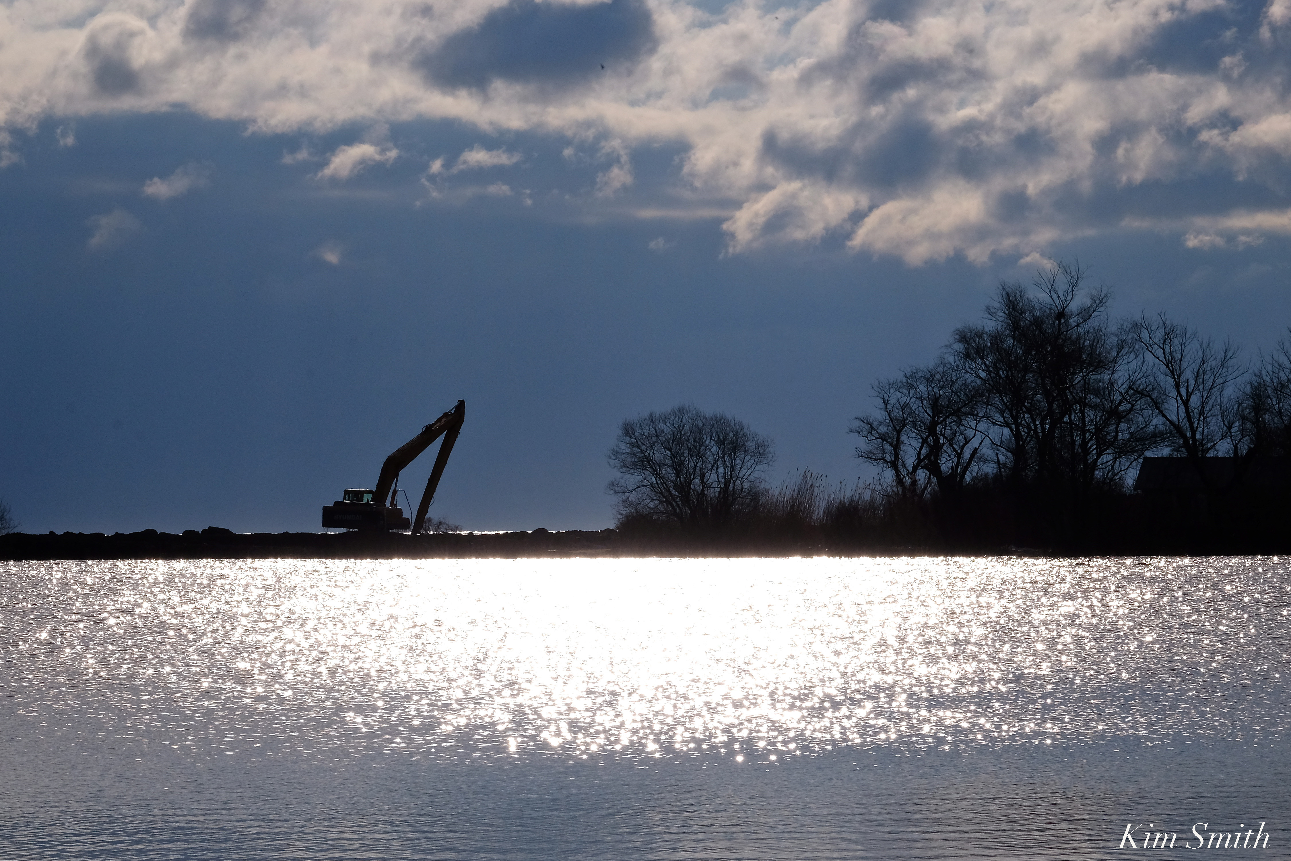
R. B. Strong’s Larry expertly operates the John Deere excavator, deftly extracting and moving boulders around as if they were pebbles on the shore. The track-hoe not only scoops and lifts the massive rocks, the bucket is also used to tamp down the boulders once in place, as you can see in the video below.