
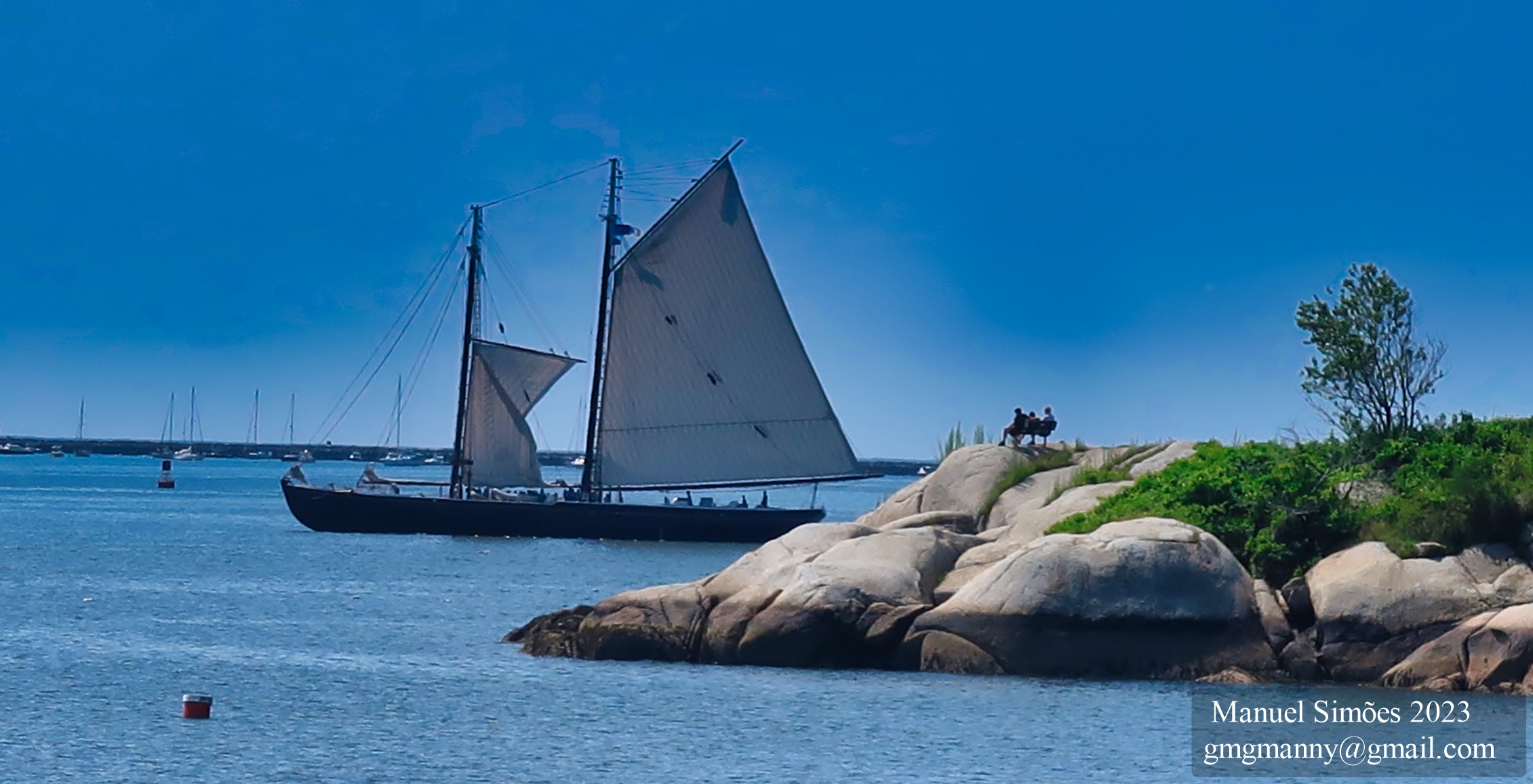
My View of Life on the Dock


Link to post by Catharine in 2019 for old photos of area https://goodmorninggloucester.com/2019/10/16/sam-novello-asks-gmg-what-happened-to-the-cannons-at-stage-fort-park/


Sam Novello asks GMG, “Joe, what happened to the cannons at Stage Fort Park—— two are gone?”
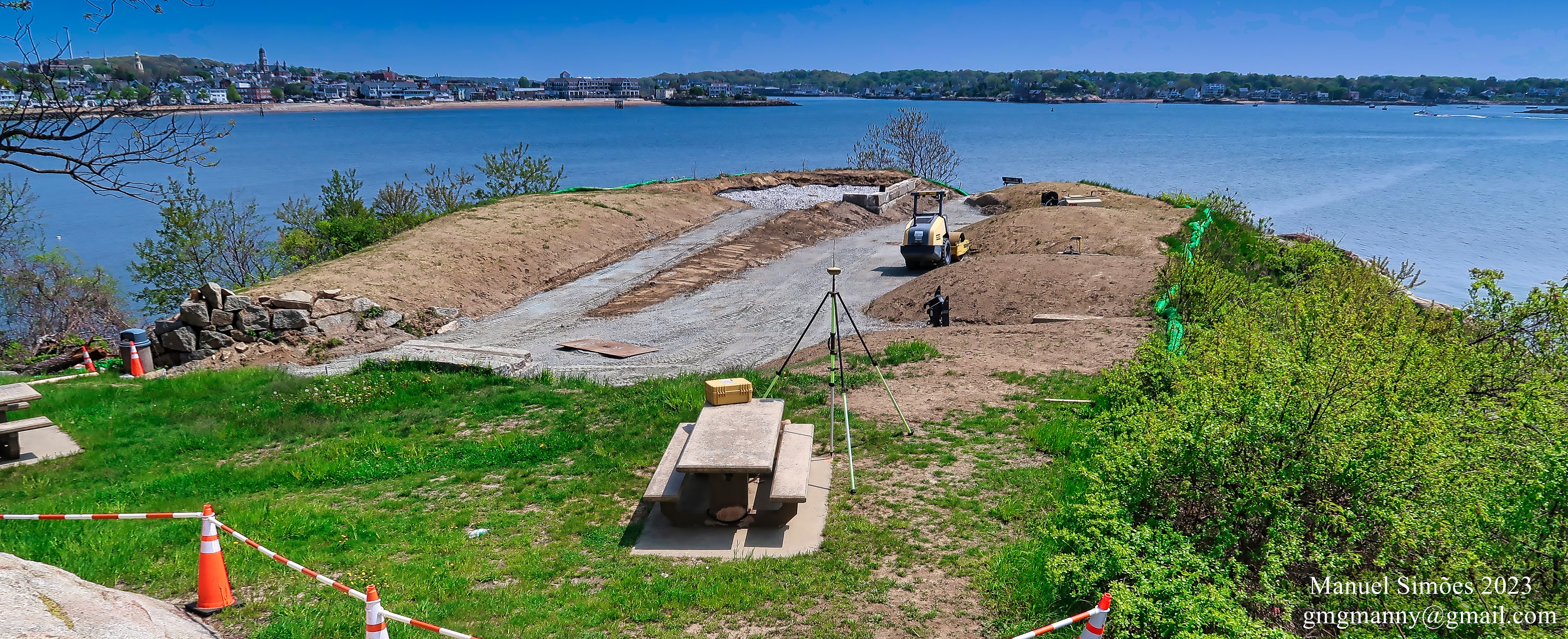
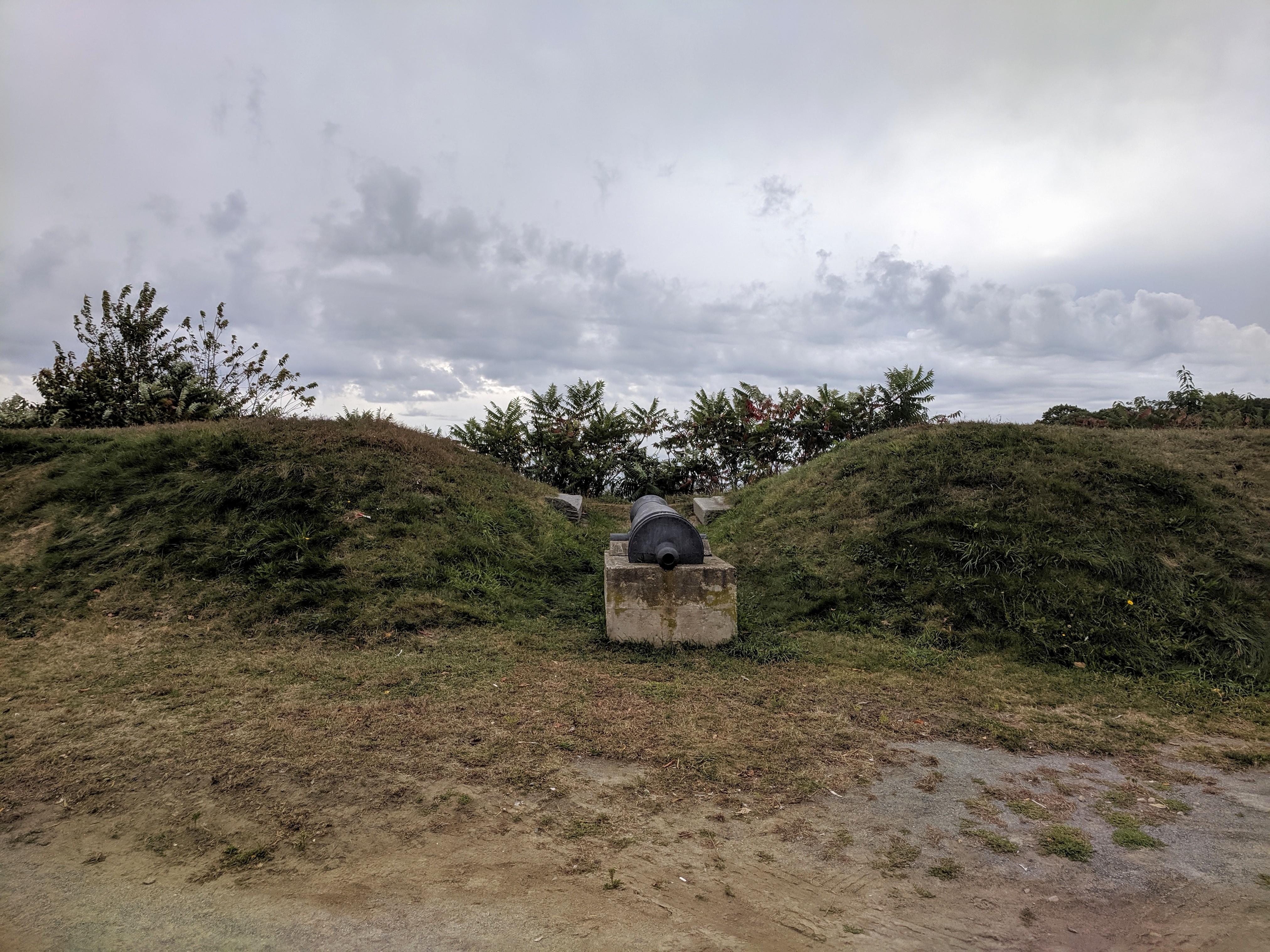
The cannon(s) are undergoing restoration (cleaning, chemical treatment and re-painting). In 2018, the CPA Committee awarded $22,705 of an estimated $46,000 to the Stage Fort Park Advisory Committee to refurbish the Parrot Rifle Cannon for work scheduled to commence spring 2020. The project is led by the Stage Fort Park Advisory Committee. The grant application project summary indicates the scope of work as follows:
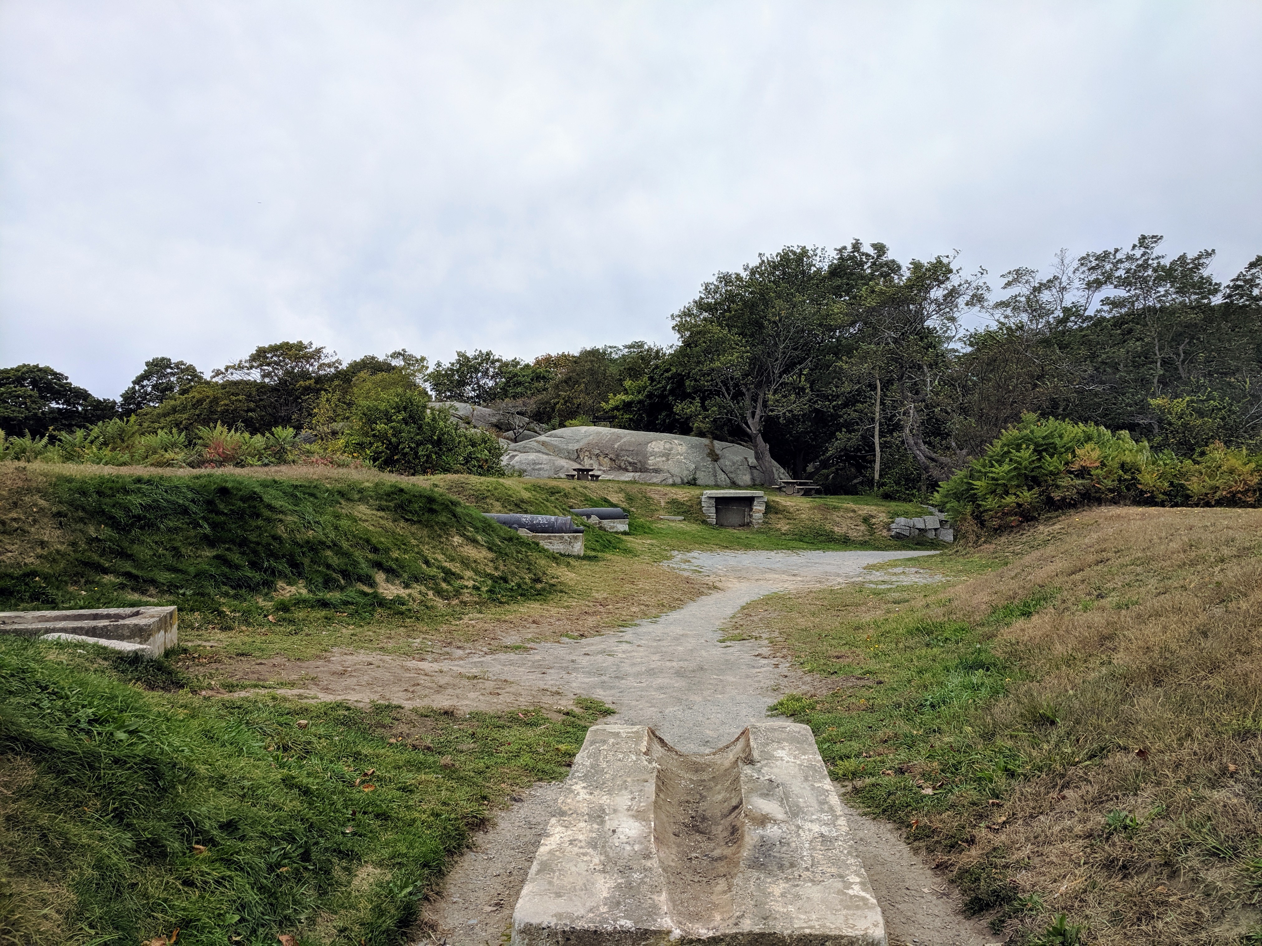
“Our final goal is to restore the Fort area as a historic feature of the Park and its importance to our local military history.* Repairs and restoration of this site are long overdue. The ramparts are overgrown with vegetation**. The cannon barrels are suffering due to neglect. The barrels are subject to trash, dirt and debris. We hope to preserve this site for future generations. The cleaning, capping and painting of the cannon will protect the barrel against future damage. We have proposed an annual stipend in the city budget of $2000 for maintenance of the Fort as well as a security plan for the Fort which would include lighting and security cameras. *Our ultimate goals include a visitor education center with historic references to the Fort and its history. It is expected that the entire Stage Fort Park will be used as a centerpiece of the city’s 400th anniversary celebrations.”


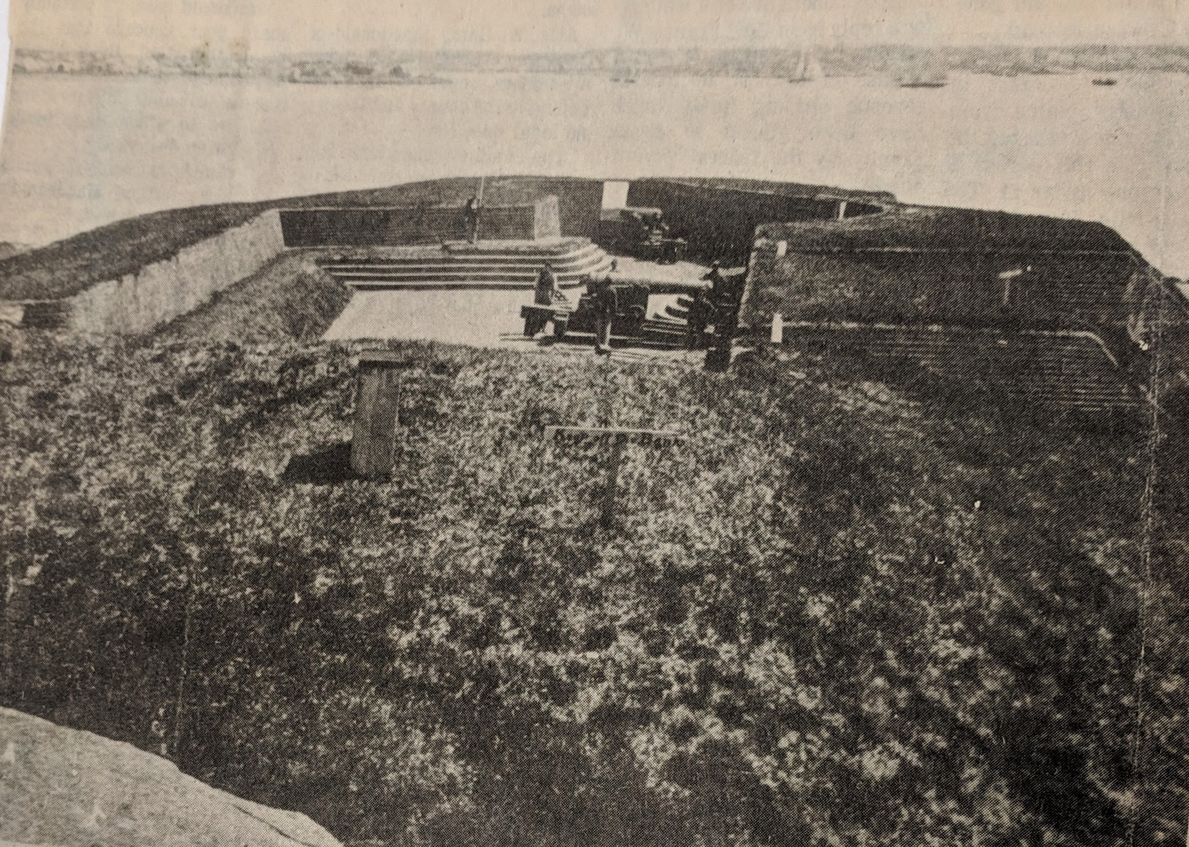
– Stage Fort Park Advisory Committee CPA application excerpt, photo from packet and phasing goals
Read the full application here: 2019 CPA Application SFP Parrot Rifle Cannon Carriage
*There is no finalized plan for this area overall. (See photographs then/now below.)There IS a history of Fort use and restoration for historic battles –as well as city celebrations– honoring this legacy and the kind souls who volunteered to do so.
For example: I’m not sure if the 187th Infantry Brigade was paid for the work they did in 1973, which I’m assuming was the last big overhaul. The CPA grant is just about the work on the cannons. The Historical Commission wrote a letter of support stressing replica accuracy using period materials (wood and metal)
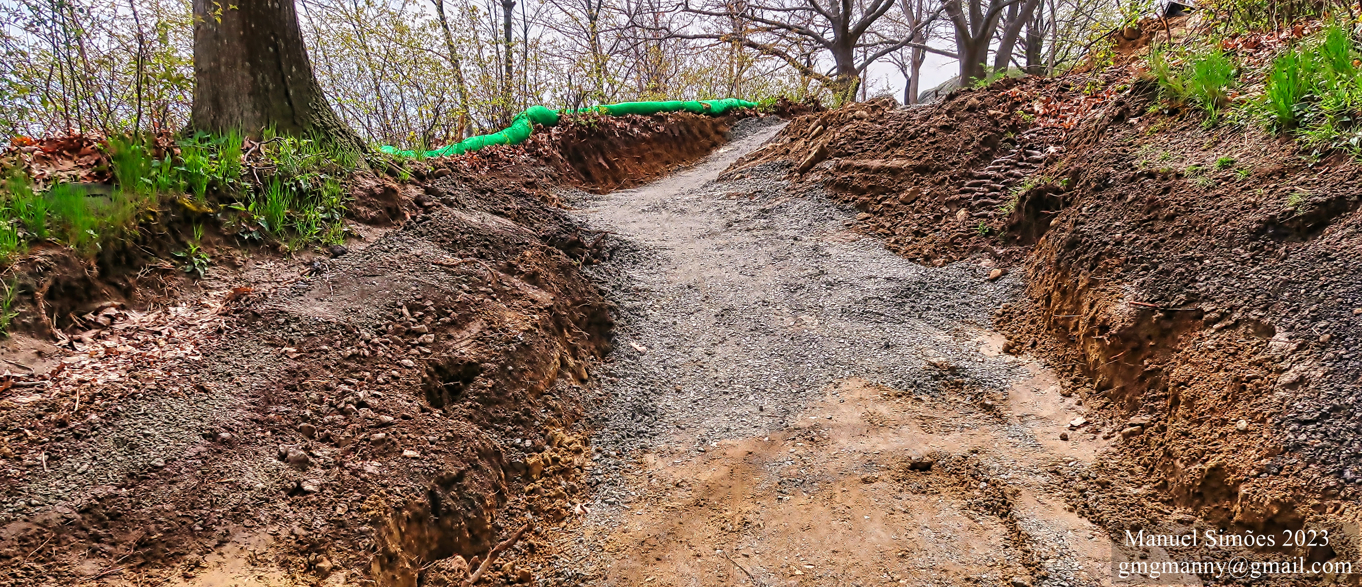
**The area is overgrown at the moment because of various DPW work on the boulevard and future plans. (When I photographed the area annually it’s cleared.)
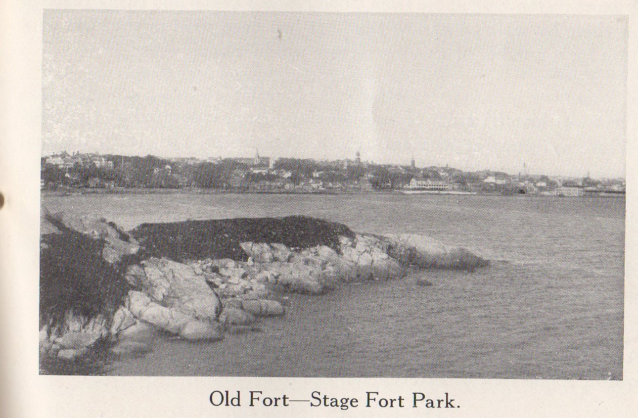
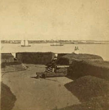
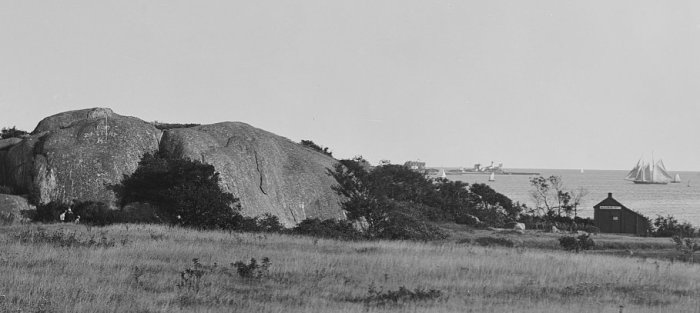
Stage Fort is the oldest fort in the Massachusetts Bay Colony.
")
")
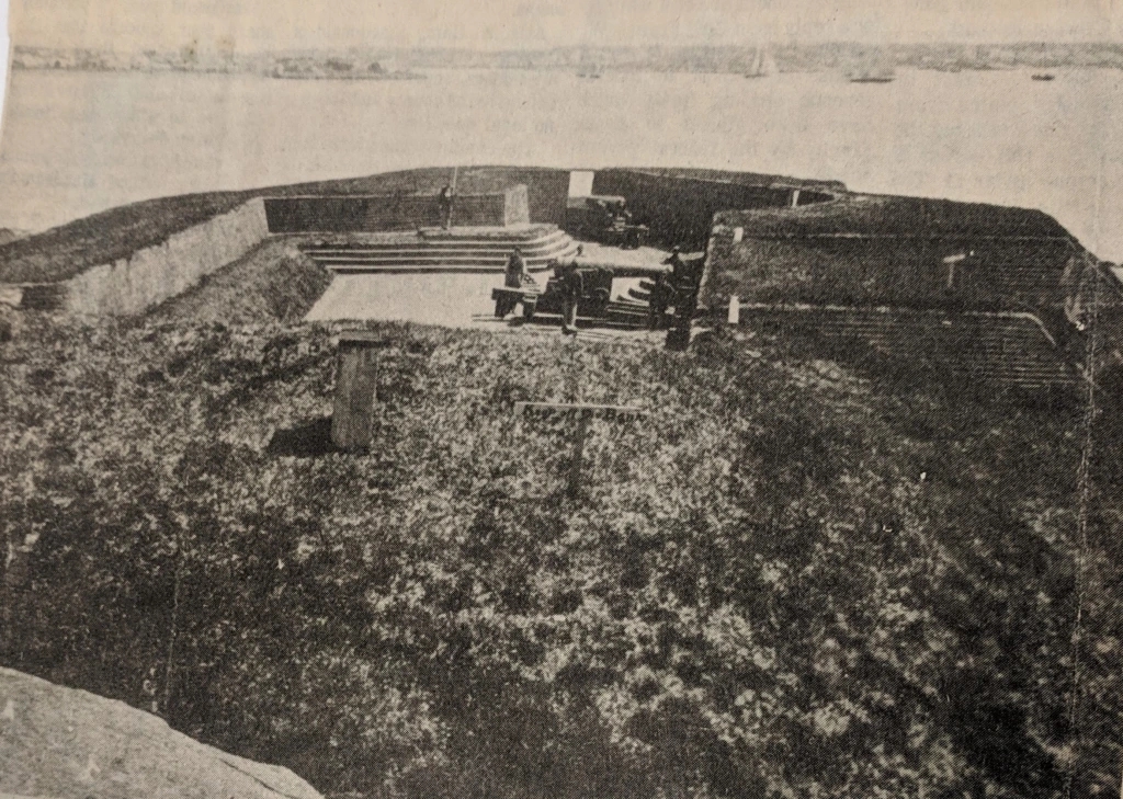
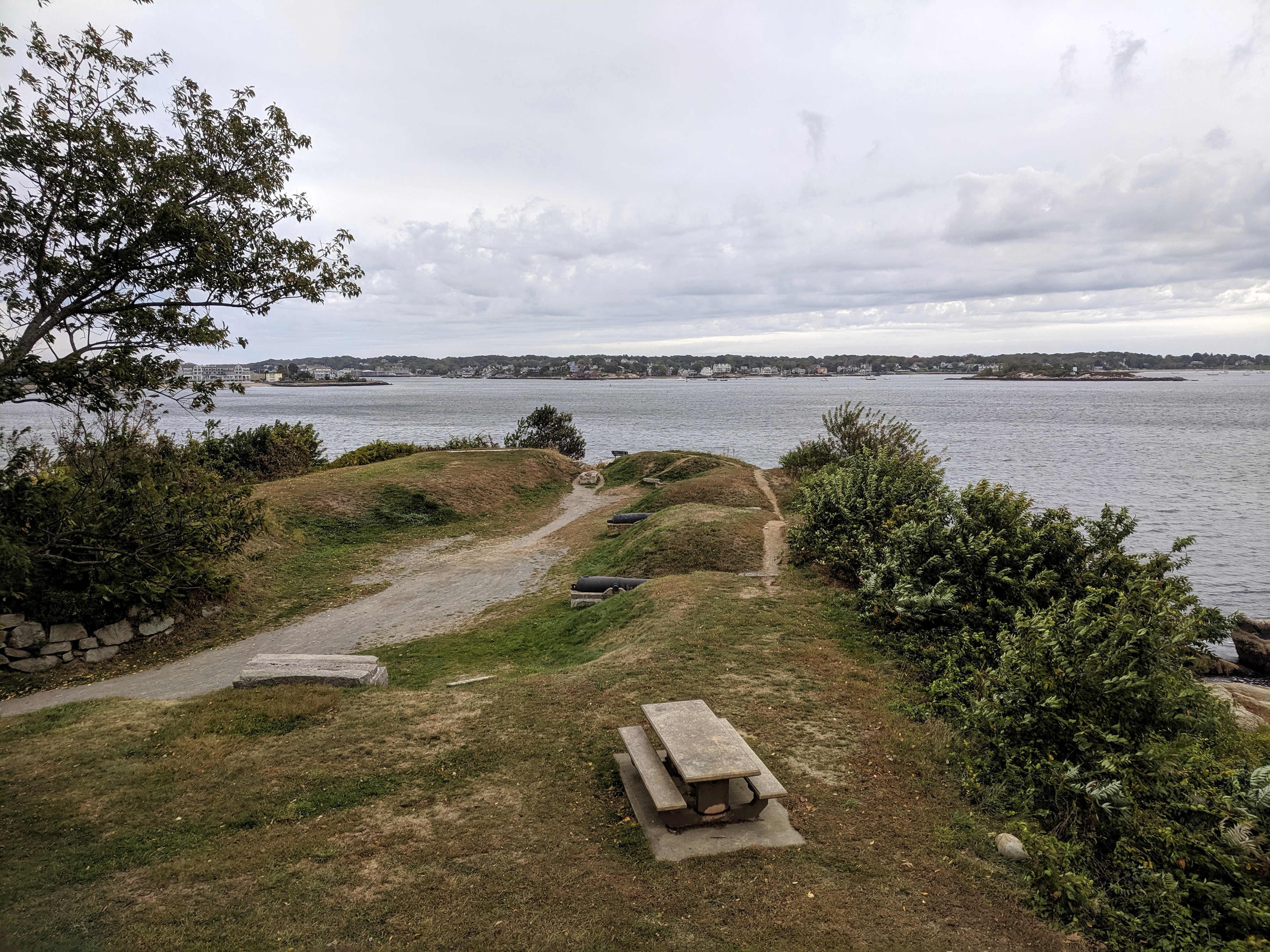
As part of the city’s 350th celebration prep, the cannon site area (earthworks, entrance area, powder magazine, and gun embrasures) was restored by an engineer brigade from Wollaston. The design intent turned the clock back to how the fort would have been built out in the 1700s. Julian Hatch, the chairman of the 350th, had been director of public works for the city. The project was decades in the wishing and sensitively designed at long last.
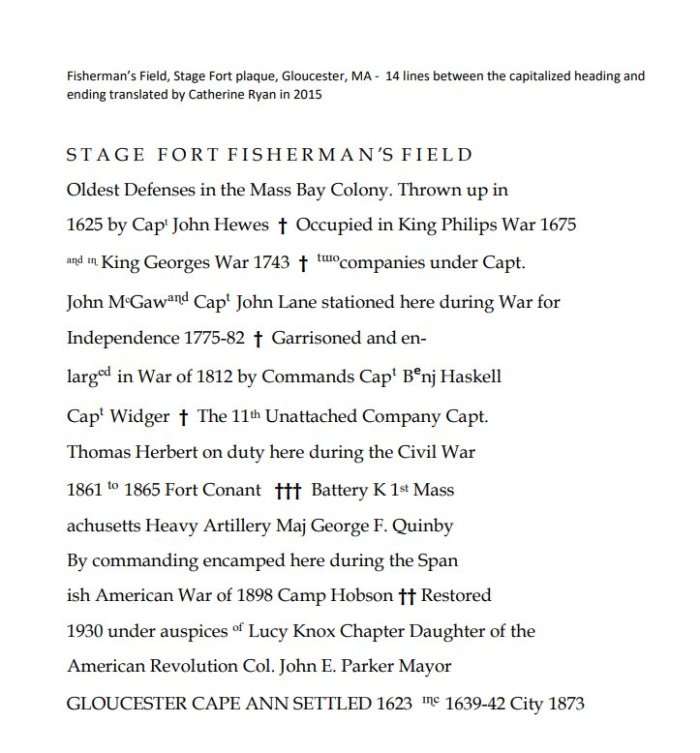
In 1930, the Fort was spruced up from its formal design post Civil and Spanish war. Fisherman’s Field Stage Fort information plaques were commissioned and unveiled.
Bronze tribute plaques embedded in Tablet Rock at Stage Fort Park detail the site’s history and were commissioned and unveiled at different times. The monumental and stunning Founders plaque from 1907 on Tablet Rock itself is in fantastic condition. Two DAR plaques were inlaid on the glacial outcroppings past half moon beach on the way to the cannons. The Fisherman’s Field (ca.1930) is so worn it’s nearly indecipherable, though that’s part of its charm. The plaque compels close inspection, lingering and discovery. It’s a fun family activity for anyone who likes a challenge. For those who want help reading the content, I transcribed it back in 2010. ”
Printable PDF of the plaque translation here
Read more about historic battles and Gloucester Stage Fort Park in this trivia quiz designed by Shaun Goulart, GHS history teacher, in this prior GMG post.
copy of Frank L. Cox fine art photograph (pre dates 1921) he used to illustrate his pocket Gloucester guide “The Gloucester Book”, and sell prints


ANSWERS TO SHAUN GOULART’S LOCAL HISTORY TRIVIA WEEK TWO
How did you do? Week two delved into scenes of historic battles. I’ve added some background. Stop here if you prefer to go back to see Week 2 questions only from 3/17/19
*“In 1623, 14 English fishermen set up the first European colony on Cape Ann here in what was then Fisherman’s Field and is now Stage Fort Park. These ramparts overlook the harbor, first built during the Revolutionary War, renewed for the War of 1812, the Civil War and the Spanish American War. Alas, those first settlers, sent across the ocean by the Dorchester Company, were unable to live off the sea and these rock-bound fields. They moved a few miles south to what is now Salem in 1626. Then, within a decade, there were enough permanent settlers on Cape Ann to incorporate the town of Gloucester. The first meetinghouse was built on the Town Green in 1642 near what is now the Grant Circle rotary of Route 128. The City set this land aside as a public park in 1898 and its Tablet Rock was dedicated by Henry Cabot Lodge in 1907. James R. Pringle was designated to write the inscription for the bronze plaque. The execution of the design was by Eric Pape. “The nautical scheme of decorative framework and embellishment was the composite suggestion” of various committees dating as far back as the 1880s.” *see Gloucester HarborWalk Stage Fort Park marker #42 photo on marker ©Sharon Lowe. See also Stage Fort Park then/now photos in prior GMG post
Bronze tribute plaques embedded in Tablet Rock at Stage Fort Park detail the site’s history and were commissioned and unveiled at different times. The monumental and stunning Founders plaque from 1907 on Tablet Rock itself is in fantastic condition. Two DAR plaques were inlaid on the glacial outcroppings past half moon beach on the way to the cannons. The Fisherman’s Field (ca.1930) is so worn it’s nearly indecipherable, though that’s part of its charm. The plaque compels close inspection, lingering and discovery. It’s a fun family activity for anyone who likes a challenge. For those who want help reading the content, I transcribed it back in 2010. Scroll down below the “read more” break in this post to open.


location 2 courtesy photos
")
")
")
“In 1743, what is known as the old fort on Commercial Street, now encroached upon and surrounded by buildings, was completed. On this point, well selected strategically, is a hill which effectually commands the inner harbor. In 1742 and 1742, the General Court appropriated 527 pounds to defray the cost of fortification. Breastworks were thrown up and eight 12-pounders placed in position in the fort. The immediate cause of its erection was the fear of French incursions, but these fears were never realized. An effort had been made as early as 1703 to fortify the place, but the petition of the selectmen to the General Court for an appropriation for the purpose was refused. The petition shows that he harbor, even at that early date was extensively frequent for shelter, and was “very seldom free from vessels.”
“In order to be better prepared for future assaults breastworks were thrown up at Stage Fort, the Cut, Duncan’s Point and Fort Point. This, however was the last attack by sea or land that the people experienced.”
“Immediate action was taken toward the erection of fortifications. Land at Eastern Point, belonging to Thomas Niles was acquired by the government, and earthwork fort erected and manned…”
")
")
")


