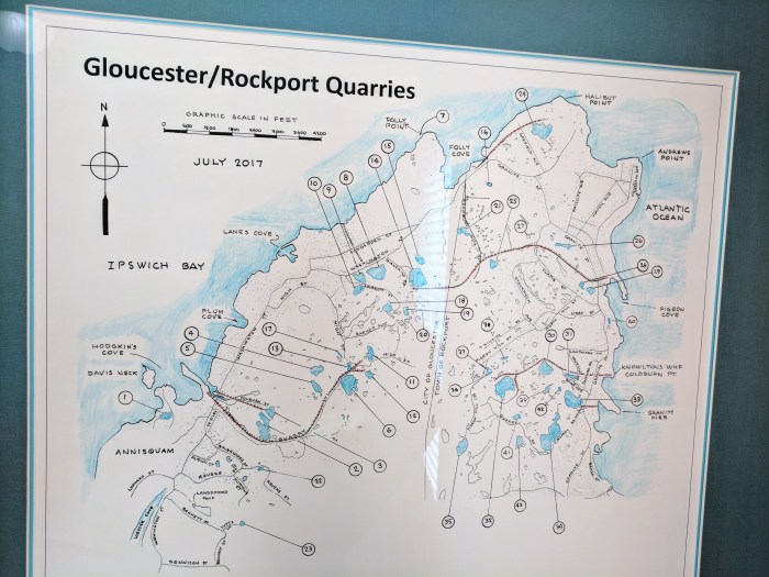
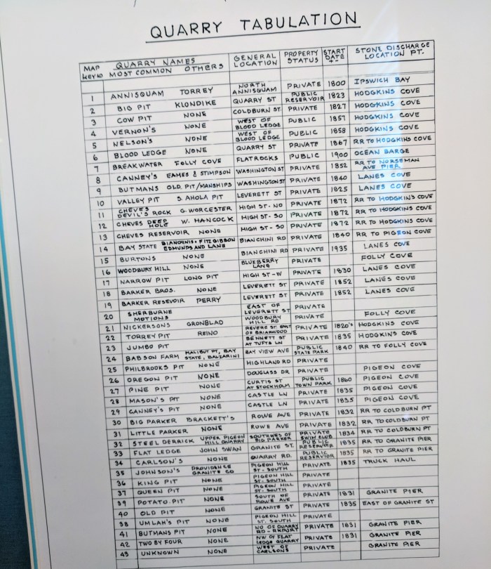
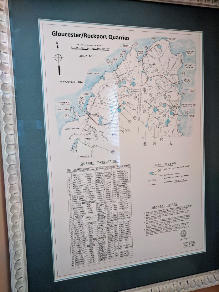
I like how area businesses display art and historic ephemera. The waiting area of Dr. Powers’ dentist office features a fascinating poster of the Gloucester Rockport Quarries © July 2017, a working document created by James A Ryan*, Reg / Prof Civil Engineer from Gloucester, MA, based on “2011 aerial surveys provided by Gloucester DPW Engineering Department and Rockport counterpart”
I know Dr. Powers is a history buff and that’s why it’s displayed. (I had a chuckle thinking about these are the first fillings at a dentist that I don’t mind learning about :))
(*no relation)


Can you get a copy of that map anywhere?
LikeLiked by 1 person
I’ve seen them at Main Street Art & Antiques.
LikeLike
This is a great job and been to quite a few of the locations growing up that way before they became water supplies both private and public can see so many were private then…Stewardship… 50’s and 60’s thanks Catherine! 🙂 Dave & Kim 🙂
LikeLike
FYI…to document the historical name as we knew it growing up in Folly Cove, what is now Burton’s quarry (bought by my Aunt’s family, Hilja (Johnson) and Ross Burton, …Burtons quarry was known as “Little Fitzgibbons”….”Little Fitzies” ..and the state quarry. “Big Fitzgibbons”
LikeLike