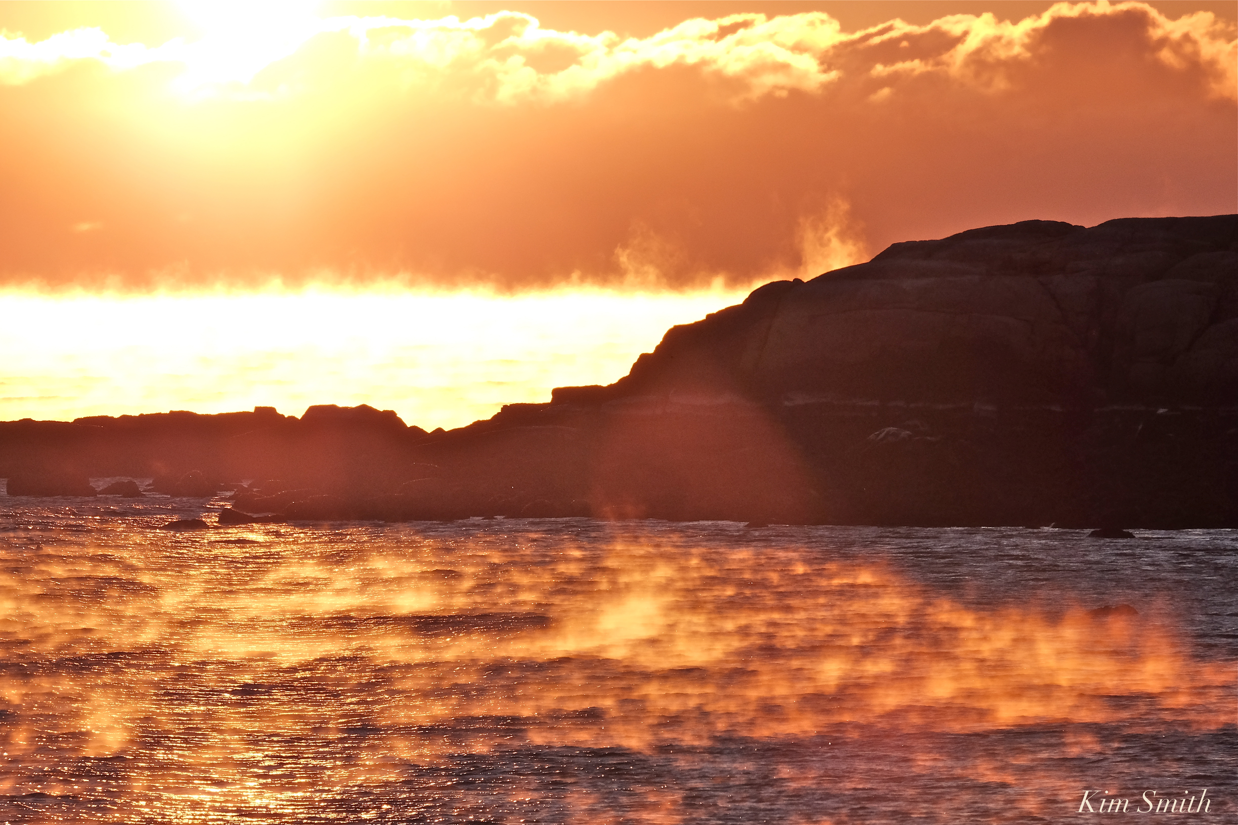
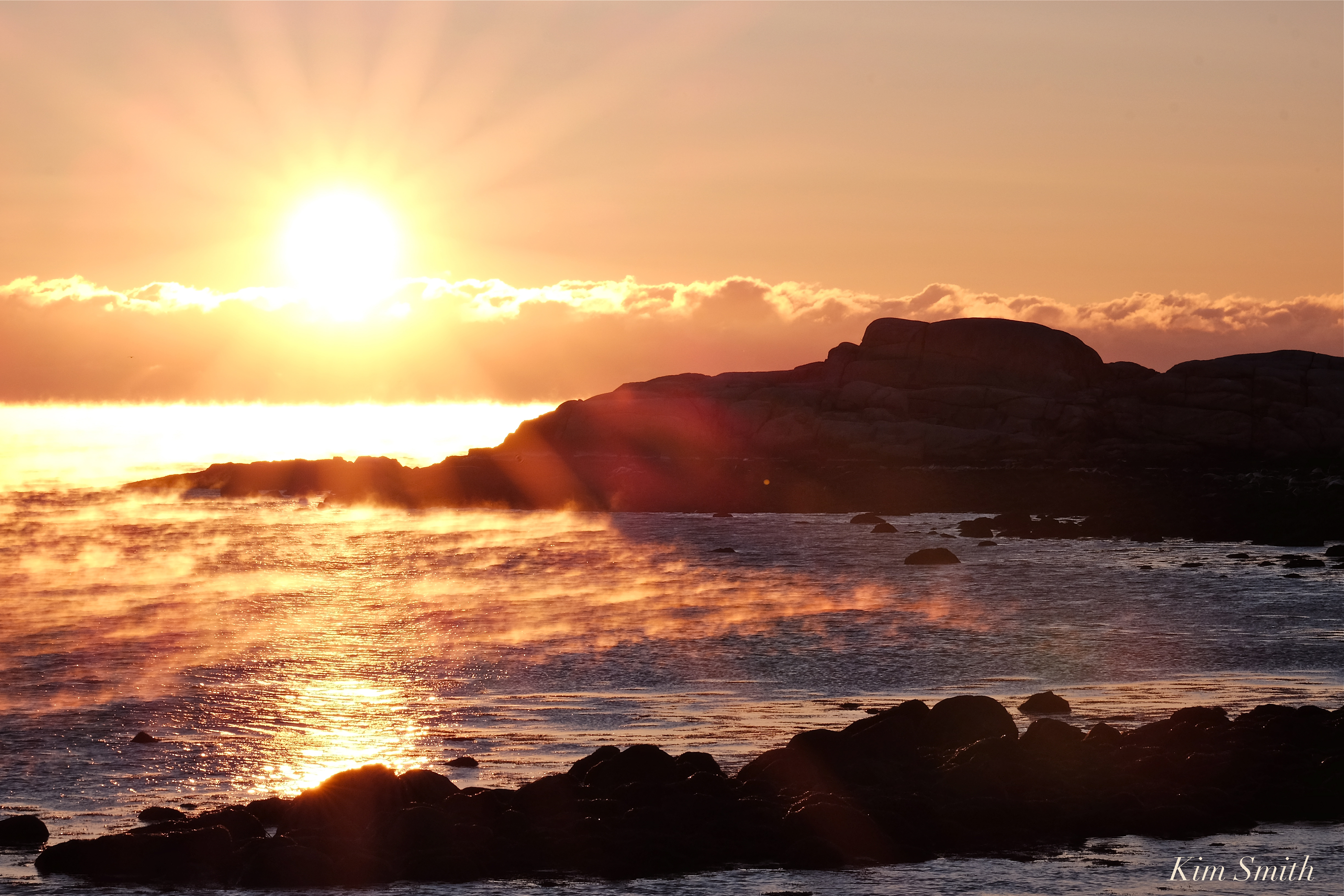
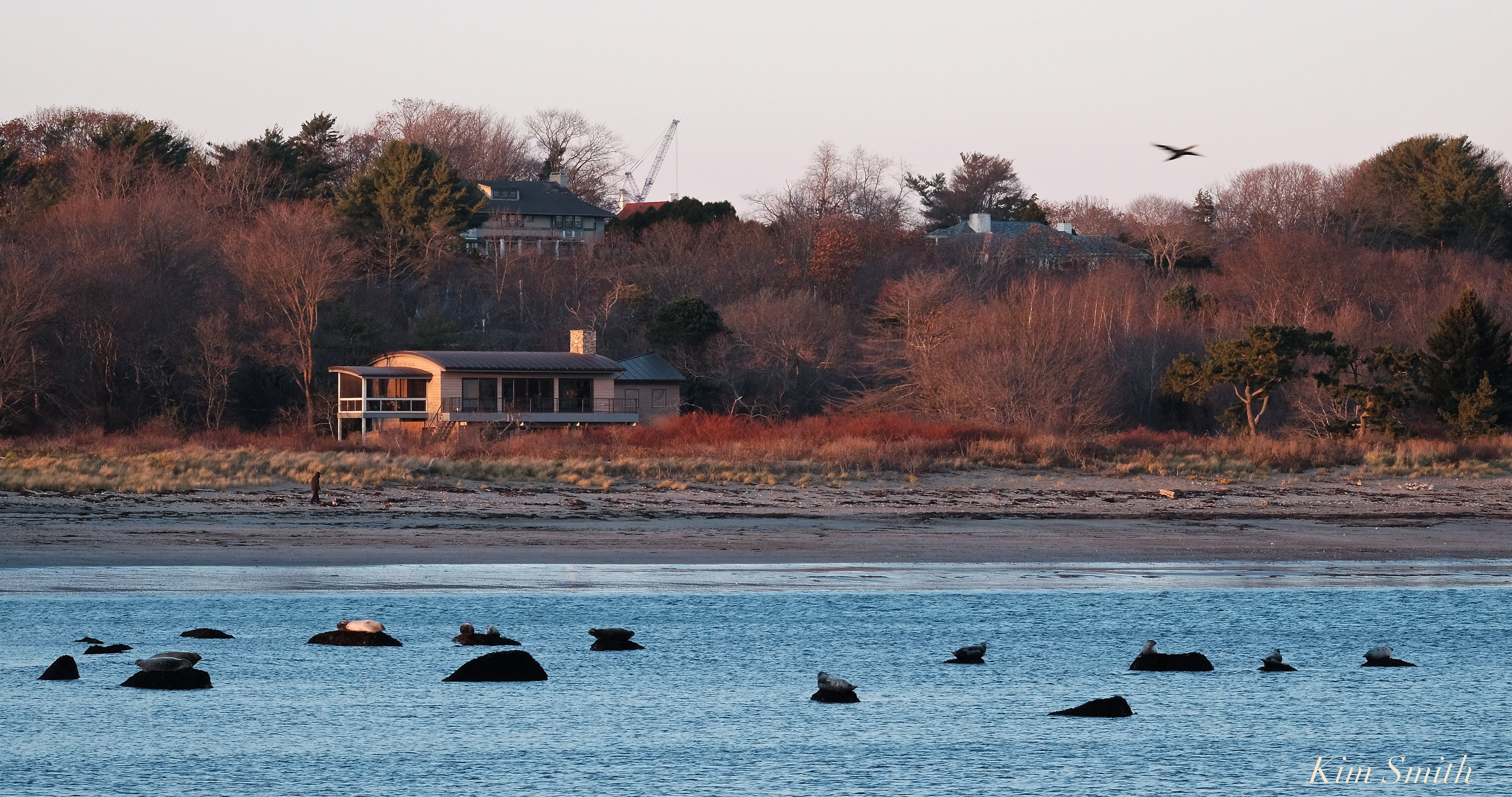
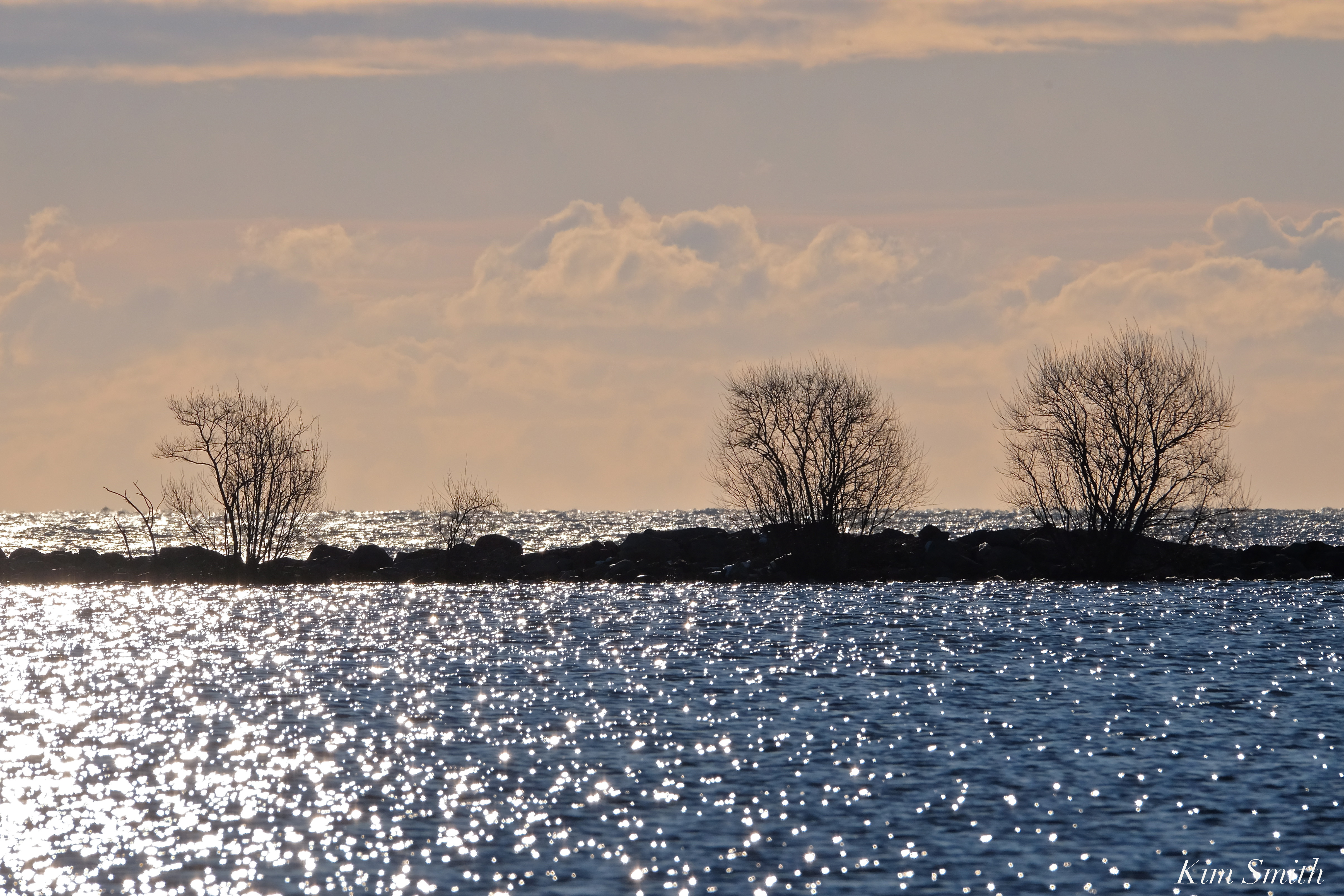
Friday morning after the moon descended over the city skyline I then caught the sun rising at Brace Cove. Frozen fingers kept me from staying out and photographing for very long, but it was all so magical to see.
My View of Life on the Dock
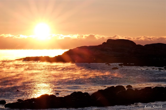
Friday morning after the moon descended over the city skyline I then caught the sun rising at Brace Cove. Frozen fingers kept me from staying out and photographing for very long, but it was all so magical to see.

 Brace Cove Sunrise


November’s nearly full Frost Moon was rising over Brace Cove, while the sun was setting over the harbor. Violet sunset clouds swirled around the rising moon when moments later the moon shone brightly through the pine trees.
November’s full moon is also called the Beaver Moon-both the early colonists and Algonquin tribes named it so because November was the designated time of year to set Beaver traps before ponds and swamps froze.
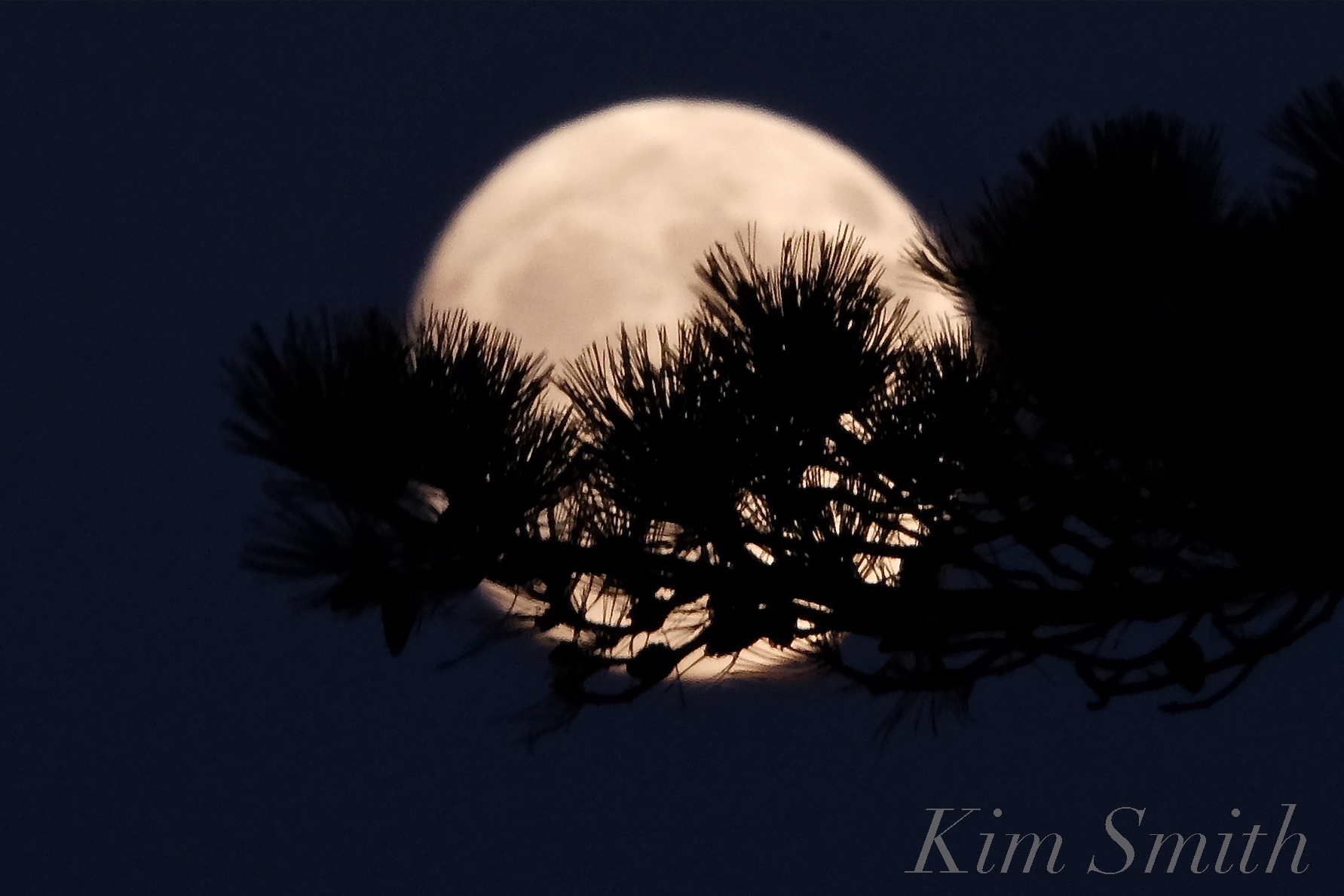
November Frost Moon rising over Niles Pond

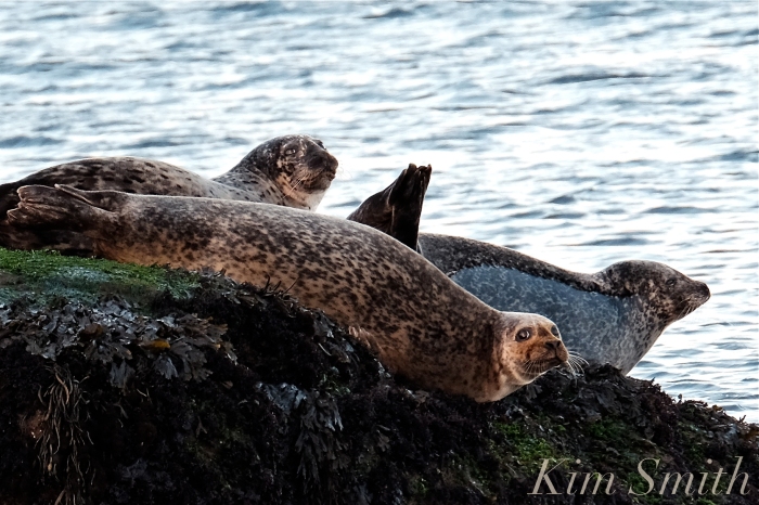
Harbor Seals in the setting sun and rising moonlight–a seal-a-rock 🙂


From Connecticut at Brace Cove

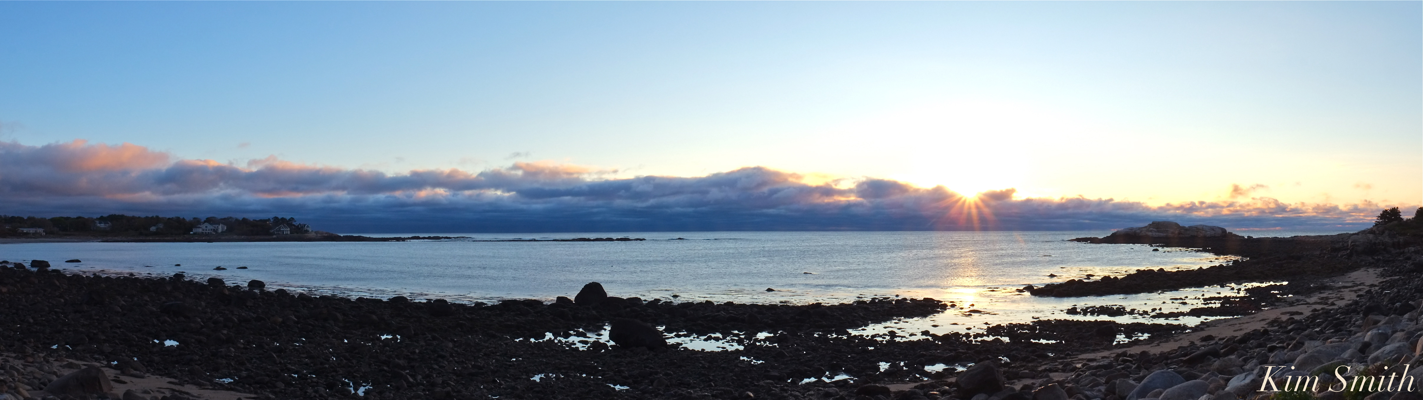
 Brace Cove at daybreak -click on the panorama images to view larger


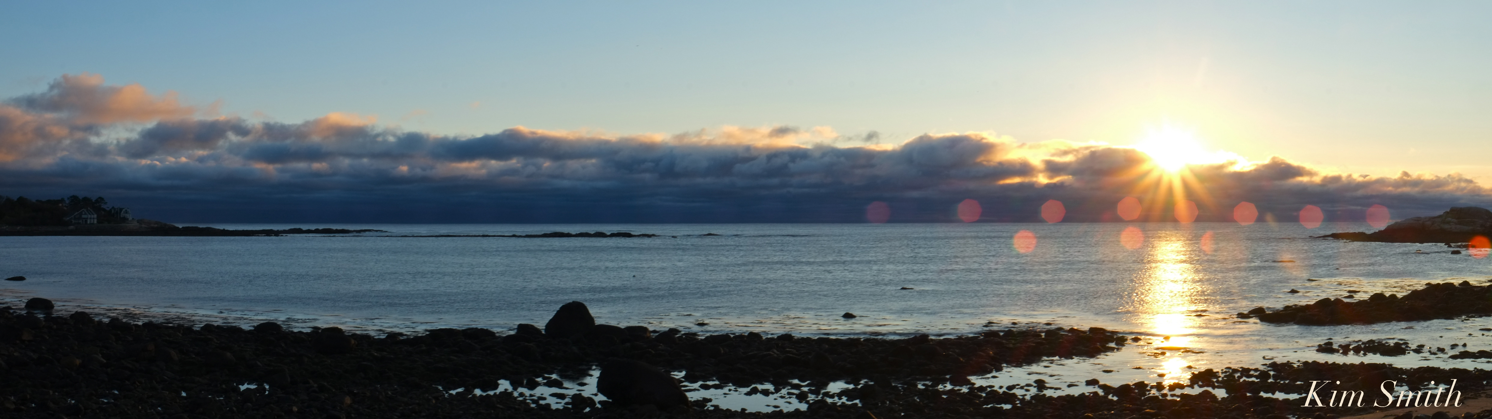
 Brace Cove Today

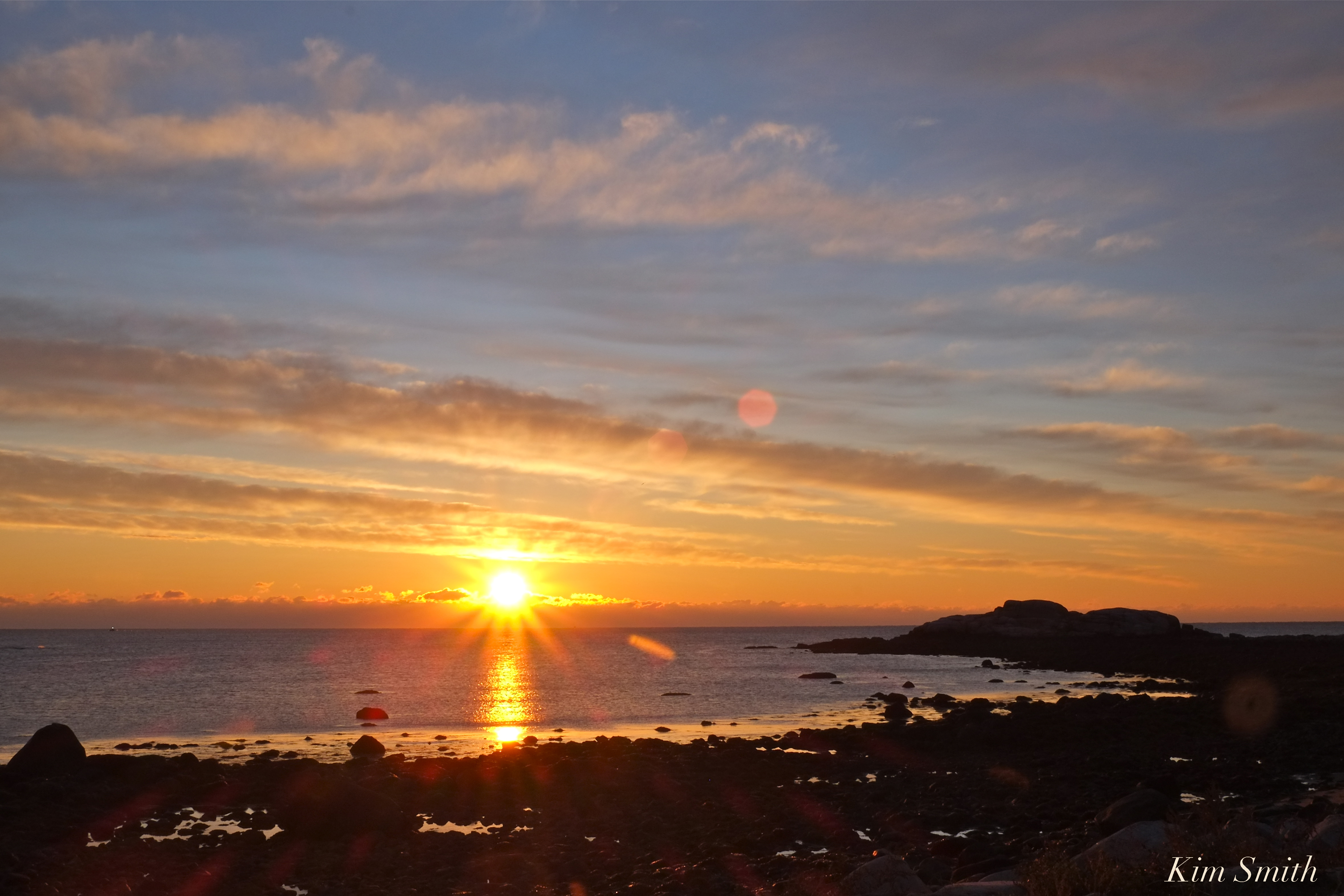
 Brace Cove before the rain

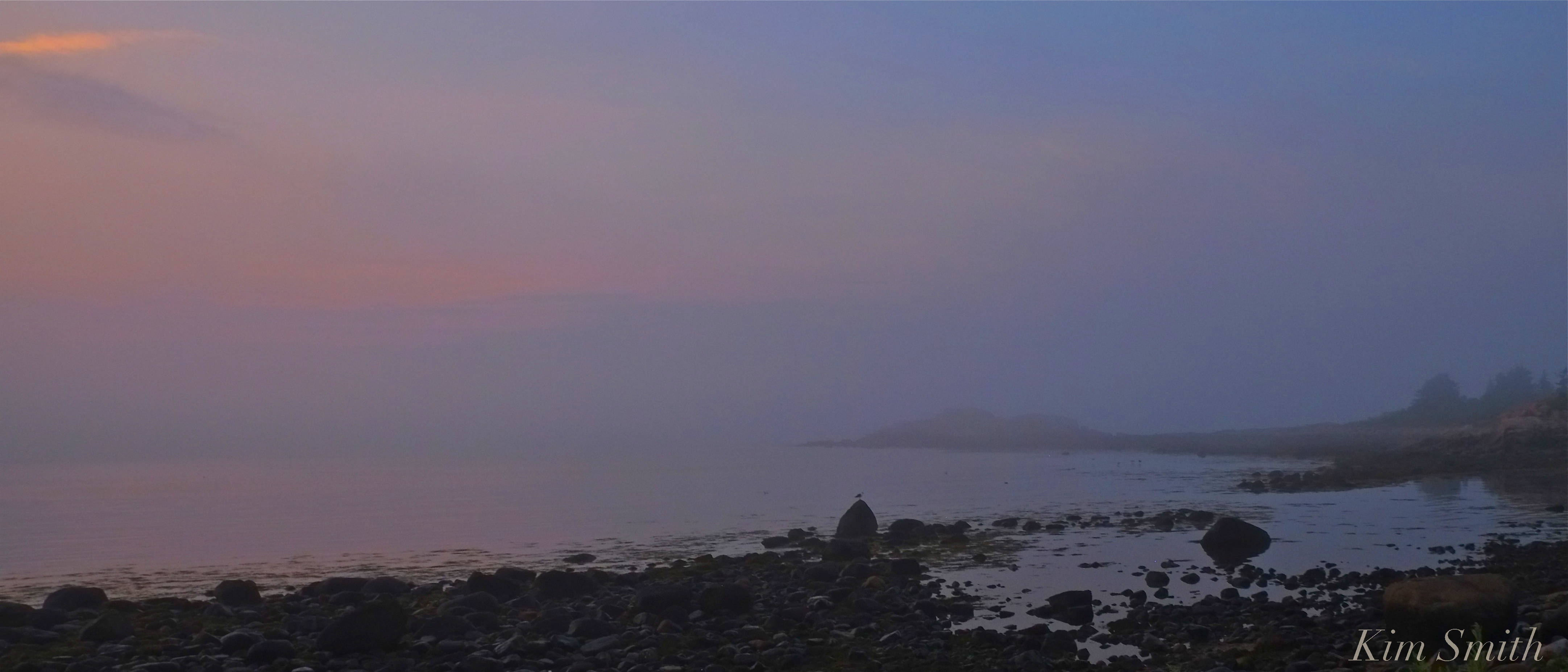 Brace Cove beautiful foggy summer morning at daybreak

Gloucester public schools have stellar community partners and locales
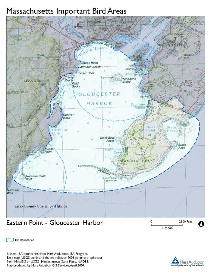
Mass Audubon Eastern Point Wildlife Sanctuary

")
Two+ centuries of naturalists in Gloucester is quite a legacy. Here’s a partial list from Robbins to Cramer and Smith to Smith–there have been notable champions most every decade.
organizations such as Gloucester Civic and Garden Club, Essex County Greenbelt, Mass Audubon, Ocean Alliance, Martime Gloucester, UMASS Marine Station…

Just another beautiful morning in the neighborhood.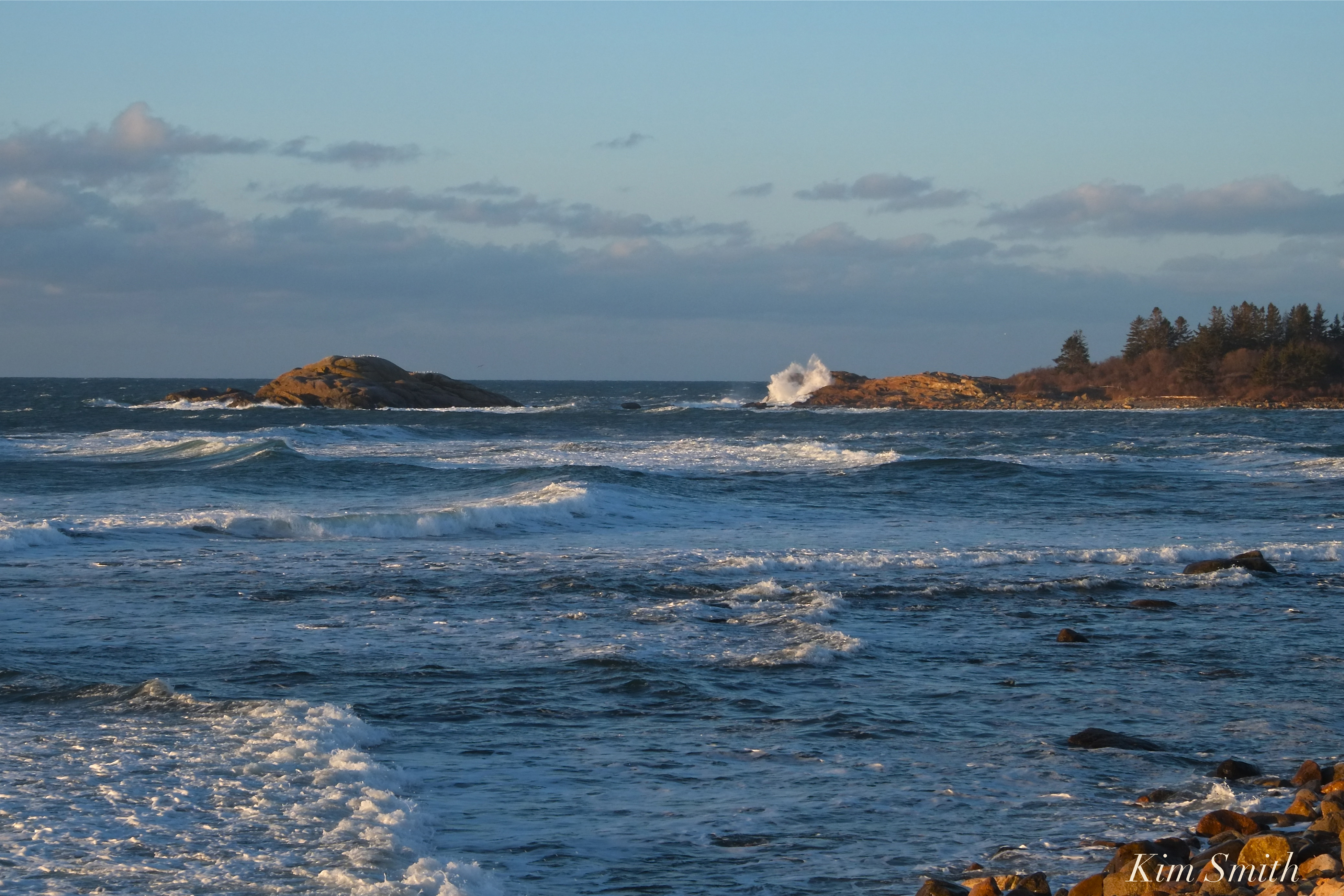

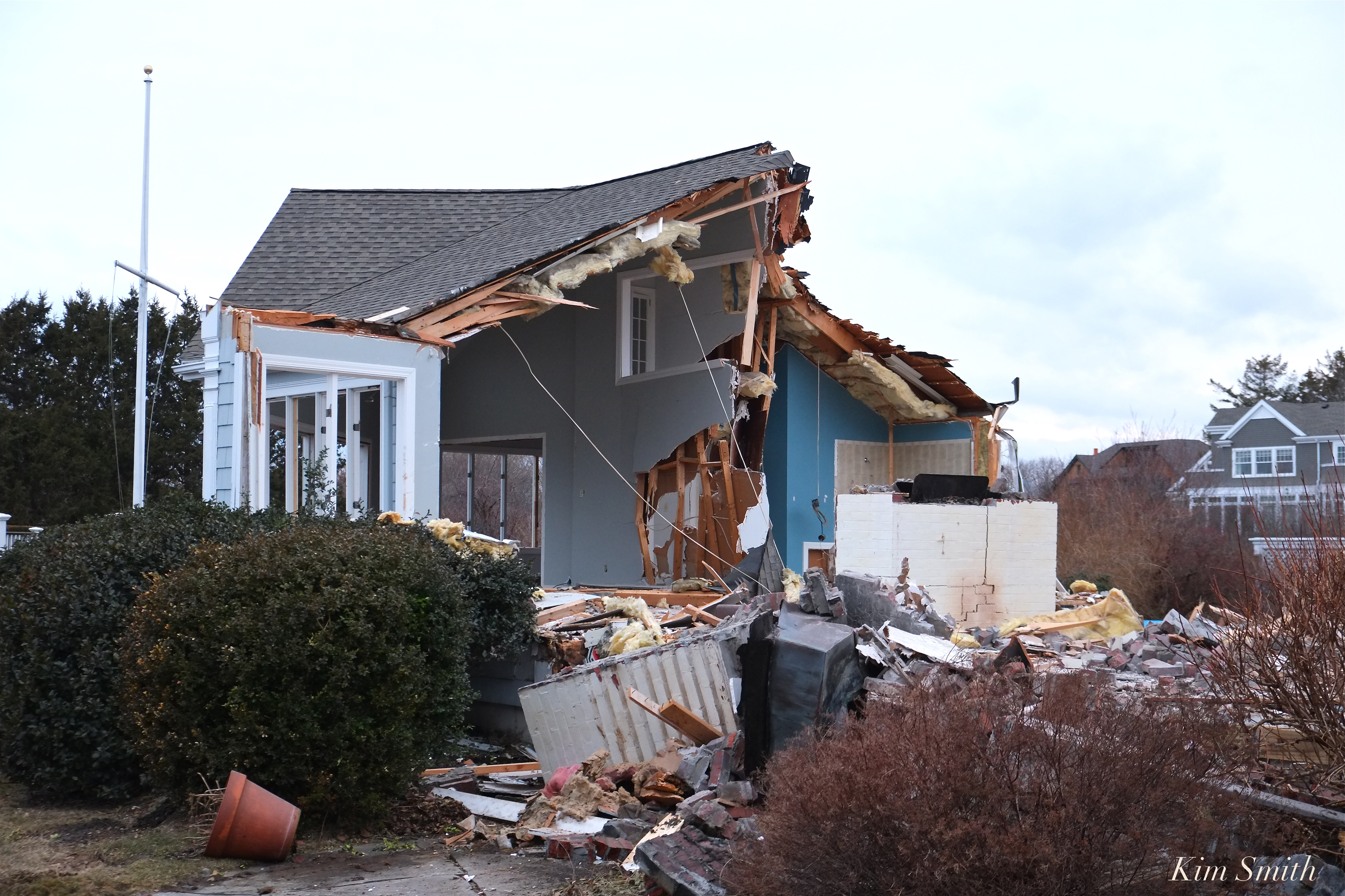
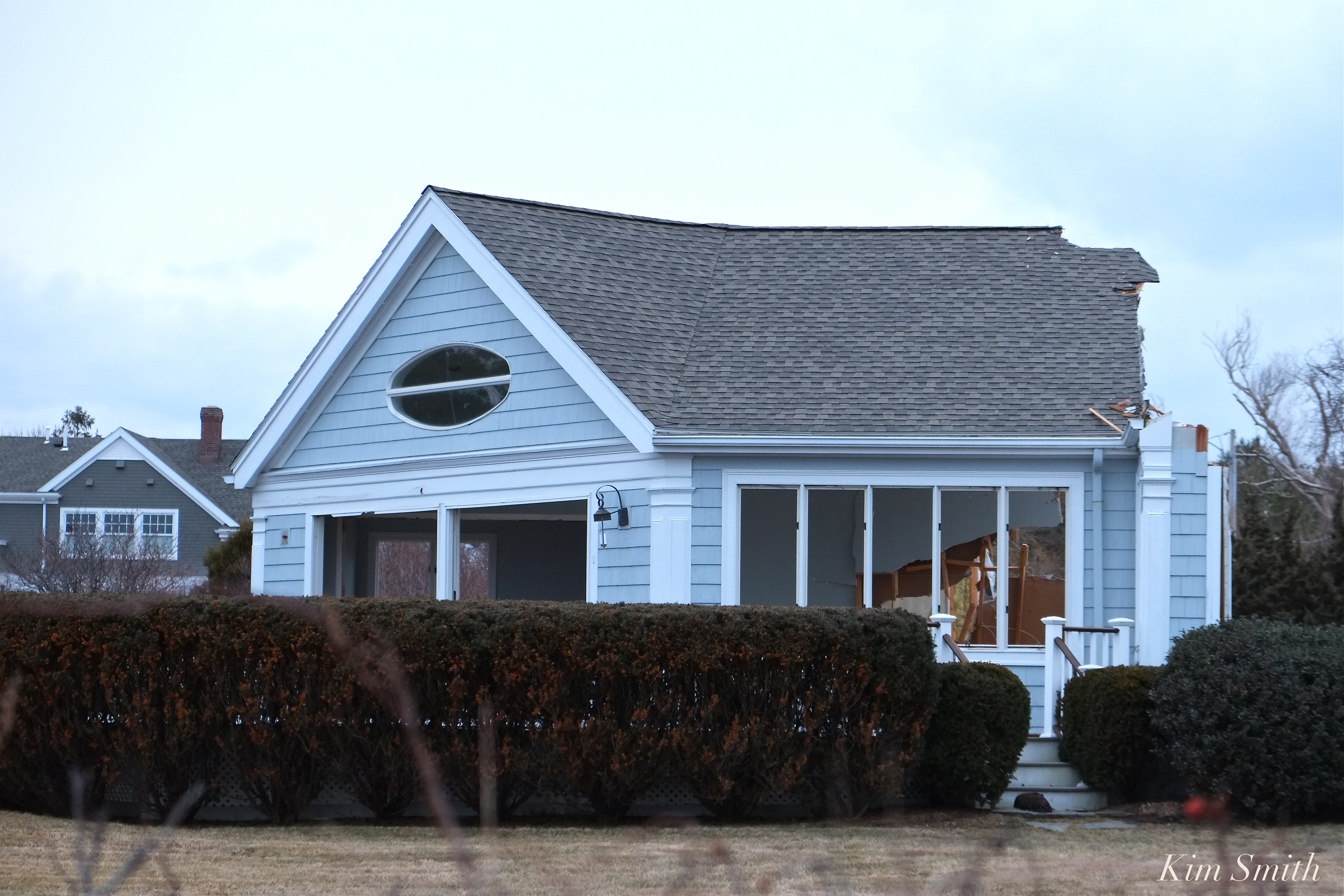
Before sunset last Friday evening, the sky and clouds were so beautiful. Did you notice the crane in the background? Hope they can fix the wall between Brace Cove and Niles Pond.


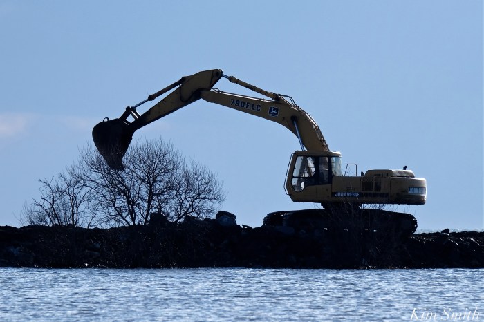
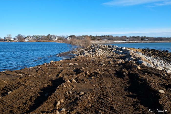
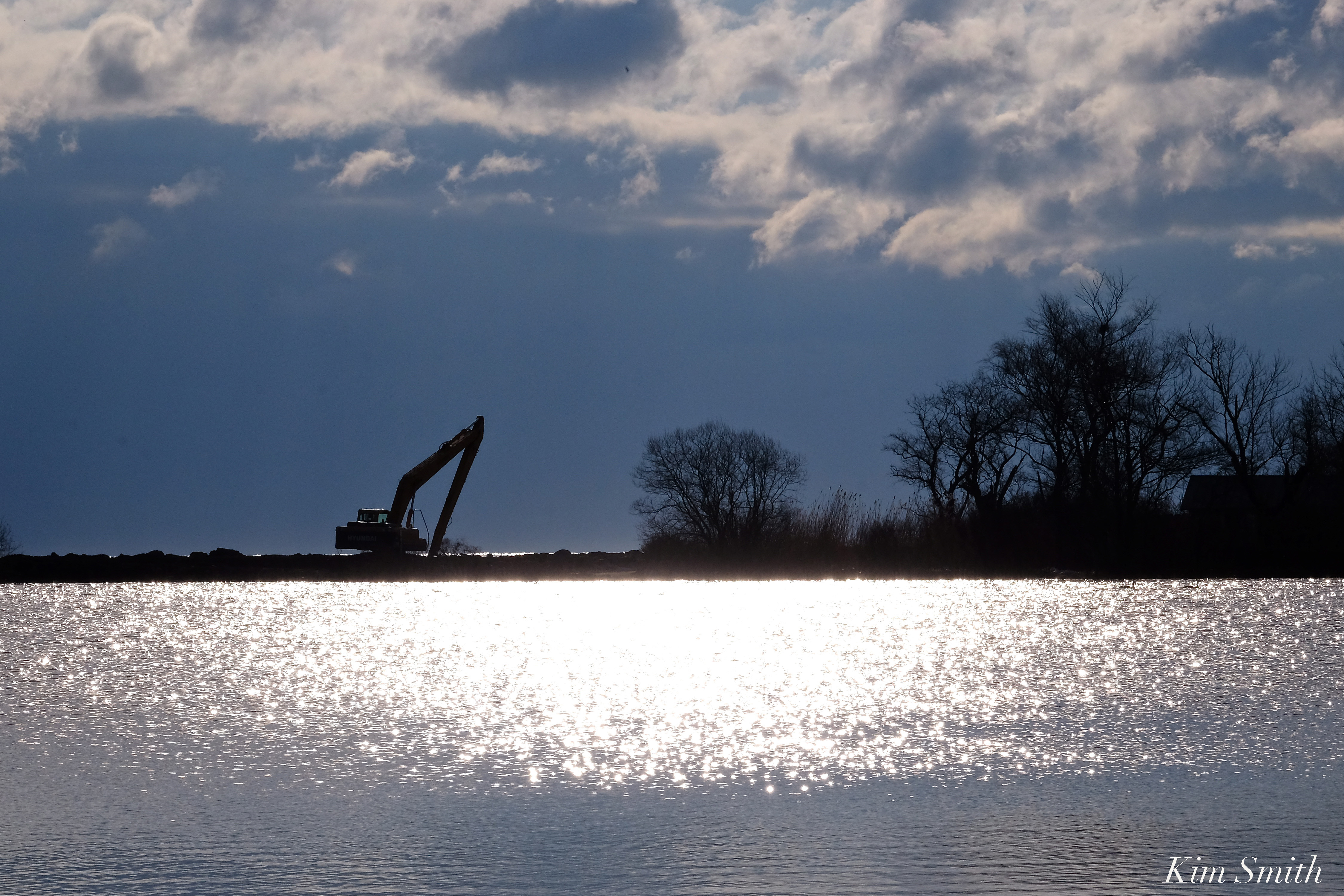 The arduous work of rebuilding the Niles Pond Brace Cove causeway continues, despite the mid-week blizzard. I walked the causeway Tuesday night and then again the past several mornings–the pace of the restoration is fantastic and will soon be completed. Many, many thanks to the generous residents of Eastern Point who are striving to keep Niles Pond from being engulfed by the sea.
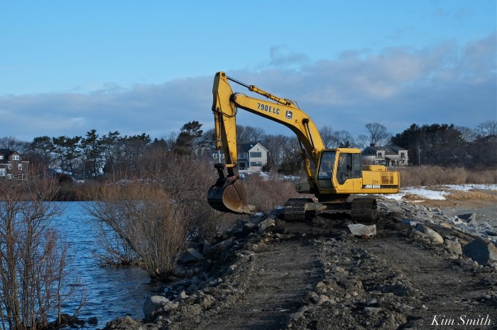
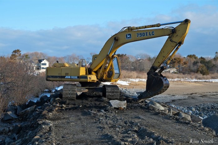
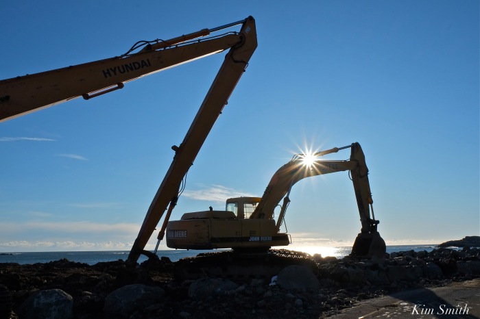
R. B. Strong’s Larry expertly operates the John Deere excavator, deftly extracting and moving boulders around as if they were pebbles on the shore. The track-hoe not only scoops and lifts the massive rocks, the bucket is also used to tamp down the boulders once in place, as you can see in the video below.


These cute seals hanging out near Brace Cove are so much at peace.


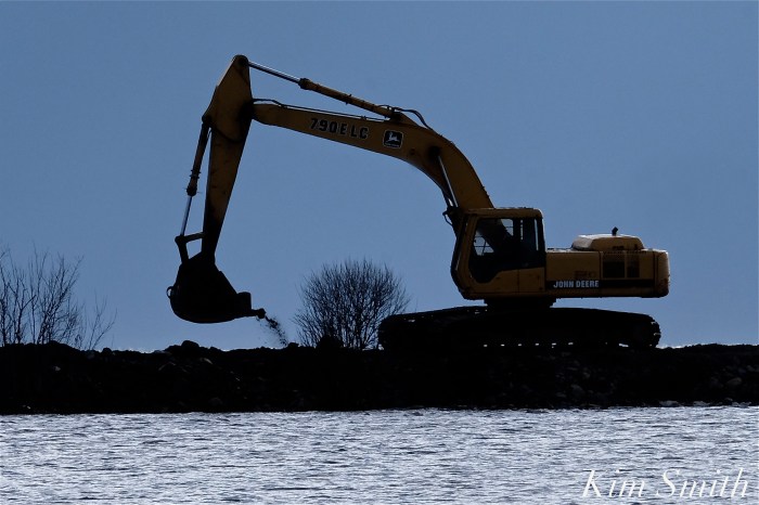
 With the third nor’easter to hit our shores during the month of March expected to arrive tonight, track-hoe excavator Larry shares that the work continued today to fortify the causeway, and to possibly get more water to flow through the clogged drain that is preventing excess water from leaving Niles Pond.
For our readers general information, the cost of the repairs, restoration, and continued ongoing maintenance of the causeway, and surrounding area, are paid for entirely by the generous residents of Eastern Point, not tax payer dollars.
https://www.instagram.com/p/BgOc1uoncPA/

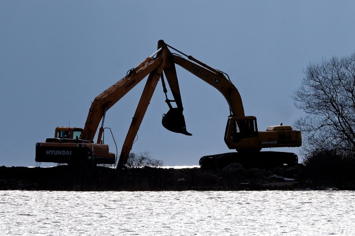
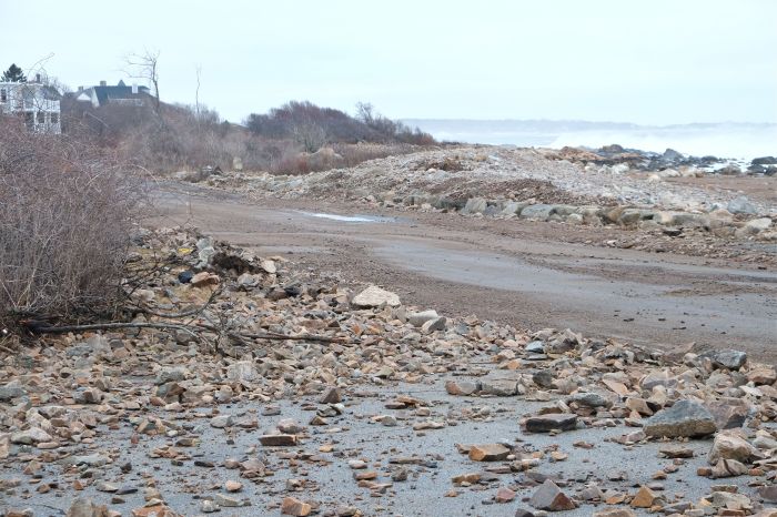
 Large track-hoes (excavators) are needed to repair the damage done by the March nor’easter storm known as Riley.


 The narrowest slip of land between a body of fresh water and the sea.
 Native pussy willow trees survive storm after storm after storm after storm. More pussy willows, as well as other deep-rooted natives, need to be planted to help with the unending erosion.
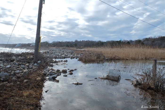
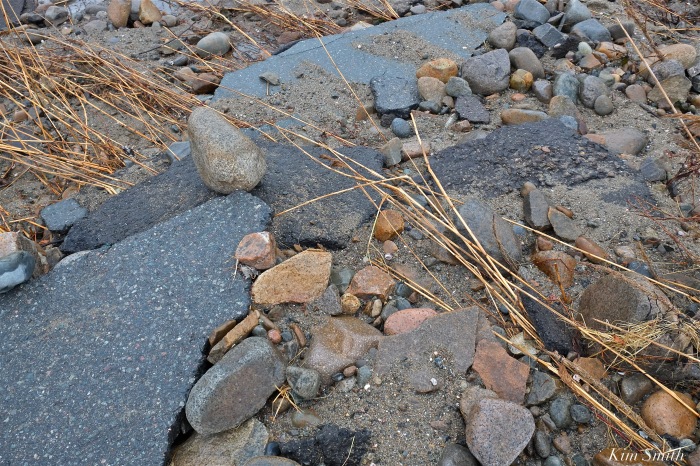
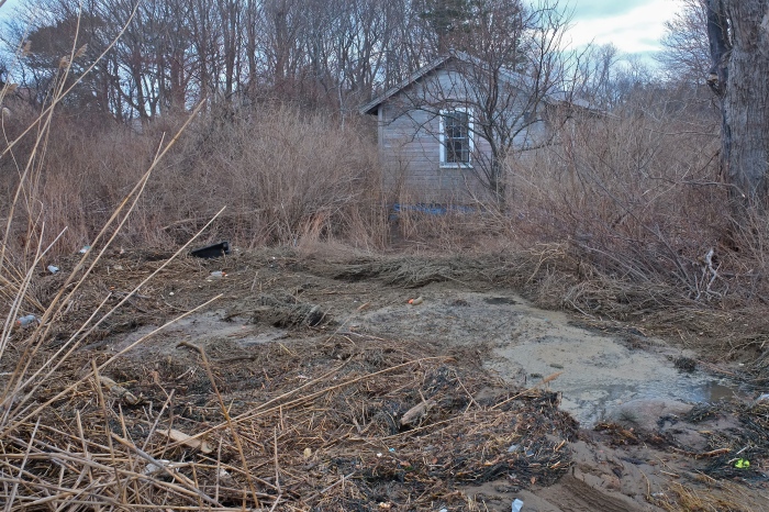
 Niles Pond water overflowing the bank and littered with debris swept in by the sea.
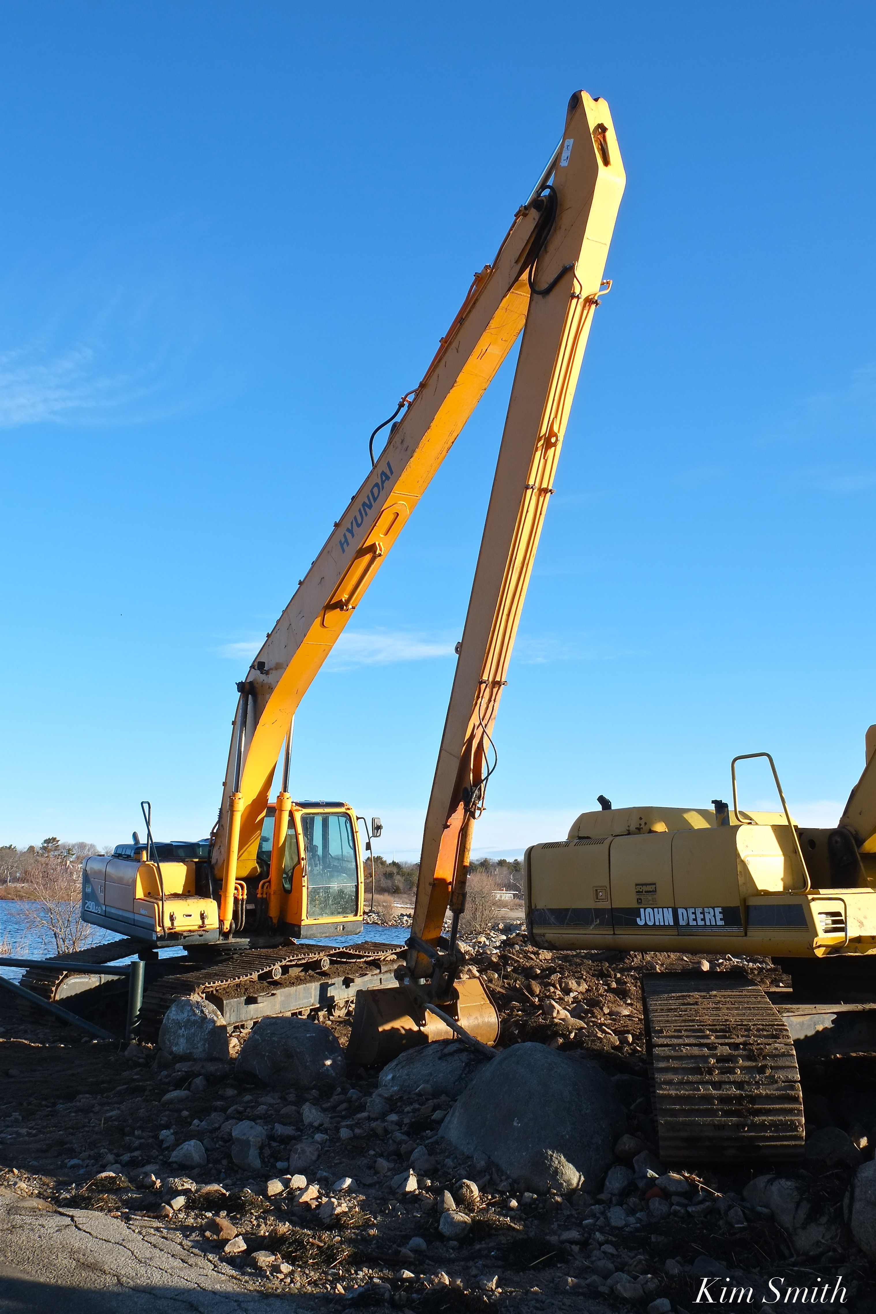

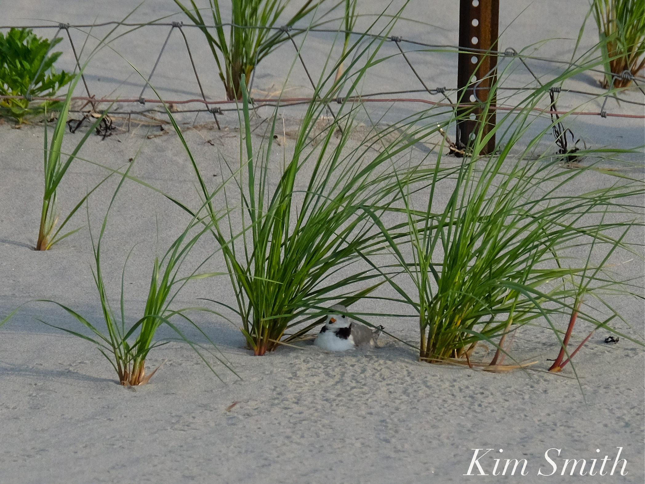
 Female Piping Plover Sitting on an Egg
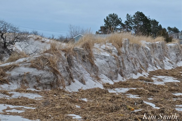
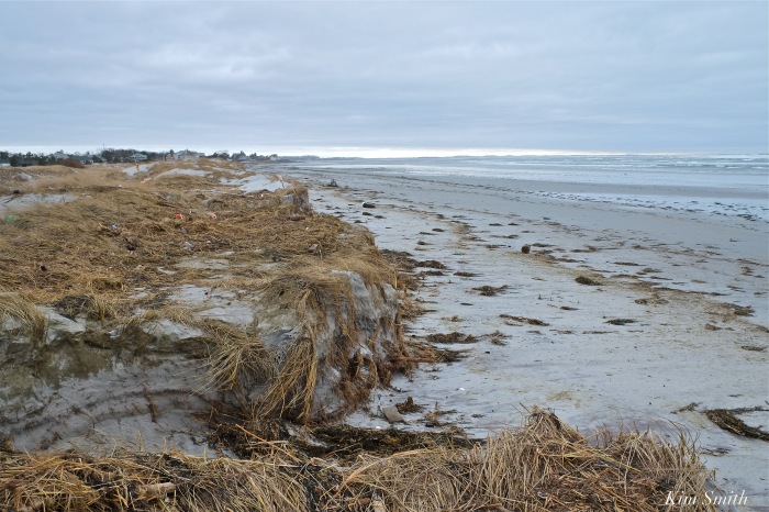
The recent winter storms of 2018 have provided empirical evidence of how global climate change and the consequential rising sea level is impacting the Massachusetts coastline. Whether broken barriers between the ocean and small bodies of fresh water, the tremendous erosion along beaches, or the loss of plant life at the edge of the sea, these disturbances are profoundly impacting wildlife habitats.
The following photos were taken after the March nor’easter of 2018 along with photos of the same areas, before the storm, and identify several specific species of wildlife that are affected by the tremendous loss of habitat.
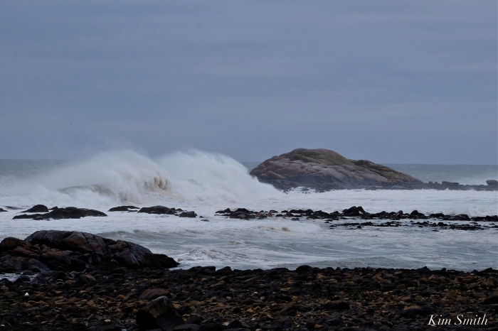
Barrier Beach Erosion
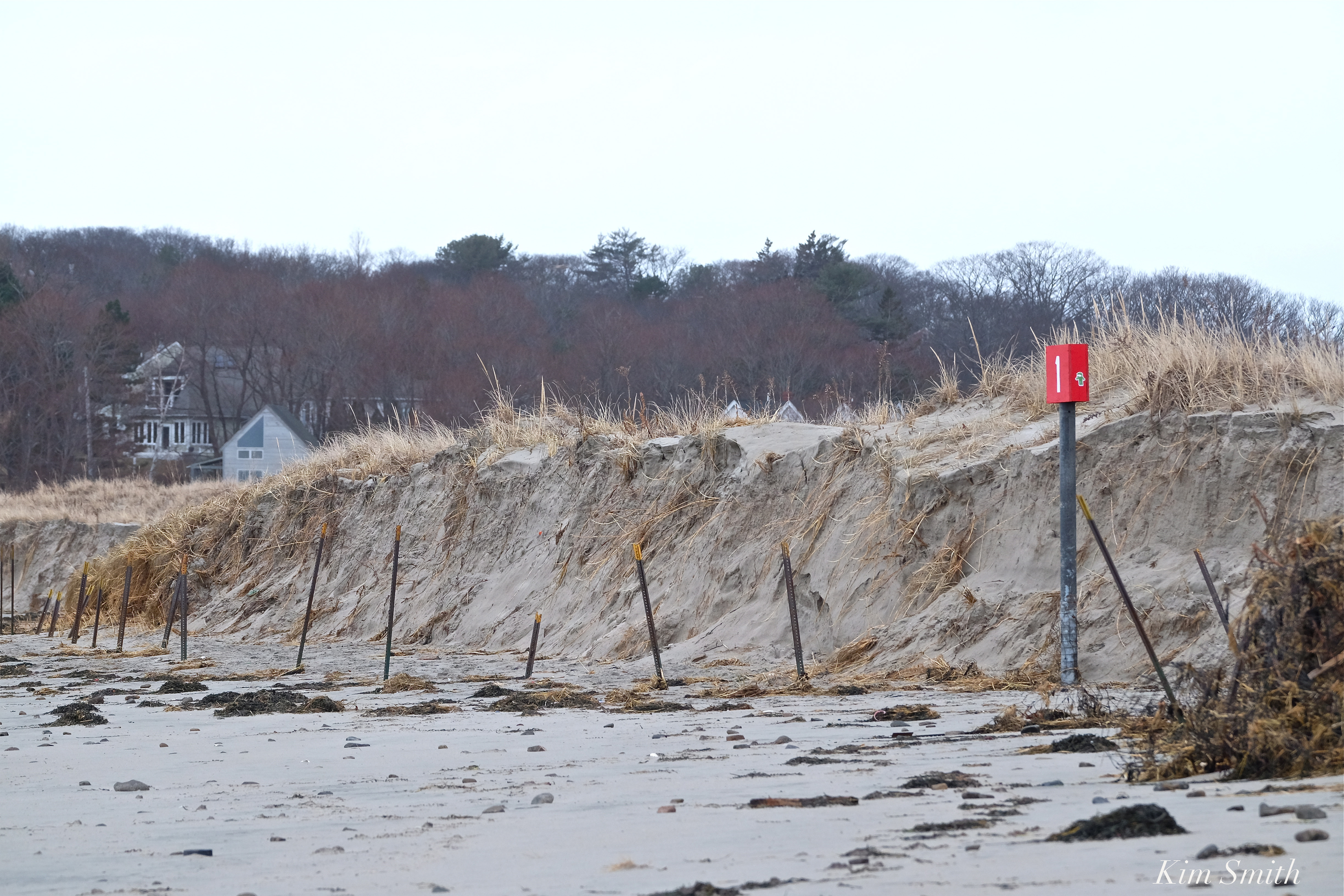
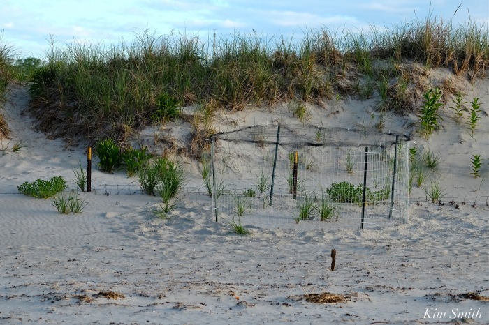
Nesting species of shorebirds such as Piping Plovers require flat or gently sloping areas above the wrack line for chick rearing. Notice how the March nor’easter created bluffs with steep sides, making safe areas for tiny chicks nonexistent.

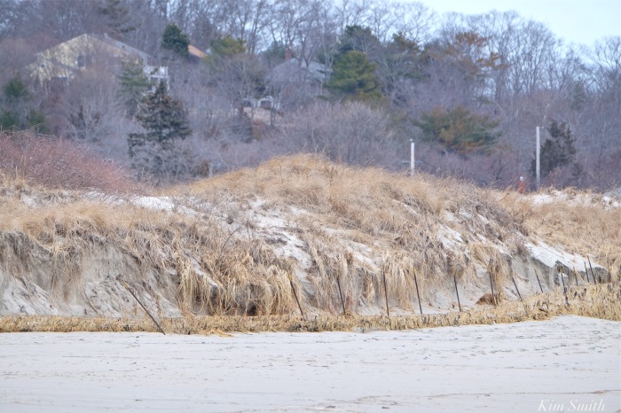
You can see in the photos of Good Harbor Beach (top photo and photos 3 and 4 in the gallery) that the metal fence posts are completely exposed. In 2016, the posts were half buried and in 2017, the posts were nearly completely buried. After the recent storms, the posts are fully exposed and the dune has eroded half a dozen feet behind the posts.
 In the photo of the male Piping Plover sitting on his nest from 2016 the metal posts are half buried.
Although scrubby growth shrubs and sea grass help prevent erosion, the plants have been ripped out by the roots and swept away due to the rise in sea level.
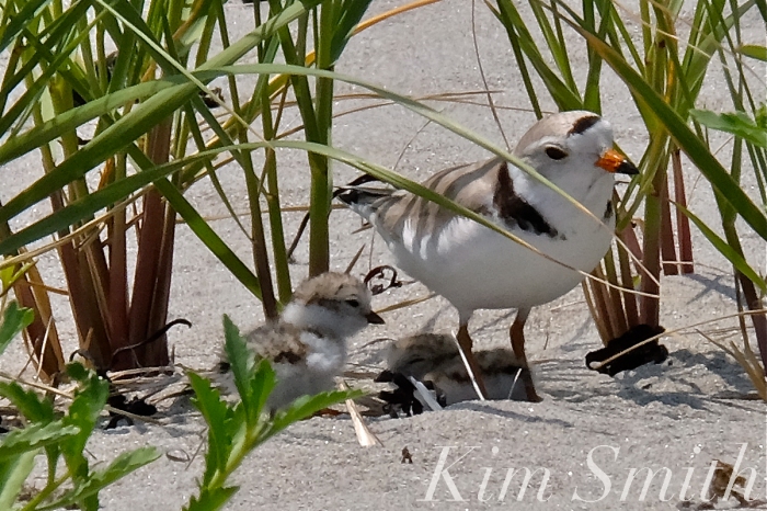
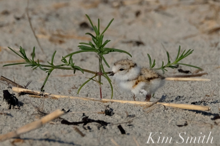
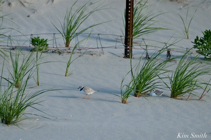
Plants draw tiny insects, which is food for tiny chicks, and also provide cover from predators, as well as shelter from weather conditions. If the Piping Plovers return, will they find suitable nesting areas, and will plant life recover in time for this year’s brood?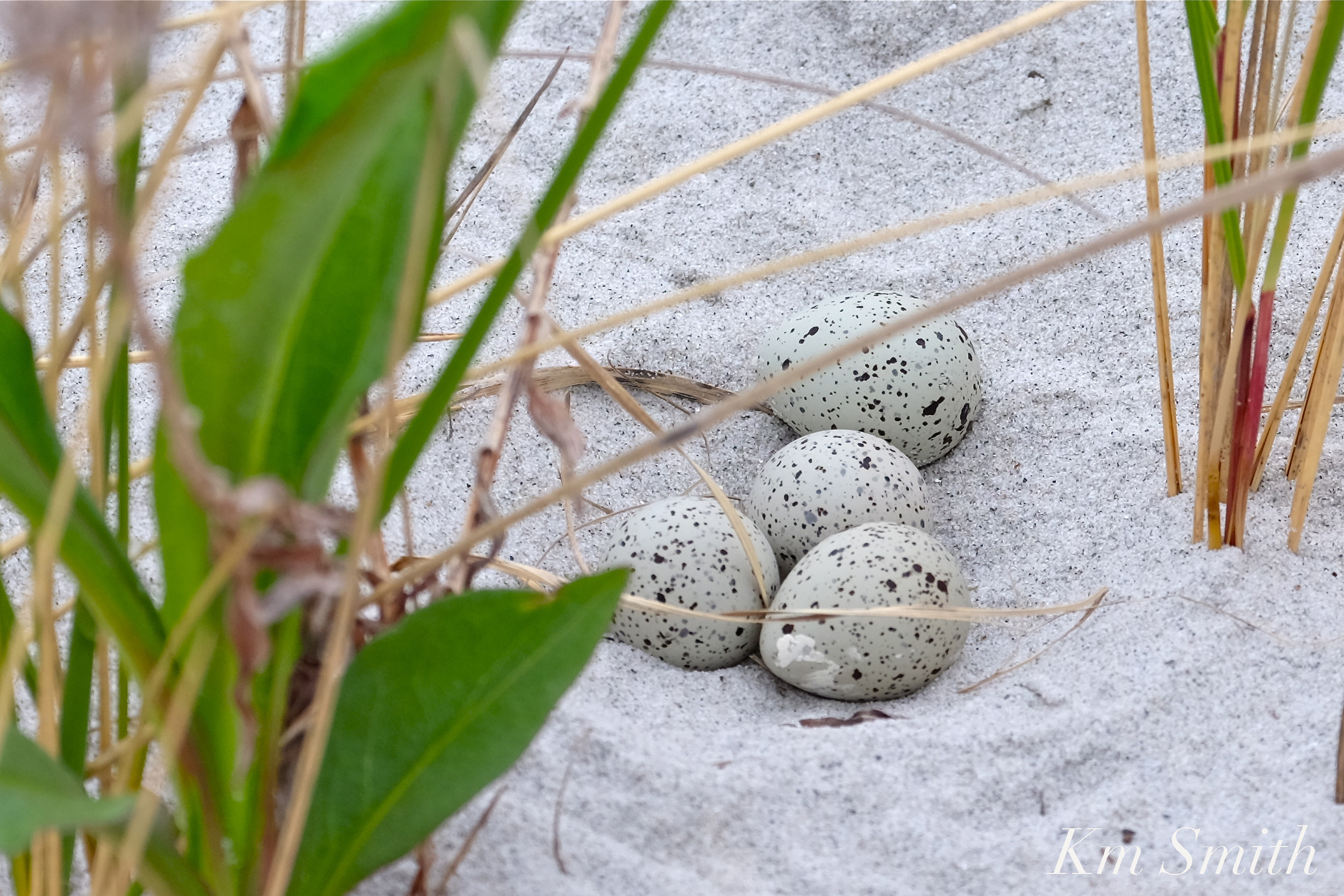 Other species of shorebirds that nest on Massachusetts’s beaches include the Common Tern, Least Tern, Roseate Tern, American Oyster Catcher, Killdeer, and Black Skimmer.
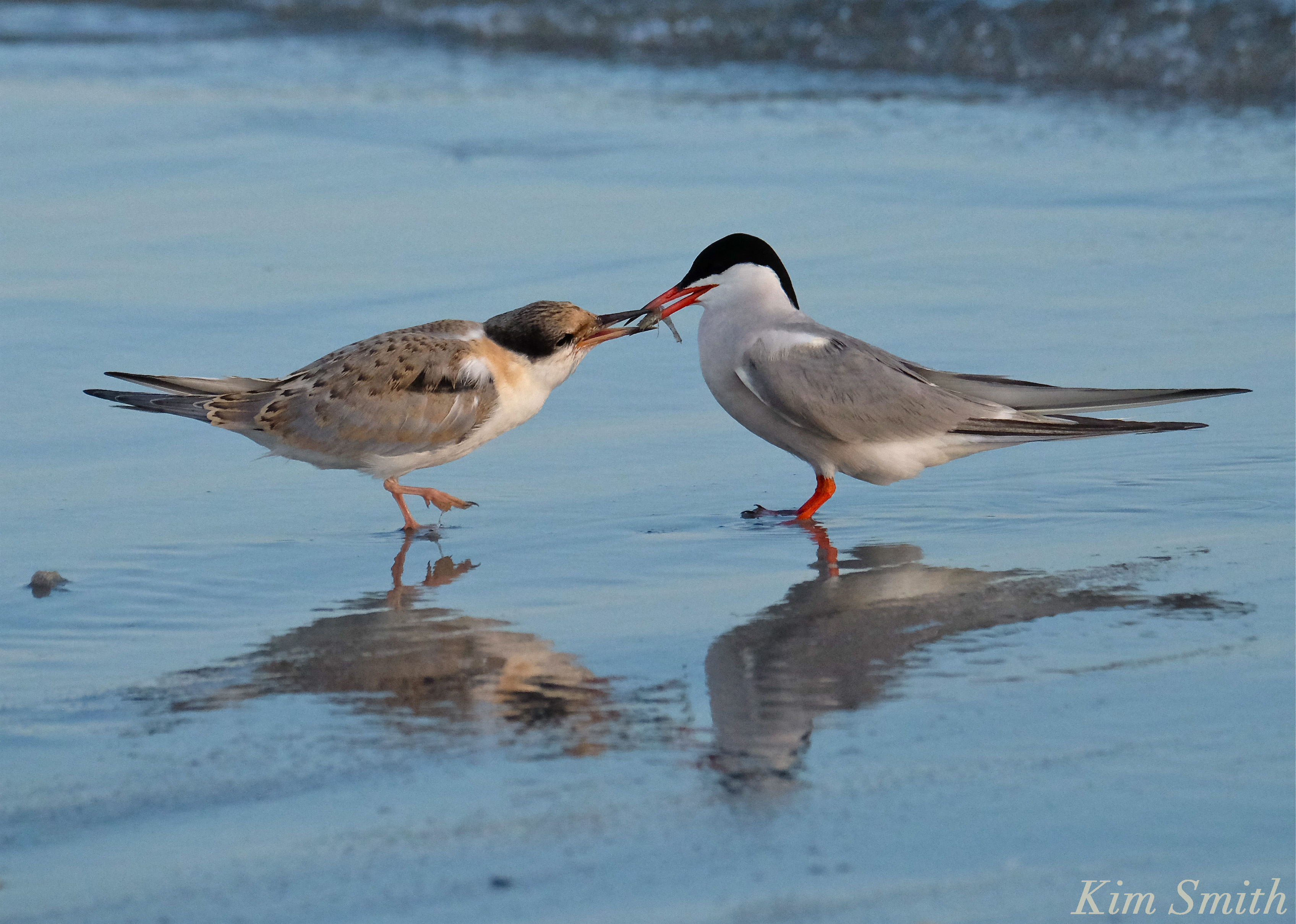 Common Tern parent feeding fledgling
Where Have All the Wildflowers Gone?
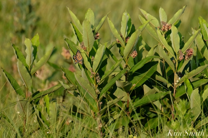
 Female Monarch Depositing Egg on Common Milkweed Leaf
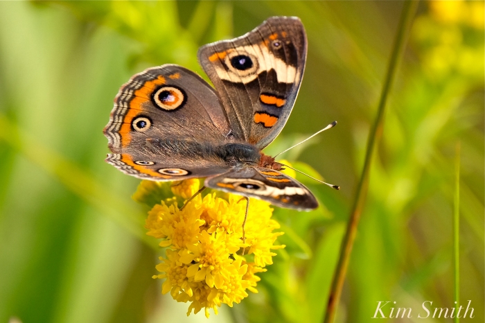

Wildflowers are the main source of food for myriad species of beneficial insects such as native bees and butterflies.
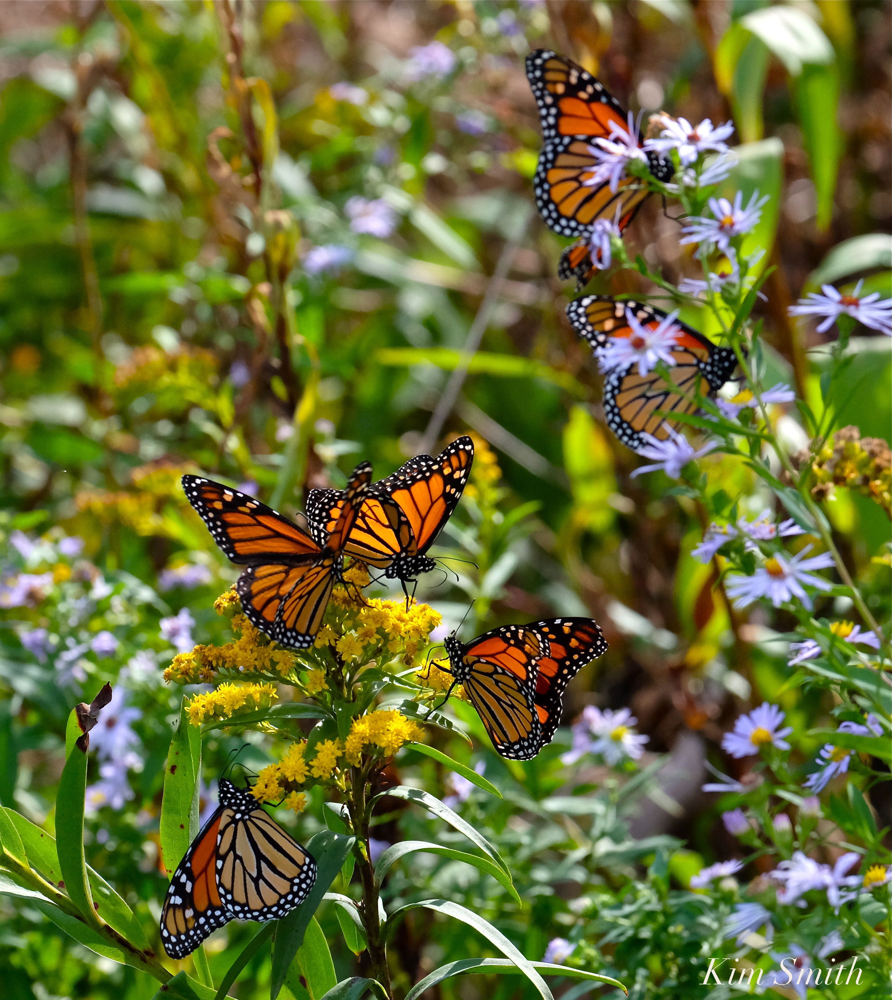 Monarch Butterflies arriving on our shores not only depend upon milkweed for the survival of the species, but the fall migrants rely heavily on wildflowers that bloom in late summer and early fall. Eastern Point is a major point of entry, and stopover, for the southward migrating butterflies. We have already lost much of the wildflower habitat that formerly graced the Lighthouse landscape.
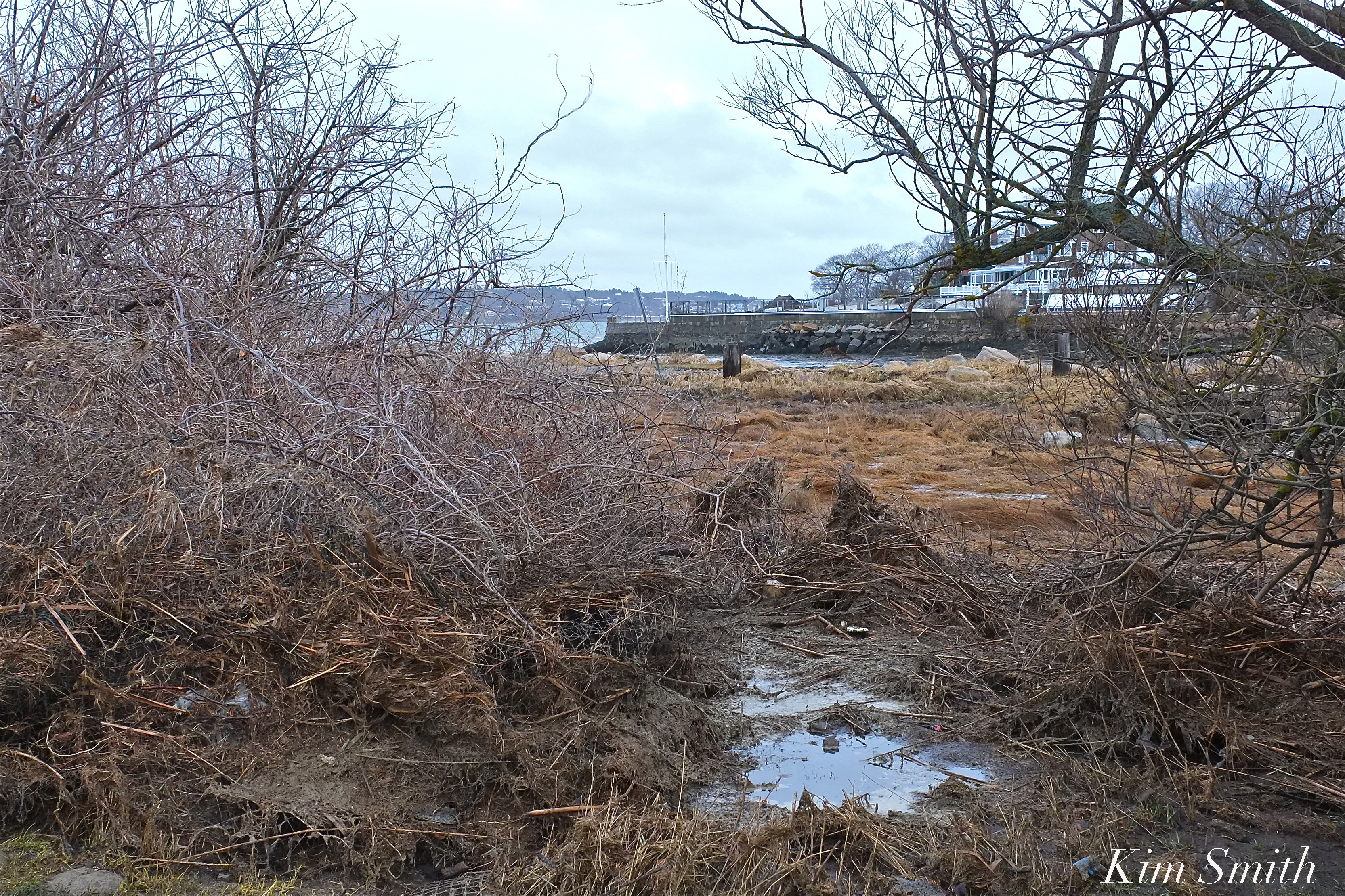 Masses of sea debris from the storm surge washed over the wildflower patches and are covering much of the pollinator habitat at the Lighthouse.
Broken Barriers
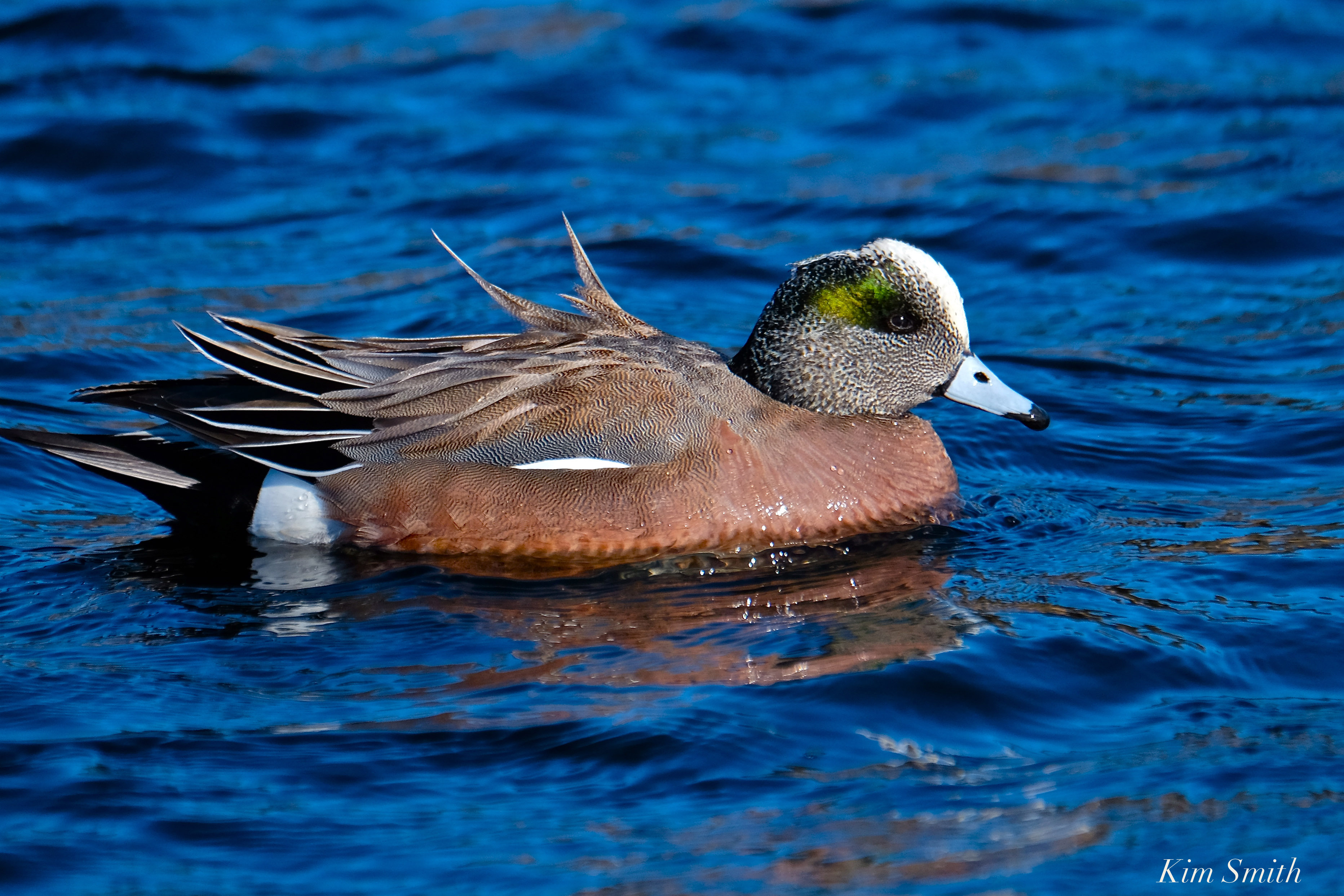 American Wigeon Migrating at Henry’s Pond
Barriers that divide small bodies of fresh water from the open sea have been especially hard hit. The fresh bodies of water adjacent to the sea provide habitat, food, and drinking water for hundreds of species of wildlife and tens of thousands of migrating song and shorebirds that travel through our region.
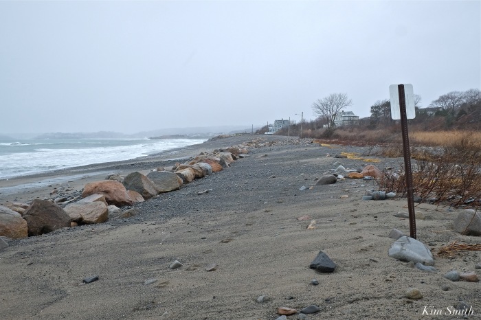
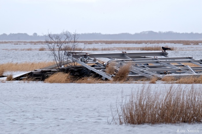
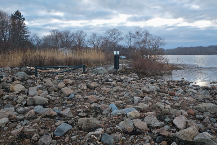
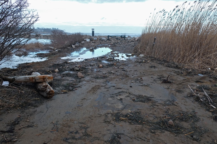
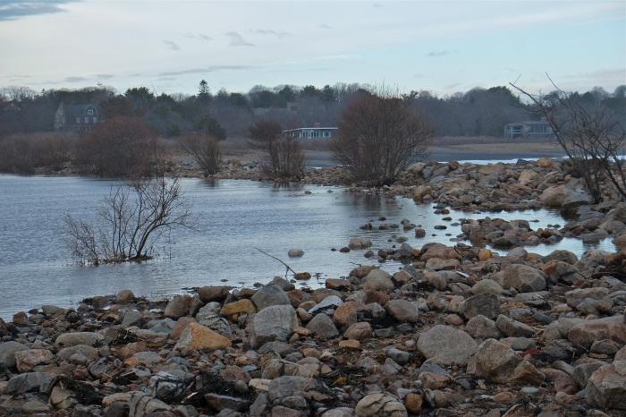
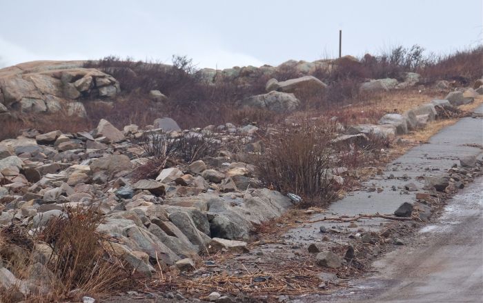
 The newly rebuilt causeway between Niles Pond and Brace Cove was breached many times during the nor’easter. The causeway is littered in rocks and debris from the sea.
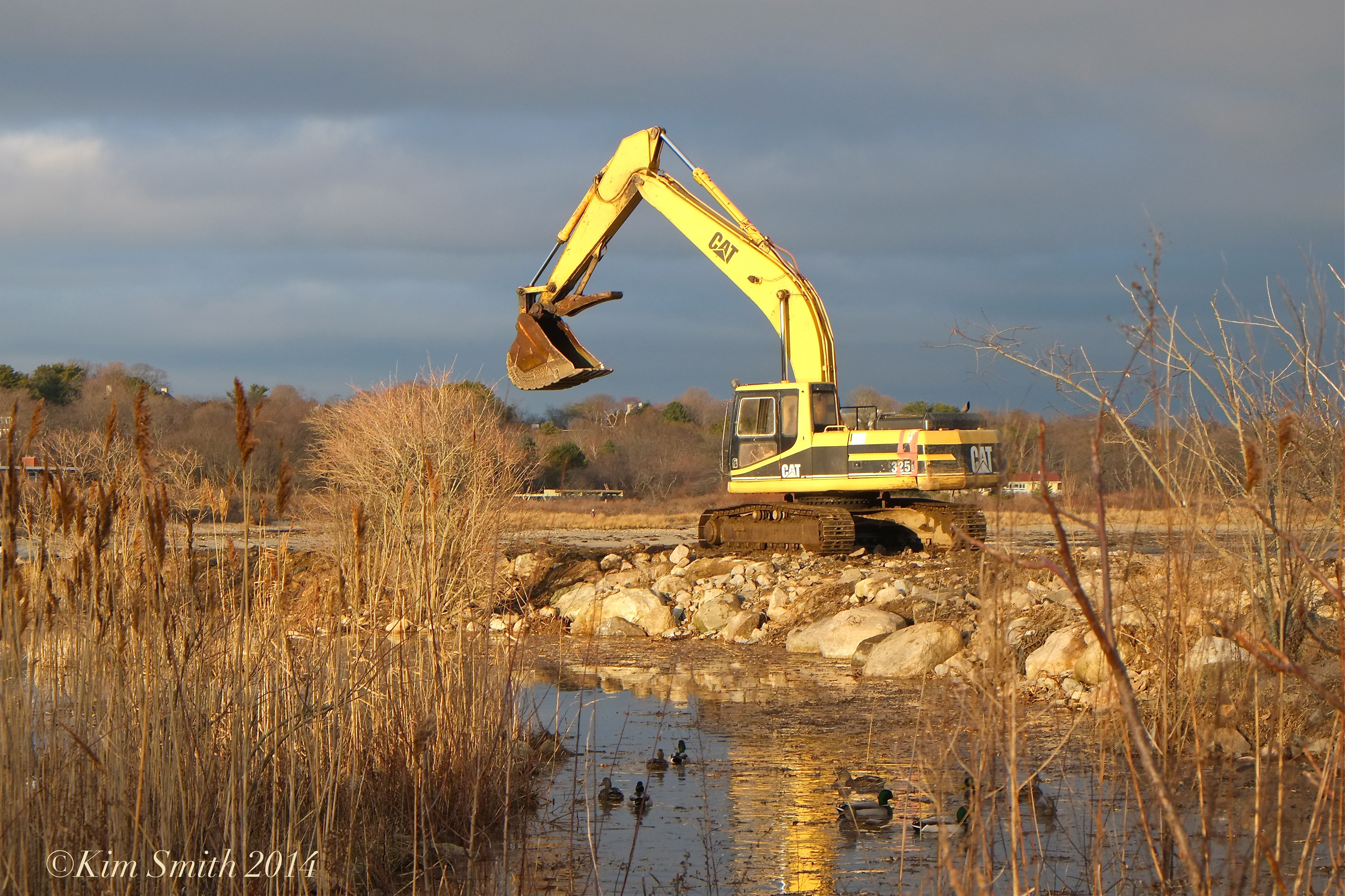 The causeway being rebuilt in 2014.

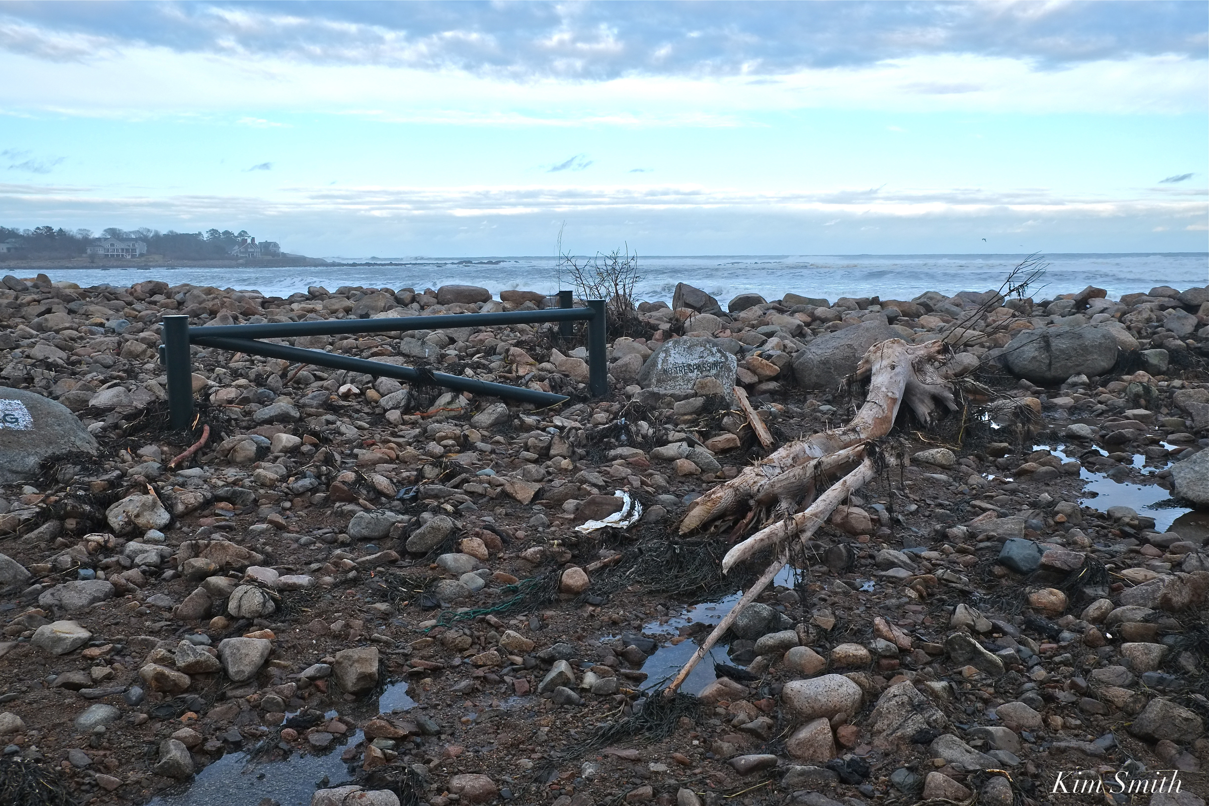
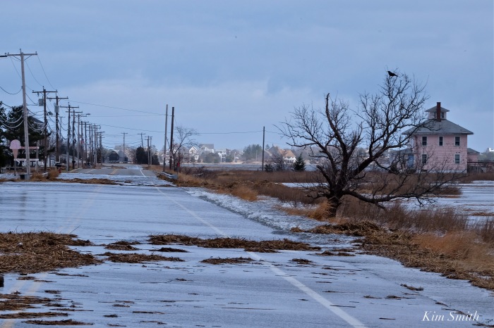
The road that runs along Pebble Beach, separating the sea from Henry’s Pond has been washed out.
 The footsteps in the sand are where the road ran prior to the storm.
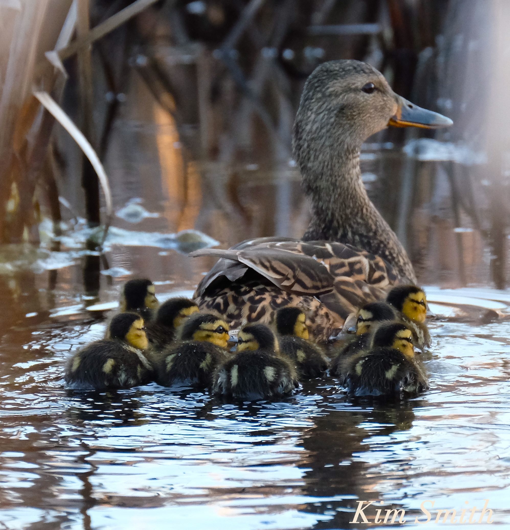
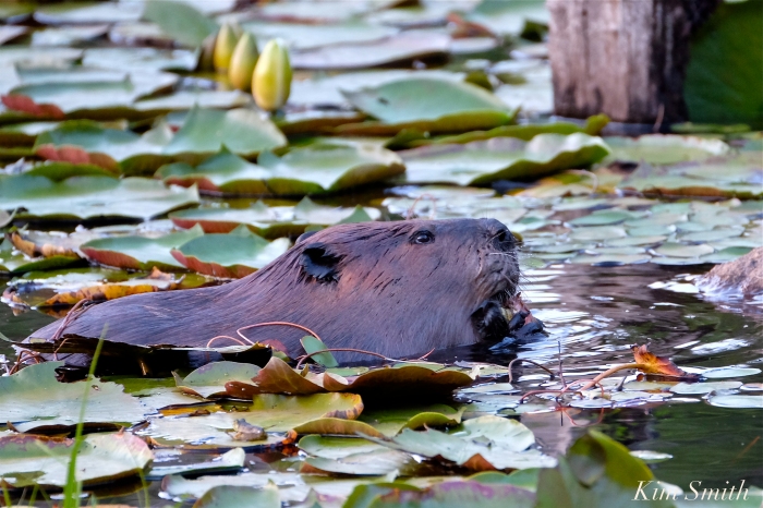
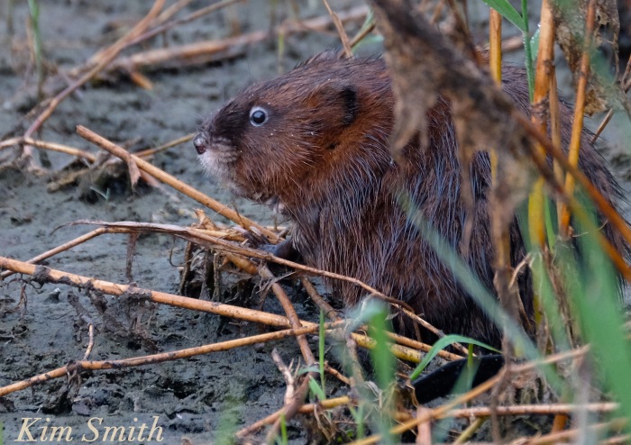
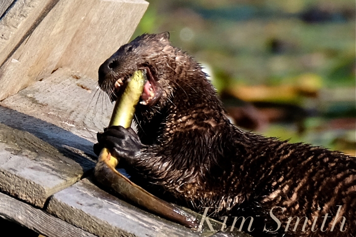
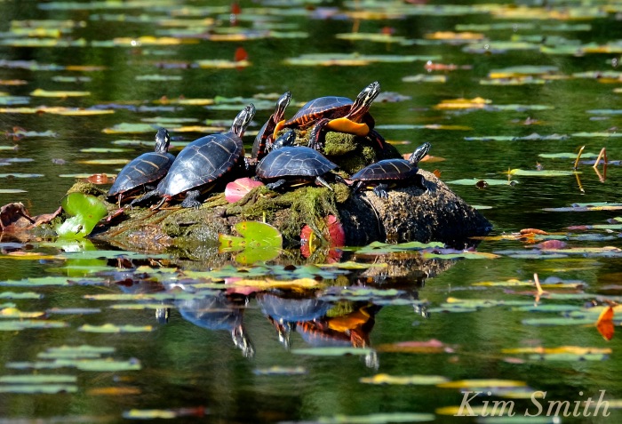
Mallards, North American Beavers, Muskrats, North American River Otters, and Painted Turtles are only a few examples of species that breed in Massachusetts fresh water ponds and wetlands. All the wildlife photos and videos were shot on Cape Ann.
 Migrating Black-bellied Plover
Cape Ann is hardly alone in coping with the impact of our warming planet and of rising sea level. These photos are meant to show examples of what is happening locally. Regions like Plymouth County, which include Scituate and Hingham, have been equally as hard hit. Plum Island is famously heading for disaster and similar Massachusetts barrier beaches, like Cranes Beach, have all been dramatically altered by the cumulative effects of sea level rising, and recently accelerated by the devastating winter storms of 2018.
To be continued.

Impassable Road to Plum Island
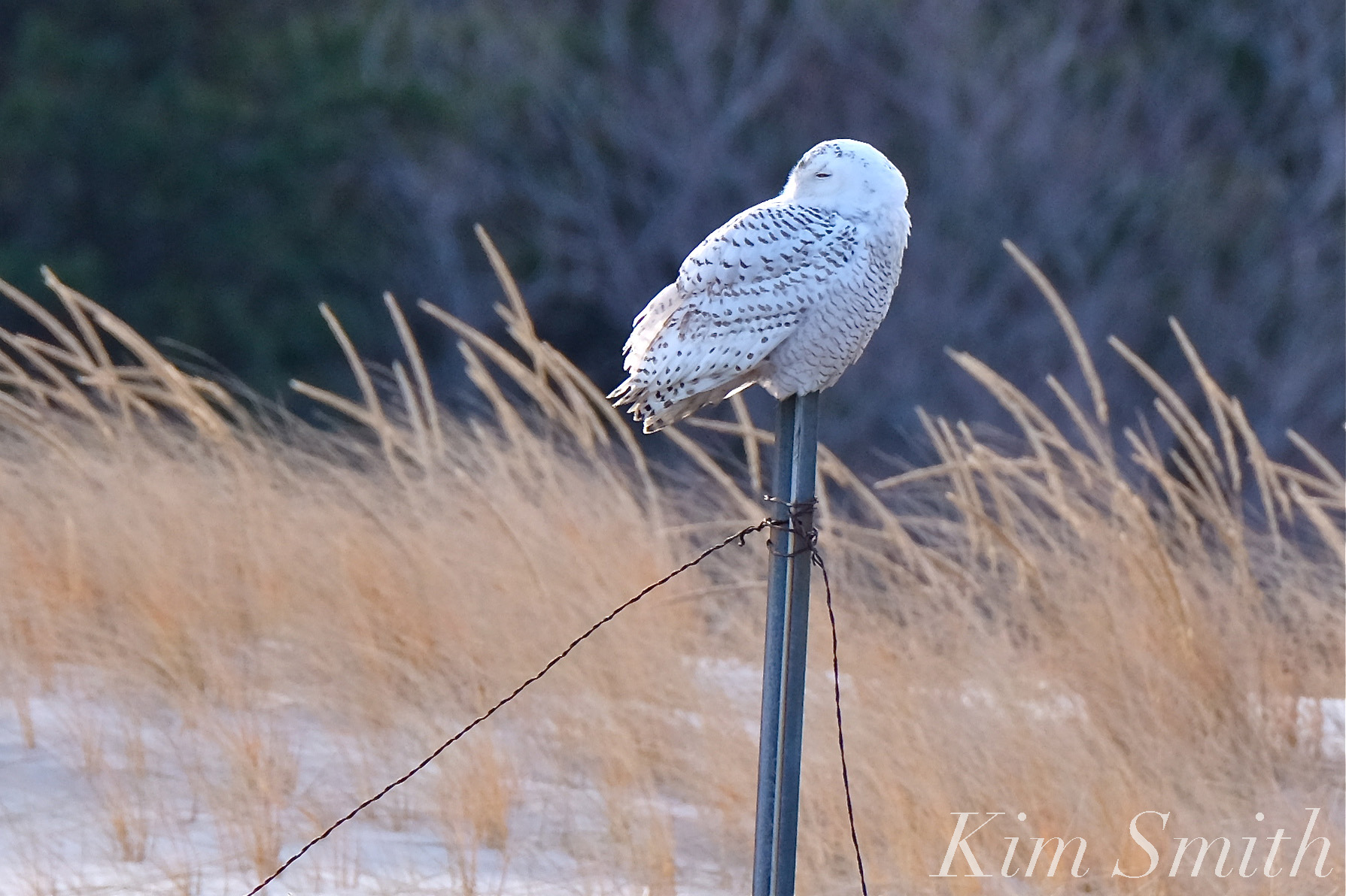 Snowy Owl Cranes Beach

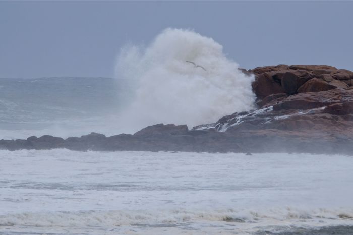
The beautiful newly constructed causeway that separates Niles Pond and Brace Cove, which was rebuilt several years ago, is now a jumble of rocks and boulders. Niles Pond Road is narrowing from the sea water surging into the Pond. The water has nowhere to go. The road to the Retreat House is impassable. The destructive force of climate change is rearing its ugly head in our own backyards and a fifth super high tide is expected again tonight. 


https://www.instagram.com/p/Bf61crQFsmc/

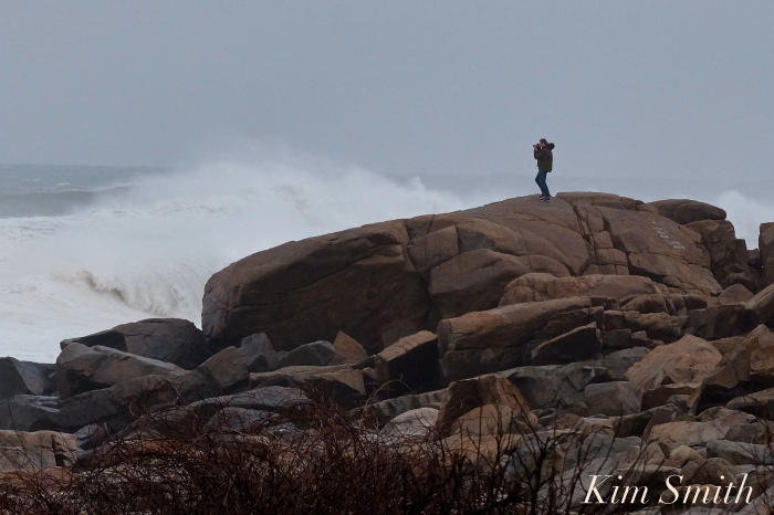
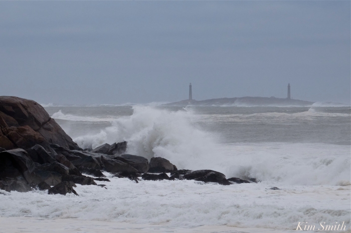
Popples and debris are littering Atlantic Road, the footbridge sustained damage to the last half, fences and trees are down throughout the neighborhood, and the seas are gaining in ferocity, with the third of the super high tides expected at noon. Please be safe, the wind is mighty powerful this morning and their are potential projectiles everywhere.
 Good Harbor Beach Footbridge damaged.
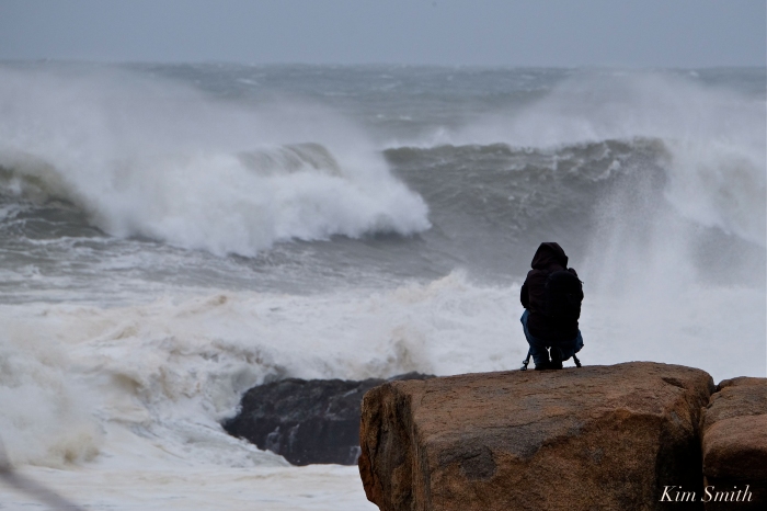
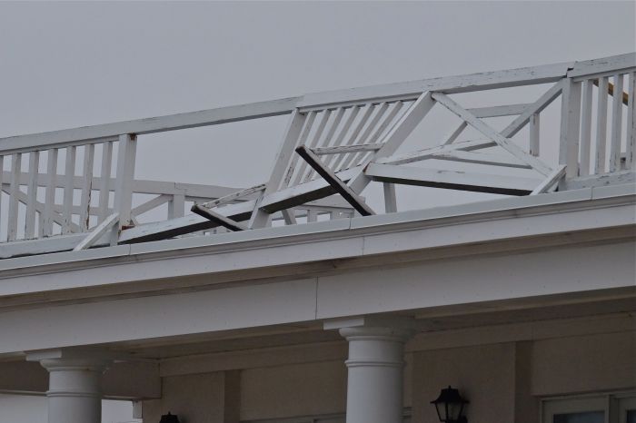


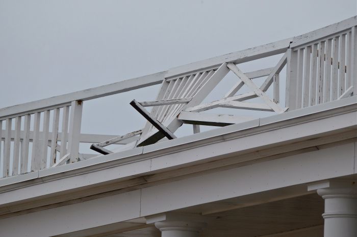

Extensive damage to the railings at the Ocean House Inn, our Snowy Owl Hedwig’s current favorite perch. No sign of her the past few days, but Hedwig is so resourceful, we are hoping for the best.

 Brace Cove

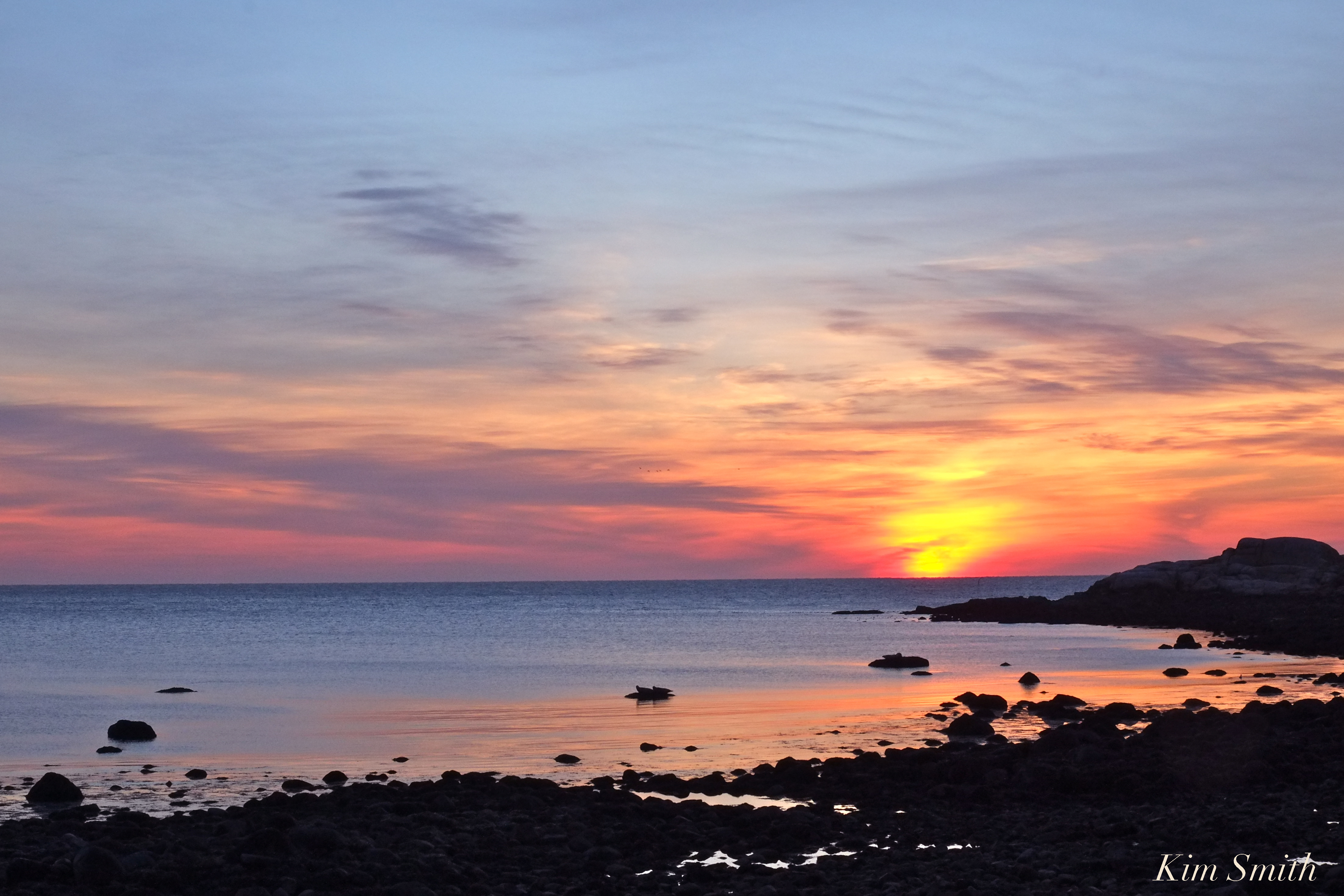
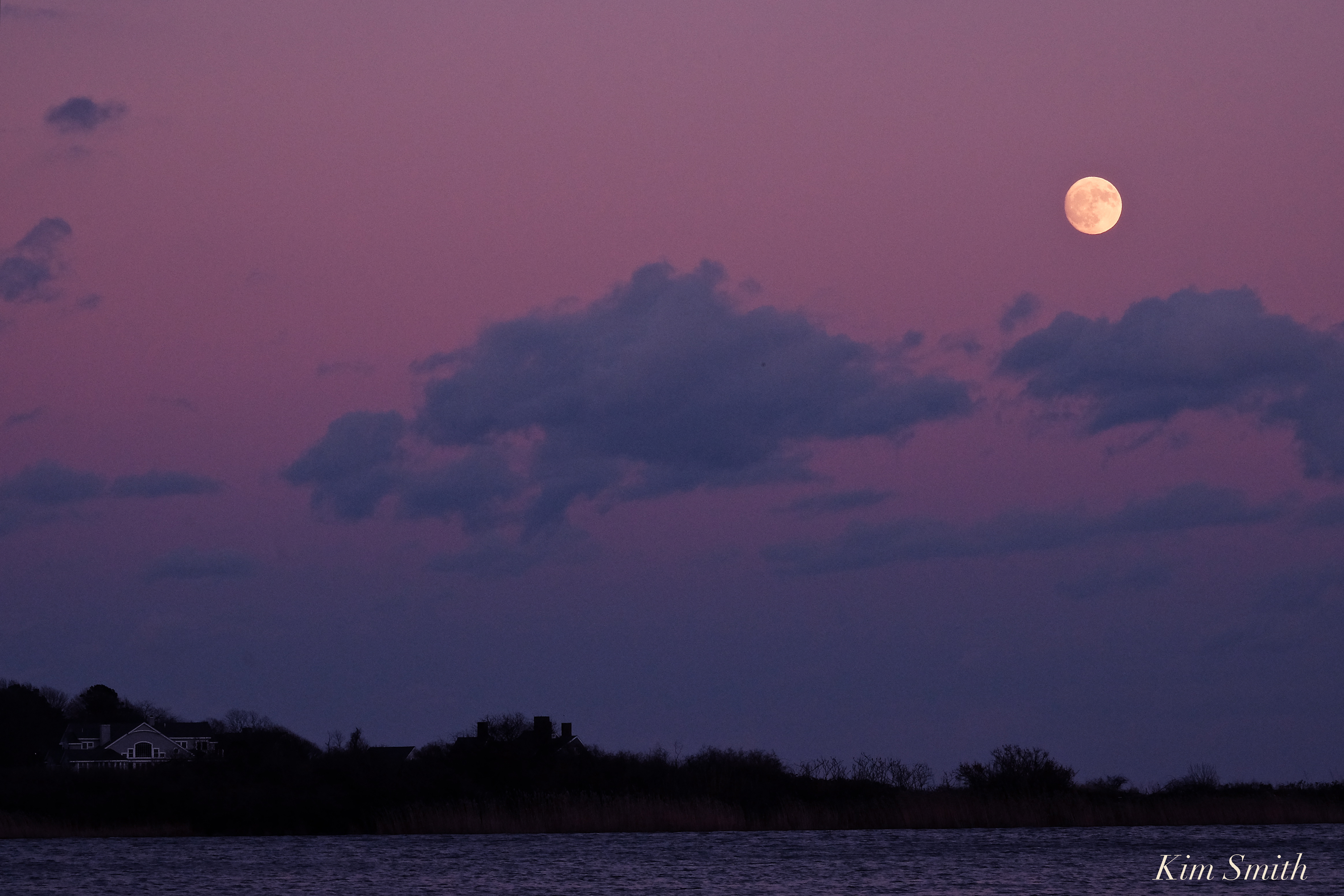
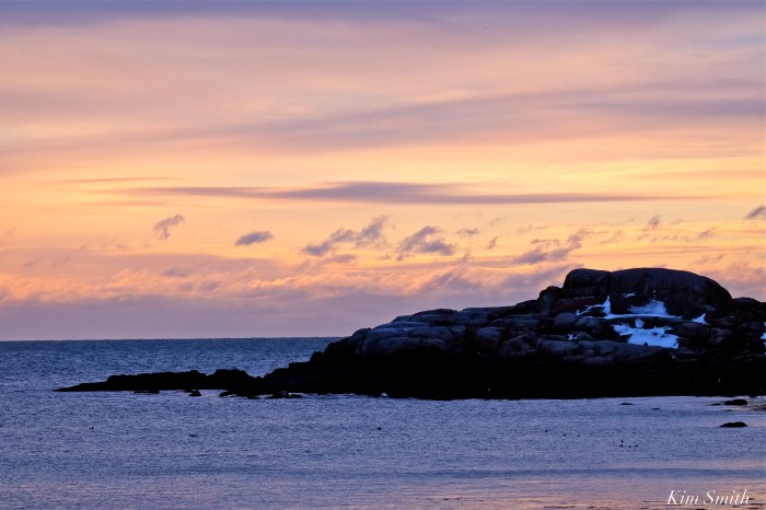
Cotton candy pink sunset colors –
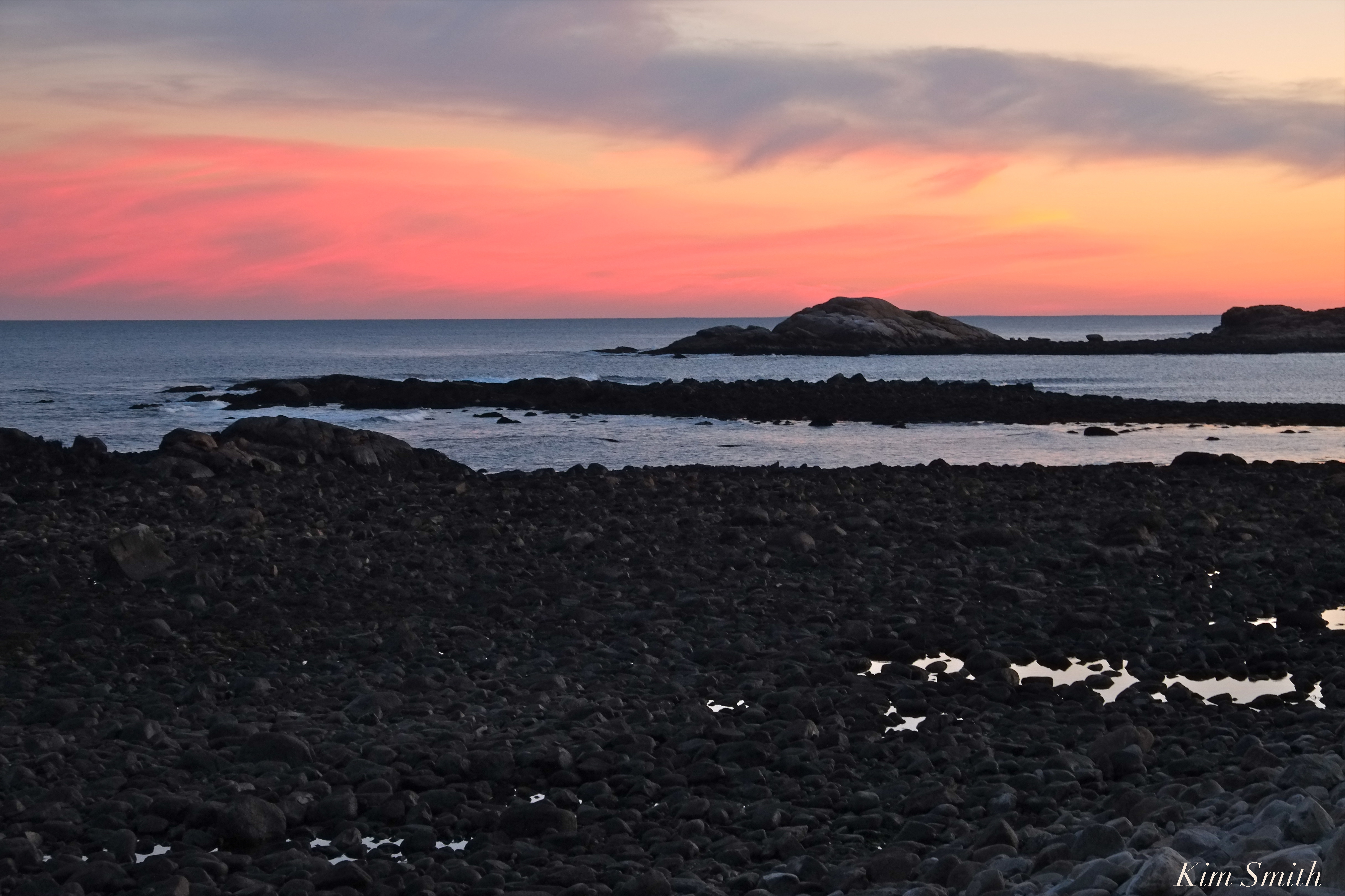 Brace Cove Sunset
 And further up the coast it was just as pretty.

