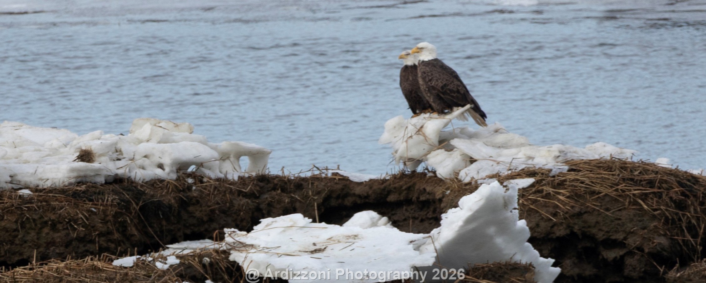
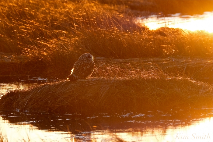
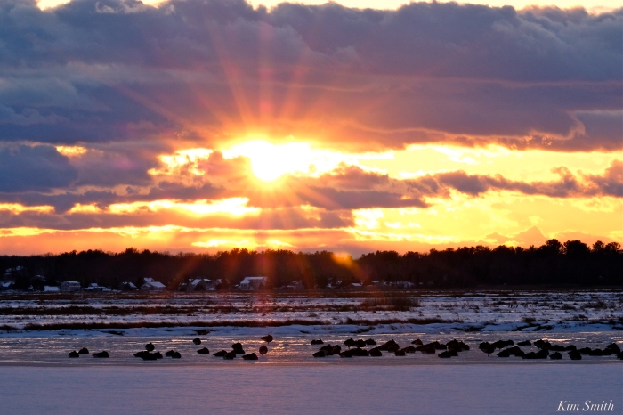
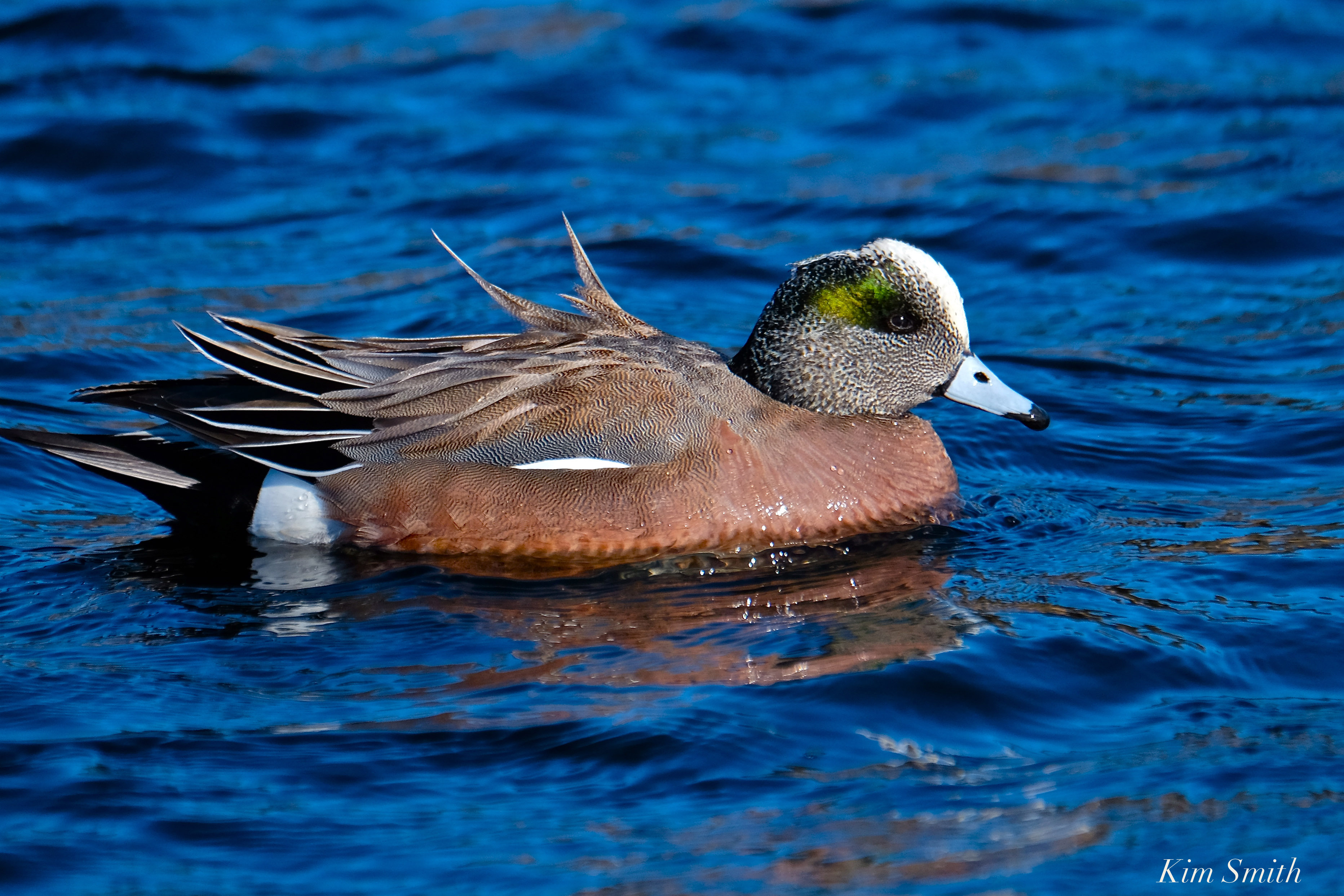
Amazing to see these beautiful birds at Plum Island on Valentine’s Day.
My View of Life on the Dock
Amazing to see these beautiful birds at Plum Island on Valentine’s Day.

We love walking Parker River Refuge. The exercise is great, and the scenery is beautiful. We did see the Barred Owl, but this owl was hiding in the trees so no photos, I tried but this beautiful bird was having none of it. The Coyote was way out in the marsh just sitting there with ducks.


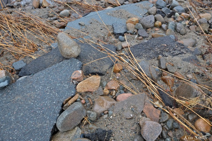
Hard to miss in the wintertime both at Crane Beach and at Plum Island are the layers and swirls of pink and purple sand. On a recent visit to Revere Beach I noticed there were also rivulets of pink and purple sands.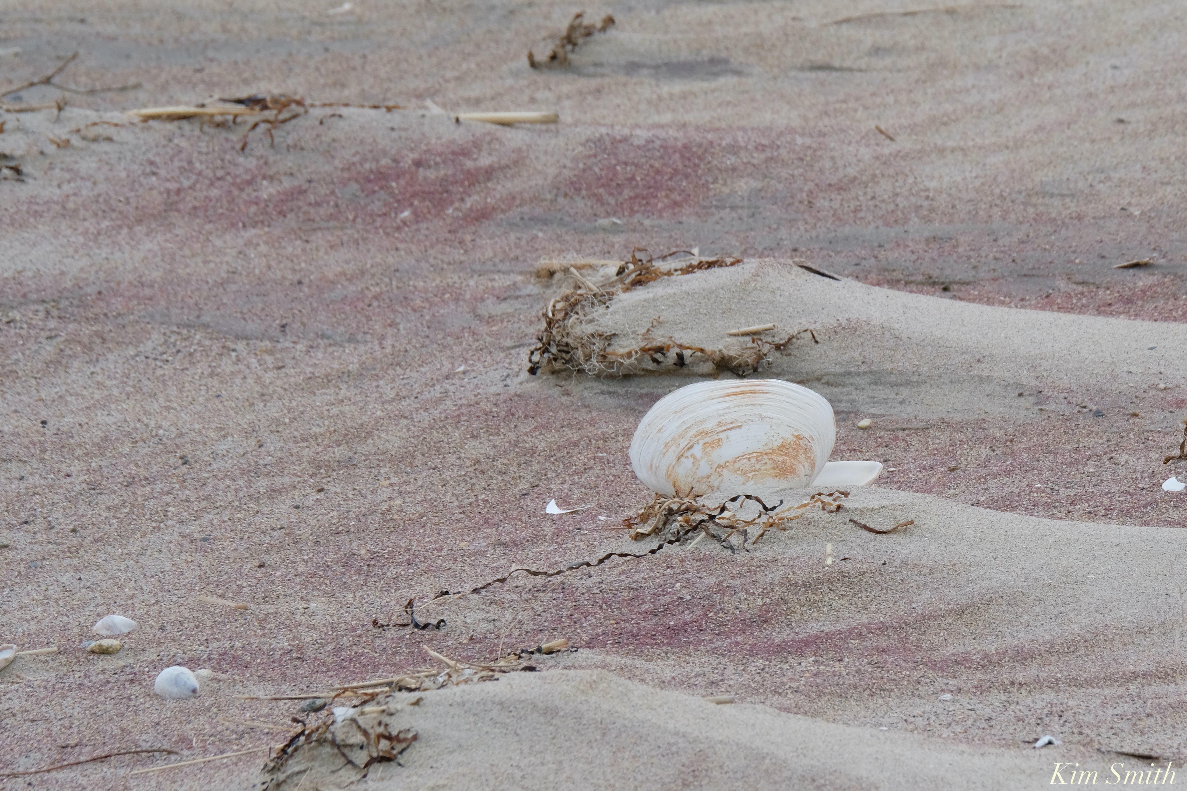
The pink and purple are mineral deposits of rose quart and garnet and come to north of Boston beaches via the White Mountains. Water and wind worn rock is carried in river waters until it meets the ocean and becomes deposited on barrier beaches. We mostly see the garnet and quartz deposits in winter as storms erode the dunes, leaving the heavier minerals exposed. During the spring and summer, the lighter white quartz sand blows back over the dunes and covers the heavier sand.


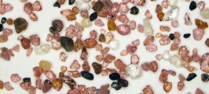
JEOL is a supplier of electron microscopes, ion beam instruments, mass spectrometers and NMR spectrometers. On a visit to Plum Island looking for Snowy Owls, several JEOL employees found purple sand. They analyzed it using an optical microscope, a scanning electron microscopes (SEM) and an energy dispersive X-Ray spectrometer (EDS).
At first look under the optical microscope, the granules of sand appeared like scattered jewels of many colors; predominantly glassy pink angular grains, with smaller quantities of milky white rounded grains, clear angular grains, black grains (some magnetic and some not), and even the occasional green.
What could be the cause of the purple color? The answer was one that came as no surprise to the scientist, but was exciting for the beach walkers because they had an exact answer to a question that no doubt is one that many people have when they visit Plum Island – which was actually named for its beach plum bushes, not the plum-colored sand.
When large amounts of fine grained pink is intermixed with a smaller number of darker grains and dampened by rain or sea water the human eye will “see” the sand as a much darker pink to almost purple. The two most common pink minerals are rose quartz (while quartz is one of the two most common minerals on earth, the pink rose quartz variety is not so common ,especially in the New England geology, and is found only in a few isolated pegmatite deposits in NH & southern Maine which are where most gemstones originate) and the solid solution series of almandine and pyrope garnet which is also a very common mineral (and is quite common in the Seacoast area from the abundance of metamorphic rocks called mica schist and from contact metamorphism. This is also why many commercial sandpaper products have a pink color as the angular hard gains of almandine / pyrope garnet are the perfect abrasive. The most likely candidates for the white and clear are any of the feldspars and or quartz. The green is most likely epidote. Just based on the optical examination these are no more than educated logical guesses (but still guesses).
Vern Robertson, JEOL’s SEM Technical Sales Manager, originally examined the grains under a low power optical stereo microscope with the above conclusions. In addition to providing technical and scientific support to JEOL SEM customers for a multitude of applications, Vern holds a degree in Geology. After a cursory look optically, it was time to get down to some spectroscopic analysis to determine the actual mineral species present in the sand.
Individual grains of various colors were selected and mounted for examination with the JSM-6010LA+ InTouchScope SEM and for analysis using EDS. The SEM allows much higher magnification imaging with greater depth of field than a traditional OM and the low vacuum capability allows examination of the sample without the traditional conductive coating that needs to be applied for SEM imaging. However, it generates images in only black & white (electrons have no color!). One specialized detector in the SEM, the Backscatter Electron Detector, yields images with the gray level intensity directly proportional to the average atomic number (or density). This means that minerals containing only lighter elements like O, Si are darker in appearance to minerals that contain heavier elements like Fe or any of the metallic or rare earth elements.
Once located, each grain can be analyzed with the EDS. When an electron beam hits a sample it creates not only an image from the emitted electrons but creates X-rays, which when collected in a spectrum, indicate what elements are present and at what concentrations. This allows not only the elemental composition of the individual grains to be determined but the concentrations can be compared to known stoichiometry of the suspected mineral grains. The combination of color and magnetic properties from OM examination and the chemical makeup of the individual grains yield the answer.
The purple color (or more appropriately, pink color) comes from the abundance of almandine-pyrope garnet with a nominal solid solution composition of Fe3+2Al2Si3O12 to Mg3+2Al2Si3O12. As expected, the white grains are a mix of feldspars but mostly K-feldspar (potassium alumino-silicates) and quartz SiO2. The black nonmagnetic grains were a mix of a pyroxene called augite which showed its characteristic strong cleavage, (Ca,Na)(Mg,Fe,Al)(Si,Al)2O6 , and a mix of ilmenite FeTiO3 and hematite Fe2O3 which are the magnetic components. The green was confirmed to be epidote Ca2(Al,Fe)3(SiO4) 3(OH). With the exception of the high concentration of garnets the rest are common minerals one would expect to find in sands.

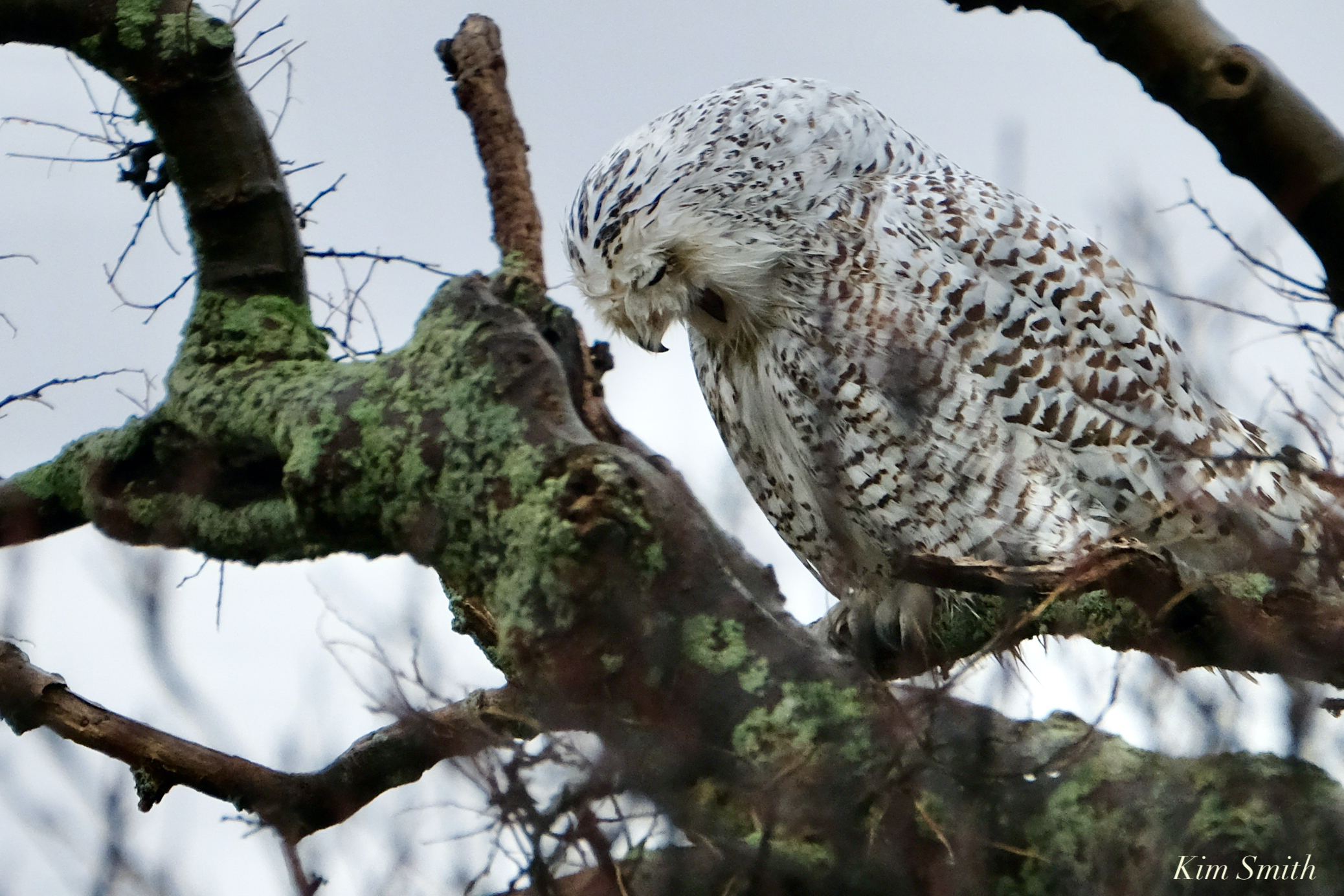
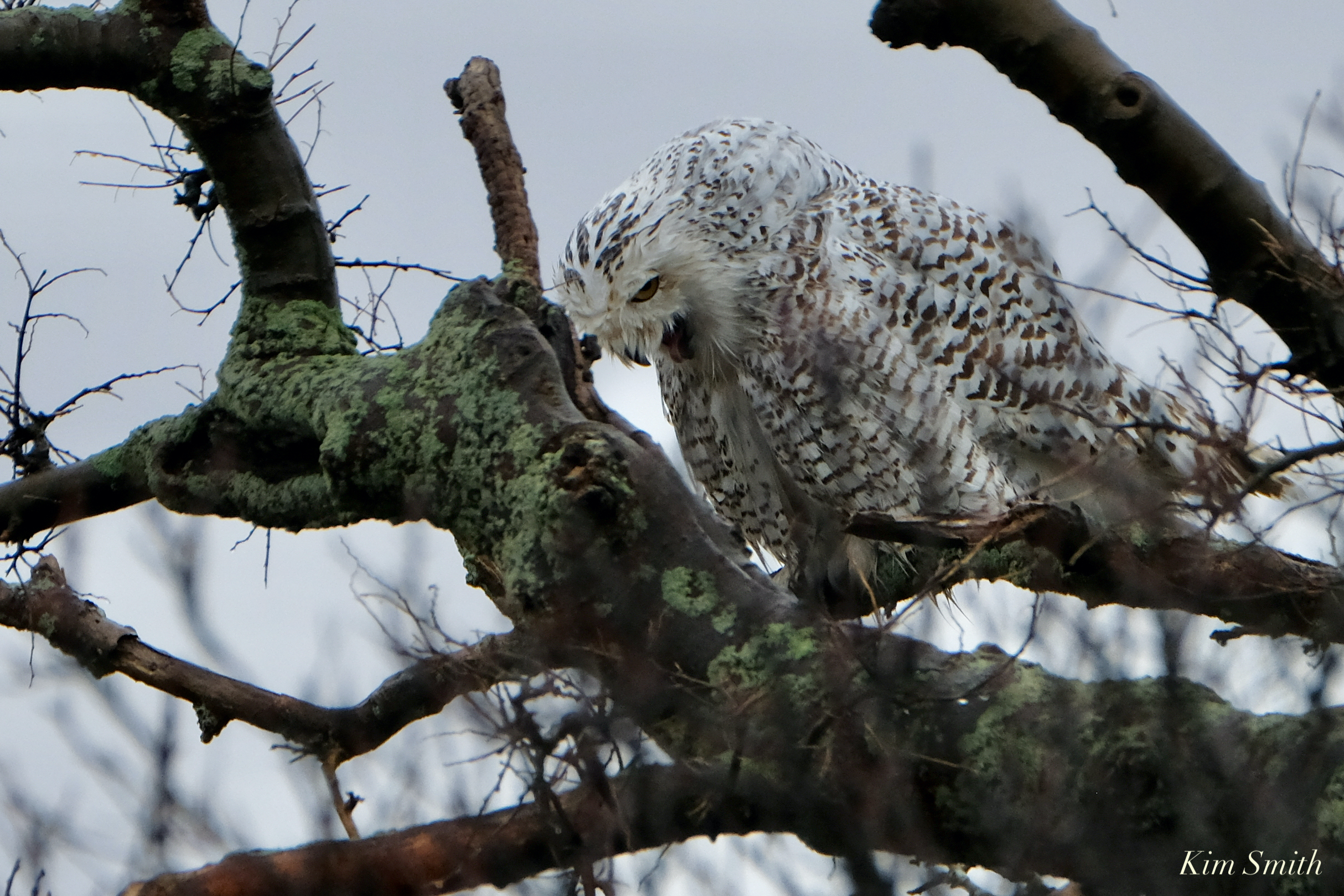
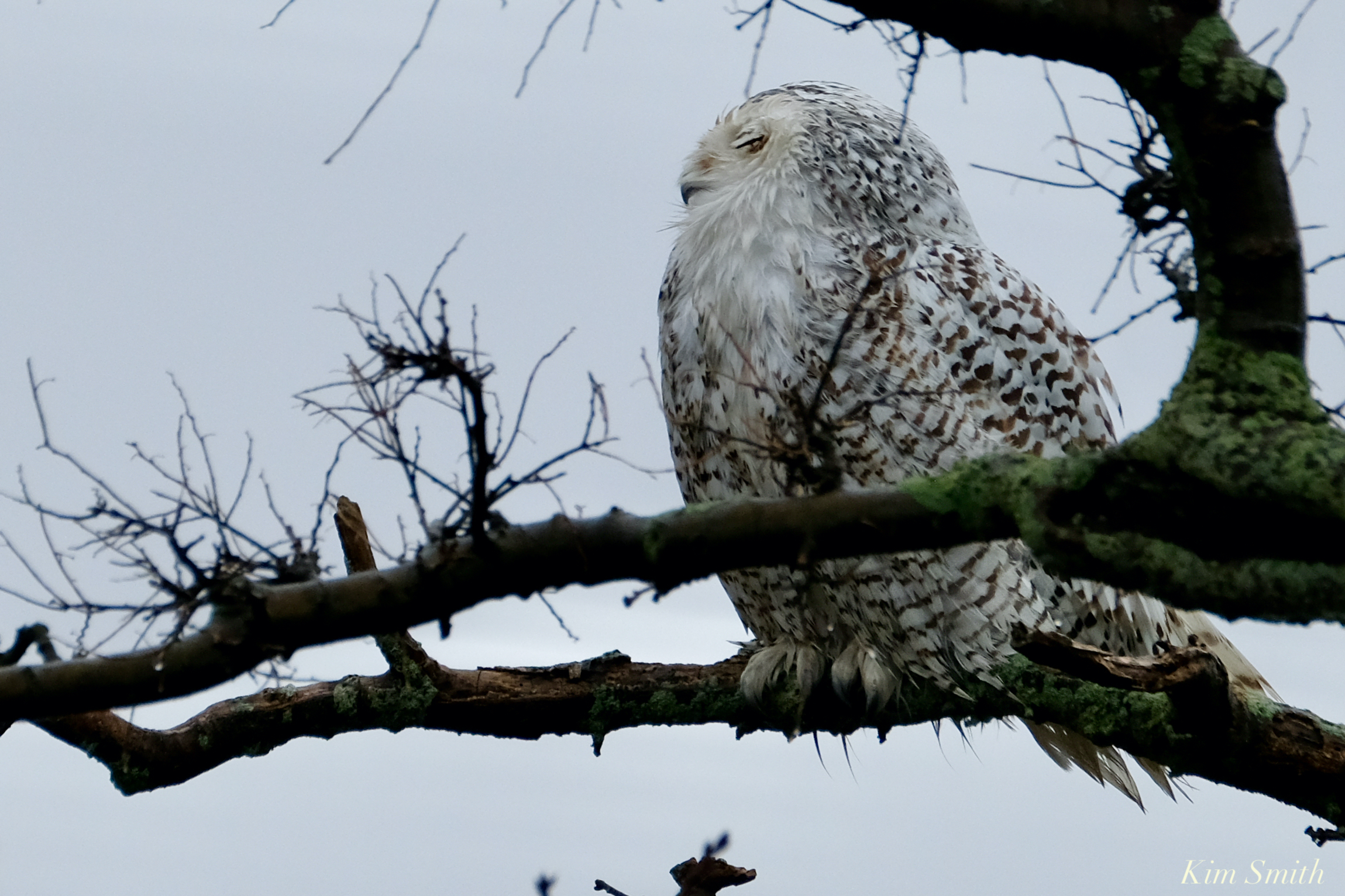
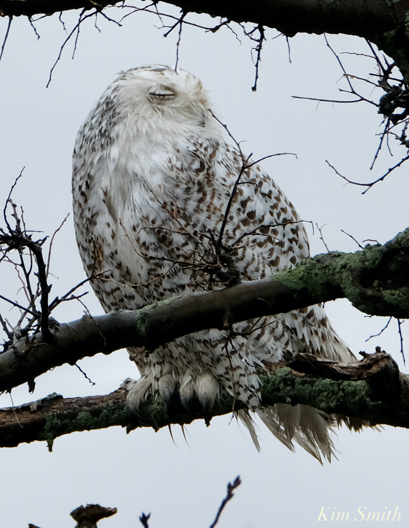
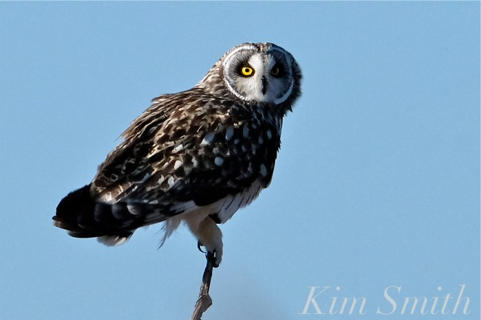
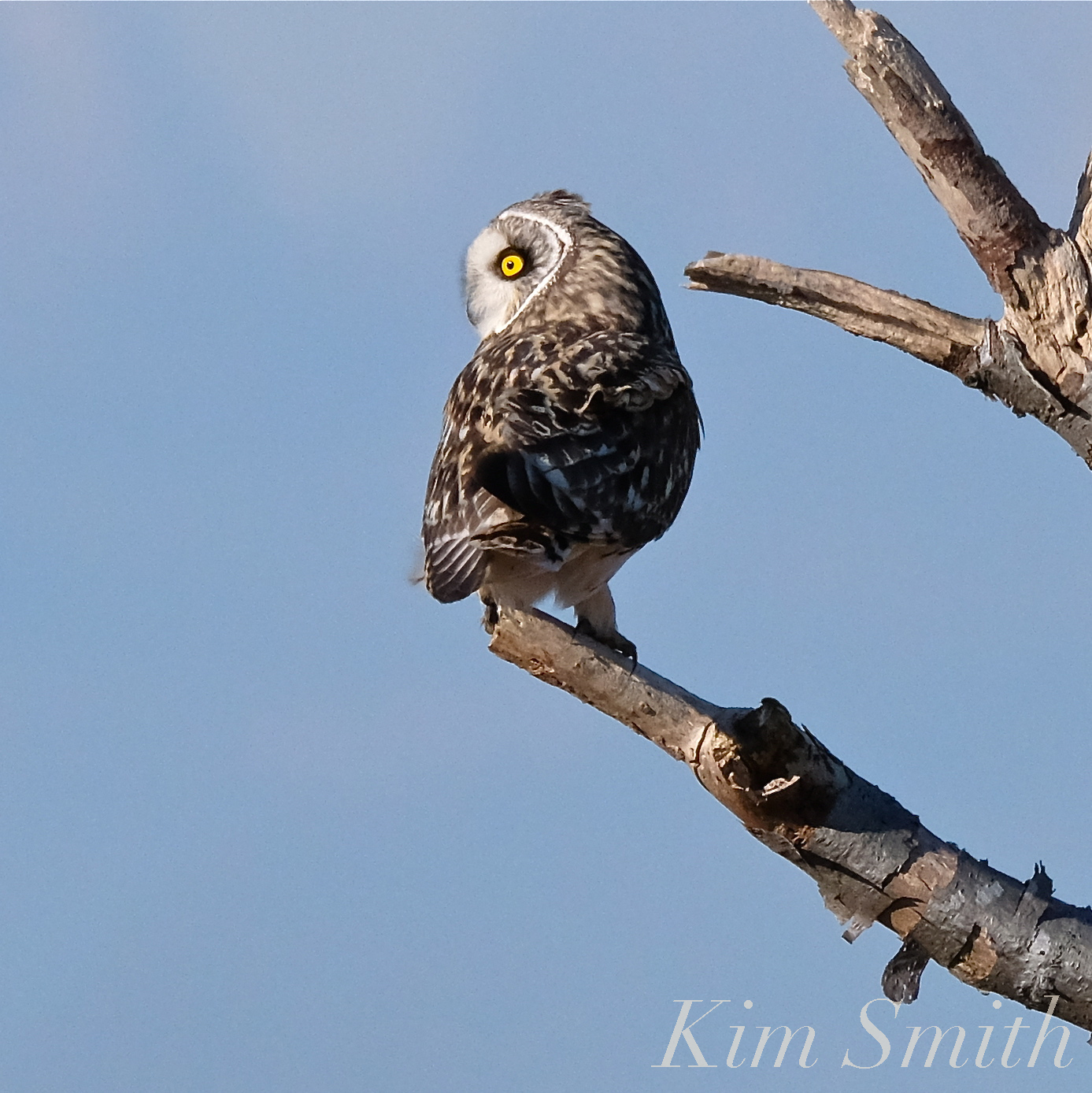
This sweet messy-faced girl was relaxing on the limb of a craggy tree after what had been a clearly successful morning hunt. She coughed up a pellet while enjoying a rare quiet moment perched in the branches

Snapshots of the beauty that surrounds, both wildlife and wild scapes –
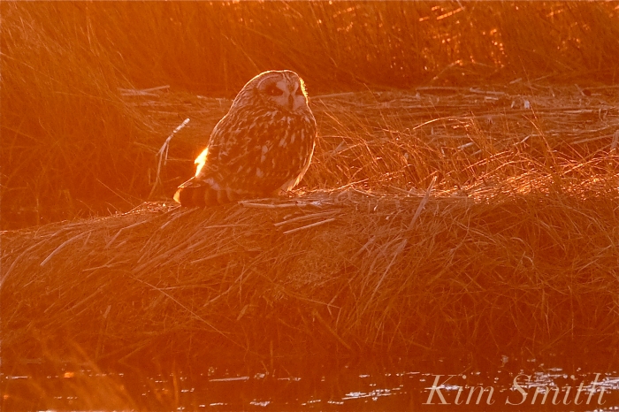
 Short-eared owl in red sunset glow

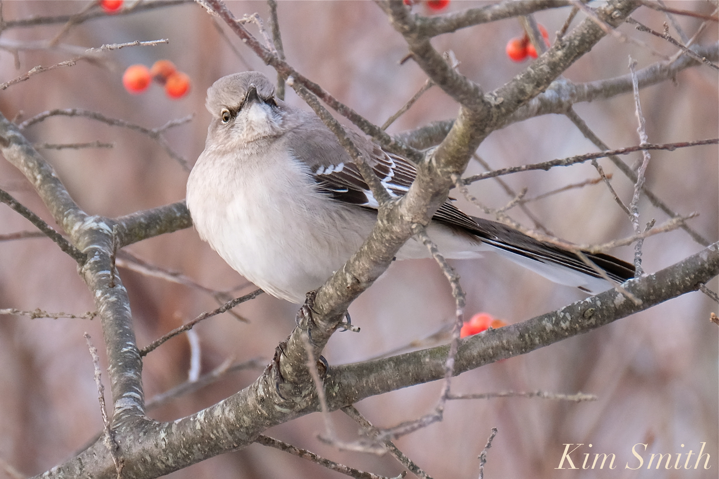 A Northern Mockingbird’s Paradise
 Please don’t get electrocuted Red-tailed!


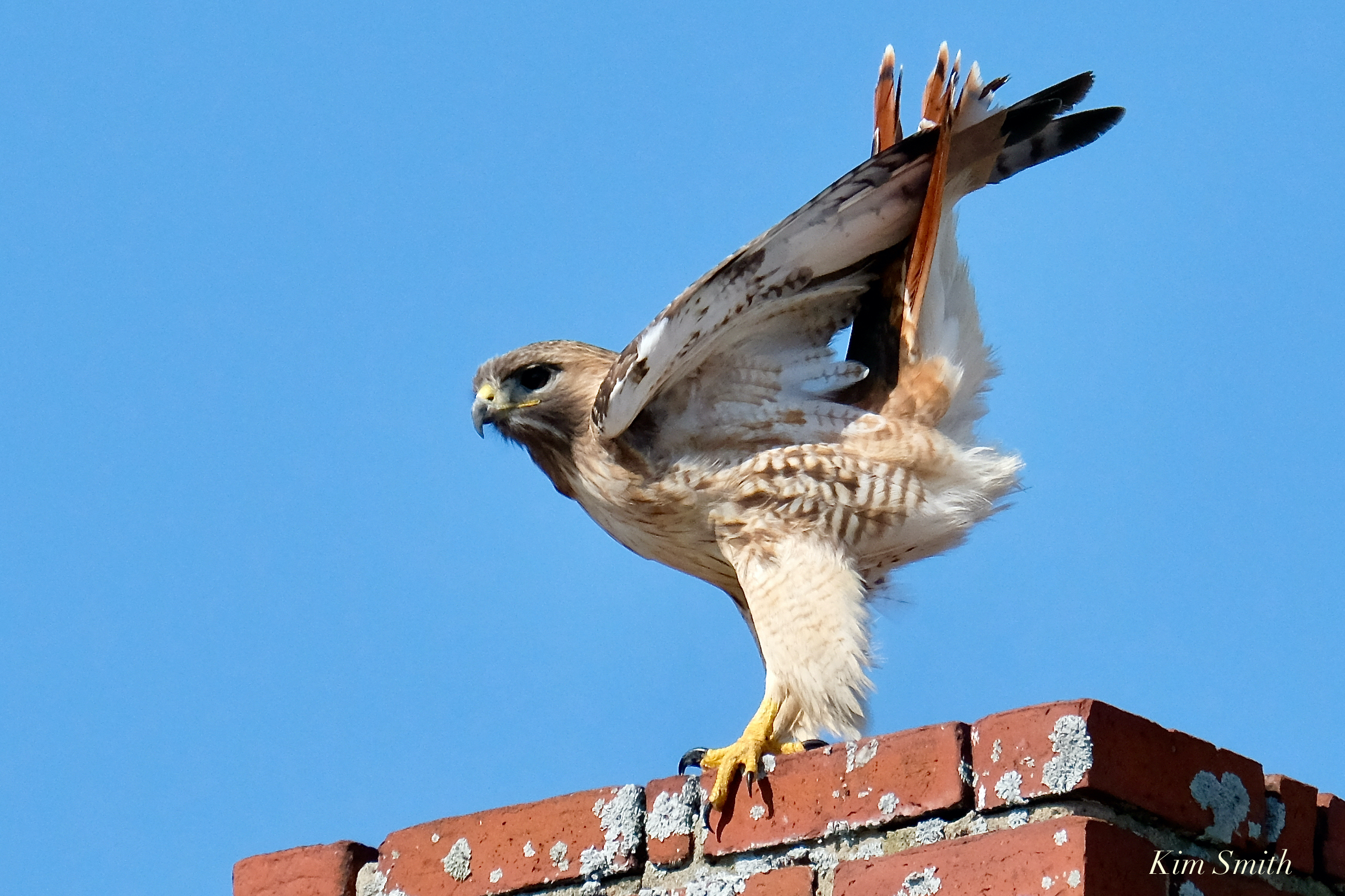 Red-tailed perched on a chimney scanning the marsh with its keen vision.
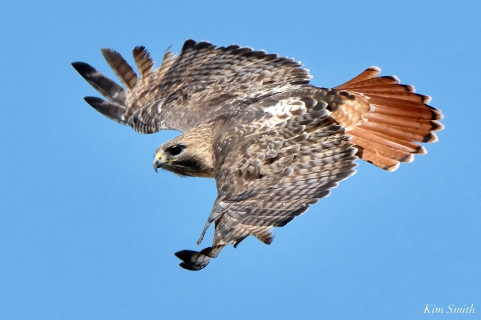
The Red-tailed Hawk’s vision is eight times more powerful than a human’s, allowing it see a small rodent such as a mouse or vole from 100 feet away. It dove into the tall dry grass making a loud crackly rushing sound but, came up empty-mouthed. Again it flew to the top of the Pink House chimney from where, only a few moments later, it made a second dive.


 When diving to catch prey, their speed may exceed 120 miles per hour, and no joke, this Hawk’s speed appeared to increase as it became almost torpedo-like in shape.
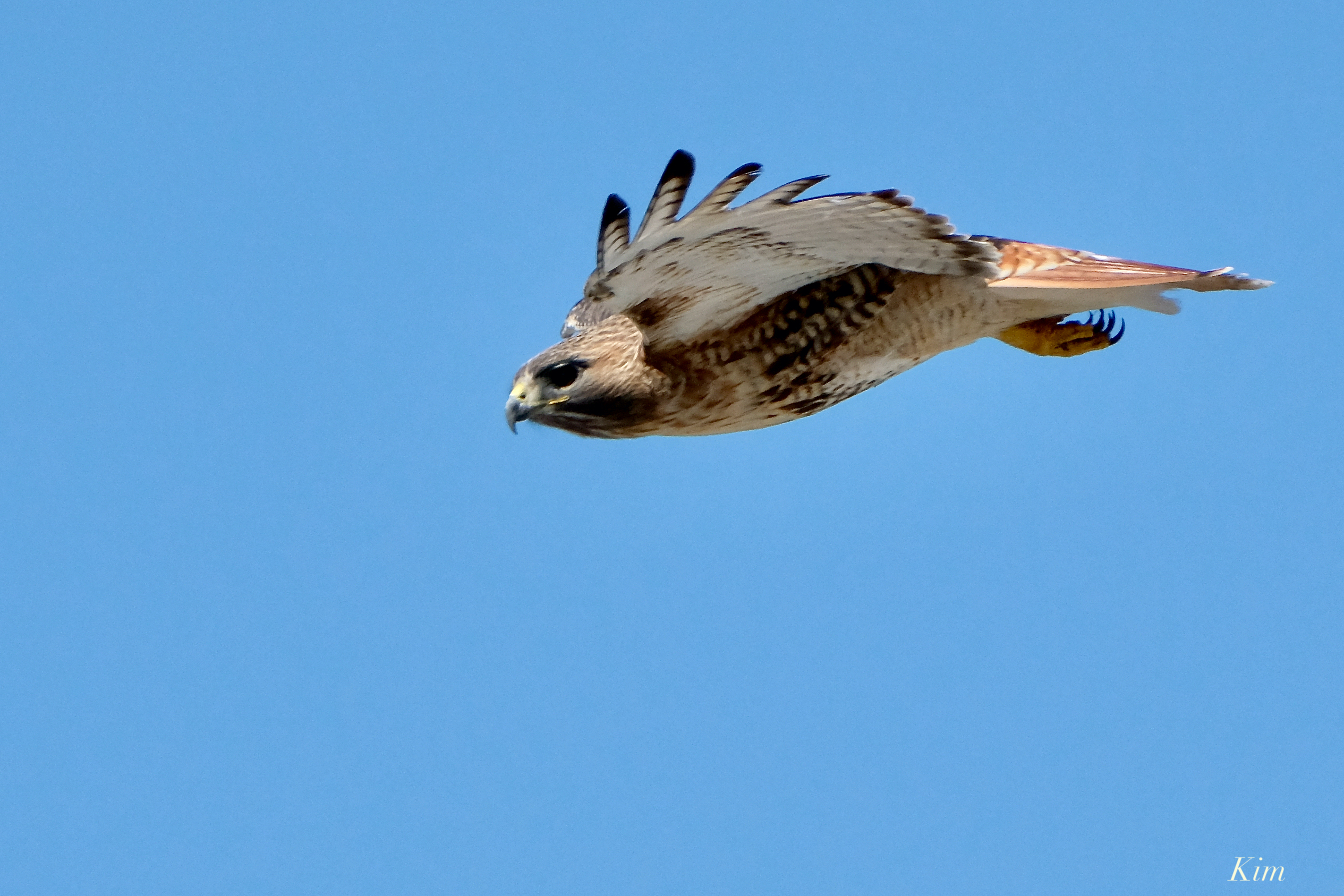
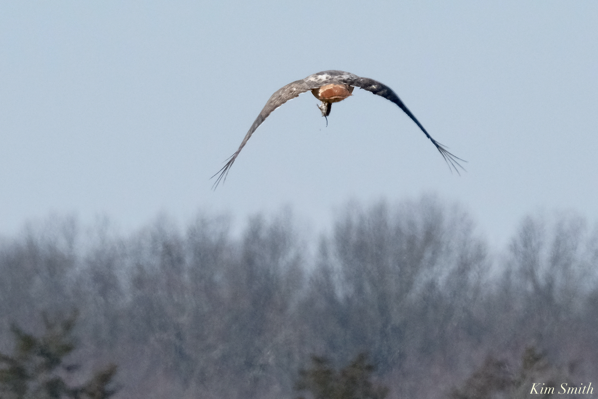 Successful hunting! I only captured a photo of the second half of its flight from a distance; nonetheless, you can see the mouse (or vole) in its mouth in the last photo.

Went to Parker River Wildlife Refuge on Sunday. What a beautiful day. The Snowy Owl was about half mile away. Not a great photo but at least I was able to see it.


Sandy Point State Reservation is at the end of Parker River Wildlife Refuge.
The reason the sand is purple is due to quartz and manganese garnet deposits from the nearby hills that washed down to create the purple colors and is most visible after storms.


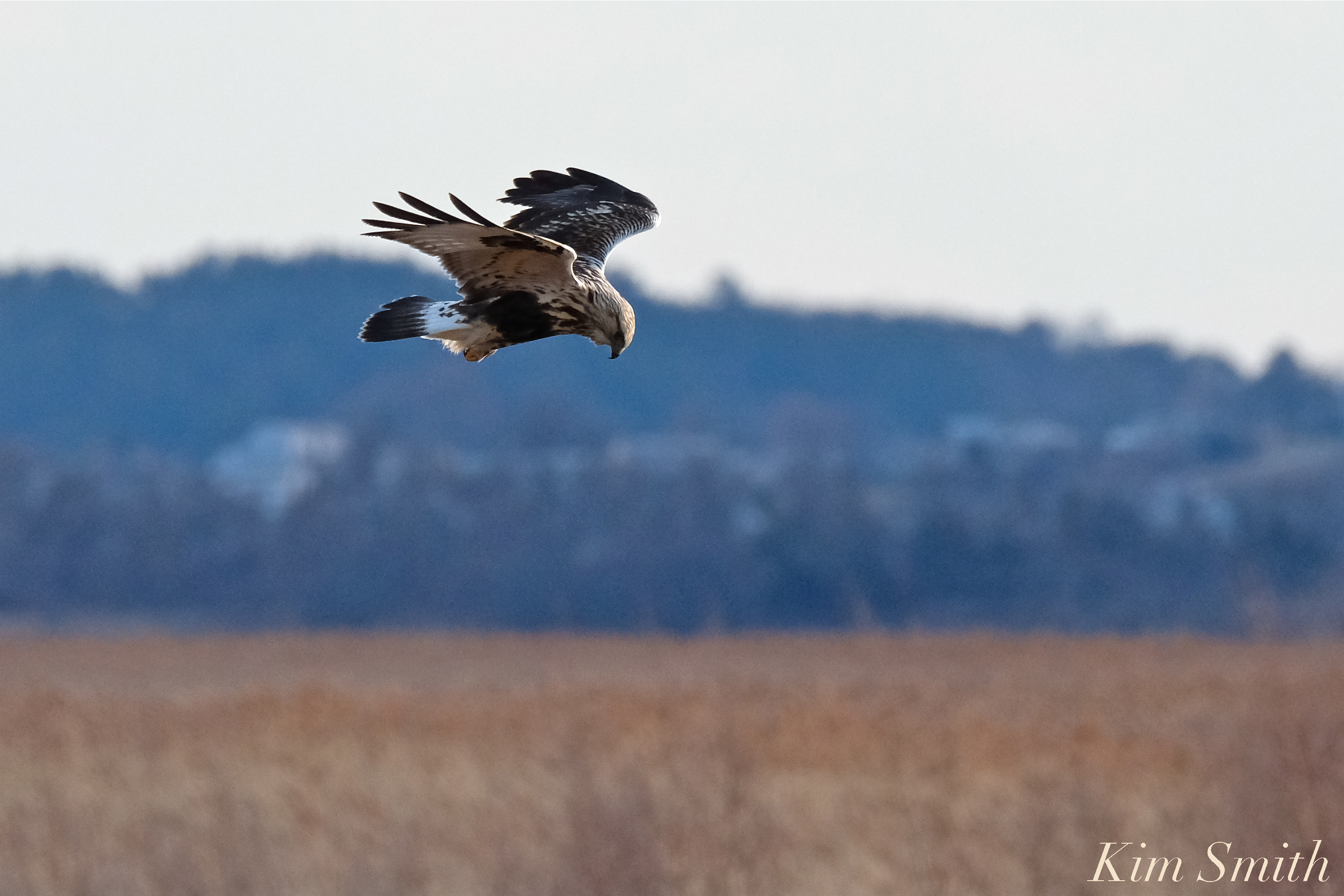
Watching this beautiful creature hunting at day’s end, it was fascinating to see the Marsh Hawk hovering, suspended mid-air for moments at a time. With razor sharp focus it’s gaze did not swerve. He swooped down toward the tall grass and I lost sight of him after a brief, second long glance from the ground. I hope he caught his dinner!


Charlotte and I had a wonderful adventure morning checking on the owls at Plum Island. We observed several Harrier Hawks flying low over the marsh grass hunting for prey, a Short-eared Owl perched on a craggy tree, and a Snowy parked for the morning far out in the dunes. We played on the beach and she had a blast zooming up and down the boardwalk at lot no.2.


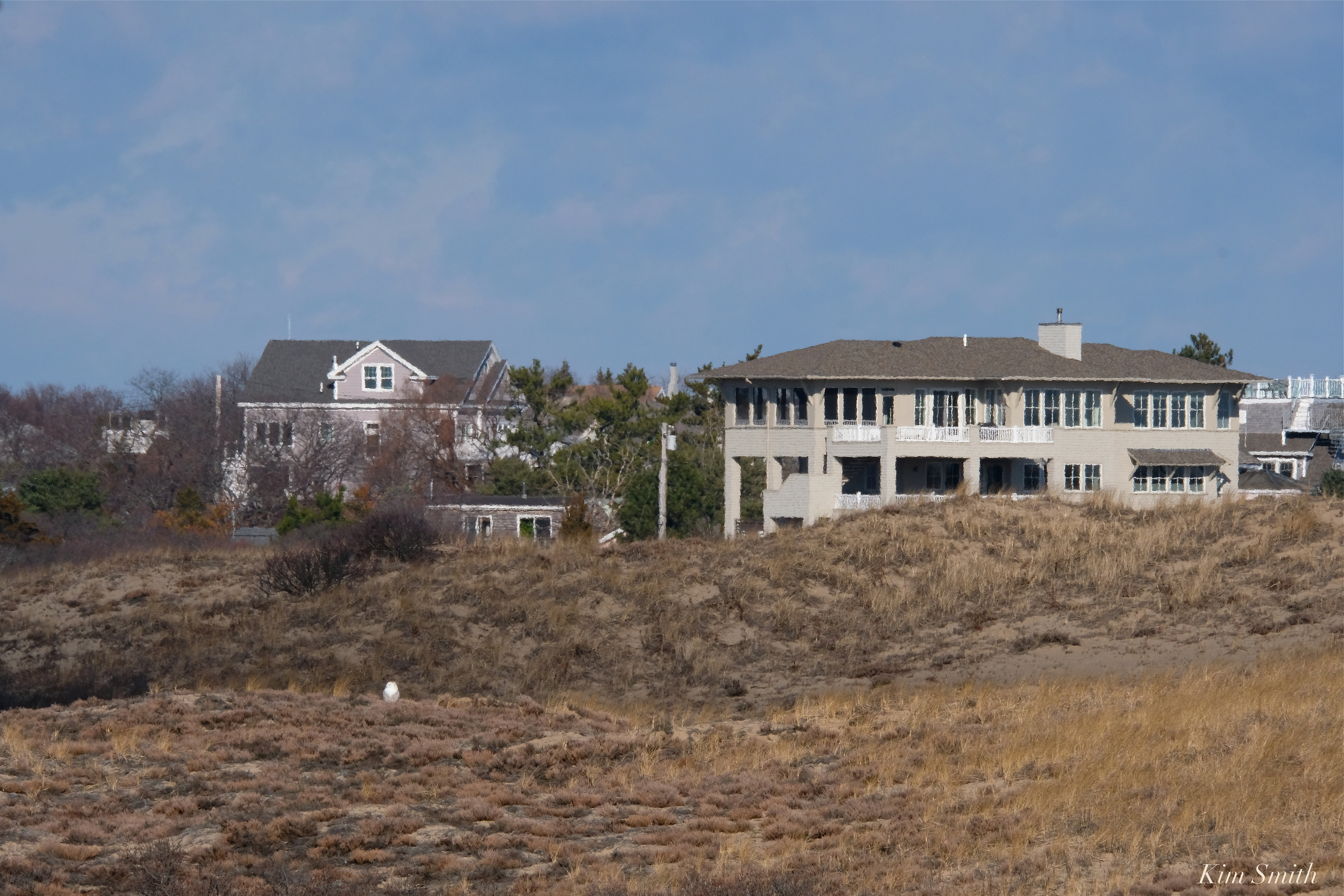
Tiny white wedge in the distance
We next stopped at the refuge headquarters to play in the marsh boat that is part of the exhibit about the Great Salt Marsh. She brought along her own stuffed Snowy to join on the boat ride.
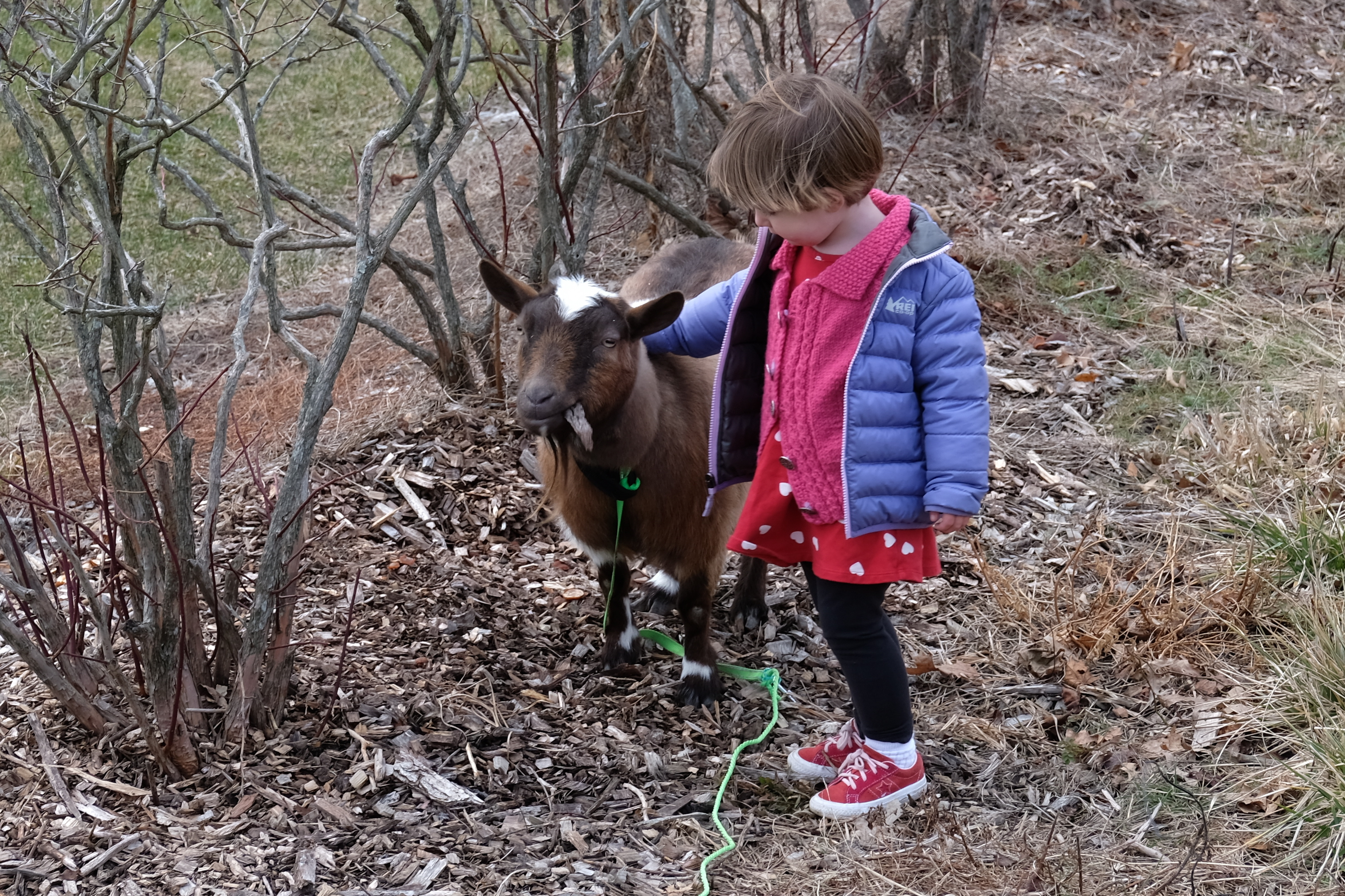
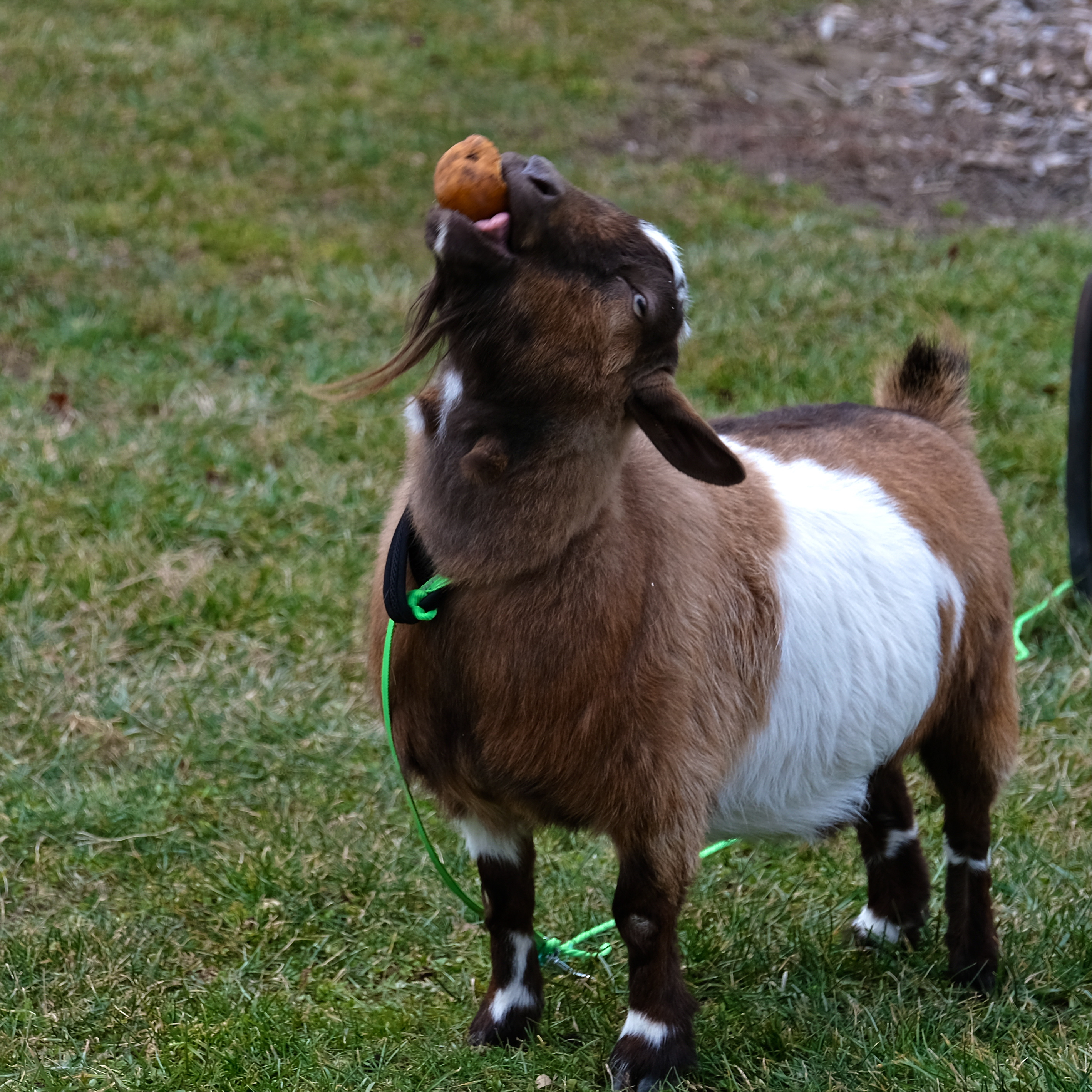
Next destination was a visit to see the farm friends at Tendercrop Farm. Currently in residence are a turkey, ginormous steer, pony, chickens, ducks, llama, and the sweetest miniature goat who is just wonderful with toddlers.
I purchased the best steaks we have ever had, Tendercrop’s own grass fed rib-eye, made even more magnificent cooked to perfection by Alex, with a beautiful red wine demi-glace.
Everything at Tendercrop Farm is always amazingly delicious. They have the freshest and best selection of fruits and vegetables during the winter months, bar none.
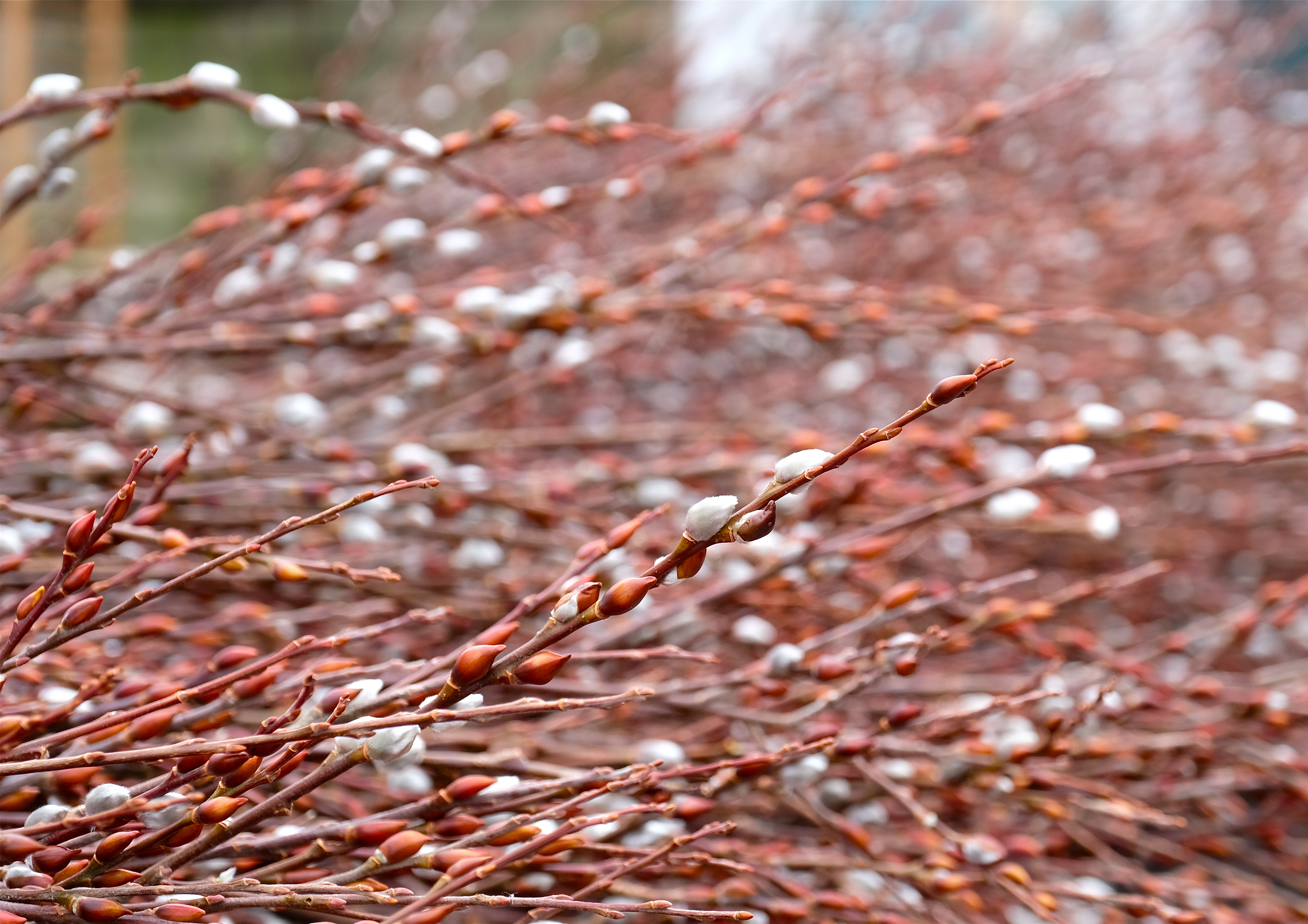 Great bunches of freshly cut pussy willows are for sale at Tendercrop
Last stop was lunch at the Ipswich Clambake. The owners and staff are just the most friendly. The clam chowder at the Clambake is perfection. Charlotte and I shared a mini super fresh fried clam appetizer and that, along with the chowder, made the best sort of lunch to top off our fun adventure morning.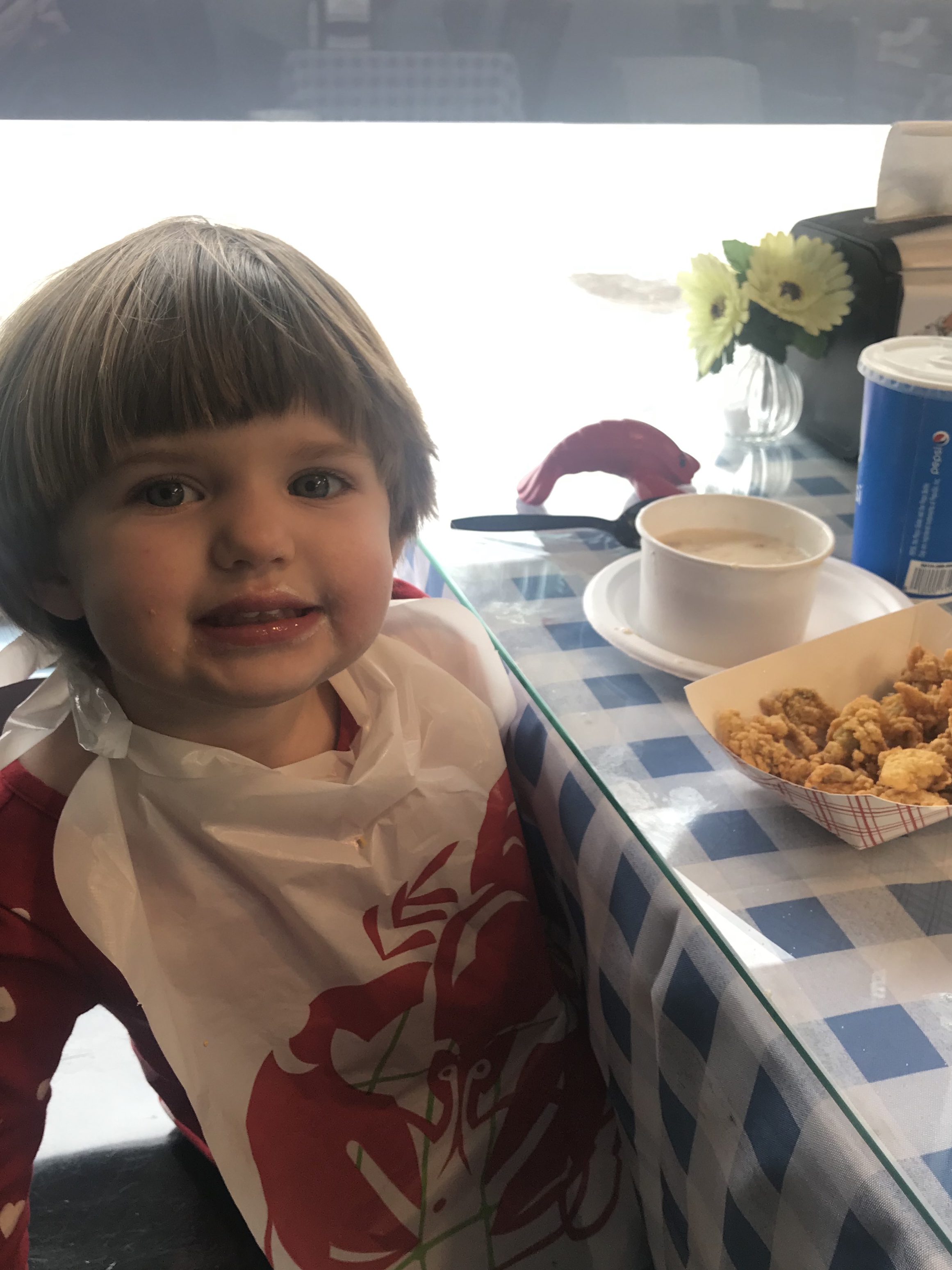
Tendercrop Farm is located at 108 High Road, 1A, in Newbury.
Ipswich Clambake is located at 196 High Street, 1A, in Ipswich.

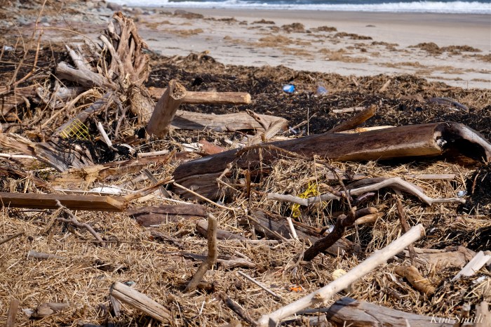
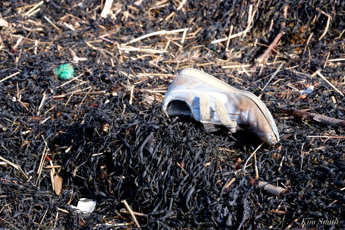
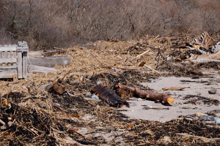
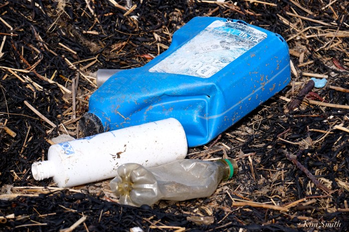
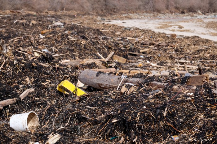
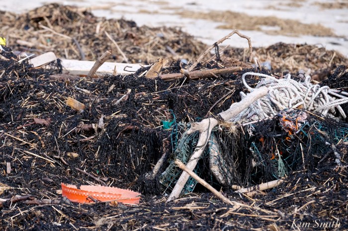
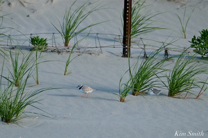
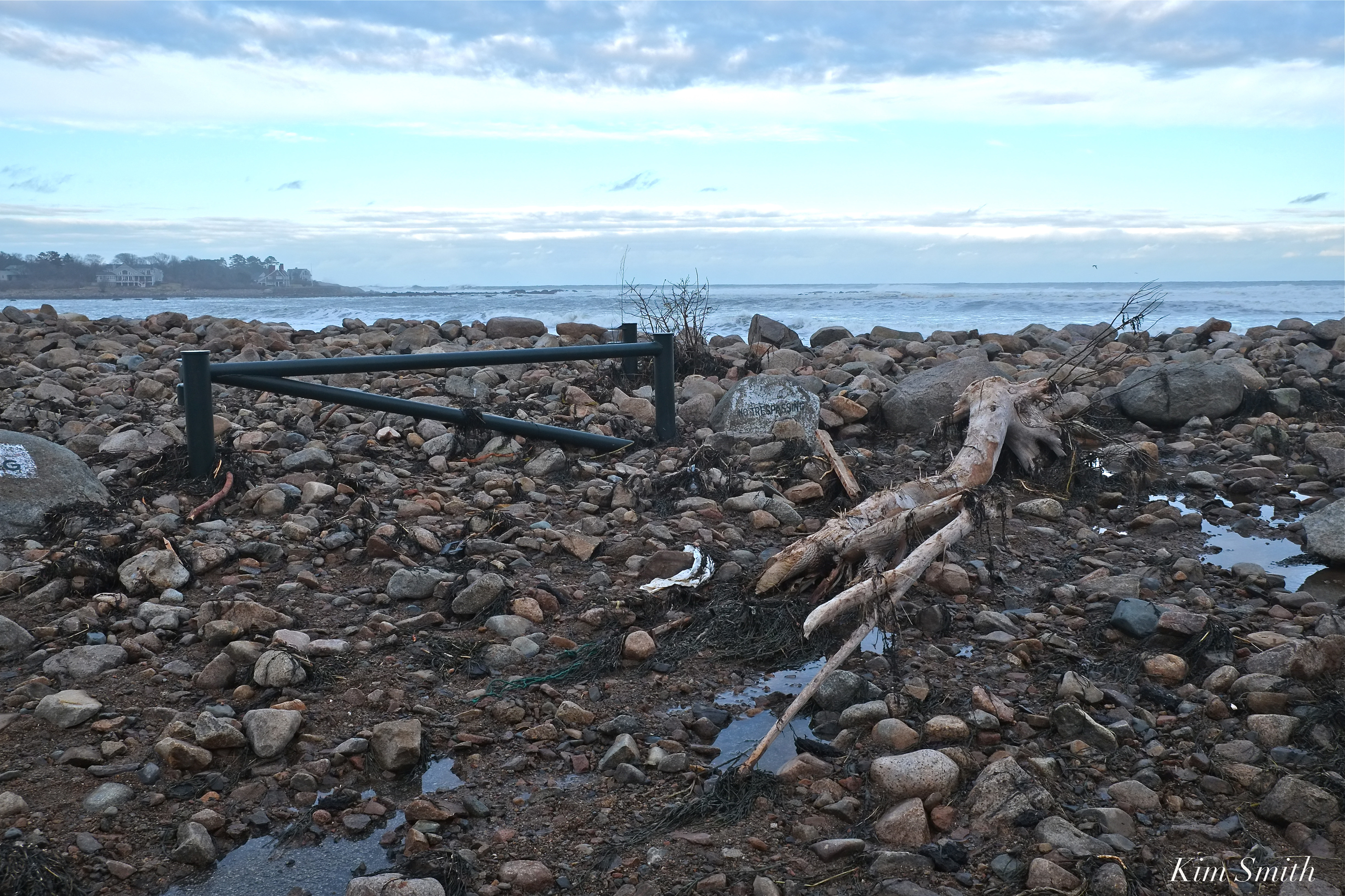
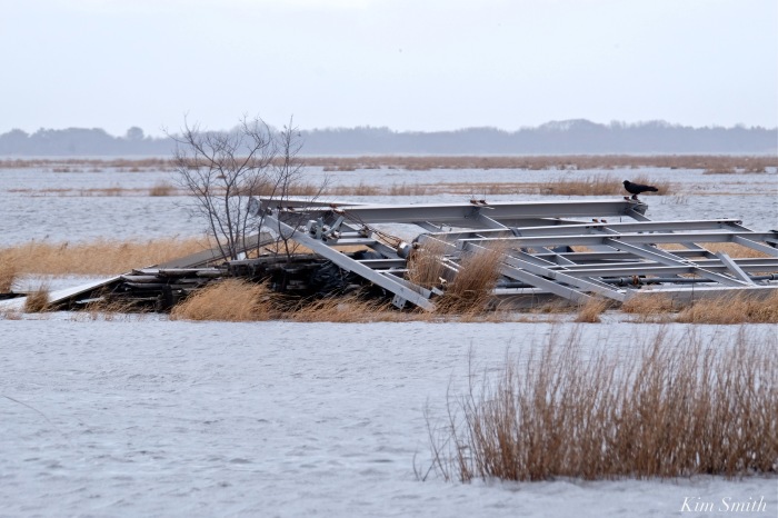
The storm devastation at Sandy Point Beach on Plum Island is alarming. The thing is, exactly where the debris pile-up is the densest, is precisely where the Piping Plovers nest. These photos were taken several weeks ago, and the mass of garbage has only grown greater with two subsequent storms.
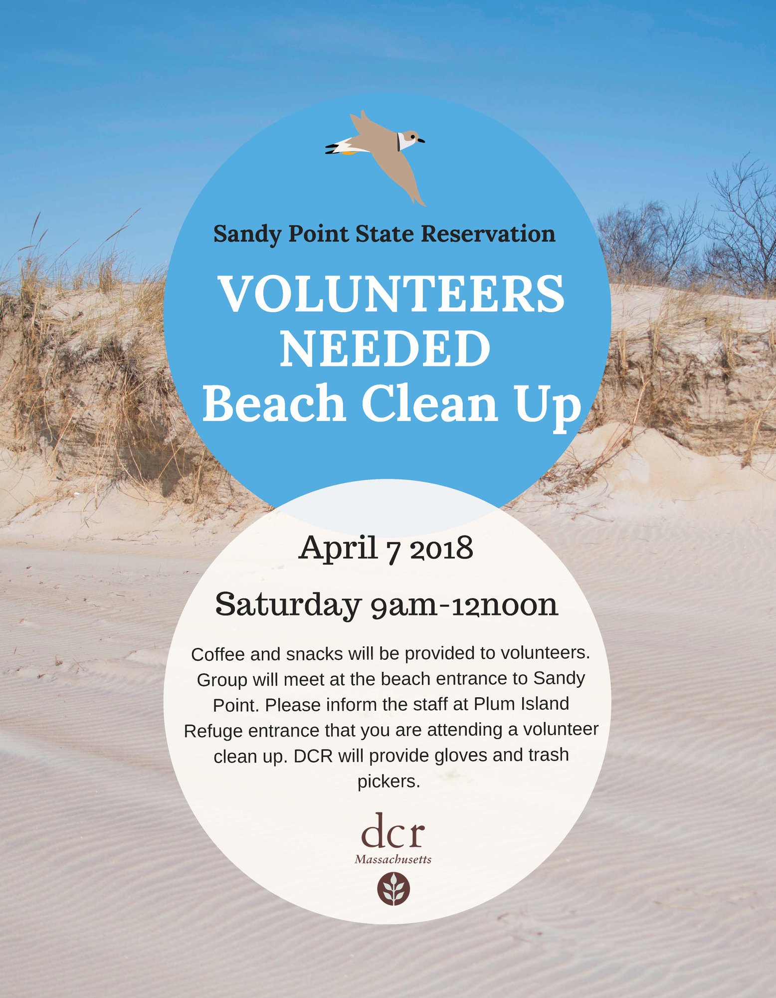 From PRNWR, “Although the refuge isn’t hosting a spring beach cleanup this year, Sandy Point State Reservation is! Join DCR on April 7th to clean up the southern tip of the island. Parking is limited, so carpooling from the refuge Visitor Center is encouraged.”

 Female Piping Plover Sitting on an Egg
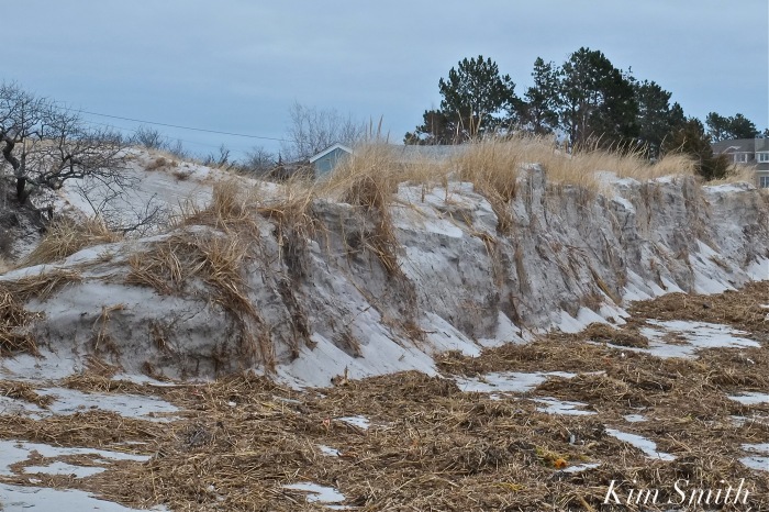
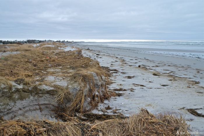
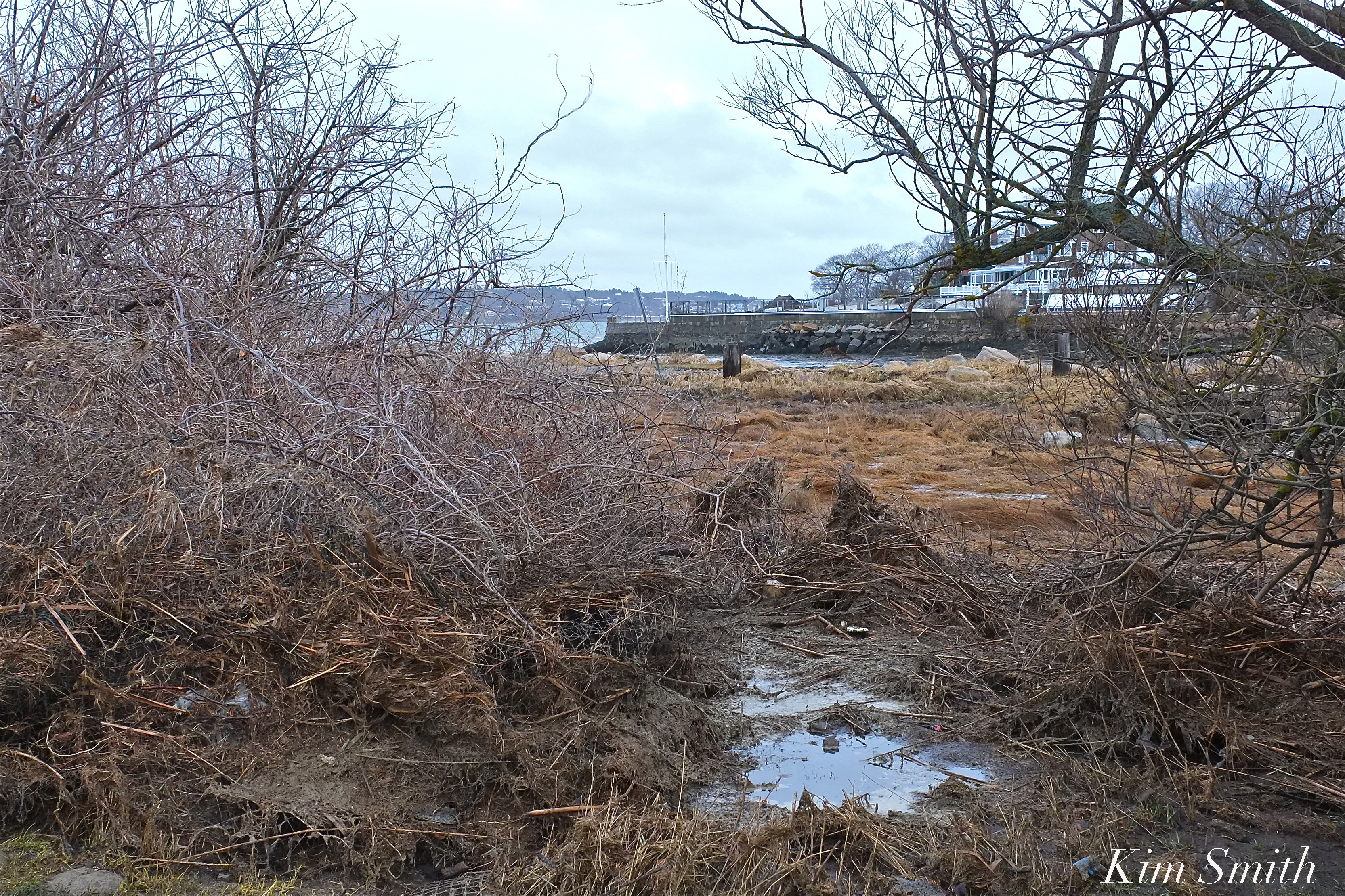
The recent winter storms of 2018 have provided empirical evidence of how global climate change and the consequential rising sea level is impacting the Massachusetts coastline. Whether broken barriers between the ocean and small bodies of fresh water, the tremendous erosion along beaches, or the loss of plant life at the edge of the sea, these disturbances are profoundly impacting wildlife habitats.
The following photos were taken after the March nor’easter of 2018 along with photos of the same areas, before the storm, and identify several specific species of wildlife that are affected by the tremendous loss of habitat.
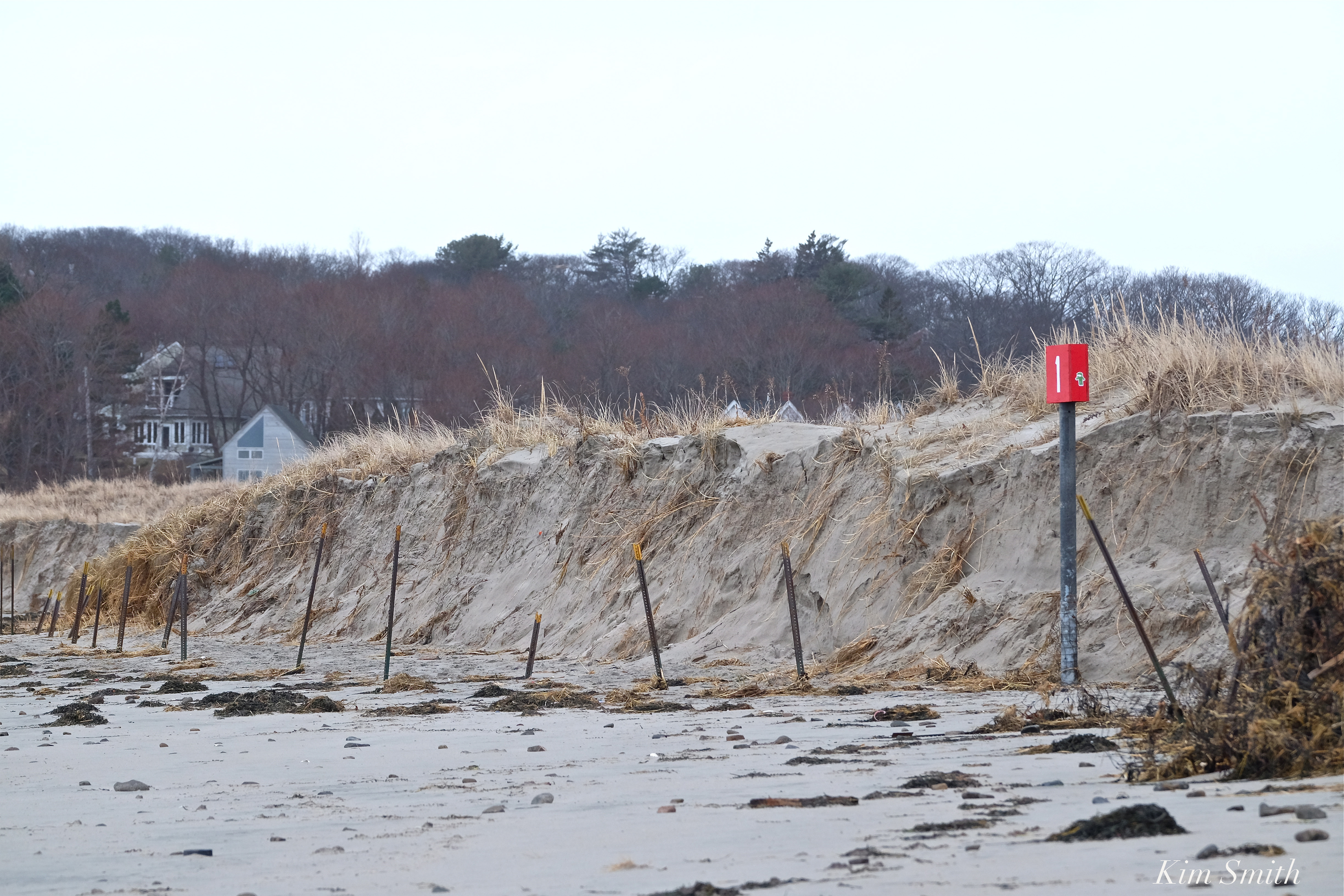
Barrier Beach Erosion
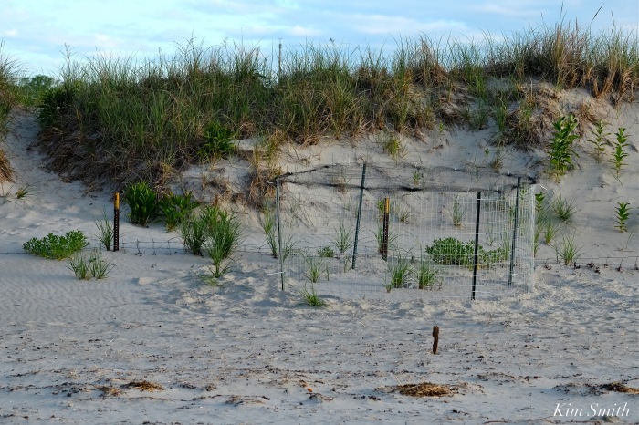
Nesting species of shorebirds such as Piping Plovers require flat or gently sloping areas above the wrack line for chick rearing. Notice how the March nor’easter created bluffs with steep sides, making safe areas for tiny chicks nonexistent.

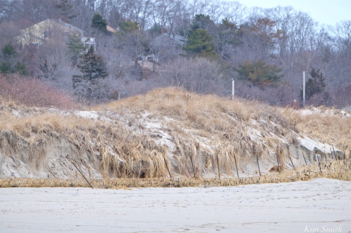
You can see in the photos of Good Harbor Beach (top photo and photos 3 and 4 in the gallery) that the metal fence posts are completely exposed. In 2016, the posts were half buried and in 2017, the posts were nearly completely buried. After the recent storms, the posts are fully exposed and the dune has eroded half a dozen feet behind the posts.
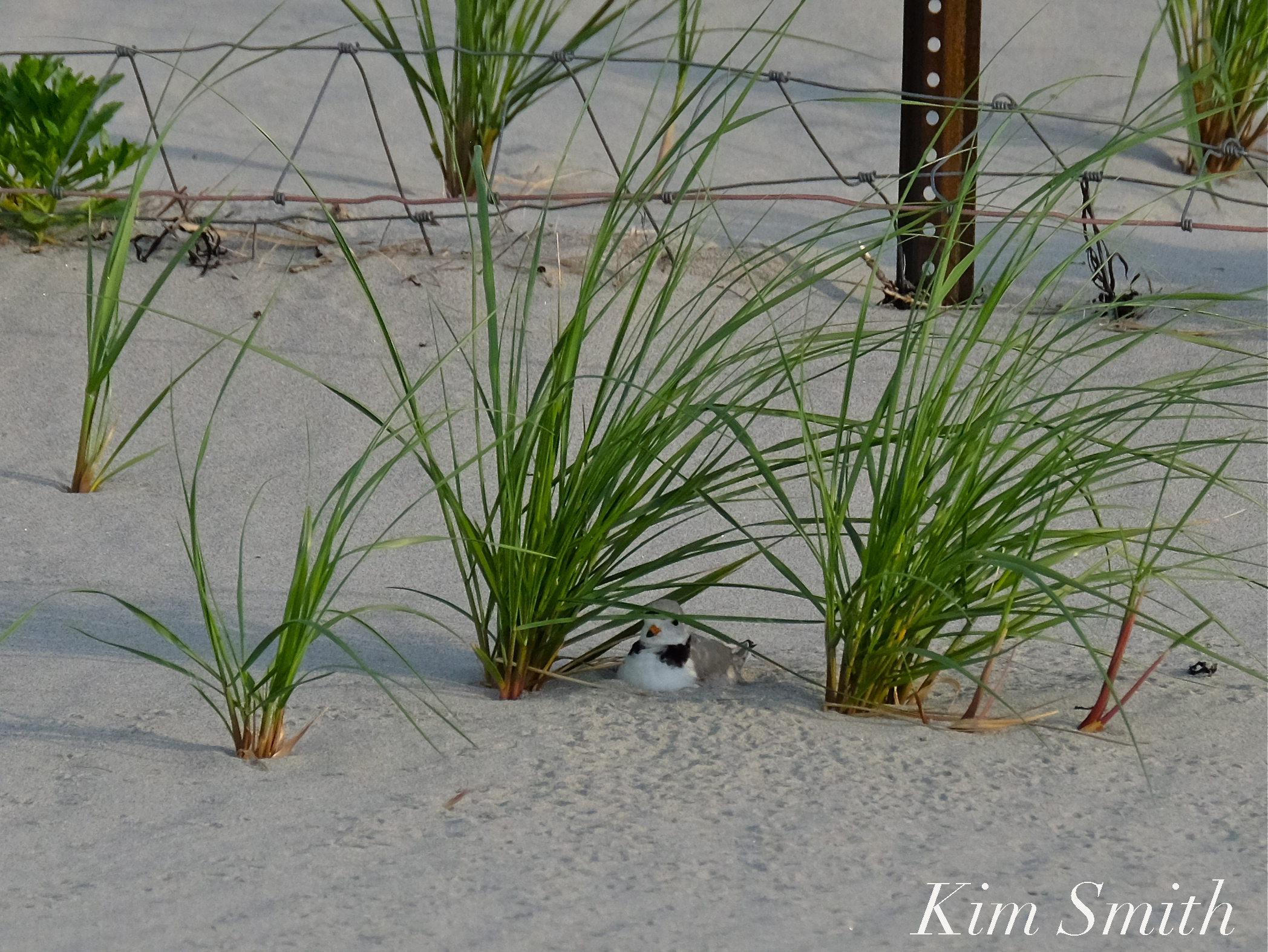 In the photo of the male Piping Plover sitting on his nest from 2016 the metal posts are half buried.
Although scrubby growth shrubs and sea grass help prevent erosion, the plants have been ripped out by the roots and swept away due to the rise in sea level.
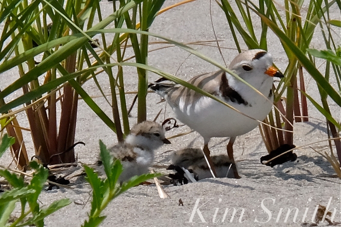
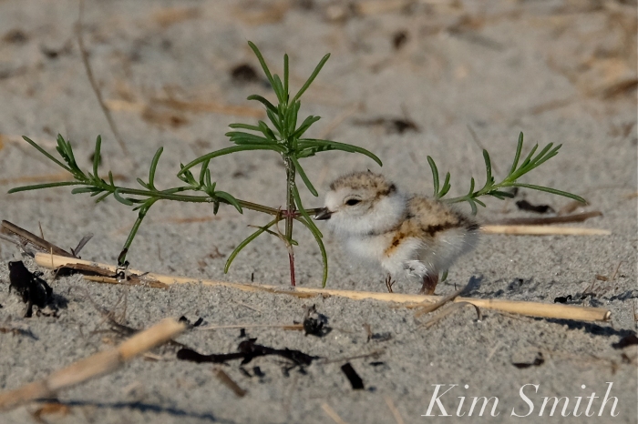
Plants draw tiny insects, which is food for tiny chicks, and also provide cover from predators, as well as shelter from weather conditions. If the Piping Plovers return, will they find suitable nesting areas, and will plant life recover in time for this year’s brood?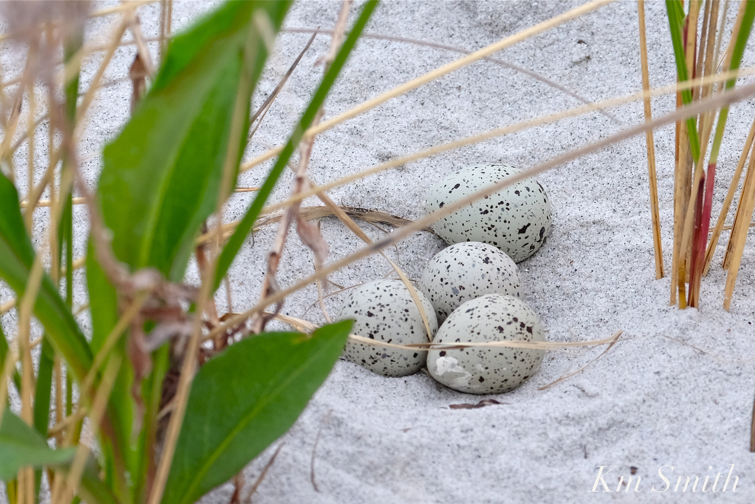 Other species of shorebirds that nest on Massachusetts’s beaches include the Common Tern, Least Tern, Roseate Tern, American Oyster Catcher, Killdeer, and Black Skimmer.
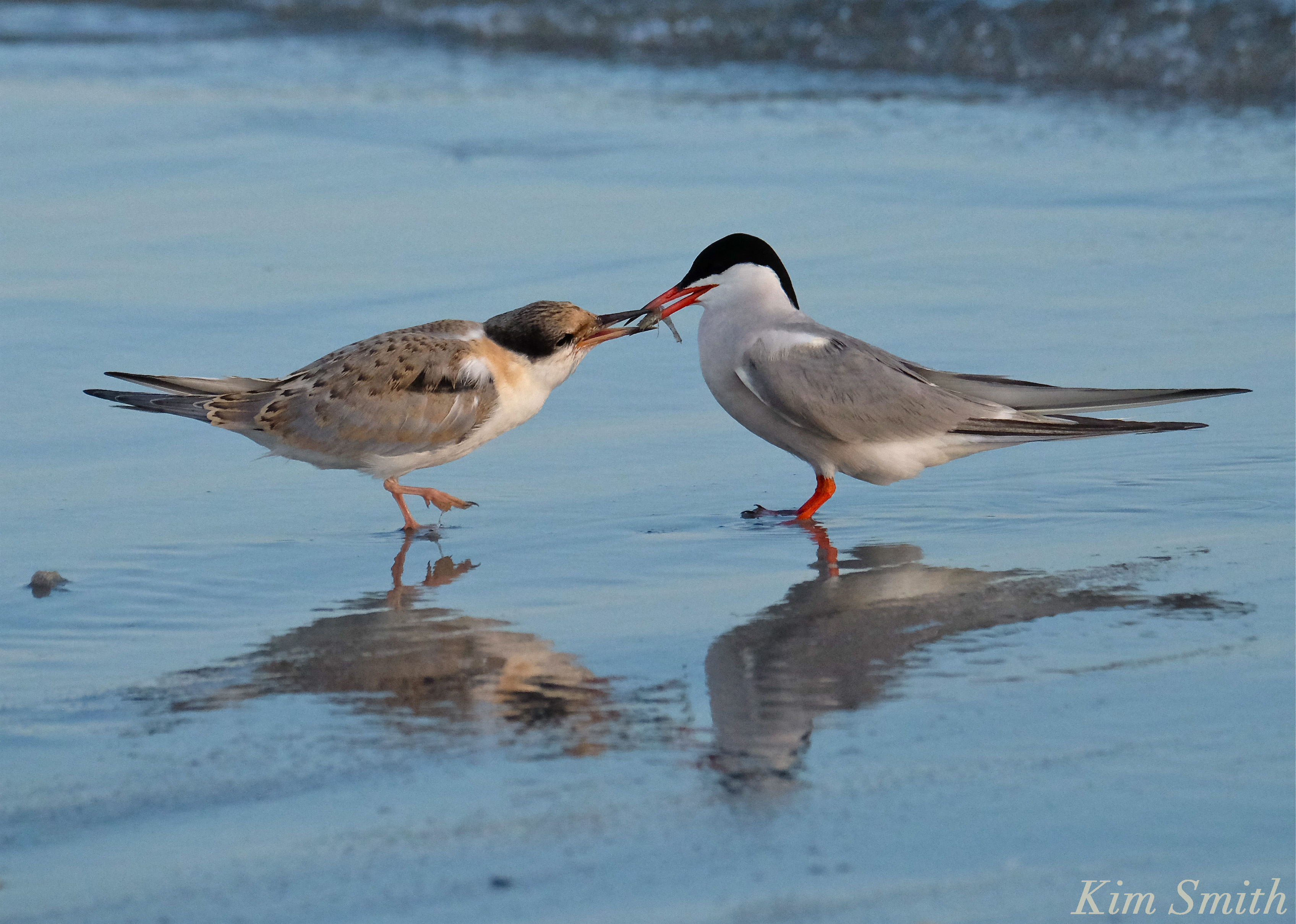 Common Tern parent feeding fledgling
Where Have All the Wildflowers Gone?
 Female Monarch Depositing Egg on Common Milkweed Leaf
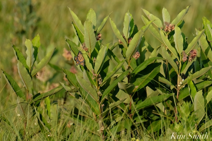

Wildflowers are the main source of food for myriad species of beneficial insects such as native bees and butterflies.
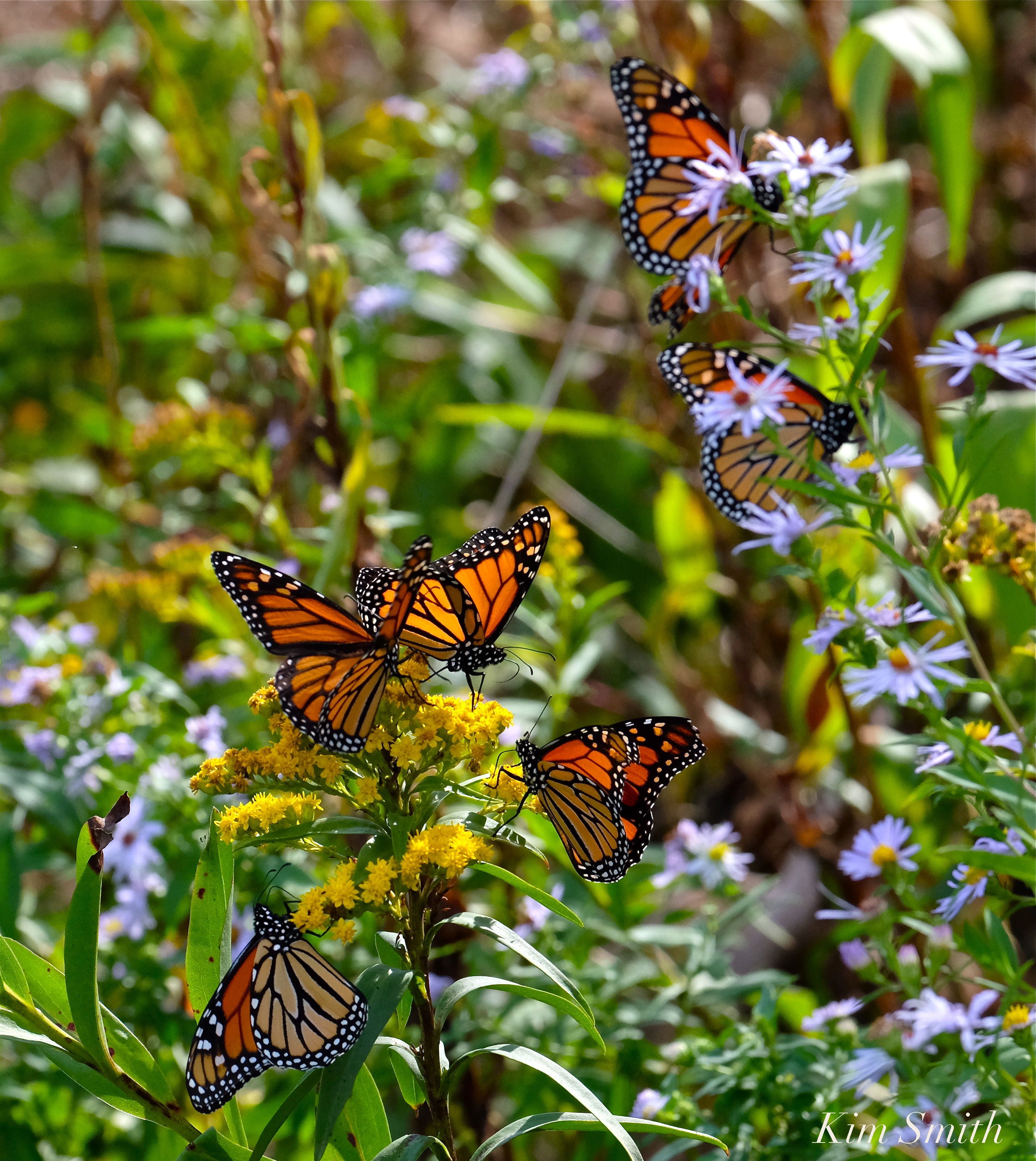 Monarch Butterflies arriving on our shores not only depend upon milkweed for the survival of the species, but the fall migrants rely heavily on wildflowers that bloom in late summer and early fall. Eastern Point is a major point of entry, and stopover, for the southward migrating butterflies. We have already lost much of the wildflower habitat that formerly graced the Lighthouse landscape.
 Masses of sea debris from the storm surge washed over the wildflower patches and are covering much of the pollinator habitat at the Lighthouse.
Broken Barriers
 American Wigeon Migrating at Henry’s Pond
Barriers that divide small bodies of fresh water from the open sea have been especially hard hit. The fresh bodies of water adjacent to the sea provide habitat, food, and drinking water for hundreds of species of wildlife and tens of thousands of migrating song and shorebirds that travel through our region.
 The newly rebuilt causeway between Niles Pond and Brace Cove was breached many times during the nor’easter. The causeway is littered in rocks and debris from the sea.
 The causeway being rebuilt in 2014.

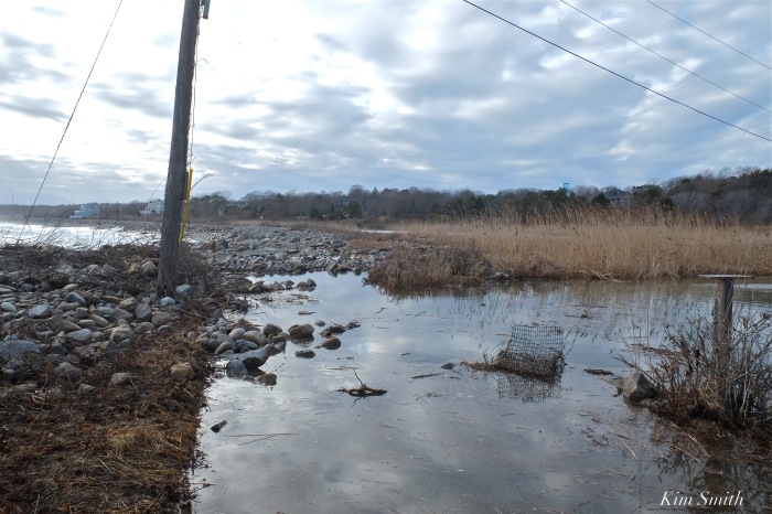
The road that runs along Pebble Beach, separating the sea from Henry’s Pond has been washed out.
 The footsteps in the sand are where the road ran prior to the storm.
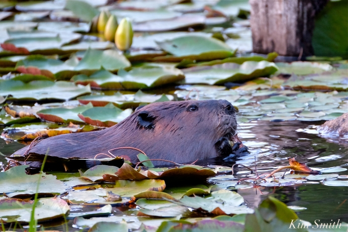
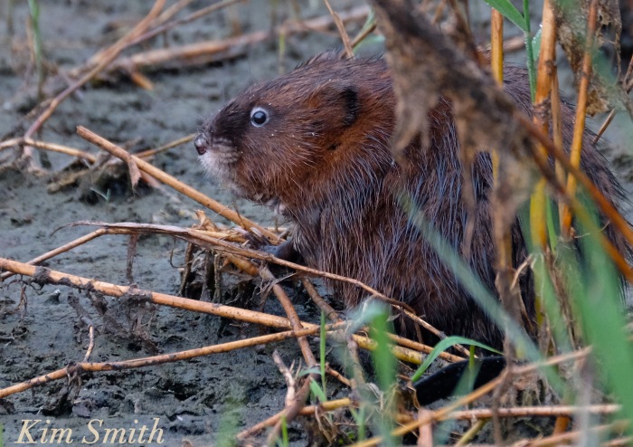
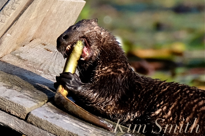
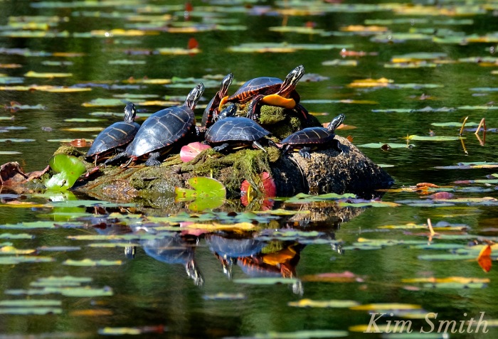
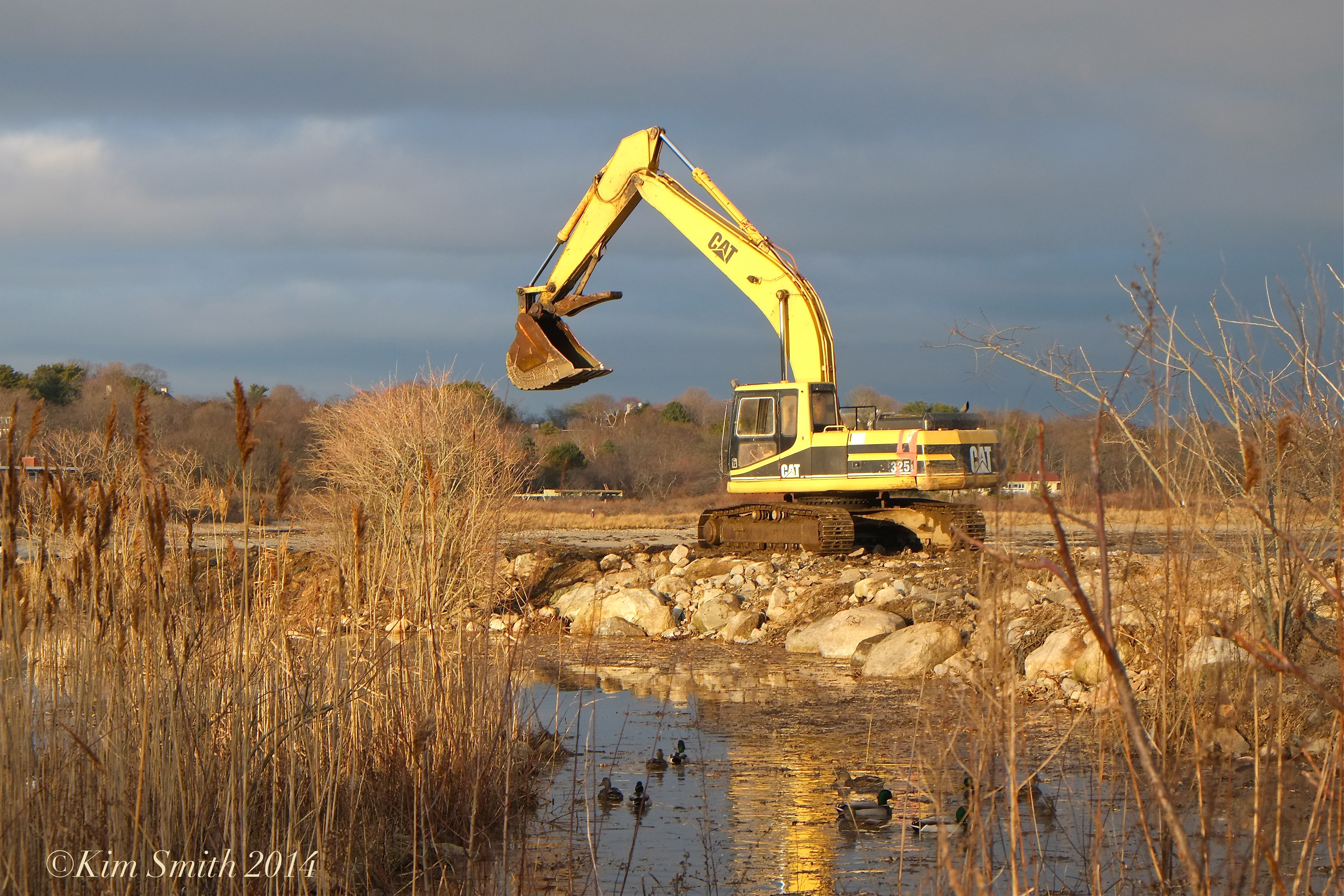
Mallards, North American Beavers, Muskrats, North American River Otters, and Painted Turtles are only a few examples of species that breed in Massachusetts fresh water ponds and wetlands. All the wildlife photos and videos were shot on Cape Ann.
 Migrating Black-bellied Plover
Cape Ann is hardly alone in coping with the impact of our warming planet and of rising sea level. These photos are meant to show examples of what is happening locally. Regions like Plymouth County, which include Scituate and Hingham, have been equally as hard hit. Plum Island is famously heading for disaster and similar Massachusetts barrier beaches, like Cranes Beach, have all been dramatically altered by the cumulative effects of sea level rising, and recently accelerated by the devastating winter storms of 2018.
To be continued.

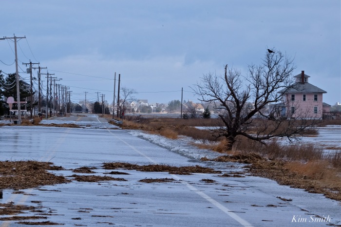
Impassable Road to Plum Island
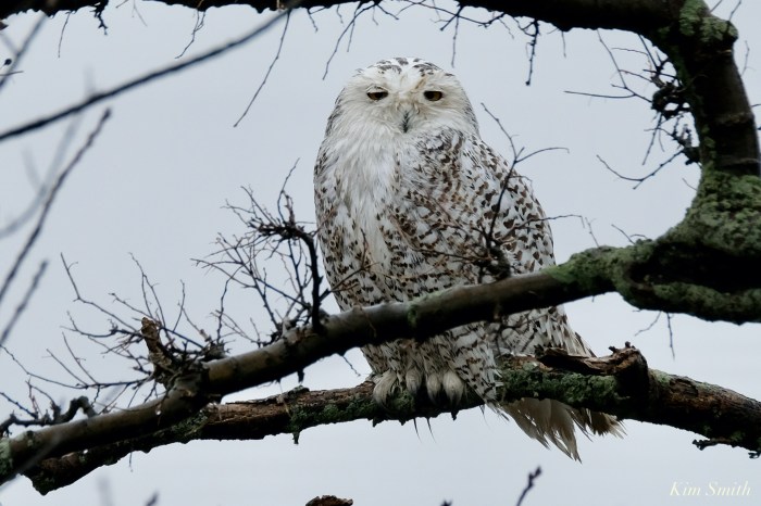
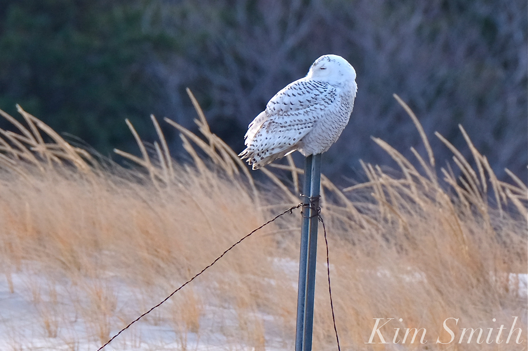 Snowy Owl Cranes Beach

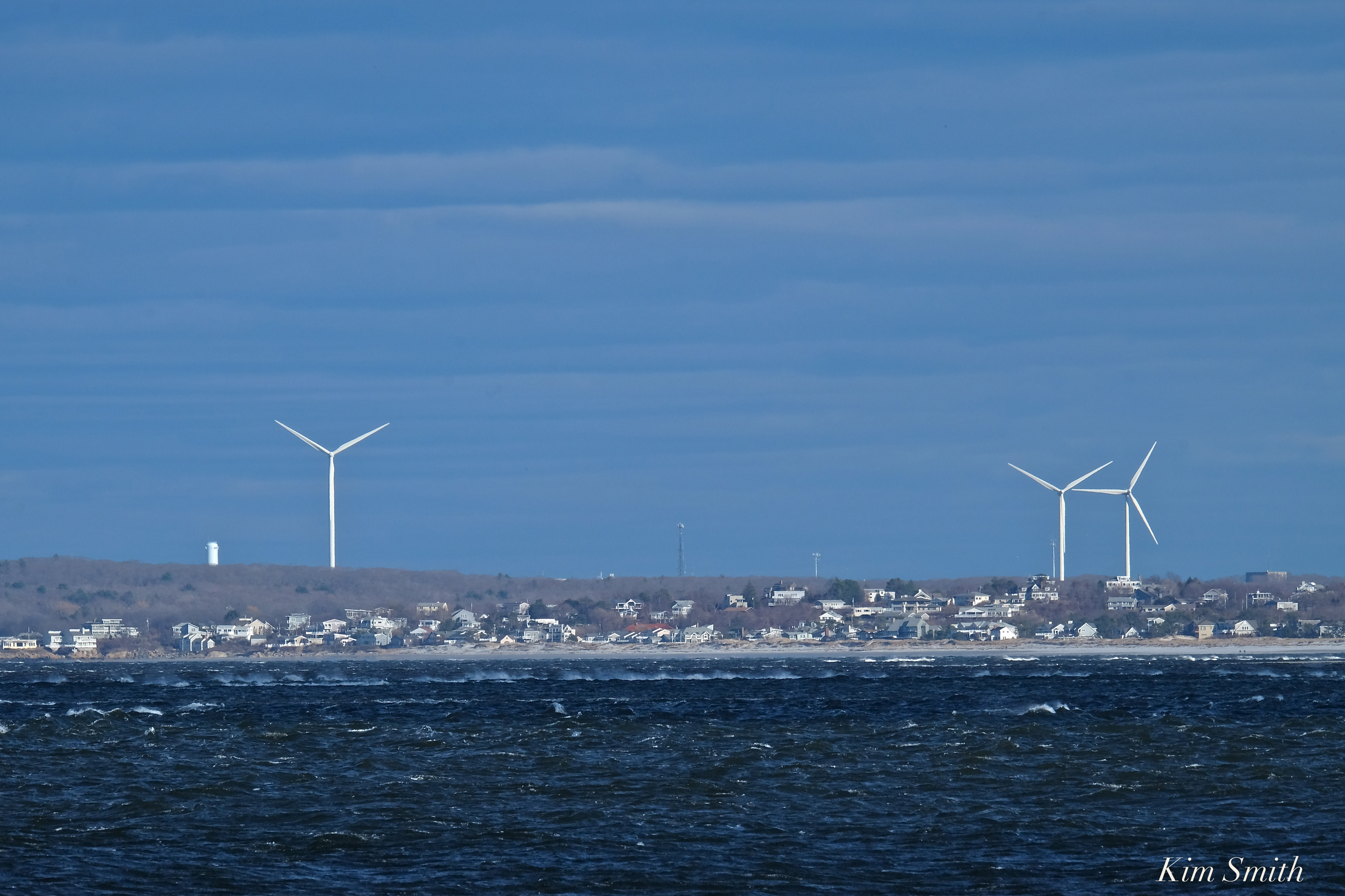
I think these are Gloucester’s wind turbines, looking across Ipswich Bay. The photo was taken at Sandy Point. Please write if you believe otherwise. Thank you!
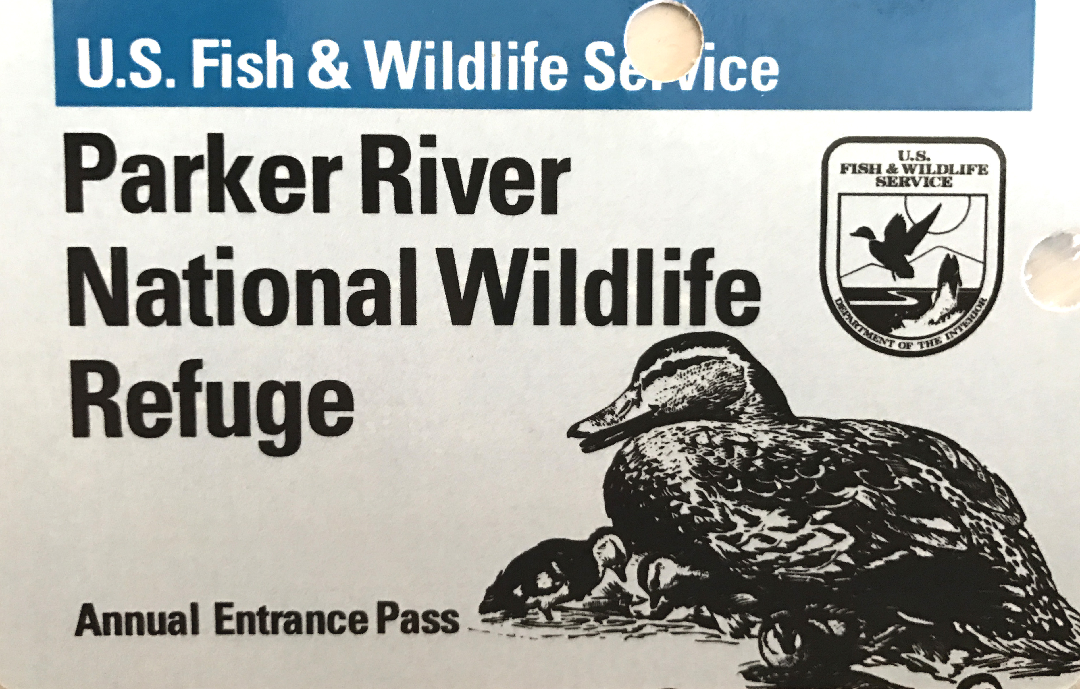
Super windy and chilly Saturday afternoon but nonetheless beautiful. I renewed our annual Parker River National Wildlife Refuge pass, which is good for one year, and think it is the best twenty dollars spent. Kudos for being the cutest pass, too!
https://www.instagram.com/p/BSpWN8CFncy/


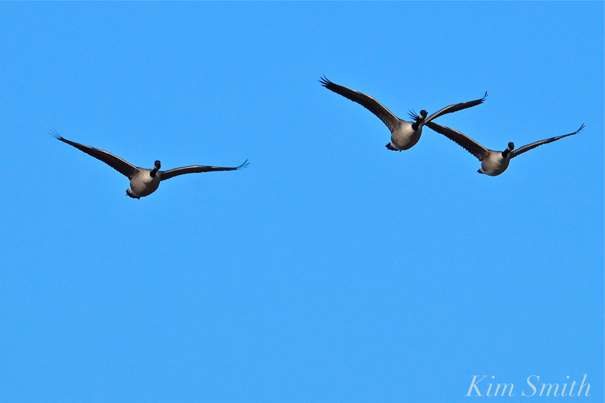 Plum Island Canada Geese

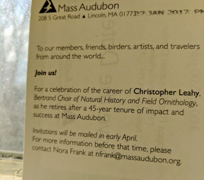
It’s not a surprise party, but it is limited in size. Invitations will go out in April. Mass Audubon is hosting a special retirement tribute for Chris Leahy in celebration of his remarkable career –45 years of “impact and success”. How nice to see a Gloucester naturalist treasure being recognized in the spring –(bird-a-thon season!)– at Joppa Flats Education Center, Parker River National Wildlife sanctuary. Folks and fans can also swarm cards and MA Audubon gifts as a great way to acknowledge this milestone. Chris’s astonishing powers of observation and communication skills can make anyone care about birds, nature, and place. Within a mere twenty seconds of conversation he can capture history and immediacy in such an affable and effortless manner. What an ambassador.
“If I said, ‘Are there more birds around in the summer or the winter?’ most people would say the summer, and that’s right. But not by much,” said tour leader Christopher Leahy of Gloucester, who holds the Gerard A. Bertrand chair of natural history and field ornithology at Mass Audubon. “Actually almost 50 percent of the 300 bird species that occur in Massachusetts occur here during the winter.”– Chris Leahy from Boston Globe article Thrills and Chills: Birders Brave the Cape Ann Cold and Find What They’re Looking For by Joel Brown, published February 5, 2009
Congratulations, Chris


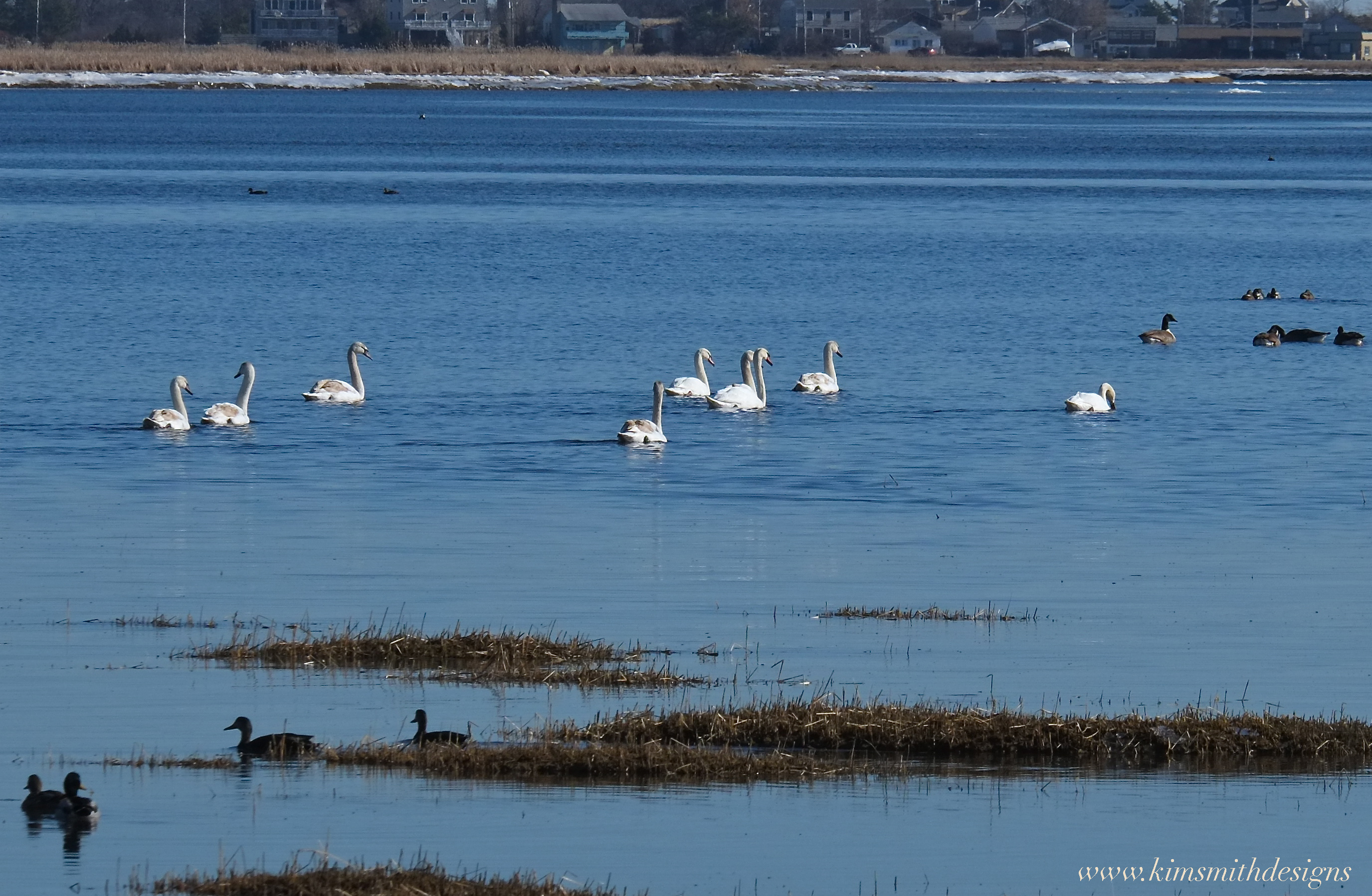
Nine Swans a-Swimming
After checking in with my elbow doctor at Anna Jacques Hospital in Newburyport, I took a drive along the road to Plum Island. I only meant to stay for a few minutes as I was planning to hurry on back to work on current projects but within moments of being there, a gorgeous Red-tailed Hawk was spied circling around. It was too tempting and I desperately wanted to stay longer and photograph and film but turned right around and headed back over the causeway. Halfway across a bevy of some sort of large white avian creature caught my eye–could it be–yes, it was a large flock of swans! They were feeding on the seaweed and seagrass along the Merrimack River shoreline.
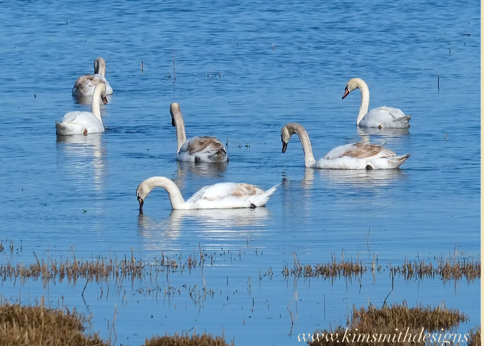 Quickly finding a place to park I got out my gear and with a wide swathe of marsh grass dividing me from the swans, I tried to get as close to the water’s edge as possible. There were NINE swans in all, two adults and seven almost year-old swans. So much for getting back quickly. And was I ever pleased with my rule never to leave the house without cameras.
A passing woman from the neighborhood out walking said that this was the first time she had seen the swans at the river’s edge in over two years. For my swan film, footage of one year old swans was needed, and here were seven! Every cloud has a silver lining as I never would have been on Plum Island today if not for elbow injury.


Great info from Fred
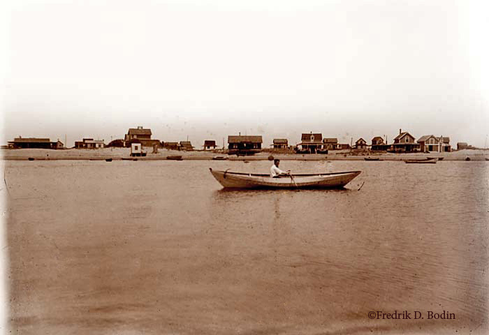
1910 Plum Island
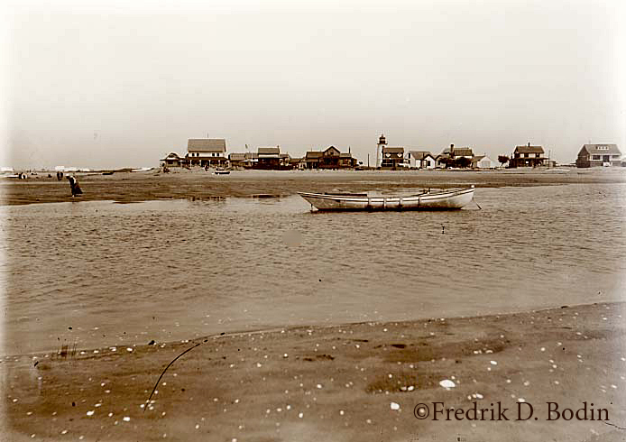


Plum Island
I shot this and a bunch of other photos on Sunday using an old Nikkor 24mm f2.8 manual lens that I got at a yard sale for $15. It was more work, but if you have lenses from your old SLR’s and they fit on your DSLR, try experimenting with them. You might be surprised with the results! Here’s more information on this.


thanks Len Burgess for submitting the link

Beth Roenker writes-
Joey, attached are some pictures Chris Roenker of Rockport took on Thursday from a helicopter piloted by Dan Zimmermann also of Rockport. They flew around Cape Ann and got some really great shots. Thought you might want to share them. Love the blog! Beth


more pics coming tomorrow
1 is the photographer, Chris Roenker
3 is the helicopter pilot, Dan Zimmermann
6 and 7 – great foliage shots
9 and 10 – Essex Marshes and Cape Ann golf course
11 is Plumb Island
12 – Wingarsheek beach
14 – Halibut Point State park

