Marine Forecast…
Mon: N winds around 10 kt. Seas around 2 ft.
Mon Night: N winds around 10 kt. Seas around 2 ft.
Monday storm system going underneath SNE will bring snow south of mass pike with possible flurries or light snow up to Cape Ann. Little or no accumulation expected . Highs 35-40 degrees with a northerly wind around 10 mph .. Monday clouds break becoming clear lows in the upper 20’s with a northerly wind around 5-10 mph.. Tuesday break highs in 30’s mostly sunny north to northeast winds 10-15 mph and becoming variable .. Now Tuesday night we see snow after midnight into Wednesday Afternoon , morning commute will be a nightmare ..
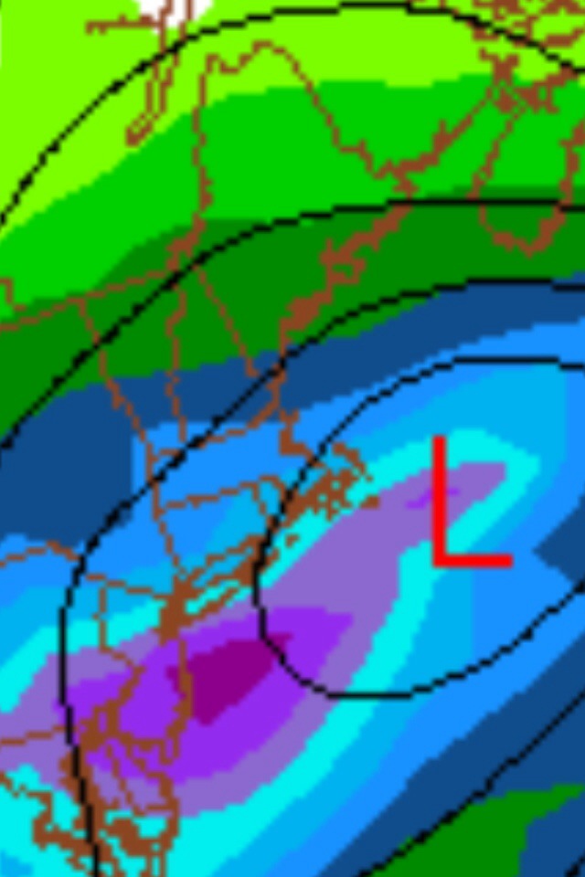
Position of Low just south of Long Island shows us in heavy snow Wednesday am…

Total Snow Fall Model Map for Wednesday .. Shows us in the pink area which to me would suggest 6-8″ of heavy wet snow …

GFS 12z shows mainly a heavy snow event for Wednesday .. So all in all looks like a good lock for Wednesday … Have a wonderful Monday … Thanks For Reading …
Peter J Lovasco
GMG
Weatherman


So you’re telling me that driving back from Maine on Wednesday afternoon is going to kind of suck? 😦
LikeLike
Yup I think so 😦 sorry .. Drive safe …
LikeLike
loving your forecasts and maps and explanations and the comics are pretty good, too! keep up the good work, much appreciated from someone who commutes over 100 miles a day.
LikeLike
Thank u Jenn 🙂 and Damn that’s a lot of traveling ! Drive safe … Wednesday u should just call in … Just saying …
LikeLike
Thanks so much! Yes, I am going to work from home on Wednesday for sure, luckily I have a laptop so can do so when needed!
LikeLike
Well done and guess there are many Rider’s on the Storm 🙂 Keep the weather and toons coming
🙂
LikeLike
Thanks Dave up late watching models come in / going over data … 🙂
LikeLike
You be buring the midnight oil for sure – what you do when you love your work! Keep up the great Job both of you 🙂
LikeLike
Thanks Dave working on overtime with no sleep barely lol .
LikeLike