I found Catherine’s post very interesting. The 1954 article includes some very alluring descriptions of the locations of two old military training or muster fields in West Gloucester.
The first is south of Concord St and in 1954 was known as the Currier Pasture. Does anyone know where that is located? According to the article, there are carvings in the granite that memorialize the use of the field by the Danvers Light Infantry in 1861. The carvings were in good condition in 1954 and might remain so today.
The second location said to have been used by the militia in 1776. Its location is obscure, said to be “somewhere off of Thompson street.” There is supposed to be an inscription on a granite boulder at that location as well.
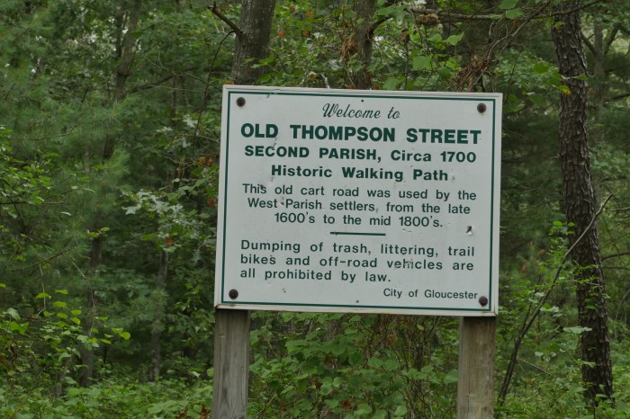
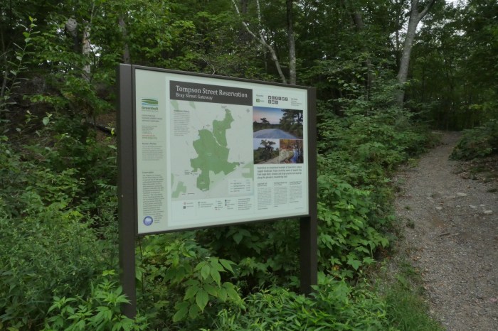
Well, Thompson Street is easy enough to find. It connects with Concord St. just north of the Rte 128 underpass. Follow the road a few hundred yards and you come upon a City of Gloucester sign marking “The Old Thompson Street Historic Walking Path.” The path (which I have not yet trod) meets Bray Street where the Essex County Greenway has established the Thompson Street Reservation that contains a network of trails. Old Thompson continues across Bray St., through the woods, to the Walker Creek vicinity where I believe I once saw a sign marking its terminus.
Somewhere along Thompson St., there might exist a flat area that contains an inscribed boulder that would be an awesome Revolutionary War relic.
Does anyone have any information that might be useful in finding either of these two fields? Please share your knowledge in a posted comment.
Thanks.
Spread The GMG Love By Sharing With These Buttons:


")