Marine Forecast …
Wed: N winds 10 to 15 kt with gusts up to 20 kt…becoming NE around 5 kt in the afternoon. Seas around 2 ft.
Wed Night: SE winds 5 to 10 kt. Seas 1 foot or less.
Today mostly sunny cold after morning lows in single digits temps will only rise to mid to upper 20’s with north northwest winds 10-15 mph..
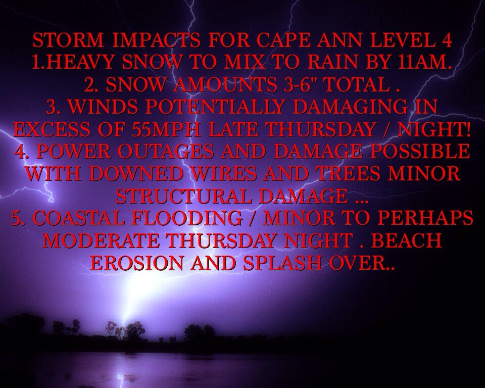
Wednesday night increasing clouds lows around 20-25 degrees .. Late night snows break out well after midnight .. Thursday heavy snow in the morning going over to sleet / freezing rain then rain by 11am to noontime ..highs in the upper 30’s with se winds 20-25 mph increasing to 25-35mph by late Thursday afternoon and evening .. Thursday night heavy rain early with damaging winds possible , gusting over 55mph ! Winds turn north northeast late evening rain changes back to snow .. 3-6″ total ..
Over view / LP tracks from OBX to just SE of ACK , this track will likely induce Warmer air to come from off the ocean with water temps in 30’s . How ever I’m not sold on this and think it’s possible as LP intensifies off ACK it creates “DYNAMIC COOLING” which would crash the temps with all heights above us creating a quicker transition back to snow. Something to watch for Thursday . Also watch for damaging wind potential .. More later today with special video update on impending storm .. Thank u for reading and viewing …
Peter Lovasco
GMG
Weatherman


Another good one here – with the toons and it’ when the rain turns to ice things can get a wee bit on the cat and dog slide…Thanks 🙂
LikeLike