The infamous one follows up with this –
joey – here’s a piece from the 1909 sanborn insurance map that shows where the parkhurst and burnham railways were in relation to each other. few years earlier than the pilot boat pix, but the layout of the inner harbor didn’t change that much until urban renewal. fyi, around 2005, some internet angel posted a complete set of the cape ann sanborn maps, from 1885-1917 in pdf format. i downloaded them and have been using them ever since. gave copies to the gloucester archives and sfl, and converted them to grayscale tifs for my own research purposes. museum has these on board as well as the original full color hand-annotated atlases (that weigh about 50 pounds each!) you want to know how this place has changed over the years? never mind the pretty pictures, go to the maps. they tell the story like nothing else can.
joey,
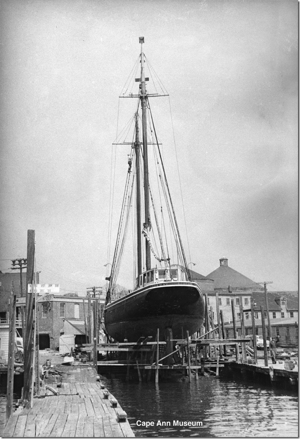
last month a nice chap named dave bennis came in to see me at the museum. he was one of the volunteer crew on the ‘highlander sea’ (nee ‘pilot’) when she came into our port and wanted to see if we had any photos of the vessel in her days as a pilot boat in boston. we found a few and here’s one taken of her by gordon thomas in 1960 on parkhurst railways for some work. just so she wouldn’t feel lonely, i found another one of ‘roseway’ (pilot boat #2) on gloucester marine railways in the mid 50s. dave’s gone back to his day job as lighthouse keeper in the upper peninsula of michigan, but i hope he sees these and comes back to visit us again.
infamous fred buck
check out the cape ann museum
Joey adds-
After recognizing the building in back of the parkurst railways I decided to pull up this picture I took on September 4th ,2011- 
Can you line up the windows with the building in the top picture?


