James A Ryan map of Gloucester / Rockport quarries displayed at local dentist office

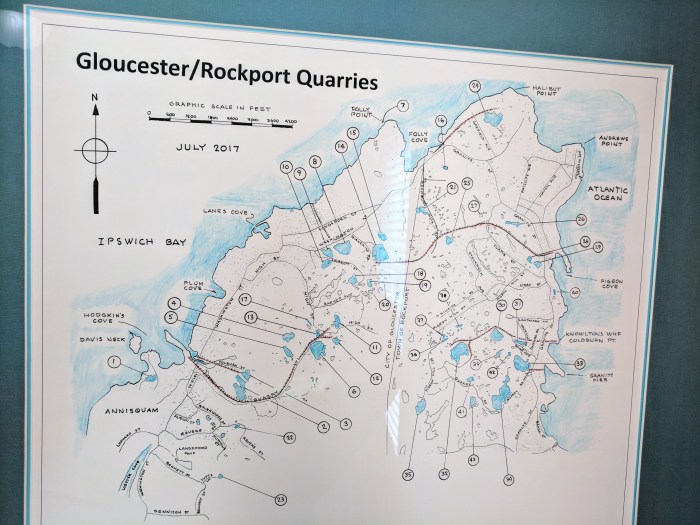
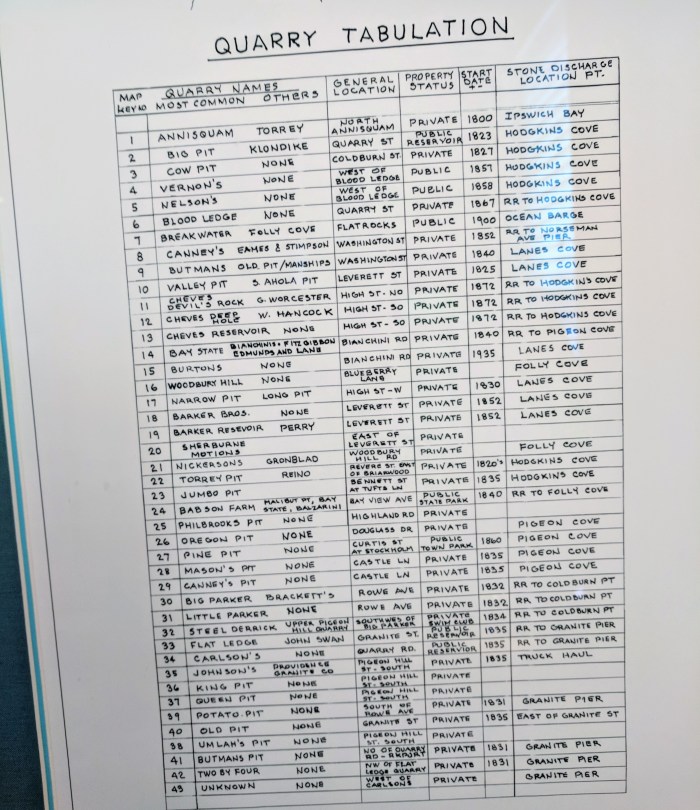
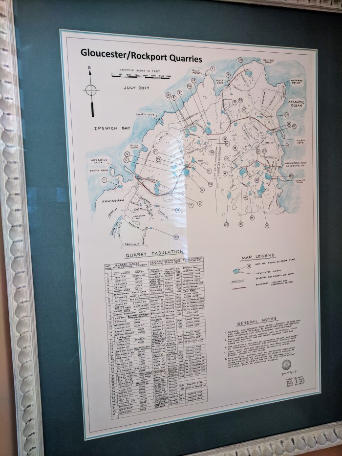
I like how area businesses display art and historic ephemera. The waiting area of Dr. Powers’ dentist office features a fascinating poster of the Gloucester Rockport Quarries © July 2017, a working document created by James A Ryan*, Reg / Prof Civil Engineer from Gloucester, MA, based on “2011 aerial surveys provided by Gloucester DPW Engineering Department and Rockport counterpart”

I know Dr. Powers is a history buff and that’s why it’s displayed. (I had a chuckle thinking about these are the first fillings at a dentist that I don’t mind learning about :))

(*no relation)

2011 map quarries (2)2011 map quarries

IMG_20180228_141437 (1).jpg

Beverly Map

Beverly, 1872. This map includes North Beverly, Downtown, Cove Village, Prides Crossing, and Beverly Farms. I’ve spent some time in Beverly lately.
Beverly

Step by step instructions on how to find the current Rockport flood zone maps as well as the "new", proposed maps

From Kenny MacCarthy

Gloucester Maps in the next installment

Eight Different Gloucester Tourism Maps

While at The Cormorant Shop with Janice she pointed out that there are eight different Gloucester Tourism Maps.