Marine Forecast….
Fri NW winds 10 to 15 kt with gusts up to 20 kt…becoming SW 5 to 10 kt in the afternoon. Seas 3 to 5 ft.
Fri Night S winds 10 to 15 kt. Gusts up to 20 kt after midnight. Seas 3 to 5 ft. A chance of showers.
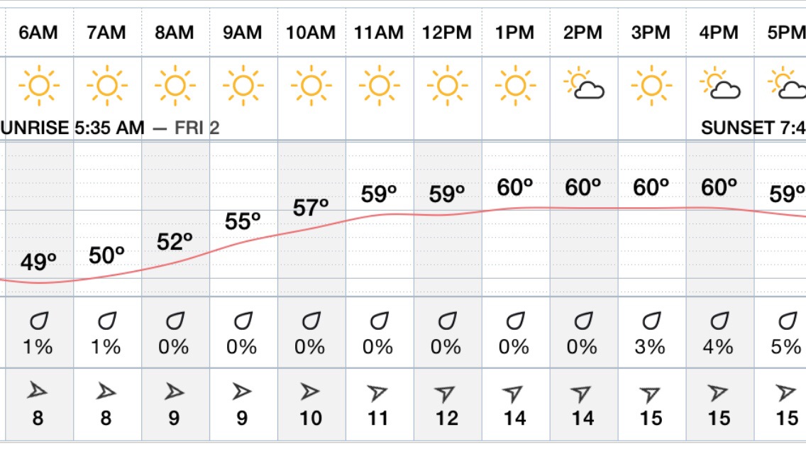
Friday Forecast : Beautiful plenty of Sunshine mild temps in the Mid – Upper 60’s away from the Coast , lower 50’s to mid 50’s with Sea breeze’s at the shore .. Light north west winds 10-12 mph…
Friday Night increasing clouds chance of rain very late .. Winds turning on shore with increasing gusts …
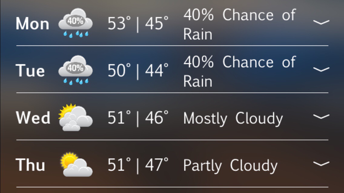
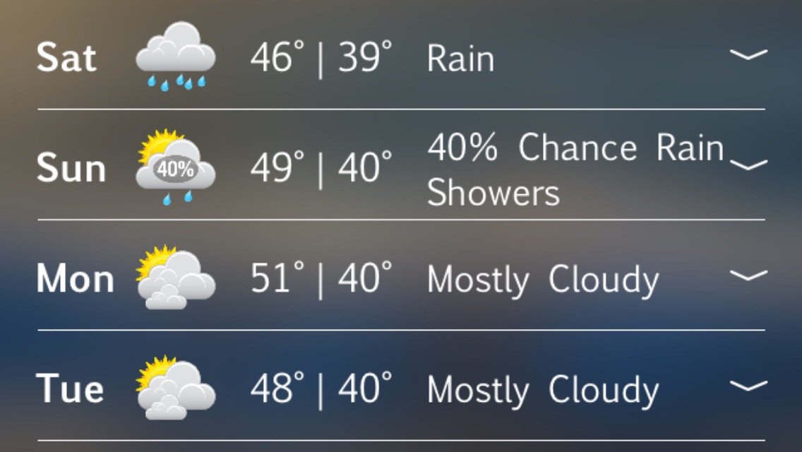
Seems as we go into the Weekend and Beyond , Rex Block will be in position and set up over the North Atlantic .. Most times this would mean miserable weather with cool to cold conditions and precipitation in the form of rain and or Snow! Also introduces storms to stall off our coastline as they approach our latitude . So in a nutshell it’s not looking good through next week , timing and strength of systems is difficult to process with such a pattern in place . Just bet on below normal temps and above Normal Precip! Temps 40’s to Low 50’s and 30’s at night …
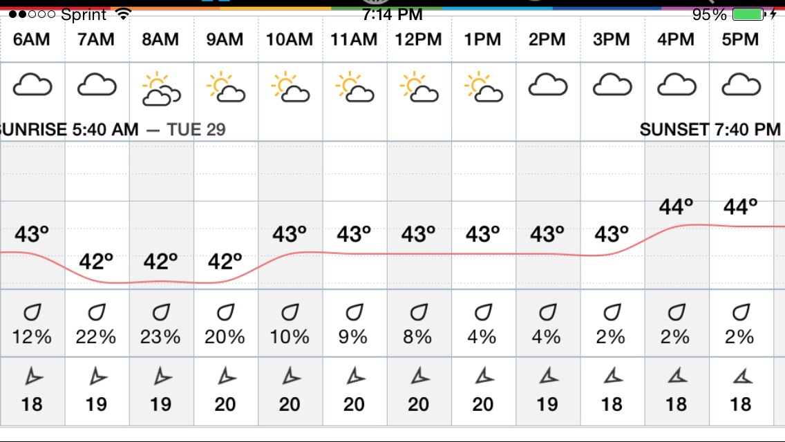
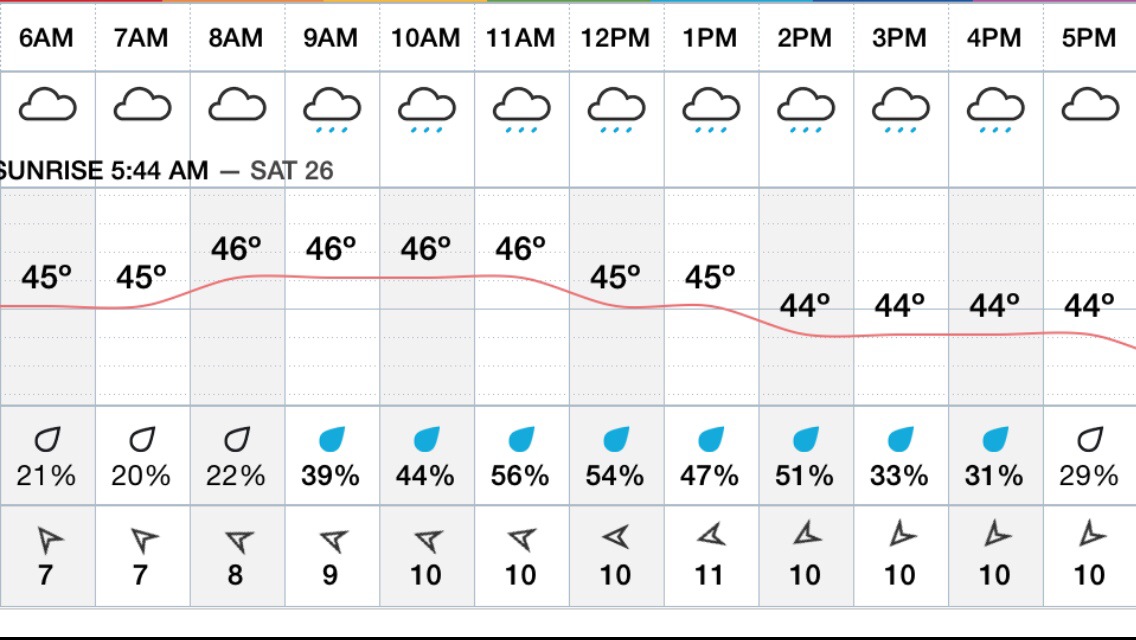
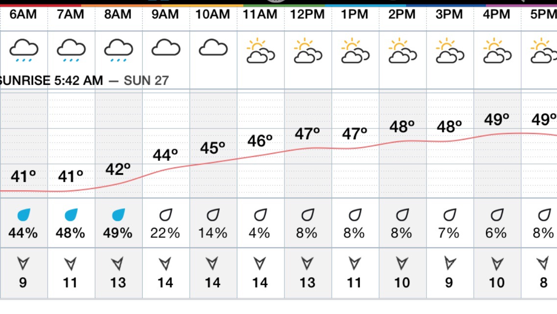
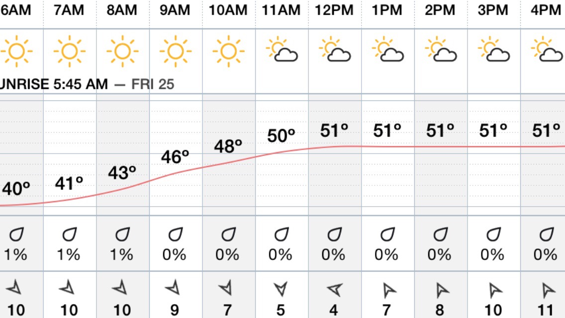
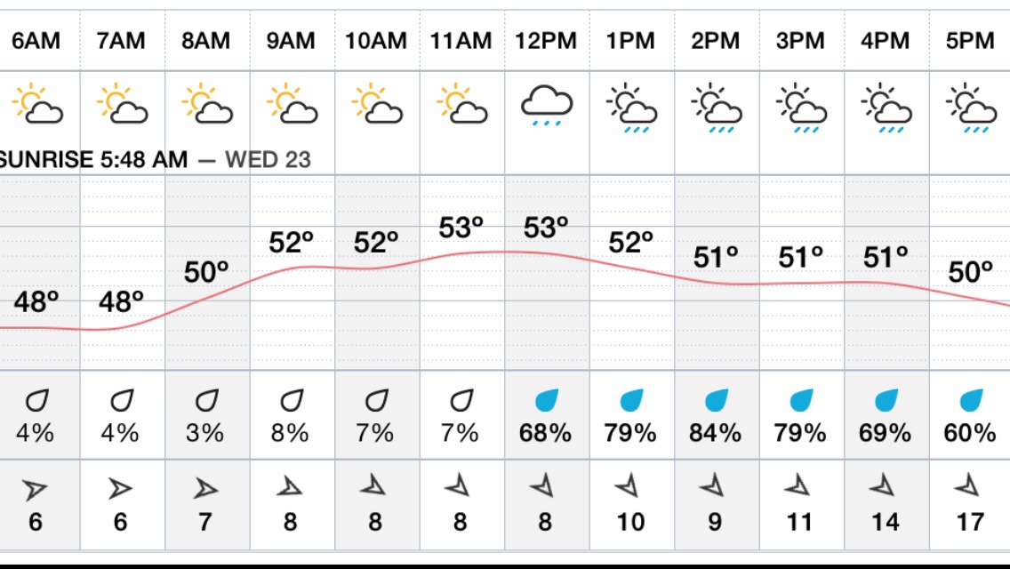
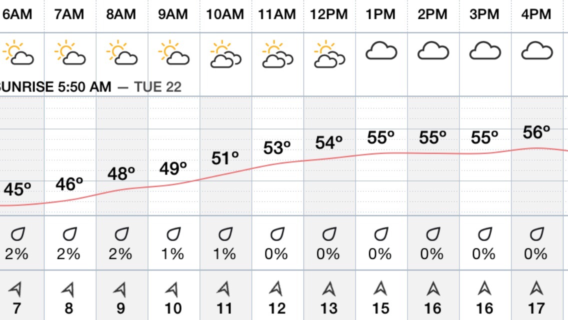
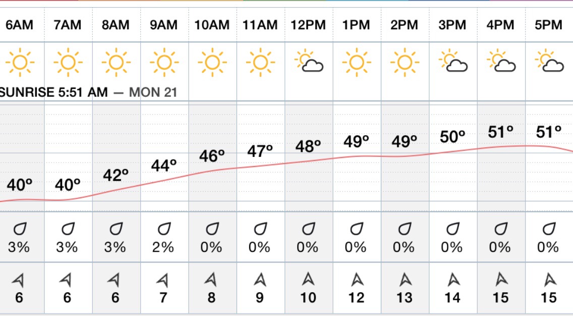
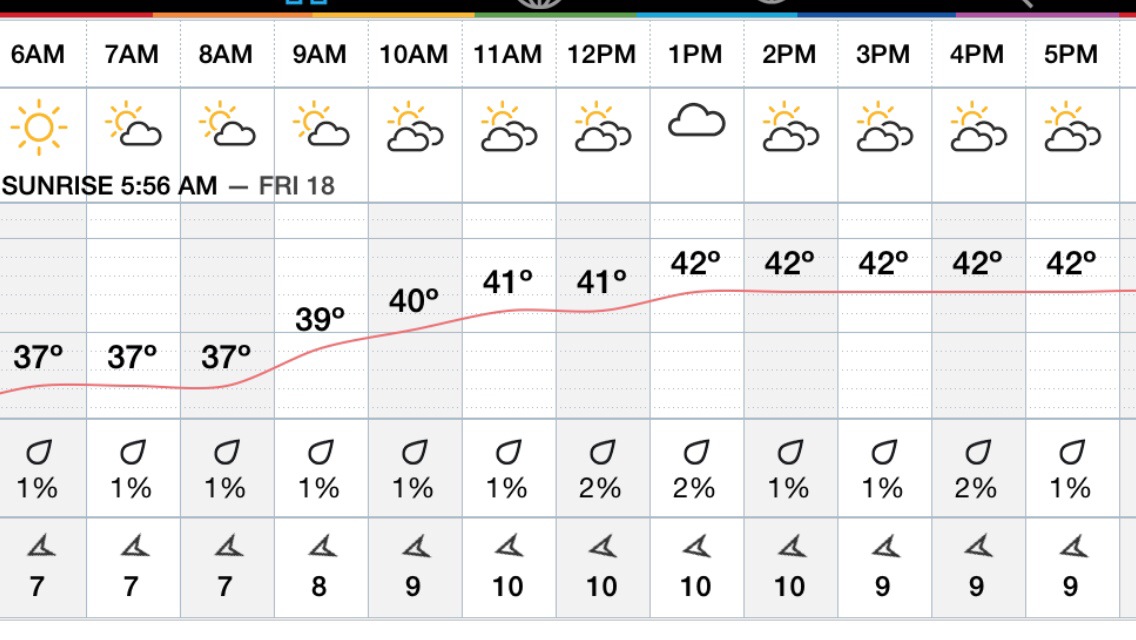
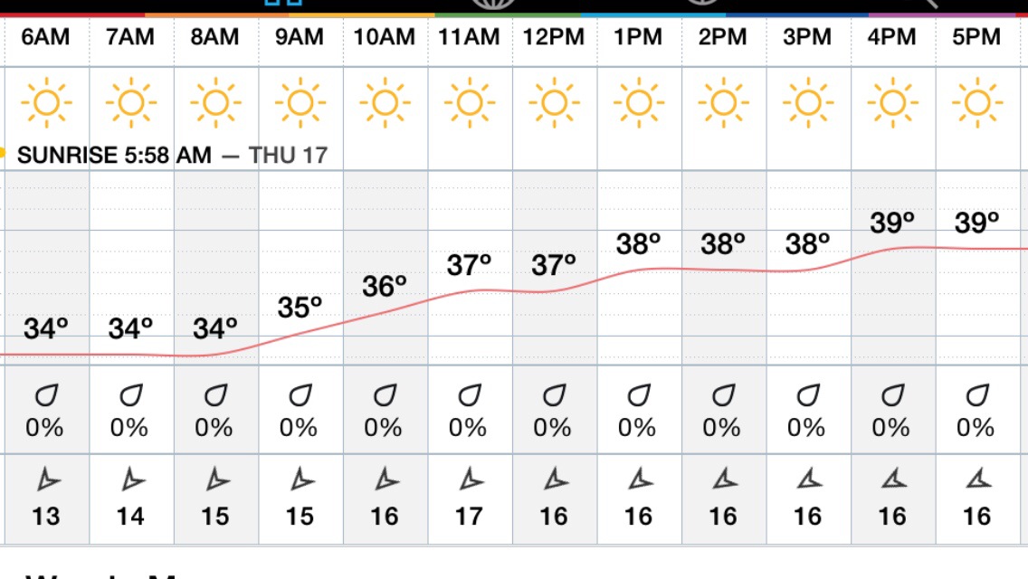
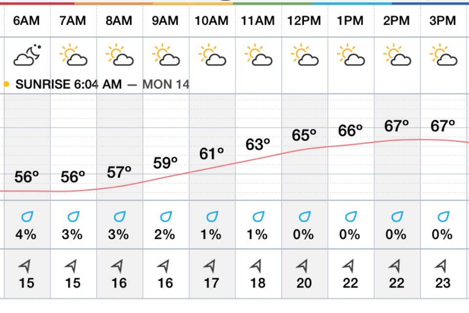
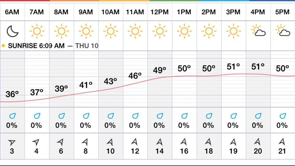
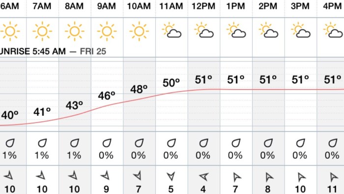
Hourly Forecast…
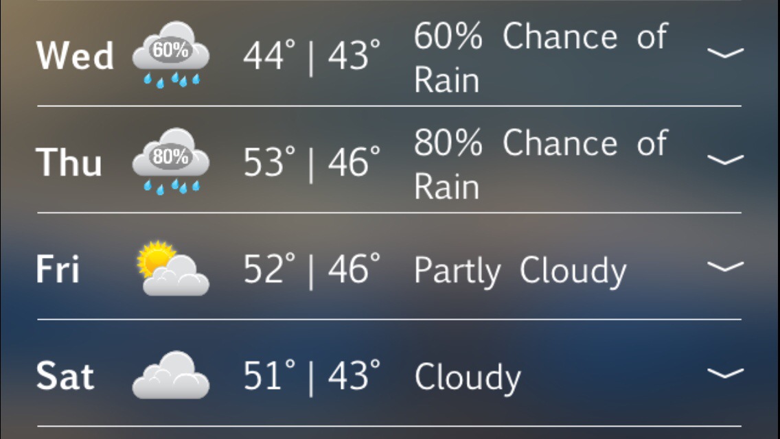
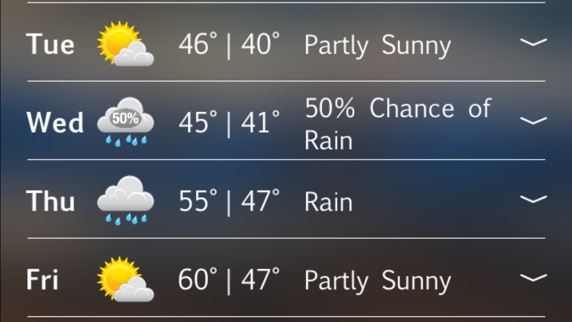
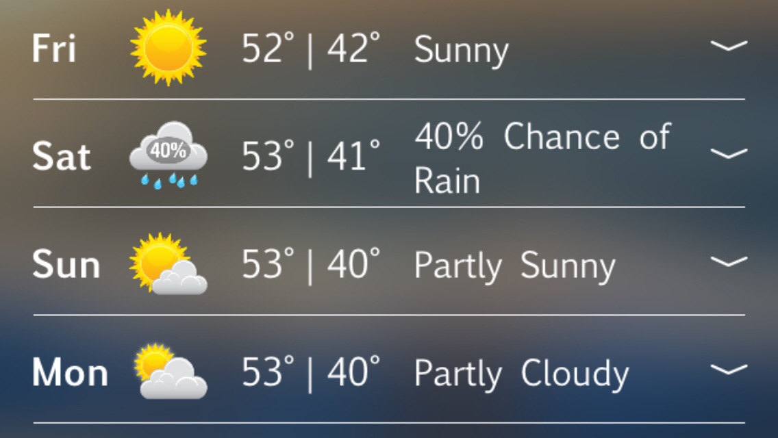
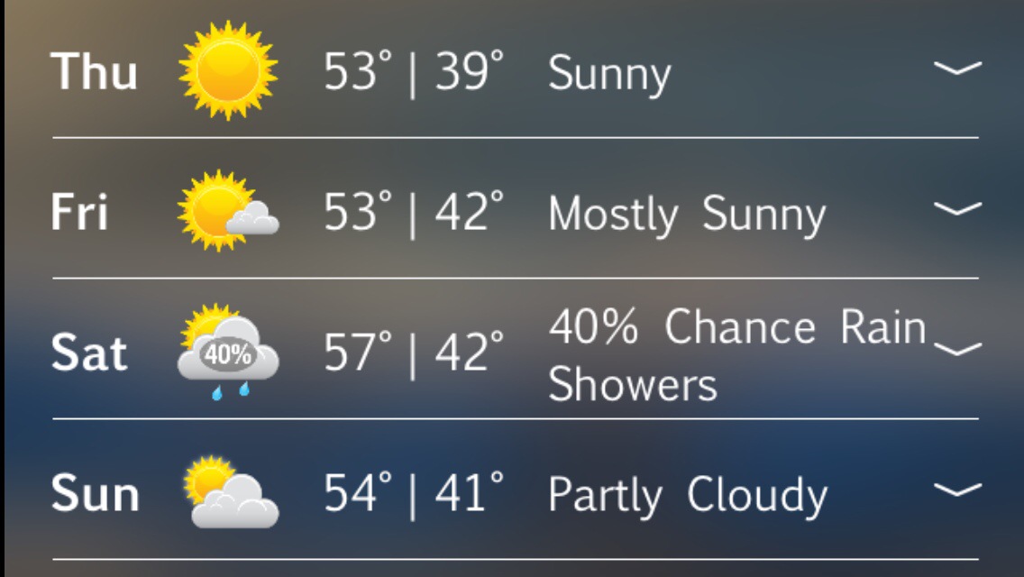
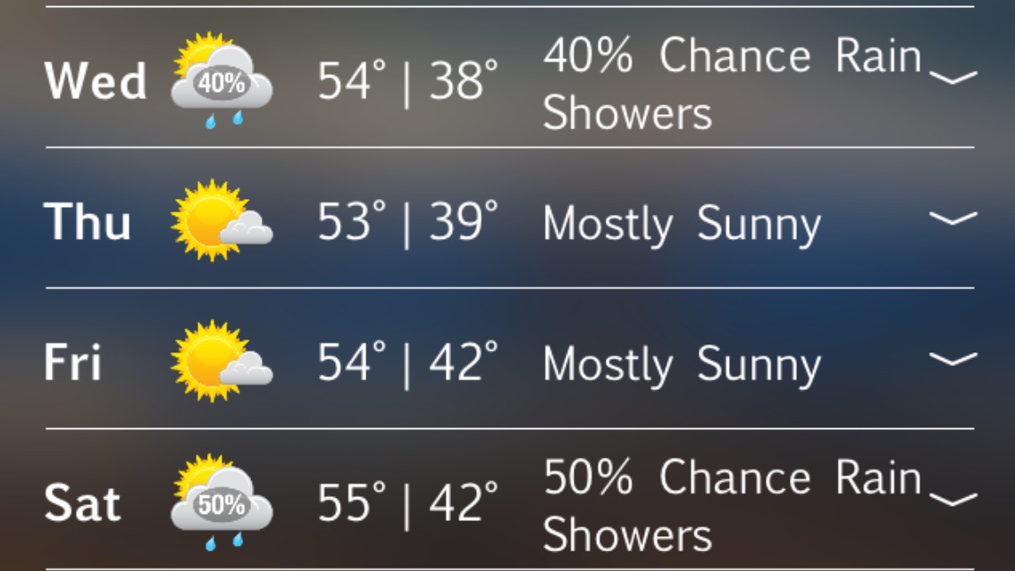
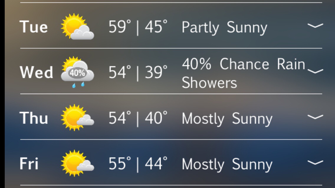
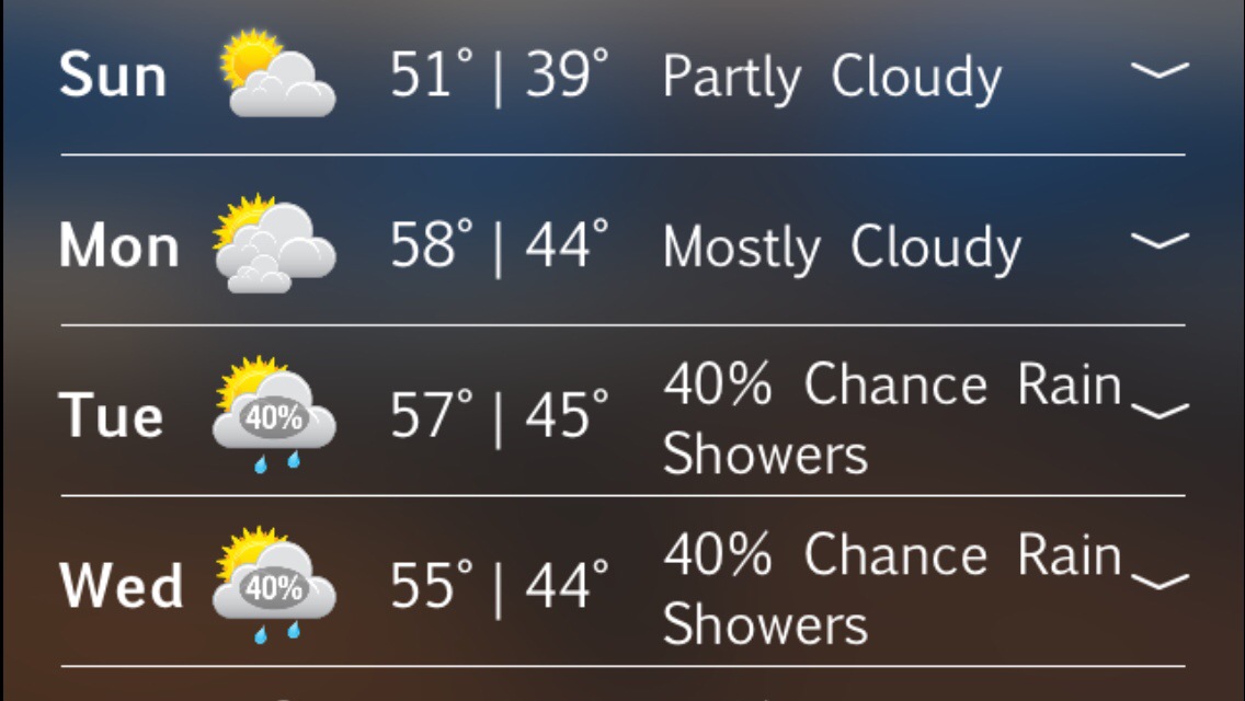
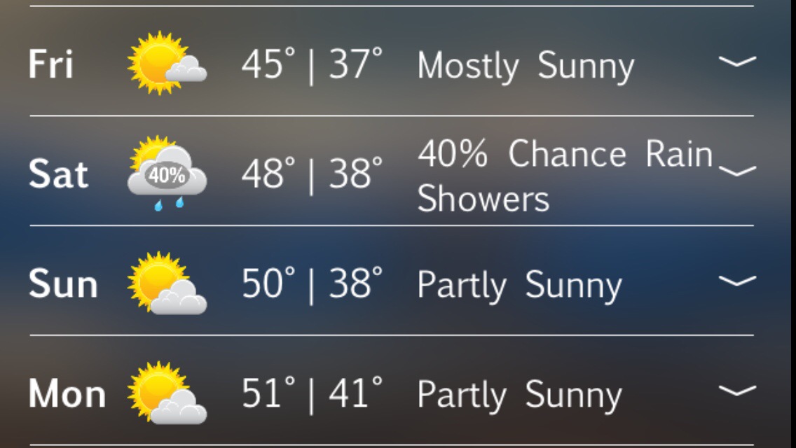
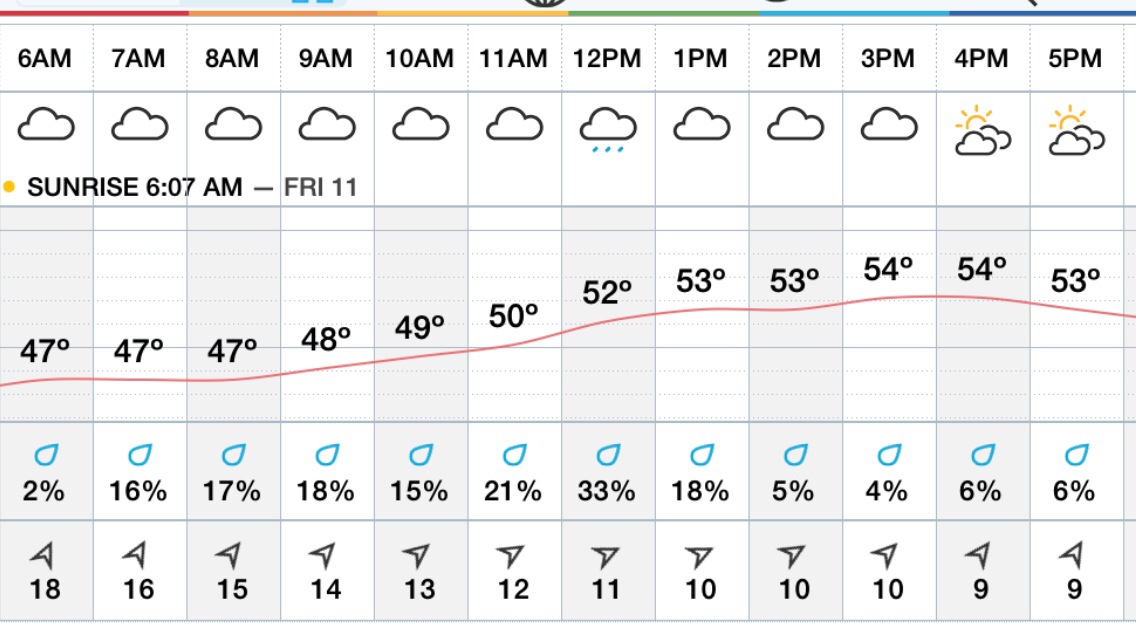
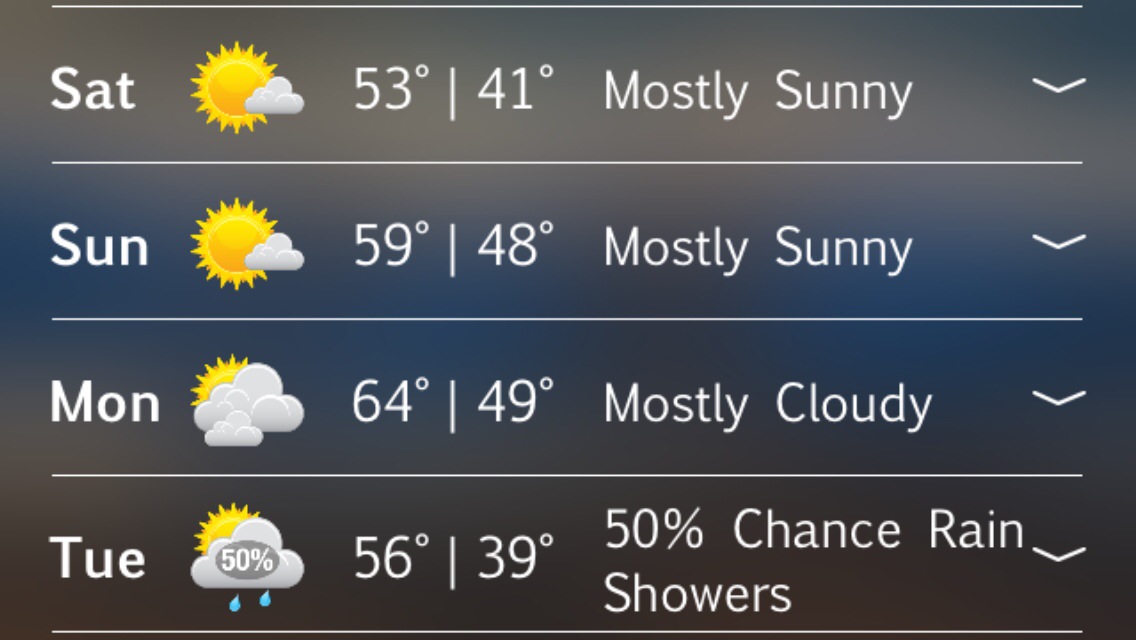
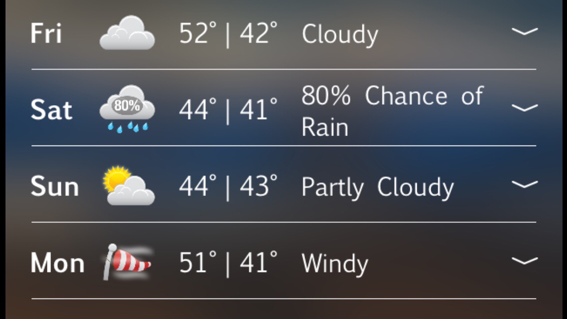
Extended Forecast :

Thanks for viewing …
GMG
Weatherman Peter Lovasco
Spread The GMG Love By Sharing With These Buttons: