Monday February 24th 2014 Cape Ann Forecast ..

Marine Forecast …
Small Craft Advisory…
Mon: NW winds 15 to 20 kt…becoming W 20 to 25 kt in the afternoon. Gusts up to 30 kt. Seas 4 to 6 ft.

Mon Night: NW winds 20 to 25 kt with gusts up to 30 kt. Seas 4 to 6 ft. Light freezing spray.

Now to our forecast .. Well Cape Ann I hate to be the bad news messenger but our mild warm times are done for the time being . Temps today 35-40 degrees with clouds and sun .. West to north west winds 15-20 mph .. Monday night cold yup cold nights are back for quite sometime .. Lows in the lower 20’s..
Tuesday even colder highs only around 30 degrees with mostly sunny skies and west winds 15-20mph!
Tuesday night temps plummet into the teens with a chance of snow after midnight ..
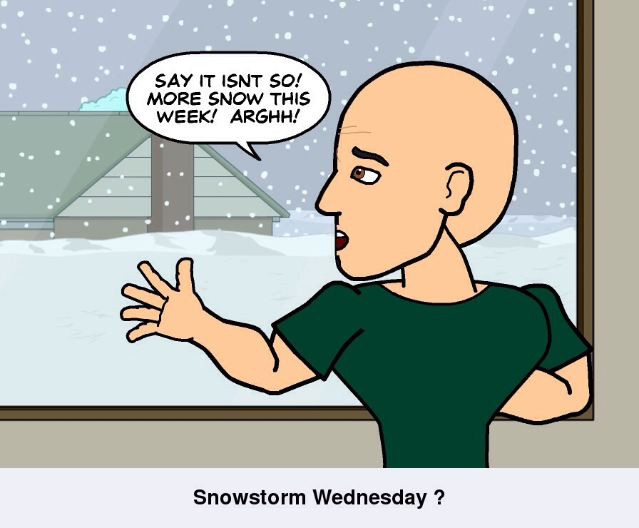
Wednesday chance of snow highs around 30 degrees …
Thursday through Sunday sun and clouds temps in low to mid 20’s with night time lows in the single digits to teens .. Saturday snow threat / then very cold Sunday high 21 degrees …

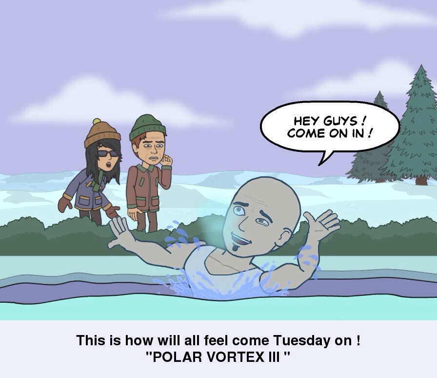
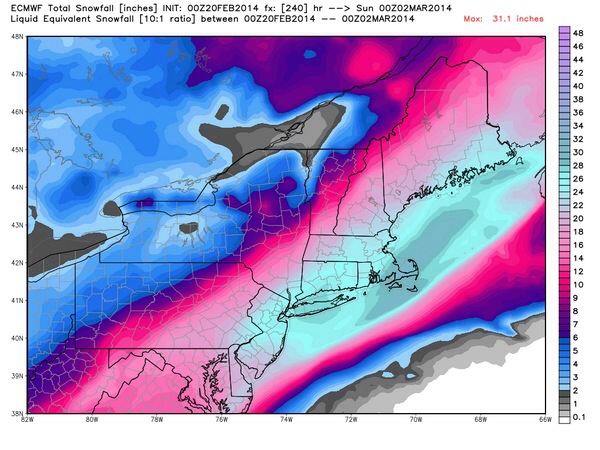
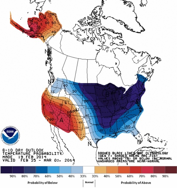
So winter is back with only 24 days left till spring , March is actually looking to be a very cold and potentially snowy stormy month .. 10-15 degrees below the monthly average .. And plenty of chances for frozen precip events …
So hang in there for a 3-4 more weeks .. Then hopefully will have “SPRING” like weather… Thanks for reading … I’ll have more on Wednesday’s snow threat Tuesday morning …Have a wonderful day ..
Peter Lovasco
GMG
Weatherman

20140223-215530.jpg

20140223-215544.jpg

20140223-215604.jpg

Sunday February 23rd 2014 Cape Ann Forecast…

Marine Forecast …
Today: SW winds 5 to 10 kt. Seas 1 foot or less. A slight chance of showers this afternoon.

Tonight: SW winds around 5 kt…becoming W 10 to 15 kt with gusts up to 20 kt after midnight. Seas 1 foot or less. A chance of rain and snow. Vsby 1 to 3 nm.

Sunday forecast sun / clouds this morning becoming mostly cloudy late highs 45-50 . Brief late sprinkle possible otherwise a beautiful day .
Sunday night clouds few flurries late possible temps in the 30’s… Light winds ..
Monday cold 30’s sun / clouds
Tuesday colder 20’s / 30’s
Wednesday Snow ? 20’s
Thur-Sat very cold low to mid 20’s / night time lows 0-10 above …
Have a wonderful Sunday ! 🙂
Thanks for reading .
Peter Lovasco
GMG
Weatherman

20140223-070715.jpg

20140223-070728.jpg

Saturday February 22nd 2014 Cape Ann Forecast …

Marine Forecast ….
Clear / Calm smooth sailing !!!
Today: SW winds 10 to 15 kt…increasing to 15 to 20 kt this afternoon. Seas 2 to 3 ft.

Tonight: SW winds 15 to 20 kt…diminishing to 10 to 15 kt after midnight. Gusts up to 25 kt. Seas 2 to 3 ft.

Today SUN AND WARMTH!! 50’s!!!! Get out and Enjoy!!! That is all 🙂

Next week Polar Vortex ! Frigid and Snow possible ! ESP Wednesday !!! Have a great Weekend !!!

20140222-091440.jpg

20140222-091453.jpg

20140222-091505.jpg

Friday February 21st 2014 Cape Ann Forecast…

Happy TGIF everyone !!
Marine Forecast …
•••SMALL CRAFT ADVISORY•••
Fri: SE winds 15 to 20 kt with gusts up to 30 kt. Seas 3 to 5 ft. Areas of fog. Rain. Vsby 1 to 3 nm.

Fri Night: SW winds 15 to 20 kt…diminishing to 10 to 15 kt after midnight. Gusts up to 25 kt. Seas 2 to 4 ft. Patchy fog. Rain. Vsby 1 to 3 nm.

Here’s your Friday Video Forecast..

This is Funny but hopefully unlikely !!

20140220-204829.jpg
Euro snow outlook for next week into next weekend ! I’m thinking the Euro has been brainwashed from the American GFS Model…

20140220-205015.jpg

20140220-205028.jpg

Thursday February 20th 2014 Cape Ann Forecast..

Marine Forecast …
Thu: W winds 10 to 15 kt with gusts up to 20 kt… Becoming SW 5 to 10 kt in the afternoon. Seas 2 to 4 ft.

Thu Night: SE winds 5 to 10 kt. Seas around 2 ft. Rain likely. Vsby 1 to 3 nm.

Today sunny mild 45-50 degrees!!!! Yes mild for once , so get out and enjoy because it’s not gonna last very long .. West winds 10-15mph.. Thursday night a chance of rain well after midnight , otherwise mostly cloudy with a low around 36-40 degrees.. Patchy fog also possible …
Coming up for Friday very mild temps near 50 degrees with periods of showers possible embedded thunderstorms… South east to southwest winds 10-20mph …Friday night showers ending by early evening lows in the 30’s..
Your weekend outlook
Saturday mostly sunny highs in the mid to upper 40’s lows upper 20’s to lower 30’s..
Sunday sunny highs around 40 ..

Ok so we get this brief mild spell followed by another Polar Arctic Vortex , and extreme storm track . It seems as if winter keeps playing the broken record over and over .. One thing will need to watch besides the cold air is plenty of opportunities for snowstorms .. And being this far ahead into winter , we usually get our biggest storms . So no panic , but be ready for rapidly changing weather conditions … Here’s a look at what’s in store for the next two weeks …..

20140219-202652.jpg
Yup frigid temps ! And it could shunt the storm track a bit further south of New England ! One will have to watch …I know your all ready for Spring as I am .. So let’s be patient and hope for the best …:) Thanks for viewing ..
Peter Lovasco
GMG
Weatherman

20140219-203703.jpg

20140219-203715.jpg

Wednesday February 19th 2014 Cape Ann Forecast…

Marine Forecast….
Wed: SW winds 5 to 10 kt…becoming SE with gusts up to 20 kt in the afternoon. Seas 2 to 4 ft. Rain with a chance of snow. Vsby 1 to 3 nm.

Wed Night: W winds 15 to 20 kt with gusts up to 25 kt. Seas 2 to 4 ft. A chance of rain. Vsby 1 to 3 nm.

Today sun / clouds with mostly cloudy skies late morning highs around 35-42 degrees .. Rain late possibly mixed with snow but mostly a wet afternoon .. Winds SW 10-15 mph becoming SE 10-20 mph late …
Wednesday night rain mixing with wet snow flakes .. No accumulations .. Rain ends by 10pm or so , lows around 30-35 degrees . West winds 10-15mph
Thursday Sunny with a few clouds temps in the 40’s..
Friday periods of rain very mild temps in low 50’s .
Saturday Sunny 40’s Sunday chance of rain low 40s . Night time lows 30’s
Colder trend next week with a few chances at snow or mixed rain and snow … Thanks for reading .. Happy Hump Day ….

20140218-223603.jpg

20140218-223619.jpg
Model Map of our rain late Wednesday ..

20140218-224957.jpg
Low pressure moving across our area .

20140218-225103.jpg

Tuesday February 18th 2014 Cape Ann Weather Update !

As of last nights forecast , this event for midday into early evening looks very minor with nuisance snows 1-2″ inches for our viewing area .. Storm is weak and most moisture remains to our North ! Se winds will limit snow amounts . And make it tough to stick on roadways . Even a mix or change to rain is possible , so again no big event ! More weather on Wednesday .. Have a great Tuesday … Thanks for reading …
Peter Lovasco
GMG
Weatherman

20140218-064055.jpg