TUESDAY, JULY 23 AT 2:00 PM (rain or shine)
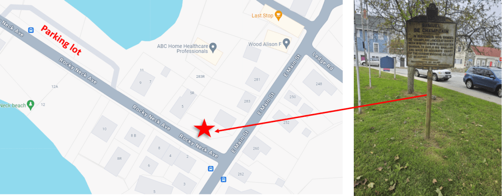
Corner of East Main Street and Rocky Neck Avenue
Join Mayor Verga and the Department of Public Works for the unveiling of the newly restored Samuel de Champlain historical roadside marker on Rocky Neck, which had rusted and disintegrated almost beyond repair. Spearheaded by Rocky Neck resident, Susan Morreale, this 7-year project is finally ready for prime time!
Susan, a member of the Historical Commission, worked with DPW, who funded the project, and the restoration firm, Skylight Studios in Woburn, to bring this 200-pound, double-sided, cast iron marker back to life.
A total of 275 markers were made and erected along Massachusetts’s roadways to celebrate the 300th anniversary of the Massachusetts Bay Colony in 1930. Each marker tells a concise, significant story about the history of Massachusetts in just a few short, inscribed lines, identical on both sides, so they could be read from either direction by passing cars.
They commemorate “places which played a leading part in the history of the colony,” according to the official catalog issued at the time by the Massachusetts Bay Colony Tercentenary Commission. Beyond value in noting historical moments, the markers are a kind of history themselves — a standing museum of how the state saw its past in the 1930s.
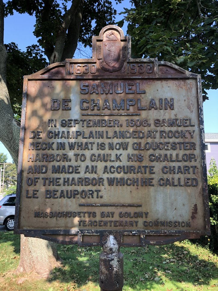
Gloucester has four such markers, the others are in Annisquam and two at Stage Fort Park. As of 2011, of the original inventory, there were only 146 markers still standing in the state. Of the original 83 markers in Essex County, only 43 remain.1630 – 1930 SAMUEL DE CHAMPLAIN
IN SEPTEMBER, 1606, SAMUEL DE CHAMPLAIN LANDED AT ROCKY NECK IN WHAT IS NOW GLOUCESTER HARBOR, TO CAULK HIS SHALLOP, AND MADE AN ACCURATE CHART OF THE HARBOR WHICH HE CALLED LE BEAUPORT.

